Please register to participate in our discussions with 2 million other members - it's free and quick! Some forums can only be seen by registered members. After you create your account, you'll be able to customize options and access all our 15,000 new posts/day with fewer ads.
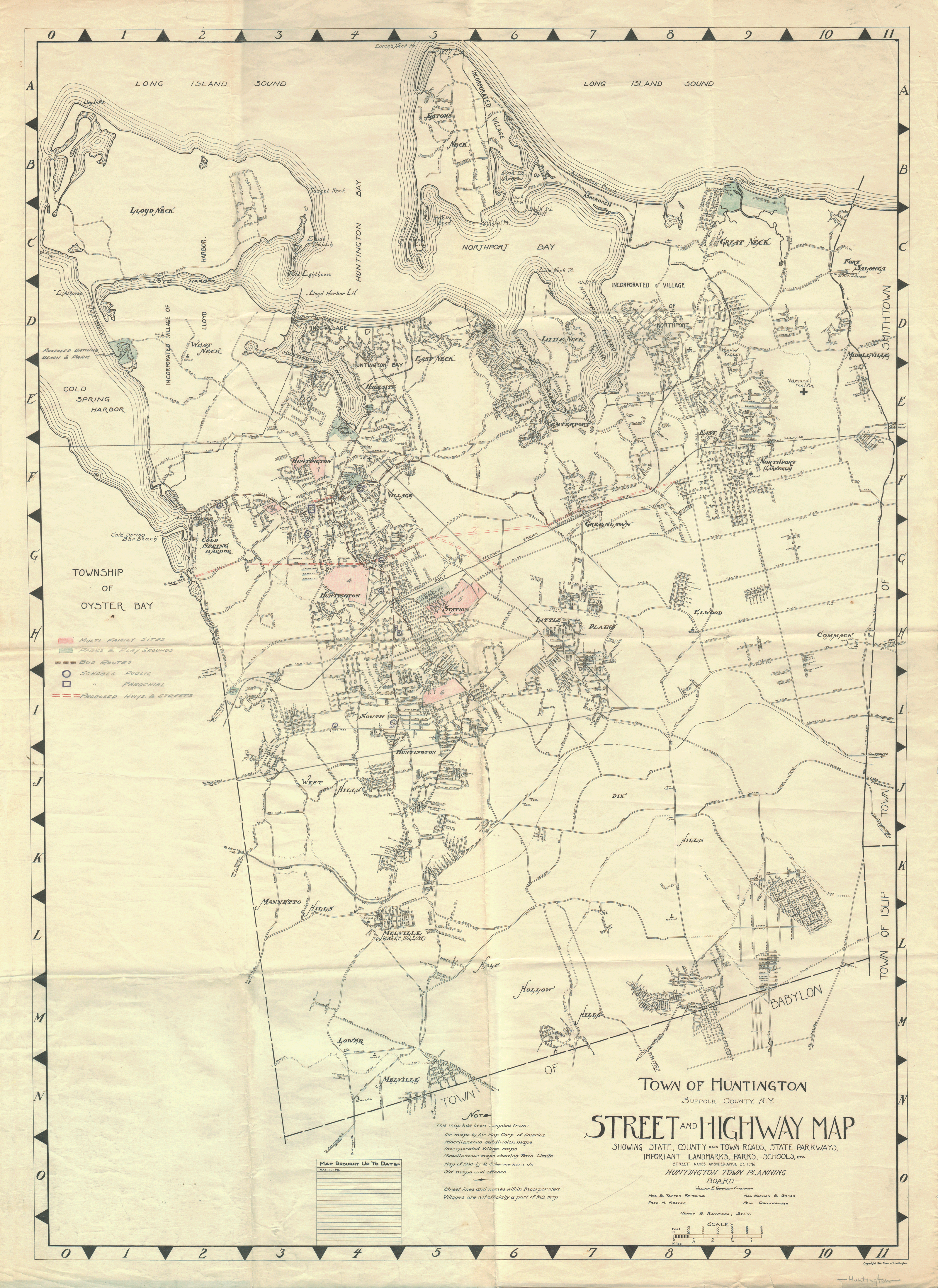
I came across this early post WWII planning map of the Town of Huntington from 1946 at this blog, and thought it might be of interest to you C-D folks. Click here to view full-size.
Interestingly, the blog points out:
- The colloquial nature of hamlet place names, as these unofficial places can change identification generationally. The map identifies several names no longer used in the ToH (Great Neck, Middleville, Vernon Valley) and several that were in name-transition (Melville (formerly known as Sweet Hollow), East Northport (formerly known as Larkfield)).
- An unbuilt proposed east-west highway that would have cut through Cold Spring Harbor and Huntington Station, connecting with Pulaski Road in Greenlawn.
- The proposed and later built Lieutenant General Frank Libutti Way which created a second east-west road through the heart of Huntington Village, parallel to Main Street/25A.
- Although construction of the Long Island Expressway began seven years earlier in 1939, there are no references to its future route through the southern part of Huntington Township.
Additionally, I noticed:
- The identification of the "Township of Oyster Bay," the historical title of the town.
- The Northern State terminating at Melville.
- Sections of land, including the future site of Huntington High School, proposed as "multi family sites."
- The proposal for the later realized West Neck Beach in Lloyd Harbor.
- There appears to be a proposed or existing park or playground in the Cold Spring Harbor LIRR station parking lot.
Anybody see anything else?
The LIE still had another 16 years before making it's way to what is now the 110 corridor. My thought is that it doesn't appear because this map is for town planning as opposed to county, state or federal level planning.
I am wondering whether that red proposed roadway wasn't a possible 25A bypass?
I noticed the broken lines indicating the Long Island Motor Parkway toward the lower left hand side starting at the town line and heading through lower Meville, winding eastward disappearing and then reappearing by the town line at Half Hollow Hills. It continues eastward into Dix Hills where it solidifies as the Vanderbilt Motor Parkway.
Status:
" Charleston South Carolina"
(set 1 day ago)
Location: home...finally, home .
8,814 posts, read 21,271,680 times
Reputation: 20102
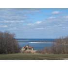
Thanks for the map. It is a little hard to discern on my small screen. I think that the Marshall Field Estate is still there. My cousin lives on the current property.
__________________ ******************
People may not recall what you said to them, but they will always remember how you made them feel .
It looks like Fleets Cove Beach is marshland and hadn't been build up yet. I've always wondered when it was created. Must have been sometime in the 50s.
Thanks for the map. It is a little hard to discern on my small screen. I think that the Marshall Field Estate is still there. My cousin lives on the current property.
You're welcome. If you click on the link above the map you should be able to view it full size, and scroll through it even on a small screen.
Yes, the Marshall Field estate is still there. It is now Caumsett State Park (since about 1960). My brother also lives bordering the estate/park. I guess they're neighbors!
Status:
" Charleston South Carolina"
(set 1 day ago)
Location: home...finally, home .
8,814 posts, read 21,271,680 times
Reputation: 20102
Yes, probably so. She lives in one of the original buildings. It is such a wonderful area.
__________________ ******************
People may not recall what you said to them, but they will always remember how you made them feel .
Please register to post and access all features of our very popular forum. It is free and quick. Over $68,000 in prizes has already been given out to active posters on our forum. Additional giveaways are planned.
Detailed information about all U.S. cities, counties, and zip codes on our site: City-data.com.

 Please register to participate in our discussions with 2 million other members - it's free and quick! Some forums can only be seen by registered members. After you create your account, you'll be able to customize options and access all our 15,000 new posts/day with fewer ads.