FEMA flood maps did not (and still do not) accurately reflect flood risk. If the flood risk was accurately reflected the cost of insurance would need to be over $10,000 per 100,000 near Lawson Blvd thus a large part of Oceanside would need to be condemned (which it should be). If the maps were accurate nobody would be able to afford insurance which now artificially tops out between $3500-5000, but in many cases is very artificially priced between $400-$600 on old policies. That implies a flood every 100 to 500 years! with the fact being well under 100 years; given barrier degradation probably between 12 and 25 year risk would be my best guess.. That would put an average policy cost near $10k on 250 coverage assuming the payout was half on average.
The mortgage lending industry is being subsidized by low cost and available flood insurance. What is a house worth without the availability of insurance? -0- and that is why it is currently available as a matter of public policy even on flood prone Lawson BLVD. Your risk is much much higher than your policy suggests. You have no right, assurance, or expectation that you will be able to get flood insurance at an affordable rate over the life or your mortgage. NONE. Flood insurance really did not work in 2012.
Home prices are VASTLY inflated along with medical and education prices because that is all our economy is good for, that is all that remains of our hollowed out shell of an economy. Time to grab a ***** in protest that this sad state of affairs might be called out for what it is and changed.
But you don't need to worry about flood insurance because NOBODY really paid in any meaningful or easy way. (it was an abortion of epic proportion to collect on insurance {with the mortgage servicer getting paid first, and the insurance company squealing over the cost of every sheet rock screw while using a labor cost table from North Carolina}, and NY Rising grants were even more of an abortion to this day). Flood insurance is not for you, it is for the integrity of your mortgage loan. (which I advised people not to pay in 2012 and who had NO NONE ZERO Zilch ramifications for missing payments NONE). A buddy of mine in Greenwich lived in his 3.5 million dollar mansion for free for 7 years with no ramification; I know another guy who got paid a settlement from the bank to move out of a house he was not paying for; another casual acquaintance walked away from his house in 2012, moved in with his mom, and is now watching the lawyers scramble to compensate him for holding out on his fraudulent insurance payout offer. NYS has intentionally slowed foreclosures down to years; and they are chiding the new Treasury Secretary for actually foreclosing on nonpaying people. Zombie houses are also distorting the price of houses upwards. Real estate currently operates under "the greater fool theory" which is that there is a guy stupider than you ready to buy your house; most likely he is an immigrant coming from queens looking for the American Dream instead he is a muppet, a dupe, a fool, a bag holder.
The following flood simulation website I think is quite accurate. Did you, your PE, or your mortgage lender look at the accurate flood map? NO! You are not supposed to do due diligence on a home purchase because you are using OPM (other people's money).
By setting the flood level at 1 meter you can see accurately which parts of Oceanside are subject to flooding on a frequent basis. Lawson from Walkena to Atlantic is at the most risk; I remember Jet skies on youtube during Irene
https://www.youtube.com/watch?v=iXN3bhm7FWM
Flood Map: Water Level Elevation Map
Based on my perceptions in 2012 Oceanside flooded OVER the 2-3 meter setting on the map but below the 4 meter setting. The map was quite accurate in 2012 Bellmore at 4 meters.
Flood Map: Water Level Elevation Map
Flood Map: Water Level Elevation Map
Basically anything south of Merrick Road is a risk in a repeat storm, especially so because Sandy destroyed natural barriers to flooding. In a real class 1 hurricane I don't think anything south of Sunrise Highway would be safe. At a real class 1 the scope of disaster could not have been hidden. I remember remarking that south of Merrick road was Haiti (dysfunctional) and north of Merrick road was the Dominican Republic (functional and could not care less about Haiti).
FEMA, NY Rising, Gosr, and HUD (insurance claims as well) are still presenting themselves as disasters to the homeowners to this day. Newsday is nowhere to be found. in holding NY Rising, NYS, and HUD responsible for this abortion that is hurricane aid. If you cannot easily sell something don't buy it. If you are looking for a house use the flood tool at 4+ meters before you buy.
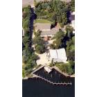
Here is Lawson a day after Sandy,
https://www.youtube.com/watch?v=i_6cHBqeroU
The following is the more expensive Madison Area
https://www.youtube.com/watch?v=XkKR4SEIq_I I had to help a relative and had to walk over devistation in Madison (built on fill over wetland). The area in question is near Boardman school which is near the highest area of Madison closer to the entrance of the development. The video ends around Mott Street but the flooding progressed much further than that towards Merrick road (ending near the old Nathans) Even today the canals are near the gills.
My suggestion is wait for prices to go way WAY down before you buy in Oceanside or LI or any Blue State, buy on high land, and pay in cash <-yes the prices of houses may actually go that low in the next five years. Dont be the greater fool.

 Please register to participate in our discussions with 2 million other members - it's free and quick! Some forums can only be seen by registered members. After you create your account, you'll be able to customize options and access all our 15,000 new posts/day with fewer ads.