Please register to participate in our discussions with 2 million other members - it's free and quick! Some forums can only be seen by registered members. After you create your account, you'll be able to customize options and access all our 15,000 new posts/day with fewer ads.
Does anyone think that 7th street has the potential to clean up and possibly develop a bit of college retail? I was driving by the other day, and they actually have built two apartment buildings flush with 7th street, just to the left of that historic warehouse (which will be converted to a parking garage, but facade kept intact).
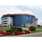
Here is the site for perspective (obviously several years old from street view)
Location: New Albany, Indiana (Greater Louisville)
11,974 posts, read 25,473,841 times
Reputation: 12187
I actually think the 9th/ 7th Street corridor does have a lot of realistic potential from Algonquin Parkway to Broadway.
People not familiar with Old Louisville may not realize that several of the area's most affluent and safe streets back right up to 7th Street: Floral Terrace, Park Ave, and Ormsby Ave. There is a large abandoned lot right across the street that could see new development of the single family form that would compliment those streets. There are long term unfunded plans to turn both the abandoned factory building on that site and one a few blocks away at 9th and Oak into apartments or condos.
The transition from Floral Terrace to the industrial area along 7th is deliciously abrubt. You pass out past Floral Terrace onto 7th, and, boom, there is a big industria loftl bldg to the SW a bit.
The area along 6th and 7th south of Hill was the old "Cabbage Patch", so the area has a lot of historical associations. Interesting area. The area just to the north of the American Standard plant, on 7th, was a nice little business corner, but some of that was torn down over the years.
Jeff, what is cabbage patch? where can I read about it
I think its in the Louisville Enyclopedia. It was the old name for that neighborhood around 7th & Hill, though I thought it extended to 6th.
The neighborhood was the setting for a sentimental best seller of 1901, Mrs Wiggs of the Cabbage Patch, later made into an early talkie (1934) starring WC Fields and comedienne Zasu Pitts.
This is such a fascinating city to me, but I bet I can learn alot of history from a person like you. I read what I can online and know the city inside and out, but since I have only been here a few years, you have me on the history. If you would like to come give me a historical based tour sometime I would enjoy it.
Another question I had, is what is the history behind the surface lots on the east and west and south edges of downtown (which is strictly defined as east of 9th, north of York/Broadway and west of preston)? what kind of residential districts were once there? I think downtown Louisville is so nice and one of the fastest upcoming in its size range, but the surface parking on the edges is a real weakness and makes it feel empty in parts even though it's not. Ive seen signs in the 7th and Hill area for "Limerick neighborhood" and I have also noticed surface parking plagues 2nd thru 7th between Broadway and Hill.
^
thanks, and I am finding out that I know a lot less than I tought i did. I recieved "The Encyclopedia of Louisville as a Christmas present a few years ago and it was a real revelation. Tom Owens DVD walking tours are also full of stuff I never knew.
@@@
The area south of Broadway was the encroachment of downtown south of Broadway, by businessess and institutins that needed a lot of parking. This was identified as an issue by "Rebirth and the Road to Vigor", the 1960s-era Old Louisville urban renewal plan, which tells me that the phenomeonon was already underway by then. (this book is worth looking for at the LFPL as its a good background to Old Louisville). The book said that Oak Street was the rough southern limit of this commercial encroachment and that the areas south were still mostly residential and to be the focus of preservation. Though, as you know, there are still residential blocks and streets north of Oak, too.
Rebirth and the Road to Vigor considered the area between Broadway and UofL, I-65 to the railroads..or was it the Southwest Lateral?.... as its planning area, but it didnt mention Limerick, from what I recall. Limerick was the area around St Louis Bertrand and was a vaguely defined area. There used to be a Limerick Tavern, but it closed years ago. The SW Lateral was the ancestor of four lane that connects 7th street with 9th street, and the 9th street interchange. That was planned in the 1960s already, and was to eventually extend southwest to what is now the Gene Snyder. That plan was dropped in the 1970s, except for that northern part, apparently.
@@@
For the east & west of downtown area you mentioned, I don't now much though i know parts of them were part of a big urban renewal project. The east one led to the Medical center cluster of hospitals and med stuff. The west part was still partially unbuilt in the early 1970s, with big grassy blocks between 6th and 9th, federal building to city hall.
If was still living in the city I would be spending some time with this collection at the UofL library. which might hold the answer to your question on what used to be on some of this area:
Louisville urban renewal project photographs /Extent : 1963; 345 items, 9 linear ft.
Description : These original prints and negatives were taken by Charles Byrne for the Louisville urban renewal project. The photographs served as documentation of areas that were to be razed or otherwise developed. In many cases, the photographs are the only existing representations of these buildings. The photographs include urban renewal project areas in east downtown and west downtown Louisville, from Market Street south to Broadway and Fifteenth Street east to Jackson Street, the Southwick neighborhood, and the Louisville riverfront. The photographs document every lot and structure in over one thousand city blocks.
You are a wealth of information. I will check out that archive. If you are ever in town, I got a good cup of Derby City Espresso coffee on me.
^
thanks, and I am finding out that I know a lot less than I tought i did. I recieved "The Encyclopedia of Louisville as a Christmas present a few years ago and it was a real revelation. Tom Owens DVD walking tours are also full of stuff I never knew.
@@@
The area south of Broadway was the encroachment of downtown south of Broadway, by businessess and institutins that needed a lot of parking. This was identified as an issue by "Rebirth and the Road to Vigor", the 1960s-era Old Louisville urban renewal plan, which tells me that the phenomeonon was already underway by then. (this book is worth looking for at the LFPL as its a good background to Old Louisville). The book said that Oak Street was the rough southern limit of this commercial encroachment and that the areas south were still mostly residential and to be the focus of preservation. Though, as you know, there are still residential blocks and streets north of Oak, too.
Rebirth and the Road to Vigor considered the area between Broadway and UofL, I-65 to the railroads..or was it the Southwest Lateral?.... as its planning area, but it didnt mention Limerick, from what I recall. Limerick was the area around St Louis Bertrand and was a vaguely defined area. There used to be a Limerick Tavern, but it closed years ago. The SW Lateral was the ancestor of four lane that connects 7th street with 9th street, and the 9th street interchange. That was planned in the 1960s already, and was to eventually extend southwest to what is now the Gene Snyder. That plan was dropped in the 1970s, except for that northern part, apparently.
@@@
For the east & west of downtown area you mentioned, I don't now much though i know parts of them were part of a big urban renewal project. The east one led to the Medical center cluster of hospitals and med stuff. The west part was still partially unbuilt in the early 1970s, with big grassy blocks between 6th and 9th, federal building to city hall.
If was still living in the city I would be spending some time with this collection at the UofL library. which might hold the answer to your question on what used to be on some of this area:
Louisville urban renewal project photographs /Extent : 1963; 345 items, 9 linear ft.
Description : These original prints and negatives were taken by Charles Byrne for the Louisville urban renewal project. The photographs served as documentation of areas that were to be razed or otherwise developed. In many cases, the photographs are the only existing representations of these buildings. The photographs include urban renewal project areas in east downtown and west downtown Louisville, from Market Street south to Broadway and Fifteenth Street east to Jackson Street, the Southwick neighborhood, and the Louisville riverfront. The photographs document every lot and structure in over one thousand city blocks.
Very interesting! Louisville is a city rich in history, no doubt.
Please register to post and access all features of our very popular forum. It is free and quick. Over $68,000 in prizes has already been given out to active posters on our forum. Additional giveaways are planned.
Detailed information about all U.S. cities, counties, and zip codes on our site: City-data.com.

 Please register to participate in our discussions with 2 million other members - it's free and quick! Some forums can only be seen by registered members. After you create your account, you'll be able to customize options and access all our 15,000 new posts/day with fewer ads.