Please register to participate in our discussions with 2 million other members - it's free and quick! Some forums can only be seen by registered members. After you create your account, you'll be able to customize options and access all our 15,000 new posts/day with fewer ads.
Which school was flooded and closed during Irene? Which school that you mentioned had 3+ fee of water? I heard perhaps Brookside Place Elementary was devastated by Irene. I'm curious about Orange Ave and Walnut Ave Elementary.
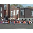
Brookside and the High School flooded. The properties are back to back.
Like most schools with large flat play areas, Walnut and Orange will get soggy in the grass areas, but neither is close enough to the river to be in the flood zone.
Like most schools with large flat play areas, Walnut and Orange will get soggy in the grass areas, but neither is close enough to the river to be in the flood zone.
What about Hillside Ave elementary? It's pretty close to the Rahway River.
What about Hillside Ave elementary? It's pretty close to the Rahway River.
It has never flooded from the river.
AFAIK it has never flooded at all, though I remember the ceiling used to leak here and there in bad, persistent rain. They'd put garbage cans under the leaks. It's a pretty old building with a flat roof, that's to be expected.
Brookside was the one that was gutted and renovated after Irene. The High School's first floor flooded but they dried it out, they did no massive renovating. I was out of high school at that point but a family member said it smelled musty for a little while after. AFAIK all is good now. The High School is an even older building than the other schools.
That's good to know, because he river appears to be pretty close when looking at a map. Are the houses near Hillside Ave school safe from flooding too? I know Munsee Dr floods because it's in a flood zone and right along the river. But what about streets like Ramapo, Cayuga, Cranford Ter, and Wall St? I still get nervous if houses are too close to water, even if they aren't in a flood zone on the FEMA map. I hear even the Parkway at exit 136 flooded during Irene, and Centennial was under water too so you couldn't get off on the exit. I just have this fear that every flood from now on will be worse than the last, given the recent disasters in Florida, Houston, PR, and the Caribbean.
A lot of the houses next to the river don't flood because, well, they're built next to the river. The water is designed to flow down the yard and into the river, there's a slope for the water to move away from the house. If you look at the flood zone it's flat planes like Nomehegan Park next to the pond that are the major problem. Exit 136 has a problem because it's where the river turns into a shallow pond area and then travels parallel to the Parkway for nearly a mile.
That's good to know, because he river appears to be pretty close when looking at a map. Are the houses near Hillside Ave school safe from flooding too? I know Munsee Dr floods because it's in a flood zone and right along the river. But what about streets like Ramapo, Cayuga, Cranford Ter, and Wall St? I still get nervous if houses are too close to water, even if they aren't in a flood zone on the FEMA map. I hear even the Parkway at exit 136 flooded during Irene, and Centennial was under water too so you couldn't get off on the exit. I just have this fear that every flood from now on will be worse than the last, given the recent disasters in Florida, Houston, PR, and the Caribbean.
The houses on the end of Crane Parkway where it loops with Hillside Avenue flooded during Irene, but only in that area. This is because the river loops halfway around the neighborhood, so it's on two sides at that point. The river on Crane came up to the street and up the street from the direction of Hillside about halfway, but most driveways are slightly sloped, so on that end of the street, there was no water going up into houses except, like I said, on the loop itself. If you've driven the area or see it on a map you should know what I mean. The river had never come this high in that area before, Irene was a rare flood in its severity. Areas of Cranford that never flooded before flooded, like that particular area. We had bad floods in 2007 and also I believe in 2009, and I think the most recent one before that was Floyd in 1999.
There is a decent amount of woods then the field protecting Crane Parkway from the river. Hillside Avenue has never flooded, except again, maybe the houses just near the loop with Crane.
I don't think houses on Munsee flooded during Irene, but I could be wrong. Again, there are woods, then a path, then yards separating the river from the houses on the portion of Munsee the river is close to. The rest of Munsee backs up to the pond but I don't recall those houses flooding. Wall Street didn't and doesn't flood, neither does Cranford Terris, Ramapo, or Cayuga. And on the other side of the river, the Indian Village area, it's all on visibly higher ground so that area is totally safe.
The north side really gets the brunt of flooding. The Parkway did flood at 136 but if you look at that area, which is by Mohawk Park and Big Bend Lake, the path area behind Munsee, the river is right under the parkway and the bridge is rather low, plus there's the pond. Basically, the river just rose enough to flood those lanes at the bridge. Centennial flooded between North and South Avenues, I don't recall it flooding the 136 exit but I could be wrong. It was like 7 years ago now. We haven't had a flood since in Cranford. Most of Cranford is totally safe from flooding.
Centennial between North and South always has problems, mostly because it runs parallel to the river, is a low area to get under the train bridge, and debris sometimes builds up on the north side of the bridge at North Ave and water just goes up and to the east of it: Right down Centennial. I think it was about a year or so that it got about six inches deep during a set of really bad storms after the spring melt.
But yes, if you read the FEMA maps and review the land around the house it's not very difficult to find a place that won't flood. Standing at the edge of the pond in Nomahegan park and being eye level with the front doors of surrounding houses means those places shouldn't have been built there, but elsewhere along the river you can see that houses are much higher and slopes are much steeper.
Cranford gets a bad rap regarding flooding, but it's because some people are determined to ignore advice and build in locations they shouldn't.
Yes, if you drive around parts of the north side, you can see people have begun raising their houses high up in these notorious and flat areas. Riverside Drive and that surrounding area is a big one. On Riverside at one point, there are like 6 houses in a row or almost in a row that are raised a whole story, and one of them is huge with a 2 car garage. They look a little ridiculous, these old colonials, cape cods, or large homes raised, but hey, if it helps (which it does). There is also a house on Park Drive which was raised slightly, and some on Balmiere Parkway. The river at this point, Riverside and Balmiere, has levees - raised up dirt and grass around it - but once it gets that high, and it really isn't THAT high, it spills over the levee and that area is screwed. There is no preventing it at that point.
I have a friend who lives over in the Riverside area and the river was up to the second floor during Irene on her street, the fire department deployed boats to rescue people out their bedroom windows. Some of my family has lived in Cranford since the early 1960s, I'm a second generation Cranfordian raised here, and we've never seen anything like it.
Please register to post and access all features of our very popular forum. It is free and quick. Over $68,000 in prizes has already been given out to active posters on our forum. Additional giveaways are planned.
Detailed information about all U.S. cities, counties, and zip codes on our site: City-data.com.

 Please register to participate in our discussions with 2 million other members - it's free and quick! Some forums can only be seen by registered members. After you create your account, you'll be able to customize options and access all our 15,000 new posts/day with fewer ads.