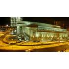
East Liberty becoming a mixed-income success story (Pittsburgh, Highland Park: 2013, apartment complex)
Please register to participate in our discussions with 2 million other members - it's free and quick! Some forums can only be seen by registered members. After you create your account, you'll be able to customize options and access all our 15,000 new posts/day with fewer ads.
It makes it an insufficient idea. Once a few thousand new commuters to Downtown are living in the Allegheny Riverfront area, the relevant roads are going to be jammed. All the non-auto transportation components of the Allegheny Riverfront plan--including the commuter rail, the streetcar, and the bikeway--are designed in part to address this problem.
Note this wouldn't be an issue if you weren't talking about rebranding the 88 as if it was a substitute for the streetcar plan. But since that is what you are doing, I think it is very important to note why that won't work to deal with the transportation needs the Riverfront plan anticipates.
Quote:
I suppose you could add east busway stops
That also won't do much to address the problem, because the East Busway isn't positioned correctly to serve the Allegheny Riverfront.
Quote:
penn ave really isn't that narrow...I suggest you visit Philly sometime and look at some of the streets buses run on there.
I've been to Philly many times, and Philly also has a large open street grid to work with.
In general, you can't reliably compare Pittsburgh to other cities without the same topographic challenges. The Allegheny Riverfront is a long, narrow strip of land crammed between a river and a cliff/gorge, which terminates in the densest job center in the entire metro area. That is a recipe for severe road congestion once this becomes a dense residential area, and the people behind the Allegheny Riverfront plan have taken that into account when coming up with a general transportation plan. You really need to do the same when thinking about what will actually work in this case.
Quote:
I think using the 88 as a tourist circulator makes some good sense
I think you have misunderstood the nature of the streetcar. It isn't JUST a tourist circulator, it is part of an overall transportation plan for the Allegheny Riverfront. That's why a rebranded 88 isn't going to be an adequate substitute--you need to be thinking in terms of moving thousands of new commuters past congested roads.
It makes it an insufficient idea. Once a few thousand new commuters to Downtown are living in the Allegheny Riverfront area, the relevant roads are going to be jammed. All the non-auto transportation components of the Allegheny Riverfront plan--including the commuter rail, the streetcar, and the bikeway--are designed in part to address this problem. Note this wouldn't be an issue if you weren't talking about rebranding the 88 as if it was a substitute for the streetcar plan. But since that is what you are doing, I think it is very important to note why that won't work to deal with the transportation needs the Riverfront plan anticipates.
you are misunderstanding. After you mentioned the Allegheny Riverfront I said your point makes sense, and maybe it's just better to rebrand the 88 and extend it to the incline than use it as a new line to also serve the allegheny riverfront. still, it's unlikely that a streetcar AND the AVRR commuter rail will be necessary. A bus instead of a streetcar would still be perfectly acceptable in all likelihood.
Quote:
Originally Posted by BrianTH
That also won't do much to address the problem, because the East Busway isn't positioned correctly to serve the Allegheny Riverfront.
actually the RFP mentions adding a stop. and yes, it would address a problem, lack of stops on the busway which limits its utility. the extra time can be offset with faster acceleration.
Quote:
Originally Posted by BrianTH
I've been to Philly many times, and Philly also has a large open street grid to work with.
wrong, many buses run on streets far smaller than penn ave. the streets in pittsburgh, particularly downtown, are much less crowded and narrow. there's little difference between penn ave and, say, baltimore ave or lancaster ave.
Quote:
Originally Posted by BrianTH
In general, you can't reliably compare Pittsburgh to other cities without the same topographic challenges.
but this isn't about topography, it's about street width.
and do I need to remind you we're talking about east liberty here, not the allegheny riverfront.
Quote:
Originally Posted by BrianTH
I think you have misunderstood the nature of the streetcar. It isn't JUST a tourist circulator, it is part of an overall transportation plan for the Allegheny Riverfront... you need to be thinking in terms of moving thousands of new commuters past congested roads. .
I think you're getting ahead of yourself. that's what the AVRR will do, a bus would be a perfectly acceptable complement. the area isn't magically going to become manhattan. I'm not against the streetcar either, I just think it's unlikely and if it requires a significant public subsidy, probably unwise.
you are misunderstanding. After you mentioned the Allegheny Riverfront I said your point makes sense, and maybe it's just better to rebrand the 88 and extend it to the incline than use it as a new line to also serve the allegheny riverfront.
I did indeed misunderstand, then, although I would suggest your posts prior to this one were not clear on what you were proposing, and in this post you are still explicitly addressing the components of the Riverfront plan. But I am happy to treat your discussion of rebranding the 88 as unrelated to your discussion of the Riverfront plan.
Quote:
still, it's unlikely that a streetcar AND the AVRR commuter rail will be necessary.
I don't understand why you would think that. The primary purpose of the AVRR will be to bring in commuters from much farther upriver. The couple stops they have planned for the Riverfront area will be able to accommodate some local commuters, but it won't have nearly enough stops to provide full local service.
Quote:
A bus instead of a streetcar would still be perfectly acceptable in all likelihood.
Assuming you mean a bus in its own ROW, that might be sufficient. But given the likelihood of high usage along this route, likely future energy costs, and the observed development-inducing effects of more fixed infrastructure, it would likely be smarter in the long run to go with trolleybuses or streetcars.
Quote:
actually the RFP mentions adding a stop. and yes, it would address a problem, lack of stops on the busway which limits its utility.
I didn't say adding a stop to the Busway is a bad idea or would address NO problem whatsoever. But it won't do much to address THE problem I identified above, the anticipated congestion on roads in the Riverfront area. The same thing applies to the proposed new incline--it is a good idea for its own reasons, but isn't a substitute for the other parts of the Riverfront transportation plan.
Quote:
wrong, many buses run on streets far smaller than penn ave.
You misunderstood me. I was referring to the nature of the street grid, not the individual streets. Buses run on narrow streets in Pittsburgh too. The problem is when those streets become filled with cars.
Quote:
but this isn't about topography, it's about street width.
Oh, but it very much IS about topography. When you have a lot of parallel streets, you can divert traffic from one street to the next street over to reduce congestion--in fact, people automatically do this, and you can shift bus routes as needed as well.
But when topography limits the number of parallel streets in the desired direction, you are limited in how much congestion relief you can get in that way. And in fact additional street width doesn't do all that much to help out this problem (that's sort of the opposite of the findings about road diets--in these sorts of urban road situations, extra width and even extra lanes doesn't buy you as much extra capacity as you might expect).
Quote:
and do I need to remind you we're talking about east liberty here, not the allegheny riverfront.
I'm talking about the Riverfront. And so are you whenever you are talking about the streetcar proposal for the Riverfront, the AVRR, or so on.
Quote:
that's what the AVRR will do
Nope, as I noted above it won't have enough local stops in the Riverfront.
Quote:
the area isn't magically going to become manhattan.
You don't need Manhattanesque densities to get crippling road congestion, you just need enough cars trying to get through a particular bottleneck--a point which we unfortunately prove on a regular basis in Pittsburgh. And the Riverfront is one long bottleneck.
Quote:
I'm not against the streetcar either, I just think it's unlikely and if it requires a significant public subsidy, probably unwise.
Some sort of dedicated ROW for a local transit service is going to be required to make this plan a success. The AVRR isn't going to provide enough local stops, and the East Busway is in the wrong place, so they will need to do something else. The vehicle technology they use is less of a given--heck, I'd propose this is a good situation for a gondola route--but one way or another, they will have to provide local transit that isn't fighting local car traffic.
Thanks for those links. It is amazing that people can pay that much money all in one area of East Liberty and the property values stay so low for taxes. If I bought a home like that in my area and paid that much more than current value, the school district would have me in court so fast it would make your head spin. Guess they don't do that in the city. I would hate to be them if the taxes get reassessed. I can't imagine the tax bill if they were assessed at purchase price on those. Probably something like $16K a year or something like that. Yahoo!
Great to see that little pocket do well though. That is right next to Highland Park and to be honest, not my favorite area. I will have to ride my bike through that street. Lots of crime right around there all the time. Hope it keeps cleaning itself up.
East Liberty some day might be a really nice place if they can rid the area of the drugs and such. Hope it continues on a more high end track and it becomes too expensive for the litter bugs. One can only hope.
Interesting that the city doesn't appeal the assessed value of these houses. Curtis is correct, the suburbs frequently appeal the base year assessment arguing that it is wrong. They start with the purchase price and take a certain percentage off each year. Clearly, comps would help combat this approach. However, the city is leaving money on the table by not appealing these sales.
However, the city is leaving money on the table by not appealing these sales.
That isn't a given. The legal standard is the 2002 value, and if the buyer has good comparables from 2002 to support the assessed value, they will likely win.
I suspect part of the observed discrepancy between some suburbs and the City is that prices have been much more volatile in the City than in some suburbs. So, whereas "taking a certain percentage off each year" might make sense in some suburbs, in the City you really couldn't justify such a methodology.
Usually, the buyer throws a bone to the school district because they don't want to risk getting their assessment increased. So, they likely settle for a little more than the current base year.
Agreed, that this would be tough because most likely any comps in this area would be really really low.
... But I am happy to treat your discussion of rebranding the 88 as unrelated to your discussion of the Riverfront plan.
sorry for not being clear, initially I thought the two would be one and the same until you mentioned it was part of the riverfront plan
Quote:
Originally Posted by BrianTH
...
I don't understand why you would think that. The primary purpose of the AVRR will be to bring in commuters from much farther upriver.
removing them from the streets
Quote:
Originally Posted by BrianTH
...
Assuming you mean a bus in its own ROW, that might be sufficient. But given the likelihood of high usage along this route, likely future energy costs, and the observed development-inducing effects of more fixed infrastructure, it would likely be smarter in the long run to go with trolleybuses or streetcars.
that depends, really. It is probably smarter to start with buses and trade up over time based on demand. if the city is paying, it should probably put trolley buses on existing routes where they would be a benefit. it also frees up the other end, you can try different termini until you find something that works. As noted, Pittsburgh isn't short on street space so sacrificing some isn't a huge deal. obviously if real estate developers are willing to pony up cash for a trolley for its cache, so be it.
Quote:
Originally Posted by BrianTH
...
I didn't say adding a stop to the Busway is a bad idea or would address NO problem whatsoever. But it won't do much to address THE problem I identified above, the anticipated congestion on roads in the Riverfront area. The same thing applies to the proposed new incline--it is a good idea for its own reasons, but isn't a substitute for the other parts of the Riverfront transportation plan.
a busway stop would solve more problems if it ran under downtown to the northshore, but it doesn't. THE problem identified above? which one? I identified a different problem, and clearly tourism is important to some folks.
Quote:
Originally Posted by BrianTH
...
You misunderstood me. I was referring to the nature of the street grid, not the individual streets. Buses run on narrow streets in Pittsburgh too. The problem is when those streets become filled with cars.Oh, but it very much IS about topography. When you have a lot of parallel streets, you can divert traffic from one street to the next street over to reduce congestion--in fact, people automatically do this, and you can shift bus routes as needed as well.
also incorrect, that happens in other cities as well, that's not unique. there are also parallel streets here... and more cars there.
Quote:
Originally Posted by BrianTH
...
But when topography limits the number of parallel streets in the desired direction, you are limited in how much congestion relief you can get in that way. And in fact additional street width doesn't do all that much to help out this problem (that's sort of the opposite of the findings about road diets--in these sorts of urban road situations, extra width and even extra lanes doesn't buy you as much extra capacity as you might expect).
sure it does. if you can go around a bus it makes a difference than if you cannot. as noted, penn ave already has a bus route, this would be more about altering it and perhaps beefing it up to serve both casual users and anticipated new residents. how does one take the incline and get to doughboy sq today?
Quote:
Originally Posted by BrianTH
...
You don't need Manhattanesque densities to get crippling road congestion, you just need enough cars trying to get through a particular bottleneck--a point which we unfortunately prove on a regular basis in Pittsburgh. And the Riverfront is one long bottleneck.
seems to me the more likely problem will not be people driving to downtown, but people driving to other locations. you seem to be envisioning some massive increase.
Quote:
Originally Posted by BrianTH
...
Some sort of dedicated ROW for a local transit service is going to be required to make this plan a success. The AVRR isn't going to provide enough local stops, and the East Busway is in the wrong place, so they will need to do something else. The vehicle technology they use is less of a given--heck, I'd propose this is a good situation for a gondola route--but one way or another, they will have to provide local transit that isn't fighting local car traffic.
color me skeptical of your assertions. why would a gondola be a good fit for downtown to the strip? pittsburgh has a number of half hearted transit initiatives and today, the east busway may well be the biggest impediment to greensburg/latrobe commuter rail.
That's true and I agree the AVRR is related. But I think it will be far from sufficient given the likely number of new commuters not just upriver but in the Riverfront area itself.
Quote:
that depends, really. It is probably smarter to start with buses and trade up over time based on demand. if the city is paying, it should probably put trolley buses on existing routes where they would be a benefit. . . . obviously if real estate developers are willing to pony up cash for a trolley for its cache, so be it.
I agree some of this depends on financing, but you can't get financing without having a robust proposal. So they need the study to work up the best options and then they can see if they can get funding for those options. If they can't, they can always go with cheaper options instead.
Quote:
a busway stop would solve more problems if it ran under downtown to the northshore, but it doesn't.
I think the regular traffic from the Riverfront to Downtown is going to dwarf any traffic from the Riverfront to the North Shore.
Quote:
THE problem identified above? which one? I identified a different problem, and clearly tourism is important to some folks.
The problem I identified is that if the Riverfront development follows the general plan they have adopted, the lengthwise roads in the Riverfront area are going to regularly become jammed with car traffic at key times, including rush hours, but also weekend mornings, a key time for Strip-related tourism. Local transit with its own ROW addresses both of those problems, which are really two different facets of the same problem--this is a natural bottleneck right next to Downtown.
Quote:
also incorrect, that happens in other cities as well, that's not unique. there are also parallel streets here... and more cars there.
I'm not sure what you are saying here, but it is certainly the case that other cities can also have natural bottlenecks along highly-traveled routes. And in those cases, they also tend to experience regular congestion, and they also are often well-advised to provide transit with its own ROW to bypass that congestion, which in fact they often do.
I'm just objecting to the notion that you don't need to look at natural bottlenecks which limit the number of streets, and instead that you can just look at street widths, when determining if this problem will arise. That is not at all correct.
Quote:
as noted, penn ave already has a bus route, this would be more about altering it and perhaps beefing it up to serve both casual users and anticipated new residents.
I think you may not be grasping what a radical increase in local transportation demand this bottleneck will be facing if the Strip and Lawrenceville develop along the lines they have sketched. There is a huge amount of land along this stretch which is currently not being put to much use, and similarly many structures which are underutilized. As that land and those structures are redeveloped, the local transportation demand is not going to go up just some percentage, it is going to go up some multiple, particularly at peak periods. And the relevant roads are already getting congested at certain times, so it is extremely likely these roads are going to become regularly jammed at key times.
So "altering" and "beefing up" the current bus routes isn't going to work to support those future transportation needs, unless by that you mean giving them dedicated ROW.
Quote:
how does one take the incline and get to doughboy sq today?
I'd take the T from the Mon Incline (Station Square) to Steel Plaza, then take the 87 from right outside USX.
But again, we are clearly talking about very different issues. I don't know if there are actually enough people trying to make that trip to justify a dedicated tourist route, but if there are, fine.
I'm focused on the fact that getting just from Downtown to Doughboy Square by mixed-use lanes is going to become a nightmare as the Riverfront develops, which will affect not just that hypothetical tourist wanting to go straight from an incline to Doughboy Square, but also every other person trying to move along that route.
Quote:
you seem to be envisioning some massive increase.
Yes! More importantly, not just me, but everyone involved in the Riverfront planning process.
And that is entirely realistic. For example, according to the 2010 Census, there were 616 people living in the Strip. Just developing the land behind the Produce Terminal with mid-rise apartment buildings (as currently contemplated) may double that. Many more units could be added throughout the Strip. Lower Lawrenceville similarly has potential to add many more new units, and meanwhile the mix in the existing units will likely move to people more likely to want to commute Downtown.
Of course it is correct that more people will also being trying to get into this area, but that includes from potentially many different directions. At least we know that Downtown serves as a collection point for the existing transit system, and is also a growing locus of hotel development, so securing a good transit link from Downtown into the Riverfront will kill a lot of birds with one stone.
Seriously, the anticipated future transportation demand from Downtown through the Riverfront and back is much, much higher than the current demand--a "massive increase" is exactly right.
Quote:
why would a gondola be a good fit for downtown to the strip?
Gondolas can add public transit with its own ROW without taking any street space away from mixed-use traffic. In that sense they are sort of like subways, but you can build them out for a tiny fraction of the cost of subways. They also provide for a more pleasant experience than subways, particularly if they are passing through scenic areas.
The notable downsides to gondolas are that with the current technology they can only make significant turns at stations, and while they provide good total trip times for shorter routes, they are not fast enough to provide competitive service along longer routes.
That actually makes this route pretty ideal for a gondola application. Again, the streets are likely to be regularly jammed so it would be nice to provide transit with its own ROW without taking away any street space. Traffic on the contemplated route probably won't be high enough to justify investing in a subway, and it would be a very scenic gondola route. Finally, the contemplated route would be relatively short and straight, so the main limitations of gondolas wouldn't be a problem.
Quote:
pittsburgh has a number of half hearted transit initiatives and today, the east busway may well be the biggest impediment to greensburg/latrobe commuter rail.
Well, if we could only have one of the two, I'd take the East Busway in a heartbeat.
But generally, I think people are going to need to start adjusting their mindset to deal with a Pittsburgh that is experiencing population growth, and in particular concentrated population growth in certain core areas. That's a reversal of what Pittsburgh has been dealing with in recent decades, and I think it is going to quickly become apparent we are going to need to make some serious upgrades to our transit system if we are going to accommodate those new development patterns.
Of course if we had tens of billions of dollars to spend on subways, maybe we could do something conceptually simple. Assuming we won't get that level of funding, we are going to have to be more creative, and target our key emerging needs in more cost-effective ways.
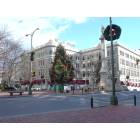
Developers plan theater/office project in Pittsburgh's East Liberty neighborhood
Quote:
Working jointly, Cunningham, director of real estate for East Liberty Development Inc.* * , and Blasier, a developer who played a key role in working to draw Whole Foods* * to the neighborhood nearly 10 years ago, have inked a deal with Georgia-based Spotlight Theatres to establish a five-screen cineplex on a redevelopment site now occupied by a former PNC* * bank branch and some neighboring properties at the corner of Penn and Highland avenues in the center of the East Liberty business ...
I suppose I don't understand where BrianTH's concerns about increasing traffic congestion between the "Riverfront" (I'm assuming the revamped master plan for the Strip District) and Downtown when you can easily walk or bike between the two locales if you're not disabled or lazy. I live in Polish Hill, which is much further away, and routinely walk Downtown myself. If I were going to live in perhaps the upcoming expansion of the Cork Factory Lofts, for example, why on Earth would I need a streetcar or trolley to get me Downtown when I could walk there in about 20 minutes or bike there in much less time? I'd be more concerned about building an additional parking garage or two in the area to accommodate vehicles that will be displaced when the seas of asphalt in the Lower Strip District (i.e. along Penn Avenue and Smallman Street between 11th Street and 16th Street) are reclaimed for mixed-use redevelopment.
If anything one would think more people moving closer to the area's dense urban core would decrease congestion. Since so much discussion about NoVA occurs on this sub-forum given our strong connection to the DC Metro Area let me use Arlington as a prime example. That area has well over 200,000 people and has far less surface street traffic congestion than a place like Reston, with about 65,000 people, because Arlington was planned to be dense and walkable while Reston was planned to be autocentric with all of its cul-de-sacs and wide gaps of open space between developed areas. Similarly I foresee many of the new people who will be moving into the Strip District in the coming years being those who currently live further out from the core and are tiring of their commutes. More of those people driving between Downtown and Highland Park, Shadyside, or wherever else via Liberty Avenue moving to the Strip District and walking or biking to work would mean LESS traffic congestion in the area Brian is concerned about, right?
Please register to post and access all features of our very popular forum. It is free and quick. Over $68,000 in prizes has already been given out to active posters on our forum. Additional giveaways are planned.
Detailed information about all U.S. cities, counties, and zip codes on our site: City-data.com.

 Please register to participate in our discussions with 2 million other members - it's free and quick! Some forums can only be seen by registered members. After you create your account, you'll be able to customize options and access all our 15,000 new posts/day with fewer ads.