Please register to participate in our discussions with 2 million other members - it's free and quick! Some forums can only be seen by registered members. After you create your account, you'll be able to customize options and access all our 15,000 new posts/day with fewer ads.
Actually, the residents of the Lower Hill dispersed to Beltzhoover, Homewood (which went from 20% to 80% black in a decade), Manchester, and East Liberty, with a substantial portion moving into the Hill's projects as the whites that previously lived there left. Few blacks lived in Mt Oliver until the mid 90's, and black youths passing through Mt. Oliver frequently risked violence in the 50's, 60's, and 70's.
Ok..
I'm commenting on the content of the daydream that the Hill District become a gentrified neighborhood.
Sorry to derail a bit, but what cluster of buildings on the satellite view was the Windgap Plaza that had a Hill's and Giant Eagle in the Fairywood area that was spoken of?
If you are looking at the satellite view it is the two building cluster closest to windgap ave on broadhead fording road on the side closer to mckees rocks. They are unmarked.
Across the street is 50 or so long thin buildings that was old westgate village projects (now emerald gardens). If you go down broadhead fording road you can see the few streets of houses (eric way, w prospect and the other portion of fairywood street).
You then have the long skinny buildings on fairywood street and west court and south court that are the remains of broadhead manor projects surrounding brodhead manor park. Most of these buildings were torn down.
I found an old cmu pdf file speaking of fairy wood. Part of it is cut off and I am estimating the date around 1988 or 1989.
Sorry to derail a bit, but what cluster of buildings on the satellite view was the Windgap Plaza that had a Hill's and Giant Eagle in the Fairywood area that was spoken of?
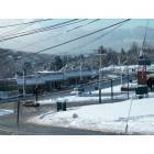
This is how Fairywood looked as late as the early 2000's.
Broadhead Manor housing projects were located on: Old Orchard Circle, East Court, West Court, South Court, and Fairywood Street.
The Westgate Village section 8 apartment complex was: the apartment complex which was remodeled and renamed the Emerald Gardens Apartments.
Fairywood-west of the park is off Broadhead Flooring Road (Fairywood St, Mazette Rd, Prospect Ave, etc).
The Unjama Westside Market space was the only thing west of Broadhead Flooring Rd besides Broadhead...
Fairywood was one of the first five neighborhoods in the metro to be hit by the crack epidemic. During the late 80's-early 90's, Brooklyn's A-Team/Jamican Posses, LA/Detroit's Crips & Bloods, Detroit/New Castle's Y.B.I. flooded the area and went to war with eachother and the local crews. By 1993 the local crews became established street gangs (like the Westgate Convictz, BroadHead Convictz, Down Low Goonies, and Down Bottom Fairywood Bloods) and either joined forces with or killed off/drove off most of the out of town gang bangers. The gangs manifested so much drugs & violence that the city sent an officer to walk the beat, and even he would get shot at!
1. When they close the last of the old Bedford Dwellings, which is apparently coming within the next few years. I have no idea where the residents will go. Obviously fitting with previous projects they'll build some mixed-income infill in Lower Hill/the lower part of the Middle Hill, but this will only be a fraction of the old residents. There is no nearby affordable neighborhood to absorb the spillover, as was the case in the Southern Hilltop and the West End. I highly doubt they'll be staying in the East End in general, as even in the remaining rough neighborhoods I don't think they'll be room to house them (unless they go crazy with that new Larimer development). Most likely they'll move to an already declining part of the Southern Hilltop, West End, or outer North Side.
My guess is perhaps Bentley folks may even go as far out as Penn Hills, East Pittsburgh, Swissvale, etc. It's little known but Westgate & Broadhead's residents temporarily relocated to Brett Manor & when the East Mall apts closed the Skytop Manor & Residents of South Hills (formerly Leland Point), so maybe people will go there. Also there's Carnegie Towers & Groveton Manor to the west.
Quote:
3. Another issue is if/when Uptown turns. I think Uptown's transformation will be key, as it will ultimately turn around rough but intact areas like De Raud and Moutine Streets, as well as working its way back up into the Lower Hill via Dinwiddie.
I forgot to mention the attempt to revitalize Dinwiddie St. Though I doubt unless the city redevelops Oakland's two most dangerous streets that they will ever become desirable.
Quote:
Sugar Top is it's own thing. Once you get off of Herron, it's pretty astounding how much more intact that it is compared to the Hill District at large. Something like 85% of buildings are standing, often in good condition. The Schenley Heights area is already desirable, as are the backwoods streets closer to Polish Hill. I can only think the main reason why it's not become desirable is residual racism - both people never exploring the area because it's a black neighborhood, as well as not considering it as an option because it's a black neighborhood. It does lack a business district, so it will never be hip, but I could see it turning into a more racially mixed Greenfield (with nicer housing stock) eventually.
Other than spill over crime on the blocks near Herron the Upper Hill is largely disconnected from the streets of the Hill. Despite being a middle class area, I agree there's still a stigma of living there often due to ignorance or white privilege.
Quote:
Edit: I should say I don't think the "core" of the Hill (between Herron and Kilpatrick, and north of Centre) is going to change any time soon. Infill is prretty much only being built now in the Lower Hill, and even if it becomes safe, I expect demolitions here to continue. It will be largely urban prairie minus the weird enclaves of later development like Francis Court within two decades.
If you are looking at the satellite view it is the two building cluster closest to windgap ave on broadhead fording road on the side closer to mckees rocks. They are unmarked.
Across the street is 50 or so long thin buildings that was old westgate village projects (now emerald gardens). If you go down broadhead fording road you can see the few streets of houses (eric way, w prospect and the other portion of fairywood street).
You then have the long skinny buildings on fairywood street and west court and south court that are the remains of broadhead manor projects surrounding brodhead manor park. Most of these buildings were torn down.
I found an old cmu pdf file speaking of fairy wood. Part of it is cut off and I am estimating the date around 1988 or 1989.
Thanks. It is a neighborhood that is rarely talked about as it is isolated and in a floodplain. For whatever reason my grandparents went shopping at that hills with me in the late 80s. I was 5 or 6 years old but i remember how scary it was. People would stare and toy boxes were ripped open as other kids were playing in the aisles.
Aside from that it is pretty safe to say that fairywood was probably the worst neighborhood for drugs, poverty and crime in probably the county if not the entire metro from the 70s through early 2000s. Its sad but what else to do with the land.
You realize this is the same dream of the white planners in the 1950's, right?
They destroyed the lower Hill and the residents fled to Belzhoover and Mt. Oliver.
First, gentrification of the Hill District isn't my goal. I see it in a neutral manner.
Secondly, the precepts of "Urban Renewal" were the exact opposite of gentrification. Urban Renewal was all about the idea if you change the form of the inner city (to more closely approximate the suburbs, in some manners) you'll cause more suburban behavior in inner-city populations. In contrast, gentrification (at least, for outright proponents) is all about keeping the form of a neighborhood intact, but replacing the population.
Quote:
Originally Posted by jay5835
Is this not also true of Carrick? When I was in college in the early '70s, I thought Carrick was white, maybe Irish.
It's already been intimated, but Carrick (as of 2010) was 86% white and 10% black. Even if current trends continue, it will be decades before it's even a racially mixed neighborhood, let alone majority black.
Knoxville is a better example, as it recently tipped into being majority black. Or Sheraden, which will be a black neighborhood by 2020. The black population is rising pretty fast in most of the northern parts of the West End (Sheraden, Esplen, Elliot, Windgap, Chartiers, and the northern parts of East Carnegie. It wouldn't surprise me if the area ultimately became a new black side of town.
Quote:
Originally Posted by I_Like_Spam
Most of the Italians and Syrians that were displaced from the urban renewal went to Brookline and Beechview.
People forget that the Hill district was still a multiracial (albeit black majority) neighborhood still in the 1950s. The area destroyed for the Arena was actually one of the whiter parts of the Hill District.
People also forget that neighborhoods the black population moved to all had black populations before the Civic Arena was built. In a certain way, this isn't surprising. Displaced black people followed the path of least resistance, and moving to a neighborhood 5%-20% black was way easier than being the first black family in a 100% white neighborhood.
Quote:
Originally Posted by I_Like_Spam
In the current renewal phase over here in L'ville, most of the older residents are fleeing to Shaler.
One of my neighbors (an old-timer who is a city garbageman) has remarked regarding how much he could sell for here in Lawrenceville that "We can buy two houses in the North Hills for one house here now - of course, then I'll need to call 43rd Street Concrete to pave my front yard."
Quote:
Originally Posted by Uptown kid
I forgot to mention the attempt to revitalize Dinwiddie St. Though I doubt unless the city redevelops Oakland's two most dangerous streets that they will ever become desirable.
My thought is that those streets are full of historic rowhouses, and unlike the hill the majority of them are still standing and seem to be in reasonably good structural shape. Obviously Uptown will need to gentrify first, but if it gets to the point where even the rough streets of Uptown past Jumonville get gentrified, I think it's only a matter of time until the gentrification crosses fifth.
Quote:
Originally Posted by Uptown kid
Other than spill over crime on the blocks near Herron the Upper Hill is largely disconnected from the streets of the Hill. Despite being a middle class area, I agree there's still a stigma of living there often due to ignorance or white privilege.
To be fair, the Upper Hill has been getting whiter. Between 2000 and 2010 the Upper Hill lost around 350 black residents and gained 140 white residents. Still, at current rates, it's going to be a majority-black neighborhood at least until 2030 - which is a good thing in my book. I still hope some neighborhood in Pittsburgh, be it Sugar Top, Manchester, or elsewhere, catches on as the focal point for the region's black professional population.
Actually, the residents of the Lower Hill dispersed to Beltzhoover, Homewood (which went from 20% to 80% black in a decade), Manchester, and East Liberty, with a substantial portion moving into the Hill's projects as the whites that previously lived there left. Few blacks lived in Mt Oliver until the mid 90's, and black youths passing through Mt. Oliver frequently risked violence in the 50's, 60's, and 70's.
When did Homewood go through that change? I had no idea it was such a quick and dramatic change.
Please register to post and access all features of our very popular forum. It is free and quick. Over $68,000 in prizes has already been given out to active posters on our forum. Additional giveaways are planned.
Detailed information about all U.S. cities, counties, and zip codes on our site: City-data.com.

 Please register to participate in our discussions with 2 million other members - it's free and quick! Some forums can only be seen by registered members. After you create your account, you'll be able to customize options and access all our 15,000 new posts/day with fewer ads.