Please register to participate in our discussions with 2 million other members - it's free and quick! Some forums can only be seen by registered members. After you create your account, you'll be able to customize options and access all our 15,000 new posts/day with fewer ads.
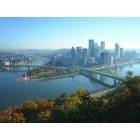
I just finished reading The Steps of Pittsburgh: Portrait of a City, by Bob Regan. Although shorter than I had hoped, it is a great and complete documentation of Pittsburgh's steps and their history, with lots of great pics and maps. I'd highly recommend it to anybody interested in learning about the steps/staircase streets.
Thought I'd bring up one point that the book didn't get into. I'm very interested in traffic efficiency, mapping, and street patterns, and when I look at the map of all staircase streets that the city GIS department put together for me, it's fairly evident that the decision to build steps in most places was based on a localized desire or need for them and not on the overall placement of steps throughout the city from a strategic standpoint. In other words, some neighborhoods have 2-3 staircases a block apart from each other while other neighborhoods have a long hillside with no steps nor street, requiring a long walk (or bike ride, for those who want to carry their bike up the steps) around.
Troy Hill has three staircases leading down to Spring Garden to the north, which I doubt are used very frequently since they do not go downtown nor to a shopping area. The South Side Slopes have steps or a street nearly every block. In the West End, there appear to be three sets of steps a block apart going from Steuben up to Attica. These are all great things, and I'm very glad they're all there, but I wish that other areas would've been considered, in order to link neighborhoods together and provide more efficient ways of walking throughout the city.
The biggest place that I see a lack of pedestrian connectivity that could use it is between Mt. Washington and Banksville/Beechview/Brookline, with Banksville having the longest walking or biking detour to go towards town.
This connectivity does not in all cases need to be accomplished by steps. I think the Banksville connection would be best accomplished by a sidewalk following the west side of the parkway from where Banksville Rd joins it to Woodville Ave. in the West End. Bicyclists and pedestrians could proceed from there to Shaler St. and go over Mt. Washington to go downtown or elsewhere, or proceed down Woodville and Wabash to the West End Circle to avoid having to go up and over Mt. Washington. The West End Circle, from what I’ve seen, could use far better bicycle and pedestrian accommodations, in sharp contrast to the convenient stairs only blocks away off Steuben St.
I’d say that the north end of Beechview is next in priority. Shadycrest Dr. is very close to Mt. Washington, but there is no connection without going perhaps ½ mile to the south to Crane Ave. A staircase from that area to meet with Woodruff St. in Mt. Washington would be very convenient.
It would be nice if the former Indian Trail steps were still there, up Mt. Washington near the Duquesne Incline, for those who don’t want to or can’t pay for the inclines. Avoiding the incline is a really long biking or walking detour.
Next would be a pedestrian/bicycle lane across the Fort Pitt bridge, assuming it doesn’t exist already, so those coming from over Mt. Washington and the West End would not have to detour over ½ mile to the east to the Smithfield St. bridge.
There are also smaller areas that have no access (without a longish detour) and consequently could use a staircase, such as the west edge of Beltzhoover down to Warrington and the far eastern edge of Spring Hill (Rockledge St. area) easterly down to Spring Garden. Not a whole lot of people would need or want to use these steps, but they’d provide more connectivity. Other areas such as Bon Air next to route 51 may have similarly lacked a connection to route 51 and the neighborhoods across it in the past, but I’m fairly certain that pedestrian connections were added when the light rail was built so people from these neighborhoods could use the light rail.
Granted, most people don’t walk long distances, so these steps may not get a whole lot of use, but I think steps in these locations would achieve the goal of making Pittsburgh a more walkable city all-around, without the impediments of certain areas with no walkable connections for a long distance. Bicyclists would probably find this more useful than pedestrians, as they could get from Banksville to downtown, for example, without going up and over the huge hill on Crane. They could also go through the West End to avoid going up Mt. Washington. A pedestrian/bicycle lane through one of the tunnels would be ideal, but it’s not really feasible due to space needed for lanes and I doubt the city would justify digging a new lane for pedestrians and bicycles due to cost.
For those of you familiar with the area, what route would you take if you wanted to bike from Banksville Road to downtown today? I’d probably backtrack to Greentree Rd then go through the West End, because, although it’s longer, it has one big hill as opposed to the two one would hit if one went over Crane Ave. and Mt. Washington.
Lastly, probably about a third of the staircases I saw as I wandered around the city were blocked by welded pipes and in no condition for most people to walk up. Often, entire sets of steps were missing, and trees had fallen over the steps. Some of these were in places where they wouldn’t get much use, but others were in places that provided critical links between different areas or neighborhoods.
Again, I think it’s great that the Burgh has so many steps, and many of them are very convenient. I love all the steps all throughout the city. But it’s obvious that certain areas (blufflines in the southwestern part of the city, for the most point) are lacking any steps at all, causing huge detours for pedestrians and bicyclists, and I thought this would make for an interesting discussion topic.
And I can’t help but mention that most of Pittsburgh’s suburbs, outside of the few older suburbs directly outside of the city like Dormont, Mt. Lebo, and McKees Rocks, are not walkable at all from a practical standpoint, outside of one’s own small neighborhood, because the arterials are narrow, hilly, and curvy, making them very dangerous to walk or bike down, with no sidewalk nor alternative to the arterials. Clearly a lot of people don’t mind this, since many people live in these suburbs, but I feel the need to live somewhere where it’s easy to bike and walk in most directions.
Last edited by Squeamish; 03-03-2010 at 12:41 PM..
Reason: Corrected paragraph formatting
I'm very interested in traffic efficiency, mapping, and street patterns, and when I look at the map of all staircase streets that the city GIS department put together for me . . .
Have you made, or can you make, this available to us?
Have you made, or can you make, this available to us?
I just now took pictures of the different quadrants of the city on the map to share on here, but then remembered that they had sent me a PDF copy of the map. It's 10.8 MB. BrianTH, if you want, PM me your e-mail address and I'll try to send it to you.
The pics aren't great but they're the best I can do. Also this map is well-worn from my travels around the city over the past couple weeks. But all the staircase streets are still visible as dotted yellow lines. If anyone wants a paper copy, it's $30 and you can also include other features such as parks, paper streets, cemeteries, etc. Be sure to ask for the PDF as well if you get a paper map from them - it doesn't cost extra.
For those not familiar with Pittsburgh proper, the most interesting areas to look on these maps (with the greatest density of steps) are the NE corner of the South Side map and slightly south of the center of the North Side map.
Note that it's difficult if not impossible to tell the difference between a sidewalk staircase (with street alongside it) and a street staircase (by itself with no street alongside it).
And I can’t help but mention that most of Pittsburgh’s suburbs, outside of the few older suburbs directly outside of the city like Dormont, Mt. Lebo, and McKees Rocks, are not walkable at all from a practical standpoint, outside of one’s own small neighborhood, because the arterials are narrow, hilly, and curvy, making them very dangerous to walk or bike down, with no sidewalk nor alternative to the arterials. Clearly a lot of people don’t mind this, since many people live in these suburbs, but I feel the need to live somewhere where it’s easy to bike and walk in most directions.
Just because there are no official steps, doesn't mean our hillsides aren't walkable for residents. People who live in the hilly neighborhoods know the shortcuts through the wooded hilllsides to the neighborhoods and shopping areas below. There are very few areas that are too steep to safely walk at some point on the hillside. The paths generally angle down the hillsides. It's very beautiful to walk these paths---almost every hillside in every neighborhood has them. You might not be able to bike many of them, but you wouldn't be able to bike them if there was a staircases either. I've always loved walking along the paths of Pittsburgh's wooded hillsides. If you don't know an area, you need to learn how to identify a path entrance since they are often hidden from street view.
There are also smaller areas that have no access (without a longish detour) and consequently could use a staircase, such as........the far eastern edge of Spring Hill (Rockledge St. area) easterly down to Spring Garden.
I lived on Spring Hill many years ago. No steps are needed there because that hillside is walkable via path.
Just because there are no official steps, doesn't mean our hillsides aren't walkable for residents. People who live in the hilly neighborhoods know the shortcuts through the wooded hilllsides to the neighborhoods and shopping areas below. There are very few areas that are too steep to safely walk at some point on the hillside. The paths generally angle down the hillsides. It's very beautiful to walk these paths---almost every hillside in every neighborhood has them. You might not be able to bike many of them, but you wouldn't be able to bike them if there was a staircases either. I've always loved walking along the paths of Pittsburgh's wooded hillsides. If you don't know an area, you need to learn how to identify a path entrance since they are often hidden from street view.
I would love to explore these paths. Do most suburbs and townships really have them? Not knowing they existed, I've never made a specific effort to find them, but I seem to recall a number of times thinking a certain area would be convenient and practical for a path but then not finding one there. I did find a short one at the west edge of Green Tree where it is very much needed.
I also highly doubt that it would be practical or feasible to stay on side streets and paths when one is walking a long distance through the suburbs. It depends on the starting point and destination, but even with short paths being available connecting neighborhoods across hillsides, I'd imagine most longer-distance walks through suburbs (at least outer suburbs) would still require a long walk down a dangerous arterial, or possibly a big detour to avoid said arterial if side streets and paths were available.
RE Spring Hill, I did stumble on a very nice path going from the park on Romanhoff down to Schubert, which is an important connection. I guess I was referring more to the southern part of the eastern strip of Spring Hill, ideally from Admiral, Serene, or Damas down to Spring Garden. Do you know if one exists in this area? I've never looked for one.
I am currently in the process of compiling an interactive Pittsburgh City Steps map on google. It'll be free for whomever is looking for the information. I too read Bob Regan's wonderful book but felt it didn't quiet have the information I was looking for. I desired a full map with locations of the city steps; One that showcased exactly where they were with the backdrop of google earth's 3D renderings, but more importantly, a map that was up to date. I noticed a ton of new steps and also a ton of steps that have been razed. In addition, I realized the count could be drastically off. For instance, in the book it states the longest set of steps in the city is Ray Ave. in Brookline with 315 (if I recall correctly) steps. This is inaccurate; I have the number at 258. If anyone is interested in my research so far here it the link.
Last edited by BenjaminH; 05-06-2011 at 02:47 PM..
Reason: bad link
Please register to post and access all features of our very popular forum. It is free and quick. Over $68,000 in prizes has already been given out to active posters on our forum. Additional giveaways are planned.
Detailed information about all U.S. cities, counties, and zip codes on our site: City-data.com.

 Please register to participate in our discussions with 2 million other members - it's free and quick! Some forums can only be seen by registered members. After you create your account, you'll be able to customize options and access all our 15,000 new posts/day with fewer ads.