Please register to participate in our discussions with 2 million other members - it's free and quick! Some forums can only be seen by registered members. After you create your account, you'll be able to customize options and access all our 15,000 new posts/day with fewer ads.
Gosh, you'd think with such GREAT TECHNOLOGY available to them that they would have gotten a good photo. Supposedly high tech gps but no decent camera? I call shenanigans.
Your babbling continues I see...
You're being kind.
Odd that even when I explicitly stated that the Greenland aeryplanes are not suitable proof as a counter to the Antarctic Ice cores, even with a pic of the globe showing where exactly these were taken, he deflects back to the north pole. Must be his moral compass
Now there is ample articles concerning valid Greenland Ice Core project, revealing some 100k years of data, the Kent Hovind rebuttal was them aeryplanes, he has no rebuttal to the Antarctic Ice cores which have almost 8 times the data of the Greenland project.
Kent only repeated the words of Bob Cardin. And Bob Cardin was responsible for the planes recovery. And Bob has stated the samething to many others outside of Kent. So maybe you should accuse Bob Cardin of lying. Really, this appears to be a pattern with you. It looks to me, that anytime someone makes a claim that does not agree with your worldview, you just automatically question their honesty. No matter how you want to play with the facts. Bob Cardin clearly stated, that there were many hundreds of layers of ice over that plane.
I think you just made that up.....Not very honest of you, but it's what I've come to expect.... Bob Cardin would have no way of knowing how many layers of ice were covering "Glacier Girl". He found and recovered the plane using steam hoses....His interest was only in recovering the aircraft, not counting ice layers. You cannot count annual layers using steam.
One thing you forgot to mention about this plane, Tom. It was found more than a mile from where it originally went down. It was traveling in a river of ice.
What say you about the link I provided regarding the Greenland ice cores and the impossibility of a global flood before 110,000 years ago?
Try to answer instead of changing the subject yet again, please.
Now let me point this out to you rifleman. We did not have to wait till 1989 for the first GPS satellite to be shot into space in order for commercial use to begin.
"The Global positioning System (GPS) is a satellite-based navigation system made up of a network of 24 satellites placed in orbit by the U.S. Department of Defense. GPS was originally intended for military applications, but in the (1980s), the government made the system available for (CIVILIAN USE). Consider link below. What is GPS? Getting started, how it works, how accurate is GPS?
In the 1980s, civilians could draw on anyone of 24 satellites already in orbit rifleman. And that is why Magellan Corporation had already introduced their first hand held receiver back in 1989. And if those who made the climb to Mt. Ararat in 1989 wanted to use a GPS receiver, it was fully available to them.
And apperently, you did not look into it thoroughly enought.
And your outcrop does not have three decks with cages inside, nor is it broken in two.
GPS was crap until the intentional signal error was turned off in May of 2000. I know because I installed one on my commercial fishing vessel in the mid 90s. It was only marginally useful for navigation when the Loran C system went down because of weather...If I had tried use it to fish with my gear would be either lost or tangled with some one elses gear....
Anyway what the heck does GPS have to do with the flood myth?
Now let me point this out to you rifleman. We did not have to wait till 1989 for the first GPS satellite to be shot into space in order for commercial use to begin.
In the 1980s, civilians could draw on anyone of 24 satellites already in orbit rifleman. And that is why Magellan Corporation had already introduced their first hand held receiver back in 1989. And if those who made the climb to Mt. Ararat in 1989 wanted to use a GPS receiver, it was fully available to them.
And apperently, you did not look into it thoroughly enought.
And your outcrop does not have three decks with cages inside, nor is it broken in two.
THERE WERE NOT 24 FRIGGIN GPS SATELLITES IN ORBIT IN THE 1980s!!!!!!
If you aren't going to take my word for it as a guy who worked GPS in the Air Force, take it from your own link...and I quote:
"A full constellation of 24 satellites was achieved in 1994."
"On June 26, 1993, however, the answer became as simple as the question. On that date, the U.S. Air Force launched the 24th Navstar satellite into orbit, completing a network of 24 satellites known as the Global Positioning System, or GPS."
From the Federation of American Scientists Website (www.fas.org)
"The Air Force launched the first Block I research and development satellite in February 1978, and as of February 1991, the GPS network consisted of six Block I R&D satellites. These satellites were used for the development and testing of Navstar receivers and user equipment. "
"The first of 28 Block II SVs, SV PRN number 14, was launched on 14 February 1989 from Cape Canaveral AFS, FL using a Delta II MLV and was set "healthy" in its broadcast 50 Hz navigation message for global use on 15 April 1989."
"After the Soviet shooting down of the Korean airliner KAL 007 in 1983, President Ronald Regan announced that the civilian population would have access for use to the GPS navigation system once it was completed. During President Bill Clinton’s administration the government realized the importance of the GPS system to civilian users as well as the military. Clinton then created the Interagency GPS Executive Board to administer and over see the Global Positioning System. At this point GPS really became a dual-use system for both civilian and military use."
Although the U.S. Department of Defense began work on the Global Positioning System in the early 1970s, GPS was not declared fully operational until 1993, following the successful deployment of the remaining satellites in the 24-satellite constellation. From the mid-1980s through the early 1990s, commercial use of GPS was limited to fixed-station applications, such as survey, or applications which did not require 24-hour daily satellite coverage, such as off-shore shipping and boating.
Lastly, from the Library of Congress (www.loc.gov)
"At first, the military did not want to let civilians use GPS, fearing that smugglers, terrorists, or hostile forces would use it. Finally, bowing to pressure from the companies that built the equipment, The Defense Department made GPS available for non-military purposes, with some restrictions."
"In 1989 the Magellan Corp. introduced the first hand-held GPS receiver." (this was the Magellan Nav 1000 and sold for just under $3000.)
Again from me:
The first EXPERIMENTAL Block 1 GPS satellite was launched in 1978. All the Block 1 satellites launched between 1978 and 1985 were EXPERIMENTAL and used for proof-of-concept. Big difference between operational and experimental. Initial Operational Capability (IOC) wasn't reached until 1993. The GPS system did not reach full operational capability (FOC) until 1995. It wasn't until then that civilian use came into being. Ark hunters in the mid-1980s would not have had access to GPS. The only civilian application at that time was surveying being done by NOAA. This was part of the testing of the system and they did not have a full constellation to work with. BTW, of you are going to use the argument that the airlines and private aviation were using it right after the KAL 007 shootdown, GPS was not approved for civil use by the FAA until June 9, 1993.
God, you're stubborn.
Last edited by Fullback32; 10-13-2009 at 04:55 PM..
Gosh, you'd think with such GREAT TECHNOLOGY available to them that they would have gotten a good photo. Supposedly high tech gps but no decent camera? I call shenanigans.
Your babbling continues I see...
Even the best cameras in public use do not have X ray vision. And when conditions make it hard to get within a quarter mile of the Ark. You would need X ray vision, with a super zoom lens. Not on the market yet. No babbling, just stating facts.
Odd that even when I explicitly stated that the Greenland aeryplanes are not suitable proof as a counter to the Antarctic Ice cores, even with a pic of the globe showing where exactly these were taken, he deflects back to the north pole. Must be his moral compass
Now there is ample articles concerning valid Greenland Ice Core project, revealing some 100k years of data, the Kent Hovind rebuttal was them aeryplanes, he has no rebuttal to the Antarctic Ice cores which have almost 8 times the data of the Greenland project.
Eight times of assumed data. You guys throw out those 100,000 years like you were there to experienced them. And suggesting that the Greenland airplanes are not suitable proof. Well, I believe if I could show you a picture of Noah dancing on the Ark during the storm, that would not be suitable either. The fact is, nothing I could show you would be suitable proof. And thats because I believe you do not consider anything outside of your assumptions. And your assumptions are not based on facts, only on other assumptions.
Even the best cameras in public use do not have X ray vision. And when conditions make it hard to get within a quarter mile of the Ark. You would need X ray vision, with a super zoom lens. Not on the market yet. No babbling, just stating facts.
As I thought you continue to ignore the hard questions, and babble on about what you think are facts, but which really is nonsense.
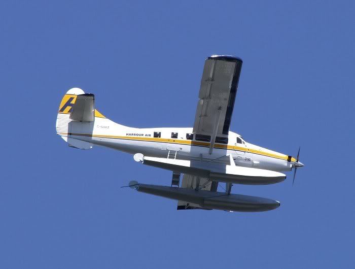
Give me a break, a quarter of a mile is nothing...Here is a photo I took from a distance of more than 1/4 mile. There are much larger lenses available than the one I used.
Perhaps God gave all the animals TomToms or Garmins so they could find their way to Noah's Ark
In 1989, a picture was taken of the Ark of Noah useing GPS numbers. And some here did not want to believe such numbers were in use by the public at that time. I believe, I have successfully put those doubts to rest. Needless to say, not many here find comfort in that revelation.
As I thought you continue to ignore the hard questions, and babble on about what you think are facts, but which really is nonsense.
Give me a break, a quarter of a mile is nothing...Here is a photo I took from a distance of more than 1/4 mile. There are much larger lenses available than the one I used.
After climbing three miles to the top, the person who actually took the picture did not know he was going to be in that position. He though he would be able to walk right up to it. His window of opportunity was very limited. He also stated the entire area was very dangerous, and that was as close as he could get because of obvious dangers. They did get premission to do a fly over, yet by that time, most of the area was being covered by snow again.
Please register to post and access all features of our very popular forum. It is free and quick. Over $68,000 in prizes has already been given out to active posters on our forum. Additional giveaways are planned.
Detailed information about all U.S. cities, counties, and zip codes on our site: City-data.com.

 Please register to participate in our discussions with 2 million other members - it's free and quick! Some forums can only be seen by registered members. After you create your account, you'll be able to customize options and access all our 15,000 new posts/day with fewer ads.


") Supposedly high tech gps but no decent camera? I call shenanigans.
Supposedly high tech gps but no decent camera? I call shenanigans.