Please register to participate in our discussions with 2 million other members - it's free and quick! Some forums can only be seen by registered members. After you create your account, you'll be able to customize options and access all our 15,000 new posts/day with fewer ads.
There's something that I've been wondering about for a long time, but can't seem to find an answer for. It's the intended route of the Lake Ontario State Parkway.
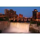
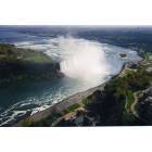
My family moved to the Rochester area at the end of 1957, so my father could begin his new job assignment on January 1st, 1958. Back in those days "Sunday drives" were a common thing, and I can recall that we took a few drives on the Parkway, heading out to Hamlin Beach. The Parkway, as I seem to recall, was originally intended to roughly follow the lakeshore, and run between the Robert Moses Parkway in Niagara Falls, at it's western end, then all the way to Watertown, at it's eastern end. Obviously, the project barely got started, before funding and/or interest ran out, and it's never been finished.
Something that I've always wondered, however, is how the engineers planned on getting the Parkway through the Rochester area, especially through Irondequoit. This was the only section of the Parkway that would have been going through a populated area that was already in existence. It's quite obvious that replacing the old Stutson Street bridge, over the Genesee River, was a key to keeping the Parkway project going, and that took YEARS to happen. However, since the Parkway construction had stalled, that put the new bridge on the "back burner", for quite a while. (OR, was it the other way around, the lack of a new bridge, stalled the Parkway? H-m-m-m.)
Nonetheless, while Irondequoit was already pretty well "built out" in the late 40s-early 50s, when this project was being proposed, and still on the drawing board, it wasn't as densely populated as it is today. Therefore, building the highway wouldn't have been as difficult as it would be in later years, but still a challenge. And Webster was still a big farm, back then, so building a 4 lane highway through there wouldn't have been a problem. But getting the Parkway across Irondequoit Bay, would have required a creative solution....or were the "unfinished ramps" on the west end of the Bay Bridge, the answer to that question?
Anybody have any information they'd like to share? While this certainly isn't an earth shattering question, it's something that I've always wondered, and anything that people could provide, would be appreciated...
I drive on part of the Parkway almost every day, and I've gotta say, It's a shame, the lack of mantainance the state provides now. I remember it was a very pleasurable ride from Lake Ave. to the end in both spring and fall. There used to be beautiful landscaping, and flowering bushes and trees, it was like driving through a park. Now, they barely cut even a small amount of the grass, and vines have strangled everything. Funny that they have the money to put up signs,(Seaway trail, Seabee hyway, etc), but not any money for maintanence,
I don't recall the bit about Watertown, but here's what I do remember. At one time the Parkway was to connect to Lakeshore blvd through Durand Eastman Park to connect to what is now 590, completing what was known as the Outer Loop (NY47). Lakeshore Blvd WAS 4 lanes, but as always, our very lame leadership narrowed it just before the O'Rouke Bridge was built.
So there's how they were to cross Irondequoit, but I have no info of it going further east. I would think that it would have to piggy back on NY104 and maybe head north after Sodus Bay.
BTW, those ramps are still a good idea to finish, especially with the outlet closed to cars all summer. Seabreeze would greatly benefit
A little more information about how it would cross Irondequoit.
If you notice, the O'Rourke Bridge takes a sharp northern curve on the east end. The original plan called for the road to run behind Stutson Plaza and follow an old rail route going over Thomas Ave. and St Paul Blvd, following the rail line which is behind the houses on the north side of Lakeshore Blvd and finally connecting to where it used to have 2 more lanes. You can see it on google maps.
Interesting.
It used to be such a nice road to drive on. The last time I recall driving the parkway was in '06.
Part of the reason why they planned a stretch of it to go through Irondequoit was where Pattonwood Drive is there was a huge municipal dump. The planned parkway through there was on the drawing board many years before the post-war housing was built, some of those houses are falling apart due to the fact the dump underneath them is shifting.
There is a problem with 2 houses and it is being dealt with, but that is north of this
……I don't recall the bit about Watertown, but here's what I do remember. At one time the Parkway was to connect to Lakeshore blvd through Durand Eastman Park to connect to what is now 590, completing what was known as the Outer Loop (NY47). Lakeshore Blvd WAS 4 lanes, but as always, our very lame leadership narrowed it just before the O'Rouke Bridge was built.
So there's how they were to cross Irondequoit, but I have no info of it going further east. I would think that it would have to piggy back on NY104 and maybe head north after Sodus Bay.
BTW, those ramps are still a good idea to finish, especially with the outlet closed to cars all summer. Seabreeze would greatly benefit
I did talk to someone else about this topic, several years back, and they essentially told me pretty much the same thing, although they emphasized that they were going strictly by vague memories. However, when two unrelated people tell you the same thing, that would make me believe that you're both on the right track.
Yeah, I do remember when Lakeshore Boulevard was 4 lanes. I also remember when I590, formerly NY 47, was 4 lanes, north of the Ridge Road exits. I don't know who was responsible for narrowing Lakeshore, but I'm pretty sure that out illustrious Congressman, Joe Morelle, was responsible for the "park-like upgrade" of 590....at the cost to the taxpayers, to the tune of $10 MILLION!!
Quote:
Originally Posted by JWRocks
A little more information about how it would cross Irondequoit.
If you notice, the O'Rourke Bridge takes a sharp northern curve on the east end. The original plan called for the road to run behind Stutson Plaza and follow an old rail route going over Thomas Ave. and St Paul Blvd, following the rail line which is behind the houses on the north side of Lakeshore Blvd and finally connecting to where it used to have 2 more lanes. You can see it on google maps.
OK, then, as you previously mentioned, the Parkway would have connected with 47/590, use the never finished ramps to cross the bay, they head east, in some way, shape or form.....
Quote:
Originally Posted by HowardRoarke
Interesting.
It used to be such a nice road to drive on. The last time I recall driving the parkway was in '06.
Part of the reason why they planned a stretch of it to go through Irondequoit was where Pattonwood Drive is there was a huge municipal dump. The planned parkway through there was on the drawing board many years before the post-war housing was built, some of those houses are falling apart due to the fact the dump underneath them is shifting.
My wife's aunt, sadly spent the last 10-12 months of her life in a nursing facility on Island Cottage Road, and we used the Parkway to get there. That was from around late March of 2018 through Late January-early February of 2019. Prior to that, the last time we were on the Parkway was around '06, also. We had gone to Niagara Falls for lunch, and for a change, we came back on Route 104. After slowing/speeding up, while going through the numerous small towns, I saw a sign for the Parkway, and decided to switch to that roadway. We headed north, and took a crazily circuitous route around a big pond, and picked up the Parkway at it's western terminus. Yeah, sadly, it was pretty beat up, and that was 13 years ago.
I sort of agree with your thoughts about the route east of the O'Rourke bridge, but I'll add this. Along with that area initially being the Irondequoit town dump, I'm thinking that the houses on Pattonwood Drive hadn't been started until around the time the Parkway project, at least to the east, had stalled. When it then looked like the eastern portion wouldn't be constructed, the houses started going up.
One other rather sinister thought was that several "heavy hitters" had protested, and blocked, the completion of the Bay Bridge ramps. I heard that from several people, a LONG time ago. If they did that early enough in time, that, too, could have put the brakes on the continuation of the Parkway, since the ramps were a "lynchpin" in the Parkway project. It still would be interesting to know if the "new" Route 104 was what the Parkway was originally intended to be, or if the Parkway was going to be a separate roadway, closer to the lakeshore. If that was the case, planning a route around Sodus Bay would have been interesting.
One last "memory"....I'm pretty sure that while the Parkway was being built, they did it one lane at a time, in each direction. I seem to recall my family driving out to Hamlin Beach, when I was pretty young, and one of my aunts and uncles had come to Rochester for a visit. I'm envisioning that as we were driving in one lane, the road crews were laying down asphalt for the other.
I'm not 100% sure, but I think the Parkway was concrete originally.
Also, that northern part of 590 is a waste. I think Bill Gray's had a lot to do with it. I would have much preferred that traffic go down Culver rd to bolster the "downtown" part of Seabreeze. Also, instead of the road I would have wanted housing built there. Imagine 100 new housing units (250 people) and what a boost it would give to that area. A few years back someone proposed a 13 story residential tower, but I guess it didn't get off the ground.
I'm not so sure I can agree with that. It seems to me, that the politicians, in a constant attempt to appease the area's boaters, and at the same time capitalize on the allure of the lake's shoreline, were/are trying to turn Irondequoit Bay into some sort of "recreational paradise". It began in the mid-1980s, when several tracts of Bayfront land were purchased by VERY influential people, and they began building condos with boat docks, and promised access to the lake. Since the Hojack rail line was no longer in use, it became a "no brainer" to remove the rail bridge, and "since we're at it", the bridge that carried Culver Road over the outlet was pulled out, too.
Getting back to the Parkway, I'm beginning to think that my initial thoughts about it were somewhat simplistic. Given it's proximity to the lakeshore, especially along the western portion of Monroe County, I more or less assumed that the roadway would remain fairly close to the shoreline. I took the name "Lake Ontario State Parkway" pretty literally. I suppose it's entirely possible that it was NOT the intention of the civil engineers, and the renovation of Route 104, which by itself, has taken some 25-30 years, was the original thought for the road that would be known as the "Parkway".
I'm not so sure I can agree with that. It seems to me, that the politicians, in a constant attempt to appease the area's boaters, and at the same time capitalize on the allure of the lake's shoreline, were/are trying to turn Irondequoit Bay into some sort of "recreational paradise". It began in the mid-1980s, when several tracts of Bayfront land were purchased by VERY influential people, and they began building condos with boat docks, and promised access to the lake. Since the Hojack rail line was no longer in use, it became a "no brainer" to remove the rail bridge, and "since we're at it", the bridge that carried Culver Road over the outlet was pulled out, too.
.
Can you elaborate more about your feelings? Sounds like you have an issue with the bay
Can you elaborate more about your feelings? Sounds like you have an issue with the bay
I don't have an issue with the bay. What I do have somewhat of an issue with, is that it appears, and has appeared for a LONG time, that a handful of people, people with strong governmental influence, are controlling the fate of the bay. It began in the early 60s, when the property owners I earlier referred to, prevented the bay bridge ramps from being completed. Later, property owners got the railroad and Culver Road bridges removed, opening the bay for boats (5-6 months of the year), but closing the route for automobile traffic, 12 months a year. Both of these actions had a major impact on the greater good of the population, yet were directed by a very small minority of the population. And as far as I know, there were never any public voting options offered, before the actions took place.
Please register to post and access all features of our very popular forum. It is free and quick. Over $68,000 in prizes has already been given out to active posters on our forum. Additional giveaways are planned.
Detailed information about all U.S. cities, counties, and zip codes on our site: City-data.com.

 Please register to participate in our discussions with 2 million other members - it's free and quick! Some forums can only be seen by registered members. After you create your account, you'll be able to customize options and access all our 15,000 new posts/day with fewer ads.