Please register to participate in our discussions with 2 million other members - it's free and quick! Some forums can only be seen by registered members. After you create your account, you'll be able to customize options and access all our 15,000 new posts/day with fewer ads.
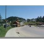
I have noticed that most of the roads that are located in the interior of the Black Hills are denoted as gravel roads. In general, most of the roads that are west of 385 and east of 85, seem to be designated as gravel. Can any these roads be driven in a passenger vehicle?
Can one assume that the roads between the towns in the interior such as, Deerfield, Mystic, Rochford would be in better shape than some of the others?
My "guide" describes Rochford Road as connecting Rochford with Lead to the north. The on-line BH tourism map identifies this road as a paved road, "17". However, my Garmin (2007) software identifies Rochford Road as running generally to the west and connecting Rochford to Highway 85 near the WY border and also appears to be designated FR231 on the BH tourism map. Can anyone clear this up for me?
My intuition tells me the most drivable route in this area may be to drive from Hill City to Deerfield then to Rochford and on to Lead through Dumont. Is this doable? Are there any other Forest Roads that provide a reasonably safe alternative to the more highly congested touron routes? I promise that I won't tell anyone.
I'd assume the gravel will be much harder on your cars tires too. Make sure they are in good condition to reduce the amounts of spare tire changes!
We once changed tires THREE times on a Suburban in Montana gravel roads!! Thank god we at least got in to get the tires patched before the next flat! ha ha
I have noticed that most of the roads that are located in the interior of the Black Hills are denoted as gravel roads. In general, most of the roads that are west of 385 and east of 85, seem to be designated as gravel. Can any these roads be driven in a passenger vehicle?
Can one assume that the roads between the towns in the interior such as, Deerfield, Mystic, Rochford would be in better shape than some of the others?
My "guide" describes Rochford Road as connecting Rochford with Lead to the north. The on-line BH tourism map identifies this road as a paved road, "17". However, my Garmin (2007) software identifies Rochford Road as running generally to the west and connecting Rochford to Highway 85 near the WY border and also appears to be designated FR231 on the BH tourism map. Can anyone clear this up for me?
My intuition tells me the most drivable route in this area may be to drive from Hill City to Deerfield then to Rochford and on to Lead through Dumont. Is this doable? Are there any other Forest Roads that provide a reasonably safe alternative to the more highly congested touron routes? I promise that I won't tell anyone.
Thanks everyone for your great advice!
Ghengis, I looked at official state map that the state puts out, as well as the 2009 Rand McNally Road Atlas. The road between Rochford and Lead was labeled as Forest Service Road 17 too. It shows on both that the road is paved.
The road from Hill City to Deerfield is also paved, according to the maps.
Ghengis, I can't say for sure that I've ever been on that road but do make sure that you take an adequate vehicle on BH gravel roads. You'd be surprised how many large potholes and large bumps come up. For example, a Toyota Corolla probably won't fare as well as a Jeep Wrangler.
Watch your speed too and don't make swift turns! Have fun!
Please register to post and access all features of our very popular forum. It is free and quick. Over $68,000 in prizes has already been given out to active posters on our forum. Additional giveaways are planned.
Detailed information about all U.S. cities, counties, and zip codes on our site: City-data.com.

 Please register to participate in our discussions with 2 million other members - it's free and quick! Some forums can only be seen by registered members. After you create your account, you'll be able to customize options and access all our 15,000 new posts/day with fewer ads.