Please register to participate in our discussions with 2 million other members - it's free and quick! Some forums can only be seen by registered members. After you create your account, you'll be able to customize options and access all our 15,000 new posts/day with fewer ads.
TRANSPORTAION CONSTRUCTION PROJECT FOR TAMPA AND ST PETERSBURGE FLORIDA
THE ‘43 BRIDGE PROPOSAL to link Tampa and St. Petersburg—finally.
by Ross Nicholson, (the genius who invented the modern meaning of ‘inclusive’)
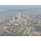
The '43 Bridge project is a new road, rail, and bicycle route from downtown Tampa across Old Tampa Bay to St. Petersburg’s I-375. Both I-175 and the SR 618 Lee Roy Selmon Crosstown Expressway toll-road are ‘highways to nowhere.’ Both are stub roads from the downtown business districts of St. Petersburg, FL and Tampa, FL, respectively. In Tampa, the new route will continue an existing expressway down an open, little-used, very wide rail corridor owned by CSX. The nearly abandoned rail corridor is occupied down half its length south from downtown Tampa by both the railroad tracks and SR 618. CSX has no objection to sharing the rest of the right of way. The county recently purchased the old abandoned phosphate mine on the waters edge next to Mac Dill Field Air Force Base where the bridge would begin on the Tampa side.
Because the '43 Bridge traverses "an estuary of national significance", the Environmental
Protection Agency will be designated the "lead Federal agency" for this transportation construction project. The '43 Bridge project is designed to improve transportation in a quickly growing area. It will create wildlife habitat, improve water quality and encourage wildlife in our estuary while mitigating, containing and treating air pollution, and providing a desperately needed hurricane evacuation route to save the lives of tens of thousands of Americans.
South St. Petersburg residents, largely African-Americans, will be trapped like rats in a cat 4 or category 5 hurricane because the southern escape Sunshine Skyway Bridge is always blocked off due to wind. We have all seen the projections. South St. Petersburg is the most dangerously hurricane-exposed large population on the Gulf of Mexico, exceeding even New Orleans.
See: Could Tampa Bay be the next New Orleans? (http://www.palmbeachpost.com/storm/content/state/epaper/2006/07/09/m1a_TAMPA_CANE_0709.html - broken link)
And
Palm Beach Post - If a storm surge hit Tampa (http://www.palmbeachpost.com/storm/content/storm/multimedia/flash/tampa_bay.html - broken link)
AIR: Emissions from traffic on the covered bridge and covered sound-deadened, vibration stopped roofed enclosed road extensions bordering residential neighborhoods will be removed. The roadway will be enclosed within a grass-covered, sound-deadening shed. The enclosure will also provide a means to treat the air with solar and wind powered scrubbers to remove all air pollution.
Two bridge designs are suggested as alternatives.
In the bay, plans are to build a dozen acres of new mangrove islands and causeways accessible only to wildlife. Causeway beaches (e.g. Davis Beach and the Red Neck Riveara on Gandy Causeway have been commercially unsuccessful.
Management Challenge: Getting agencies to cooperate: The causeway and islands would be suitable uses for dredged material from the loop channel in Hillsborough Bay being studied by the US Army Corps of Engineers. The new bridge construction site is actually closer than the traditional dumping bird islands, which already blocks after-hurricane Hillsborough Bay drainage disastrously as any fool can see from Palm Beach Post - If a storm surge hit Tampa (http://www.palmbeachpost.com/storm/content/storm/multimedia/flash/tampa_bay.html - broken link)
Mangrove islands depend on exposure to brackish waters. The new mangrove islands and causeways can use freshwater runoff from the bridge's roof to a pool in each one's interior. It is hoped that endangered species such as loggerhead sea turtles, brown pelicans, roseate spoonbills, blue heron and other species will take root and thrive there. Although some traffic noise and vibration may get through soundproofing, it may not be all bad, as guano build-up can be detrimental to mangrove islands.
The new bridge and highway work will be in residential neighborhoods in south Tampa, and St. Petersburg. The covered bridge design extends much of the length of the project, in residential neighborhoods from Interstate Highway I-375 to the Lee Roy Selmon Crostown Expressway on the Interbay peninsula. The roadbed will be like conventional limited access expressway designs with viaducts and cloverleaves, but undulations of the road surface will be minimized to enhance traffic flow. Unfortunately, putting railroad tracks under the same sound-deadening canopy would be prohibitively expensive, the railroad tracks will be left outside as seen north of Gandy Boulevard on the shared Lee Roy Selmon Crosstown Expressway right of way.
EPA is eager to be the "lead federal agency" on this. It is felt that EPA is the best choice because there is no other way to protect individual homeowner property rights properly. People don't want a stinky, noisy neighbor and transportation corridors should not automatically get exemption. In comparison to civil engineering structures, it costs almost nothing to cover the roadway and absorb all the noise. With this simple design, each component doesn't need to be waterproof, just the roof.
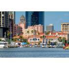
The primary reason for building the '43 Bridge is to improve traffic, especially right before a hurricane. The bridge will provide a hurricane evacuation route for at least 50,000 additional people, mostly on St. Petersburg's south side who would otherwise drown waiting for their white northern neighbors to clear the northern exit routes. Pinellas County is Florida's most densely populated county and the most exposed to disaster. Currently, south St. Petersburg and the southernmost beaches can escape via the Sunshine Skyway
Bridge or up the Pinellas peninsula through the isthmus on existing roads and bridges further north, but the Skyway closes far too soon to allow the population to leave.
Because of its great height and exposed roadway, the Sunshine Skyway closes earliest. That leaves the people on Pinellas' low ground waiting for their neighbors to clear the roads first, even though they are already on higher ground.
The practical solution is the '43 Bridge. It will be the penultimate southernmost hurricane
evacuation exit from Pinellas County, at the northern margin of downtown St. Petersburg. The design under consideration is cable stayed "with a twist." The '43 Bridge will be a covered bridge because the design prevents fog and high-wind truck accidents that so often plague the nearby Sunshine Skyway Bridge. More importantly, the covered bridge design extends the hurricane evacuation route's viability in our St. Petersburg neighbors' most desperate hour. It also provides an opportunity to manage unwanted travel emissions of pollution and noise, Tampa's main concern.
The downtown to downtown corridor to be occupied by the continuation of the Selmon
Expressway and the '43 Bridge is nearly seven miles shorter than the circuitous back way via I-275 and I-375. Cutting pollution and traffic congestion between the two downtowns by nearly 1/3 is a worthy transportation objective which will qualify for special federal funding to mitigate congestion and air pollution. Given President Obama’s personal interest in this project, Florida's increased representation in Congress and our area's continuing growth, the expectation is that the '43 Bridge will be funded as part of the Interstate Highway System in the very next fiscal year.
Existing CSX rails seem likely to run mass transit between the downtowns as well. One of
Hillsborough Area Rapid Transit's leaders are very interested in running light rail downtown to downtown. With a more attractive destination for the line (downtown St. Pete vs. Port Tampa), it should be an easy sell. An extension of track to a passenger station in St. Petersburg will not overly burden CSX Transportation. Running heavy locomotives over the high '43 Bridge will be uneconomical, it is not going to happen, but a combination supertrain acella high speed rail station and airport on the Tampa side midway between the downtowns is feasible. The proximity of Mac Dill Field and its potential as a commercial air transit hub (with long airstrips and neighborhood friendly over-water runway approaches) has not escaped attention, either. TIA will suffer diseconomies of scale (that's when crowding/rebuilding reduces efficiency) to accommodate High Speed Rail and the Mac Dill Field Terminal would be new construction with the station designed in.
The new civilian air terminal at Mac Dill Field is also in the discussion and preliminary design stage. Rumor has it that the Air Force is going to let us have commercial access on the same terms as we got Drew Field for Tampa International Airport (TIA), perhaps in exchange for an expressway exit.
The proposal has been before seven Tampa civic groups all in favor (5) or not opposed (2).
According to the St. Petersburg Times (Oct 31st, 2002) and City Times (Nov 1st, 2002), the St. Petersburg Chamber of Commerce is behind the idea, too. Several weeks ago, it was taken to Tampa City Council and they liked it, as did the Tampa chamber of commerce staff.
2. FLOATING COVERED BRIDGE. A floating covered bridge between two cities made of plastic (mostly recycled). To allow passage of pleasure boats (Old Tampa Bay is nearly devoid of commercial shipping.), the middle of the bridge would allow open water intermittently by either submersion (like a submarine) or ending the two joining spans to a lock ship, which splits to allow water traffic to pass. It may be cheaper to operate a conventional bridged canal reopening the old Picnic Island channel that was filled in with phosphate mine waste many years ago.
The advantages of the floating bridge are:
Low height so as not to interfere with aviation at Mac Dill Field.
No resistance to tidal flows. Decreased resistance to tidal flows if Picnic Island Channel is reopened.
No disturbance of the bay floor.
Absorbs energy from ship wakes allowing Mango habitat improvement.
Low cost, quickly constructed of mostly recycled materials.
Can be constructed off-site and towed in.
Pedestrian and bike friendly routes across the bay on top of the covered bridge or at the margins or as separate spans similar to my floating riverwalk idea.
Mooring pull energy during tidal ebbs and flows could generate power.
Very interesting! From where was this obtained? If I read that correctly, the new 'bridge' is supposed to improve the enviroment? The Leroy Selmon ends at Gandy Blvd. now, so it connects to the Gandy bridge which doesn't support the statement that it's a road to nowhere. This sounds like hundreds of millions of dollars in pork to me.
I was wondering why something this old was popping up again and then I saw who wrote it.
Didn't this idea die back in 2002?
Is it being renewed again or just by the OP?
As someone who is in the business, I can tell you that many of the claims made in this article are erroneous. This project lacks merit and is not even included in either County's Long Range Transportation Plan which is necessary in order to receive any type of federal funding
The drive time in the Tampa Bay area is long compared to other cities of similar size. This is because of our paucity of bridges. This is not an error. Glance at a map.
Building a new bridge between Tampa and St. Petersburg is an inevitability. Existing road corridors between the two cities cannot be widened further with safety. The Howard Franklin Bridge is 9 lanes wide now.
Adding rail over a light rail bridge to downtown St. Petersburg is also an economic inevitability because other people in other cities enjoy such amenities and will require them of elected officials. Current plans to run light rail on existing corridors exaggerate the distance between the two downtowns dramatically.
SR 618 is a 'road to nowhere' on the western side of Tampa because it does not connect to another expressway. The Lee Roy Selmon Expressway, highway 618, ends at Gandy Boulevard while the wide old rail corridor upon which the Selmon was built runs all the way to the bay. This is no error as can be verified by google maps. The corridor on the Tampa side is open. The shallow bay is already in public ownership. On the St. Pete side, there are old single-story houses and cheaply constructed office buildings between the bay and I-375. The Old North East subdivision would appreciate being 'cut off' from downtown by a quiet green hill (which is what the roadway and sound/vibration insulated shed would look like on the outside).
Research is available to demonstrate that roadway noise can be effectively muffled without digging a tunnel as they did in Boston for the same goal. It's cheap and it's been shown on This Old House and Hometime. Technology also exists to stop roadway vibration (digging a ten foot deep ditch between the edge of the road and the residential area, a few inches wide filled with foam--used as a utility tunnel). This is not an error. It is merely novel.
The roadway would save 14 minutes a day in cross-bay drive time for people living in downtown and south St. Petersburg. This is easy geometry and is no error. 14 minutes less drive time for 50,000 cars a day would substantially reduce Tampa Bay's air pollution and reduce fuel consumption. The tolls would pay for the bridge and there would be no need for new taxes. However property values would increase substantially (which would enhance revenues substantially as well).
As to me, personally, I am not 'in the trade' but I was trained in place theory in graduate school at Georgia Tech. I'm in Mensa. The 'frequent fireworks during tourist season', 'Lights On! Tampa!', and 'Floating Riverwalk' were all my ideas which is a matter of public record which anyone can search at City Hall (email). These projects have all had obvious merit as well.
I proposed the '43 bridge. I also proposed Lights on Tampa and Floating Riverwalk.
Quote:
Originally Posted by On-da-Beach
If I read that correctly, the new 'bridge' is supposed to improve the enviroment?
When 50 to 100 thousand people get to destinations at least 7 minutes faster, there is a lot less air pollution. Much of the roadway is proposed to be covered over under a sound-insulated shed to abate noise through residential neighborhoods in South Tampa, and air pollution from vehicles will be vented to a small air pollution treatment facility (basically another run through catalytic converters to remove more pollution).
Quote:
Originally Posted by On-da-Beach
The Leroy Selmon ends at Gandy Blvd. now, so it connects to the Gandy bridge which doesn't support the statement that it's a road to nowhere.
The Selmon expressway 618 does not connect to another expressway. Gandy Blvd. is a surface street. I-375 also ends on surface streets and does not connect to an expressway, they are both 'stub' expressways to nowhere.
Quote:
Originally Posted by On-da-Beach
This sounds like hundreds of millions of dollars in pork to me.
It's proposed as a private toll road, no local tax contribution necessary, although a federal contribution would be correct for this extension of I-375.
The economic benefits are gigantic and include:
Bigger convention venues coming to the Tampa Bay area: Multiplier for total hotel rooms and convention facilities (downtown St. Pete's hotel rooms & facilities 7 minutes away from downtown Tampa's convention center and hotels).
Less roadway congestion, another shorter alternative across the bay.
Safer South St. Petersburg (hurricane evac. route)
No more heavy trucks on surface roads in the Port Tampa area running 24 hours a day.
Higher property values for south interbay peninsula in Tampa, Old Northeast Neighborhood in St. Pete.
Ability to eat lunch in St. Petersburg if you work in downtown Tampa and vice versa.
As someone who is also in the business, I can tell you this has no merit. It is not in either county's long-range transportation plan. It is highly unlikely to see any new bridges built across Tampa Bay in our lifetime. This bridge would be much too long, would ruin the natural look of many parts Tampa Bay, and would face extreme public opposition. The Gandy and Howard Frankland were born in eras when public participation really didn't matter.
What is more likely is that you would see a third span added to the Howard Frankland (to be reversible lanes or HOV/HOT lanes) . The Crosstown will most likely be extended all the way to the Gandy bridge.
Please register to post and access all features of our very popular forum. It is free and quick. Over $68,000 in prizes has already been given out to active posters on our forum. Additional giveaways are planned.
Detailed information about all U.S. cities, counties, and zip codes on our site: City-data.com.

 Please register to participate in our discussions with 2 million other members - it's free and quick! Some forums can only be seen by registered members. After you create your account, you'll be able to customize options and access all our 15,000 new posts/day with fewer ads.