As some of you may know, Pinellas County is a jumble of municipalities. What you may call St. Pete might actually be in Pinellas Park, or simply unincorporated county. Fortunately, there is an easier way to find out where exactly you are in Pinellas. Thanks to the street signs, you can figure out exactly which city/town you're in, unless, of course, the city line runs down the middle of the street or cuts the block in half, which happens more than you might think.
I don't have examples for every city just yet, but I do have most of them.
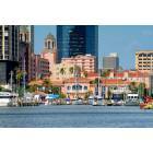
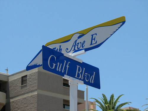
First off, let's start with St. Petersburg.
 Corner
 (http://www.flickr.com/photos/ferret111/4216674995/ - broken link) by
ferret111 (http://www.flickr.com/people/ferret111/ - broken link), on Flickr
Kenneth City, a bizarre little city surrounded by St. Pete and unincorporated Lealman.
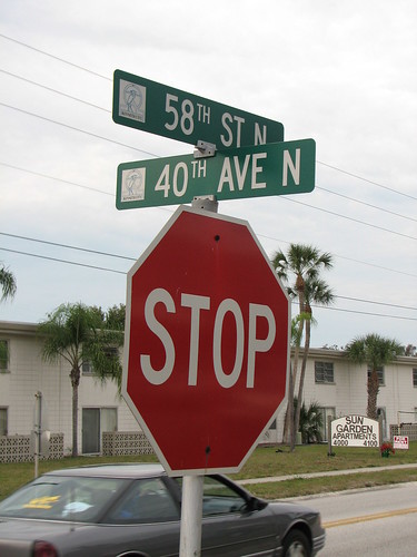 Stop
Stop (http://www.flickr.com/photos/ferret111/4216675771/ - broken link) by
ferret111 (http://www.flickr.com/people/ferret111/ - broken link), on Flickr
Pinellas Park, one of the bigger Pinellas cities.
 58/62
58/62 (http://www.flickr.com/photos/ferret111/4223633477/ - broken link) by
ferret111 (http://www.flickr.com/people/ferret111/ - broken link), on Flickr
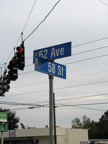
Gulfport, one of the more established Pinellas cities. Surrounded by St. Pete on two sides, Boca Ciega Bay on one, and a sliver of unincorporated no man's land on the other.
 Beach Boulevard
 (http://www.flickr.com/photos/ferret111/4576232590/ - broken link) by
ferret111 (http://www.flickr.com/people/ferret111/ - broken link), on Flickr
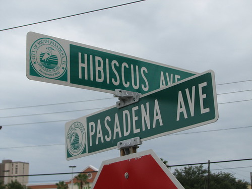
South Pasadena. A lot of people travel through this city, but I don't think many realize that it is a separate entity.
 Pasadena Avenue
 (http://www.flickr.com/photos/ferret111/4856241860/ - broken link) by
ferret111 (http://www.flickr.com/people/ferret111/ - broken link), on Flickr
St. Pete Beach. Formerly St. Petersburg Beach until an early 90s name change.
 Gulf Way
 (http://www.flickr.com/photos/ferret111/4227823784/ - broken link) by
ferret111 (http://www.flickr.com/people/ferret111/ - broken link), on Flickr
Treasure Island, Redington Shores, Indian Rocks Beach, Redington Beach, and Madeira Beach all use a simple green sign:
 Plain Jane
 (http://www.flickr.com/photos/ferret111/4666548624/ - broken link) by
ferret111 (http://www.flickr.com/people/ferret111/ - broken link), on Flickr
North Redington Beach uses a blue sign with a beach scene:
 Mean Streets of North Redington Beach
 (http://www.flickr.com/photos/ferret111/5002091505/ - broken link) by
ferret111 (http://www.flickr.com/people/ferret111/ - broken link), on Flickr
Indian Shores used to use a blue sign for the relatively few streets in town:
 Old Street Sign
 (http://www.flickr.com/photos/ferret111/4653479127/ - broken link) by
ferret111 (http://www.flickr.com/people/ferret111/ - broken link), on Flickr
Now Indian Shores uses a very elaborate street sign. I've only seen it in one place so far:
 New Street Sign
 (http://www.flickr.com/photos/ferret111/4653478445/ - broken link) by
ferret111 (http://www.flickr.com/people/ferret111/ - broken link), on Flickr
Belleair Beach likely gets its signs made by Clearwater, which explains their similarities.
 Seashell City
 (http://www.flickr.com/photos/ferret111/5002626512/ - broken link) by
ferret111 (http://www.flickr.com/people/ferret111/ - broken link), on Flickr
Belleair Bluffs is another tiny municipality located just over the causeway from Belleair Beach.
 Generic Belleair Bluffs
 (http://www.flickr.com/photos/ferret111/4718076709/ - broken link) by
ferret111 (http://www.flickr.com/people/ferret111/ - broken link), on Flickr
Belleair is the oldest of the four Belleairs. There's a lot of money in this city, so they can afford some pretty fancy signs:
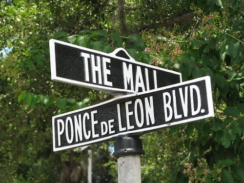 The Mall
 (http://www.flickr.com/photos/ferret111/4721849599/ - broken link) by
ferret111 (http://www.flickr.com/people/ferret111/ - broken link), on Flickr
Seminole isn't nearly as big as many people think. You almost have to seek out a City of Seminole street sign.
 Seminole Stylin'
 (http://www.flickr.com/photos/ferret111/4811857545/ - broken link) by
ferret111 (http://www.flickr.com/people/ferret111/ - broken link), on Flickr
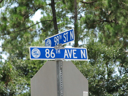
Largo is either the second- or third-largest Pinellas city.
 East Bay Drive
 (http://www.flickr.com/photos/ferret111/4795133555/ - broken link) by
ferret111 (http://www.flickr.com/people/ferret111/ - broken link), on Flickr
Safety Harbor uses the traditional green sign, except that a lot of them seem to be recycled signs with different lettering and various in various stages of aging:
 Safety Harbor Stylin'
 (http://www.flickr.com/photos/ferret111/5002119817/ - broken link) by
ferret111 (http://www.flickr.com/people/ferret111/ - broken link), on Flickr
Most of Oldsmar uses a blue sign, while Downtown Oldsmar features a decorative sign with an early Oldsmobile car.
 Oldsmar Stylin'
 (http://www.flickr.com/photos/ferret111/4705981159/ - broken link) by
ferret111 (http://www.flickr.com/people/ferret111/ - broken link), on Flickr
Clearwater used to use a blue sign with a hibiscus flower. While these still comprise the vast majority of Clearwater signs, the city has since switched to an almost solid blue design.
 Gulf to Bay Boulevard
 (http://www.flickr.com/photos/ferret111/5002751320/ - broken link) by
ferret111 (http://www.flickr.com/people/ferret111/ - broken link), on Flickr
Finally we have the default sign for Pinellas County. This sign is used in all of the unincorporated areas like Lealman, Oakhurst, and Palm Harbor:
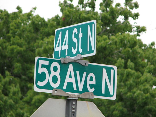 Lealman Avenue
 (http://www.flickr.com/photos/ferret111/4725449345/ - broken link) by
ferret111 (http://www.flickr.com/people/ferret111/ - broken link), on Flickr
I don't have pictures for Tarpon Springs and Dunedin, nor do I have pictures for Belleair Shore, since there aren't any actual streets in that city.
I hope this helps you next time you find yourself lost or confused in Pinellas County, Florida.

 Please register to participate in our discussions with 2 million other members - it's free and quick! Some forums can only be seen by registered members. After you create your account, you'll be able to customize options and access all our 15,000 new posts/day with fewer ads.