Please register to participate in our discussions with 2 million other members - it's free and quick! Some forums can only be seen by registered members. After you create your account, you'll be able to customize options and access all our 15,000 new posts/day with fewer ads.
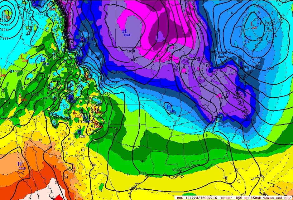
Current temps and radar. Classic Cold Air Damming situation coming up. High Pressure up north giving below zero temps north of the U.S border will filter down cold air and that cold air will get stuck at the surface for many locations. If there wasnt warm air from the south pushing north, it would be snow... but because this warm air is coming up and because cold air doesnt rise, Ice situations occur.
This is something I've been mentioning since November worried about ice storms because this seems to be the setup lately. While this weekend wont have a lot of moisture, I dont expect an "ice storm" but there will be areas with ice and all it takes is a little to create a mess out there!
Who remembers this one? Arctic air dives south, low from the gulf meets it. Ice storm in the south, Low merges with a MidWest storm, big snowstorm up the East coast.
This gets us through Dec. 27th. For those predicting some soft of permanent white-out north of I-90, the National Weather Service disagrees with you. So far they have been pretty much on the money for this month.
Huh. Looking at the right map? The forecast looks below average above I-90. I'm a bit worried now, it's the first downturn I've seen. Hopefully short.
OK, I just noticed that the link goes to the latest long range, so that thing will be changing a lot. Next time I'll just upload the static image.
Please register to post and access all features of our very popular forum. It is free and quick. Over $68,000 in prizes has already been given out to active posters on our forum. Additional giveaways are planned.
Detailed information about all U.S. cities, counties, and zip codes on our site: City-data.com.

 Please register to participate in our discussions with 2 million other members - it's free and quick! Some forums can only be seen by registered members. After you create your account, you'll be able to customize options and access all our 15,000 new posts/day with fewer ads.


 I'm a bit worried now, it's the first downturn I've seen. Hopefully short.

