Please register to participate in our discussions with 2 million other members - it's free and quick! Some forums can only be seen by registered members. After you create your account, you'll be able to customize options and access all our 15,000 new posts/day with fewer ads.
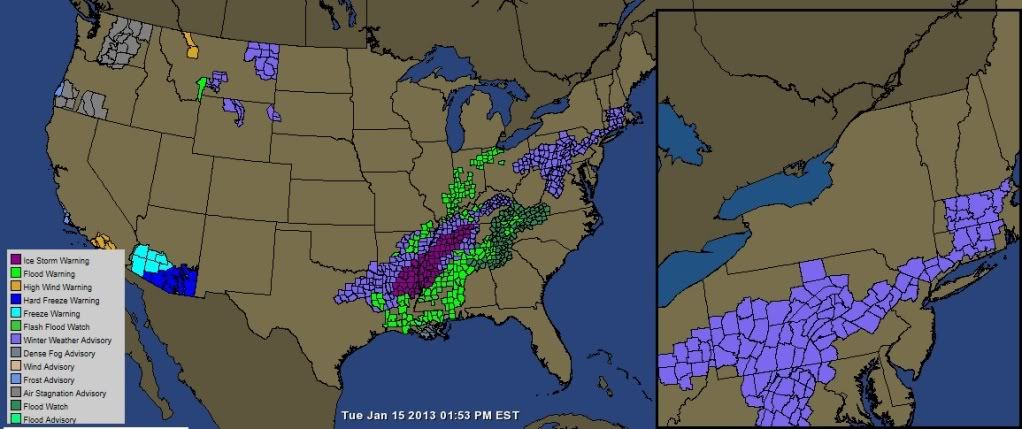
"Cold and snow lovers rejoice! Much more seasonably cold January weather will continue for the foreseeable future, along with numerous bouts of lake effect snow. Tonight will be mainly quiet, before a strong cold front arrives with a period of wind and snow showers on Wednesday. In its wake, much colder air arrives for Thursday, with accumulating lake effect likely for the snowbelts. A few Alberta clippers will make a visit Friday into Saturday, before more sustained cold and lake effect arrive into midweek next week."
We'll see how everything pans out, as much of this winter nothing has come into play as they predict. So we will wait and see what happens. We did get about 3-4" of some nice powder to cover up all the ugly left from the January thaw from last week. Now if we can just keep adding to it this week and next. It was 9F / -12C this morning and that was unexpected.
Why is winter weather more interesting than summer? Because you get to look at the vertical profile of the atmosphere and figure out whats snow and whats not and see where the layers are cold and warm.
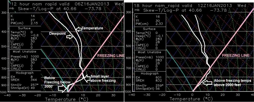
Lets take the latest NAM model for instance for NYC tonight.
Left image is for 1am. Right image for 7am.
At 1am the 2 white lines are together all the way to the surface which means moisture is present and falling. Small layer around 4000' is above freezing but below freezing from 3000' to surface. This would indicate a mix to me. Snow/Sleet or Freezing Rain/Snow
At 7am notice the lines are above freezing. Its raining in NYC at this point.
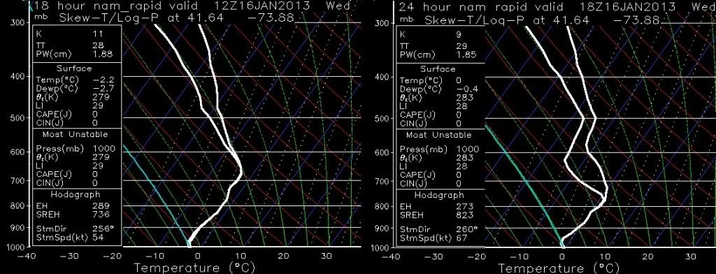
Now here's Poughkeepsie, NY about an hour north from NYC. Notice anything different?
Looks like all snow for POU there. Defeinetly snow at 1am then I think theres not enough warm layer in the right image at 7am to melt the snow and looks cold enough to refreeze. If anything I say Freezing rain there maybe mix snow/ice.
Not sure what the green/blue lines are, I believe it shows instability or mixing ratios, or something regarding the atmosphere. Im still learning the advance stuff.
Whats the nearest station near you I'll pull that up. Coordinates would be best of closet area
Please register to post and access all features of our very popular forum. It is free and quick. Over $68,000 in prizes has already been given out to active posters on our forum. Additional giveaways are planned.
Detailed information about all U.S. cities, counties, and zip codes on our site: City-data.com.

 Please register to participate in our discussions with 2 million other members - it's free and quick! Some forums can only be seen by registered members. After you create your account, you'll be able to customize options and access all our 15,000 new posts/day with fewer ads.