Please register to participate in our discussions with 2 million other members - it's free and quick! Some forums can only be seen by registered members. After you create your account, you'll be able to customize options and access all our 15,000 new posts/day with fewer ads.
Your temperature variablity isn't as high as here, but your seasonal changes aren't as drastic, so perhaps the two effects cancel each other out? Last frost is usually in the first two weeks of May:
Data includes years from the early part of the 20th century, which were a bit cooler.
On May 10, the average morning low is 42.5°F with a standard deviation of 7.4°F, so if a normal distribution is correct, 16% of the time the morning will be below 35°F. By the end of May, the morning low is 50°F so a frost becomes unlikely. Early July, 58°F so essentially impossible.
Yes thats what I am thinking.
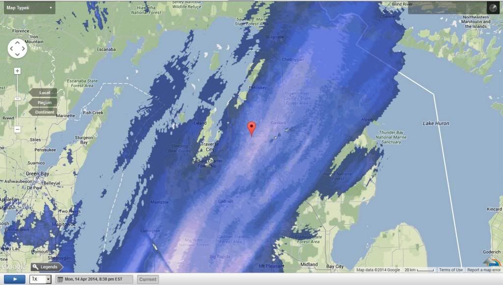
Apparently I have the same last frost date as central Canada but not anywhere near the same amount of frosts. Perhaps the cold sea keeps ground cooler.
11 States with a Freeze Warning in them. (AR CO IL IN KS KY MO NM OH OK TX)
16 with a Freeze Watch. (DC DE GA IL IN KY MD MO NC NJ OH PA SC TN VA WV)
4 with a Hard freeze (KS, NM, OK, TX)
If this was only January or February. LOL. 993mb coastal storm, 850 freezing line off the coast. Surface in the 30s. Moisture around. I'd be more excited.
huge high pressure ridge building up over northeastern europe. with some luck we'll hit 20C. i'm beginning to doubt we'll ever get below normal temperatures here again
11 States with a Freeze Warning in them. (AR CO IL IN KS KY MO NM OH OK TX)
16 with a Freeze Watch. (DC DE GA IL IN KY MD MO NC NJ OH PA SC TN VA WV)
4 with a Hard freeze (KS, NM, OK, TX)
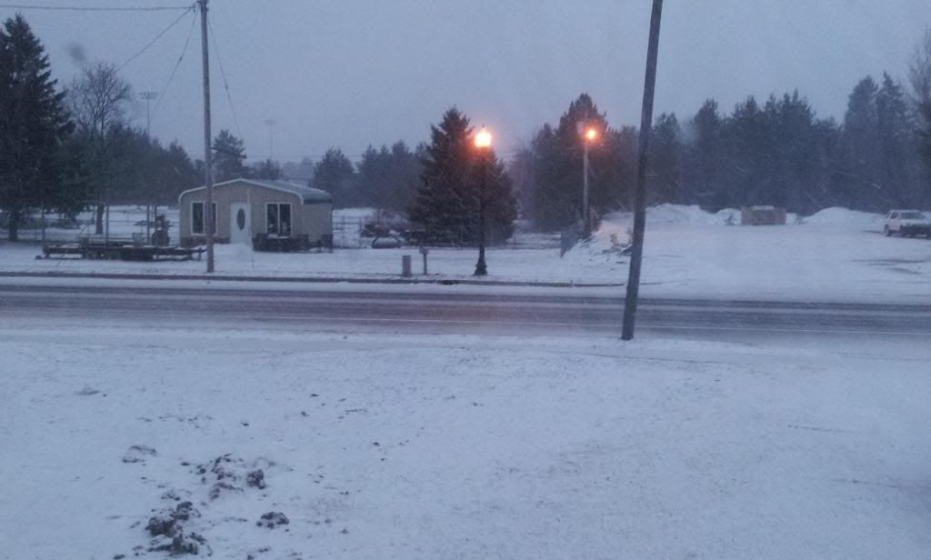
Yeah, I hope so, too. Even the local news showed that some snow could move into this area around 1 AM Wednesday. Growing season already underway. Got stuck this afternoon behind an enormous tractor, so wide I couldn't even pass it on a two-lane road with no shoulder on either side for quite some way.
Been pretty decent this past week. Up into the 50's with rain off and on and we were finally down to a few snow clumps in the yard, but then the temps decided to show us who was still in charge.
Probably will get freeze alerts here too. Here's nws ny. You guys ready for the cold air? Mid level temps drop hard and the surface will reflect on it. Lately 850mb temps have been above 8c.
A BRIEF BURST OF MODERATE TO HEAVY SNOW IS NOT OUT
OF THE QUESTION TUE EVENING N&W OF NYC. THIS POSES POTENTIAL FOR
SOME LIGHT SNOW ACCUMULATION...AND WITH TEMPS FALLING INTO THE
20S SOME ICY ROAD CONDITIONS OVERNIGHT.
LOW TEMPERATURES WILL BE NEAR OR BELOW FREEZING LATE TUESDAY NIGHT
INTO VERY EARLY WEDNESDAY MORNING. WITH THE GROWING FOR THE ENTIRE
COASTAL AREAS AND PORTIONS OF INTERIOR NE NJ/LOWER HUDSON
VALLEY...THERE IS POTENTIAL THAT FREEZE CONDITIONS COULD BE MET FOR
MUCH OF THIS AREA.
.LONG TERM /WEDNESDAY THROUGH MONDAY/...
THE BIG STORY DURING THIS PERIOD WILL BE THE TEMPERATURES...AS THEY
WILL BE WELL BELOW NORMAL FOR THIS TIME OF YEAR...AND ESPECIALLY
CONSIDERING HOW WARM IT HAS BEEN ACROSS THE AREA RECENTLY. WEDNESDAY
WILL FEATURE STRONG COLD AIR ADVECTION AS HIGH PRESSURE CENTERED
OVER THE OHIO VALLEY BUILDS IN. 850 TEMPERATURES ON WEDNESDAY WILL
RANGE FROM AROUND -8C INLAND...TO -3C TO -6C ACROSS LONG ISLAND.
THIS SHOULD TRANSLATE INTO TEMPERATURES IN THE MIDDLE TO UPPER 40S
FOR MUCH OF THE AREA...WITH LOWER 50S POSSIBLE ACROSS THE NYC METRO
AREA.
Please register to post and access all features of our very popular forum. It is free and quick. Over $68,000 in prizes has already been given out to active posters on our forum. Additional giveaways are planned.
Detailed information about all U.S. cities, counties, and zip codes on our site: City-data.com.

 Please register to participate in our discussions with 2 million other members - it's free and quick! Some forums can only be seen by registered members. After you create your account, you'll be able to customize options and access all our 15,000 new posts/day with fewer ads.