Please register to participate in our discussions with 2 million other members - it's free and quick! Some forums can only be seen by registered members. After you create your account, you'll be able to customize options and access all our 15,000 new posts/day with fewer ads.
Squaw Valley Resort, 1960 Squaw Valley Road, Olympic Valley, CA 96146
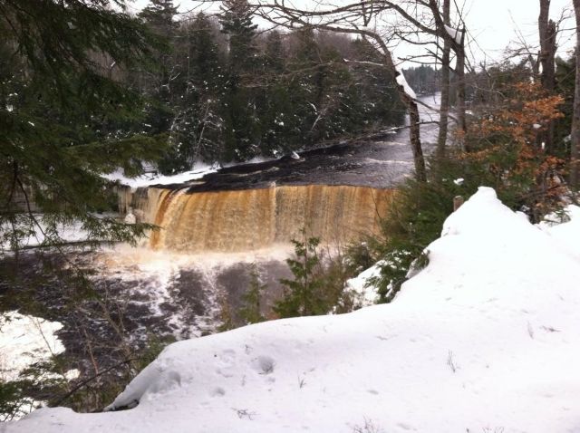
I wonder if the mountains around LA are going to get snow with this storm coming ashore? I enjoy pics of the snow covered mountains out west. Much better looking than our snow covered Appalachians around here.
I wonder if the mountains around LA are going to get snow with this storm coming ashore? I enjoy pics of the snow covered mountains out west. Much better looking than our snow covered Appalachians around here.
Probably only at the highest elevations.
The southwest winds ahead of this system will allow temperatures to stay on the warm side, keeping snow levels high and above pass levels. However, some high elevation mountain snow is likely, with over a foot of snow possible above 7500 feet. Over two feet of snow is possible near the Sierra Crest.
I wonder if the mountains around LA are going to get snow with this storm coming ashore? I enjoy pics of the snow covered mountains out west. Much better looking than our snow covered Appalachians around here.
Sub Tropical jet ramping up as Nino becomes consistent. California will get bigger storms than us next couple weeks.
This was just issued hours ago..
THE NATIONAL WEATHER SERVICE IN SACRAMENTO HAS ISSUED A WINTER
STORM WATCH ABOVE 7000 FEET...WHICH IS IN EFFECT FROM TUESDAY
MORNING THROUGH LATE WEDNESDAY NIGHT FOR THE WEST SLOPES OF THE
NORTHERN SIERRA NEVADA AND LASSEN NATIONAL PARK.
* IMPACTS: TRAVELERS MAY EXPERIENCE DELAYS. CHAIN RESTRICTIONS
LIKELY THROUGH THE PASSES.
* CONFIDENCE: HIGH.
* TIMING: A STRONG WINTER STORM WILL BEGIN TO AFFECT THE REGION
TUESDAY AND WILL CONTINUE INTO THURSDAY. THE PERIOD OF HEAVIEST
SNOWFALL IS EXPECTED TUESDAY NIGHT AND WEDNESDAY.
* SNOW ACCUMULATIONS: 12 TO 18 INCHES WITH WITH 2 TO 3 FEET OVER THE HIGHER PEAKS
Hmm. But that's for mountains far to the north of Los Angeles. The Los Angeles peaks are about the same latitude as Atlanta, Northern Sierra Nevada about the same as Baltimore. Anyhow, what's the snow line for Los Angeles region mountains? Looks like the snowline is almost the same as the northern Sierra... shows how weak the north-south temperature gradients can be on the west coast. From NWS Los Angeles. Will copy the rest of it on the winter thread.
OTHER POTENTIAL IMPACTS FROM THIS STORM SYSTEM INCLUDE GUSTY
SOUTHEAST TO SOUTH WINDS ON TUESDAY...ESPECIALLY ACROSS HIGHER
TERRAIN WHERE GUSTS OVER 50 MPH WILL BE POSSIBLE. THE SUBTROPICAL
NATURE OF THIS MOISTURE WILL LIKELY KEEP SNOW LEVELS VERY
HIGH...GENERALLY ABOVE 7500 FEET THROUGH AT LEAST TUESDAY NIGHT.
SCATTERED SHOWERS BEHIND THE MAIN FRONT WILL LIKELY LINGER INTO
WEDNESDAY OR WEDNESDAY NIGHT...AND SNOW LEVELS WOULD LOWER SOME AT
THAT TIME.
Hmm. But that's for mountains far to the north of Los Angeles. The Los Angeles peaks are about the same latitude as Atlanta, Northern Sierra Nevada about the same as Baltimore.
Yup, was just awesome to see the 2-3 feet of snow so figured I post that. Here's the current alerts in California per county. CA - Weather Alerts
Please register to post and access all features of our very popular forum. It is free and quick. Over $68,000 in prizes has already been given out to active posters on our forum. Additional giveaways are planned.
Detailed information about all U.S. cities, counties, and zip codes on our site: City-data.com.

 Please register to participate in our discussions with 2 million other members - it's free and quick! Some forums can only be seen by registered members. After you create your account, you'll be able to customize options and access all our 15,000 new posts/day with fewer ads.


 Here's the current alerts in California per county.