Please register to participate in our discussions with 2 million other members - it's free and quick! Some forums can only be seen by registered members. After you create your account, you'll be able to customize options and access all our 15,000 new posts/day with fewer ads.
Weird, Boston and the rest of the east coast of Massachusetts is an island of warmth. In the spring it's off the opposite, usually with any onshore air flow; remember they dropped below 60°F during the heat wave the weekend before last.
Weird, Boston and the rest of the east coast of Massachusetts is an island of warmth. In the spring it's off the opposite, usually with any onshore air flow; remember they dropped below 60°F during the heat wave the weekend before last.
Yeah cool but Not weird. Cool airmass hasn't reached them yet. Watch tonight and tomorrow. Currently getting the change dropped to 60s during the afternoon.
Tomorrow Max temp departure
Moderate Saturday to seasonable levels then .......... reinforcing shot of cool that stays north of NYC
For Nei ... Enjoy.. Posting whole thing. So detailed and interesting!!
Go Take a hike Nei! lol
Quote:
National Weather Service Burlington VT
317 PM EDT WED JUN 8 2016
As of 210 PM EDT Wednesday...Unseasonably cool and mostly cloudy
conditions to continue through the next 24-30 hours. Broad mid-
upper tropospheric trough in place across SERN Canada/New England
with deep closed 500mb low centered across New Brunswick this
afternoon. Several embedded mid-level vort centers are moving
through the cyclonic/nw flow regime. The first is passing across
NJ/sern NY this afternoon, and is associated with just a
few/isold light rain showers across s-central VT on nrn fringe of
the system. These showers will tend to diminish/move east of VT
after 21-22Z. The next shortwave trough is across swrn Quebec, and
will track sewd across VT during the overnight hours. While there
are some breaks in the clouds this afternoon, looking for
conditions trending overcast after sunset areawide.
Should see some light orographic precipitation develop across both the nrn Adirondacks and nrn Green mountains with this
synoptic feature and continued NW flow (850mb winds 30-35 kts).
Have indicated PoPs around 60% for the higher elevations, and
generally 20-40% for the valleys. NAM12/BTV-4km WRF/NAM-4km all
indicate a few hundreths QPF in the orographically favored
locations of the Adirondacks and nrn Greens. Freezing levels drop to 2000-2500` after midnight. That said, saturated layer is
relatively shallow per NAM/GFS model soundings (just a 2kft thick
band from 3- 5kft in the 12Z NAM) and not particularly cold
(generally warmer than -5C), thus thermal regime favors
supercooled water over frozen condensate. Anticipate a bit of
riming or freezing drizzle across the ridge tops tonight, with
perhaps intermittent snow flurries at times, if saturation can
occur at colder temperatures within the clouds. Lowered any snow accumulation to <1" for the highest peaks of the nrn Greens and nrn Adirondacks based on anticipated sounding profiles. Low
temperatures tonight generally 42-46F at surface elevations AOB
1000 ft, with is 7-10DEG below the 30-yr climo mean in most spots.
Thursday: Continued deep-layer NW/cyclonic flow regime in place
across NY and Northern New England for Thursday. NAM12/BTV-4km
WRF/NAM-4km show continued orographic showers, mainly across far
n-central into nern VT, where best deep-layer moisture is
expected tomorrow. Freezing levels remain relatively low, around
2kft at 12Z and climbing to around 3kft at 18z per 12Z NAM
soundings across nrn VT. Again, saturated layer is relatively
shallow and generally warmer than -5C, so again rime and/or a bit
of freezing drizzle is favored over snow for the ridge tops, but did keep some snow mention in case saturation extends deeper and to colder temps. Otherwise, anticipate mostly cloudy skies in
upslope areas, and some partly sunny conditions in downslope areas
downwind of the nrn Adirondacks and into the CT river Valley given
the NW flow. Low- level mixing should yield NW daytime winds
10-20mph, with gusts 20-30 mph during the late morning thru aftn
period given steep lapse rates and moderately strong sea-level
pressure gradient in place. In terms of temperature, should be
our coolest day of the stretch with highs only in the low-mid 50s
for n-central and nern VT - as well as the Adirondack communities
- and upr 50s to lower 60s in the St. Lawrence Valley, the
Champlain Valley, and into the CT valley with some
adiabatic/downslope warming conditions.
&&
.SHORT TERM /THURSDAY NIGHT THROUGH FRIDAY NIGHT/...
As of 317 PM EDT Wednesday...Cyclonic flow and continued
unsettled conditions will continue into Thursday evening. 12z
NAM/GFS and most recent SREF mean suggest primary axis of 925-700
mb moisture is mainly focused across the northern mtns of VT.
Meanwhile depth of moisture becomes increasingly more shallow
across the Adirondacks into the evening hours. Accordingly, I`ve
focused PoPs for light showers in the slight chance to chance
category across the Northeast Kingdom and the northern/north-
central Greens. Partly to mostly cloudy skies along with 850 mb temps around 0 to +2C support lows in the 40s except mid/upper 30s across the mtns.
Temperatures then begin to moderate on Friday, in response to a
pattern change toward building 500-mb heights. Slight chances for
showers across the Northeast Kingdom will continue for the morning
hours on Friday, but expect the depth of moisture to become more
shallow here as well. Prevalence of showers should therefore
become fewer and far between, with dry conditions then the rule
Friday afternoon and evening. 925-850 mb warm advection to take
place on northwest flow Friday, with warming 850 temps to +3 to
+6C by early Friday evening, and then further rising to +5 to +9C.
Under partial sunshine, look for highs Friday in the upper 50s to
low 60s eastern VT to mid/upper 60s in the milder valley
locations. Lows Friday night generally in the 40s to near 50 in
the Champlain Valley.
&&
.LONG TERM /SATURDAY THROUGH TUESDAY/...
As of 317 PM EDT Wednesday... Highly-amplified CONUS mid-
tropospheric pattern to evolve into the extended. In this pattern,
large-scale troughing with fast mid-level flow in the mean across
the Northeast US is about the only detail that can be confidently
stated about the period. Timing and phase differences of
individual shortwave troughs in the northwest flow unfortunately
preclude more specific daily details. As the previous forecaster
alluded to, expect a rollercoaster of temps initially near or
slightly above normal with below-normal temperatures a likely
outcome late in the weekend into the middle of next week.
Per indications inherent in today`s 12z GFS and ECMWF, a possible
window of significant active weather would be Saturday afternoon
or Sunday, as a strong cold front is likely to pass across the
North Country. Latest indication is that the front would arrive
Saturday evening. Aloft, both models show strong upper dynamics
associated with potent mid-level shortwave trough - including
diffluent mid-level flow focused mainly Saturday evening.
Unfavorable time of day limits available instability for the front
to work with, but the strong dynamics would at this point support
a limited risk of T-storms. Maintained idea of high-chance/low-
likely PoPs for Sat night. Timing that front will be a point to
monitor in later model runs. Saturday`s also the warmest day in
the extended period with highs low/mid 70s.
Upper trough progresses southeastward Sunday and then evolves into a wrapped-up upper low setting up shop somewhere in the Gulf of Maine or Nova Scotia/Canadian Maritimes region. Unseasonably cool temperatures aloft (reflected by sub-550 dm 1000-500
thickness with 850 mb temps a couple degrees either side of 0C should lead to highs only in the 60s with good mixing of northerly gusts. Slight chance to chance PoPs indicated for early
next week as moisture is wrapped around, highest around the
northern mtns of VT. It adds up to a potentially raw couple days by mid-June standards.
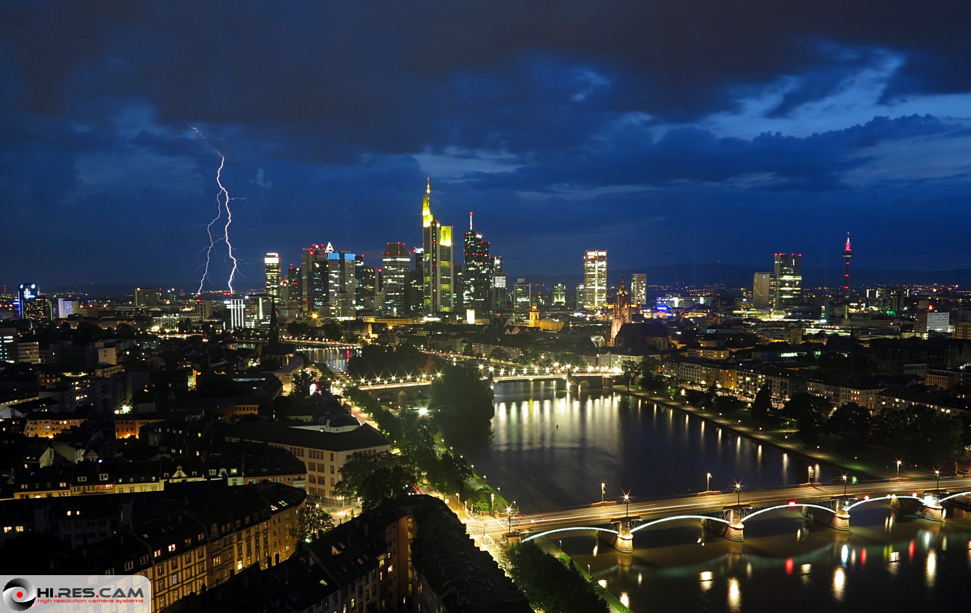
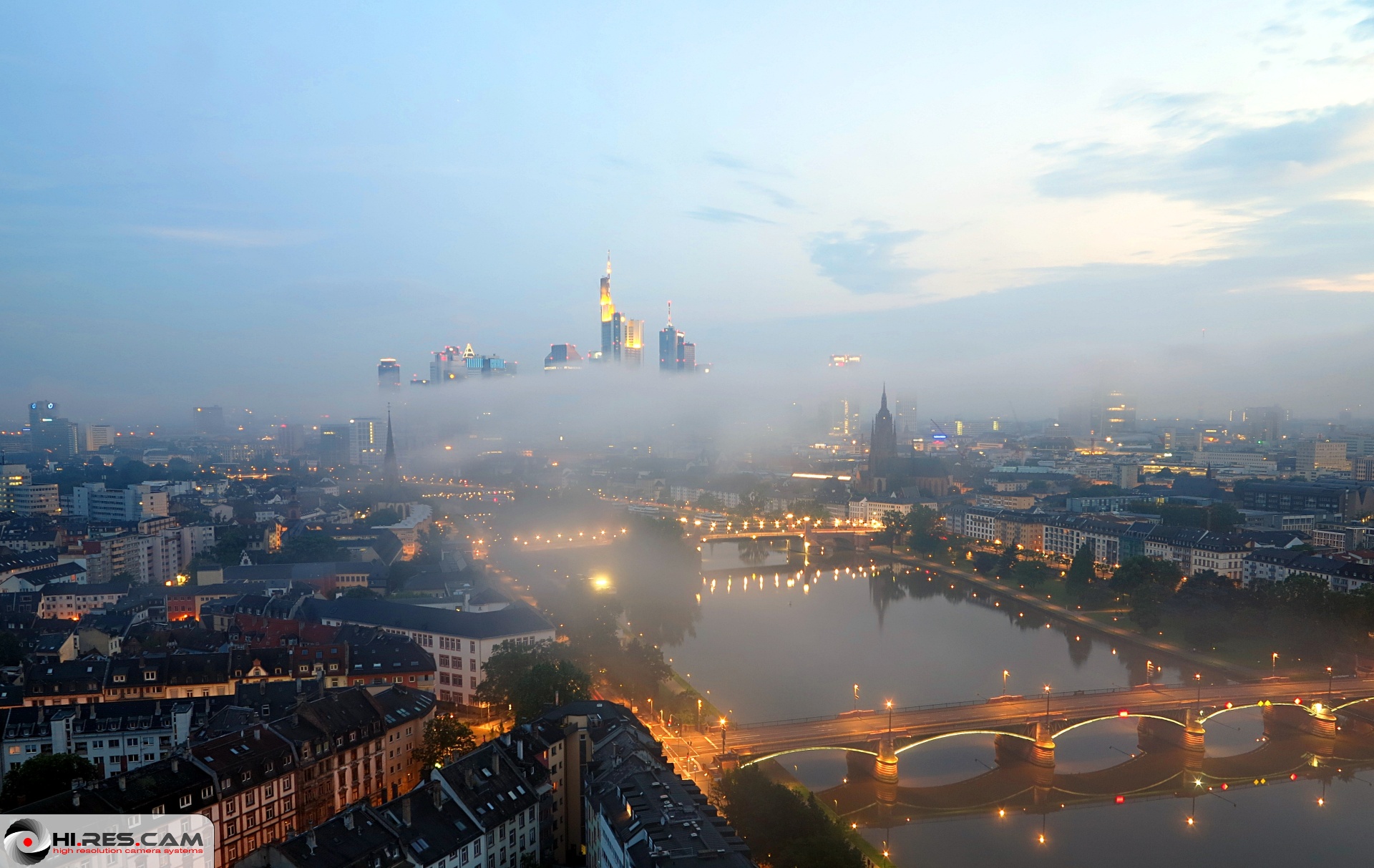
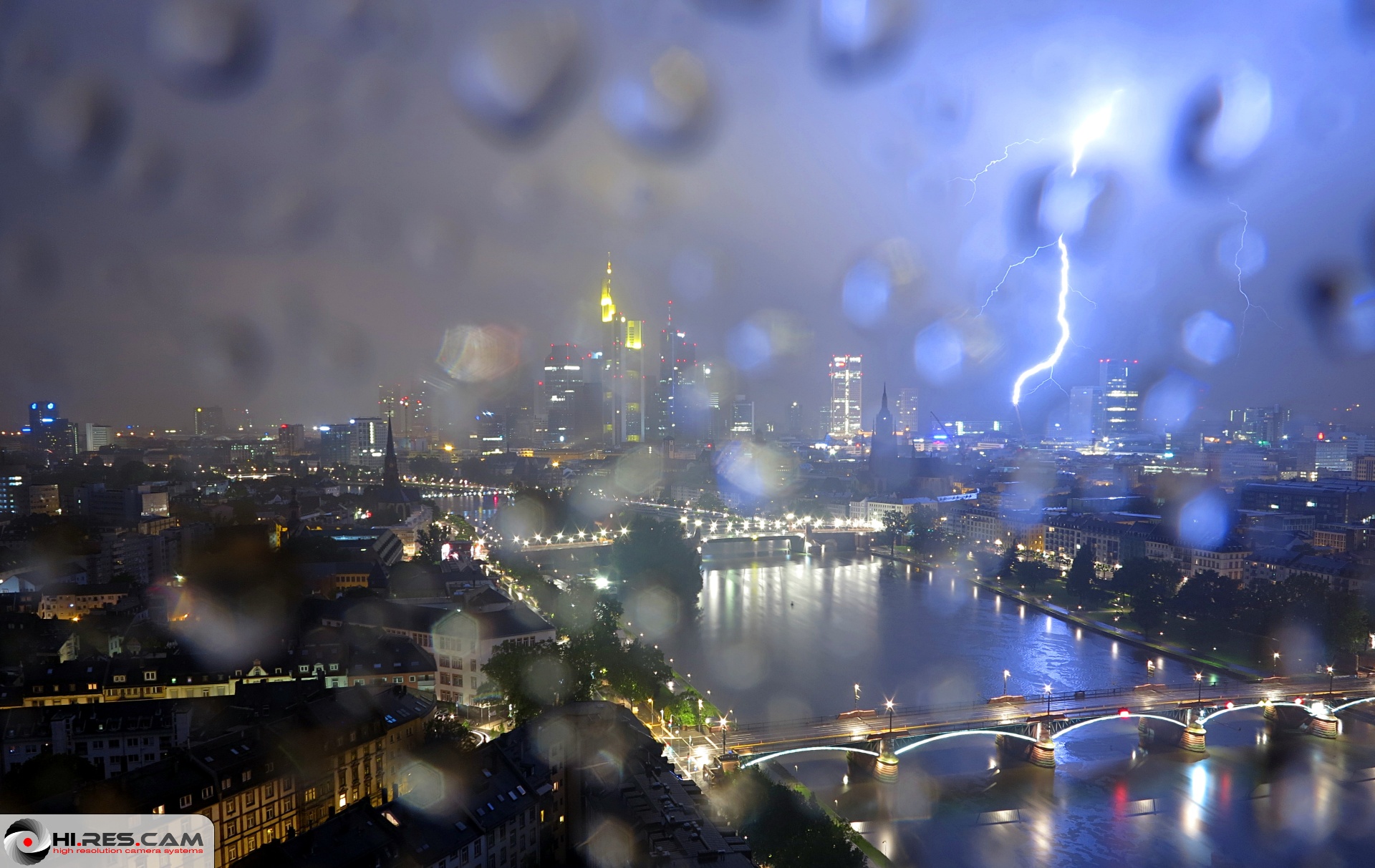
I use to check a webcam here for interesting weather shots. These are my favourites from last week. (The webcam takes a picture every 5 minutes, so a lightning is rather seldom.)
Lol. Love your humor. Im outside and its almost chilly for short sleeves. Lol
Rejuvenating! Sun is out now, windy! Air is cleaner and fresher.
Thanks
Five minutes ago it was jacket weather, now with the sun I think a shirt would be enough. Rain today was freezing! Usually that type of rain the summer in New York City would feel like swimming in a bowl of ramen, but not today
Please register to post and access all features of our very popular forum. It is free and quick. Over $68,000 in prizes has already been given out to active posters on our forum. Additional giveaways are planned.
Detailed information about all U.S. cities, counties, and zip codes on our site: City-data.com.

 Please register to participate in our discussions with 2 million other members - it's free and quick! Some forums can only be seen by registered members. After you create your account, you'll be able to customize options and access all our 15,000 new posts/day with fewer ads.


 Had the heat on in the car with windows open.