Please register to participate in our discussions with 2 million other members - it's free and quick! Some forums can only be seen by registered members. After you create your account, you'll be able to customize options and access all our 15,000 new posts/day with fewer ads.
Trailhead elevation: 490 m (1,608 ft)
Summit elevation: 3,538 m (11,608 ft)
(hadn't realized that it's exactly a 10,000 feet ascent!)
Time to summit: 6 hours
Time back to car: 4 hours
Distance hiked: 24 km (15 miles)
Temperature: between 22°C and minus few °C (70s to 20s °F), windchill probably around -10°C at the summit (lower teens °F)
Rozenn....1 word... Wow.
I think these were your best photos yet. Will try to comment later. Gotta run.
Maybe we crossed paths. I've witnessed a bit of damage on trees near Foresto.
July 14, 2016
Trailhead elevation: 490 m (1,608 ft)
Summit elevation: 3,538 m (11,608 ft)
(hadn't realized that it's exactly a 10,000 feet ascent!)
Time to summit: 6 hours
Time back to car: 4 hours
Distance hiked: 24 km (15 miles)
Temperature: between 22°C and minus few °C (70s to 20s °F), windchill probably around -10°C at the summit (lower teens °F)
[...]
And so you really did it!
I'm really surprised to read this post, and I'm even more surprised thinking about what happened that night... I really don't know what to say about that
Anyway, so that this is the weather forum and this is the thread about our summer photos, I will concentrate on those aspects.
So, first of all, you took fantastic pictures, really! I live just at the feet of that mountain, but I've never gone up to that mountain, I'm too lazy probably. And then I don't know if I would be able to reach the summit and the Sculpture of Virgin Mary (I'm a little afraid of heights, and I don't have any kind of technical preparation...).
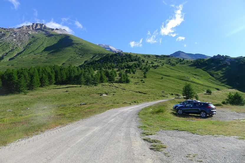
Anyway, you have taken a really long road for reaching the summit! Usually the people in here reach by car the "rifugio la Riposa" (it should be near the place in which you took the picture of the parked cars), and then they walk just for the last part of the path.
In addition, you have also chosen a day with particular weather conditions that our average July day, colder than usual and with more wind. I'm feeling cold just looking at the ice on the Sculpture, was it windy too?
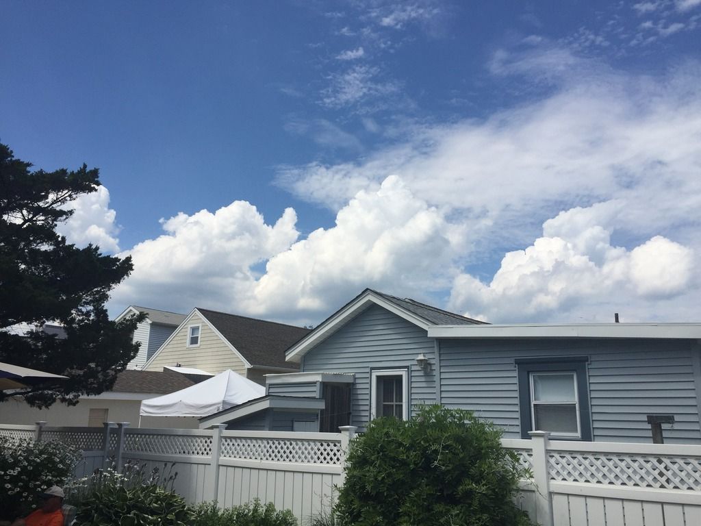
About the power lines (and the roads, the railways...) it is true what you have written, our valley is the main connection road between Italy and France of this sector of the Alps and so we have a lot of infrastructures of any kind. We probably live in the most "artificial" valley of this area of the Alps, sometimes it is difficult to find an angle for taking pictures without showing any man-made stuff...
About the vegetation, that seems quite Mediterranean in the driest points, I've found this webpage: in Italian or in French (sorry, no English yet).
Summarizing the content of that page, it says that in the area of Bussoleno, Chianocco, Mompantero, Susa and Venaus there is a "xerothermic oasis" ("xerothermic" refers to the climatic conditions present on the southern side of the Alps just after the last glaciation. In that period the climate in here was generally warmer and drier than now. Which means that this sector of our valley has a drier and warmer climate than usual, that allowed to species of that period to survive in here until now).
About the climate it says that the position of the Susa Valley favors particular climatic conditions, characterized by low precipitations (less than 800 mm/year). In addition, the south exposition of that side of the valley determine a particularly mild winter and a really dry summer that gives some Mediterranean characteristic to the local flora and fauna. In this area species originating in the mediterranean area or in central area (from warm and dry climates) can be found. Several of those species are extremely rare or completely absents in the rest of Piedmont. Among the plants found in this area there are the holm oak and theJuniperus oxycedrus (in particular around the area of the Orrido di Foresto). There are also Lavandula angustifolia, Ononis pusilla, Leuzea conifera, Fumana ericoides and Cheilanthes acrostica. About animals there are several species of invertebrates, which are really rare in Piedmont or present only in here.
On the other side of the valley there are mainly normal deciduous trees forests, which become conifers with the altitude.
About the French toponyms, they could also be partly in Piedmontese (so our regional language) or in some other patois. For example I'm quite sure that "Grange" is read in the Italian way, and not in the French one.
For the pictures of the summit I really can't say nothing, just spectacular!
The last pictures are from the high part of the valley and nearby, right? The last picture with a village in it looks like Pragelato.
In conclusion, I'm really impressed for both the pictures and the effort of the trip itself (you have really walked a lot!)
Trailhead elevation: 490 m (1,608 ft)
Summit elevation: 3,538 m (11,608 ft)
(hadn't realized that it's exactly a 10,000 feet ascent!)
Time to summit: 6 hours
Time back to car: 4 hours
Distance hiked: 24 km (15 miles)
Temperature: between 22°C and minus few °C (70s to 20s °F), windchill probably around -10°C at the summit (lower teens °F)
I thought my hike was big. This is a longer version of a hike I've done several times in the last few years. One of my White Mountain January hikes had similar summit temperature to your Alps hike last Thursday. 3500 m gets you colder mountains, though that still sounds cold for that elevation and time of year there.
Up and around the Great Gulf, July 12, Presidential Range, White Mountains
Trailhead elevation: 1,400 feet
Summit elevation: 6,288 feet (though it was a loop
Elevation gain: 7,500 feet
Total time: about 15 hours
Distance hiked: about 18 miles
Temperature: around 60°F at the start in early morning, upper 50s at the summit, maybe reached low 70s somewhere along the middle of the hike
At the beginning of the Great Gulf. Viewpoint near the beginning of the trail ontop of a flat topped boulder
Same mountain. Everywhere else was sunny but there were cumulus ? clouds lingering over the higher peaks
Lush and muddy trail. It rained recently, leaving water on the trail in many places
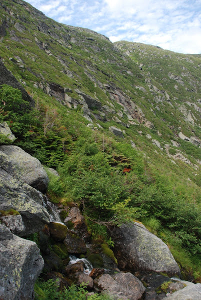
Followed a river for a long time, there was a 0.5-1 mile stretch with cascades and waterfalls
Spoiler
Saw a lot of this plant
Spoiler
Stream crossing, had a lot of them
River ends at a lake (in the lower right) and the headwall of the vally lies in front.
trail is annoyingly frequently underwater. Looked around a bit and went off trail, not believing that was the real trail.
trailside vegetation:
Spoiler
getting closer to the headwall
now it follows waterfalls. Is trail the right word or route?
it's even marked in places
see the lake where I was? The valley I had hiked through for ~7 miles. The peaks from front to back walling the valley: Jefferson, Adams and Madison. Washingon is right behind, or rather above me.
like this foreground
eventually the trail goes from following a stream to just a boulder slope
Spoiler
from
to on the boulders
getting close to the final stretch up. Or at least what I think is the final stretch.
going close to the final stretch up. Or at least what I think is the final stretch. Cairns became sparse, I chose the wrong route. Though I saw another stretch of rock to the right with a cairn, it looked harder than the one I was on. At the top, after re-finding the trail
Looking south from the summit of Mt. Washington. Nice, gentle not that rock strewn hiking trail
Looking north has more up and down. The rest of my hike follows the ridge connecting those peaks.
Unlike Rozenn's summit there was a cafeteria and hundreds of tourists. Unpleasantly crowded but I needed a break, a water refill and something caffeinated. They only sold hot coffee no iced coffee or iced tea. Summit was 57°F (dewpoint 50°F) but with the sun and uphill hiking I felt warm. Building inside had windows open but wasn't that well ventalited, usually not much of a need for cooling. Air was rather still on the summit and the sun heated the rocks. Wind was 5-10 mph. Still preferable over 20s in the summer… Wouldn't be as irritated by the crowds in a big city but a mountaintop? After seeing no one on the entire way up it was a shock. Hard to sit and look out with eager people taking each other's photos. Anyway, back to the rest of the hike
Train coming down the summit
Interesting convective clouds:
Spoiler
Looking back at my route up
close-up
Spoiler
Think I marked it right; red arrow is the route I took, green arrow is the "trail". Wished it was well marked, but as a wilderness area, the forest service doesn't bother to mark it well. The inital start of the green route looked a bit steeper but it's clear it was less steep overall. Also wasted time once I got to the top figuring out the best way to get on trail while minimizing trampling on fragile vegetation. My headwall climb came out to 1700 feet of elevation gain in about 3/4 mile.
From this angle, the peaks are almost in a line
On the uphill to the next peak (Jefferson)
saw lots of these flowers above treeline
Spoiler
the summit of Jefferson was anti-climatic
Spoiler
Low spot on the trail in between Jefferson and Adams
view back to Washington and Jefferson and the Great Gulf
near the summits it turns to rockpile. on the upper part of Adams
from the top of Adams looking towards Madison
Opposite direction back towards Washington
Steep descent to the col between Adams and Madison. And rough on our feet. Altocumulus skies to the north ahead approaching warm front of hot, humid air. Looks like rain, but no rain tonight.
Saw a rabbit in the shrubs. At around 4900 feet. Didn't expect to see rabbits near treeline. Summit of Mt. Madison
Trailhead elevation: 490 m (1,608 ft)
Summit elevation: 3,538 m (11,608 ft)
(hadn't realized that it's exactly a 10,000 feet ascent!)
Time to summit: 6 hours
Time back to car: 4 hours
Distance hiked: 24 km (15 miles)
Temperature: between 22°C and minus few °C (70s to 20s °F), windchill probably around -10°C at the summit (lower teens °F)
Still a long way to go:
1st ... Holy Crap at the climb!!! 10,000 feet?? Wait ... in 6 hours??? The time and miles is a nice hike but the ascent is mind boggling me. Either the grade was steep the entire way or you move like lightning.
Temp range is perfect but would mean a heavier backpack I guess. Nice wind chills but while sweating maybe wasn't pleasant? Were you prepared or were you wearing shorts as usual?
How much liquid did you consume?
Was there cell phone service up there? Or what elevation did you start to lose it?
Very hard to pick a favorite. I found 3 I really liked. This ..... This .... and the above
Was that a Giant Groundhog or an Otter just chillin on that rock? Nice wildlife catch....again.
Nice snow patches! And nice catch on that "brave" tree at that elevation. lol You think it was planted by someone?
Anyway .. welcome back, many of us were thinking about you.
Quote:
Originally Posted by nei
Up and around the Great Gulf, July 12, Presidential Range, White Mountains
Trailhead elevation: 1,400 feet
Summit elevation: 6,288 feet (though it was a loop
Elevation gain: 7,500 feet
Total time: about 15 hours
Distance hiked: about 18 miles
Temperature: around 60°F at the start in early morning, upper 50s at the summit, maybe reached low 70s somewhere along the middle of the hike
Nice hike nei. You guys giving me the itch but no way I can do anything now. Have to wait a month at least or perfect timing.
So it took you 5 hours more to do a 4,888 climb vs Rozenn's 10,000 climb. Plus yours was longer distance. I wonder if there's a typo with Rozenn's numbers.
I have to say ... I really like the Adirondacks better. I think even has better views but I'm only judging by photos not experience. Just something bland about the hikes in NH. (Yes, I'm trying to get you to go to the ADKs for a hike)
All the little 1/4" rain events (& humidity maybe) must be helping, otherwise usually the grass is browner by now.. but I almost forgot, it's about neglect and care mostly. This was taken at 8:30am. It gets full hot sun 10-6pm
It's time to apple Summer Guard. It says to water in after applying so with the rain coming later I will time it perfectly & apply it an hour before it starts. Why pay to water when mother nature can do it for you?
Other than low rivers and me needing to water the garden everyday, you can hardly notice we're in a Moderate drought here. Droughts are so overrated. In the near future we'll wish it would stop raining so much.
Impressive project. I guess it was almost unnoticeable from the nake eye?
Amazing hike you did, and stunning photos.
Please register to post and access all features of our very popular forum. It is free and quick. Over $68,000 in prizes has already been given out to active posters on our forum. Additional giveaways are planned.
Detailed information about all U.S. cities, counties, and zip codes on our site: City-data.com.

 Please register to participate in our discussions with 2 million other members - it's free and quick! Some forums can only be seen by registered members. After you create your account, you'll be able to customize options and access all our 15,000 new posts/day with fewer ads.


 I've witnessed a bit of damage on trees near Foresto.