Welcome to City-Data.com Forum!
U.S. CitiesCity-Data Forum Index
Go Back   City-Data Forum > General Forums > Weather
 [Register]
Please register to participate in our discussions with 2 million other members - it's free and quick! Some forums can only be seen by registered members. After you create your account, you'll be able to customize options and access all our 15,000 new posts/day with fewer ads.
View detailed profile (Advanced) or search
site with Google Custom Search

Search Forums  (Advanced)
 
Old 06-28-2012, 04:38 PM
 
Location: Yorkshire, England
5,586 posts, read 10,653,022 times
Reputation: 3111

Advertisements

Not very interesting, but I'll happily take it:

 
Old 06-29-2012, 01:33 PM
 
Location: Coldwind Farm
647 posts, read 797,129 times
Reputation: 558
 
Old 06-29-2012, 02:55 PM
 
Location: Mid Atlantic USA
12,623 posts, read 13,927,203 times
Reputation: 5895
Just plain old hot.


Old 06-30-2012, 05:04 AM
 
Location: Columbus, Ohio
1,682 posts, read 3,207,108 times
Reputation: 1224
It's like I never left the South

Today: A chance of showers and thunderstorms after noon. Partly sunny, with a high near 92. West wind between 5 and 11 mph, with gusts as high as 20 mph. Chance of precipitation is 30%.
Tonight: Partly cloudy, with a low around 60. Northwest wind between 3 and 10 mph.

Sunday: Mostly sunny, with a high near 91. Light north northwest wind.
Sunday Night: Partly cloudy, with a low around 66. North northeast wind at 7 mph becoming east southeast.

Monday: Mostly sunny, with a high near 91. South southwest wind between 3 and 8 mph.
Monday Night: Partly cloudy, with a low around 67.

Tuesday: A chance of showers and thunderstorms. Partly sunny, with a high near 91. Chance of precipitation is 40%.
Tuesday Night: A chance of showers and thunderstorms. Mostly cloudy, with a low around 69.

Independence Day: Partly sunny, with a high near 92.
Wednesday Night: Partly cloudy, with a low around 69.

Thursday: Mostly sunny, with a high near 93.
Thursday Night: Partly cloudy, with a low around 70.

Friday: Sunny and hot, with a high near 94.
 
Old 06-30-2012, 05:12 AM
 
1,463 posts, read 3,266,820 times
Reputation: 2828
Quote:
Originally Posted by ausweatherman View Post
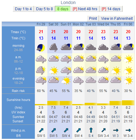
I'll start a thread on weather forecasts for your area.

I will start with my forecast for Perth:

All TEMPS in celsius.

Forecast for Wednesday eveningChance of a shower but mainly fine. Light winds.Precis: Mainly fine.

Forecast for Thursday Chance of a morning shower but otherwise fine. Light winds.Precis: Mainly fine. City: Min 7 Max 20 Mandurah: Min 9 Max 19
Friday Fine. Min 6 Max 21
Saturday Fine day. Evening showers. Min 7 Max 22
Sunday Morning showers easing. Min 12 Max 18
Monday Becoming fine. Min 6 Max 18
Tuesday Shower or two. Min 7 Max 18
Wednesday Fine. Min 6 Max 18.
Brrrrr chilly for you! Our winter is yet to come and we will be having those cooler temps for sure. Right now it is our summer time and in Farenheit, we are going to be 95 degrees here in the state of Connecticut today. We will perhaps get 3 maybe 4 months of warm weather and then we will be going into Fall and finally winter come November/December. Stay warm!
 
Old 06-30-2012, 05:14 AM
 
1,463 posts, read 3,266,820 times
Reputation: 2828
Quote:
Originally Posted by tom77falcons View Post
Just plain old hot.

I hear ya! Yesterday here in Connecticut it was 96 and the air was too thick to even enjoy a swin in our pool. Today, going to be about the same but a little less humid. Going to swim and relax for a time by the pool, can't wait! Have a good day and stay cool!
 
Old 06-30-2012, 08:11 AM
 
Location: New Jersey
15,318 posts, read 17,219,445 times
Reputation: 6959
Today: A slight chance of showers and thunderstorms after 3pm. Mostly sunny, with a high near 92. West wind around 7 mph. Chance of precipitation is 20%.

Tonight: A chance of showers and thunderstorms, mainly after 10pm. Mostly cloudy, with a low around 64. Light west wind. Chance of precipitation is 30%. New rainfall amounts of less than a tenth of an inch, except higher amounts possible in thunderstorms.

Sunday: A slight chance of showers and thunderstorms. Partly sunny, with a high near 90. West wind between 3 and 10 mph. Chance of precipitation is 20%.

Sunday Night: A slight chance of showers and thunderstorms before midnight. Partly cloudy, with a low around 61. North wind between 3 and 5 mph. Chance of precipitation is 20%.

Monday: A slight chance of showers and thunderstorms after noon. Mostly sunny, with a high near 86. West wind between 5 and 9 mph. Chance of precipitation is 20%.

Monday Night: Partly cloudy, with a low around 63.

Tuesday: Mostly sunny, with a high near 87.

Tuesday Night: Partly cloudy, with a low around 64.

Independence Day: Scattered showers and thunderstorms. Partly sunny, with a high near 89. Chance of precipitation is 30%.

Wednesday Night: Mostly cloudy, with a low around 66.

Thursday: Scattered showers and thunderstorms. Mostly sunny, with a high near 87. Chance of precipitation is 30%.

Thursday Night: Partly cloudy, with a low around 65.

Friday: Mostly sunny, with a high near 87.
 
Old 06-30-2012, 08:53 AM
B87
 
Location: Surrey/London
11,769 posts, read 10,595,401 times
Reputation: 3099
Not a single day above average in this forecast, sunshine below average and lots of rain.

 
Old 07-04-2012, 06:25 PM
 
Location: Buxton, England
6,990 posts, read 11,415,160 times
Reputation: 3672
Wow this forecast from a new amateur forecaster Hector Wilberforce sure doesn't look promising for summer:

HECTOR WILBER-FORCE'S LONG RANGE WEATHER FORECAST 2012 - UK

JULY 5H - JULY 13TH

IN THIS WEEK - RAIN AND GLOOM AND HUMID FOR THE FIRSRT TWO DAYS
MORE LOW PRESSURE SITTING WEST OF THE UK. NORTHERLY WINDS USHERING IN LATTER PERIOD

JULY 14TH - JULY 21ST
COOL ARCTIC NORTHERLY WINDS WITH OVERCAST AND DRIZZLE IN MOST PARTS. MORE SHOWERY PERIODS IN THE SE AND

COOLER THAN NORMAL BY ABOUT 2-3 DEGREES BOTH DAY AND NIGHT BUT ONLY BY DAY IN THE NW AND NORTH.

RAINFALL TO BE AROUND AVERAGE OR SLIGHTLY BELOW IN THIS WEEK, BUT COOL AND BREEZY

JULY 22ND - 28TH

NO SIGNS OF SUMMER. VERY COOL WITH BANDS OF FRONTAL RAIN USHERING IN FROM THE NWS AND AFFECTING ALL

PLACES, PARTICULARLY SE AND CENTRAL ENGLAND, AND THE SW LATER. SNOW OVER THE HIGHLANDS. TEMPS DOWN BY 4

DEGREES ON THE AVERAGE. WINDY PERIODS. GENERALLY OVERCAST.

JULY 29TH-31ST
ONE MILD DAY AS A LOW BRINGS SOME TROPICAL MARITIME AIR. HOWEVER WILL BE OVERCAST AND DRIZZLY IN THE

WEST WITH FEW CLOUD BREAKS TO THE VERY NE. AND VERY SE. THIS SHOULD ALLOW MAX TEMPS TO BE NEAR AVERAGE

THERE, BUT NIGHT TIME TEMPS ABOVE AVERAGE UNDER HEAVY CLOUD AND HUMIDITY, AND THEN ALSO WINDY, AND THEN

BANDS OF HEAVY SQUALLY RAIN ON 31ST AS COLD FRONT COMES THROUGH

OVERALL JULY LOOKS TO BE VERY COOL AND WET WITH TEMPS 3 DEGREES- TO 3.5-4 BELOW AVERAGE, AND 300MM OF

RAIN. ON AVERAGE OVER THE COUNTRY. ABOUT 70-90 HOURS SUN FOR MOST PLACES.

AUGUST 1ST - 8TH
A COLD WEEK AGAIN, WITH PERSISTENT NORTHERLY OR NORTH WESTERLY WINDS, COOL WITH SHOWERS, SOME WITH

HAIL. HOWEVER CONDITIONS COULD BE WET IN THE VERY SOUTH WITH MORE FRONTAL SYSTEMS PRESENT HERE FROM

LOWS TRACKING SOUTH INTO EUROPE. THE OLYMPICS WEATHER FORECAST IS FOR WET AND COOL CONDITIONS AND A

STIFF COLD WIND. TEMPERATURE 6 DEGREES BELOW AVERAGE TO 8 DEGREES BELOW AVERAGE IN THE RAIN AND THICK

CLOUDS.

AUGUST 9TH - 15TH
WE SEE A CHANGE TO A MORE DIRECT NORTHERLY WIND AND PROBABLY SOME NE INFLUENCE WITH CLOUD NOW BOTHERING

THE NE AND CAUSING SOME VERY DULL CONDITIONS, DRIZZLE FOG AND TEMPERATURES ABOUT 7 DEGREES BELOW

AVERAGE. MORE SUN IN THE WEST BUT CLOUDS FORMING IN THE HILLS. NOT TOO WET. SOME OUTBREAKS OF STRATUS

INDUCED DRIZZLE IN PLACES.

AUGUST 16TH - 23RD
WE SEE AGAIN THE ATLANTIC TRAIN REVVING UP AND CREATING MORE WET CONDITIONS WITH THIS TIME SERIOUS

FLOODING AND ISSUES IN THE SW AND INTO THE MIDLANDS. SW WINDS FOR A TIME SO A BIT MILDER AND 1-2

DEGREES ABOVE AVERAGE BUT THIS IS DUE TO MILD NIGHTS BUT WITH COOL DAYTIME HIGHS OF 1 DEGREES BELOW

AVERAGE WHILE LOWS ARE 4-5 DEGREES ABOVE AVERAGE SO DIURNAL RANGES OF ONLY 2 DEGREES. AND MUCH DRIZZLE

AND RAIN. HEAVY PULSES OF FRONTAL RAIN. RAINY PERIODS MORE LIKELY DURING THE DAY WITH CLOUDS CLEARING

MORE AT NIGHT TO LEAVE CLEAR NIGHTS BEFORE RAIN AND CLOUD AFTER SUNSET EVERY DAY.

AUGUST 24TH - 31ST
WE SEE NOW A MILD DAY AS A BRIEF SOUTHERLY INCURSIOIN SETS UP FROM A STALLED LOW TO THE WEST PUMPING IN

SOME CONTINENTAL AIR. HWOEVER THIS GETS HEAVILY MODIFIED WITH SERIOUS CLOUD COVER PROBLEMS IN MOST

PLACES INHIBITING ANY CHANCES OF A STORM OUTBREAK AND LEADING TO HEAVY THICK CLOUD WITH DRIZZLE

PERSISTING UNDER BELOW AVERAGE TO AVERAGE DAYTIME TEMPERATURES WITH ABOVE AVERAGE NIGHT TIME

TEMPERATURES.

OVERALL AUGUST SEES TEMPERATURES 1 DEGREES BELOW NORMAL AND 200MM OF RAIN IN TOTAL WITH ABOUT 70-100

HOURS SUN IN MOST PLACES.

SEPTEMBER FIRST HALF INITIAL SUSPICIONS

SEPTEMBER LOOOKS TO BE DOMINATED BY STRONG NW'LY WINDS AND WITH MUCH LOW PRESSURE AND GALES LIKELY.

RAIN 400% ABOVE AVERAGE. WITH FLOODING IN ALL AREAS. SEVERE GAILS TO TOPPEL TREES AND CAUSE DEATH AND

DESTRUCTION WITH THE THREAD OF TORNADOES LIKELY, HOWEVER THESE FROM SQUALLS WITHOUT MUCH OR ANY THUNDER

BECUASE THAT WILL BE NEARLY EXTINCT BY THEN. TEMPS 3-5 DEGREES BELOW AVERAGE.

SEPTEMBER SECOND HALF INITIAL SUSPICIONS

WE EXPECT TO SEE SOME VERY DULL CONDITIONS OF TROPICAL MARITIME AIR SO A MILDER HALF BUT VERY COOL BY

DAY AND MILD AT NIGHT ONLY UNDER 100% OVERCAST CONDITIONS EVERY DAY. DRIZZLE AND LIGHT RAIN WITH A

STIFF WIND.

SEPTEMBER WILL SEE AVERAGE HIGHS BETWEEN 10°c IN THE NORTH OF ENGLAND AND 15°c IN THE SOUTH. SO A VERY

COOL MONTH. CET IN SINGLE FIGURES.
 
Old 07-06-2012, 06:03 AM
 
Location: Buxton, England
6,990 posts, read 11,415,160 times
Reputation: 3672
Fuxton Borecast

7th
Cloudy, rain developing later.
8°C / 17°C

8th
Overcast with continuous rain or drizzle.
10°C / 14°C

9th
Overcast with drizzle.
9°C / 17°C

10th
Overcast with drizzle.
10°C / 15°C

11th
Overcast with drizzle.
9°C / 13°C

12th
Some sun AM then overcast with drizzle later.
4°C / 14°C

Not a single day near the average temperatures... this will be one of the coldest Julies on record.
Please register to post and access all features of our very popular forum. It is free and quick. Over $68,000 in prizes has already been given out to active posters on our forum. Additional giveaways are planned.

Detailed information about all U.S. cities, counties, and zip codes on our site: City-data.com.


Closed Thread


Over $104,000 in prizes was already given out to active posters on our forum and additional giveaways are planned!

Go Back   City-Data Forum > General Forums > Weather
Similar Threads

All times are GMT -6. The time now is 07:09 PM.

© 2005-2024, Advameg, Inc. · Please obey Forum Rules · Terms of Use and Privacy Policy · Bug Bounty

City-Data.com - Contact Us - Archive 1, 2, 3, 4, 5, 6, 7, 8, 9, 10, 11, 12, 13, 14, 15, 16, 17, 18, 19, 20, 21, 22, 23, 24, 25, 26, 27, 28, 29, 30, 31, 32, 33, 34, 35, 36, 37 - Top