Please register to participate in our discussions with 2 million other members - it's free and quick! Some forums can only be seen by registered members. After you create your account, you'll be able to customize options and access all our 15,000 new posts/day with fewer ads.
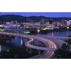
US Rt 50 at Parkersburg has changed. Once the bridge opens this spring, the Corridor D routing around Parkersburg will be complete. Originally slated to open last fall, the bridge crosses historic Blennerhassett Island State Park.
Motorists passing through will no longer wind through city streets and traffic lights, you can clip along at 65 mph to the Ohio state line.
We didn't get a more picturesque "signature" bridge as planned, but a bridge none the less.
Here's a link to the bridge cam. It's a bit fussy at times, and has several views, zooms, and settings. The bridge is quite a bit longer than it appears at the setting in the link below, if you click the zoom to 'minus', you'll see the full length...and the huge cake we left at the interchange for DuPont: Blennerhassett Bridge Construction Cam - West Virginia Division of Highways
Mountains were moved and plains filled to build this road, changing the landscape forever. New business has already moved into some locations along the route. Here's the link to the main page where there is more info and construction photos. Appalachian Corridor D Project Information Website
Last edited by Two-Rivers; 05-06-2008 at 06:53 AM..
Reason: no coffee yet
Fortunately, it crosses Blennerhassett Island at the far western (downriver) tip; the state park is on the upstream end of the island. I believe the lower part of the island is owned by DuPont.
Fortunately, it crosses Blennerhassett Island at the far western (downriver) tip; the state park is on the upstream end of the island. I believe the lower part of the island is owned by DuPont.
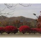
Fortunate yes, unfortunate that it crossed the island wetland. One low lying spot that was home to Blue Herons, Kingfishers, ducks, geese, and the hapless fish that wound up there during floods. Haven't been there to see how much is left. Originally, the piers weren't supposed to land on the island.
DuPont does have some stake there, whether ownership or lease, they do have water wells and pumps there.
Opens June 13th with the ribbon cutting announced today. Most expensive bridge in WV, but with rising prices, the next new bridge would take that distinction.
I grew up on 19th Street near City Park. I came home one day after not being in town for a decently long while (7 months or so). I'm driving down Rt 50....expecting it to turn into 7th street.....next thing I know, I'm in this mysterious new town and the highway crapped me out by G&W Rootbeer. Confused was I....
I'm impressed that they actually built it so fast, though. Seems like it was started just yesterday....
Snorpus, I looked in WVUPharm2007's profile to get his first name, he was 24 when he filled out the profile, I don't think he's familiar with aging yet, the 24's I know aren't. And I reminisced about seeing the Beatles on Ed Sullivan just yesterday.
WVUPharm2007, I wonder if you know of Lee's hill, and the clay mines and brick kiln that used to be there? As teenagers we would crawl deep into the old mines, for kicks we had one 'room' painted white. The top of that hill is 958 feet above the roadway. Anyway, the whole face of that hill, the mines, the kiln...all gone. At one point, every dump truck in whole valley was on that project. And the big machines were busy bringing mountains to fill flood plains and valleys. Many houses were bought up and torn down, although I dare say a few more should have been taken to remove some of the blighted look the highway has in spots.
Sounds like you tried to go straight on into 7th St., which now has an exit off Rt.50 instead. The exits, in order heading west are, I-77, 7thSt., Rt.47/Staunton Ave., 5th St./Division St., Marrtown Rd., Lubeck/Rt. 68, DuPont/Washington/Rt.892, then the bridge, exit to Rts.50/7 Ohio.
"The 4,009-foot bridge, which spans the Ohio River and Blennerhassett Island, is the last major component of the Corridor D project to be completed. The bridge is one of the largest bridge construction projects undertaken by the state."
"The Corridor D project in Wood County is an 11-mile multi-lane highway connecting U.S. 50 in Wood County with U.S. 50 in Washington County at Porterfield. The entire highway was designated as a corridor in the Appalachian Development Highway System by the Appalachian Regional Development Act of 1965. It was later designated as part of the National Highway System."
One note of sad irony...The Canadian geese that used to stay in the backwaters off the 5th St. bridge approach can now be seen walking across the four-lane, which is 300' above their old stomping grounds.
Pharm- When you get back to town again, take a cruise to the Marrtown exit and check out the new Fort Boreman Park, high atop Fort Boreman Hill, of course...a great view. I'm lobbying for a park atop Lee's hill, another great view.
Last edited by Two-Rivers; 05-07-2008 at 08:20 AM..
Reason: CRS
What type of stores are going to open along this corridor?
I grew up in Charleston but moved long before Corridor G opened. I haven't even seen photos of it! But I do know it brought stores into the Charleston area that had avoided it in all the years I lived there. I would assume the Parkersburg project is just a duplicate of that regarding what's going in?
Here in Atlanta, they literally and I do mean literally build the equivalent of an entire Charleston, Huntington AND Parkersburg here combined every single year in the metro area. It's insane. Unfortunately in the past, this explosive growth has also taken out some wetlands and unofficial bird sanctuary areas too. They are TRYING to better control that kind of destruction though, but it's sad to hear it happened up there with this project.
I'm still 24...25 on Saturday. It only takes 6-7 years to get a PharmD. And, yes, time goes by incredibly fast. It's starting to kinda scare me. When I stop and think...I graduated from high school *7* years ago. Wow....time has flown by. I'm moving even further away next Summer. After that, I'll probably only see Parkersburg once a year if I'm lucky. I miss Rubi's on 7th Street and the Pizza Place every day of my life. But all of my friends, like me, have left the area. It's quite sad, actually. Any young person with any sort of talent leaves and never even THINKS of coming back. Just like me....
What type of stores are going to open along this corridor?
Here in Atlanta, they literally and I do mean literally build the equivalent of an entire Charleston, Huntington AND Parkersburg here combined every single year in the metro area. It's insane.
So far we've picked up a Tim Horton's, Sonic is building now, Western Sizzlin' just reopened on Rt. 50 after closing for a different road project a few years back. We're not picking up quickly, it seems.
Atlanta must be just about like Phoenix.
Please register to post and access all features of our very popular forum. It is free and quick. Over $68,000 in prizes has already been given out to active posters on our forum. Additional giveaways are planned.
Detailed information about all U.S. cities, counties, and zip codes on our site: City-data.com.

 Please register to participate in our discussions with 2 million other members - it's free and quick! Some forums can only be seen by registered members. After you create your account, you'll be able to customize options and access all our 15,000 new posts/day with fewer ads.


 And I reminisced about seeing the Beatles on Ed Sullivan just yesterday.