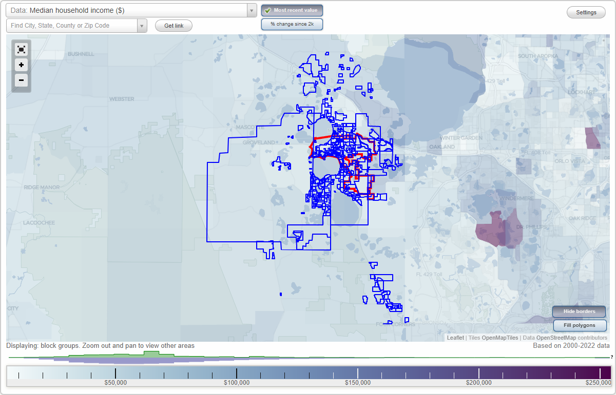
Clermont, Florida Neighborhood Map - Income, House Prices, Occupations, Boundaries
Settings
X

- City boundary
- Neighborhood boundaries
Business Search - 14 Million verified businesses
16th Fairway Villas - Oak Village Neighborhoods:
16th Fairway Villas, Alta Vista, Amanda's Place, Amberhill, Anderson Hills, Apshawa Acres, Arbors, Arrowhead, Arrowtree Reserve, Aurora Homes, Barrington Estates, Bennett Heights, Bent Tree, Beverly Estates, Bishop's Point, Blue Spring Reserve, Bridges Glen, Buckhill Ridge, Camphorwood Shores, Cascades of Groveland, Cashwell Minnehaha Shores, Caywood Hills, Centerhill, Chatham Park at Jacks Lake, Chelsea Parc, Cherith Hill, Cherry Knoll, Cherry Lake Oaks, Chester Oaks, Citrus Highlands, Citrus Tower Centre, Citrus Tower Commercial Center, Clear Creek, Clerando, Clerando, Clermont, Clermont Commons, Clermont Countryside Acres, Clermont Farms, Clermont Heights, Clermont Oaks Office Park, Clermont Professional Center, Clermont Shores, Clermont Shores, Clermont Shores, Clermont Shores, Clermont Town Center, Clermont Yacht Club, College Park, Country Ridge, Country Road, Crescent Bay, Crescent Cove, Crescent Lake Club, Crescent West, Crest View, Crown Pointe, Crystal Cove, Crystal Lake at Clermont, Cypress Landing, Cypress Walk, Dazzling Sunset, Dickson Shores, Dove Hollow, Eagleridge, East Lake Estates, East Lake Estates, East Lake Ridge, Eastlawn, Eastridge, Edgewood, Ella Vista Heights, Estates at Lake Susan, Fairview Place, Ferndale, Fernwood, Forty Pines, Foxchase, Glenbrook, Gourd Neck Springs, Grace Pointe, Graceland, Greater Groves, Greater Hills, Greater Pines, Green Valley Commons, Greengrove Estates, Groveland Farms, Hancock Center, Hartwood Pines, Hartwood Reserve, Hasson Ridge, Hazelwood, Herring-Hooks Estates, Hiawatha Shores, Hidden Forest at Silver Creek, Hidden Hills, Hidden Oaks Condominium, High Grove, High Pointe, Highland Estates, Highland Groves, Highland Oaks, Highland Pines, Highland Point, Highland Reserve, Highland Ridge, Highland Terraces, Highlander Estates, Hillcrest, Hills of Clermont, Hills of Lake Louisa, Hillside Terrace, Hillside Villas, Hilly Acres, Homedale, Hooks Street Commercial Center, Hosptial View, Hunter Trace Commercial, Hunters Ridge, Indian Fields, Indian Hills, Indian Shores, Isle of Bali, Jarrett Ridge, Johns Lake Acres, Johns Lake Estates, Kings Ridge, Lake Apopka Heights, Lake Clair Place, Lake Crescent Hills, Lake Crescent Pines, Lake Crescent View, Lake Dot Villas, Lake Glona Shores, Lake Highland Estates, Lake Kirkland Shores, Lake Louisa Estates, Lake Louisa Highlands, Lake Louisa Oaks, Lake Louisa Park, Lake Minnehaha Chain O' Lakes, Lake Minnehaha Shores, Lake Minneola Woods, Lake Mongomery Estates, Lake Monte Vista, Lake Nellie Oaks, Lake Nellie Shores, Lake Ridge Club, Lake Shepherd Victorian Estates, Lake Shepperd Shores, Lake Susan Outlook, Lake Valley, Lake View Heights, Lakeview Hills, Lakewood Ridge, Lancaster Beach, Ledoux Acres, Lee's Villa, Legends, Lincoln Park, Lincoln Park, Lincoln Park, Lincoln Park, Lost Lake, Lost Lake, Louisa Pointe, Madison Park, Magnolia Bay, Magnolia Island, Magnolia Park, Magnolia Pointe, Manlow Park, Margaree Gardens, Marina Cove, Marsh Hammock, Martin's Landing, Marus Center, Meadowbrook, Middleton Park, Minnehaha Beach, Minnehaha Oaks, Minnehaha Shores, Minnehaha Terrace, Minneola, Minneola Hills, Minni Flora Heights, Mission Park, Montclair, Monte Vista Farms, Murcott Hill, Myers Cove, North Ridge, Nottingham at Legends, Oak Haven Estates, Oak Hill Commons, Oak Hill Estates, Oak Valley, Oak View, Oak Village16th Fairway Villas neighborhood in Clermont statistics: (Find on map)
Area: 0.005 square miles
16th Fairway Villas neighborhood detailed profile
Area: 0.005 square miles
16th Fairway Villas neighborhood detailed profile
Alta Vista neighborhood in Clermont statistics: (Find on map)
Area: 0.023 square miles
Alta Vista neighborhood detailed profile
Area: 0.023 square miles
Alta Vista neighborhood detailed profile
Amanda's Place neighborhood in Clermont statistics: (Find on map)
Area: 0.001 square miles
Amanda's Place neighborhood detailed profile
Area: 0.001 square miles
Amanda's Place neighborhood detailed profile
Amberhill neighborhood in Clermont statistics: (Find on map)
Area: 0.071 square miles
Roads and streets: Amber Ave; Sapphire Dr; Garnet Dr; Topaz St; Garnet Ct.
Amberhill neighborhood detailed profile
Area: 0.071 square miles
Roads and streets: Amber Ave; Sapphire Dr; Garnet Dr; Topaz St; Garnet Ct.
Amberhill neighborhood detailed profile
Anderson Hills neighborhood in Clermont statistics: (Find on map)
Area: 0.030 square miles
Roads and streets: Warren Rd; Palmer Dr; Casper Ln.
Anderson Hills neighborhood detailed profile
Area: 0.030 square miles
Roads and streets: Warren Rd; Palmer Dr; Casper Ln.
Anderson Hills neighborhood detailed profile
Apshawa Acres neighborhood in Clermont statistics: (Find on map)
Area: 0.096 square miles
Roads and streets: Whisperwind Dr; Tuscarora Ln; Kanuba Ct.
Apshawa Acres neighborhood detailed profile
Area: 0.096 square miles
Roads and streets: Whisperwind Dr; Tuscarora Ln; Kanuba Ct.
Apshawa Acres neighborhood detailed profile
Arbors neighborhood in Clermont statistics: (Find on map)
Area: 0.056 square miles
Roads and streets: Arbor Hills Cir; South Ave.
Arbors neighborhood detailed profile
Area: 0.056 square miles
Roads and streets: Arbor Hills Cir; South Ave.
Arbors neighborhood detailed profile
Arrowhead neighborhood in Clermont statistics: (Find on map)
Area: 0.182 square miles
Roads and streets: Arrowhead Trl; Wishing Wind Way; Dream Catcher Ct; Full Moon Ct; Timucua Pl; Rain Dance Ct; Hawk's Nest Ct; Eagle's Eye Ct; Apalachee Cir; Eagles Eye Ct.
Arrowhead neighborhood detailed profile
Area: 0.182 square miles
Roads and streets: Arrowhead Trl; Wishing Wind Way; Dream Catcher Ct; Full Moon Ct; Timucua Pl; Rain Dance Ct; Hawk's Nest Ct; Eagle's Eye Ct; Apalachee Cir; Eagles Eye Ct.
Arrowhead neighborhood detailed profile
Arrowtree Reserve neighborhood in Clermont statistics: (Find on map)
Area: 1.217 square miles
Population: 107
Population density:
Median household income in 2021:
Median rent in in 2021:
Male vs Females
Median age
Most popular occupations of males: construction, extraction, and maintenance occupations (36.7%); management occupations (except farmers) (14.9%); service occupations (14.8%); community and social services occupations (8.3%); transportation occupations (7.8%); sales and office occupations (4.1%); business and financial operations occupations (3.7%)
Most popular occupations of females: management occupations (except farmers) (30.9%); sales and office occupations (26.8%); education, training, and library occupations (15.9%); service occupations (12.8%); healthcare practitioners and technical occupations (4.8%); business and financial operations occupations (4.5%); material moving occupations (2.1%)
Roads and streets: Arrowtree Blvd; Howey Cross Rd; Angels Landing Ct; Canoe Crossing Ct.
Arrowtree Reserve neighborhood detailed profile
Area: 1.217 square miles
Population: 107
Population density:
| Arrowtree Reserve: | 88 people per square mile |
| Clermont: | 3,964 people per square mile |
Median household income in 2021:
| Arrowtree Reserve: | $74,074 |
| Clermont: | $69,930 |
Median rent in in 2021:
| Arrowtree Reserve: | $1,116 |
| Clermont: | $1,424 |
Male vs Females
| Males: | 55 |
| Females: | 52 |
Median age
| Males: | 49.8 years |
| Females: | 44.9 years |
Most popular occupations of males: construction, extraction, and maintenance occupations (36.7%); management occupations (except farmers) (14.9%); service occupations (14.8%); community and social services occupations (8.3%); transportation occupations (7.8%); sales and office occupations (4.1%); business and financial operations occupations (3.7%)
Most popular occupations of females: management occupations (except farmers) (30.9%); sales and office occupations (26.8%); education, training, and library occupations (15.9%); service occupations (12.8%); healthcare practitioners and technical occupations (4.8%); business and financial operations occupations (4.5%); material moving occupations (2.1%)
Roads and streets: Arrowtree Blvd; Howey Cross Rd; Angels Landing Ct; Canoe Crossing Ct.
Arrowtree Reserve neighborhood detailed profile
Aurora Homes neighborhood in Clermont statistics: (Find on map)
Area: 0.046 square miles
Roads and streets: Denali Dr; Lakeshore Dr.
Aurora Homes neighborhood detailed profile
Area: 0.046 square miles
Roads and streets: Denali Dr; Lakeshore Dr.
Aurora Homes neighborhood detailed profile
Barrington Estates neighborhood in Clermont statistics: (Find on map)
Area: 0.062 square miles
Barrington Estates neighborhood detailed profile
Area: 0.062 square miles
Barrington Estates neighborhood detailed profile
Bennett Heights neighborhood in Clermont statistics: (Find on map)
Area: 0.008 square miles
Bennett Heights neighborhood detailed profile
Area: 0.008 square miles
Bennett Heights neighborhood detailed profile
Bent Tree neighborhood in Clermont statistics: (Find on map)
Area: 0.076 square miles
Population: 383
Population density:
Median household income in 2021:
Median rent in in 2021:
Male vs Females
Median age
Most popular occupations of males: sales and office occupations (19.3%); computer and mathematical occupations (11.3%); service occupations (10.7%); construction, extraction, and maintenance occupations (9.0%); farming, fishing, and forestry occupations (8.4%); business and financial operations occupations (7.6%); transportation occupations (5.9%)
Most popular occupations of females: sales and office occupations (35.1%); service occupations (14.1%); management occupations (except farmers) (11.3%); business and financial operations occupations (10.7%); education, training, and library occupations (10.2%); transportation occupations (7.1%); production occupations (2.6%)
Roads and streets: Sunshine Cir; Sunshine Dr; Still Meadow Dr.
Bent Tree neighborhood detailed profile
Area: 0.076 square miles
Population: 383
Population density:
| Bent Tree: | 5,045 people per square mile |
| Clermont: | 3,964 people per square mile |
Median household income in 2021:
| Bent Tree: | $63,665 |
| Clermont: | $69,930 |
Median rent in in 2021:
| Bent Tree: | $1,527 |
| Clermont: | $1,424 |
Male vs Females
| Males: | 157 |
| Females: | 226 |
Median age
| Males: | 67.2 years |
| Females: | 62.2 years |
Most popular occupations of males: sales and office occupations (19.3%); computer and mathematical occupations (11.3%); service occupations (10.7%); construction, extraction, and maintenance occupations (9.0%); farming, fishing, and forestry occupations (8.4%); business and financial operations occupations (7.6%); transportation occupations (5.9%)
Most popular occupations of females: sales and office occupations (35.1%); service occupations (14.1%); management occupations (except farmers) (11.3%); business and financial operations occupations (10.7%); education, training, and library occupations (10.2%); transportation occupations (7.1%); production occupations (2.6%)
Roads and streets: Sunshine Cir; Sunshine Dr; Still Meadow Dr.
Bent Tree neighborhood detailed profile
Beverly Estates neighborhood in Clermont statistics: (Find on map)
Area: 0.013 square miles
Roads and streets: Beverly Ct.
Beverly Estates neighborhood detailed profile
Area: 0.013 square miles
Roads and streets: Beverly Ct.
Beverly Estates neighborhood detailed profile
Bishop's Point neighborhood in Clermont statistics: (Find on map)
Area: 0.016 square miles
Bishop's Point neighborhood detailed profile
Area: 0.016 square miles
Bishop's Point neighborhood detailed profile
Blue Spring Reserve neighborhood in Clermont statistics: (Find on map)
Area: 0.547 square miles
Population: 48
Population density:
Median household income in 2021:
Median rent in in 2021:
Male vs Females
Median age
Most popular occupations of males: construction, extraction, and maintenance occupations (36.7%); management occupations (except farmers) (14.9%); service occupations (14.8%); community and social services occupations (8.3%); transportation occupations (7.8%); sales and office occupations (4.1%); business and financial operations occupations (3.7%)
Most popular occupations of females: management occupations (except farmers) (30.9%); sales and office occupations (26.8%); education, training, and library occupations (15.9%); service occupations (12.8%); healthcare practitioners and technical occupations (4.8%); business and financial operations occupations (4.5%); material moving occupations (2.1%)
Blue Spring Reserve neighborhood detailed profile
Area: 0.547 square miles
Population: 48
Population density:
| Blue Spring Reserve: | 88 people per square mile |
| Clermont: | 3,964 people per square mile |
Median household income in 2021:
| Blue Spring Reserve: | $74,074 |
| Clermont: | $69,930 |
Median rent in in 2021:
| Blue Spring Reserve: | $1,116 |
| Clermont: | $1,424 |
Male vs Females
| Males: | 24 |
| Females: | 23 |
Median age
| Males: | 49.8 years |
| Females: | 44.9 years |
Most popular occupations of males: construction, extraction, and maintenance occupations (36.7%); management occupations (except farmers) (14.9%); service occupations (14.8%); community and social services occupations (8.3%); transportation occupations (7.8%); sales and office occupations (4.1%); business and financial operations occupations (3.7%)
Most popular occupations of females: management occupations (except farmers) (30.9%); sales and office occupations (26.8%); education, training, and library occupations (15.9%); service occupations (12.8%); healthcare practitioners and technical occupations (4.8%); business and financial operations occupations (4.5%); material moving occupations (2.1%)
Blue Spring Reserve neighborhood detailed profile
Bridges Glen neighborhood in Clermont statistics: (Find on map)
Area: 0.122 square miles
Population: 10
Population density:
Median household income in 2021:
Median rent in in 2021:
Male vs Females
Median age
Most popular occupations of males: construction, extraction, and maintenance occupations (36.7%); management occupations (except farmers) (14.9%); service occupations (14.8%); community and social services occupations (8.3%); transportation occupations (7.8%); sales and office occupations (4.1%); business and financial operations occupations (3.7%)
Most popular occupations of females: management occupations (except farmers) (30.9%); sales and office occupations (26.8%); education, training, and library occupations (15.9%); service occupations (12.8%); healthcare practitioners and technical occupations (4.8%); business and financial operations occupations (4.5%); material moving occupations (2.1%)
Bridges Glen neighborhood detailed profile
Area: 0.122 square miles
Population: 10
Population density:
| Bridges Glen: | 82 people per square mile |
| Clermont: | 3,964 people per square mile |
Median household income in 2021:
| Bridges Glen: | $74,074 |
| Clermont: | $69,930 |
Median rent in in 2021:
| Bridges Glen: | $1,116 |
| Clermont: | $1,424 |
Male vs Females
| Males: | 5 |
| Females: | 5 |
Median age
| Males: | 49.8 years |
| Females: | 44.9 years |
Most popular occupations of males: construction, extraction, and maintenance occupations (36.7%); management occupations (except farmers) (14.9%); service occupations (14.8%); community and social services occupations (8.3%); transportation occupations (7.8%); sales and office occupations (4.1%); business and financial operations occupations (3.7%)
Most popular occupations of females: management occupations (except farmers) (30.9%); sales and office occupations (26.8%); education, training, and library occupations (15.9%); service occupations (12.8%); healthcare practitioners and technical occupations (4.8%); business and financial operations occupations (4.5%); material moving occupations (2.1%)
Bridges Glen neighborhood detailed profile
Buckhill Ridge neighborhood in Clermont statistics: (Find on map)
Area: 0.045 square miles
Population: 3
Population density:
Median household income in 2021:
Median rent in in 2021:
Male vs Females
Median age
Most popular occupations of males: construction, extraction, and maintenance occupations (36.7%); management occupations (except farmers) (14.9%); service occupations (14.8%); community and social services occupations (8.3%); transportation occupations (7.8%); sales and office occupations (4.1%); business and financial operations occupations (4.0%)
Most popular occupations of females: management occupations (except farmers) (30.9%); sales and office occupations (26.8%); education, training, and library occupations (15.9%); service occupations (12.8%); healthcare practitioners and technical occupations (4.8%); business and financial operations occupations (4.5%); material moving occupations (2.1%)
Buckhill Ridge neighborhood detailed profile
Area: 0.045 square miles
Population: 3
Population density:
| Buckhill Ridge: | 66 people per square mile |
| Clermont: | 3,964 people per square mile |
Median household income in 2021:
| Buckhill Ridge: | $74,074 |
| Clermont: | $69,930 |
Median rent in in 2021:
| Buckhill Ridge: | $1,116 |
| Clermont: | $1,424 |
Male vs Females
| Males: | 2 |
| Females: | 1 |
Median age
| Males: | 49.8 years |
| Females: | 44.9 years |
Most popular occupations of males: construction, extraction, and maintenance occupations (36.7%); management occupations (except farmers) (14.9%); service occupations (14.8%); community and social services occupations (8.3%); transportation occupations (7.8%); sales and office occupations (4.1%); business and financial operations occupations (4.0%)
Most popular occupations of females: management occupations (except farmers) (30.9%); sales and office occupations (26.8%); education, training, and library occupations (15.9%); service occupations (12.8%); healthcare practitioners and technical occupations (4.8%); business and financial operations occupations (4.5%); material moving occupations (2.1%)
Buckhill Ridge neighborhood detailed profile
Camphorwood Shores neighborhood in Clermont statistics: (Find on map)
Area: 0.005 square miles
Roads and streets: Claywood Dr.
Camphorwood Shores neighborhood detailed profile
Area: 0.005 square miles
Roads and streets: Claywood Dr.
Camphorwood Shores neighborhood detailed profile
Cascades of Groveland neighborhood in Clermont statistics: (Find on map)
Area: 0.772 square miles
Roads and streets: E Libby Rd.
Cascades of Groveland neighborhood detailed profile
Area: 0.772 square miles
Roads and streets: E Libby Rd.
Cascades of Groveland neighborhood detailed profile
Cashwell Minnehaha Shores neighborhood in Clermont statistics: (Find on map)
Area: 0.044 square miles
Roads and streets: Elbert St; Bronson Rd; Burton St.
Cashwell Minnehaha Shores neighborhood detailed profile
Area: 0.044 square miles
Roads and streets: Elbert St; Bronson Rd; Burton St.
Cashwell Minnehaha Shores neighborhood detailed profile
Caywood Hills neighborhood in Clermont statistics: (Find on map)
Area: 0.029 square miles
Roads and streets: Lakeshore Dr (S Lakeshore Dr); Claywood Dr.
Caywood Hills neighborhood detailed profile
Area: 0.029 square miles
Roads and streets: Lakeshore Dr (S Lakeshore Dr); Claywood Dr.
Caywood Hills neighborhood detailed profile
Centerhill neighborhood in Clermont statistics: (Find on map)
Area: 0.007 square miles
Centerhill neighborhood detailed profile
Area: 0.007 square miles
Centerhill neighborhood detailed profile
Chatham Park at Jacks Lake neighborhood in Clermont statistics: (Find on map)
Area: 0.092 square miles
Roads and streets: Pelham Way; Cavendish Ct; Skip Jack Dr.
Chatham Park at Jacks Lake neighborhood detailed profile
Area: 0.092 square miles
Roads and streets: Pelham Way; Cavendish Ct; Skip Jack Dr.
Chatham Park at Jacks Lake neighborhood detailed profile
Chelsea Parc neighborhood in Clermont statistics: (Find on map)
Area: 0.031 square miles
Roads and streets: Chelsea Park Dr.
Chelsea Parc neighborhood detailed profile
Area: 0.031 square miles
Roads and streets: Chelsea Park Dr.
Chelsea Parc neighborhood detailed profile
Cherith Hill neighborhood in Clermont statistics: (Find on map)
Area: 0.024 square miles
Cherith Hill neighborhood detailed profile
Area: 0.024 square miles
Cherith Hill neighborhood detailed profile
Cherry Knoll neighborhood in Clermont statistics: (Find on map)
Area: 0.013 square miles
Roads and streets: W Division St.
Cherry Knoll neighborhood detailed profile
Area: 0.013 square miles
Roads and streets: W Division St.
Cherry Knoll neighborhood detailed profile
Cherry Lake Oaks neighborhood in Clermont statistics: (Find on map)
Area: 0.062 square miles
Cherry Lake Oaks neighborhood detailed profile
Area: 0.062 square miles
Cherry Lake Oaks neighborhood detailed profile
Chester Oaks neighborhood in Clermont statistics: (Find on map)
Area: 0.013 square miles
Chester Oaks neighborhood detailed profile
Area: 0.013 square miles
Chester Oaks neighborhood detailed profile
Citrus Highlands neighborhood in Clermont statistics: (Find on map)
Area: 0.094 square miles
Population: 2
Population density:
Median household income in 2021:
Median rent in in 2021:
Male vs Females
Median age
Most popular occupations of males: service occupations (26.4%); transportation occupations (20.7%); material moving occupations (20.3%); computer and mathematical occupations (10.7%); farming, fishing, and forestry occupations (7.4%); construction, extraction, and maintenance occupations (7.4%); sales and office occupations (6.4%)
Most popular occupations of females: service occupations (24.6%); education, training, and library occupations (19.6%); sales and office occupations (13.6%); management occupations (except farmers) (11.1%); business and financial operations occupations (11.1%); healthcare practitioners and technical occupations (11.1%); legal occupations (7.3%)
Roads and streets: Citrus Pkwy; Caithness Way; Culloden Ct; Arran Ct; Barra Ct; Tiree Dr; Citrus Cir.
Citrus Highlands neighborhood detailed profile
Area: 0.094 square miles
Population: 2
Population density:
| Citrus Highlands: | 21 people per square mile |
| Clermont: | 3,964 people per square mile |
Median household income in 2021:
| Citrus Highlands: | $67,224 |
| Clermont: | $69,930 |
Median rent in in 2021:
| Citrus Highlands: | $576 |
| Clermont: | $1,424 |
Male vs Females
| Males: | 1 |
| Females: | 1 |
Median age
| Males: | 31.7 years |
| Females: | 29.4 years |
Most popular occupations of males: service occupations (26.4%); transportation occupations (20.7%); material moving occupations (20.3%); computer and mathematical occupations (10.7%); farming, fishing, and forestry occupations (7.4%); construction, extraction, and maintenance occupations (7.4%); sales and office occupations (6.4%)
Most popular occupations of females: service occupations (24.6%); education, training, and library occupations (19.6%); sales and office occupations (13.6%); management occupations (except farmers) (11.1%); business and financial operations occupations (11.1%); healthcare practitioners and technical occupations (11.1%); legal occupations (7.3%)
Roads and streets: Citrus Pkwy; Caithness Way; Culloden Ct; Arran Ct; Barra Ct; Tiree Dr; Citrus Cir.
Citrus Highlands neighborhood detailed profile
Citrus Tower Centre neighborhood in Clermont statistics: (Find on map)
Area: 0.013 square miles
Citrus Tower Centre neighborhood detailed profile
Area: 0.013 square miles
Citrus Tower Centre neighborhood detailed profile
Citrus Tower Commercial Center neighborhood in Clermont statistics: (Find on map)
Area: 0.024 square miles
Citrus Tower Commercial Center neighborhood detailed profile
Area: 0.024 square miles
Citrus Tower Commercial Center neighborhood detailed profile
Clear Creek neighborhood in Clermont statistics: (Find on map)
Area: 0.125 square miles
Roads and streets: Clear Creek Cir; Silver Clear Creek Cir; Woodcrest Way; Winding Water Way; Pebble Creek Ct; Deep Creek Ct; Gold Creek Ct.
Clear Creek neighborhood detailed profile
Area: 0.125 square miles
Roads and streets: Clear Creek Cir; Silver Clear Creek Cir; Woodcrest Way; Winding Water Way; Pebble Creek Ct; Deep Creek Ct; Gold Creek Ct.
Clear Creek neighborhood detailed profile
Clerando neighborhood in Clermont statistics: (Find on map)
Area: 0.024 square miles
Clerando neighborhood detailed profile
Area: 0.024 square miles
Clerando neighborhood detailed profile
Clerando neighborhood in Clermont statistics: (Find on map)
Area: 0.024 square miles
Clerando neighborhood detailed profile
Area: 0.024 square miles
Clerando neighborhood detailed profile
Clermont neighborhood in Clermont statistics: (Find on map)
Area: 0.001 square miles
Clermont neighborhood detailed profile
Area: 0.001 square miles
Clermont neighborhood detailed profile
Clermont Commons neighborhood in Clermont statistics: (Find on map)
Area: 0.059 square miles
Roads and streets: Commons Ct.
Clermont Commons neighborhood detailed profile
Area: 0.059 square miles
Roads and streets: Commons Ct.
Clermont Commons neighborhood detailed profile
Clermont Countryside Acres neighborhood in Clermont statistics: (Find on map)
Area: 0.029 square miles
Clermont Countryside Acres neighborhood detailed profile
Area: 0.029 square miles
Clermont Countryside Acres neighborhood detailed profile
Clermont Farms neighborhood in Clermont statistics: (Find on map)
Area: 2.046 square miles
Population: 414
Population density:
Median household income in 2021:
Median rent in in 2021:
Male vs Females
Median age
Most popular occupations of males: service occupations (19.3%); construction, extraction, and maintenance occupations (16.0%); business and financial operations occupations (13.5%); management occupations (except farmers) (9.2%); transportation occupations (9.2%); production occupations (8.4%); architecture and engineering occupations (7.4%)
Most popular occupations of females: sales and office occupations (65.5%); management occupations (except farmers) (19.9%); education, training, and library occupations (6.6%); service occupations (4.7%); business and financial operations occupations (3.3%); material moving occupations (1.7%); healthcare practitioners and technical occupations (1.5%)
Roads and streets: Lakeshore Dr; Versailles Blvd; Log House Rd; Lake Hill Dr; Crescent Bay Blvd; Lake Katherine Cir; Autumn Wind Loop; Co Rd 561; Bronson Rd; Haskell Dr; Lantana Crst; Cedar Forest Cir; Oswalt Rd; Alameda Alma; Crescent Lake Ct; Carlson Cir; Clair Pl; Preston Cove Rd; Crescent Ridge Loop; Oakshore Ln; Rosehill Dr; Crescent Ln; Priebe Rd; Harder Rd; Country Hill Rd; Summit Lake Ln; Log House Landfill Rd; Cherith Ln; Parkway Dr; Lake Hasson Cir; Mesa Ln; Patrico Loop; Sooner Dr; Belo Horizonte Ave; Cayo Costa Ct; Cypress Dr; Oleander Dr; Jaron de Largo; Marseilles Blvd; Lake Clair Cir; Vineyard Ct; Summer Elm Ave; Spring Moss Ave; Alameda Sanda (Alameda Sandra); Summit Lakes Ln; Holmes Dr; Mira Lago Ln; Astatula Ln; Point Overlook Dr; Ave Augusta; Skyway Dr; Big Tree Ln; Regal Dr; Paradise Bay Ct; Wind Chime Cir; Jacaranda Ave; Alameda Sandra; Myakka Dr; Willowwood Ct; Via de Renee Pl; N Crescent Ln; Beggs Ct; Summer Wind Ct (Summerwind Ct); Park Promenade Way; Via Mari Cae Ct; Bee Tree Trl; Ollie Ct; Summit View Way; Sterling View Ct; Crystal View Ct; Highland Point Dr; Beaman Cir; Lyons Ct; Bitteroot Ct; Chantilly Ct; Cannes Pl; Lake Tree Ct.
Other features: Crescent Lk.
Clermont Farms neighborhood detailed profile
Area: 2.046 square miles
Population: 414
Population density:
| Clermont Farms: | 202 people per square mile |
| Clermont: | 3,964 people per square mile |
Median household income in 2021:
| Clermont Farms: | $44,722 |
| Clermont: | $69,930 |
Median rent in in 2021:
| Clermont Farms: | $822 |
| Clermont: | $1,424 |
Male vs Females
| Males: | 203 |
| Females: | 210 |
Median age
| Males: | 44.0 years |
| Females: | 46.7 years |
Most popular occupations of males: service occupations (19.3%); construction, extraction, and maintenance occupations (16.0%); business and financial operations occupations (13.5%); management occupations (except farmers) (9.2%); transportation occupations (9.2%); production occupations (8.4%); architecture and engineering occupations (7.4%)
Most popular occupations of females: sales and office occupations (65.5%); management occupations (except farmers) (19.9%); education, training, and library occupations (6.6%); service occupations (4.7%); business and financial operations occupations (3.3%); material moving occupations (1.7%); healthcare practitioners and technical occupations (1.5%)
Roads and streets: Lakeshore Dr; Versailles Blvd; Log House Rd; Lake Hill Dr; Crescent Bay Blvd; Lake Katherine Cir; Autumn Wind Loop; Co Rd 561; Bronson Rd; Haskell Dr; Lantana Crst; Cedar Forest Cir; Oswalt Rd; Alameda Alma; Crescent Lake Ct; Carlson Cir; Clair Pl; Preston Cove Rd; Crescent Ridge Loop; Oakshore Ln; Rosehill Dr; Crescent Ln; Priebe Rd; Harder Rd; Country Hill Rd; Summit Lake Ln; Log House Landfill Rd; Cherith Ln; Parkway Dr; Lake Hasson Cir; Mesa Ln; Patrico Loop; Sooner Dr; Belo Horizonte Ave; Cayo Costa Ct; Cypress Dr; Oleander Dr; Jaron de Largo; Marseilles Blvd; Lake Clair Cir; Vineyard Ct; Summer Elm Ave; Spring Moss Ave; Alameda Sanda (Alameda Sandra); Summit Lakes Ln; Holmes Dr; Mira Lago Ln; Astatula Ln; Point Overlook Dr; Ave Augusta; Skyway Dr; Big Tree Ln; Regal Dr; Paradise Bay Ct; Wind Chime Cir; Jacaranda Ave; Alameda Sandra; Myakka Dr; Willowwood Ct; Via de Renee Pl; N Crescent Ln; Beggs Ct; Summer Wind Ct (Summerwind Ct); Park Promenade Way; Via Mari Cae Ct; Bee Tree Trl; Ollie Ct; Summit View Way; Sterling View Ct; Crystal View Ct; Highland Point Dr; Beaman Cir; Lyons Ct; Bitteroot Ct; Chantilly Ct; Cannes Pl; Lake Tree Ct.
Other features: Crescent Lk.
Clermont Farms neighborhood detailed profile
Clermont Heights neighborhood in Clermont statistics: (Find on map)
Area: 0.155 square miles
Roads and streets: Palm Ln; Almond St; Anderson St.
Clermont Heights neighborhood detailed profile
Area: 0.155 square miles
Roads and streets: Palm Ln; Almond St; Anderson St.
Clermont Heights neighborhood detailed profile
Clermont Oaks Office Park neighborhood in Clermont statistics: (Find on map)
Area: 0.009 square miles
Clermont Oaks Office Park neighborhood detailed profile
Area: 0.009 square miles
Clermont Oaks Office Park neighborhood detailed profile
Clermont Professional Center neighborhood in Clermont statistics: (Find on map)
Area: 0.023 square miles
Clermont Professional Center neighborhood detailed profile
Area: 0.023 square miles
Clermont Professional Center neighborhood detailed profile
Clermont Shores neighborhood in Clermont statistics: (Find on map)
Area: 0.010 square miles
Population: 2
Population density:
Median household income in 2021:
Male vs Females
Median age
Most popular occupations of males: service occupations (19.3%); construction, extraction, and maintenance occupations (16.0%); business and financial operations occupations (13.5%); management occupations (except farmers) (9.2%); transportation occupations (9.2%); production occupations (8.4%); architecture and engineering occupations (7.4%)
Most popular occupations of females: sales and office occupations (65.5%); management occupations (except farmers) (19.9%); education, training, and library occupations (6.6%); service occupations (4.7%); business and financial operations occupations (3.3%)
Clermont Shores neighborhood detailed profile
Area: 0.010 square miles
Population: 2
Population density:
| Clermont Shores: | 197 people per square mile |
| Clermont: | 3,964 people per square mile |
Median household income in 2021:
| Clermont Shores: | $47,043 |
| Clermont: | $69,930 |
Male vs Females
| Males: | 1 |
| Females: | 1 |
Median age
| Males: | 46.3 years |
| Females: | 49.1 years |
Most popular occupations of males: service occupations (19.3%); construction, extraction, and maintenance occupations (16.0%); business and financial operations occupations (13.5%); management occupations (except farmers) (9.2%); transportation occupations (9.2%); production occupations (8.4%); architecture and engineering occupations (7.4%)
Most popular occupations of females: sales and office occupations (65.5%); management occupations (except farmers) (19.9%); education, training, and library occupations (6.6%); service occupations (4.7%); business and financial operations occupations (3.3%)
Clermont Shores neighborhood detailed profile
Clermont Town Center neighborhood in Clermont statistics: (Find on map)
Area: 0.056 square miles
Roads and streets: Hunt Trace Blvd.
Clermont Town Center neighborhood detailed profile
Area: 0.056 square miles
Roads and streets: Hunt Trace Blvd.
Clermont Town Center neighborhood detailed profile
Clermont Yacht Club neighborhood in Clermont statistics: (Find on map)
Area: 0.028 square miles
Roads and streets: Nautica Mile Dr.
Clermont Yacht Club neighborhood detailed profile
Area: 0.028 square miles
Roads and streets: Nautica Mile Dr.
Clermont Yacht Club neighborhood detailed profile
College Park neighborhood in Clermont statistics: (Find on map)
Area: 0.157 square miles
Roads and streets: Princeton Dr; Rollins Ave; Auburn Ave; Drexel Ave; Dartmouth Ave; Georgetown Ave; Furman Ave; Stanford Ct.
College Park neighborhood detailed profile
Area: 0.157 square miles
Roads and streets: Princeton Dr; Rollins Ave; Auburn Ave; Drexel Ave; Dartmouth Ave; Georgetown Ave; Furman Ave; Stanford Ct.
College Park neighborhood detailed profile
Country Ridge neighborhood in Clermont statistics: (Find on map)
Area: 0.074 square miles
Roads and streets: Brimming Lake Rd; Brook Ridge Cir; Bramble Way; Pebble Ct; Turkey Farm Rd.
Country Ridge neighborhood detailed profile
Area: 0.074 square miles
Roads and streets: Brimming Lake Rd; Brook Ridge Cir; Bramble Way; Pebble Ct; Turkey Farm Rd.
Country Ridge neighborhood detailed profile
Country Road neighborhood in Clermont statistics: (Find on map)
Area: 0.012 square miles
Population: 3
Population density:
Median household income in 2021:
Median rent in in 2021:
Male vs Females
Median age
Most popular occupations of males: construction, extraction, and maintenance occupations (16.1%); management occupations (except farmers) (14.7%); transportation occupations (14.4%); sales and office occupations (13.8%); service occupations (12.6%); healthcare practitioners and technical occupations (5.0%); material moving occupations (3.5%)
Most popular occupations of females: sales and office occupations (35.9%); service occupations (19.6%); management occupations (except farmers) (15.8%); education, training, and library occupations (7.1%); business and financial operations occupations (5.5%); arts, design, entertainment, sports, and media occupations (3.6%); healthcare practitioners and technical occupations (3.6%)
Country Road neighborhood detailed profile
Area: 0.012 square miles
Population: 3
Population density:
| Country Road: | 256 people per square mile |
| Clermont: | 3,964 people per square mile |
Median household income in 2021:
| Country Road: | $82,210 |
| Clermont: | $69,930 |
Median rent in in 2021:
| Country Road: | $1,206 |
| Clermont: | $1,424 |
Male vs Females
| Males: | 1 |
| Females: | 1 |
Median age
| Males: | 53.5 years |
| Females: | 49.3 years |
Most popular occupations of males: construction, extraction, and maintenance occupations (16.1%); management occupations (except farmers) (14.7%); transportation occupations (14.4%); sales and office occupations (13.8%); service occupations (12.6%); healthcare practitioners and technical occupations (5.0%); material moving occupations (3.5%)
Most popular occupations of females: sales and office occupations (35.9%); service occupations (19.6%); management occupations (except farmers) (15.8%); education, training, and library occupations (7.1%); business and financial operations occupations (5.5%); arts, design, entertainment, sports, and media occupations (3.6%); healthcare practitioners and technical occupations (3.6%)
Country Road neighborhood detailed profile
Crescent Bay neighborhood in Clermont statistics: (Find on map)
Area: 0.093 square miles
Roads and streets: Crescent Bay Blvd; Country Hill Rd; Skyway Dr; Wind Chime Cir.
Crescent Bay neighborhood detailed profile
Area: 0.093 square miles
Roads and streets: Crescent Bay Blvd; Country Hill Rd; Skyway Dr; Wind Chime Cir.
Crescent Bay neighborhood detailed profile
Crescent Cove neighborhood in Clermont statistics: (Find on map)
Area: 0.031 square miles
Crescent Cove neighborhood detailed profile
Area: 0.031 square miles
Crescent Cove neighborhood detailed profile
Crescent Lake Club neighborhood in Clermont statistics: (Find on map)
Area: 0.121 square miles
Roads and streets: Alameda Alma; Belo Horizonte Ave; Alameda Sanda (Alameda Sandra); Jaron de Largo; Oswalt Rd; Ave Augusta; Alameda Sandra; Via de Renee Pl; Via Mari Cae Ct; Jardim Orlando Ct.
Crescent Lake Club neighborhood detailed profile
Area: 0.121 square miles
Roads and streets: Alameda Alma; Belo Horizonte Ave; Alameda Sanda (Alameda Sandra); Jaron de Largo; Oswalt Rd; Ave Augusta; Alameda Sandra; Via de Renee Pl; Via Mari Cae Ct; Jardim Orlando Ct.
Crescent Lake Club neighborhood detailed profile
Crescent West neighborhood in Clermont statistics: (Find on map)
Area: 0.109 square miles
Roads and streets: Lake Hill Dr; Lantana Crst; Willowwood Ct; Bitteroot Ct; Swallow Pt.
Crescent West neighborhood detailed profile
Area: 0.109 square miles
Roads and streets: Lake Hill Dr; Lantana Crst; Willowwood Ct; Bitteroot Ct; Swallow Pt.
Crescent West neighborhood detailed profile
Crest View neighborhood in Clermont statistics: (Find on map)
Area: 0.016 square miles
Roads and streets: Carroll St; Lake Minneola Dr; 5th St.
Railroad features: Seaboard Coast Line RR.
Crest View neighborhood detailed profile
Area: 0.016 square miles
Roads and streets: Carroll St; Lake Minneola Dr; 5th St.
Railroad features: Seaboard Coast Line RR.
Crest View neighborhood detailed profile
Crown Pointe neighborhood in Clermont statistics: (Find on map)
Area: 0.023 square miles
Crown Pointe neighborhood detailed profile
Area: 0.023 square miles
Crown Pointe neighborhood detailed profile
Crystal Cove neighborhood in Clermont statistics: (Find on map)
Area: 0.017 square miles
Crystal Cove neighborhood detailed profile
Area: 0.017 square miles
Crystal Cove neighborhood detailed profile
Crystal Lake at Clermont neighborhood in Clermont statistics: (Find on map)
Area: 0.007 square miles
Crystal Lake at Clermont neighborhood detailed profile
Area: 0.007 square miles
Crystal Lake at Clermont neighborhood detailed profile
Cypress Landing neighborhood in Clermont statistics: (Find on map)
Area: 0.051 square miles
Roads and streets: Cypress Landing Ave; Cypress Bay St; Cypress Hill St.
Cypress Landing neighborhood detailed profile
Area: 0.051 square miles
Roads and streets: Cypress Landing Ave; Cypress Bay St; Cypress Hill St.
Cypress Landing neighborhood detailed profile
Cypress Walk neighborhood in Clermont statistics: (Find on map)
Area: 0.039 square miles
Cypress Walk neighborhood detailed profile
Area: 0.039 square miles
Cypress Walk neighborhood detailed profile
Dazzling Sunset neighborhood in Clermont statistics: (Find on map)
Area: 0.005 square miles
Dazzling Sunset neighborhood detailed profile
Area: 0.005 square miles
Dazzling Sunset neighborhood detailed profile
Dickson Shores neighborhood in Clermont statistics: (Find on map)
Area: 0.007 square miles
Dickson Shores neighborhood detailed profile
Area: 0.007 square miles
Dickson Shores neighborhood detailed profile
Dove Hollow neighborhood in Clermont statistics: (Find on map)
Area: 0.015 square miles
Roads and streets: White Wing Cir.
Dove Hollow neighborhood detailed profile
Area: 0.015 square miles
Roads and streets: White Wing Cir.
Dove Hollow neighborhood detailed profile
Eagleridge neighborhood in Clermont statistics: (Find on map)
Area: 0.120 square miles
Roads and streets: Coopers Hawk Ave; Blackhawk St; Golden Eagle Blvd; White Eagle St; Majestic Eagle Cir; Fish Eagle St.
Eagleridge neighborhood detailed profile
Area: 0.120 square miles
Roads and streets: Coopers Hawk Ave; Blackhawk St; Golden Eagle Blvd; White Eagle St; Majestic Eagle Cir; Fish Eagle St.
Eagleridge neighborhood detailed profile
East Lake Estates neighborhood in Clermont statistics: (Find on map)
Area: 0.056 square miles
East Lake Estates neighborhood detailed profile
Area: 0.056 square miles
East Lake Estates neighborhood detailed profile
East Lake Estates neighborhood in Clermont statistics: (Find on map)
Area: 0.056 square miles
East Lake Estates neighborhood detailed profile
Area: 0.056 square miles
East Lake Estates neighborhood detailed profile
East Lake Ridge neighborhood in Clermont statistics: (Find on map)
Area: 0.003 square miles
East Lake Ridge neighborhood detailed profile
Area: 0.003 square miles
East Lake Ridge neighborhood detailed profile
Eastlawn neighborhood in Clermont statistics: (Find on map)
Area: 0.031 square miles
Roads and streets: Old Co Rd 50 (Old Hwy 50 W); Madison St; Grassy Lake Rd.
Railroad features: Seaboard Coast Line RR.
Eastlawn neighborhood detailed profile
Area: 0.031 square miles
Roads and streets: Old Co Rd 50 (Old Hwy 50 W); Madison St; Grassy Lake Rd.
Railroad features: Seaboard Coast Line RR.
Eastlawn neighborhood detailed profile
Eastridge neighborhood in Clermont statistics: (Find on map)
Area: 0.097 square miles
Roads and streets: Scenic View Cir; Marquee Dr; Parrish Dr; South Ave.
Eastridge neighborhood detailed profile
Area: 0.097 square miles
Roads and streets: Scenic View Cir; Marquee Dr; Parrish Dr; South Ave.
Eastridge neighborhood detailed profile
Edgewood neighborhood in Clermont statistics: (Find on map)
Area: 0.090 square miles
Roads and streets: North St; Crestview Dr; Frontage Rd; Overlook Dr; Brooke Ct; Bloxam Ave; Edgewood Dr; Tower St.
Edgewood neighborhood detailed profile
Area: 0.090 square miles
Roads and streets: North St; Crestview Dr; Frontage Rd; Overlook Dr; Brooke Ct; Bloxam Ave; Edgewood Dr; Tower St.
Edgewood neighborhood detailed profile
Ella Vista Heights neighborhood in Clermont statistics: (Find on map)
Area: 0.005 square miles
Ella Vista Heights neighborhood detailed profile
Area: 0.005 square miles
Ella Vista Heights neighborhood detailed profile
Estates at Lake Susan neighborhood in Clermont statistics: (Find on map)
Area: 0.048 square miles
Estates at Lake Susan neighborhood detailed profile
Area: 0.048 square miles
Estates at Lake Susan neighborhood detailed profile
Fairview Place neighborhood in Clermont statistics: (Find on map)
Area: 0.005 square miles
Fairview Place neighborhood detailed profile
Area: 0.005 square miles
Fairview Place neighborhood detailed profile
Ferndale neighborhood in Clermont statistics: (Find on map)
Area: 0.013 square miles
Population: 1
Population density:
Median household income in 2021:
Median rent in in 2021:
Most popular occupations of males: construction, extraction, and maintenance occupations (22.9%); service occupations (19.2%); management occupations (except farmers) (13.5%); sales and office occupations (12.3%); healthcare practitioners and technical occupations (4.1%); transportation occupations (3.9%); community and social services occupations (3.8%)
Most popular occupations of females: sales and office occupations (32.0%); management occupations (except farmers) (20.3%); education, training, and library occupations (12.4%); service occupations (9.4%); arts, design, entertainment, sports, and media occupations (8.6%); healthcare practitioners and technical occupations (6.7%); business and financial operations occupations (4.9%)
Roads and streets: 3rd Ave; Center St.
Railroad features: Seaboard Coast Line RR.
Ferndale neighborhood detailed profile
Area: 0.013 square miles
Population: 1
Population density:
| Ferndale: | 79 people per square mile |
| Clermont: | 3,964 people per square mile |
Median household income in 2021:
| Ferndale: | $80,759 |
| Clermont: | $69,930 |
Median rent in in 2021:
| Ferndale: | $1,047 |
| Clermont: | $1,424 |
Most popular occupations of males: construction, extraction, and maintenance occupations (22.9%); service occupations (19.2%); management occupations (except farmers) (13.5%); sales and office occupations (12.3%); healthcare practitioners and technical occupations (4.1%); transportation occupations (3.9%); community and social services occupations (3.8%)
Most popular occupations of females: sales and office occupations (32.0%); management occupations (except farmers) (20.3%); education, training, and library occupations (12.4%); service occupations (9.4%); arts, design, entertainment, sports, and media occupations (8.6%); healthcare practitioners and technical occupations (6.7%); business and financial operations occupations (4.9%)
Roads and streets: 3rd Ave; Center St.
Railroad features: Seaboard Coast Line RR.
Ferndale neighborhood detailed profile
Fernwood neighborhood in Clermont statistics: (Find on map)
Area: 0.016 square miles
Population: 1
Population density:
Median household income in 2021:
Median rent in in 2021:
Most popular occupations of males: construction, extraction, and maintenance occupations (36.7%); management occupations (except farmers) (14.9%); service occupations (14.8%); community and social services occupations (8.3%); transportation occupations (7.8%); sales and office occupations (4.1%); business and financial operations occupations (3.9%)
Most popular occupations of females: management occupations (except farmers) (30.9%); sales and office occupations (26.8%); education, training, and library occupations (15.9%); service occupations (12.8%); healthcare practitioners and technical occupations (4.8%); business and financial operations occupations (4.5%); material moving occupations (2.1%)
Fernwood neighborhood detailed profile
Area: 0.016 square miles
Population: 1
Population density:
| Fernwood: | 64 people per square mile |
| Clermont: | 3,964 people per square mile |
Median household income in 2021:
| Fernwood: | $77,534 |
| Clermont: | $69,930 |
Median rent in in 2021:
| Fernwood: | $1,168 |
| Clermont: | $1,424 |
Most popular occupations of males: construction, extraction, and maintenance occupations (36.7%); management occupations (except farmers) (14.9%); service occupations (14.8%); community and social services occupations (8.3%); transportation occupations (7.8%); sales and office occupations (4.1%); business and financial operations occupations (3.9%)
Most popular occupations of females: management occupations (except farmers) (30.9%); sales and office occupations (26.8%); education, training, and library occupations (15.9%); service occupations (12.8%); healthcare practitioners and technical occupations (4.8%); business and financial operations occupations (4.5%); material moving occupations (2.1%)
Fernwood neighborhood detailed profile
Forty Pines neighborhood in Clermont statistics: (Find on map)
Area: 0.005 square miles
Roads and streets: E Magnolia St.
Forty Pines neighborhood detailed profile
Area: 0.005 square miles
Roads and streets: E Magnolia St.
Forty Pines neighborhood detailed profile
Foxchase neighborhood in Clermont statistics: (Find on map)
Area: 0.120 square miles
Foxchase neighborhood detailed profile
Area: 0.120 square miles
Foxchase neighborhood detailed profile
Glenbrook neighborhood in Clermont statistics: (Find on map)
Area: 0.102 square miles
Roads and streets: Glenbrook Blvd; Watson Woods Rd; Rolling Green Dr; Morning Star Dr; Palm Spring Dr; Hidden Spring Dr; Lake Vista Ct.
Glenbrook neighborhood detailed profile
Area: 0.102 square miles
Roads and streets: Glenbrook Blvd; Watson Woods Rd; Rolling Green Dr; Morning Star Dr; Palm Spring Dr; Hidden Spring Dr; Lake Vista Ct.
Glenbrook neighborhood detailed profile
Gourd Neck Springs neighborhood in Clermont statistics: (Find on map)
Area: 0.629 square miles
Population: 116
Population density:
Median household income in 2021:
Median rent in in 2021:
Male vs Females
Median age
Housing prices:
Average estimated value of detached houses in 2021 (76.2% of all units):
Average estimated value of mobile home in 2021 (16.7% of all units):
Most popular occupations of males: service occupations (22.9%); sales and office occupations (19.2%); management occupations (except farmers) (12.3%); construction, extraction, and maintenance occupations (11.2%); business and financial operations occupations (6.0%); production occupations (6.0%); healthcare practitioners and technical occupations (5.3%)
Most popular occupations of females: sales and office occupations (37.1%); arts, design, entertainment, sports, and media occupations (15.4%); management occupations (except farmers) (10.1%); education, training, and library occupations (9.1%); healthcare practitioners and technical occupations (8.4%); service occupations (6.1%); business and financial operations occupations (5.3%)
Roads and streets: Apopka Springs Blvd; Winter Rd (Winters Rd); Gourd Neck Blvd.
Gourd Neck Springs neighborhood detailed profile
Area: 0.629 square miles
Population: 116
Population density:
| Gourd Neck Springs: | 184 people per square mile |
| Clermont: | 3,964 people per square mile |
Median household income in 2021:
| Gourd Neck Springs: | $123,435 |
| Clermont: | $69,930 |
Median rent in in 2021:
| Gourd Neck Springs: | $1,354 |
| Clermont: | $1,424 |
Male vs Females
| Males: | 55 |
| Females: | 61 |
Median age
| Males: | 55.4 years |
| Females: | 56.9 years |
Housing prices:
Average estimated value of detached houses in 2021 (76.2% of all units):
| Gourd Neck Springs: | $457,565 |
| Clermont: | $284,448 |
Average estimated value of mobile home in 2021 (16.7% of all units):
| Gourd Neck Springs: | $76,883 |
| Clermont: | $118,731 |
Most popular occupations of males: service occupations (22.9%); sales and office occupations (19.2%); management occupations (except farmers) (12.3%); construction, extraction, and maintenance occupations (11.2%); business and financial operations occupations (6.0%); production occupations (6.0%); healthcare practitioners and technical occupations (5.3%)
Most popular occupations of females: sales and office occupations (37.1%); arts, design, entertainment, sports, and media occupations (15.4%); management occupations (except farmers) (10.1%); education, training, and library occupations (9.1%); healthcare practitioners and technical occupations (8.4%); service occupations (6.1%); business and financial operations occupations (5.3%)
Roads and streets: Apopka Springs Blvd; Winter Rd (Winters Rd); Gourd Neck Blvd.
Gourd Neck Springs neighborhood detailed profile
Grace Pointe neighborhood in Clermont statistics: (Find on map)
Area: 0.020 square miles
Grace Pointe neighborhood detailed profile
Area: 0.020 square miles
Grace Pointe neighborhood detailed profile
Graceland neighborhood in Clermont statistics: (Find on map)
Area: 0.015 square miles
Roads and streets: Graceland Dr.
Graceland neighborhood detailed profile
Area: 0.015 square miles
Roads and streets: Graceland Dr.
Graceland neighborhood detailed profile
Greater Groves neighborhood in Clermont statistics: (Find on map)
Area: 0.308 square miles
Roads and streets: Greater Groves Blvd; Nectarine Trl; Kiwi Trl; Clementine Trl; Duncan Trl; Mercott Ct; Pink Grapefruit Trl; Dancy Trl; Pekoe Ct; Onecco Ct; Citron Ct; Jaffa Ct; Hamlin Trl; Marsh Ct; Star Trl; Seedling Ct; Robel Trl; Flame Ct; Parson Ct; Kiwi Ct; Sour Root Ct.
Greater Groves neighborhood detailed profile
Greater Hills neighborhood in Clermont statistics: (Find on map)
Area: 0.406 square miles
Roads and streets: Hidden Lake Cir; Peppermill Trl; Indian Ridge Trl; Pointe East Trl; Sausalito Cir; Charter Oaks Trl; N Greater Hills Blvd; Kensington Trl; S Greater Hills Blvd; Greater Trl; Bay Lakes Trl; Goodings Ln; Meadows West Trl; Lake Orienta Ct; Crystal Creek Ct; Indian Wells Ct; Watermill Ct; Oakland Ct; Carriage Hill Ct; Royal Oak Ct; Kensington Ct; Lake Hodge Ct; Summit Ct; Gingermill Ct; Summerset Ct; River Run Ct.
Greater Hills neighborhood detailed profile
Greater Pines neighborhood in Clermont statistics: (Find on map)
Area: 0.468 square miles
Roads and streets: Greater Pines Blvd; Pine Cone Trl; Scottish Pine (Scottish Pine Ln); Loblolly Ln; Long Pine Trl; Brown Bark Trl; Yellow Pine Ln; Pine Arbor Dr; Sandy Pine Ln; Spruce Pine Ln; Pine Lake St; White Pine Ln; Douglas Fir Ct; Piney Woods Way; Pond Pine Ln; Short Leaf Ct; Royal Pines Ct; Pine Sap Ct; Stone Pine Ct; Pine Forest Ct; Slash Pine Ct.
Greater Pines neighborhood detailed profile
Green Valley Commons neighborhood in Clermont statistics: (Find on map)
Area: 0.020 square miles
Green Valley Commons neighborhood detailed profile
Area: 0.020 square miles
Green Valley Commons neighborhood detailed profile
Greengrove Estates neighborhood in Clermont statistics: (Find on map)
Area: 1.099 square miles
Population: 23
Population density:
Median household income in 2021:
Median rent in in 2021:
Male vs Females
Median age
Housing prices:
Average estimated value of detached houses in 2021 (70.0% of all units):
Average estimated value of mobile home in 2021 (20.0% of all units):
Most popular occupations of males: sales and office occupations (20.5%); service occupations (17.1%); management occupations (except farmers) (11.2%); construction, extraction, and maintenance occupations (9.0%); business and financial operations occupations (8.8%); arts, design, entertainment, sports, and media occupations (7.1%); material moving occupations (6.9%)
Most popular occupations of females: sales and office occupations (34.5%); healthcare practitioners and technical occupations (12.9%); service occupations (12.7%); architecture and engineering occupations (11.5%); education, training, and library occupations (8.4%); business and financial operations occupations (8.3%); management occupations (except farmers) (7.9%)
Roads and streets: Greengrove Blvd; Ocilla Loop; Pompano Dr; Ona Ct; Roman Ct.
Greengrove Estates neighborhood detailed profile
Area: 1.099 square miles
Population: 23
Population density:
| Greengrove Estates: | 21 people per square mile |
| Clermont: | 3,964 people per square mile |
Median household income in 2021:
| Greengrove Estates: | $54,296 |
| Clermont: | $69,930 |
Median rent in in 2021:
| Greengrove Estates: | $822 |
| Clermont: | $1,424 |
Male vs Females
| Males: | 12 |
| Females: | 11 |
Median age
| Males: | 45.2 years |
| Females: | 49.5 years |
Housing prices:
Average estimated value of detached houses in 2021 (70.0% of all units):
| Greengrove Estates: | $338,765 |
| Clermont: | $284,448 |
Average estimated value of mobile home in 2021 (20.0% of all units):
| Greengrove Estates: | $199,263 |
| Clermont: | $118,731 |
Most popular occupations of males: sales and office occupations (20.5%); service occupations (17.1%); management occupations (except farmers) (11.2%); construction, extraction, and maintenance occupations (9.0%); business and financial operations occupations (8.8%); arts, design, entertainment, sports, and media occupations (7.1%); material moving occupations (6.9%)
Most popular occupations of females: sales and office occupations (34.5%); healthcare practitioners and technical occupations (12.9%); service occupations (12.7%); architecture and engineering occupations (11.5%); education, training, and library occupations (8.4%); business and financial operations occupations (8.3%); management occupations (except farmers) (7.9%)
Roads and streets: Greengrove Blvd; Ocilla Loop; Pompano Dr; Ona Ct; Roman Ct.
Greengrove Estates neighborhood detailed profile
Groveland Farms neighborhood in Clermont statistics: (Find on map)
Area: 84.371 square miles
Population: 10,009
Population density:
Median household income in 2021:
Median rent in in 2021:
Male vs Females
Median age
Housing prices:
Average estimated value of detached houses in 2021 (77.5% of all units):
Average estimated value of mobile home in 2021 (21.5% of all units):
Most popular occupations of males: service occupations (19.1%); management occupations (except farmers) (17.9%); business and financial operations occupations (12.0%); construction, extraction, and maintenance occupations (7.7%); transportation occupations (7.2%); sales and office occupations (7.0%); arts, design, entertainment, sports, and media occupations (5.5%)
Most popular occupations of females: sales and office occupations (44.0%); management occupations (except farmers) (16.9%); education, training, and library occupations (12.9%); service occupations (12.4%); material moving occupations (5.7%); production occupations (2.3%); business and financial operations occupations (2.2%)
Highways in this neighborhood: Broad St (State Hwy 50); State Rd 33; State Rd 33 (W Broad St, State Hwy 50); State Rd 33 (Orange St, State Hwy 50, E Broad St); Howey Rd (State Hwy 19).
Roads and streets: Co Rd 561; Co Rd 565 (Bay Lake Rd); Lake Erie Rd; Monte Vista Rd (Co Rd 565A, Montevista Rd); Mattioda Rd; Co Rd 565B (Pine Island Rd); Lake Nellie Rd; Florida Boys Ranch Rd; Laws Rd; Co Rd 565A; Groveland Farms Rd; Dwights Rd; Church Rd (Empire Church Rd); Eden Ln; Calvin Lee Rd; Bay Lake Loop; Redwing Rd; Silver Eagle Rd; Sampey Rd; Co Rd 565A (Mount Pleasant Rd); Millstream Dr; Los Robles Dr; Kijik Trl; Phillips Rd; Ag Rd; Duboise Dr; Max Hooks Rd; Empire Church Rd; Green Swamp Rd; Postal Colony Rd; Mascotte Empire Rd; Green Valley Blvd; Bogaert Dr; Cypress Bend; Palmetto Way; Roy's Rd; E Anderson Rd (E Anderson St, Anderson Rd); Empire Rd (Empire Church Rd); Sandy Ridge Ave; Water Fern Cir; Whoopers Run; Pretty Lake Rd; Line Block Rd; Twin Lake Dr; Shady Ln; McGill Rd; Island Ranch Rd; Groveland Airport Rd; Oak Island Ln; Whooping Dr; S Main Ave; Turkey Oak Ln; Mascotte Empire Rd (S Sunset Ave); Park Rd; Timber Village Rd; Cobhill Ln; Skylark Ln; Claytor Rd; E Redwing Rd; Curtis Ave; Fiesta St; Ruby Lee Rd; Sawmill Rd; Skipper Ln; Lake Gary Rd; Glenwood St; Justamere Ln; Lakeshore Dr; Bay Root Rd; Gadson St; Caroe St; Swamp Dr; Beverly Dr; Autumn Ln; Edgehill Dr; Edgewater Dr; Jack Underwood Rd; Colony Barn Rd; Cherry Lake Rd (Co Hwy 478); Nellie Oaks Bend; Cypress Landing Ave; Parkwood St; Swiss Fairways Ave; Rester Rd; Pasture Ln; Reds Ln; Chelsea Ln; Story Ln; Spyglass Loop; Skiing Paradise Blvd; Paso Fino Ln; Bellerive Dr; Ed Douglas Rd; Canal Zone Way; Hunt Rd; Cedar Forest Cir; Hidden View Dr; Equestrian Dr; Clair Pl; Sandy Pines Rd; Beth Ave; Last Chance Rd; S Phillips Rd; Adonijah Way; Singleton Cir; Hillcrest Dr; Old Studio Rd; Vis Pines Lp; Spring Lake Dr; Grand Hills Blvd; Co Rd 561 (Lake Minneola Shores); Conniff Rd; Bailey Dr; Demoiselle St; Mossy Oak Ln; Park Central Cir; Gator Ln; Brantley Rd; Meadow Ridge Dr (Meadow Ridge Rd); Country Lakes Cir; Dry Fork Rd; Bakers Ln; Lake Ave; Cathedral Ln; E Beach St; E Magnolia St; E Waldo St; Gillman St; Village Green Blvd; Ridgeline Rd (Milstream Rd); Our Kids Rd; Tl Cline Rd; 2nd St; Division St; Spikeys Ln; Kansas Ave; Sherington Pl; Tyson Ln; S Michigan Ave; Metz Rd; Swanson St; Compton Rd; Old Grove Rd; Ventura Acres Rd; Coffee Creek Ln; Sandhill St; Oak Dr; Crittenden St; Cockatoo Ln; 1st St; Water Orchard Ave; S Lake Ave; Olsen Lake Dr; Honeycomb Rd; Sharon Rd; Cherry St; Cameron Ln; Grovemont Estates Rd; Bear Lake Rd; Greenley Ave; Reynolds Rd; Avondale Rd; Timber Run Ln; Georgia Ave; Lake Kirkland Dr; E Sunset St; Muraro Groves Rd; Log House Landfill Rd; Cypress St; Center Ave; San Juan Rd; 4th St; Green Isle Ter; Varnado Rd; E Warner St; Lighthouse Ln; Green Isle Dr; S Indiana Ave; Edgewood Boys Ranch Rd; Westmoreland Ave; Shady Oak Pl; Bailey Palm Dr; Ohio Ave; Dean Rd; Hill of Lake Louisa (Grand Bay Blvd); Lake Hasson Cir; Tower View Dr; Doctor Baker Rd; Mesa Ln; Lake Glona Ct; Ardmore Rd; Log House Rd; S Iowa Ave; Ledbetter St; Greenwood St; W Grove St (Grove St); Lake Hill Dr; Evans Ave; Charles Ave; Crowned Ave; Key Ct; Gano Rd; Regal Vw Lp; Grove Ave; Courtyard Ln; L M Stacks Dr; Stoneham Dr; Flora Ave; Ott Williams Rd; Island Grove Rd; N Main Ave; Scrub Jay Ln; Elaine Dr; Quail Oaks Cir; Bradley Cir; Cooper Rd; Indiana Ave; N Arnold Ave; Peregrine St; Oak St; Downing St; W Sunset St; Spivey Farms Rd; Manchester Ave; Battleground Lake Rd; Jim Payne Rd; Palisades Blvd; Elberta St; Apshawa Rd; Garden Ave; Manchurian St; Florida St; Illinois Ave; Rockwell Heights Ln; Schreffler Rd; Golf Paradise Way; Jamison Farm Rd; Switch Cane St; Golden Club St; Palmetto Dr; Central Dr; Patterson St; Cypress Dr; Spurlocks Trl; Orange St; E Pomelo St; 3rd St; Stanley Ave; Sarus Ave; Cypress View Ln; E Phelps St; Lake Village Ave; W Pomelo St; Brolga St; Belle Isle Dr; Blue St; Harrison Ln; Lake Denise Blvd; Delores St; Lantana Crst; Fender Rd; Village Cir; Wendell Ave; Arlington Rd; N Lake Ave; W Apshawa Rd; Quail Lake Dr; 7 Oaks Dr; Cypress Cove Ln; Wynn Rd; Wisconsin Ave; E Patterson St; E Side St; Blue Heron Ct; Mariner Dr; Summit Lake Ln; Lake St; Center St; Cortese Cir; Hart St; Evmar Dr; Lake Katherine Cir; Park Ave; Thompson Pl; W Phelps St; Hidden Point Ln; Doral Dr; Anderson St (Anderson Ave); Pebble Beach Pl; Kent St; Myakka Dr; Stina Ave; Groveland St; Sable Dr; Palmetto Ave; Smokerise Ln; Warner St; Edge Ct; Thompson St; Wright St; Mills St; South St; Sunset St; Double H Ln; Periwinkle Dr; Firestone Cir; Scenic Pkwy; Rice Ct; Sunset Ln; Oak Ln; Amber Way; Howard St; Lennox Ave; Janette Ln; Taylor Ave; Poplar St; Clay Rd; Gopherbroke Rd; Tl Kline Rd; Augusta Ct; Cortese Pl; Sawgrass Dr; Marsh Elder St; North Dr; Graceland Dr; Meadow Crest Ln; Ivey St; Brown St; Baldwin St; Railroad St; Waldo St; W Central St; Oswalt Rd; Savage Ave; Pine St; Eagles Bluff Ct; Montevista Dr; Key Lime Dr; Southside Dr (S Side Dr); S Illinois Ave; Iowa Ave; Belle Isles Dr; Water Ridge Ln; Ester St; Cortese St; Robinson St; Rolling Hills Rd; Savage Way; Weir Pl; Circle Dr; Sterling View Ct; Crystal View Ct; W Waldo St; W Magnolia St; Summer Breeze Ct; Majestic Ct; Carlton St; Water Meadow Ct; N Indiana Ave; Marsh Hammock Way; Cypress Bay St; Lazy Oak Ct; Beach St; N Illinois Ave; Knight Rd (Knight St); Palm Dr; Canal St; Mercado Ct; Lighthouse Ct; Winding Marsh St; Cypress Hill St; State Hwy S565 (Villa City Rd); Magnolia St; Lastchance Rd; Water Ridge Ln (Water Ridge); Texas Ave; Alabama Ave; W Crittenden Blvd; Plover Ct.
Railroad features: Seaboard Coast Line RR.
Other features: Little Crk.
Groveland Farms neighborhood detailed profile
Area: 84.371 square miles
Population: 10,009
Population density:
| Groveland Farms: | 119 people per square mile |
| Clermont: | 3,964 people per square mile |
Median household income in 2021:
| Groveland Farms: | $50,451 |
| Clermont: | $69,930 |
Median rent in in 2021:
| Groveland Farms: | $822 |
| Clermont: | $1,424 |
Male vs Females
| Males: | 5,036 |
| Females: | 4,972 |
Median age
| Males: | 44.4 years |
| Females: | 47.6 years |
Housing prices:
Average estimated value of detached houses in 2021 (77.5% of all units):
| Groveland Farms: | $511,919 |
| Clermont: | $284,448 |
Average estimated value of mobile home in 2021 (21.5% of all units):
| Groveland Farms: | $121,276 |
| Clermont: | $118,731 |
Most popular occupations of males: service occupations (19.1%); management occupations (except farmers) (17.9%); business and financial operations occupations (12.0%); construction, extraction, and maintenance occupations (7.7%); transportation occupations (7.2%); sales and office occupations (7.0%); arts, design, entertainment, sports, and media occupations (5.5%)
Most popular occupations of females: sales and office occupations (44.0%); management occupations (except farmers) (16.9%); education, training, and library occupations (12.9%); service occupations (12.4%); material moving occupations (5.7%); production occupations (2.3%); business and financial operations occupations (2.2%)
Highways in this neighborhood: Broad St (State Hwy 50); State Rd 33; State Rd 33 (W Broad St, State Hwy 50); State Rd 33 (Orange St, State Hwy 50, E Broad St); Howey Rd (State Hwy 19).
Roads and streets: Co Rd 561; Co Rd 565 (Bay Lake Rd); Lake Erie Rd; Monte Vista Rd (Co Rd 565A, Montevista Rd); Mattioda Rd; Co Rd 565B (Pine Island Rd); Lake Nellie Rd; Florida Boys Ranch Rd; Laws Rd; Co Rd 565A; Groveland Farms Rd; Dwights Rd; Church Rd (Empire Church Rd); Eden Ln; Calvin Lee Rd; Bay Lake Loop; Redwing Rd; Silver Eagle Rd; Sampey Rd; Co Rd 565A (Mount Pleasant Rd); Millstream Dr; Los Robles Dr; Kijik Trl; Phillips Rd; Ag Rd; Duboise Dr; Max Hooks Rd; Empire Church Rd; Green Swamp Rd; Postal Colony Rd; Mascotte Empire Rd; Green Valley Blvd; Bogaert Dr; Cypress Bend; Palmetto Way; Roy's Rd; E Anderson Rd (E Anderson St, Anderson Rd); Empire Rd (Empire Church Rd); Sandy Ridge Ave; Water Fern Cir; Whoopers Run; Pretty Lake Rd; Line Block Rd; Twin Lake Dr; Shady Ln; McGill Rd; Island Ranch Rd; Groveland Airport Rd; Oak Island Ln; Whooping Dr; S Main Ave; Turkey Oak Ln; Mascotte Empire Rd (S Sunset Ave); Park Rd; Timber Village Rd; Cobhill Ln; Skylark Ln; Claytor Rd; E Redwing Rd; Curtis Ave; Fiesta St; Ruby Lee Rd; Sawmill Rd; Skipper Ln; Lake Gary Rd; Glenwood St; Justamere Ln; Lakeshore Dr; Bay Root Rd; Gadson St; Caroe St; Swamp Dr; Beverly Dr; Autumn Ln; Edgehill Dr; Edgewater Dr; Jack Underwood Rd; Colony Barn Rd; Cherry Lake Rd (Co Hwy 478); Nellie Oaks Bend; Cypress Landing Ave; Parkwood St; Swiss Fairways Ave; Rester Rd; Pasture Ln; Reds Ln; Chelsea Ln; Story Ln; Spyglass Loop; Skiing Paradise Blvd; Paso Fino Ln; Bellerive Dr; Ed Douglas Rd; Canal Zone Way; Hunt Rd; Cedar Forest Cir; Hidden View Dr; Equestrian Dr; Clair Pl; Sandy Pines Rd; Beth Ave; Last Chance Rd; S Phillips Rd; Adonijah Way; Singleton Cir; Hillcrest Dr; Old Studio Rd; Vis Pines Lp; Spring Lake Dr; Grand Hills Blvd; Co Rd 561 (Lake Minneola Shores); Conniff Rd; Bailey Dr; Demoiselle St; Mossy Oak Ln; Park Central Cir; Gator Ln; Brantley Rd; Meadow Ridge Dr (Meadow Ridge Rd); Country Lakes Cir; Dry Fork Rd; Bakers Ln; Lake Ave; Cathedral Ln; E Beach St; E Magnolia St; E Waldo St; Gillman St; Village Green Blvd; Ridgeline Rd (Milstream Rd); Our Kids Rd; Tl Cline Rd; 2nd St; Division St; Spikeys Ln; Kansas Ave; Sherington Pl; Tyson Ln; S Michigan Ave; Metz Rd; Swanson St; Compton Rd; Old Grove Rd; Ventura Acres Rd; Coffee Creek Ln; Sandhill St; Oak Dr; Crittenden St; Cockatoo Ln; 1st St; Water Orchard Ave; S Lake Ave; Olsen Lake Dr; Honeycomb Rd; Sharon Rd; Cherry St; Cameron Ln; Grovemont Estates Rd; Bear Lake Rd; Greenley Ave; Reynolds Rd; Avondale Rd; Timber Run Ln; Georgia Ave; Lake Kirkland Dr; E Sunset St; Muraro Groves Rd; Log House Landfill Rd; Cypress St; Center Ave; San Juan Rd; 4th St; Green Isle Ter; Varnado Rd; E Warner St; Lighthouse Ln; Green Isle Dr; S Indiana Ave; Edgewood Boys Ranch Rd; Westmoreland Ave; Shady Oak Pl; Bailey Palm Dr; Ohio Ave; Dean Rd; Hill of Lake Louisa (Grand Bay Blvd); Lake Hasson Cir; Tower View Dr; Doctor Baker Rd; Mesa Ln; Lake Glona Ct; Ardmore Rd; Log House Rd; S Iowa Ave; Ledbetter St; Greenwood St; W Grove St (Grove St); Lake Hill Dr; Evans Ave; Charles Ave; Crowned Ave; Key Ct; Gano Rd; Regal Vw Lp; Grove Ave; Courtyard Ln; L M Stacks Dr; Stoneham Dr; Flora Ave; Ott Williams Rd; Island Grove Rd; N Main Ave; Scrub Jay Ln; Elaine Dr; Quail Oaks Cir; Bradley Cir; Cooper Rd; Indiana Ave; N Arnold Ave; Peregrine St; Oak St; Downing St; W Sunset St; Spivey Farms Rd; Manchester Ave; Battleground Lake Rd; Jim Payne Rd; Palisades Blvd; Elberta St; Apshawa Rd; Garden Ave; Manchurian St; Florida St; Illinois Ave; Rockwell Heights Ln; Schreffler Rd; Golf Paradise Way; Jamison Farm Rd; Switch Cane St; Golden Club St; Palmetto Dr; Central Dr; Patterson St; Cypress Dr; Spurlocks Trl; Orange St; E Pomelo St; 3rd St; Stanley Ave; Sarus Ave; Cypress View Ln; E Phelps St; Lake Village Ave; W Pomelo St; Brolga St; Belle Isle Dr; Blue St; Harrison Ln; Lake Denise Blvd; Delores St; Lantana Crst; Fender Rd; Village Cir; Wendell Ave; Arlington Rd; N Lake Ave; W Apshawa Rd; Quail Lake Dr; 7 Oaks Dr; Cypress Cove Ln; Wynn Rd; Wisconsin Ave; E Patterson St; E Side St; Blue Heron Ct; Mariner Dr; Summit Lake Ln; Lake St; Center St; Cortese Cir; Hart St; Evmar Dr; Lake Katherine Cir; Park Ave; Thompson Pl; W Phelps St; Hidden Point Ln; Doral Dr; Anderson St (Anderson Ave); Pebble Beach Pl; Kent St; Myakka Dr; Stina Ave; Groveland St; Sable Dr; Palmetto Ave; Smokerise Ln; Warner St; Edge Ct; Thompson St; Wright St; Mills St; South St; Sunset St; Double H Ln; Periwinkle Dr; Firestone Cir; Scenic Pkwy; Rice Ct; Sunset Ln; Oak Ln; Amber Way; Howard St; Lennox Ave; Janette Ln; Taylor Ave; Poplar St; Clay Rd; Gopherbroke Rd; Tl Kline Rd; Augusta Ct; Cortese Pl; Sawgrass Dr; Marsh Elder St; North Dr; Graceland Dr; Meadow Crest Ln; Ivey St; Brown St; Baldwin St; Railroad St; Waldo St; W Central St; Oswalt Rd; Savage Ave; Pine St; Eagles Bluff Ct; Montevista Dr; Key Lime Dr; Southside Dr (S Side Dr); S Illinois Ave; Iowa Ave; Belle Isles Dr; Water Ridge Ln; Ester St; Cortese St; Robinson St; Rolling Hills Rd; Savage Way; Weir Pl; Circle Dr; Sterling View Ct; Crystal View Ct; W Waldo St; W Magnolia St; Summer Breeze Ct; Majestic Ct; Carlton St; Water Meadow Ct; N Indiana Ave; Marsh Hammock Way; Cypress Bay St; Lazy Oak Ct; Beach St; N Illinois Ave; Knight Rd (Knight St); Palm Dr; Canal St; Mercado Ct; Lighthouse Ct; Winding Marsh St; Cypress Hill St; State Hwy S565 (Villa City Rd); Magnolia St; Lastchance Rd; Water Ridge Ln (Water Ridge); Texas Ave; Alabama Ave; W Crittenden Blvd; Plover Ct.
Railroad features: Seaboard Coast Line RR.
Other features: Little Crk.
Groveland Farms neighborhood detailed profile
Hancock Center neighborhood in Clermont statistics: (Find on map)
Area: 0.084 square miles
Hancock Center neighborhood detailed profile
Area: 0.084 square miles
Hancock Center neighborhood detailed profile
Hartwood Pines neighborhood in Clermont statistics: (Find on map)
Area: 0.031 square miles
Roads and streets: Bokeelia Loop; Hartwood Pines Way.
Hartwood Pines neighborhood detailed profile
Area: 0.031 square miles
Roads and streets: Bokeelia Loop; Hartwood Pines Way.
Hartwood Pines neighborhood detailed profile
Hartwood Reserve neighborhood in Clermont statistics: (Find on map)
Area: 0.251 square miles
Hartwood Reserve neighborhood detailed profile
Area: 0.251 square miles
Hartwood Reserve neighborhood detailed profile
Hasson Ridge neighborhood in Clermont statistics: (Find on map)
Area: 0.018 square miles
Roads and streets: Hasson Ridge Dr.
Hasson Ridge neighborhood detailed profile
Area: 0.018 square miles
Roads and streets: Hasson Ridge Dr.
Hasson Ridge neighborhood detailed profile
Hazelwood neighborhood in Clermont statistics: (Find on map)
Area: 0.015 square miles
Population: 2
Population density:
Median household income in 2021:
Median rent in in 2021:
Male vs Females
Median age
Most popular occupations of males: service occupations (19.3%); construction, extraction, and maintenance occupations (16.0%); business and financial operations occupations (13.5%); management occupations (except farmers) (9.2%); transportation occupations (9.2%); production occupations (8.4%); architecture and engineering occupations (7.4%)
Most popular occupations of females: sales and office occupations (65.5%); management occupations (except farmers) (19.9%); material moving occupations (7.4%); education, training, and library occupations (6.6%); healthcare practitioners and technical occupations (6.3%); architecture and engineering occupations (5.7%); service occupations (4.7%)
Roads and streets: 14th St; 13th St; Seminole St; Magnolia St.
Hazelwood neighborhood detailed profile
Area: 0.015 square miles
Population: 2
Population density:
| Hazelwood: | 137 people per square mile |
| Clermont: | 3,964 people per square mile |
Median household income in 2021:
| Hazelwood: | $44,722 |
| Clermont: | $69,930 |
Median rent in in 2021:
| Hazelwood: | $822 |
| Clermont: | $1,424 |
Male vs Females
| Males: | 1 |
| Females: | 1 |
Median age
| Males: | 44.0 years |
| Females: | 46.7 years |
Most popular occupations of males: service occupations (19.3%); construction, extraction, and maintenance occupations (16.0%); business and financial operations occupations (13.5%); management occupations (except farmers) (9.2%); transportation occupations (9.2%); production occupations (8.4%); architecture and engineering occupations (7.4%)
Most popular occupations of females: sales and office occupations (65.5%); management occupations (except farmers) (19.9%); material moving occupations (7.4%); education, training, and library occupations (6.6%); healthcare practitioners and technical occupations (6.3%); architecture and engineering occupations (5.7%); service occupations (4.7%)
Roads and streets: 14th St; 13th St; Seminole St; Magnolia St.
Hazelwood neighborhood detailed profile
Herring-Hooks Estates neighborhood in Clermont statistics: (Find on map)
Area: 0.598 square miles
Median household income in 2021:
Median rent in in 2021:
Most popular occupations of males: service occupations (19.3%); construction, extraction, and maintenance occupations (16.0%); business and financial operations occupations (13.5%); management occupations (except farmers) (9.2%); transportation occupations (9.2%); production occupations (8.4%); architecture and engineering occupations (7.4%)
Most popular occupations of females: sales and office occupations (65.5%); management occupations (except farmers) (19.9%); education, training, and library occupations (6.6%); service occupations (4.7%); business and financial operations occupations (3.3%); material moving occupations (2.3%); healthcare practitioners and technical occupations (2.0%)
Highways in this neighborhood: State Hwy 50.
Roads and streets: W Montrose St; W Desoto St; Minneola Dr (W Minneola Ave); W Osceola St; 7th St; Lake Ave; 8th St; West Ave; Chestnut St; W Broome St; 4th St; 5th St; W Juniata St; Crystal Lake Dr; East Ave; 12th St (Co Rd 561); 2nd St; 3rd St; Linden St; 11th St; 10th St; Westgate Plz.
Railroad features: Seaboard Coast Line RR.
Herring-Hooks Estates neighborhood detailed profile
Area: 0.598 square miles
Median household income in 2021:
| Herring-Hooks Estates: | $37 |
| Clermont: | $69,930 |
Median rent in in 2021:
| Herring-Hooks Estates: | $1 |
| Clermont: | $1,424 |
Most popular occupations of males: service occupations (19.3%); construction, extraction, and maintenance occupations (16.0%); business and financial operations occupations (13.5%); management occupations (except farmers) (9.2%); transportation occupations (9.2%); production occupations (8.4%); architecture and engineering occupations (7.4%)
Most popular occupations of females: sales and office occupations (65.5%); management occupations (except farmers) (19.9%); education, training, and library occupations (6.6%); service occupations (4.7%); business and financial operations occupations (3.3%); material moving occupations (2.3%); healthcare practitioners and technical occupations (2.0%)
Highways in this neighborhood: State Hwy 50.
Roads and streets: W Montrose St; W Desoto St; Minneola Dr (W Minneola Ave); W Osceola St; 7th St; Lake Ave; 8th St; West Ave; Chestnut St; W Broome St; 4th St; 5th St; W Juniata St; Crystal Lake Dr; East Ave; 12th St (Co Rd 561); 2nd St; 3rd St; Linden St; 11th St; 10th St; Westgate Plz.
Railroad features: Seaboard Coast Line RR.
Herring-Hooks Estates neighborhood detailed profile
Hiawatha Shores neighborhood in Clermont statistics: (Find on map)
Area: 0.019 square miles
Roads and streets: Carolyn Dr.
Hiawatha Shores neighborhood detailed profile
Area: 0.019 square miles
Roads and streets: Carolyn Dr.
Hiawatha Shores neighborhood detailed profile
Hidden Forest at Silver Creek neighborhood in Clermont statistics: (Find on map)
Area: 0.048 square miles
Hidden Forest at Silver Creek neighborhood detailed profile
Area: 0.048 square miles
Hidden Forest at Silver Creek neighborhood detailed profile
Hidden Hills neighborhood in Clermont statistics: (Find on map)
Area: 0.063 square miles
Roads and streets: Autumn Wind Loop; Summer Elm Ave; Spring Moss Ave.
Hidden Hills neighborhood detailed profile
Area: 0.063 square miles
Roads and streets: Autumn Wind Loop; Summer Elm Ave; Spring Moss Ave.
Hidden Hills neighborhood detailed profile
Hidden Oaks Condominium neighborhood in Clermont statistics: (Find on map)
Hidden Oaks Condominium neighborhood detailed profile
Hidden Oaks Condominium neighborhood detailed profile
High Grove neighborhood in Clermont statistics: (Find on map)
Area: 0.074 square miles
Roads and streets: Summer Pl Lp; Caribbean Breeze Way; Sandy Point Way.
High Grove neighborhood detailed profile
Area: 0.074 square miles
Roads and streets: Summer Pl Lp; Caribbean Breeze Way; Sandy Point Way.
High Grove neighborhood detailed profile
High Pointe neighborhood in Clermont statistics: (Find on map)
Area: 0.094 square miles
Roads and streets: High Pointe Cir; Cumberland Cir; South Ave; Hatteras Ave; Ashville Dr; Roanoke Dr.
High Pointe neighborhood detailed profile
Area: 0.094 square miles
Roads and streets: High Pointe Cir; Cumberland Cir; South Ave; Hatteras Ave; Ashville Dr; Roanoke Dr.
High Pointe neighborhood detailed profile
Highland Estates neighborhood in Clermont statistics: (Find on map)
Area: 0.016 square miles
Highland Estates neighborhood detailed profile
Area: 0.016 square miles
Highland Estates neighborhood detailed profile
Highland Groves neighborhood in Clermont statistics: (Find on map)
Area: 0.099 square miles
Population: 24
Population density:
Median household income in 2021:
Median rent in in 2021:
Male vs Females
Median age
Housing prices:
Average estimated value of detached houses in 2021 (69.2% of all units):
Average estimated value of mobile home in 2021 (23.1% of all units):
Most popular occupations of males: production occupations (76.6%); computer and mathematical occupations (60.3%); service occupations (50.6%); sales and office occupations (34.9%); management occupations (except farmers) (33.1%); education, training, and library occupations (29.6%); transportation occupations (29.6%)
Most popular occupations of females: service occupations (31.3%); production occupations (29.6%); sales and office occupations (22.7%); management occupations (except farmers) (22.1%); healthcare practitioners and technical occupations (18.7%); material moving occupations (11.4%); arts, design, entertainment, sports, and media occupations (11.2%)
Roads and streets: Mason Loop; Wishing Well Ln.
Highland Groves neighborhood detailed profile
Area: 0.099 square miles
Population: 24
Population density:
| Highland Groves: | 242 people per square mile |
| Clermont: | 3,964 people per square mile |
Median household income in 2021:
| Highland Groves: | $45,346 |
| Clermont: | $69,930 |
Median rent in in 2021:
| Highland Groves: | $1,278 |
| Clermont: | $1,424 |
Male vs Females
| Males: | 15 |
| Females: | 8 |
Median age
| Males: | 62.3 years |
| Females: | 76.7 years |
Housing prices:
Average estimated value of detached houses in 2021 (69.2% of all units):
| Highland Groves: | $473,733 |
| Clermont: | $284,448 |
Average estimated value of mobile home in 2021 (23.1% of all units):
| Highland Groves: | $95,938 |
| Clermont: | $118,731 |
Most popular occupations of males: production occupations (76.6%); computer and mathematical occupations (60.3%); service occupations (50.6%); sales and office occupations (34.9%); management occupations (except farmers) (33.1%); education, training, and library occupations (29.6%); transportation occupations (29.6%)
Most popular occupations of females: service occupations (31.3%); production occupations (29.6%); sales and office occupations (22.7%); management occupations (except farmers) (22.1%); healthcare practitioners and technical occupations (18.7%); material moving occupations (11.4%); arts, design, entertainment, sports, and media occupations (11.2%)
Roads and streets: Mason Loop; Wishing Well Ln.
Highland Groves neighborhood detailed profile
Highland Oaks neighborhood in Clermont statistics: (Find on map)
Area: 0.088 square miles
Roads and streets: Southern Oak Loop; Willow Oak Loop; Cork Oak Ln; White Oak Way; Black Oak Way; Highland Oaks Blvd.
Highland Oaks neighborhood detailed profile
Area: 0.088 square miles
Roads and streets: Southern Oak Loop; Willow Oak Loop; Cork Oak Ln; White Oak Way; Black Oak Way; Highland Oaks Blvd.
Highland Oaks neighborhood detailed profile
Highland Pines neighborhood in Clermont statistics: (Find on map)
Area: 0.114 square miles
Population: 9
Population density:
Median household income in 2021:
Median rent in in 2021:
Male vs Females
Median age
Most popular occupations of males: construction, extraction, and maintenance occupations (36.7%); management occupations (except farmers) (14.9%); service occupations (14.8%); community and social services occupations (8.3%); transportation occupations (7.8%); sales and office occupations (4.1%); business and financial operations occupations (3.7%)
Most popular occupations of females: management occupations (except farmers) (30.9%); sales and office occupations (26.8%); education, training, and library occupations (15.9%); service occupations (12.8%); healthcare practitioners and technical occupations (4.8%); business and financial operations occupations (4.5%); material moving occupations (2.1%)
Highland Pines neighborhood detailed profile
Area: 0.114 square miles
Population: 9
Population density:
| Highland Pines: | 79 people per square mile |
| Clermont: | 3,964 people per square mile |
Median household income in 2021:
| Highland Pines: | $74,074 |
| Clermont: | $69,930 |
Median rent in in 2021:
| Highland Pines: | $1,116 |
| Clermont: | $1,424 |
Male vs Females
| Males: | 5 |
| Females: | 4 |
Median age
| Males: | 49.8 years |
| Females: | 44.9 years |
Most popular occupations of males: construction, extraction, and maintenance occupations (36.7%); management occupations (except farmers) (14.9%); service occupations (14.8%); community and social services occupations (8.3%); transportation occupations (7.8%); sales and office occupations (4.1%); business and financial operations occupations (3.7%)
Most popular occupations of females: management occupations (except farmers) (30.9%); sales and office occupations (26.8%); education, training, and library occupations (15.9%); service occupations (12.8%); healthcare practitioners and technical occupations (4.8%); business and financial operations occupations (4.5%); material moving occupations (2.1%)
Highland Pines neighborhood detailed profile
Highland Point neighborhood in Clermont statistics: (Find on map)
Area: 0.056 square miles
Roads and streets: Parkway Dr; Lake Clair Cir; Point Overlook Dr; Highland Point Dr.
Highland Point neighborhood detailed profile
Area: 0.056 square miles
Roads and streets: Parkway Dr; Lake Clair Cir; Point Overlook Dr; Highland Point Dr.
Highland Point neighborhood detailed profile
Highland Reserve neighborhood in Clermont statistics: (Find on map)
Area: 0.046 square miles
Population: 4
Population density:
Median household income in 2021:
Median rent in in 2021:
Male vs Females
Median age
Most popular occupations of males: construction, extraction, and maintenance occupations (36.7%); management occupations (except farmers) (14.9%); service occupations (14.8%); community and social services occupations (8.3%); transportation occupations (7.8%); sales and office occupations (4.1%); business and financial operations occupations (3.7%)
Most popular occupations of females: management occupations (except farmers) (30.9%); sales and office occupations (26.8%); education, training, and library occupations (15.9%); service occupations (12.8%); healthcare practitioners and technical occupations (4.8%); business and financial operations occupations (4.5%); material moving occupations (2.1%)
Highland Reserve neighborhood detailed profile
Area: 0.046 square miles
Population: 4
Population density:
| Highland Reserve: | 87 people per square mile |
| Clermont: | 3,964 people per square mile |
Median household income in 2021:
| Highland Reserve: | $74,074 |
| Clermont: | $69,930 |
Median rent in in 2021:
| Highland Reserve: | $1,116 |
| Clermont: | $1,424 |
Male vs Females
| Males: | 2 |
| Females: | 1 |
Median age
| Males: | 49.8 years |
| Females: | 44.9 years |
Most popular occupations of males: construction, extraction, and maintenance occupations (36.7%); management occupations (except farmers) (14.9%); service occupations (14.8%); community and social services occupations (8.3%); transportation occupations (7.8%); sales and office occupations (4.1%); business and financial operations occupations (3.7%)
Most popular occupations of females: management occupations (except farmers) (30.9%); sales and office occupations (26.8%); education, training, and library occupations (15.9%); service occupations (12.8%); healthcare practitioners and technical occupations (4.8%); business and financial operations occupations (4.5%); material moving occupations (2.1%)
Highland Reserve neighborhood detailed profile
Highland Ridge neighborhood in Clermont statistics: (Find on map)
Area: 0.080 square miles
Roads and streets: Westview Dr; Shady Pine Ct; Sugar Pine Dr; Brookwood Ct.
Highland Ridge neighborhood detailed profile
Area: 0.080 square miles
Roads and streets: Westview Dr; Shady Pine Ct; Sugar Pine Dr; Brookwood Ct.
Highland Ridge neighborhood detailed profile
Highland Terraces neighborhood in Clermont statistics: (Find on map)
Area: 0.017 square miles
Highland Terraces neighborhood detailed profile
Area: 0.017 square miles
Highland Terraces neighborhood detailed profile
Highlander Estates neighborhood in Clermont statistics: (Find on map)
Area: 0.162 square miles
Roads and streets: Rob Roy Dr; Grand Hwy; Hunt St; Heather Hills Dr; Nautica Mile Dr; Disston Ave; Masthead Blvd; Carrick Bend Way.
Highlander Estates neighborhood detailed profile
Area: 0.162 square miles
Roads and streets: Rob Roy Dr; Grand Hwy; Hunt St; Heather Hills Dr; Nautica Mile Dr; Disston Ave; Masthead Blvd; Carrick Bend Way.
Highlander Estates neighborhood detailed profile
Hillcrest neighborhood in Clermont statistics: (Find on map)
Area: 0.026 square miles
Hillcrest neighborhood detailed profile
Area: 0.026 square miles
Hillcrest neighborhood detailed profile
Hills of Clermont neighborhood in Clermont statistics: (Find on map)
Area: 0.063 square miles
Roads and streets: Cedaridge; Bond St; Pine Shadow Ln; Sunbury St; Cedaridge Cir; Stonegate Ct.
Hills of Clermont neighborhood detailed profile
Area: 0.063 square miles
Roads and streets: Cedaridge; Bond St; Pine Shadow Ln; Sunbury St; Cedaridge Cir; Stonegate Ct.
Hills of Clermont neighborhood detailed profile
Hills of Lake Louisa neighborhood in Clermont statistics: (Find on map)
Area: 0.131 square miles
Roads and streets: Hill of Lake Louisa (Grand Bay Blvd); Grand Hills Blvd; Meadow Crest Ln; Oswalt Rd; Water Ridge Ln; Summer Breeze Ct; Water Meadow Ct; White Sand Ct (White Sand); Lazy Oak Ct; Lighthouse Ct; Water Ridge Ln (Water Ridge); Sandy View Ct (Sandy Vw); Center Point Ct (Center Pt).
Hills of Lake Louisa neighborhood detailed profile
Hillside Terrace neighborhood in Clermont statistics: (Find on map)
Area: 0.005 square miles
Hillside Terrace neighborhood detailed profile
Area: 0.005 square miles
Hillside Terrace neighborhood detailed profile
Hillside Villas neighborhood in Clermont statistics: (Find on map)
Area: 0.018 square miles
Hillside Villas neighborhood detailed profile
Area: 0.018 square miles
Hillside Villas neighborhood detailed profile
Hilly Acres neighborhood in Clermont statistics: (Find on map)
Area: 0.029 square miles
Population: 2
Population density:
Median household income in 2021:
Median rent in in 2021:
Male vs Females
Median age
Most popular occupations of males: construction, extraction, and maintenance occupations (36.7%); management occupations (except farmers) (14.9%); service occupations (14.8%); community and social services occupations (8.3%); transportation occupations (7.8%); sales and office occupations (4.1%); business and financial operations occupations (3.7%)
Most popular occupations of females: management occupations (except farmers) (30.9%); sales and office occupations (26.8%); education, training, and library occupations (15.9%); service occupations (12.8%); healthcare practitioners and technical occupations (4.8%); business and financial operations occupations (4.5%); material moving occupations (2.1%)
Hilly Acres neighborhood detailed profile
Area: 0.029 square miles
Population: 2
Population density:
| Hilly Acres: | 69 people per square mile |
| Clermont: | 3,964 people per square mile |
Median household income in 2021:
| Hilly Acres: | $74,074 |
| Clermont: | $69,930 |
Median rent in in 2021:
| Hilly Acres: | $1,116 |
| Clermont: | $1,424 |
Male vs Females
| Males: | 1 |
| Females: | 1 |
Median age
| Males: | 49.8 years |
| Females: | 44.9 years |
Most popular occupations of males: construction, extraction, and maintenance occupations (36.7%); management occupations (except farmers) (14.9%); service occupations (14.8%); community and social services occupations (8.3%); transportation occupations (7.8%); sales and office occupations (4.1%); business and financial operations occupations (3.7%)
Most popular occupations of females: management occupations (except farmers) (30.9%); sales and office occupations (26.8%); education, training, and library occupations (15.9%); service occupations (12.8%); healthcare practitioners and technical occupations (4.8%); business and financial operations occupations (4.5%); material moving occupations (2.1%)
Hilly Acres neighborhood detailed profile
Homedale neighborhood in Clermont statistics: (Find on map)
Area: 0.014 square miles
Roads and streets: Freeman Ln.
Homedale neighborhood detailed profile
Area: 0.014 square miles
Roads and streets: Freeman Ln.
Homedale neighborhood detailed profile
Hooks Street Commercial Center neighborhood in Clermont statistics: (Find on map)
Area: 0.035 square miles
Hooks Street Commercial Center neighborhood detailed profile
Area: 0.035 square miles
Hooks Street Commercial Center neighborhood detailed profile
Hosptial View neighborhood in Clermont statistics: (Find on map)
Area: 0.022 square miles
Hosptial View neighborhood detailed profile
Area: 0.022 square miles
Hosptial View neighborhood detailed profile
Hunter Trace Commercial neighborhood in Clermont statistics: (Find on map)
Area: 0.010 square miles
Hunter Trace Commercial neighborhood detailed profile
Area: 0.010 square miles
Hunter Trace Commercial neighborhood detailed profile
Hunters Ridge neighborhood in Clermont statistics: (Find on map)
Area: 0.124 square miles
Population: 10
Population density:
Median household income in 2021:
Median rent in in 2021:
Male vs Females
Median age
Most popular occupations of males: construction, extraction, and maintenance occupations (36.7%); management occupations (except farmers) (14.9%); service occupations (14.8%); community and social services occupations (8.3%); transportation occupations (7.8%); business and financial operations occupations (4.2%); production occupations (4.2%)
Most popular occupations of females: management occupations (except farmers) (30.9%); sales and office occupations (26.8%); education, training, and library occupations (15.9%); service occupations (12.8%); healthcare practitioners and technical occupations (4.8%); business and financial operations occupations (4.5%); material moving occupations (2.1%)
Roads and streets: Hunters Trace Ln.
Hunters Ridge neighborhood detailed profile
Area: 0.124 square miles
Population: 10
Population density:
| Hunters Ridge: | 81 people per square mile |
| Clermont: | 3,964 people per square mile |
Median household income in 2021:
| Hunters Ridge: | $86,783 |
| Clermont: | $69,930 |
Median rent in in 2021:
| Hunters Ridge: | $1,307 |
| Clermont: | $1,424 |
Male vs Females
| Males: | 5 |
| Females: | 5 |
Median age
| Males: | 58.3 years |
| Females: | 52.6 years |
Most popular occupations of males: construction, extraction, and maintenance occupations (36.7%); management occupations (except farmers) (14.9%); service occupations (14.8%); community and social services occupations (8.3%); transportation occupations (7.8%); business and financial operations occupations (4.2%); production occupations (4.2%)
Most popular occupations of females: management occupations (except farmers) (30.9%); sales and office occupations (26.8%); education, training, and library occupations (15.9%); service occupations (12.8%); healthcare practitioners and technical occupations (4.8%); business and financial operations occupations (4.5%); material moving occupations (2.1%)
Roads and streets: Hunters Trace Ln.
Hunters Ridge neighborhood detailed profile
Indian Fields neighborhood in Clermont statistics: (Find on map)
Area: 0.014 square miles
Roads and streets: Cayo Costa Ct.
Indian Fields neighborhood detailed profile
Area: 0.014 square miles
Roads and streets: Cayo Costa Ct.
Indian Fields neighborhood detailed profile
Indian Hills neighborhood in Clermont statistics: (Find on map)
Area: 0.131 square miles
Population: 23
Population density:
Median household income in 2021:
Male vs Females
Median age
Most popular occupations of males: service occupations (19.3%); construction, extraction, and maintenance occupations (16.0%); business and financial operations occupations (13.5%); management occupations (except farmers) (9.2%); transportation occupations (9.2%); production occupations (8.4%); architecture and engineering occupations (7.4%)
Most popular occupations of females: sales and office occupations (65.5%); management occupations (except farmers) (19.9%); education, training, and library occupations (6.6%); service occupations (4.7%); business and financial operations occupations (3.3%)
Roads and streets: 12th St; W Minnehaha Ave; Rosewood Dr; 11th St; W Lakeshore Dr; Linden St; Seminole St; W Magnolia St.
Indian Hills neighborhood detailed profile
Area: 0.131 square miles
Population: 23
Population density:
| Indian Hills: | 175 people per square mile |
| Clermont: | 3,964 people per square mile |
Median household income in 2021:
| Indian Hills: | $50,501 |
| Clermont: | $69,930 |
Male vs Females
| Males: | 11 |
| Females: | 11 |
Median age
| Males: | 49.7 years |
| Females: | 52.7 years |
Most popular occupations of males: service occupations (19.3%); construction, extraction, and maintenance occupations (16.0%); business and financial operations occupations (13.5%); management occupations (except farmers) (9.2%); transportation occupations (9.2%); production occupations (8.4%); architecture and engineering occupations (7.4%)
Most popular occupations of females: sales and office occupations (65.5%); management occupations (except farmers) (19.9%); education, training, and library occupations (6.6%); service occupations (4.7%); business and financial operations occupations (3.3%)
Roads and streets: 12th St; W Minnehaha Ave; Rosewood Dr; 11th St; W Lakeshore Dr; Linden St; Seminole St; W Magnolia St.
Indian Hills neighborhood detailed profile
Indian Shores neighborhood in Clermont statistics: (Find on map)
Area: 0.067 square miles
Roads and streets: Shorecrest Cir; Indian Shore Dr; Oak Hollow Rd.
Indian Shores neighborhood detailed profile
Area: 0.067 square miles
Roads and streets: Shorecrest Cir; Indian Shore Dr; Oak Hollow Rd.
Indian Shores neighborhood detailed profile
Isle of Bali neighborhood in Clermont statistics: (Find on map)
Area: 0.099 square miles
Isle of Bali neighborhood detailed profile
Area: 0.099 square miles
Isle of Bali neighborhood detailed profile
Jarrett Ridge neighborhood in Clermont statistics: (Find on map)
Area: 0.005 square miles
Jarrett Ridge neighborhood detailed profile
Area: 0.005 square miles
Jarrett Ridge neighborhood detailed profile
Johns Lake Acres neighborhood in Clermont statistics: (Find on map)
Area: 0.012 square miles
Johns Lake Acres neighborhood detailed profile
Area: 0.012 square miles
Johns Lake Acres neighborhood detailed profile
Johns Lake Estates neighborhood in Clermont statistics: (Find on map)
Area: 0.147 square miles
Roads and streets: Meredrew Ln; Lagoon Ct; Horizon Ct; Spring Run; Lanesboro Ct; Austin Cove Ct; Bay Breeze Ct; Misty Bay Ct.
Johns Lake Estates neighborhood detailed profile
Area: 0.147 square miles
Roads and streets: Meredrew Ln; Lagoon Ct; Horizon Ct; Spring Run; Lanesboro Ct; Austin Cove Ct; Bay Breeze Ct; Misty Bay Ct.
Johns Lake Estates neighborhood detailed profile
Kings Ridge neighborhood in Clermont statistics: (Find on map)
Area: 1.286 square miles
Highways in this neighborhood: US Hwy 27 (State Hwy 25).
Roads and streets: Capland Ave; Kings Ridge Blvd; Eversholt St; Westerham Dr; Fenton Ave; Hammersmith Dr; Addison Ave; Chapel Hill Blvd; Braxton St; Kingswood Ct; Doune Way; Kingsley; Chessington St; Caxton Ave; Danbury Mill Blvd; Newland; Kingsmill Way; Hawkshead Dr; Winsley St; Twickingham Ct; Scarborough Ct; Fairfield Dr; Stonebridge Way; Avon Ct; Sambourne St; Greenwich Ct; Edmonton Ct; Rollingbrook St; St Ives Ct; Burley Ave; Hampstead Ave; Hasting Ln; Chamberlain Way; Snowdown St; Kettering Ave; Fenton St; Alamanda Ct; Calvert Ct; Payton Ct; Hythe Ln; Cardigan Dr (Cardigan Ct); Kingsley St; Clipstone Ct; Elverson Ave; Turnbridge Cir; Kingsbury St; Shelby Ln; Grasmere Cir; Folkstone; Abington; Cardiff Dr; New Castle Ct; Donegal Ave; Helmsley Cir; Belsfield Cir; Abington Ave; Folkestone Ave; Whitemoor Ct.
Kings Ridge neighborhood detailed profile
Lake Apopka Heights neighborhood in Clermont statistics: (Find on map)
Area: 0.042 square miles
Population: 11
Population density:
Median household income in 2021:
Median rent in in 2021:
Male vs Females
Median age
Housing prices:
Average estimated value of detached houses in 2021 (75.0% of all units):
Most popular occupations of males: service occupations (22.9%); sales and office occupations (19.2%); management occupations (except farmers) (12.3%); construction, extraction, and maintenance occupations (11.2%); business and financial operations occupations (6.0%); production occupations (6.0%); healthcare practitioners and technical occupations (5.3%)
Most popular occupations of females: sales and office occupations (37.1%); arts, design, entertainment, sports, and media occupations (15.4%); management occupations (except farmers) (10.1%); education, training, and library occupations (9.1%); healthcare practitioners and technical occupations (8.4%); service occupations (6.1%); business and financial operations occupations (5.3%)
Roads and streets: Co Rd 455.
Lake Apopka Heights neighborhood detailed profile
Area: 0.042 square miles
Population: 11
Population density:
| Lake Apopka Heights: | 260 people per square mile |
| Clermont: | 3,964 people per square mile |
Median household income in 2021:
| Lake Apopka Heights: | $89,545 |
| Clermont: | $69,930 |
Median rent in in 2021:
| Lake Apopka Heights: | $982 |
| Clermont: | $1,424 |
Male vs Females
| Males: | 5 |
| Females: | 6 |
Median age
| Males: | 40.2 years |
| Females: | 41.3 years |
Housing prices:
Average estimated value of detached houses in 2021 (75.0% of all units):
| Lake Apopka Heights: | $457,565 |
| Clermont: | $284,448 |
Most popular occupations of males: service occupations (22.9%); sales and office occupations (19.2%); management occupations (except farmers) (12.3%); construction, extraction, and maintenance occupations (11.2%); business and financial operations occupations (6.0%); production occupations (6.0%); healthcare practitioners and technical occupations (5.3%)
Most popular occupations of females: sales and office occupations (37.1%); arts, design, entertainment, sports, and media occupations (15.4%); management occupations (except farmers) (10.1%); education, training, and library occupations (9.1%); healthcare practitioners and technical occupations (8.4%); service occupations (6.1%); business and financial operations occupations (5.3%)
Roads and streets: Co Rd 455.
Lake Apopka Heights neighborhood detailed profile
Lake Clair Place neighborhood in Clermont statistics: (Find on map)
Area: 0.061 square miles
Roads and streets: Clair Pl; Mira Lago Ln; Ollie Ct.
Lake Clair Place neighborhood detailed profile
Area: 0.061 square miles
Roads and streets: Clair Pl; Mira Lago Ln; Ollie Ct.
Lake Clair Place neighborhood detailed profile
Lake Crescent Hills neighborhood in Clermont statistics: (Find on map)
Area: 0.140 square miles
Roads and streets: Lake Katherine Cir; Crescent Lake Ct; Mesa Ln; Astatula Ln; Summer Wind Ct (Summerwind Ct).
Lake Crescent Hills neighborhood detailed profile
Area: 0.140 square miles
Roads and streets: Lake Katherine Cir; Crescent Lake Ct; Mesa Ln; Astatula Ln; Summer Wind Ct (Summerwind Ct).
Lake Crescent Hills neighborhood detailed profile
Lake Crescent Pines neighborhood in Clermont statistics: (Find on map)
Area: 0.165 square miles
Roads and streets: Caruso Dr; Crescendo Loop; Lake Ralph Dr; Aria Ct; Siena Dr; Crescent Pines Blvd; Almo Ct.
Lake Crescent Pines neighborhood detailed profile
Area: 0.165 square miles
Roads and streets: Caruso Dr; Crescendo Loop; Lake Ralph Dr; Aria Ct; Siena Dr; Crescent Pines Blvd; Almo Ct.
Lake Crescent Pines neighborhood detailed profile
Lake Crescent View neighborhood in Clermont statistics: (Find on map)
Area: 0.035 square miles
Roads and streets: Big Tree Ln; N Crescent Ln; Lakeshore Dr.
Lake Crescent View neighborhood detailed profile
Area: 0.035 square miles
Roads and streets: Big Tree Ln; N Crescent Ln; Lakeshore Dr.
Lake Crescent View neighborhood detailed profile
Lake Dot Villas neighborhood in Clermont statistics: (Find on map)
Area: 0.004 square miles
Lake Dot Villas neighborhood detailed profile
Area: 0.004 square miles
Lake Dot Villas neighborhood detailed profile
Lake Glona Shores neighborhood in Clermont statistics: (Find on map)
Area: 0.020 square miles
Roads and streets: Lake Glona Ct.
Lake Glona Shores neighborhood detailed profile
Area: 0.020 square miles
Roads and streets: Lake Glona Ct.
Lake Glona Shores neighborhood detailed profile
Lake Highland Estates neighborhood in Clermont statistics: (Find on map)
Area: 0.007 square miles
Lake Highland Estates neighborhood detailed profile
Area: 0.007 square miles
Lake Highland Estates neighborhood detailed profile
Lake Kirkland Shores neighborhood in Clermont statistics: (Find on map)
Area: 0.015 square miles
Lake Kirkland Shores neighborhood detailed profile
Area: 0.015 square miles
Lake Kirkland Shores neighborhood detailed profile
Lake Louisa Estates neighborhood in Clermont statistics: (Find on map)
Area: 0.009 square miles
Lake Louisa Estates neighborhood detailed profile
Area: 0.009 square miles
Lake Louisa Estates neighborhood detailed profile
Lake Louisa Highlands neighborhood in Clermont statistics: (Find on map)
Area: 0.090 square miles
Roads and streets: Via Roma Cir; Via Capri Ln; Via Lugano Ct; Via Coma Ct; Via Milano Ct.
Lake Louisa Highlands neighborhood detailed profile
Area: 0.090 square miles
Roads and streets: Via Roma Cir; Via Capri Ln; Via Lugano Ct; Via Coma Ct; Via Milano Ct.
Lake Louisa Highlands neighborhood detailed profile
Lake Louisa Oaks neighborhood in Clermont statistics: (Find on map)
Area: 0.092 square miles
Roads and streets: Mossy Oak Ln.
Lake Louisa Oaks neighborhood detailed profile
Area: 0.092 square miles
Roads and streets: Mossy Oak Ln.
Lake Louisa Oaks neighborhood detailed profile
Lake Louisa Park neighborhood in Clermont statistics: (Find on map)
Area: 0.005 square miles
Lake Louisa Park neighborhood detailed profile
Area: 0.005 square miles
Lake Louisa Park neighborhood detailed profile
Lake Minnehaha Chain O' Lakes neighborhood in Clermont statistics: (Find on map)
Area: 0.058 square miles
Roads and streets: Waterview Dr (N Waterviewe Dr); Center Ln; The Cresent.
Lake Minnehaha Chain O' Lakes neighborhood detailed profile
Area: 0.058 square miles
Roads and streets: Waterview Dr (N Waterviewe Dr); Center Ln; The Cresent.
Lake Minnehaha Chain O' Lakes neighborhood detailed profile
Lake Minnehaha Shores neighborhood in Clermont statistics: (Find on map)
Area: 0.012 square miles
Lake Minnehaha Shores neighborhood detailed profile
Area: 0.012 square miles
Lake Minnehaha Shores neighborhood detailed profile
Lake Minneola Woods neighborhood in Clermont statistics: (Find on map)
Area: 0.022 square miles
Roads and streets: Tequesta Trl; Co Rd 561A (Lake Minneola Shores, Co Rd 561).
Lake Minneola Woods neighborhood detailed profile
Area: 0.022 square miles
Roads and streets: Tequesta Trl; Co Rd 561A (Lake Minneola Shores, Co Rd 561).
Lake Minneola Woods neighborhood detailed profile
Lake Mongomery Estates neighborhood in Clermont statistics: (Find on map)
Area: 0.253 square miles
Population: 22
Population density:
Median household income in 2021:
Median rent in in 2021:
Male vs Females
Median age
Most popular occupations of males: construction, extraction, and maintenance occupations (36.7%); management occupations (except farmers) (14.9%); service occupations (14.8%); community and social services occupations (8.3%); transportation occupations (7.8%); sales and office occupations (4.1%); business and financial operations occupations (3.7%)
Most popular occupations of females: management occupations (except farmers) (30.9%); sales and office occupations (26.8%); education, training, and library occupations (15.9%); service occupations (12.8%); healthcare practitioners and technical occupations (4.8%); business and financial operations occupations (4.5%); material moving occupations (2.1%)
Roads and streets: Lake Montgomery Blvd; Blue Smoke Trl.
Lake Mongomery Estates neighborhood detailed profile
Area: 0.253 square miles
Population: 22
Population density:
| Lake Mongomery Estates: | 87 people per square mile |
| Clermont: | 3,964 people per square mile |
Median household income in 2021:
| Lake Mongomery Estates: | $74,074 |
| Clermont: | $69,930 |
Median rent in in 2021:
| Lake Mongomery Estates: | $1,116 |
| Clermont: | $1,424 |
Male vs Females
| Males: | 11 |
| Females: | 10 |
Median age
| Males: | 49.8 years |
| Females: | 44.9 years |
Most popular occupations of males: construction, extraction, and maintenance occupations (36.7%); management occupations (except farmers) (14.9%); service occupations (14.8%); community and social services occupations (8.3%); transportation occupations (7.8%); sales and office occupations (4.1%); business and financial operations occupations (3.7%)
Most popular occupations of females: management occupations (except farmers) (30.9%); sales and office occupations (26.8%); education, training, and library occupations (15.9%); service occupations (12.8%); healthcare practitioners and technical occupations (4.8%); business and financial operations occupations (4.5%); material moving occupations (2.1%)
Roads and streets: Lake Montgomery Blvd; Blue Smoke Trl.
Lake Mongomery Estates neighborhood detailed profile
Lake Monte Vista neighborhood in Clermont statistics: (Find on map)
Area: 0.075 square miles
Population: 15
Population density:
Median household income in 2021:
Median rent in in 2021:
Male vs Females
Median age
Most popular occupations of males: service occupations (19.3%); construction, extraction, and maintenance occupations (16.0%); business and financial operations occupations (13.5%); management occupations (except farmers) (9.2%); transportation occupations (9.2%); production occupations (8.4%); education, training, and library occupations (7.7%)
Most popular occupations of females: sales and office occupations (65.5%); management occupations (except farmers) (19.9%); material moving occupations (8.5%); healthcare practitioners and technical occupations (7.3%); education, training, and library occupations (6.6%); architecture and engineering occupations (6.5%); service occupations (4.7%)
Roads and streets: Bailey Dr.
Lake Monte Vista neighborhood detailed profile
Area: 0.075 square miles
Population: 15
Population density:
| Lake Monte Vista: | 199 people per square mile |
| Clermont: | 3,964 people per square mile |
Median household income in 2021:
| Lake Monte Vista: | $44,722 |
| Clermont: | $69,930 |
Median rent in in 2021:
| Lake Monte Vista: | $822 |
| Clermont: | $1,424 |
Male vs Females
| Males: | 7 |
| Females: | 7 |
Median age
| Males: | 44.0 years |
| Females: | 46.7 years |
Most popular occupations of males: service occupations (19.3%); construction, extraction, and maintenance occupations (16.0%); business and financial operations occupations (13.5%); management occupations (except farmers) (9.2%); transportation occupations (9.2%); production occupations (8.4%); education, training, and library occupations (7.7%)
Most popular occupations of females: sales and office occupations (65.5%); management occupations (except farmers) (19.9%); material moving occupations (8.5%); healthcare practitioners and technical occupations (7.3%); education, training, and library occupations (6.6%); architecture and engineering occupations (6.5%); service occupations (4.7%)
Roads and streets: Bailey Dr.
Lake Monte Vista neighborhood detailed profile
Lake Nellie Oaks neighborhood in Clermont statistics: (Find on map)
Area: 0.050 square miles
Roads and streets: Nellie Oaks Bend.
Lake Nellie Oaks neighborhood detailed profile
Area: 0.050 square miles
Roads and streets: Nellie Oaks Bend.
Lake Nellie Oaks neighborhood detailed profile
Lake Nellie Shores neighborhood in Clermont statistics: (Find on map)
Area: 0.066 square miles
Roads and streets: Point Nellie Dr; Nellie View Ct; Nellie Ter; Nellie Hills Ct.
Lake Nellie Shores neighborhood detailed profile
Area: 0.066 square miles
Roads and streets: Point Nellie Dr; Nellie View Ct; Nellie Ter; Nellie Hills Ct.
Lake Nellie Shores neighborhood detailed profile
Lake Ridge Club neighborhood in Clermont statistics: (Find on map)
Area: 0.096 square miles
Roads and streets: Lake Ridge Cir; Overlook Dr; Lakeview Ln; Ridge View Cir; Hilltop Dr.
Lake Ridge Club neighborhood detailed profile
Area: 0.096 square miles
Roads and streets: Lake Ridge Cir; Overlook Dr; Lakeview Ln; Ridge View Cir; Hilltop Dr.
Lake Ridge Club neighborhood detailed profile
Lake Shepherd Victorian Estates neighborhood in Clermont statistics: (Find on map)
Area: 0.033 square miles
Roads and streets: Victorian Dr.
Lake Shepherd Victorian Estates neighborhood detailed profile
Area: 0.033 square miles
Roads and streets: Victorian Dr.
Lake Shepherd Victorian Estates neighborhood detailed profile
Lake Shepperd Shores neighborhood in Clermont statistics: (Find on map)
Area: 0.024 square miles
Population: 2
Population density:
Median household income in 2021:
Median rent in in 2021:
Male vs Females
Median age
Most popular occupations of males: construction, extraction, and maintenance occupations (36.7%); management occupations (except farmers) (14.9%); service occupations (14.8%); community and social services occupations (8.3%); transportation occupations (7.8%); business and financial operations occupations (4.2%); production occupations (4.2%)
Most popular occupations of females: management occupations (except farmers) (30.9%); sales and office occupations (26.8%); education, training, and library occupations (15.9%); service occupations (12.8%); healthcare practitioners and technical occupations (4.8%); business and financial operations occupations (4.5%); material moving occupations (2.1%)
Roads and streets: Basin St.
Lake Shepperd Shores neighborhood detailed profile
Area: 0.024 square miles
Population: 2
Population density:
| Lake Shepperd Shores: | 82 people per square mile |
| Clermont: | 3,964 people per square mile |
Median household income in 2021:
| Lake Shepperd Shores: | $74,074 |
| Clermont: | $69,930 |
Median rent in in 2021:
| Lake Shepperd Shores: | $1,116 |
| Clermont: | $1,424 |
Male vs Females
| Males: | 1 |
| Females: | 1 |
Median age
| Males: | 49.8 years |
| Females: | 44.9 years |
Most popular occupations of males: construction, extraction, and maintenance occupations (36.7%); management occupations (except farmers) (14.9%); service occupations (14.8%); community and social services occupations (8.3%); transportation occupations (7.8%); business and financial operations occupations (4.2%); production occupations (4.2%)
Most popular occupations of females: management occupations (except farmers) (30.9%); sales and office occupations (26.8%); education, training, and library occupations (15.9%); service occupations (12.8%); healthcare practitioners and technical occupations (4.8%); business and financial operations occupations (4.5%); material moving occupations (2.1%)
Roads and streets: Basin St.
Lake Shepperd Shores neighborhood detailed profile
Lake Susan Outlook neighborhood in Clermont statistics: (Find on map)
Area: 0.015 square miles
Roads and streets: Outlook Dr.
Lake Susan Outlook neighborhood detailed profile
Area: 0.015 square miles
Roads and streets: Outlook Dr.
Lake Susan Outlook neighborhood detailed profile
Lake Valley neighborhood in Clermont statistics: (Find on map)
Area: 0.041 square miles
Roads and streets: Lake Valley Dr; Valley Ridge Rd.
Lake Valley neighborhood detailed profile
Area: 0.041 square miles
Roads and streets: Lake Valley Dr; Valley Ridge Rd.
Lake Valley neighborhood detailed profile
Lake View Heights neighborhood in Clermont statistics: (Find on map)
Area: 0.016 square miles
Roads and streets: Lakeview Dr.
Lake View Heights neighborhood detailed profile
Area: 0.016 square miles
Roads and streets: Lakeview Dr.
Lake View Heights neighborhood detailed profile
Lakeview Hills neighborhood in Clermont statistics: (Find on map)
Area: 0.074 square miles
Roads and streets: Lakeview Ave; Haddock Dr; Ridge Ave; S Lakeshore Dr (Lakeshore Dr); Brogden Dr.
Lakeview Hills neighborhood detailed profile
Area: 0.074 square miles
Roads and streets: Lakeview Ave; Haddock Dr; Ridge Ave; S Lakeshore Dr (Lakeshore Dr); Brogden Dr.
Lakeview Hills neighborhood detailed profile
Lakewood Ridge neighborhood in Clermont statistics: (Find on map)
Area: 0.142 square miles
Roads and streets: Forestwood Dr; Elm Forest Dr; Maple Forest Ave; South Ave; Palm Forest Ln; Forest Hill Dr.
Lakewood Ridge neighborhood detailed profile
Area: 0.142 square miles
Roads and streets: Forestwood Dr; Elm Forest Dr; Maple Forest Ave; South Ave; Palm Forest Ln; Forest Hill Dr.
Lakewood Ridge neighborhood detailed profile
Lancaster Beach neighborhood in Clermont statistics: (Find on map)
Area: 0.032 square miles
Roads and streets: Lake Louisa Rd; Canal Dr.
Lancaster Beach neighborhood detailed profile
Area: 0.032 square miles
Roads and streets: Lake Louisa Rd; Canal Dr.
Lancaster Beach neighborhood detailed profile
Ledoux Acres neighborhood in Clermont statistics: (Find on map)
Area: 0.010 square miles
Roads and streets: Bronson Rd.
Ledoux Acres neighborhood detailed profile
Area: 0.010 square miles
Roads and streets: Bronson Rd.
Ledoux Acres neighborhood detailed profile
Lee's Villa neighborhood in Clermont statistics: (Find on map)
Area: 0.017 square miles
Roads and streets: Lakeshore Dr (N Lakeshore Dr).
Lee's Villa neighborhood detailed profile
Area: 0.017 square miles
Roads and streets: Lakeshore Dr (N Lakeshore Dr).
Lee's Villa neighborhood detailed profile
Legends neighborhood in Clermont statistics: (Find on map)
Area: 0.788 square miles
Roads and streets: Legendary Blvd; Fawn Meadows Cir; Beacon Ridge Way; Greystone Dr; Liberty Hill Dr; Lakemist Ln; Misty Glen Ln; Derby Glen Dr; Kennesaw Dr; Callaway Cir; Sherbrook Dr; Westfield Ln; Ledgemont Ln; Bridge Hill Ln; Orangethorpe Ln; Bentry Ct; Bridgeway Ct.
Legends neighborhood detailed profile
Lincoln Park neighborhood in Clermont statistics: (Find on map)
Area: 0.872 square miles
Population: 835
Population density:
Median household income in 2021:
Median rent in in 2021:
Male vs Females
Median age
Housing prices:
Average estimated value of detached houses in 2021 (77.2% of all units):
Average estimated value of mobile home in 2021 (17.6% of all units):
Most popular occupations of males: service occupations (22.9%); sales and office occupations (19.2%); management occupations (except farmers) (12.3%); construction, extraction, and maintenance occupations (11.2%); business and financial operations occupations (6.0%); production occupations (6.0%); healthcare practitioners and technical occupations (5.3%)
Most popular occupations of females: sales and office occupations (37.1%); arts, design, entertainment, sports, and media occupations (15.4%); management occupations (except farmers) (10.1%); education, training, and library occupations (9.1%); healthcare practitioners and technical occupations (8.4%); service occupations (6.1%); business and financial operations occupations (5.3%)
Highways in this neighborhood: State Hwy 50.
Roads and streets: Hartle Rd; Myers Ct; Castlehill Rd; Granville Ave; Co Rd 455; Tiny Morse Blvd.
Lincoln Park neighborhood detailed profile
Area: 0.872 square miles
Population: 835
Population density:
| Lincoln Park: | 957 people per square mile |
| Clermont: | 3,964 people per square mile |
Median household income in 2021:
| Lincoln Park: | $106,793 |
| Clermont: | $69,930 |
Median rent in in 2021:
| Lincoln Park: | $1,171 |
| Clermont: | $1,424 |
Male vs Females
| Males: | 395 |
| Females: | 440 |
Median age
| Males: | 47.9 years |
| Females: | 49.3 years |
Housing prices:
Average estimated value of detached houses in 2021 (77.2% of all units):
| Lincoln Park: | $457,565 |
| Clermont: | $284,448 |
Average estimated value of mobile home in 2021 (17.6% of all units):
| Lincoln Park: | $76,883 |
| Clermont: | $118,731 |
Most popular occupations of males: service occupations (22.9%); sales and office occupations (19.2%); management occupations (except farmers) (12.3%); construction, extraction, and maintenance occupations (11.2%); business and financial operations occupations (6.0%); production occupations (6.0%); healthcare practitioners and technical occupations (5.3%)
Most popular occupations of females: sales and office occupations (37.1%); arts, design, entertainment, sports, and media occupations (15.4%); management occupations (except farmers) (10.1%); education, training, and library occupations (9.1%); healthcare practitioners and technical occupations (8.4%); service occupations (6.1%); business and financial operations occupations (5.3%)
Highways in this neighborhood: State Hwy 50.
Roads and streets: Hartle Rd; Myers Ct; Castlehill Rd; Granville Ave; Co Rd 455; Tiny Morse Blvd.
Lincoln Park neighborhood detailed profile
Lost Lake neighborhood in Clermont statistics: (Find on map)
Area: 0.727 square miles
Roads and streets: Johns Lake Rd; Nature Cove Ln; Beaver Ridge Loop; Eagle Lake Dr; Gopherwood Way.
Lost Lake neighborhood detailed profile
Area: 0.727 square miles
Roads and streets: Johns Lake Rd; Nature Cove Ln; Beaver Ridge Loop; Eagle Lake Dr; Gopherwood Way.
Lost Lake neighborhood detailed profile
Louisa Pointe neighborhood in Clermont statistics: (Find on map)
Area: 0.107 square miles
Roads and streets: Crenshaw Cir; Saragossa St; Sanhatchee St; Louisa Point Blvd; Shoshonie Way; Coosa Ct; Chikasaw Ct.
Louisa Pointe neighborhood detailed profile
Area: 0.107 square miles
Roads and streets: Crenshaw Cir; Saragossa St; Sanhatchee St; Louisa Point Blvd; Shoshonie Way; Coosa Ct; Chikasaw Ct.
Louisa Pointe neighborhood detailed profile
Madison Park neighborhood in Clermont statistics: (Find on map)
Area: 0.016 square miles
Madison Park neighborhood detailed profile
Area: 0.016 square miles
Madison Park neighborhood detailed profile
Magnolia Bay neighborhood in Clermont statistics: (Find on map)
Area: 0.072 square miles
Roads and streets: Bay Club Dr; Bayridge Dr; Magnolia Bay Blvd.
Magnolia Bay neighborhood detailed profile
Area: 0.072 square miles
Roads and streets: Bay Club Dr; Bayridge Dr; Magnolia Bay Blvd.
Magnolia Bay neighborhood detailed profile
Magnolia Island neighborhood in Clermont statistics: (Find on map)
Area: 0.079 square miles
Roads and streets: Magnolia Island Blvd; Magnolia Blossom Ct; Magnolia Cove Ct.
Magnolia Island neighborhood detailed profile
Area: 0.079 square miles
Roads and streets: Magnolia Island Blvd; Magnolia Blossom Ct; Magnolia Cove Ct.
Magnolia Island neighborhood detailed profile
Magnolia Park neighborhood in Clermont statistics: (Find on map)
Area: 0.123 square miles
Roads and streets: White Blossom Ln; White Magnolia Loop; Park Branch Ave; Magnolia Petal Ct; Glossy Leaf Ln; C W Harrell Rd.
Magnolia Park neighborhood detailed profile
Area: 0.123 square miles
Roads and streets: White Blossom Ln; White Magnolia Loop; Park Branch Ave; Magnolia Petal Ct; Glossy Leaf Ln; C W Harrell Rd.
Magnolia Park neighborhood detailed profile
Magnolia Pointe neighborhood in Clermont statistics: (Find on map)
Area: 0.206 square miles
Roads and streets: Fountainbleau Dr; Magnolia Pointe Blvd; Cobblestone Ln; Magnolia View Dr; Promenade Dr; Chateau Pine Way; Summerlake Way; Whisper Bay Dr; Summer Oak Ln; Hidden Beach Way; Tiger Lilly Ct; Woodsedge Way; Picasso Pl; Tailfeather Ct; Woodfair Dr; Autumn Pines Ct; Summer Sun Ct; Monet Ct; Creekside Ct.
Magnolia Pointe neighborhood detailed profile
Manlow Park neighborhood in Clermont statistics: (Find on map)
Area: 0.014 square miles
Manlow Park neighborhood detailed profile
Area: 0.014 square miles
Manlow Park neighborhood detailed profile
Margaree Gardens neighborhood in Clermont statistics: (Find on map)
Area: 0.040 square miles
Roads and streets: Brantley Cir.
Margaree Gardens neighborhood detailed profile
Area: 0.040 square miles
Roads and streets: Brantley Cir.
Margaree Gardens neighborhood detailed profile
Marina Cove neighborhood in Clermont statistics: (Find on map)
Area: 0.002 square miles
Marina Cove neighborhood detailed profile
Area: 0.002 square miles
Marina Cove neighborhood detailed profile
Marsh Hammock neighborhood in Clermont statistics: (Find on map)
Area: 0.121 square miles
Roads and streets: Water Fern Cir; Water Orchard Ave; Switch Cane St; Golden Club St; Marsh Elder St; Marsh Hammock Way.
Marsh Hammock neighborhood detailed profile
Area: 0.121 square miles
Roads and streets: Water Fern Cir; Water Orchard Ave; Switch Cane St; Golden Club St; Marsh Elder St; Marsh Hammock Way.
Marsh Hammock neighborhood detailed profile
Martin's Landing neighborhood in Clermont statistics: (Find on map)
Area: 0.020 square miles
Martin's Landing neighborhood detailed profile
Area: 0.020 square miles
Martin's Landing neighborhood detailed profile
Marus Center neighborhood in Clermont statistics: (Find on map)
Marus Center neighborhood detailed profile
Marus Center neighborhood detailed profile
Meadowbrook neighborhood in Clermont statistics: (Find on map)
Area: 0.013 square miles
Meadowbrook neighborhood detailed profile
Area: 0.013 square miles
Meadowbrook neighborhood detailed profile
Middleton Park neighborhood in Clermont statistics: (Find on map)
Area: 0.007 square miles
Roads and streets: Ramie Rd.
Middleton Park neighborhood detailed profile
Area: 0.007 square miles
Roads and streets: Ramie Rd.
Middleton Park neighborhood detailed profile
Minnehaha Beach neighborhood in Clermont statistics: (Find on map)
Area: 0.028 square miles
Minnehaha Beach neighborhood detailed profile
Area: 0.028 square miles
Minnehaha Beach neighborhood detailed profile
Minnehaha Oaks neighborhood in Clermont statistics: (Find on map)
Area: 0.002 square miles
Minnehaha Oaks neighborhood detailed profile
Area: 0.002 square miles
Minnehaha Oaks neighborhood detailed profile
Minnehaha Shores neighborhood in Clermont statistics: (Find on map)
Area: 0.003 square miles
Minnehaha Shores neighborhood detailed profile
Area: 0.003 square miles
Minnehaha Shores neighborhood detailed profile
Minnehaha Terrace neighborhood in Clermont statistics: (Find on map)
Area: 0.014 square miles
Minnehaha Terrace neighborhood detailed profile
Area: 0.014 square miles
Minnehaha Terrace neighborhood detailed profile
Minneola neighborhood in Clermont statistics: (Find on map)
Area: 0.680 square miles
Highways in this neighborhood: US Hwy 27 (State Hwy 25).
Roads and streets: Chester St (W Chester St); Main Ave; Osceola St (W Osceola St); E Washington St; S Disston Ave; Madison St; W Silverton St; S Lakeshore Dr (Lakeshore Dr); Grassy Lake Rd; Lake Minneola Dr; Center St (W Center St); S Bloxam Ave (Bloxam Ave); Galena Ave S (Galena Ave); W Washington St; Baker St (E Baker St); Seminole Ave (S Seminole Ave); S Oakland Ave; Division St; The Crescent; E Sumter St; Old Co Rd 50 (Old Hwy 50 W); Summerhill Ct; Silverton St; S Galena Ave; Sunset Shores Dr; Raymond St; Royal St; Virginia St; Village Ct; Lillian St; Pearl St (W Pearl St); W Osceola Ct; Hideaway Ct; Orange Brook Ct; Isabel St; Patricia St; W Sumter St; Rockwell Ave; Fairview St; E Osceola Ct; S Bloxam Ave; Sunset Cove Dr; Divison St.
Railroad features: Seaboard Coast Line RR.
Minneola neighborhood detailed profile
Minneola Hills neighborhood in Clermont statistics: (Find on map)
Area: 0.030 square miles
Roads and streets: E Minneola St.
Minneola Hills neighborhood detailed profile
Area: 0.030 square miles
Roads and streets: E Minneola St.
Minneola Hills neighborhood detailed profile
Minni Flora Heights neighborhood in Clermont statistics: (Find on map)
Area: 0.039 square miles
Roads and streets: Minni Flora Dr.
Minni Flora Heights neighborhood detailed profile
Area: 0.039 square miles
Roads and streets: Minni Flora Dr.
Minni Flora Heights neighborhood detailed profile
Mission Park neighborhood in Clermont statistics: (Find on map)
Area: 0.090 square miles
Roads and streets: Markham Dr; Merlot Way; Callerton Rd; Rawcliffe Rd; Effingham Dr.
Mission Park neighborhood detailed profile
Area: 0.090 square miles
Roads and streets: Markham Dr; Merlot Way; Callerton Rd; Rawcliffe Rd; Effingham Dr.
Mission Park neighborhood detailed profile
Montclair neighborhood in Clermont statistics: (Find on map)
Area: 0.108 square miles
Roads and streets: Versailles Blvd; Marseilles Blvd; Park Promenade Way; Lyons Ct; Chantilly Ct; Cannes Pl; Nice Ct.
Montclair neighborhood detailed profile
Area: 0.108 square miles
Roads and streets: Versailles Blvd; Marseilles Blvd; Park Promenade Way; Lyons Ct; Chantilly Ct; Cannes Pl; Nice Ct.
Montclair neighborhood detailed profile
Monte Vista Farms neighborhood in Clermont statistics: (Find on map)
Area: 0.217 square miles
Monte Vista Farms neighborhood detailed profile
Area: 0.217 square miles
Monte Vista Farms neighborhood detailed profile
Murcott Hill neighborhood in Clermont statistics: (Find on map)
Area: 0.014 square miles
Murcott Hill neighborhood detailed profile
Area: 0.014 square miles
Murcott Hill neighborhood detailed profile
Myers Cove neighborhood in Clermont statistics: (Find on map)
Area: 0.009 square miles
Myers Cove neighborhood detailed profile
Area: 0.009 square miles
Myers Cove neighborhood detailed profile
North Ridge neighborhood in Clermont statistics: (Find on map)
Area: 0.126 square miles
Roads and streets: Willow Crest Dr; N Jacks Lake Rd; N Ridge Blvd; Pleasant Hill Dr; Laurel Hill Dr; Hillview Dr; Willow Bend Dr; Cascade Falls Dr; Laurel Cove Ct.
North Ridge neighborhood detailed profile
Area: 0.126 square miles
Roads and streets: Willow Crest Dr; N Jacks Lake Rd; N Ridge Blvd; Pleasant Hill Dr; Laurel Hill Dr; Hillview Dr; Willow Bend Dr; Cascade Falls Dr; Laurel Cove Ct.
North Ridge neighborhood detailed profile
Nottingham at Legends neighborhood in Clermont statistics: (Find on map)
Area: 0.166 square miles
Nottingham at Legends neighborhood detailed profile
Area: 0.166 square miles
Nottingham at Legends neighborhood detailed profile
Oak Haven Estates neighborhood in Clermont statistics: (Find on map)
Area: 0.018 square miles
Oak Haven Estates neighborhood detailed profile
Area: 0.018 square miles
Oak Haven Estates neighborhood detailed profile
Oak Hill Commons neighborhood in Clermont statistics: (Find on map)
Area: 0.040 square miles
Oak Hill Commons neighborhood detailed profile
Area: 0.040 square miles
Oak Hill Commons neighborhood detailed profile
Oak Hill Estates neighborhood in Clermont statistics: (Find on map)
Area: 0.033 square miles
Population: 51
Population density:
Median household income in 2021:
Median rent in in 2021:
Male vs Females
Median age
Average estimated value of detached houses in 2021 (44.4% of all units):
Most popular occupations of males: service occupations (18.8%); sales and office occupations (14.3%); transportation occupations (13.4%); production occupations (11.1%); computer and mathematical occupations (9.1%); management occupations (except farmers) (6.4%); construction, extraction, and maintenance occupations (5.4%)
Most popular occupations of females: sales and office occupations (40.5%); service occupations (31.1%); healthcare practitioners and technical occupations (8.5%); production occupations (7.0%); management occupations (except farmers) (4.9%); community and social services occupations (3.8%); business and financial operations occupations (2.3%)
Oak Hill Estates neighborhood detailed profile
Area: 0.033 square miles
Population: 51
Population density:
| Oak Hill Estates: | 1,529 people per square mile |
| Clermont: | 3,964 people per square mile |
Median household income in 2021:
| Oak Hill Estates: | $56,941 |
| Clermont: | $69,930 |
Median rent in in 2021:
| Oak Hill Estates: | $1,057 |
| Clermont: | $1,424 |
Male vs Females
| Males: | 28 |
| Females: | 22 |
Median age
| Males: | 34.7 years |
| Females: | 43.9 years |
Average estimated value of detached houses in 2021 (44.4% of all units):
| Oak Hill Estates: | $284,602 |
| Clermont: | $284,448 |
Most popular occupations of males: service occupations (18.8%); sales and office occupations (14.3%); transportation occupations (13.4%); production occupations (11.1%); computer and mathematical occupations (9.1%); management occupations (except farmers) (6.4%); construction, extraction, and maintenance occupations (5.4%)
Most popular occupations of females: sales and office occupations (40.5%); service occupations (31.1%); healthcare practitioners and technical occupations (8.5%); production occupations (7.0%); management occupations (except farmers) (4.9%); community and social services occupations (3.8%); business and financial operations occupations (2.3%)
Oak Hill Estates neighborhood detailed profile
Oak Valley neighborhood in Clermont statistics: (Find on map)
Area: 0.424 square miles
Roads and streets: Oak Valley Blvd; Windy Bluff Dr; Chateau Cir; Lakeview Oaks Dr; Golden Pond Dr; Oak Valley (Oak Valley Blvd); Rain Forest Ln; Heather Glen Dr; Summit Oak Cir; Canopy Oaks Dr; Hillmount Dr; Windy Meadow Dr; Black Jack Ridge St; Breezy Knoll St; Woods Edge Ct; Brightwater Vw; Oak Woods Ct; Cherry Lake Rd.
Oak Valley neighborhood detailed profile
Oak View neighborhood in Clermont statistics: (Find on map)
Area: 0.014 square miles
Oak View neighborhood detailed profile
Area: 0.014 square miles
Oak View neighborhood detailed profile
Oak Village neighborhood in Clermont statistics: (Find on map)
Area: 0.016 square miles
Roads and streets: Cypress Ln.
Oak Village neighborhood detailed profile
Area: 0.016 square miles
Roads and streets: Cypress Ln.
Oak Village neighborhood detailed profile