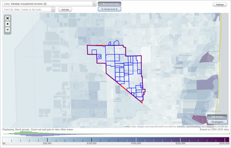
Hialeah, Florida Neighborhood Map - Income, House Prices, Occupations, Boundaries
Settings
X

- City boundary
- Neighborhood boundaries
Business Search - 14 Million verified businesses
Neighborhoods:
Andrews Park, Carole Anne Park, Central Hialeah, Deer Park, Downtown, East Hialeah, El Prado, El Prado Country Club, Essex Village, Ingleside Park, Knights Park, Lago Grande, Lake Adele, Lake Patricia, Linden Gardens, Mango Hill, Palm Springs, Palm Springs Estates, Rosedale Park, Saratoga Heights, Seminola, Suntan Village, Trojan Park, Ulelah, West Buena Vista, West Hialeah, Westhaven Heights, Westhaven ParkAndrews Park neighborhood in Hialeah statistics: (Find on map)
Area: 0.447 square miles
Population: 4,126
Population density:
Median household income in 2021:
Median rent in in 2021:
Male vs Females
Median age
Average estimated value of detached houses in 2021 (91.4% of all units):
Most popular occupations of males: sales and office occupations (37.0%); construction, extraction, and maintenance occupations (13.2%); management occupations (except farmers) (10.9%); production occupations (8.1%); service occupations (5.1%); business and financial operations occupations (3.1%); computer and mathematical occupations (2.8%)
Most popular occupations of females: healthcare practitioners and technical occupations (45.2%); sales and office occupations (25.9%); service occupations (15.4%); management occupations (except farmers) (4.8%); production occupations (3.9%); education, training, and library occupations (2.7%); architecture and engineering occupations (2.1%)
Highways in this neighborhood: State Hwy 823 (N Red Rd); W 49th St (State Hwy 932).
Roads and streets: Palm Ave; W 2nd Ave; W 3rd Ave; W 1st Ave; W 44th St; W 43rd St; W 42nd St; W 41st St; W 35th St; W 40th Pl; W 39th Pl; W 38th St; W 37th St; W 36th St; W 45th St; W 48th St; W 47th St; W 46th St; W 36th Ter; W 39th St; W 2nd Ln; W 2nd Ct; W 45th Pl; W 3rd Ln; W 36th Pl; W 3rd Ct; W 39th Ave; W 40th St.
Andrews Park neighborhood detailed profile
Area: 0.447 square miles
Population: 4,126
Population density:
| Andrews Park: | 9,226 people per square mile |
| Hialeah: | 11,459 people per square mile |
Median household income in 2021:
| Andrews Park: | $53,959 |
| Hialeah: | $46,674 |
Median rent in in 2021:
| Andrews Park: | $1,131 |
| Hialeah: | $1,241 |
Male vs Females
| Males: | 2,093 |
| Females: | 2,032 |
Median age
| Males: | 42.4 years |
| Females: | 51.5 years |
Average estimated value of detached houses in 2021 (91.4% of all units):
| Andrews Park: | $332,994 |
| Hialeah: | $353,442 |
Most popular occupations of males: sales and office occupations (37.0%); construction, extraction, and maintenance occupations (13.2%); management occupations (except farmers) (10.9%); production occupations (8.1%); service occupations (5.1%); business and financial operations occupations (3.1%); computer and mathematical occupations (2.8%)
Most popular occupations of females: healthcare practitioners and technical occupations (45.2%); sales and office occupations (25.9%); service occupations (15.4%); management occupations (except farmers) (4.8%); production occupations (3.9%); education, training, and library occupations (2.7%); architecture and engineering occupations (2.1%)
Highways in this neighborhood: State Hwy 823 (N Red Rd); W 49th St (State Hwy 932).
Roads and streets: Palm Ave; W 2nd Ave; W 3rd Ave; W 1st Ave; W 44th St; W 43rd St; W 42nd St; W 41st St; W 35th St; W 40th Pl; W 39th Pl; W 38th St; W 37th St; W 36th St; W 45th St; W 48th St; W 47th St; W 46th St; W 36th Ter; W 39th St; W 2nd Ln; W 2nd Ct; W 45th Pl; W 3rd Ln; W 36th Pl; W 3rd Ct; W 39th Ave; W 40th St.
Andrews Park neighborhood detailed profile
Carole Anne Park neighborhood in Hialeah statistics: (Find on map)
Area: 1.050 square miles
Population: 9,345
Population density:
Median household income in 2021:
Median rent in in 2021:
Male vs Females
Median age
Average estimated value of detached houses in 2021 (85.3% of all units):
Most popular occupations of males: sales and office occupations (26.9%); construction, extraction, and maintenance occupations (11.9%); production occupations (10.3%); service occupations (8.4%); management occupations (except farmers) (8.0%); transportation occupations (6.5%); business and financial operations occupations (4.3%)
Most popular occupations of females: sales and office occupations (34.9%); healthcare practitioners and technical occupations (26.5%); service occupations (18.9%); management occupations (except farmers) (5.7%); business and financial operations occupations (3.8%); production occupations (2.8%); transportation occupations (2.3%)
Highways in this neighborhood: State Hwy 823 (N Red Rd).
Roads and streets: Palm Ave; W 2nd Ave; E 2nd Ave; W 1st Ave; E 1st Ave; W 3rd Ave; E 4th Ave; E 47th St; E 46th St; E 3rd Ave; E 45th St; E 43rd St; E 44th St; E 42nd St; E 41st St; E 40th St; E 39th St; E 38th St; E 37th St; E 36th St; E 34th St; E 33rd St; W 44th St; W 43rd St; W 42nd St; W 41st St; W 35th St; W 40th Pl; W 34th St; W 39th Pl; W 38th St; W 36th St; W 37th St; E 48th St; E 35th St; W 32nd St; W 33rd St; W 45th St; E 39th Pl; W 46th St; W 36th Ter; W 39th St; W 48th St; W 2nd Ct; W 47th St; W 45th Pl; W 2nd Ln; W 36th Pl; E 1st Ct; E Palm Ct; E 3rd Ct; E 2nd Ct; W 3rd Ct; W 3rd Ln; W 39th Ave; W 40th St.
Carole Anne Park neighborhood detailed profile
Area: 1.050 square miles
Population: 9,345
Population density:
| Carole Anne Park: | 8,904 people per square mile |
| Hialeah: | 11,459 people per square mile |
Median household income in 2021:
| Carole Anne Park: | $53,542 |
| Hialeah: | $46,674 |
Median rent in in 2021:
| Carole Anne Park: | $1,351 |
| Hialeah: | $1,241 |
Male vs Females
| Males: | 4,589 |
| Females: | 4,756 |
Median age
| Males: | 40.0 years |
| Females: | 50.5 years |
Average estimated value of detached houses in 2021 (85.3% of all units):
| Carole Anne Park: | $332,990 |
| Hialeah: | $353,442 |
Most popular occupations of males: sales and office occupations (26.9%); construction, extraction, and maintenance occupations (11.9%); production occupations (10.3%); service occupations (8.4%); management occupations (except farmers) (8.0%); transportation occupations (6.5%); business and financial operations occupations (4.3%)
Most popular occupations of females: sales and office occupations (34.9%); healthcare practitioners and technical occupations (26.5%); service occupations (18.9%); management occupations (except farmers) (5.7%); business and financial operations occupations (3.8%); production occupations (2.8%); transportation occupations (2.3%)
Highways in this neighborhood: State Hwy 823 (N Red Rd).
Roads and streets: Palm Ave; W 2nd Ave; E 2nd Ave; W 1st Ave; E 1st Ave; W 3rd Ave; E 4th Ave; E 47th St; E 46th St; E 3rd Ave; E 45th St; E 43rd St; E 44th St; E 42nd St; E 41st St; E 40th St; E 39th St; E 38th St; E 37th St; E 36th St; E 34th St; E 33rd St; W 44th St; W 43rd St; W 42nd St; W 41st St; W 35th St; W 40th Pl; W 34th St; W 39th Pl; W 38th St; W 36th St; W 37th St; E 48th St; E 35th St; W 32nd St; W 33rd St; W 45th St; E 39th Pl; W 46th St; W 36th Ter; W 39th St; W 48th St; W 2nd Ct; W 47th St; W 45th Pl; W 2nd Ln; W 36th Pl; E 1st Ct; E Palm Ct; E 3rd Ct; E 2nd Ct; W 3rd Ct; W 3rd Ln; W 39th Ave; W 40th St.
Carole Anne Park neighborhood detailed profile
Central Hialeah neighborhood in Hialeah statistics: (Find on map)
Area: 1.966 square miles
Population: 18,137
Population density:
Median household income in 2021:
Median rent in in 2021:
Male vs Females
Median age
Average estimated value of detached houses in 2021 (91.5% of all units):
Most popular occupations of males: sales and office occupations (37.0%); construction, extraction, and maintenance occupations (13.2%); management occupations (except farmers) (10.9%); production occupations (8.1%); service occupations (5.1%); business and financial operations occupations (3.1%); computer and mathematical occupations (2.8%)
Most popular occupations of females: healthcare practitioners and technical occupations (45.2%); sales and office occupations (25.9%); service occupations (15.4%); management occupations (except farmers) (4.8%); production occupations (3.9%); business and financial operations occupations (3.0%); education, training, and library occupations (2.7%)
Highways in this neighborhood: W 49th St (State Hwy 932); Hialeah Expy (State Hwy 934); N Red Rd (State Hwy 823).
Roads and streets: W 8th Ave; W 10th Ave; W 6th Ave; W 4th Ave; W 11th Ave; W 27th St; W 37th St; Sc Barrett Blvd (W 23rd St); W 29th St; W 9th Ave; W 33rd St; W 44th Pl; W 9th Ct; W 39th Pl; W 5th Ave; W 51st Pl; W 28th St; W 25th St; W 8th Ct; W 39th St; W 40th Pl; W 43rd Pl; W 10th Ct; W 31st St; W 30th St; W 32nd St; W 34th St; W 26th St; W 7th Ave; W 8th Ln; W 50th St; W 45th Pl; W 35th St; W 36th St; W 6th Ct; W 33rd Pl; W 22nd St; W 50th Pl; W 9th Ln; W 4th Ct; W 42nd Pl; W 38th St; W 41st Pl; W 35th Pl; W 42nd St; W 48th St; W 6th Ln; W 5th Ct; W 24th St; W 36th Pl; W 7th Ln; W 11th Ln; W 34th Pl; W 38th Pl; W 5th Way; W 46th Pl; W 37th Ter; W 41st St; W 21st Pl; W 44th St; W 11th Ct; W 10th Ln; W 40th St; W 5th Ln; W 8th Pl; W 38th Ter; W 9th Way; W 37th Pl; W 7th Ct; W 30th Pl; W 32nd Pl; W 29th Pl; W 31st Pl; W 40th Dr; W 8th Way; W 43rd St; W 25th Pl; W 39th Ter; W 44th Ter; 7th Ct; W 10th Dr; W 24th Ter (W 24th Pl).
Railroad features: Florida East Coast Rlwy.
Central Hialeah neighborhood detailed profile
Area: 1.966 square miles
Population: 18,137
Population density:
| Central Hialeah (Central): | 9,226 people per square mile |
| Hialeah: | 11,459 people per square mile |
Median household income in 2021:
| Central Hialeah (Central): | $69,178 |
| Hialeah: | $46,674 |
Median rent in in 2021:
| Central Hialeah (Central): | $1,131 |
| Hialeah: | $1,241 |
Male vs Females
| Males: | 9,204 |
| Females: | 8,933 |
Median age
| Males: | 46.2 years |
| Females: | 52.1 years |
Average estimated value of detached houses in 2021 (91.5% of all units):
| Central Hialeah (Central): | $332,994 |
| Hialeah: | $353,442 |
Most popular occupations of males: sales and office occupations (37.0%); construction, extraction, and maintenance occupations (13.2%); management occupations (except farmers) (10.9%); production occupations (8.1%); service occupations (5.1%); business and financial operations occupations (3.1%); computer and mathematical occupations (2.8%)
Most popular occupations of females: healthcare practitioners and technical occupations (45.2%); sales and office occupations (25.9%); service occupations (15.4%); management occupations (except farmers) (4.8%); production occupations (3.9%); business and financial operations occupations (3.0%); education, training, and library occupations (2.7%)
Highways in this neighborhood: W 49th St (State Hwy 932); Hialeah Expy (State Hwy 934); N Red Rd (State Hwy 823).
Roads and streets: W 8th Ave; W 10th Ave; W 6th Ave; W 4th Ave; W 11th Ave; W 27th St; W 37th St; Sc Barrett Blvd (W 23rd St); W 29th St; W 9th Ave; W 33rd St; W 44th Pl; W 9th Ct; W 39th Pl; W 5th Ave; W 51st Pl; W 28th St; W 25th St; W 8th Ct; W 39th St; W 40th Pl; W 43rd Pl; W 10th Ct; W 31st St; W 30th St; W 32nd St; W 34th St; W 26th St; W 7th Ave; W 8th Ln; W 50th St; W 45th Pl; W 35th St; W 36th St; W 6th Ct; W 33rd Pl; W 22nd St; W 50th Pl; W 9th Ln; W 4th Ct; W 42nd Pl; W 38th St; W 41st Pl; W 35th Pl; W 42nd St; W 48th St; W 6th Ln; W 5th Ct; W 24th St; W 36th Pl; W 7th Ln; W 11th Ln; W 34th Pl; W 38th Pl; W 5th Way; W 46th Pl; W 37th Ter; W 41st St; W 21st Pl; W 44th St; W 11th Ct; W 10th Ln; W 40th St; W 5th Ln; W 8th Pl; W 38th Ter; W 9th Way; W 37th Pl; W 7th Ct; W 30th Pl; W 32nd Pl; W 29th Pl; W 31st Pl; W 40th Dr; W 8th Way; W 43rd St; W 25th Pl; W 39th Ter; W 44th Ter; 7th Ct; W 10th Dr; W 24th Ter (W 24th Pl).
Railroad features: Florida East Coast Rlwy.
Central Hialeah neighborhood detailed profile
Deer Park neighborhood in Hialeah statistics: (Find on map)
Area: 0.071 square miles
Roads and streets: To To Lo Chee Dr; SE 4th Ave; E Circle Dr; Pash E Ho Wa Dr; Pen Na Na Dr; NW Fo A Kee Dr; Eucalyptus Dr; Circle Dr; SE 4th St.
Deer Park neighborhood detailed profile
Area: 0.071 square miles
Roads and streets: To To Lo Chee Dr; SE 4th Ave; E Circle Dr; Pash E Ho Wa Dr; Pen Na Na Dr; NW Fo A Kee Dr; Eucalyptus Dr; Circle Dr; SE 4th St.
Deer Park neighborhood detailed profile
Downtown neighborhood in Hialeah statistics: (Find on map)
Area: 0.490 square miles
Population: 1,972
Population density:
Median household income in 2021:
Median rent in in 2021:
Male vs Females
Median age
Housing prices:
Average estimated value of detached houses in 2021 (51.4% of all units):
Average estimated value of townhouses or other attached units in 2021 (17.8% of all units):
Most popular occupations of males: construction, extraction, and maintenance occupations (22.0%); sales and office occupations (18.9%); service occupations (12.5%); healthcare practitioners and technical occupations (12.2%); arts, design, entertainment, sports, and media occupations (11.4%); transportation occupations (9.5%); production occupations (8.5%)
Most popular occupations of females: service occupations (89.7%); education, training, and library occupations (38.2%); sales and office occupations (33.8%); business and financial operations occupations (22.1%); material moving occupations (14.0%); healthcare practitioners and technical occupations (10.2%); production occupations (3.8%)
Roads and streets: E 8th St; E 4th St; E 5th St; Hialeah Dr; E 7th St; E 3rd St; E 6th St; Flamingo Way (E 4th Ave); E 2nd Ave; E 3rd Ave; E 1st Ave; E 6th Ave (NE 6th Ave); E 2nd St; Palm Ave; E 5th Ave (NE 5th Ave); W 1st Ave; Essex Ave; Suffolk Ave; W 6th St; W 7th St; SE 1st St; W 4th St; W 5th St; W 8th St; Eucalyptus Dr; Olive Dr; SE 5th Ave; SE 6th Ave; Lindsey Ct; E Olive Dr.
Downtown neighborhood detailed profile
Area: 0.490 square miles
Population: 1,972
Population density:
| Downtown (Downtown Hialeah): | 4,028 people per square mile |
| Hialeah: | 11,459 people per square mile |
Median household income in 2021:
| Downtown (Downtown Hialeah): | $59,094 |
| Hialeah: | $46,674 |
Median rent in in 2021:
| Downtown (Downtown Hialeah): | $1,138 |
| Hialeah: | $1,241 |
Male vs Females
| Males: | 1,152 |
| Females: | 819 |
Median age
| Males: | 47.1 years |
| Females: | 52.1 years |
Housing prices:
Average estimated value of detached houses in 2021 (51.4% of all units):
| Downtown (Downtown Hialeah): | $324,495 |
| Hialeah: | $353,442 |
Average estimated value of townhouses or other attached units in 2021 (17.8% of all units):
| This neighborhood: | $242,187 |
| city: | $285,621 |
Most popular occupations of males: construction, extraction, and maintenance occupations (22.0%); sales and office occupations (18.9%); service occupations (12.5%); healthcare practitioners and technical occupations (12.2%); arts, design, entertainment, sports, and media occupations (11.4%); transportation occupations (9.5%); production occupations (8.5%)
Most popular occupations of females: service occupations (89.7%); education, training, and library occupations (38.2%); sales and office occupations (33.8%); business and financial operations occupations (22.1%); material moving occupations (14.0%); healthcare practitioners and technical occupations (10.2%); production occupations (3.8%)
Roads and streets: E 8th St; E 4th St; E 5th St; Hialeah Dr; E 7th St; E 3rd St; E 6th St; Flamingo Way (E 4th Ave); E 2nd Ave; E 3rd Ave; E 1st Ave; E 6th Ave (NE 6th Ave); E 2nd St; Palm Ave; E 5th Ave (NE 5th Ave); W 1st Ave; Essex Ave; Suffolk Ave; W 6th St; W 7th St; SE 1st St; W 4th St; W 5th St; W 8th St; Eucalyptus Dr; Olive Dr; SE 5th Ave; SE 6th Ave; Lindsey Ct; E Olive Dr.
Downtown neighborhood detailed profile
East Hialeah neighborhood in Hialeah statistics: (Find on map)
Area: 6.722 square miles
Population: 51,624
Population density:
Median household income in 2021:
Median rent in in 2021:
Male vs Females
Median age
Housing prices:
Average estimated value of detached houses in 2021 (87.5% of all units):
Average estimated value of townhouses or other attached units in 2021 (5.2% of all units):
Most popular occupations of males: sales and office occupations (20.4%); service occupations (16.7%); transportation occupations (13.9%); construction, extraction, and maintenance occupations (11.1%); production occupations (7.8%); healthcare practitioners and technical occupations (4.8%); management occupations (except farmers) (4.4%)
Most popular occupations of females: sales and office occupations (30.0%); service occupations (19.2%); healthcare practitioners and technical occupations (15.3%); education, training, and library occupations (6.8%); business and financial operations occupations (6.5%); management occupations (except farmers) (5.8%); production occupations (4.5%)
Highways in this neighborhood: E 8th Ave (State Hwy 953); State Hwy 932 (E 49th St); E 21st St (State Hwy 934); State Hwy 934 (NW 79th St); State Hwy 953 (SE 8th Ave); US Hwy 27.
Roads and streets: Flamingo Way (E 4th Ave); E 6th Ave (NE 6th Ave); E 5th Ave; E 7th Ave; E 10th Ave; E 3rd Ave; E 2nd Ave; NW 37th Ave; E 1st Ave; E 11th Ave; E 9th Ct; E 8th Ct; E 20th St; E 17th St; E 18th St; E 41st St; E 9th St (NW 62nd St); E 45th St; E 47th St; E 19th St; E 32nd St; E 13th St; E 33rd St; E 10th Ct; E 56th St; E 37th St; E 52nd St; E 43rd St; E 35th St; E 9th Ave; E 31st St; E 9th Ln; E 40th St; E 14th St; E 36th St; E 30th St; E 34th St; E 8th Ln; E 24th St (NW 78th St); E 55th St; E 54th St; E 38th St; E 27th St; E 28th St; E 8th St; E 23rd St; E 29th St; E 5th St; E 46th St; E 39th St; E 57th St; SE 9th Ct; SE 9th Ave; E 26th St; Hialeah Dr; E 15th St; E 61st St; E 63rd St; E 62nd St; SE 8th St; E 42nd St; E 44th St; E 22nd St; E 50th St; E 48th St; E 60th St; E 51st St; E 59th St; E 58th St; E 53rd St; E 16th St; E 11th St; E 10th St; E 7th St; E 6th St; E 12th St; E 64th St; SE 7th Ave; E 10th Ln; SE 10th Ave; E 4th St; SE 6th Ave; SE 1st St; SE 4th St; NW 37th Ct; SE 8th Ct; SE 1st Pl; E 39th Pl; SE 5th Ave; SE 3rd Pl; SE 2nd Pl; E 16th Pl; SE 7th Pl; SE 6th Pl; SE 12th St; NW 51st St; E 11th Pl; SE 4th Pl; NE 1st Pl; NE 2nd Pl; NE 3rd Pl; SE 5th Pl; NE 4th Pl; SE 9th Ter; E 6th Ct; SE Park Dr; NW 54th St; E 10th Pl; SE 14th St; E 14th Pl; SE 5th St; E 15th Pl; SE 10th Ct; E 12th Pl; Curtiss Dr; SE 10th St; Flamingo Plz; E 3rd St; E 6th Pl; NW 58th St; NW 55th St; NW 38th Ave; NW 36th Ave; SE 8th Pl; E 53rd Ter; NE 9th Ave; NW 50th St; E 2nd St; E 11th Ct; NW 35th Ave; E 7th Ct; SE 10th Pl; NW 35th Ct; NW 52nd St; SE 9th Pl; NW 53rd St; Essex Ave; Suffolk Ave; E 50th Pl; E Palm Ct; E 1st Ct; SE 11th Pl; E 51st Pl; SE 7th St; SE 6th St; SE 3rd St; SE 2nd St; NW 48th St; NW 46th St; NW 43rd St; NW 41st St; SE 10th Ter; NW 62nd St; NW 49th St; NW 51st Ter; NW 72nd St; NW 67th St; E 52nd Pl; NW 76th St; E 6th Ln; NW 74th St; NW 73rd St; E 9th Pl; SE 11th St; NW 80th St; NW 81st St; NW 82nd St; Park Dr; SE 11th Ave; E 1st St; NW 77th St; E 3rd Ct; E 2nd Ct; NW 59th St; NW 71st St; NW 38th St; NW 69th St.
Railroad features: Seaboard Coast Line RR; Florida East Coast Rlwy.
Other features: Little River Cnl.
East Hialeah neighborhood detailed profile
Area: 6.722 square miles
Population: 51,624
Population density:
| East Hialeah: | 7,679 people per square mile |
| Hialeah: | 11,459 people per square mile |
Median household income in 2021:
| East Hialeah: | $60,738 |
| Hialeah: | $46,674 |
Median rent in in 2021:
| East Hialeah: | $1,375 |
| Hialeah: | $1,241 |
Male vs Females
| Males: | 26,704 |
| Females: | 24,919 |
Median age
| Males: | 43.8 years |
| Females: | 48.7 years |
Housing prices:
Average estimated value of detached houses in 2021 (87.5% of all units):
| East Hialeah: | $305,074 |
| Hialeah: | $353,442 |
Average estimated value of townhouses or other attached units in 2021 (5.2% of all units):
| This neighborhood: | $242,188 |
| city: | $285,621 |
Most popular occupations of males: sales and office occupations (20.4%); service occupations (16.7%); transportation occupations (13.9%); construction, extraction, and maintenance occupations (11.1%); production occupations (7.8%); healthcare practitioners and technical occupations (4.8%); management occupations (except farmers) (4.4%)
Most popular occupations of females: sales and office occupations (30.0%); service occupations (19.2%); healthcare practitioners and technical occupations (15.3%); education, training, and library occupations (6.8%); business and financial operations occupations (6.5%); management occupations (except farmers) (5.8%); production occupations (4.5%)
Highways in this neighborhood: E 8th Ave (State Hwy 953); State Hwy 932 (E 49th St); E 21st St (State Hwy 934); State Hwy 934 (NW 79th St); State Hwy 953 (SE 8th Ave); US Hwy 27.
Roads and streets: Flamingo Way (E 4th Ave); E 6th Ave (NE 6th Ave); E 5th Ave; E 7th Ave; E 10th Ave; E 3rd Ave; E 2nd Ave; NW 37th Ave; E 1st Ave; E 11th Ave; E 9th Ct; E 8th Ct; E 20th St; E 17th St; E 18th St; E 41st St; E 9th St (NW 62nd St); E 45th St; E 47th St; E 19th St; E 32nd St; E 13th St; E 33rd St; E 10th Ct; E 56th St; E 37th St; E 52nd St; E 43rd St; E 35th St; E 9th Ave; E 31st St; E 9th Ln; E 40th St; E 14th St; E 36th St; E 30th St; E 34th St; E 8th Ln; E 24th St (NW 78th St); E 55th St; E 54th St; E 38th St; E 27th St; E 28th St; E 8th St; E 23rd St; E 29th St; E 5th St; E 46th St; E 39th St; E 57th St; SE 9th Ct; SE 9th Ave; E 26th St; Hialeah Dr; E 15th St; E 61st St; E 63rd St; E 62nd St; SE 8th St; E 42nd St; E 44th St; E 22nd St; E 50th St; E 48th St; E 60th St; E 51st St; E 59th St; E 58th St; E 53rd St; E 16th St; E 11th St; E 10th St; E 7th St; E 6th St; E 12th St; E 64th St; SE 7th Ave; E 10th Ln; SE 10th Ave; E 4th St; SE 6th Ave; SE 1st St; SE 4th St; NW 37th Ct; SE 8th Ct; SE 1st Pl; E 39th Pl; SE 5th Ave; SE 3rd Pl; SE 2nd Pl; E 16th Pl; SE 7th Pl; SE 6th Pl; SE 12th St; NW 51st St; E 11th Pl; SE 4th Pl; NE 1st Pl; NE 2nd Pl; NE 3rd Pl; SE 5th Pl; NE 4th Pl; SE 9th Ter; E 6th Ct; SE Park Dr; NW 54th St; E 10th Pl; SE 14th St; E 14th Pl; SE 5th St; E 15th Pl; SE 10th Ct; E 12th Pl; Curtiss Dr; SE 10th St; Flamingo Plz; E 3rd St; E 6th Pl; NW 58th St; NW 55th St; NW 38th Ave; NW 36th Ave; SE 8th Pl; E 53rd Ter; NE 9th Ave; NW 50th St; E 2nd St; E 11th Ct; NW 35th Ave; E 7th Ct; SE 10th Pl; NW 35th Ct; NW 52nd St; SE 9th Pl; NW 53rd St; Essex Ave; Suffolk Ave; E 50th Pl; E Palm Ct; E 1st Ct; SE 11th Pl; E 51st Pl; SE 7th St; SE 6th St; SE 3rd St; SE 2nd St; NW 48th St; NW 46th St; NW 43rd St; NW 41st St; SE 10th Ter; NW 62nd St; NW 49th St; NW 51st Ter; NW 72nd St; NW 67th St; E 52nd Pl; NW 76th St; E 6th Ln; NW 74th St; NW 73rd St; E 9th Pl; SE 11th St; NW 80th St; NW 81st St; NW 82nd St; Park Dr; SE 11th Ave; E 1st St; NW 77th St; E 3rd Ct; E 2nd Ct; NW 59th St; NW 71st St; NW 38th St; NW 69th St.
Railroad features: Seaboard Coast Line RR; Florida East Coast Rlwy.
Other features: Little River Cnl.
East Hialeah neighborhood detailed profile
El Prado neighborhood in Hialeah statistics: (Find on map)
Area: 0.040 square miles
Roads and streets: W 65th St; W 64th Pl; W 25th Ct; W 24th Ln; W 25th Ln; W 25th Ave.
El Prado neighborhood detailed profile
Area: 0.040 square miles
Roads and streets: W 65th St; W 64th Pl; W 25th Ct; W 24th Ln; W 25th Ln; W 25th Ave.
El Prado neighborhood detailed profile
El Prado Country Club neighborhood in Hialeah statistics: (Find on map)
Area: 0.252 square miles
Roads and streets: W 29th Ave; W 72nd St; W 30th Ave; W 30th Ct; W 29th Way; W 30th Ln; W 31st Ave; W 74th St; W 28th Ct; W 68th Pl; W 76th St (130th St); NW 123rd St; W 71st St; W 29th Ln; W 75th Ter; W 71st Pl; W 75th St; W 74th Pl; W 73rd St; W 73rd Ter; W 72nd Ter; 70th St; 69th Pl; 71st Pl.
El Prado Country Club neighborhood detailed profile
Essex Village neighborhood in Hialeah statistics: (Find on map)
Area: 0.493 square miles
Population: 1,875
Population density:
Median household income in 2021:
Median rent in in 2021:
Male vs Females
Median age
Average estimated value of detached houses in 2021 (62.3% of all units):
Most popular occupations of males: service occupations (31.1%); sales and office occupations (23.1%); construction, extraction, and maintenance occupations (23.1%); production occupations (7.1%); management occupations (except farmers) (5.3%); arts, design, entertainment, sports, and media occupations (3.2%); material moving occupations (2.5%)
Most popular occupations of females: service occupations (33.7%); sales and office occupations (24.2%); community and social services occupations (20.4%); production occupations (16.3%); material moving occupations (8.8%); healthcare practitioners and technical occupations (8.5%); business and financial operations occupations (6.7%)
Highways in this neighborhood: State Hwy 953 (SE 8th Ave); E 8th Ave (State Hwy 953).
Roads and streets: Hialeah Dr; SE 8th St; SE 9th Ct; SE 9th Ave; SE 7th Ave; SE 1st Pl; SE 3rd Pl; SE 1st St; SE 2nd Pl; SE 4th St; SE 10th Ave; SE 7th Pl; SE 6th Pl; NE 2nd Pl; SE 4th Pl; NE 1st Pl; SE 5th Pl; NE 3rd Pl; NE 4th Pl; E 10th Ave; E 10th Ct; E 9th Ct; NE 9th Ave; E 7th Ave; SE 5th St; E 3rd St; E 4th St; SE 8th Ct; SE 11th Ave; E 2nd St; E 1st St; SE 10th Ct.
Railroad features: Seaboard Coast Line RR.
Essex Village neighborhood detailed profile
Area: 0.493 square miles
Population: 1,875
Population density:
| Essex Village: | 3,800 people per square mile |
| Hialeah: | 11,459 people per square mile |
Median household income in 2021:
| Essex Village: | $49,204 |
| Hialeah: | $46,674 |
Median rent in in 2021:
| Essex Village: | $912 |
| Hialeah: | $1,241 |
Male vs Females
| Males: | 1,000 |
| Females: | 875 |
Median age
| Males: | 36.9 years |
| Females: | 36.8 years |
Average estimated value of detached houses in 2021 (62.3% of all units):
| Essex Village: | $253,220 |
| Hialeah: | $353,442 |
Most popular occupations of males: service occupations (31.1%); sales and office occupations (23.1%); construction, extraction, and maintenance occupations (23.1%); production occupations (7.1%); management occupations (except farmers) (5.3%); arts, design, entertainment, sports, and media occupations (3.2%); material moving occupations (2.5%)
Most popular occupations of females: service occupations (33.7%); sales and office occupations (24.2%); community and social services occupations (20.4%); production occupations (16.3%); material moving occupations (8.8%); healthcare practitioners and technical occupations (8.5%); business and financial operations occupations (6.7%)
Highways in this neighborhood: State Hwy 953 (SE 8th Ave); E 8th Ave (State Hwy 953).
Roads and streets: Hialeah Dr; SE 8th St; SE 9th Ct; SE 9th Ave; SE 7th Ave; SE 1st Pl; SE 3rd Pl; SE 1st St; SE 2nd Pl; SE 4th St; SE 10th Ave; SE 7th Pl; SE 6th Pl; NE 2nd Pl; SE 4th Pl; NE 1st Pl; SE 5th Pl; NE 3rd Pl; NE 4th Pl; E 10th Ave; E 10th Ct; E 9th Ct; NE 9th Ave; E 7th Ave; SE 5th St; E 3rd St; E 4th St; SE 8th Ct; SE 11th Ave; E 2nd St; E 1st St; SE 10th Ct.
Railroad features: Seaboard Coast Line RR.
Essex Village neighborhood detailed profile
Ingleside Park neighborhood in Hialeah statistics: (Find on map)
Area: 0.515 square miles
Population: 2,776
Population density:
Median household income in 2021:
Median rent in in 2021:
Male vs Females
Median age
Average estimated value of detached houses in 2021 (100.0% of all units):
Most popular occupations of males: service occupations (36.3%); construction, extraction, and maintenance occupations (23.3%); transportation occupations (17.0%); production occupations (15.4%); sales and office occupations (10.8%); education, training, and library occupations (6.4%)
Most popular occupations of females: service occupations (33.0%); sales and office occupations (26.0%); education, training, and library occupations (13.1%); production occupations (9.4%); transportation occupations (9.4%); business and financial operations occupations (4.9%); healthcare practitioners and technical occupations (4.2%)
Highways in this neighborhood: State Hwy 932 (E 49th St).
Roads and streets: E 10th Ave; E 10th Ct; E 8th Ct; E 9th Ct; E 9th Ln; E 8th Ln; E 11th Ave; E 10th Ln; E 41st St; E 52nd St; E 45th St; E 43rd St; E 47th St; E 37th St; E 35th St; E 34th St; E 40th St; E 39th Pl; E 36th St; E 9th Ave; E 38th St.
Railroad features: Seaboard Coast Line RR.
Ingleside Park neighborhood detailed profile
Area: 0.515 square miles
Population: 2,776
Population density:
| Ingleside Park: | 5,392 people per square mile |
| Hialeah: | 11,459 people per square mile |
Median household income in 2021:
| Ingleside Park: | $91,971 |
| Hialeah: | $46,674 |
Median rent in in 2021:
| Ingleside Park: | $1,360 |
| Hialeah: | $1,241 |
Male vs Females
| Males: | 1,250 |
| Females: | 1,525 |
Median age
| Males: | 36.8 years |
| Females: | 47.4 years |
Average estimated value of detached houses in 2021 (100.0% of all units):
| Ingleside Park: | $313,731 |
| Hialeah: | $353,442 |
Most popular occupations of males: service occupations (36.3%); construction, extraction, and maintenance occupations (23.3%); transportation occupations (17.0%); production occupations (15.4%); sales and office occupations (10.8%); education, training, and library occupations (6.4%)
Most popular occupations of females: service occupations (33.0%); sales and office occupations (26.0%); education, training, and library occupations (13.1%); production occupations (9.4%); transportation occupations (9.4%); business and financial operations occupations (4.9%); healthcare practitioners and technical occupations (4.2%)
Highways in this neighborhood: State Hwy 932 (E 49th St).
Roads and streets: E 10th Ave; E 10th Ct; E 8th Ct; E 9th Ct; E 9th Ln; E 8th Ln; E 11th Ave; E 10th Ln; E 41st St; E 52nd St; E 45th St; E 43rd St; E 47th St; E 37th St; E 35th St; E 34th St; E 40th St; E 39th Pl; E 36th St; E 9th Ave; E 38th St.
Railroad features: Seaboard Coast Line RR.
Ingleside Park neighborhood detailed profile
Knights Park neighborhood in Hialeah statistics: (Find on map)
Area: 0.128 square miles
Population: 403
Population density:
Median household income in 2021:
Median rent in in 2021:
Male vs Females
Median age
Most popular occupations of males: service occupations (19.3%); production occupations (17.4%); transportation occupations (13.5%); material moving occupations (13.2%); sales and office occupations (10.9%); construction, extraction, and maintenance occupations (9.7%); management occupations (except farmers) (3.6%)
Most popular occupations of females: sales and office occupations (45.8%); service occupations (22.2%); transportation occupations (6.9%); material moving occupations (6.7%); healthcare practitioners and technical occupations (5.8%); management occupations (except farmers) (3.8%); community and social services occupations (2.2%)
Roads and streets: NW 37th Ave; E 11th Ct; E 11th Ave; NW 62nd St; NW 67th St; NW 37th Ct; NW 69th St.
Railroad features: Seaboard Coast Line RR.
Knights Park neighborhood detailed profile
Area: 0.128 square miles
Population: 403
Population density:
| Knights Park: | 3,138 people per square mile |
| Hialeah: | 11,459 people per square mile |
Median household income in 2021:
| Knights Park: | $38,628 |
| Hialeah: | $46,674 |
Median rent in in 2021:
| Knights Park: | $978 |
| Hialeah: | $1,241 |
Male vs Females
| Males: | 216 |
| Females: | 187 |
Median age
| Males: | 27.6 years |
| Females: | 36.7 years |
Most popular occupations of males: service occupations (19.3%); production occupations (17.4%); transportation occupations (13.5%); material moving occupations (13.2%); sales and office occupations (10.9%); construction, extraction, and maintenance occupations (9.7%); management occupations (except farmers) (3.6%)
Most popular occupations of females: sales and office occupations (45.8%); service occupations (22.2%); transportation occupations (6.9%); material moving occupations (6.7%); healthcare practitioners and technical occupations (5.8%); management occupations (except farmers) (3.8%); community and social services occupations (2.2%)
Roads and streets: NW 37th Ave; E 11th Ct; E 11th Ave; NW 62nd St; NW 67th St; NW 37th Ct; NW 69th St.
Railroad features: Seaboard Coast Line RR.
Knights Park neighborhood detailed profile
Lago Grande neighborhood in Hialeah statistics: (Find on map)
Area: 0.242 square miles
Roads and streets: W 26th Ct; W 64th Pl; W 60th Pl; W 24th Ct; W 65th St; W 60th St; W 67th Pl; W 27th Ct; W 27th Ave; W 24th Ave; W 24th Ln; 66th St; W 63rd St; W 61st Pl; W 26th Dr; W 61st St; W 28th Ave (NW 87th Ave); 26th Ct; 67th Pl; W 25th Ct; W 63 Pl; 27th Way; W 25th Ln; W 27th Ln; W 63rd Pl; W 62nd Pl; W 62nd St; N Gate; W 25th Ave; W 66th St.
Lago Grande neighborhood detailed profile
Lake Adele neighborhood in Hialeah statistics: (Find on map)
Area: 0.066 square miles
Population: 139
Population density:
Median household income in 2021:
Median rent in in 2021:
Male vs Females
Median age
Most popular occupations of males: construction, extraction, and maintenance occupations (16.6%); transportation occupations (12.9%); sales and office occupations (9.7%); service occupations (8.6%); management occupations (except farmers) (8.2%); business and financial operations occupations (7.9%); arts, design, entertainment, sports, and media occupations (7.9%)
Most popular occupations of females: sales and office occupations (36.9%); management occupations (except farmers) (22.2%); service occupations (14.9%); healthcare practitioners and technical occupations (9.0%); business and financial operations occupations (5.7%); education, training, and library occupations (4.2%); community and social services occupations (3.7%)
Roads and streets: Leaning Pine Dr; Cypress Ct; Bamboo St; Miami Lakeway S (E Miami Lakeway, Miami Lakeway); Bamboo Ct.
Lake Adele neighborhood detailed profile
Area: 0.066 square miles
Population: 139
Population density:
| Lake Adele: | 2,121 people per square mile |
| Hialeah: | 11,459 people per square mile |
Median household income in 2021:
| Lake Adele: | $107,797 |
| Hialeah: | $46,674 |
Median rent in in 2021:
| Lake Adele: | $1,509 |
| Hialeah: | $1,241 |
Male vs Females
| Males: | 67 |
| Females: | 72 |
Median age
| Males: | 46.0 years |
| Females: | 45.4 years |
Most popular occupations of males: construction, extraction, and maintenance occupations (16.6%); transportation occupations (12.9%); sales and office occupations (9.7%); service occupations (8.6%); management occupations (except farmers) (8.2%); business and financial operations occupations (7.9%); arts, design, entertainment, sports, and media occupations (7.9%)
Most popular occupations of females: sales and office occupations (36.9%); management occupations (except farmers) (22.2%); service occupations (14.9%); healthcare practitioners and technical occupations (9.0%); business and financial operations occupations (5.7%); education, training, and library occupations (4.2%); community and social services occupations (3.7%)
Roads and streets: Leaning Pine Dr; Cypress Ct; Bamboo St; Miami Lakeway S (E Miami Lakeway, Miami Lakeway); Bamboo Ct.
Lake Adele neighborhood detailed profile
Lake Patricia neighborhood in Hialeah statistics: (Find on map)
Area: 0.246 square miles
Population: 524
Population density:
Median household income in 2021:
Median rent in in 2021:
Male vs Females
Median age
Most popular occupations of males: construction, extraction, and maintenance occupations (16.6%); transportation occupations (12.9%); sales and office occupations (9.7%); service occupations (8.6%); management occupations (except farmers) (8.2%); business and financial operations occupations (7.9%); arts, design, entertainment, sports, and media occupations (7.9%)
Most popular occupations of females: sales and office occupations (36.9%); management occupations (except farmers) (22.2%); service occupations (14.9%); healthcare practitioners and technical occupations (9.0%); business and financial operations occupations (5.7%); education, training, and library occupations (4.2%); community and social services occupations (3.7%)
Roads and streets: Lake Patricia Dr; Lake Candlewood Ct; E Miami Lakeway (Miami Lakeway S); NW 67th Ave (Ludlam Rd); Lake Blue Dr; Lake Childs Ct; Lake Lure Ct; Lake Saranac Ave; Lake Crescent Pl; Lake George Ct; Lake Claire Ct; Lake Champlain Ter; Lake Placid Ct; Lake Como Ter; Lake Success Pl; Lake June Rd; Lake Geneva Rd; NW 139th St.
Lake Patricia neighborhood detailed profile
Area: 0.246 square miles
Population: 524
Population density:
| Lake Patricia: | 2,126 people per square mile |
| Hialeah: | 11,459 people per square mile |
Median household income in 2021:
| Lake Patricia: | $107,797 |
| Hialeah: | $46,674 |
Median rent in in 2021:
| Lake Patricia: | $1,509 |
| Hialeah: | $1,241 |
Male vs Females
| Males: | 253 |
| Females: | 270 |
Median age
| Males: | 46.0 years |
| Females: | 45.4 years |
Most popular occupations of males: construction, extraction, and maintenance occupations (16.6%); transportation occupations (12.9%); sales and office occupations (9.7%); service occupations (8.6%); management occupations (except farmers) (8.2%); business and financial operations occupations (7.9%); arts, design, entertainment, sports, and media occupations (7.9%)
Most popular occupations of females: sales and office occupations (36.9%); management occupations (except farmers) (22.2%); service occupations (14.9%); healthcare practitioners and technical occupations (9.0%); business and financial operations occupations (5.7%); education, training, and library occupations (4.2%); community and social services occupations (3.7%)
Roads and streets: Lake Patricia Dr; Lake Candlewood Ct; E Miami Lakeway (Miami Lakeway S); NW 67th Ave (Ludlam Rd); Lake Blue Dr; Lake Childs Ct; Lake Lure Ct; Lake Saranac Ave; Lake Crescent Pl; Lake George Ct; Lake Claire Ct; Lake Champlain Ter; Lake Placid Ct; Lake Como Ter; Lake Success Pl; Lake June Rd; Lake Geneva Rd; NW 139th St.
Lake Patricia neighborhood detailed profile
Linden Gardens neighborhood in Hialeah statistics: (Find on map)
Area: 0.138 square miles
Population: 742
Population density:
Median household income in 2021:
Median rent in in 2021:
Male vs Females
Median age
Average estimated value of detached houses in 2021 (100.0% of all units):
Most popular occupations of males: service occupations (36.4%); construction, extraction, and maintenance occupations (22.8%); transportation occupations (17.0%); production occupations (15.4%); sales and office occupations (10.7%); healthcare practitioners and technical occupations (7.7%); education, training, and library occupations (6.2%)
Most popular occupations of females: service occupations (33.1%); sales and office occupations (25.9%); education, training, and library occupations (13.2%); production occupations (9.4%); transportation occupations (9.4%); business and financial operations occupations (4.9%); management occupations (except farmers) (4.3%)
Roads and streets: E 10th Ave; E 8th Ct; E 9th Ln; E 8th Ln; E 9th Ct; E 37th St; E 34th St; E 40th St; E 39th Pl; E 36th St; E 33rd St; E 35th St; E 9th Ave; E 38th St.
Linden Gardens neighborhood detailed profile
Area: 0.138 square miles
Population: 742
Population density:
| Linden Gardens: | 5,376 people per square mile |
| Hialeah: | 11,459 people per square mile |
Median household income in 2021:
| Linden Gardens: | $66,483 |
| Hialeah: | $46,674 |
Median rent in in 2021:
| Linden Gardens: | $1,364 |
| Hialeah: | $1,241 |
Male vs Females
| Males: | 334 |
| Females: | 408 |
Median age
| Males: | 55.2 years |
| Females: | 41.9 years |
Average estimated value of detached houses in 2021 (100.0% of all units):
| Linden Gardens: | $313,731 |
| Hialeah: | $353,442 |
Most popular occupations of males: service occupations (36.4%); construction, extraction, and maintenance occupations (22.8%); transportation occupations (17.0%); production occupations (15.4%); sales and office occupations (10.7%); healthcare practitioners and technical occupations (7.7%); education, training, and library occupations (6.2%)
Most popular occupations of females: service occupations (33.1%); sales and office occupations (25.9%); education, training, and library occupations (13.2%); production occupations (9.4%); transportation occupations (9.4%); business and financial operations occupations (4.9%); management occupations (except farmers) (4.3%)
Roads and streets: E 10th Ave; E 8th Ct; E 9th Ln; E 8th Ln; E 9th Ct; E 37th St; E 34th St; E 40th St; E 39th Pl; E 36th St; E 33rd St; E 35th St; E 9th Ave; E 38th St.
Linden Gardens neighborhood detailed profile
Mango Hill neighborhood in Hialeah statistics: (Find on map)
Area: 0.259 square miles
Roads and streets: W 10th Ct; W 9th Ct; W 8th Ave; W 44th Pl; W 39th Pl; W 10th Ave; W 11th Ln; W 42nd Pl; W 37th Ter; W 8th Ct; W 41st St; W 8th Ln; W 11th Ave; W 44th St; W 42nd St; W 40th Pl; W 10th Ln; W 43rd Pl; W 9th Ln; W 40th St; W 38th Ter; W 9th Way; W 11th Ct; W 40th Dr; W 41st Pl; W 38th St; W 9th Ave; W 8th Way; W 43rd St; W 39th Ter; W 44th Ter; W 10th Dr; NW 11th Ave.
Mango Hill neighborhood detailed profile
Palm Springs neighborhood in Hialeah statistics: (Find on map)
Area: 5.855 square miles
Population: 59,483
Population density:
Median household income in 2021:
Median rent in in 2021:
Male vs Females
Median age
Housing prices:
Average estimated value of detached houses in 2021 (91.8% of all units):
Average estimated value of housing units in 2-unit structures in 2021 (4.5% of all units):
Average estimated '21 value of housing units in 5-or-more-unit structures (52.4% of all units):
Most popular occupations of males: transportation occupations (18.5%); sales and office occupations (17.5%); service occupations (11.0%); production occupations (9.6%); construction, extraction, and maintenance occupations (8.3%); management occupations (except farmers) (6.6%); education, training, and library occupations (5.3%)
Most popular occupations of females: sales and office occupations (35.6%); service occupations (20.2%); management occupations (except farmers) (11.0%); healthcare practitioners and technical occupations (9.2%); education, training, and library occupations (4.8%); business and financial operations occupations (3.9%); production occupations (3.8%)
Highways in this neighborhood: State Hwy 932 (W 49th St); N Red Rd (State Hwy 823); E 49th St (State Hwy 932); W 84th St (State Hwy 916, Gratigny Pkwy, State Hwy 924).
Roads and streets: W 68th St; W 53rd St; W 60th St; W 12th Ave; W 8th Ave; W 16th Ave; W 56th St; W 76th St; W 53rd Ter; W 64th St; W 10th Ave; W 6th Ave; W 20th Ave; W 56th Pl; W 14th Ave; W 14th Ct; W 72nd St; W 77th St; W 62nd St; W 2nd Ct; W 79th St; W 58th St; W 50th St; W 18th Ave; W 15th Ct; W 4th Ave; W 63rd St; W 65th St; W 51st Pl; Opa Locka Exd; W 54th St; Palm Ave; W 2nd Ave; E 2nd Ave; W 80th St; W 55th Pl; W 15th Ave; W 83rd St; E 3rd Ave; W 19th Ct; W 13th Ave; W 66th St; W 69th Pl; E 4th Ave; W 5th Ln; W 64th Ter; W 3rd Ct; W 50th Pl; W 78th St; W 75th St; E 1st Ave; W 71st St; W 14th Ln; W 7th Ave; W 3rd Ave; W 18th Ln; W 59th St; W 9th Ct; W 12th Ln; W 74th St; W 57th St; W 12th Ct; W 73rd Pl; W 1st Ave; W 70th Pl; W 81st St; W 13th Ct; W 69th St; E 65th St; E 63rd St; E 62nd St; E 60th St; E 61st St; E 56th St; E 58th St; E 59th St; NW 113th Ter; E 57th St; E 55th St; W 55th St; W 78th Ter; NW 110th Ter; W 51st St; W 52nd St; W 74th Pl; E 54th St; W 9th Ave; W 70th St; W 79th Pl; W 72nd Pl; W 18th Ct; W 10th Ct; Gratigny Dr (W 65th Dr); W 9th Ln; W 64th Dr; E 64th St; W 61st St; W 4th Ct; W 17th Ct; W 8th Ct; W 4th Ln; W 67th St; W 17th Ave; W 11th Ct; W 11th Ave; NW 112th Ter; W 49th Pl; W 57th Ter; W 58th Ter; W 82nd St; W 5th Ave; NW 58th Ave; W 63rd Dr; W 71st Pl; W 48th St; NW 114th St; NW 111th Ter; W 6th Ct; E 51st Pl; E 50th Pl; E 50th St; E 51st St; E 52nd St; E 53rd St; W 61st Pl; W 60th Ter; W 80th Pl; W 5th Ct; W 8th Ln; W 47th Pl; W 2nd Way; W 2nd Ln; E 53rd Ter; E 52nd Pl; NW 59th Ct; W 59th Pl; W 48th Pl; W 64th Pl; NW 58th Pl; W 81st Pl; NW 115th St; W 5th Pl; W 75th Pl; W 1st Ct; NW 59th Ave; W 16th Ct; NW 62nd Ct; NW 118th St; Frontage Rd; W 15th Ln; W 19th Ave; W 16th Ln; W 4th Way; W 78th Rd; NW 59th Pl; NW 60th Ct; NW 61st Ave; W 66th Pl; W 11th Ln; W 16th Dr; W 18th Lane Rd; NW 57th Ct; W 10th Ln; W 7th Ct; W 6th Ln; W 4th Pl; W 65th Ter; W 17th Ln; W 6th Rd; W 73rd St; W 81st Rd; E Palm Ct; E 1st Ct; W 56th Ter; 53rd St; W 3rd Ln; NW 12th Ct; NW 110th Ter (NW 110th Dr); 2nd Ct; W 13th Ln; W Palm Ct; NW 119th St; W 3rd Pl; 57th Ter; W 67th Pl.
Other features: Gratigny Cnl; Little River Cnl; Red Road Cnl.
Palm Springs neighborhood detailed profile
Area: 5.855 square miles
Population: 59,483
Population density:
| Palm Springs: | 10,159 people per square mile |
| Hialeah: | 11,459 people per square mile |
Median household income in 2021:
| Palm Springs: | $62,693 |
| Hialeah: | $46,674 |
Median rent in in 2021:
| Palm Springs: | $1,495 |
| Hialeah: | $1,241 |
Male vs Females
| Males: | 29,990 |
| Females: | 29,492 |
Median age
| Males: | 45.2 years |
| Females: | 51.1 years |
Housing prices:
Average estimated value of detached houses in 2021 (91.8% of all units):
| Palm Springs: | $337,321 |
| Hialeah: | $353,442 |
Average estimated value of housing units in 2-unit structures in 2021 (4.5% of all units):
| This neighborhood: | $123,113 |
| Hialeah: | $207,624 |
Average estimated '21 value of housing units in 5-or-more-unit structures (52.4% of all units):
| Palm Springs: | $150,567 |
| Hialeah: | $239,263 |
Most popular occupations of males: transportation occupations (18.5%); sales and office occupations (17.5%); service occupations (11.0%); production occupations (9.6%); construction, extraction, and maintenance occupations (8.3%); management occupations (except farmers) (6.6%); education, training, and library occupations (5.3%)
Most popular occupations of females: sales and office occupations (35.6%); service occupations (20.2%); management occupations (except farmers) (11.0%); healthcare practitioners and technical occupations (9.2%); education, training, and library occupations (4.8%); business and financial operations occupations (3.9%); production occupations (3.8%)
Highways in this neighborhood: State Hwy 932 (W 49th St); N Red Rd (State Hwy 823); E 49th St (State Hwy 932); W 84th St (State Hwy 916, Gratigny Pkwy, State Hwy 924).
Roads and streets: W 68th St; W 53rd St; W 60th St; W 12th Ave; W 8th Ave; W 16th Ave; W 56th St; W 76th St; W 53rd Ter; W 64th St; W 10th Ave; W 6th Ave; W 20th Ave; W 56th Pl; W 14th Ave; W 14th Ct; W 72nd St; W 77th St; W 62nd St; W 2nd Ct; W 79th St; W 58th St; W 50th St; W 18th Ave; W 15th Ct; W 4th Ave; W 63rd St; W 65th St; W 51st Pl; Opa Locka Exd; W 54th St; Palm Ave; W 2nd Ave; E 2nd Ave; W 80th St; W 55th Pl; W 15th Ave; W 83rd St; E 3rd Ave; W 19th Ct; W 13th Ave; W 66th St; W 69th Pl; E 4th Ave; W 5th Ln; W 64th Ter; W 3rd Ct; W 50th Pl; W 78th St; W 75th St; E 1st Ave; W 71st St; W 14th Ln; W 7th Ave; W 3rd Ave; W 18th Ln; W 59th St; W 9th Ct; W 12th Ln; W 74th St; W 57th St; W 12th Ct; W 73rd Pl; W 1st Ave; W 70th Pl; W 81st St; W 13th Ct; W 69th St; E 65th St; E 63rd St; E 62nd St; E 60th St; E 61st St; E 56th St; E 58th St; E 59th St; NW 113th Ter; E 57th St; E 55th St; W 55th St; W 78th Ter; NW 110th Ter; W 51st St; W 52nd St; W 74th Pl; E 54th St; W 9th Ave; W 70th St; W 79th Pl; W 72nd Pl; W 18th Ct; W 10th Ct; Gratigny Dr (W 65th Dr); W 9th Ln; W 64th Dr; E 64th St; W 61st St; W 4th Ct; W 17th Ct; W 8th Ct; W 4th Ln; W 67th St; W 17th Ave; W 11th Ct; W 11th Ave; NW 112th Ter; W 49th Pl; W 57th Ter; W 58th Ter; W 82nd St; W 5th Ave; NW 58th Ave; W 63rd Dr; W 71st Pl; W 48th St; NW 114th St; NW 111th Ter; W 6th Ct; E 51st Pl; E 50th Pl; E 50th St; E 51st St; E 52nd St; E 53rd St; W 61st Pl; W 60th Ter; W 80th Pl; W 5th Ct; W 8th Ln; W 47th Pl; W 2nd Way; W 2nd Ln; E 53rd Ter; E 52nd Pl; NW 59th Ct; W 59th Pl; W 48th Pl; W 64th Pl; NW 58th Pl; W 81st Pl; NW 115th St; W 5th Pl; W 75th Pl; W 1st Ct; NW 59th Ave; W 16th Ct; NW 62nd Ct; NW 118th St; Frontage Rd; W 15th Ln; W 19th Ave; W 16th Ln; W 4th Way; W 78th Rd; NW 59th Pl; NW 60th Ct; NW 61st Ave; W 66th Pl; W 11th Ln; W 16th Dr; W 18th Lane Rd; NW 57th Ct; W 10th Ln; W 7th Ct; W 6th Ln; W 4th Pl; W 65th Ter; W 17th Ln; W 6th Rd; W 73rd St; W 81st Rd; E Palm Ct; E 1st Ct; W 56th Ter; 53rd St; W 3rd Ln; NW 12th Ct; NW 110th Ter (NW 110th Dr); 2nd Ct; W 13th Ln; W Palm Ct; NW 119th St; W 3rd Pl; 57th Ter; W 67th Pl.
Other features: Gratigny Cnl; Little River Cnl; Red Road Cnl.
Palm Springs neighborhood detailed profile
Palm Springs Estates neighborhood in Hialeah statistics: (Find on map)
Area: 1.819 square miles
Population: 19,122
Population density:
Median household income in 2021:
Median rent in in 2021:
Male vs Females
Median age
Average estimated value of detached houses in 2021 (95.4% of all units):
Most popular occupations of males: transportation occupations (18.3%); sales and office occupations (16.9%); service occupations (10.1%); production occupations (9.3%); management occupations (except farmers) (7.7%); construction, extraction, and maintenance occupations (7.1%); education, training, and library occupations (6.2%)
Most popular occupations of females: sales and office occupations (35.5%); service occupations (18.7%); management occupations (except farmers) (12.9%); healthcare practitioners and technical occupations (10.1%); education, training, and library occupations (5.8%); business and financial operations occupations (4.0%); transportation occupations (4.0%)
Highways in this neighborhood: State Hwy 823 (N Red Rd).
Roads and streets: W 56th St; W 53rd Ter; W 64th St; W 60th St (NW 114th St); W 8th Ave; W 4th Ave; W 65th St; NW 110th St (W 56th Pl); W 53rd St; Palm Ave; W 2nd Ave; E 2nd Ave; E 3rd Ave; W 55th Pl; W 10th Ave; E 4th Ave; W 5th Ln; W 66th St; W 63rd St; E 63rd St; E 62nd St; E 60th St; E 61st St; E 56th St; E 58th St; E 59th St; NW 113th Ter; E 57th St; E 55th St; W 2nd Ct; E 1st Ave; NW 110th Ter; W 68th St (NW 122nd St); W 64th Ter; W 62nd St; W 57th St; E 54th St; W 6th Ave; W 58th St; E 65th St; Gratigny Dr (W 65th Dr); W 64th Dr; E 64th St; W 61st St; W 59th St; W 9th Ave; W 55th St; W 1st Ave; W 67th St; W 9th Ct; W 9th Ln; W 54th St; NW 112th Ter; W 58th Ter; NW 58th Ave; W 63rd Dr; W 8th Ct; W 11th Ave; NW 114th St; NW 111th Ter; W 6th Ct; E 53rd St; W 8th Ln; E 53rd Ter; NW 59th Ct; W 3rd Ct; W 3rd Ave; W 11th Ct; W 64th Pl; NW 58th Pl; NW 115th St; W 5th Pl; W 1st Ct; NW 59th Ave; NW 62nd Ct; NW 118th St; W 5th Ave; W 4th Ln; NW 59th Pl; NW 60th Ct; NW 61st Ave; W 11th Ln; NW 57th Ct; W 4th Ct; W 7th Ave; W 10th Ln; W 7th Ct; W 10th Ct; W 6th Ln; W 4th Pl; W 65th Ter; W 6th Rd; 53rd St; W 3rd Ln; NW 110th Ter (NW 110th Dr); 2nd Ct; W Palm Ct; NW 119th St; W 3rd Pl.
Other features: Little River Cnl; Red Road Cnl.
Palm Springs Estates neighborhood detailed profile
Area: 1.819 square miles
Population: 19,122
Population density:
| Palm Springs Estates: | 10,514 people per square mile |
| Hialeah: | 11,459 people per square mile |
Median household income in 2021:
| Palm Springs Estates: | $69,435 |
| Hialeah: | $46,674 |
Median rent in in 2021:
| Palm Springs Estates: | $1,616 |
| Hialeah: | $1,241 |
Male vs Females
| Males: | 9,800 |
| Females: | 9,321 |
Median age
| Males: | 47.1 years |
| Females: | 50.4 years |
Average estimated value of detached houses in 2021 (95.4% of all units):
| Palm Springs Estates: | $340,245 |
| Hialeah: | $353,442 |
Most popular occupations of males: transportation occupations (18.3%); sales and office occupations (16.9%); service occupations (10.1%); production occupations (9.3%); management occupations (except farmers) (7.7%); construction, extraction, and maintenance occupations (7.1%); education, training, and library occupations (6.2%)
Most popular occupations of females: sales and office occupations (35.5%); service occupations (18.7%); management occupations (except farmers) (12.9%); healthcare practitioners and technical occupations (10.1%); education, training, and library occupations (5.8%); business and financial operations occupations (4.0%); transportation occupations (4.0%)
Highways in this neighborhood: State Hwy 823 (N Red Rd).
Roads and streets: W 56th St; W 53rd Ter; W 64th St; W 60th St (NW 114th St); W 8th Ave; W 4th Ave; W 65th St; NW 110th St (W 56th Pl); W 53rd St; Palm Ave; W 2nd Ave; E 2nd Ave; E 3rd Ave; W 55th Pl; W 10th Ave; E 4th Ave; W 5th Ln; W 66th St; W 63rd St; E 63rd St; E 62nd St; E 60th St; E 61st St; E 56th St; E 58th St; E 59th St; NW 113th Ter; E 57th St; E 55th St; W 2nd Ct; E 1st Ave; NW 110th Ter; W 68th St (NW 122nd St); W 64th Ter; W 62nd St; W 57th St; E 54th St; W 6th Ave; W 58th St; E 65th St; Gratigny Dr (W 65th Dr); W 64th Dr; E 64th St; W 61st St; W 59th St; W 9th Ave; W 55th St; W 1st Ave; W 67th St; W 9th Ct; W 9th Ln; W 54th St; NW 112th Ter; W 58th Ter; NW 58th Ave; W 63rd Dr; W 8th Ct; W 11th Ave; NW 114th St; NW 111th Ter; W 6th Ct; E 53rd St; W 8th Ln; E 53rd Ter; NW 59th Ct; W 3rd Ct; W 3rd Ave; W 11th Ct; W 64th Pl; NW 58th Pl; NW 115th St; W 5th Pl; W 1st Ct; NW 59th Ave; NW 62nd Ct; NW 118th St; W 5th Ave; W 4th Ln; NW 59th Pl; NW 60th Ct; NW 61st Ave; W 11th Ln; NW 57th Ct; W 4th Ct; W 7th Ave; W 10th Ln; W 7th Ct; W 10th Ct; W 6th Ln; W 4th Pl; W 65th Ter; W 6th Rd; 53rd St; W 3rd Ln; NW 110th Ter (NW 110th Dr); 2nd Ct; W Palm Ct; NW 119th St; W 3rd Pl.
Other features: Little River Cnl; Red Road Cnl.
Palm Springs Estates neighborhood detailed profile
Rosedale Park neighborhood in Hialeah statistics: (Find on map)
Area: 0.215 square miles
Highways in this neighborhood: US Hwy 27 (S Okeechobee Rd).
Roads and streets: W 18th St; W 20th St; W 17th St; W 21st St; W 8th Ave; W 19th St; W 4th Ave (Red Rd); W 16th St; W 10th Ave; W 7th Ave.
Railroad features: Florida East Coast Rlwy.
Rosedale Park neighborhood detailed profile
Saratoga Heights neighborhood in Hialeah statistics: (Find on map)
Area: 0.528 square miles
Population: 3,722
Population density:
Median household income in 2021:
Median rent in in 2021:
Male vs Females
Median age
Average estimated value of detached houses in 2021 (97.2% of all units):
Most popular occupations of males: sales and office occupations (18.4%); service occupations (14.5%); transportation occupations (11.3%); construction, extraction, and maintenance occupations (11.1%); material moving occupations (7.4%); management occupations (except farmers) (5.6%); production occupations (5.6%)
Most popular occupations of females: sales and office occupations (29.2%); service occupations (16.0%); healthcare practitioners and technical occupations (15.5%); production occupations (7.4%); education, training, and library occupations (6.9%); business and financial operations occupations (6.8%); transportation occupations (5.6%)
Highways in this neighborhood: State Hwy 953 (E 8th Ave).
Roads and streets: E 53rd St; E 4th Ave; E 6th Ave; E 5th Ave; E 7th Ave; E 3rd Ave; E 55th St; E 56th St; E 54th St; E 60th St; E 59th St; E 63rd St; E 58th St; E 64th St; E 61st St; E 57th St; E 62nd St; E 65th St.
Other features: Little River Cnl.
Saratoga Heights neighborhood detailed profile
Area: 0.528 square miles
Population: 3,722
Population density:
| Saratoga Heights: | 7,055 people per square mile |
| Hialeah: | 11,459 people per square mile |
Median household income in 2021:
| Saratoga Heights: | $60,397 |
| Hialeah: | $46,674 |
Median rent in in 2021:
| Saratoga Heights: | $1,660 |
| Hialeah: | $1,241 |
Male vs Females
| Males: | 1,741 |
| Females: | 1,981 |
Median age
| Males: | 42.3 years |
| Females: | 48.6 years |
Average estimated value of detached houses in 2021 (97.2% of all units):
| Saratoga Heights: | $304,978 |
| Hialeah: | $353,442 |
Most popular occupations of males: sales and office occupations (18.4%); service occupations (14.5%); transportation occupations (11.3%); construction, extraction, and maintenance occupations (11.1%); material moving occupations (7.4%); management occupations (except farmers) (5.6%); production occupations (5.6%)
Most popular occupations of females: sales and office occupations (29.2%); service occupations (16.0%); healthcare practitioners and technical occupations (15.5%); production occupations (7.4%); education, training, and library occupations (6.9%); business and financial operations occupations (6.8%); transportation occupations (5.6%)
Highways in this neighborhood: State Hwy 953 (E 8th Ave).
Roads and streets: E 53rd St; E 4th Ave; E 6th Ave; E 5th Ave; E 7th Ave; E 3rd Ave; E 55th St; E 56th St; E 54th St; E 60th St; E 59th St; E 63rd St; E 58th St; E 64th St; E 61st St; E 57th St; E 62nd St; E 65th St.
Other features: Little River Cnl.
Saratoga Heights neighborhood detailed profile
Seminola neighborhood in Hialeah statistics: (Find on map)
Area: 1.423 square miles
Highways in this neighborhood: N Red Rd (State Hwy 823); Hialeah Expy (State Hwy 934); State Hwy 934 (W 21st St).
Roads and streets: Sc Barrett Blvd (W 23rd St); W 29th St; W 33rd St; W 27th St; W 25th St; W 30th St; W 31st St; W 32nd St; W 28th St; W 34th St; W 26th St; W 22nd St; W 10th Ave; W 8th Ave; W 11th Ave; Palm Ave; W 1st Ave; W 2nd Ave; W 3rd Ave; W 5th Ave; W 24th St; W 6th Ave; W 9th Ave; W 7th Ave; W 35th St; W 36th St; W 33rd Pl; W 4th Ave; W 3rd Ct; W 4th Ct; W 35th Pl; W 8th Ct; W 36th Pl; W 34th Pl; W 5th Way; W 8th Ln; W 6th Ln; W 9th Ct; W 9th Ln; W 6th Ct; W 21st Pl; W 10th Ct; W 5th Ct; W 30th Pl; W 32nd Pl; W 29th Pl; W 31st Pl; W 25th Pl; W 7th Ct; W 11th Ct; W 24th Ter (W 24th Pl).
Railroad features: Florida East Coast Rlwy.
Seminola neighborhood detailed profile
Suntan Village neighborhood in Hialeah statistics: (Find on map)
Area: 0.495 square miles
Population: 1,546
Population density:
Median household income in 2021:
Median rent in in 2021:
Male vs Females
Median age
Average estimated value of detached houses in 2021 (89.3% of all units):
Most popular occupations of males: construction, extraction, and maintenance occupations (44.3%); service occupations (28.9%); production occupations (23.4%); material moving occupations (23.2%); transportation occupations (12.9%); arts, design, entertainment, sports, and media occupations (12.8%); computer and mathematical occupations (7.4%)
Most popular occupations of females: service occupations (50.0%); community and social services occupations (35.9%); sales and office occupations (9.4%); production occupations (8.6%); material moving occupations (7.9%); healthcare practitioners and technical occupations (7.6%); transportation occupations (5.4%)
Highways in this neighborhood: E 8th Ave (State Hwy 953).
Roads and streets: E 9th St; E 10th Ave; E 7th Ave; E 9th Ct; E 11th Pl; E 6th St; E 5th St; E 8th Ct; E 10th Pl; E 7th St; E 12th Pl; E 8th St; Flamingo Plz; NE 2nd Pl; NE 1st Pl; NE 3rd Pl; NE 4th Pl; E 9th Ln; E 10th Ct; E 6th Ct; E 4th St; NE 9th Ave; E 8th Ln; E 3rd St; E 6th Pl; E 6th Ln; E 9th Pl; E 7th Ct; E 2nd St; E 1st St; E 10th St; E 9th Ave; E 11th St.
Railroad features: Seaboard Coast Line RR.
Suntan Village neighborhood detailed profile
Area: 0.495 square miles
Population: 1,546
Population density:
| Suntan Village (Sun-Tan Village): | 3,126 people per square mile |
| Hialeah: | 11,459 people per square mile |
Median household income in 2021:
| Suntan Village (Sun-Tan Village): | $60,509 |
| Hialeah: | $46,674 |
Median rent in in 2021:
| Suntan Village (Sun-Tan Village): | $884 |
| Hialeah: | $1,241 |
Male vs Females
| Males: | 837 |
| Females: | 709 |
Median age
| Males: | 30.6 years |
| Females: | 50.6 years |
Average estimated value of detached houses in 2021 (89.3% of all units):
| Suntan Village (Sun-Tan Village): | $253,220 |
| Hialeah: | $353,442 |
Most popular occupations of males: construction, extraction, and maintenance occupations (44.3%); service occupations (28.9%); production occupations (23.4%); material moving occupations (23.2%); transportation occupations (12.9%); arts, design, entertainment, sports, and media occupations (12.8%); computer and mathematical occupations (7.4%)
Most popular occupations of females: service occupations (50.0%); community and social services occupations (35.9%); sales and office occupations (9.4%); production occupations (8.6%); material moving occupations (7.9%); healthcare practitioners and technical occupations (7.6%); transportation occupations (5.4%)
Highways in this neighborhood: E 8th Ave (State Hwy 953).
Roads and streets: E 9th St; E 10th Ave; E 7th Ave; E 9th Ct; E 11th Pl; E 6th St; E 5th St; E 8th Ct; E 10th Pl; E 7th St; E 12th Pl; E 8th St; Flamingo Plz; NE 2nd Pl; NE 1st Pl; NE 3rd Pl; NE 4th Pl; E 9th Ln; E 10th Ct; E 6th Ct; E 4th St; NE 9th Ave; E 8th Ln; E 3rd St; E 6th Pl; E 6th Ln; E 9th Pl; E 7th Ct; E 2nd St; E 1st St; E 10th St; E 9th Ave; E 11th St.
Railroad features: Seaboard Coast Line RR.
Suntan Village neighborhood detailed profile
Trojan Park neighborhood in Hialeah statistics: (Find on map)
Area: 0.236 square miles
Highways in this neighborhood: Hialeah Expy (State Hwy 934).
Roads and streets: W 27th St; W 10th Ave; Sc Barrett Blvd (W 23rd St); W 8th Ave; W 11th Ave; W 8th Ct; W 25th St; W 28th St; W 8th Ln; W 9th Ct; W 9th Ln; W 26th St; W 21st Pl; W 10th Ct; W 9th Ave; W 24th St; W 22nd St; W 11th Ct.
Trojan Park neighborhood detailed profile
Ulelah neighborhood in Hialeah statistics: (Find on map)
Area: 0.123 square miles
Population: 1,096
Population density:
Median household income in 2021:
Median rent in in 2021:
Male vs Females
Median age
Average estimated value of detached houses in 2021 (91.3% of all units):
Most popular occupations of males: material moving occupations (517.8%); healthcare practitioners and technical occupations (417.1%); education, training, and library occupations (330.8%); sales and office occupations (35.9%); construction, extraction, and maintenance occupations (13.5%); management occupations (except farmers) (9.6%); production occupations (9.1%)
Most popular occupations of females: transportation occupations (512.5%); legal occupations (394.3%); healthcare practitioners and technical occupations (40.0%); sales and office occupations (26.1%); service occupations (16.4%); management occupations (except farmers) (4.2%); production occupations (4.0%)
Highways in this neighborhood: W 49th St (State Hwy 932); N Red Rd (State Hwy 823).
Roads and streets: W 50th St; W 51st St; W 52nd St; W 53rd St; W 3rd Ave; W 1st Ave; W 2nd Ave; Palm Ave.
Ulelah neighborhood detailed profile
Area: 0.123 square miles
Population: 1,096
Population density:
| Ulelah: | 8,903 people per square mile |
| Hialeah: | 11,459 people per square mile |
Median household income in 2021:
| Ulelah: | $63,119 |
| Hialeah: | $46,674 |
Median rent in in 2021:
| Ulelah: | $1,136 |
| Hialeah: | $1,241 |
Male vs Females
| Males: | 564 |
| Females: | 532 |
Median age
| Males: | 40.7 years |
| Females: | 50.1 years |
Average estimated value of detached houses in 2021 (91.3% of all units):
| Ulelah: | $330,962 |
| Hialeah: | $353,442 |
Most popular occupations of males: material moving occupations (517.8%); healthcare practitioners and technical occupations (417.1%); education, training, and library occupations (330.8%); sales and office occupations (35.9%); construction, extraction, and maintenance occupations (13.5%); management occupations (except farmers) (9.6%); production occupations (9.1%)
Most popular occupations of females: transportation occupations (512.5%); legal occupations (394.3%); healthcare practitioners and technical occupations (40.0%); sales and office occupations (26.1%); service occupations (16.4%); management occupations (except farmers) (4.2%); production occupations (4.0%)
Highways in this neighborhood: W 49th St (State Hwy 932); N Red Rd (State Hwy 823).
Roads and streets: W 50th St; W 51st St; W 52nd St; W 53rd St; W 3rd Ave; W 1st Ave; W 2nd Ave; Palm Ave.
Ulelah neighborhood detailed profile
West Buena Vista neighborhood in Hialeah statistics: (Find on map)
Area: 0.270 square miles
Population: 1,588
Population density:
Median household income in 2021:
Median rent in in 2021:
Male vs Females
Median age
Most popular occupations of males: construction, extraction, and maintenance occupations (31.2%); service occupations (21.3%); sales and office occupations (12.3%); material moving occupations (12.0%); production occupations (8.2%); management occupations (except farmers) (2.5%); arts, design, entertainment, sports, and media occupations (1.8%)
Most popular occupations of females: service occupations (27.8%); sales and office occupations (22.6%); production occupations (15.4%); community and social services occupations (9.4%); healthcare practitioners and technical occupations (8.7%); material moving occupations (8.3%); transportation occupations (3.2%)
Highways in this neighborhood: State Hwy 953 (SE 8th Ave).
Roads and streets: SE 12th St; SE Park Dr; SE 14th St; SE 10th Ave; SE 10th St; NW 38th Ave; SE 10th Ct; NW 37th Ct; SE 8th Pl; SE 9th Ter; SE 9th Ct; SE 9th Ave; NW 37th Ave; SE 10th Pl; SE 9th Pl; SE 8th Ct; SE 11th Pl; NW 43rd St; NW 41st St; SE 10th Ter; SE 7th Ave; SE 11th St; Park Dr; NW 38th St.
Railroad features: Seaboard Coast Line RR.
West Buena Vista neighborhood detailed profile
Area: 0.270 square miles
Population: 1,588
Population density:
| West Buena Vista: | 5,884 people per square mile |
| Hialeah: | 11,459 people per square mile |
Median household income in 2021:
| West Buena Vista: | $32,827 |
| Hialeah: | $46,674 |
Median rent in in 2021:
| West Buena Vista: | $796 |
| Hialeah: | $1,241 |
Male vs Females
| Males: | 782 |
| Females: | 805 |
Median age
| Males: | 38.3 years |
| Females: | 37.2 years |
Most popular occupations of males: construction, extraction, and maintenance occupations (31.2%); service occupations (21.3%); sales and office occupations (12.3%); material moving occupations (12.0%); production occupations (8.2%); management occupations (except farmers) (2.5%); arts, design, entertainment, sports, and media occupations (1.8%)
Most popular occupations of females: service occupations (27.8%); sales and office occupations (22.6%); production occupations (15.4%); community and social services occupations (9.4%); healthcare practitioners and technical occupations (8.7%); material moving occupations (8.3%); transportation occupations (3.2%)
Highways in this neighborhood: State Hwy 953 (SE 8th Ave).
Roads and streets: SE 12th St; SE Park Dr; SE 14th St; SE 10th Ave; SE 10th St; NW 38th Ave; SE 10th Ct; NW 37th Ct; SE 8th Pl; SE 9th Ter; SE 9th Ct; SE 9th Ave; NW 37th Ave; SE 10th Pl; SE 9th Pl; SE 8th Ct; SE 11th Pl; NW 43rd St; NW 41st St; SE 10th Ter; SE 7th Ave; SE 11th St; Park Dr; NW 38th St.
Railroad features: Seaboard Coast Line RR.
West Buena Vista neighborhood detailed profile
West Hialeah neighborhood in Hialeah statistics: (Find on map)
Area: 6.374 square miles
Population: 63,952
Population density:
Median household income in 2021:
Median rent in in 2021:
Male vs Females
Median age
Housing prices:
Average estimated value of housing units in 2-unit structures in 2021 (5.2% of all units):
Average estimated '21 value of housing units in 5-or-more-unit structures (60.6% of all units):
Most popular occupations of males: service occupations (30.3%); transportation occupations (22.8%); construction, extraction, and maintenance occupations (14.1%); sales and office occupations (9.9%); production occupations (9.5%); healthcare practitioners and technical occupations (4.8%); material moving occupations (2.4%)
Most popular occupations of females: service occupations (41.1%); sales and office occupations (37.2%); production occupations (4.8%); healthcare practitioners and technical occupations (3.9%); material moving occupations (3.9%); business and financial operations occupations (3.6%); education, training, and library occupations (2.4%)
Highways in this neighborhood: State Hwy 826 (Palmetto Expy); State Hwy 932 (W 49th St); S Okeechobee Rd (US Hwy 27).
Roads and streets: W 20th Ave; W 16th Ave; W 76th St (NW 130th St); W 68th St; Milander Blvd (W 12th Ave); W 14th Ave; W 72nd St; W 60th St; W 80th St; W 18th Ave; W 24th Ave; W 14th Ct; W 74th St; Graham Dairy Rd (W 84th St); NW 87th Ave (W 28th Ave); W 78th St; W 62nd St; W 15th Ave (W 34th St); W 26th Ave; W 79th St; NW 56th St (W 56th St); W 12th Ln; W 71st Pl; W 15th Ct; W 19th Ct; W 13th Ave; W 72nd Pl; W 14th Ln; W 44th Pl; W 73rd Pl; W 32nd Ave; W 37th St; W 22nd Ave; W 58th St; W 21st Ct; W 70th St; W 40th St; W 46th St; W 53rd St; W 18th Ct; W 18th Ln; NW 92-97 Av Corridor; W 30th Ct; W 63rd St; W 42nd Pl; W 26th Ct; W 69th St; W 54th St; W 41st St; W 52nd St (NW 106th St); W 27th Ave; W 82nd St; W 22nd Ct; W 65th St; W 77th St; W 42nd St; W 17th Ct; W 39th Pl; W 38th Pl; W 81st St; W 24th Ct; W 33rd Ln; W 30th Ln; W 64th St; W 75th St; W 25th Ct; W 68th Pl; W 12th Ct; W 13th Ct; W 74th Ter; W 60th Pl; W 71st St; W 22nd Ln; W 36th St; W 25th Ave; W 78th Ter; W 56th Pl; W 70th Pl; W 31st Ave; W 34th Ln; W 67th Pl; W 34th Ct; W 53rd Ter; W 64th Pl; W 77th Pl; W 30th Ave; W 35th Ave; W 21st Ave; W 31st St; W 29th Way; W 29th Ave; W 43rd Pl; W 73rd St; W 34th Ave; W 74th Pl; W 35th St; W 27th Ct; W 32nd St; Peter Pan; W 38th St; W 61st Pl; W 29th St; W 70th Ter; W 28th Ct; W 17th Ave; W 34th St; W 33rd St; W 72nd Ter; W 23rd Ave; W 24th Ln; W 49th Pl; W 83rd St; W 57th Ter; W 28th St; W 44th St; W 27th St (Humpty Dumpty Dr); W 73rd Ter; W 32nd Pl; W 33rd Pl; W 19th Ave; NW 123rd St; NW 79th Ave; W 25th Ln; W 64th Ter; W 60th Ter; W 30th St; W 52nd Pl; W 29th Ln; W 69th Ter; W 47th Pl; W 61st St; W 33rd Ave; W 39th St; NW 41st St; W 69th Pl; W 20th Ln; W 71st Trl; W 78th Pl; W 13th Ln; W 55th St; W 16th Ct; W 45th Pl; W 59th St; W 55th Pl; W 24th Way; W 66th St; 66th St; W 31st Ct; Frontage Rd; W 53rd Pl; W 20th Ct; W 15th Ln; W 27th Ln; W 26th Pl; W 25th Pl; W 16th Ln; W 57th St; W 66th Pl; W 16th Dr; W 30 St; W 18th Lane Rd; W 54th Ter; W 54th Pl; W 26th Dr; W 76th Pl; W 21st Ln; W 36th Ave; W 23rd Ln; W 75th Ter; W 32nd Ln; W 32nd Ct; W 64th Ct; W 79th Pl; W 62nd Pl; W 66th Pl (W 66 Ln); W 17th Ln; W 34th Pl; 14th Ct; W 35th Pl; W 50th Pl; 26th Ct; 67th Pl; W 23rd Ct; W 63 Pl; W 56th Ter; 27th Way; 14th Ln; W 52nd Ter; W 68th Ter; W 5th Ct; 13th Ct; W 63rd Pl; 14th Pl; NW 12th Ct; NW 138th St; W 31st Pl; 55th St; N Gate; NW 96th Ave; W 75th Pl; 57th Ter; SW 72nd St; W 14th St; 28th Ave (87th Ave); 70th St; 69th Pl.
Other features: Gratigny Cnl; Palmetto Cnl.
West Hialeah neighborhood detailed profile
Area: 6.374 square miles
Population: 63,952
Population density:
| West Hialeah (West): | 10,033 people per square mile |
| Hialeah: | 11,459 people per square mile |
Median household income in 2021:
| West Hialeah (West): | $56,768 |
| Hialeah: | $46,674 |
Median rent in in 2021:
| West Hialeah (West): | $1,221 |
| Hialeah: | $1,241 |
Male vs Females
| Males: | 25,640 |
| Females: | 38,312 |
Median age
| Males: | 44.8 years |
| Females: | 46.9 years |
Housing prices:
Average estimated value of housing units in 2-unit structures in 2021 (5.2% of all units):
| This neighborhood: | $123,113 |
| Hialeah: | $207,624 |
Average estimated '21 value of housing units in 5-or-more-unit structures (60.6% of all units):
| West Hialeah (West): | $122,914 |
| Hialeah: | $239,263 |
Most popular occupations of males: service occupations (30.3%); transportation occupations (22.8%); construction, extraction, and maintenance occupations (14.1%); sales and office occupations (9.9%); production occupations (9.5%); healthcare practitioners and technical occupations (4.8%); material moving occupations (2.4%)
Most popular occupations of females: service occupations (41.1%); sales and office occupations (37.2%); production occupations (4.8%); healthcare practitioners and technical occupations (3.9%); material moving occupations (3.9%); business and financial operations occupations (3.6%); education, training, and library occupations (2.4%)
Highways in this neighborhood: State Hwy 826 (Palmetto Expy); State Hwy 932 (W 49th St); S Okeechobee Rd (US Hwy 27).
Roads and streets: W 20th Ave; W 16th Ave; W 76th St (NW 130th St); W 68th St; Milander Blvd (W 12th Ave); W 14th Ave; W 72nd St; W 60th St; W 80th St; W 18th Ave; W 24th Ave; W 14th Ct; W 74th St; Graham Dairy Rd (W 84th St); NW 87th Ave (W 28th Ave); W 78th St; W 62nd St; W 15th Ave (W 34th St); W 26th Ave; W 79th St; NW 56th St (W 56th St); W 12th Ln; W 71st Pl; W 15th Ct; W 19th Ct; W 13th Ave; W 72nd Pl; W 14th Ln; W 44th Pl; W 73rd Pl; W 32nd Ave; W 37th St; W 22nd Ave; W 58th St; W 21st Ct; W 70th St; W 40th St; W 46th St; W 53rd St; W 18th Ct; W 18th Ln; NW 92-97 Av Corridor; W 30th Ct; W 63rd St; W 42nd Pl; W 26th Ct; W 69th St; W 54th St; W 41st St; W 52nd St (NW 106th St); W 27th Ave; W 82nd St; W 22nd Ct; W 65th St; W 77th St; W 42nd St; W 17th Ct; W 39th Pl; W 38th Pl; W 81st St; W 24th Ct; W 33rd Ln; W 30th Ln; W 64th St; W 75th St; W 25th Ct; W 68th Pl; W 12th Ct; W 13th Ct; W 74th Ter; W 60th Pl; W 71st St; W 22nd Ln; W 36th St; W 25th Ave; W 78th Ter; W 56th Pl; W 70th Pl; W 31st Ave; W 34th Ln; W 67th Pl; W 34th Ct; W 53rd Ter; W 64th Pl; W 77th Pl; W 30th Ave; W 35th Ave; W 21st Ave; W 31st St; W 29th Way; W 29th Ave; W 43rd Pl; W 73rd St; W 34th Ave; W 74th Pl; W 35th St; W 27th Ct; W 32nd St; Peter Pan; W 38th St; W 61st Pl; W 29th St; W 70th Ter; W 28th Ct; W 17th Ave; W 34th St; W 33rd St; W 72nd Ter; W 23rd Ave; W 24th Ln; W 49th Pl; W 83rd St; W 57th Ter; W 28th St; W 44th St; W 27th St (Humpty Dumpty Dr); W 73rd Ter; W 32nd Pl; W 33rd Pl; W 19th Ave; NW 123rd St; NW 79th Ave; W 25th Ln; W 64th Ter; W 60th Ter; W 30th St; W 52nd Pl; W 29th Ln; W 69th Ter; W 47th Pl; W 61st St; W 33rd Ave; W 39th St; NW 41st St; W 69th Pl; W 20th Ln; W 71st Trl; W 78th Pl; W 13th Ln; W 55th St; W 16th Ct; W 45th Pl; W 59th St; W 55th Pl; W 24th Way; W 66th St; 66th St; W 31st Ct; Frontage Rd; W 53rd Pl; W 20th Ct; W 15th Ln; W 27th Ln; W 26th Pl; W 25th Pl; W 16th Ln; W 57th St; W 66th Pl; W 16th Dr; W 30 St; W 18th Lane Rd; W 54th Ter; W 54th Pl; W 26th Dr; W 76th Pl; W 21st Ln; W 36th Ave; W 23rd Ln; W 75th Ter; W 32nd Ln; W 32nd Ct; W 64th Ct; W 79th Pl; W 62nd Pl; W 66th Pl (W 66 Ln); W 17th Ln; W 34th Pl; 14th Ct; W 35th Pl; W 50th Pl; 26th Ct; 67th Pl; W 23rd Ct; W 63 Pl; W 56th Ter; 27th Way; 14th Ln; W 52nd Ter; W 68th Ter; W 5th Ct; 13th Ct; W 63rd Pl; 14th Pl; NW 12th Ct; NW 138th St; W 31st Pl; 55th St; N Gate; NW 96th Ave; W 75th Pl; 57th Ter; SW 72nd St; W 14th St; 28th Ave (87th Ave); 70th St; 69th Pl.
Other features: Gratigny Cnl; Palmetto Cnl.
West Hialeah neighborhood detailed profile
Westhaven Heights neighborhood in Hialeah statistics: (Find on map)
Area: 1.088 square miles
Population: 5,574
Population density:
Median household income in 2021:
Median rent in in 2021:
Male vs Females
Median age
Most popular occupations of males: architecture and engineering occupations (28.8%); transportation occupations (27.8%); sales and office occupations (23.5%); service occupations (9.0%); healthcare practitioners and technical occupations (7.2%); production occupations (7.2%); management occupations (except farmers) (6.4%)
Most popular occupations of females: service occupations (35.4%); sales and office occupations (24.1%); education, training, and library occupations (16.7%); healthcare practitioners and technical occupations (11.2%); management occupations (except farmers) (7.5%); production occupations (3.4%); architecture and engineering occupations (1.7%)
Roads and streets: W 60th St; W 58th St; W 64th St; W 62nd St; W 18th Ave; W 12th Ave (Ludlam Rd, NW 67th Ave); W 20th Ave; W 56th Pl; W 66th St; W 16th Ave; W 63rd St; W 14th Ave; W 65th St; W 10th Ave; W 8th Ave; W 67th St; W 57th Ter; W 14th Ct; W 14th Ln; W 64th Ter; W 61st Pl; W 60th Ter; W 15th Ct; W 9th Ct; W 9th Ln; W 13th Ct; W 12th Ln; W 13th Ave; W 59th Pl; W 12th Ct; W 64th Pl; NW 62nd Ct; W 17th Ave; W 59th St; W 9th Ave; W 11th Ave; NW 62nd Ct (W 8th Ct); W 19th Ave; W 16th Ln; W 57th St; NW 112th Ter; NW 110th Ter; NW 111th Ter; NW 113th Ter; W 66th Pl; W 11th Ln; W 8th Ln; W 17th Ct; W 18th Ln; W 18th Ct; W 17th Ln; W 56th Ter; W 5th Ct; Frontage Rd; 57th Ter.
Westhaven Heights neighborhood detailed profile
Area: 1.088 square miles
Population: 5,574
Population density:
| Westhaven Heights: | 5,125 people per square mile |
| Hialeah: | 11,459 people per square mile |
Median household income in 2021:
| Westhaven Heights: | $73,750 |
| Hialeah: | $46,674 |
Median rent in in 2021:
| Westhaven Heights: | $2,361 |
| Hialeah: | $1,241 |
Male vs Females
| Males: | 2,831 |
| Females: | 2,742 |
Median age
| Males: | 45.7 years |
| Females: | 50.5 years |
Most popular occupations of males: architecture and engineering occupations (28.8%); transportation occupations (27.8%); sales and office occupations (23.5%); service occupations (9.0%); healthcare practitioners and technical occupations (7.2%); production occupations (7.2%); management occupations (except farmers) (6.4%)
Most popular occupations of females: service occupations (35.4%); sales and office occupations (24.1%); education, training, and library occupations (16.7%); healthcare practitioners and technical occupations (11.2%); management occupations (except farmers) (7.5%); production occupations (3.4%); architecture and engineering occupations (1.7%)
Roads and streets: W 60th St; W 58th St; W 64th St; W 62nd St; W 18th Ave; W 12th Ave (Ludlam Rd, NW 67th Ave); W 20th Ave; W 56th Pl; W 66th St; W 16th Ave; W 63rd St; W 14th Ave; W 65th St; W 10th Ave; W 8th Ave; W 67th St; W 57th Ter; W 14th Ct; W 14th Ln; W 64th Ter; W 61st Pl; W 60th Ter; W 15th Ct; W 9th Ct; W 9th Ln; W 13th Ct; W 12th Ln; W 13th Ave; W 59th Pl; W 12th Ct; W 64th Pl; NW 62nd Ct; W 17th Ave; W 59th St; W 9th Ave; W 11th Ave; NW 62nd Ct (W 8th Ct); W 19th Ave; W 16th Ln; W 57th St; NW 112th Ter; NW 110th Ter; NW 111th Ter; NW 113th Ter; W 66th Pl; W 11th Ln; W 8th Ln; W 17th Ct; W 18th Ln; W 18th Ct; W 17th Ln; W 56th Ter; W 5th Ct; Frontage Rd; 57th Ter.
Westhaven Heights neighborhood detailed profile
Westhaven Park neighborhood in Hialeah statistics: (Find on map)
Area: 0.501 square miles
Population: 4,621
Population density:
Median household income in 2021:
Median rent in in 2021:
Male vs Females
Median age
Average estimated value of detached houses in 2021 (91.5% of all units):
Most popular occupations of males: sales and office occupations (37.0%); construction, extraction, and maintenance occupations (13.2%); management occupations (except farmers) (10.9%); production occupations (8.1%); service occupations (5.1%); business and financial operations occupations (3.1%); computer and mathematical occupations (2.8%)
Most popular occupations of females: healthcare practitioners and technical occupations (45.2%); sales and office occupations (25.9%); service occupations (15.4%); management occupations (except farmers) (4.8%); production occupations (3.9%); education, training, and library occupations (2.7%); architecture and engineering occupations (2.1%)
Roads and streets: W 6th Ave; W 4th Ave; W 7th Ave; W 37th St; W 40th Pl; W 39th St; W 43rd Pl; W 29th St; W 5th Ave; W 39th Pl; W 33rd St; W 7th Ln; W 6th Ct; W 34th Pl; W 35th Pl; W 38th Pl; W 41st Pl; W 44th Pl; W 38th St; W 33rd Pl; W 36th Pl; W 4th Ct; W 5th Ct; W 5th Ln; W 35th St; W 42nd Pl; W 36th St; W 30th St; W 34th St; W 37th Pl; W 32nd St; W 31st St; W 42nd St; W 30th Pl; W 32nd Pl; W 29th Pl; W 31st Pl; W 6th Ln; W 7th Ct; 7th Ct.
Westhaven Park neighborhood detailed profile
Area: 0.501 square miles
Population: 4,621
Population density:
| Westhaven Park: | 9,225 people per square mile |
| Hialeah: | 11,459 people per square mile |
Median household income in 2021:
| Westhaven Park: | $110,468 |
| Hialeah: | $46,674 |
Median rent in in 2021:
| Westhaven Park: | $1,806 |
| Hialeah: | $1,241 |
Male vs Females
| Males: | 2,345 |
| Females: | 2,276 |
Median age
| Males: | 73.8 years |
| Females: | 83.2 years |
Average estimated value of detached houses in 2021 (91.5% of all units):
| Westhaven Park: | $332,994 |
| Hialeah: | $353,442 |
Most popular occupations of males: sales and office occupations (37.0%); construction, extraction, and maintenance occupations (13.2%); management occupations (except farmers) (10.9%); production occupations (8.1%); service occupations (5.1%); business and financial operations occupations (3.1%); computer and mathematical occupations (2.8%)
Most popular occupations of females: healthcare practitioners and technical occupations (45.2%); sales and office occupations (25.9%); service occupations (15.4%); management occupations (except farmers) (4.8%); production occupations (3.9%); education, training, and library occupations (2.7%); architecture and engineering occupations (2.1%)
Roads and streets: W 6th Ave; W 4th Ave; W 7th Ave; W 37th St; W 40th Pl; W 39th St; W 43rd Pl; W 29th St; W 5th Ave; W 39th Pl; W 33rd St; W 7th Ln; W 6th Ct; W 34th Pl; W 35th Pl; W 38th Pl; W 41st Pl; W 44th Pl; W 38th St; W 33rd Pl; W 36th Pl; W 4th Ct; W 5th Ct; W 5th Ln; W 35th St; W 42nd Pl; W 36th St; W 30th St; W 34th St; W 37th Pl; W 32nd St; W 31st St; W 42nd St; W 30th Pl; W 32nd Pl; W 29th Pl; W 31st Pl; W 6th Ln; W 7th Ct; 7th Ct.
Westhaven Park neighborhood detailed profile