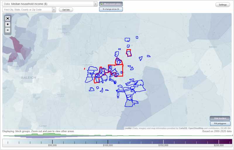
Knightdale, North Carolina Neighborhood Map - Income, House Prices, Occupations, Boundaries
Settings
X

- City boundary
- Neighborhood boundaries
Business Search - 14 Million verified businesses
Neighborhoods:
Amber Acres North, Amber Ridge, Applegate at Planters Walk, Ashebrook at Planters Walk, Ashley Hills, Autumn Ridge, Avila, Barclay Downs, Baywood Forest, Beaver Dam Plantation, Bishop Pointe, Breckenridge, Brookfield Station, Carriage Manor, Carrington Woods, Cedarwood, Charles Barnes, Churchill, Cottonwood, Country Squire Estates, Covington Cross, Edenburghs Keep, El Camino Acres, Ellendale, Emerald Pointe, Estates at Smith Crossing, Faison Estates, Fieldcrest Estates, Fox Point, Green Pines, Hidden Hollow, Horton Mill, Huntsboro, Landings at Planters Walk, Langston Ridge, Lewis Landing, Lynnwood Estates, Magnolia Place, Maplewood, Mathews Glen at Planters Walk, Mingo Creek, Moorefields, Myrick Downs, Oakdale Mobile Estates, Oaks at Planters Walk, Oakwood Acres, Panther Rock, Parkside, Pebblebrook, Pine Country Estates, Pleasant Valley, Princeton Manor, River Estates Townhomes, Robin Hood Forest, Rockbridge, Rutledge Landing, Sandy Trail, Savannah Oaks, Sherron And Frazier, Squire Estates, Stoneridge, The Meadows, Timber Ridge, Trailridge, Whitley Trails, Widewaters, Wil-Ros Meadows, Willow Ridge at Planters Walk, Woodberry at Planters Walk, Woodfield at The MeadowsAmber Acres North neighborhood in Knightdale statistics: (Find on map)
Area: 0.536 square miles
Population: 238
Population density:
Median household income in 2021:
Median rent in in 2021:
Male vs Females
Median age
Housing prices:
Average estimated value of detached houses in 2021 (76.6% of all units):
Average estimated value of mobile home in 2021 (10.6% of all units):
Most popular occupations of males: service occupations (20.5%); sales and office occupations (19.7%); computer and mathematical occupations (15.6%); construction, extraction, and maintenance occupations (13.2%); management occupations (except farmers) (11.0%); material moving occupations (8.1%); transportation occupations (6.8%)
Most popular occupations of females: sales and office occupations (28.9%); business and financial operations occupations (23.2%); healthcare practitioners and technical occupations (13.0%); service occupations (9.0%); production occupations (7.4%); management occupations (except farmers) (5.6%); life, physical, and social science occupations (5.3%)
Roads and streets: Sandy Run; Amber Acres Ln; Bonaire Way; Windward Psge; Bermuda Run; Antigua Run; Meadow Run Rd; Margarita Ln; Jennifer Ct; Spawn Pl; Aruba Ct; Rockport Pl; Meadow Run; Hatch St; Woof Pl; Amberstone Dr.
Amber Acres North neighborhood detailed profile
Area: 0.536 square miles
Population: 238
Population density:
| Amber Acres North: | 444 people per square mile |
| Knightdale: | 6,944 people per square mile |
Median household income in 2021:
| Amber Acres North: | $72,361 |
| Knightdale: | $72,118 |
Median rent in in 2021:
| Amber Acres North: | $1,035 |
| Knightdale: | $1,106 |
Male vs Females
| Males: | 115 |
| Females: | 122 |
Median age
| Males: | 27.0 years |
| Females: | 40.1 years |
Housing prices:
Average estimated value of detached houses in 2021 (76.6% of all units):
| Amber Acres North: | $251,356 |
| North Carolina: | $316,354 |
Average estimated value of mobile home in 2021 (10.6% of all units):
| Amber Acres North: | $120,509 |
| North Carolina: | $90,232 |
Most popular occupations of males: service occupations (20.5%); sales and office occupations (19.7%); computer and mathematical occupations (15.6%); construction, extraction, and maintenance occupations (13.2%); management occupations (except farmers) (11.0%); material moving occupations (8.1%); transportation occupations (6.8%)
Most popular occupations of females: sales and office occupations (28.9%); business and financial operations occupations (23.2%); healthcare practitioners and technical occupations (13.0%); service occupations (9.0%); production occupations (7.4%); management occupations (except farmers) (5.6%); life, physical, and social science occupations (5.3%)
Roads and streets: Sandy Run; Amber Acres Ln; Bonaire Way; Windward Psge; Bermuda Run; Antigua Run; Meadow Run Rd; Margarita Ln; Jennifer Ct; Spawn Pl; Aruba Ct; Rockport Pl; Meadow Run; Hatch St; Woof Pl; Amberstone Dr.
Amber Acres North neighborhood detailed profile
Amber Ridge neighborhood in Knightdale statistics: (Find on map)
Area: 0.281 square miles
Population: 125
Population density:
Median household income in 2021:
Median rent in in 2021:
Male vs Females
Median age
Housing prices:
Average estimated value of detached houses in 2021 (77.6% of all units):
Average estimated value of mobile home in 2021 (8.2% of all units):
Most popular occupations of males: service occupations (20.9%); sales and office occupations (19.2%); computer and mathematical occupations (14.3%); construction, extraction, and maintenance occupations (12.4%); management occupations (except farmers) (11.0%); transportation occupations (6.1%); business and financial operations occupations (5.6%)
Most popular occupations of females: sales and office occupations (29.8%); business and financial operations occupations (22.1%); healthcare practitioners and technical occupations (13.2%); service occupations (8.8%); production occupations (6.8%); management occupations (except farmers) (6.1%); life, physical, and social science occupations (4.9%)
Roads and streets: Ballston Pl; Varcroft Rd; Mailwood Dr; Presentation St; Van Dorn Dr; Seward Dr; Gelfield Rd; Naylor Rd.
Other features: Marks Crk.
Amber Ridge neighborhood detailed profile
Area: 0.281 square miles
Population: 125
Population density:
| Amber Ridge: | 445 people per square mile |
| Knightdale: | 6,944 people per square mile |
Median household income in 2021:
| Amber Ridge: | $103,792 |
| Knightdale: | $72,118 |
Median rent in in 2021:
| Amber Ridge: | $1,252 |
| Knightdale: | $1,106 |
Male vs Females
| Males: | 61 |
| Females: | 64 |
Median age
| Males: | 35.4 years |
| Females: | 45.9 years |
Housing prices:
Average estimated value of detached houses in 2021 (77.6% of all units):
| Amber Ridge: | $251,356 |
| North Carolina: | $316,354 |
Average estimated value of mobile home in 2021 (8.2% of all units):
| Amber Ridge: | $120,509 |
| North Carolina: | $90,232 |
Most popular occupations of males: service occupations (20.9%); sales and office occupations (19.2%); computer and mathematical occupations (14.3%); construction, extraction, and maintenance occupations (12.4%); management occupations (except farmers) (11.0%); transportation occupations (6.1%); business and financial operations occupations (5.6%)
Most popular occupations of females: sales and office occupations (29.8%); business and financial operations occupations (22.1%); healthcare practitioners and technical occupations (13.2%); service occupations (8.8%); production occupations (6.8%); management occupations (except farmers) (6.1%); life, physical, and social science occupations (4.9%)
Roads and streets: Ballston Pl; Varcroft Rd; Mailwood Dr; Presentation St; Van Dorn Dr; Seward Dr; Gelfield Rd; Naylor Rd.
Other features: Marks Crk.
Amber Ridge neighborhood detailed profile
Applegate at Planters Walk neighborhood in Knightdale statistics: (Find on map)
Area: 0.072 square miles
Roads and streets: Beddingfield Dr; Silvershire Way; Tilia Ct; Tashall Ct; Japonica Ct; Harmens Creek Ct; Pagoda Pl.
Applegate at Planters Walk neighborhood detailed profile
Area: 0.072 square miles
Roads and streets: Beddingfield Dr; Silvershire Way; Tilia Ct; Tashall Ct; Japonica Ct; Harmens Creek Ct; Pagoda Pl.
Applegate at Planters Walk neighborhood detailed profile
Ashebrook at Planters Walk neighborhood in Knightdale statistics: (Find on map)
Area: 0.032 square miles
Roads and streets: Trail Stream Way; Planters Trail Ct.
Ashebrook at Planters Walk neighborhood detailed profile
Area: 0.032 square miles
Roads and streets: Trail Stream Way; Planters Trail Ct.
Ashebrook at Planters Walk neighborhood detailed profile
Ashley Hills neighborhood in Knightdale statistics: (Find on map)
Area: 0.383 square miles
Population: 170
Population density:
Median household income in 2021:
Median rent in in 2021:
Male vs Females
Median age
Housing prices:
Average estimated value of detached houses in 2021 (77.6% of all units):
Average estimated value of mobile home in 2021 (10.4% of all units):
Most popular occupations of males: service occupations (20.5%); sales and office occupations (19.7%); computer and mathematical occupations (15.6%); construction, extraction, and maintenance occupations (13.2%); management occupations (except farmers) (11.0%); material moving occupations (8.1%); transportation occupations (6.8%)
Most popular occupations of females: sales and office occupations (28.9%); business and financial operations occupations (23.2%); healthcare practitioners and technical occupations (13.0%); service occupations (9.0%); production occupations (7.4%); management occupations (except farmers) (5.6%); life, physical, and social science occupations (5.3%)
Roads and streets: Sandy Run; Pine Run; Walton Hill Rd; Woods Run; Meadow Run; N Bend; S Bend Dr; Dwelling Pl; Link Rd; Renee Ct; Fairbluff Ln; Coy Pl; Lantis Ln; Woodfin Run; Ranco Run.
Ashley Hills neighborhood detailed profile
Area: 0.383 square miles
Population: 170
Population density:
| Ashley Hills: | 443 people per square mile |
| Knightdale: | 6,944 people per square mile |
Median household income in 2021:
| Ashley Hills: | $72,361 |
| Knightdale: | $72,118 |
Median rent in in 2021:
| Ashley Hills: | $1,035 |
| Knightdale: | $1,106 |
Male vs Females
| Males: | 82 |
| Females: | 87 |
Median age
| Males: | 27.0 years |
| Females: | 40.1 years |
Housing prices:
Average estimated value of detached houses in 2021 (77.6% of all units):
| Ashley Hills: | $251,356 |
| North Carolina: | $316,354 |
Average estimated value of mobile home in 2021 (10.4% of all units):
| Ashley Hills: | $120,509 |
| North Carolina: | $90,232 |
Most popular occupations of males: service occupations (20.5%); sales and office occupations (19.7%); computer and mathematical occupations (15.6%); construction, extraction, and maintenance occupations (13.2%); management occupations (except farmers) (11.0%); material moving occupations (8.1%); transportation occupations (6.8%)
Most popular occupations of females: sales and office occupations (28.9%); business and financial operations occupations (23.2%); healthcare practitioners and technical occupations (13.0%); service occupations (9.0%); production occupations (7.4%); management occupations (except farmers) (5.6%); life, physical, and social science occupations (5.3%)
Roads and streets: Sandy Run; Pine Run; Walton Hill Rd; Woods Run; Meadow Run; N Bend; S Bend Dr; Dwelling Pl; Link Rd; Renee Ct; Fairbluff Ln; Coy Pl; Lantis Ln; Woodfin Run; Ranco Run.
Ashley Hills neighborhood detailed profile
Autumn Ridge neighborhood in Knightdale statistics: (Find on map)
Area: 0.015 square miles
Roads and streets: Autumn Ridge Dr.
Autumn Ridge neighborhood detailed profile
Area: 0.015 square miles
Roads and streets: Autumn Ridge Dr.
Autumn Ridge neighborhood detailed profile
Avila neighborhood in Knightdale statistics: (Find on map)
Area: 0.017 square miles
Avila neighborhood detailed profile
Area: 0.017 square miles
Avila neighborhood detailed profile
Barclay Downs neighborhood in Knightdale statistics: (Find on map)
Area: 0.116 square miles
Roads and streets: Colchester Dr; Kingston Rd; Barwick Way; Wellington Dr; Manor Pl.
Barclay Downs neighborhood detailed profile
Area: 0.116 square miles
Roads and streets: Colchester Dr; Kingston Rd; Barwick Way; Wellington Dr; Manor Pl.
Barclay Downs neighborhood detailed profile
Baywood Forest neighborhood in Knightdale statistics: (Find on map)
Area: 0.116 square miles
Population: 51
Population density:
Median household income in 2021:
Median rent in in 2021:
Male vs Females
Median age
Housing prices:
Average estimated value of detached houses in 2021 (75.0% of all units):
Average estimated value of mobile home in 2021 (10.0% of all units):
Most popular occupations of males: service occupations (20.5%); sales and office occupations (19.7%); computer and mathematical occupations (15.6%); construction, extraction, and maintenance occupations (13.2%); management occupations (except farmers) (11.0%); material moving occupations (8.1%); transportation occupations (6.8%)
Most popular occupations of females: sales and office occupations (28.9%); business and financial operations occupations (23.2%); healthcare practitioners and technical occupations (13.0%); service occupations (9.0%); production occupations (7.4%); management occupations (except farmers) (5.6%); life, physical, and social science occupations (5.3%)
Roads and streets: Cottage Bluff Ln; Baywood Forest Dr; Somersworth Dr; Dantonville Ct; Highsmith Ct; Kankakee Ct; Trenburg Ct; Baffin Ct; Boniface Ct; Hammerfest Rd.
Baywood Forest neighborhood detailed profile
Area: 0.116 square miles
Population: 51
Population density:
| Baywood Forest: | 439 people per square mile |
| Knightdale: | 6,944 people per square mile |
Median household income in 2021:
| Baywood Forest: | $72,361 |
| Knightdale: | $72,118 |
Median rent in in 2021:
| Baywood Forest: | $1,035 |
| Knightdale: | $1,106 |
Male vs Females
| Males: | 25 |
| Females: | 26 |
Median age
| Males: | 27.0 years |
| Females: | 40.1 years |
Housing prices:
Average estimated value of detached houses in 2021 (75.0% of all units):
| Baywood Forest: | $251,356 |
| North Carolina: | $316,354 |
Average estimated value of mobile home in 2021 (10.0% of all units):
| Baywood Forest: | $120,509 |
| North Carolina: | $90,232 |
Most popular occupations of males: service occupations (20.5%); sales and office occupations (19.7%); computer and mathematical occupations (15.6%); construction, extraction, and maintenance occupations (13.2%); management occupations (except farmers) (11.0%); material moving occupations (8.1%); transportation occupations (6.8%)
Most popular occupations of females: sales and office occupations (28.9%); business and financial operations occupations (23.2%); healthcare practitioners and technical occupations (13.0%); service occupations (9.0%); production occupations (7.4%); management occupations (except farmers) (5.6%); life, physical, and social science occupations (5.3%)
Roads and streets: Cottage Bluff Ln; Baywood Forest Dr; Somersworth Dr; Dantonville Ct; Highsmith Ct; Kankakee Ct; Trenburg Ct; Baffin Ct; Boniface Ct; Hammerfest Rd.
Baywood Forest neighborhood detailed profile
Beaver Dam Plantation neighborhood in Knightdale statistics: (Find on map)
Area: 0.136 square miles
Roads and streets: Knollcrest Ln; Allendown Ln.
Beaver Dam Plantation neighborhood detailed profile
Area: 0.136 square miles
Roads and streets: Knollcrest Ln; Allendown Ln.
Beaver Dam Plantation neighborhood detailed profile
Bishop Pointe neighborhood in Knightdale statistics: (Find on map)
Area: 0.065 square miles
Population: 28
Population density:
Median household income in 2021:
Median rent in in 2021:
Male vs Females
Median age
Housing prices:
Average estimated value of detached houses in 2021 (72.7% of all units):
Average estimated value of mobile home in 2021 (9.1% of all units):
Most popular occupations of males: service occupations (20.5%); sales and office occupations (19.7%); computer and mathematical occupations (15.6%); construction, extraction, and maintenance occupations (13.2%); management occupations (except farmers) (11.0%); material moving occupations (8.1%); transportation occupations (6.8%)
Most popular occupations of females: sales and office occupations (28.9%); business and financial operations occupations (23.2%); healthcare practitioners and technical occupations (13.0%); service occupations (9.0%); production occupations (7.4%); management occupations (except farmers) (5.6%); life, physical, and social science occupations (5.3%)
Roads and streets: Nobleman Trl (5230); Troubadour Ln; Friarwood Way; Mylady Ct; 5229 (Scabbard Ct); 5228 (Jouster Pl).
Bishop Pointe neighborhood detailed profile
Area: 0.065 square miles
Population: 28
Population density:
| Bishop Pointe: | 430 people per square mile |
| Knightdale: | 6,944 people per square mile |
Median household income in 2021:
| Bishop Pointe: | $72,361 |
| Knightdale: | $72,118 |
Median rent in in 2021:
| Bishop Pointe: | $1,035 |
| Knightdale: | $1,106 |
Male vs Females
| Males: | 14 |
| Females: | 14 |
Median age
| Males: | 27.0 years |
| Females: | 40.1 years |
Housing prices:
Average estimated value of detached houses in 2021 (72.7% of all units):
| Bishop Pointe: | $251,356 |
| North Carolina: | $316,354 |
Average estimated value of mobile home in 2021 (9.1% of all units):
| Bishop Pointe: | $120,509 |
| North Carolina: | $90,232 |
Most popular occupations of males: service occupations (20.5%); sales and office occupations (19.7%); computer and mathematical occupations (15.6%); construction, extraction, and maintenance occupations (13.2%); management occupations (except farmers) (11.0%); material moving occupations (8.1%); transportation occupations (6.8%)
Most popular occupations of females: sales and office occupations (28.9%); business and financial operations occupations (23.2%); healthcare practitioners and technical occupations (13.0%); service occupations (9.0%); production occupations (7.4%); management occupations (except farmers) (5.6%); life, physical, and social science occupations (5.3%)
Roads and streets: Nobleman Trl (5230); Troubadour Ln; Friarwood Way; Mylady Ct; 5229 (Scabbard Ct); 5228 (Jouster Pl).
Bishop Pointe neighborhood detailed profile
Breckenridge neighborhood in Knightdale statistics: (Find on map)
Area: 0.070 square miles
Roads and streets: Tranquility Ln.
Breckenridge neighborhood detailed profile
Area: 0.070 square miles
Roads and streets: Tranquility Ln.
Breckenridge neighborhood detailed profile
Brookfield Station neighborhood in Knightdale statistics: (Find on map)
Area: 0.060 square miles
Roads and streets: (Crosstie St); Switchback St.
Brookfield Station neighborhood detailed profile
Area: 0.060 square miles
Roads and streets: (Crosstie St); Switchback St.
Brookfield Station neighborhood detailed profile
Carriage Manor neighborhood in Knightdale statistics: (Find on map)
Area: 0.186 square miles
Population: 82
Population density:
Median household income in 2021:
Median rent in in 2021:
Male vs Females
Median age
Housing prices:
Average estimated value of detached houses in 2021 (78.1% of all units):
Average estimated value of mobile home in 2021 (9.4% of all units):
Most popular occupations of males: service occupations (20.5%); sales and office occupations (19.7%); computer and mathematical occupations (15.6%); construction, extraction, and maintenance occupations (13.2%); management occupations (except farmers) (11.0%); material moving occupations (8.1%); transportation occupations (6.8%)
Most popular occupations of females: sales and office occupations (28.9%); business and financial operations occupations (23.2%); healthcare practitioners and technical occupations (13.0%); service occupations (9.0%); production occupations (7.4%); management occupations (except farmers) (5.6%); life, physical, and social science occupations (5.3%)
Roads and streets: Trackway Dr; Dipper Dr; Rider Dr; Tuffer Pl.
Carriage Manor neighborhood detailed profile
Area: 0.186 square miles
Population: 82
Population density:
| Carriage Manor: | 441 people per square mile |
| Knightdale: | 6,944 people per square mile |
Median household income in 2021:
| Carriage Manor: | $72,361 |
| Knightdale: | $72,118 |
Median rent in in 2021:
| Carriage Manor: | $1,035 |
| Knightdale: | $1,106 |
Male vs Females
| Males: | 40 |
| Females: | 42 |
Median age
| Males: | 27.0 years |
| Females: | 40.1 years |
Housing prices:
Average estimated value of detached houses in 2021 (78.1% of all units):
| Carriage Manor: | $251,356 |
| North Carolina: | $316,354 |
Average estimated value of mobile home in 2021 (9.4% of all units):
| Carriage Manor: | $120,509 |
| North Carolina: | $90,232 |
Most popular occupations of males: service occupations (20.5%); sales and office occupations (19.7%); computer and mathematical occupations (15.6%); construction, extraction, and maintenance occupations (13.2%); management occupations (except farmers) (11.0%); material moving occupations (8.1%); transportation occupations (6.8%)
Most popular occupations of females: sales and office occupations (28.9%); business and financial operations occupations (23.2%); healthcare practitioners and technical occupations (13.0%); service occupations (9.0%); production occupations (7.4%); management occupations (except farmers) (5.6%); life, physical, and social science occupations (5.3%)
Roads and streets: Trackway Dr; Dipper Dr; Rider Dr; Tuffer Pl.
Carriage Manor neighborhood detailed profile
Carrington Woods neighborhood in Knightdale statistics: (Find on map)
Area: 0.123 square miles
Roads and streets: Southampton Dr; Walbury Dr; Brookfield Dr; Plowlan Ct; Carrington Dr; Leighton Pl; Driffield Ct; Stirling Dr; Oxford Cir; Earlston Ct; Newbury Ct; Ashkirk Cir.
Carrington Woods neighborhood detailed profile
Area: 0.123 square miles
Roads and streets: Southampton Dr; Walbury Dr; Brookfield Dr; Plowlan Ct; Carrington Dr; Leighton Pl; Driffield Ct; Stirling Dr; Oxford Cir; Earlston Ct; Newbury Ct; Ashkirk Cir.
Carrington Woods neighborhood detailed profile
Cedarwood neighborhood in Knightdale statistics: (Find on map)
Area: 0.036 square miles
Roads and streets: Cedarwood Dr; Walletta; New Holly Ct.
Cedarwood neighborhood detailed profile
Area: 0.036 square miles
Roads and streets: Cedarwood Dr; Walletta; New Holly Ct.
Cedarwood neighborhood detailed profile
Charles Barnes neighborhood in Knightdale statistics: (Find on map)
Area: 0.005 square miles
Population: 2
Population density:
Median household income in 2021:
Median rent in in 2021:
Male vs Females
Median age
Most popular occupations of males: service occupations (20.5%); sales and office occupations (19.7%); computer and mathematical occupations (15.6%); construction, extraction, and maintenance occupations (13.2%); management occupations (except farmers) (11.0%); material moving occupations (8.7%); transportation occupations (6.8%)
Most popular occupations of females: sales and office occupations (28.9%); business and financial operations occupations (23.2%); healthcare practitioners and technical occupations (13.0%); service occupations (9.0%); production occupations (7.4%); management occupations (except farmers) (5.6%); life, physical, and social science occupations (5.3%)
Charles Barnes neighborhood detailed profile
Area: 0.005 square miles
Population: 2
Population density:
| Charles Barnes: | 370 people per square mile |
| Knightdale: | 6,944 people per square mile |
Median household income in 2021:
| Charles Barnes: | $72,361 |
| Knightdale: | $72,118 |
Median rent in in 2021:
| Charles Barnes: | $1,035 |
| Knightdale: | $1,106 |
Male vs Females
| Males: | 1 |
| Females: | 1 |
Median age
| Males: | 27.0 years |
| Females: | 40.1 years |
Most popular occupations of males: service occupations (20.5%); sales and office occupations (19.7%); computer and mathematical occupations (15.6%); construction, extraction, and maintenance occupations (13.2%); management occupations (except farmers) (11.0%); material moving occupations (8.7%); transportation occupations (6.8%)
Most popular occupations of females: sales and office occupations (28.9%); business and financial operations occupations (23.2%); healthcare practitioners and technical occupations (13.0%); service occupations (9.0%); production occupations (7.4%); management occupations (except farmers) (5.6%); life, physical, and social science occupations (5.3%)
Charles Barnes neighborhood detailed profile
Churchill neighborhood in Knightdale statistics: (Find on map)
Area: 0.257 square miles
Roads and streets: Twin Spires Dr; Ferdinand Dr; Churchill Glen Blvd; Kingman Dr; Pleasant Colony Dr; Sunday Silence Dr; Monarchos Dr; Charismatic Dr; Alysheba Dr; Arcaro Dr; Chant Dr.
Churchill neighborhood detailed profile
Area: 0.257 square miles
Roads and streets: Twin Spires Dr; Ferdinand Dr; Churchill Glen Blvd; Kingman Dr; Pleasant Colony Dr; Sunday Silence Dr; Monarchos Dr; Charismatic Dr; Alysheba Dr; Arcaro Dr; Chant Dr.
Churchill neighborhood detailed profile
Cottonwood neighborhood in Knightdale statistics: (Find on map)
Area: 0.087 square miles
Population: 38
Population density:
Median household income in 2021:
Median rent in in 2021:
Male vs Females
Median age
Housing prices:
Average estimated value of detached houses in 2021 (73.3% of all units):
Average estimated value of mobile home in 2021 (6.7% of all units):
Most popular occupations of males: service occupations (20.5%); sales and office occupations (19.7%); computer and mathematical occupations (15.6%); construction, extraction, and maintenance occupations (13.2%); material moving occupations (11.4%); management occupations (except farmers) (11.0%); transportation occupations (6.8%)
Most popular occupations of females: sales and office occupations (28.9%); business and financial operations occupations (23.2%); healthcare practitioners and technical occupations (13.0%); service occupations (9.0%); production occupations (7.4%); management occupations (except farmers) (5.6%); life, physical, and social science occupations (5.3%)
Roads and streets: Plum Blossum Dr; Shakentown St; Sweet Charm Ln; Sweet Melody Ln; Spring Song Ln.
Cottonwood neighborhood detailed profile
Area: 0.087 square miles
Population: 38
Population density:
| Cottonwood: | 434 people per square mile |
| Knightdale: | 6,944 people per square mile |
Median household income in 2021:
| Cottonwood: | $86,365 |
| Knightdale: | $72,118 |
Median rent in in 2021:
| Cottonwood: | $1,235 |
| Knightdale: | $1,106 |
Male vs Females
| Males: | 18 |
| Females: | 19 |
Median age
| Males: | 32.2 years |
| Females: | 47.9 years |
Housing prices:
Average estimated value of detached houses in 2021 (73.3% of all units):
| Cottonwood: | $251,356 |
| North Carolina: | $316,354 |
Average estimated value of mobile home in 2021 (6.7% of all units):
| Cottonwood: | $120,509 |
| North Carolina: | $90,232 |
Most popular occupations of males: service occupations (20.5%); sales and office occupations (19.7%); computer and mathematical occupations (15.6%); construction, extraction, and maintenance occupations (13.2%); material moving occupations (11.4%); management occupations (except farmers) (11.0%); transportation occupations (6.8%)
Most popular occupations of females: sales and office occupations (28.9%); business and financial operations occupations (23.2%); healthcare practitioners and technical occupations (13.0%); service occupations (9.0%); production occupations (7.4%); management occupations (except farmers) (5.6%); life, physical, and social science occupations (5.3%)
Roads and streets: Plum Blossum Dr; Shakentown St; Sweet Charm Ln; Sweet Melody Ln; Spring Song Ln.
Cottonwood neighborhood detailed profile
Country Squire Estates neighborhood in Knightdale statistics: (Find on map)
Area: 0.035 square miles
Country Squire Estates neighborhood detailed profile
Area: 0.035 square miles
Country Squire Estates neighborhood detailed profile
Covington Cross neighborhood in Knightdale statistics: (Find on map)
Area: 0.087 square miles
Population: 38
Population density:
Median household income in 2021:
Median rent in in 2021:
Male vs Females
Median age
Housing prices:
Average estimated value of detached houses in 2021 (73.3% of all units):
Average estimated value of mobile home in 2021 (6.7% of all units):
Most popular occupations of males: service occupations (20.5%); sales and office occupations (19.7%); computer and mathematical occupations (15.6%); construction, extraction, and maintenance occupations (13.2%); management occupations (except farmers) (11.0%); material moving occupations (8.1%); transportation occupations (6.8%)
Most popular occupations of females: sales and office occupations (28.9%); business and financial operations occupations (23.2%); healthcare practitioners and technical occupations (13.0%); service occupations (9.0%); production occupations (7.4%); management occupations (except farmers) (5.6%); life, physical, and social science occupations (5.3%)
Roads and streets: Covington Cross Dr; Troubadour Ln; Roundtable Ct; Henchman Ct; Medieval Ct; Swordsman Ct; Sorcerer Ct; Moat Ct; Dames Ct; Chilvary Ct; Heraldy Ct; Kilt Ct.
Covington Cross neighborhood detailed profile
Area: 0.087 square miles
Population: 38
Population density:
| Covington Cross: | 436 people per square mile |
| Knightdale: | 6,944 people per square mile |
Median household income in 2021:
| Covington Cross: | $72,361 |
| Knightdale: | $72,118 |
Median rent in in 2021:
| Covington Cross: | $1,035 |
| Knightdale: | $1,106 |
Male vs Females
| Males: | 18 |
| Females: | 19 |
Median age
| Males: | 27.0 years |
| Females: | 40.1 years |
Housing prices:
Average estimated value of detached houses in 2021 (73.3% of all units):
| Covington Cross: | $251,356 |
| North Carolina: | $316,354 |
Average estimated value of mobile home in 2021 (6.7% of all units):
| Covington Cross: | $120,509 |
| North Carolina: | $90,232 |
Most popular occupations of males: service occupations (20.5%); sales and office occupations (19.7%); computer and mathematical occupations (15.6%); construction, extraction, and maintenance occupations (13.2%); management occupations (except farmers) (11.0%); material moving occupations (8.1%); transportation occupations (6.8%)
Most popular occupations of females: sales and office occupations (28.9%); business and financial operations occupations (23.2%); healthcare practitioners and technical occupations (13.0%); service occupations (9.0%); production occupations (7.4%); management occupations (except farmers) (5.6%); life, physical, and social science occupations (5.3%)
Roads and streets: Covington Cross Dr; Troubadour Ln; Roundtable Ct; Henchman Ct; Medieval Ct; Swordsman Ct; Sorcerer Ct; Moat Ct; Dames Ct; Chilvary Ct; Heraldy Ct; Kilt Ct.
Covington Cross neighborhood detailed profile
Edenburghs Keep neighborhood in Knightdale statistics: (Find on map)
Area: 0.035 square miles
Roads and streets: Edenburghs Keep Dr; Belfry Dr; Battlement Way; Gauntlet Way; Barmkin Pl; Crossbow Ct.
Edenburghs Keep neighborhood detailed profile
Area: 0.035 square miles
Roads and streets: Edenburghs Keep Dr; Belfry Dr; Battlement Way; Gauntlet Way; Barmkin Pl; Crossbow Ct.
Edenburghs Keep neighborhood detailed profile
El Camino Acres neighborhood in Knightdale statistics: (Find on map)
Area: 0.020 square miles
Roads and streets: Gower Cir.
El Camino Acres neighborhood detailed profile
Area: 0.020 square miles
Roads and streets: Gower Cir.
El Camino Acres neighborhood detailed profile
Ellendale neighborhood in Knightdale statistics: (Find on map)
Area: 0.034 square miles
Roads and streets: Ellen Dr (State Rd 2577).
Ellendale neighborhood detailed profile
Area: 0.034 square miles
Roads and streets: Ellen Dr (State Rd 2577).
Ellendale neighborhood detailed profile
Emerald Pointe neighborhood in Knightdale statistics: (Find on map)
Area: 0.178 square miles
Roads and streets: Aqua Marine Ln; Spinel Ln; Gem Dr; Zircon Ln; Rock Hound Rd; Jewel Haven Way; Onyx Ln; Citrine Ct; Morganite Ct; Sapphire Ct; Jade Cir; Karat Ct; Agate Ct.
Emerald Pointe neighborhood detailed profile
Area: 0.178 square miles
Roads and streets: Aqua Marine Ln; Spinel Ln; Gem Dr; Zircon Ln; Rock Hound Rd; Jewel Haven Way; Onyx Ln; Citrine Ct; Morganite Ct; Sapphire Ct; Jade Cir; Karat Ct; Agate Ct.
Emerald Pointe neighborhood detailed profile
Estates at Smith Crossing neighborhood in Knightdale statistics: (Find on map)
Area: 0.077 square miles
Roads and streets: Font Hills Ln; Tadmore Ct; Battle Abby Ct.
Estates at Smith Crossing neighborhood detailed profile
Area: 0.077 square miles
Roads and streets: Font Hills Ln; Tadmore Ct; Battle Abby Ct.
Estates at Smith Crossing neighborhood detailed profile
Faison Estates neighborhood in Knightdale statistics: (Find on map)
Area: 0.013 square miles
Faison Estates neighborhood detailed profile
Area: 0.013 square miles
Faison Estates neighborhood detailed profile
Fieldcrest Estates neighborhood in Knightdale statistics: (Find on map)
Area: 0.048 square miles
Population: 43
Population density:
Median household income in 2021:
Median rent in in 2021:
Male vs Females
Median age
Housing prices:
Average estimated value of detached houses in 2021 (100.0% of all units):
Average estimated value of mobile home in 2021 (6.3% of all units):
Most popular occupations of males: management occupations (except farmers) (27.7%); transportation occupations (21.2%); material moving occupations (20.0%); computer and mathematical occupations (16.5%); construction, extraction, and maintenance occupations (14.5%); sales and office occupations (11.5%); business and financial operations occupations (10.9%)
Most popular occupations of females: service occupations (40.3%); sales and office occupations (33.3%); healthcare practitioners and technical occupations (7.7%); architecture and engineering occupations (6.9%); business and financial operations occupations (5.3%); production occupations (3.4%); life, physical, and social science occupations (2.2%)
Roads and streets: Marshall Dr; Yates Cir; Raines Ave; la Belle Ln.
Fieldcrest Estates neighborhood detailed profile
Area: 0.048 square miles
Population: 43
Population density:
| Fieldcrest Estates: | 888 people per square mile |
| Knightdale: | 6,944 people per square mile |
Median household income in 2021:
| Fieldcrest Estates: | $68,289 |
| Knightdale: | $72,118 |
Median rent in in 2021:
| Fieldcrest Estates: | $1,110 |
| Knightdale: | $1,106 |
Male vs Females
| Males: | 16 |
| Females: | 26 |
Median age
| Males: | 38.0 years |
| Females: | 35.0 years |
Housing prices:
Average estimated value of detached houses in 2021 (100.0% of all units):
| Fieldcrest Estates: | $153,407 |
| North Carolina: | $316,354 |
Average estimated value of mobile home in 2021 (6.3% of all units):
| Fieldcrest Estates: | $120,509 |
| North Carolina: | $90,232 |
Most popular occupations of males: management occupations (except farmers) (27.7%); transportation occupations (21.2%); material moving occupations (20.0%); computer and mathematical occupations (16.5%); construction, extraction, and maintenance occupations (14.5%); sales and office occupations (11.5%); business and financial operations occupations (10.9%)
Most popular occupations of females: service occupations (40.3%); sales and office occupations (33.3%); healthcare practitioners and technical occupations (7.7%); architecture and engineering occupations (6.9%); business and financial operations occupations (5.3%); production occupations (3.4%); life, physical, and social science occupations (2.2%)
Roads and streets: Marshall Dr; Yates Cir; Raines Ave; la Belle Ln.
Fieldcrest Estates neighborhood detailed profile
Fox Point neighborhood in Knightdale statistics: (Find on map)
Area: 0.034 square miles
Roads and streets: Ramsey Creek Dr; Fox Paint Dr.
Fox Point neighborhood detailed profile
Area: 0.034 square miles
Roads and streets: Ramsey Creek Dr; Fox Paint Dr.
Fox Point neighborhood detailed profile
Green Pines neighborhood in Knightdale statistics: (Find on map)
Area: 0.256 square miles
Roads and streets: Satterwhite Dr; Whitfield St; Daniel Cir (State Rd 2576); Allison Dr; State Rd 2589 (Westover Dr); Cliffview Dr; Milburnie Rd; State Rd 2516 (Hodge Rd); Hinton St; Dean Pl; Green St; Poole Ct; Grayson Ct; Kirvin Ct; Allen Ct; Thomas Pl; Scott Ct; Blalock Ct; Lee Ct.
Green Pines neighborhood detailed profile
Hidden Hollow neighborhood in Knightdale statistics: (Find on map)
Area: 0.059 square miles
Roads and streets: Hidden Hollow Ln; Codi Ln.
Hidden Hollow neighborhood detailed profile
Area: 0.059 square miles
Roads and streets: Hidden Hollow Ln; Codi Ln.
Hidden Hollow neighborhood detailed profile
Horton Mill neighborhood in Knightdale statistics: (Find on map)
Area: 0.048 square miles
Roads and streets: Proc Ridge Ln; Conway Ridge Xing; Haswell Way; Horton Mill Dr.
Horton Mill neighborhood detailed profile
Area: 0.048 square miles
Roads and streets: Proc Ridge Ln; Conway Ridge Xing; Haswell Way; Horton Mill Dr.
Horton Mill neighborhood detailed profile
Huntsboro neighborhood in Knightdale statistics: (Find on map)
Area: 0.057 square miles
Population: 25
Population density:
Median household income in 2021:
Median rent in in 2021:
Male vs Females
Median age
Housing prices:
Average estimated value of detached houses in 2021 (77.8% of all units):
Average estimated value of mobile home in 2021 (11.1% of all units):
Most popular occupations of males: service occupations (20.5%); sales and office occupations (19.7%); computer and mathematical occupations (15.6%); construction, extraction, and maintenance occupations (13.2%); management occupations (except farmers) (11.0%); material moving occupations (8.1%); transportation occupations (6.8%)
Most popular occupations of females: sales and office occupations (28.9%); business and financial operations occupations (23.2%); healthcare practitioners and technical occupations (13.0%); service occupations (9.0%); production occupations (7.4%); management occupations (except farmers) (5.6%); life, physical, and social science occupations (5.3%)
Roads and streets: Knotts Hill Pl.
Huntsboro neighborhood detailed profile
Area: 0.057 square miles
Population: 25
Population density:
| Huntsboro: | 442 people per square mile |
| Knightdale: | 6,944 people per square mile |
Median household income in 2021:
| Huntsboro: | $72,361 |
| Knightdale: | $72,118 |
Median rent in in 2021:
| Huntsboro: | $1,035 |
| Knightdale: | $1,106 |
Male vs Females
| Males: | 12 |
| Females: | 12 |
Median age
| Males: | 27.0 years |
| Females: | 40.1 years |
Housing prices:
Average estimated value of detached houses in 2021 (77.8% of all units):
| Huntsboro: | $251,356 |
| North Carolina: | $316,354 |
Average estimated value of mobile home in 2021 (11.1% of all units):
| Huntsboro: | $120,509 |
| North Carolina: | $90,232 |
Most popular occupations of males: service occupations (20.5%); sales and office occupations (19.7%); computer and mathematical occupations (15.6%); construction, extraction, and maintenance occupations (13.2%); management occupations (except farmers) (11.0%); material moving occupations (8.1%); transportation occupations (6.8%)
Most popular occupations of females: sales and office occupations (28.9%); business and financial operations occupations (23.2%); healthcare practitioners and technical occupations (13.0%); service occupations (9.0%); production occupations (7.4%); management occupations (except farmers) (5.6%); life, physical, and social science occupations (5.3%)
Roads and streets: Knotts Hill Pl.
Huntsboro neighborhood detailed profile
Landings at Planters Walk neighborhood in Knightdale statistics: (Find on map)
Area: 0.065 square miles
Roads and streets: Clay Hill Dr; Blackpine Ct; Laurens Way; Silverbell Ln; Stones Lndg; Serviceberry Ct.
Landings at Planters Walk neighborhood detailed profile
Area: 0.065 square miles
Roads and streets: Clay Hill Dr; Blackpine Ct; Laurens Way; Silverbell Ln; Stones Lndg; Serviceberry Ct.
Landings at Planters Walk neighborhood detailed profile
Langston Ridge neighborhood in Knightdale statistics: (Find on map)
Area: 0.154 square miles
Langston Ridge neighborhood detailed profile
Area: 0.154 square miles
Langston Ridge neighborhood detailed profile
Lewis Landing neighborhood in Knightdale statistics: (Find on map)
Area: 0.047 square miles
Roads and streets: Gallows Way.
Lewis Landing neighborhood detailed profile
Area: 0.047 square miles
Roads and streets: Gallows Way.
Lewis Landing neighborhood detailed profile
Lynnwood Estates neighborhood in Knightdale statistics: (Find on map)
Area: 0.133 square miles
Roads and streets: Lynnwood Dr; Dearing Dr; Dianne St; Hodge Rd (State Rd 2516); Temple Dr.
Lynnwood Estates neighborhood detailed profile
Area: 0.133 square miles
Roads and streets: Lynnwood Dr; Dearing Dr; Dianne St; Hodge Rd (State Rd 2516); Temple Dr.
Lynnwood Estates neighborhood detailed profile
Magnolia Place neighborhood in Knightdale statistics: (Find on map)
Area: 0.035 square miles
Roads and streets: Clematis St; Cassia Ln; Belfry Dr; Peony Ct.
Magnolia Place neighborhood detailed profile
Area: 0.035 square miles
Roads and streets: Clematis St; Cassia Ln; Belfry Dr; Peony Ct.
Magnolia Place neighborhood detailed profile
Maplewood neighborhood in Knightdale statistics: (Find on map)
Area: 0.081 square miles
Roads and streets: Maplewood Dr; Sugar Ln; Village Dr.
Maplewood neighborhood detailed profile
Area: 0.081 square miles
Roads and streets: Maplewood Dr; Sugar Ln; Village Dr.
Maplewood neighborhood detailed profile
Mathews Glen at Planters Walk neighborhood in Knightdale statistics: (Find on map)
Area: 0.029 square miles
Roads and streets: Bishopton Way; Matthews Glen Dr; Scalloway Ct; Springholm Ct.
Mathews Glen at Planters Walk neighborhood detailed profile
Area: 0.029 square miles
Roads and streets: Bishopton Way; Matthews Glen Dr; Scalloway Ct; Springholm Ct.
Mathews Glen at Planters Walk neighborhood detailed profile
Mingo Creek neighborhood in Knightdale statistics: (Find on map)
Area: 0.240 square miles
Roads and streets: Delham Rd; Savin Lndg; Mingo Bluff Blvd; Skidwith Ct; Bellefont Ct; Delray Ln; Plexor Ln; Craftway Ct; Chalkley Ct; Hadel Pl; Spinster Ln; Danley Ln; Hollins Ct; Tawana Ct; Pochard Pl.
Mingo Creek neighborhood detailed profile
Area: 0.240 square miles
Roads and streets: Delham Rd; Savin Lndg; Mingo Bluff Blvd; Skidwith Ct; Bellefont Ct; Delray Ln; Plexor Ln; Craftway Ct; Chalkley Ct; Hadel Pl; Spinster Ln; Danley Ln; Hollins Ct; Tawana Ct; Pochard Pl.
Mingo Creek neighborhood detailed profile
Moorefields neighborhood in Knightdale statistics: (Find on map)
Area: 0.124 square miles
Population: 38
Population density:
Median household income in 2021:
Median rent in in 2021:
Male vs Females
Median age
Housing prices:
Average estimated value of detached houses in 2021 (100.0% of all units):
Most popular occupations of males: business and financial operations occupations (15.5%); management occupations (except farmers) (13.7%); service occupations (12.5%); sales and office occupations (11.1%); production occupations (10.5%); community and social services occupations (8.1%); computer and mathematical occupations (7.8%)
Most popular occupations of females: sales and office occupations (24.3%); healthcare practitioners and technical occupations (20.7%); service occupations (13.9%); management occupations (except farmers) (12.8%); legal occupations (10.9%); education, training, and library occupations (6.8%); material moving occupations (3.4%)
Roads and streets: Maple View Dr; Old Forest Cir; Windy Field Cir; Golden Field Dr.
Moorefields neighborhood detailed profile
Area: 0.124 square miles
Population: 38
Population density:
| Moorefields: | 307 people per square mile |
| Knightdale: | 6,944 people per square mile |
Median household income in 2021:
| Moorefields: | $128,438 |
| Knightdale: | $72,118 |
Median rent in in 2021:
| Moorefields: | $428 |
| Knightdale: | $1,106 |
Male vs Females
| Males: | 20 |
| Females: | 18 |
Median age
| Males: | 43.0 years |
| Females: | 44.0 years |
Housing prices:
Average estimated value of detached houses in 2021 (100.0% of all units):
| Moorefields: | $283,606 |
| North Carolina: | $316,354 |
Most popular occupations of males: business and financial operations occupations (15.5%); management occupations (except farmers) (13.7%); service occupations (12.5%); sales and office occupations (11.1%); production occupations (10.5%); community and social services occupations (8.1%); computer and mathematical occupations (7.8%)
Most popular occupations of females: sales and office occupations (24.3%); healthcare practitioners and technical occupations (20.7%); service occupations (13.9%); management occupations (except farmers) (12.8%); legal occupations (10.9%); education, training, and library occupations (6.8%); material moving occupations (3.4%)
Roads and streets: Maple View Dr; Old Forest Cir; Windy Field Cir; Golden Field Dr.
Moorefields neighborhood detailed profile
Myrick Downs neighborhood in Knightdale statistics: (Find on map)
Area: 0.041 square miles
Roads and streets: Heathwick Dr; Goswick Ct; Iron Kettle Ct; Open Hearth Dr; Open Hearth Ct; Little Heath Ct.
Myrick Downs neighborhood detailed profile
Area: 0.041 square miles
Roads and streets: Heathwick Dr; Goswick Ct; Iron Kettle Ct; Open Hearth Dr; Open Hearth Ct; Little Heath Ct.
Myrick Downs neighborhood detailed profile
Oakdale Mobile Estates neighborhood in Knightdale statistics: (Find on map)
Area: 0.053 square miles
Population: 23
Population density:
Median household income in 2021:
Median rent in in 2021:
Male vs Females
Median age
Housing prices:
Average estimated value of detached houses in 2021 (77.8% of all units):
Most popular occupations of males: service occupations (20.5%); sales and office occupations (19.7%); computer and mathematical occupations (15.6%); construction, extraction, and maintenance occupations (13.2%); management occupations (except farmers) (11.0%); material moving occupations (8.1%); transportation occupations (6.8%)
Most popular occupations of females: sales and office occupations (28.9%); business and financial operations occupations (23.2%); healthcare practitioners and technical occupations (13.0%); service occupations (9.0%); production occupations (7.4%); management occupations (except farmers) (5.6%); life, physical, and social science occupations (5.3%)
Oakdale Mobile Estates neighborhood detailed profile
Area: 0.053 square miles
Population: 23
Population density:
| Oakdale Mobile Estates: | 437 people per square mile |
| Knightdale: | 6,944 people per square mile |
Median household income in 2021:
| Oakdale Mobile Estates: | $72,361 |
| Knightdale: | $72,118 |
Median rent in in 2021:
| Oakdale Mobile Estates: | $1,035 |
| Knightdale: | $1,106 |
Male vs Females
| Males: | 11 |
| Females: | 12 |
Median age
| Males: | 27.0 years |
| Females: | 40.1 years |
Housing prices:
Average estimated value of detached houses in 2021 (77.8% of all units):
| Oakdale Mobile Estates: | $251,356 |
| North Carolina: | $316,354 |
Most popular occupations of males: service occupations (20.5%); sales and office occupations (19.7%); computer and mathematical occupations (15.6%); construction, extraction, and maintenance occupations (13.2%); management occupations (except farmers) (11.0%); material moving occupations (8.1%); transportation occupations (6.8%)
Most popular occupations of females: sales and office occupations (28.9%); business and financial operations occupations (23.2%); healthcare practitioners and technical occupations (13.0%); service occupations (9.0%); production occupations (7.4%); management occupations (except farmers) (5.6%); life, physical, and social science occupations (5.3%)
Oakdale Mobile Estates neighborhood detailed profile
Oaks at Planters Walk neighborhood in Knightdale statistics: (Find on map)
Area: 0.040 square miles
Roads and streets: Laurens Way; Tarford Pl; Mingo Pl.
Oaks at Planters Walk neighborhood detailed profile
Area: 0.040 square miles
Roads and streets: Laurens Way; Tarford Pl; Mingo Pl.
Oaks at Planters Walk neighborhood detailed profile
Oakwood Acres neighborhood in Knightdale statistics: (Find on map)
Area: 0.040 square miles
Oakwood Acres neighborhood detailed profile
Area: 0.040 square miles
Oakwood Acres neighborhood detailed profile
Panther Rock neighborhood in Knightdale statistics: (Find on map)
Area: 0.105 square miles
Panther Rock neighborhood detailed profile
Area: 0.105 square miles
Panther Rock neighborhood detailed profile
Parkside neighborhood in Knightdale statistics: (Find on map)
Area: 0.013 square miles
Roads and streets: Pine Forest Trl; Pine Forest Trce.
Parkside neighborhood detailed profile
Area: 0.013 square miles
Roads and streets: Pine Forest Trl; Pine Forest Trce.
Parkside neighborhood detailed profile
Pebblebrook neighborhood in Knightdale statistics: (Find on map)
Area: 0.026 square miles
Roads and streets: Breckenridge Dr; Pebblebrook Dr; Beechwood Ct; Ashland Ct.
Pebblebrook neighborhood detailed profile
Area: 0.026 square miles
Roads and streets: Breckenridge Dr; Pebblebrook Dr; Beechwood Ct; Ashland Ct.
Pebblebrook neighborhood detailed profile
Pine Country Estates neighborhood in Knightdale statistics: (Find on map)
Area: 0.018 square miles
Pine Country Estates neighborhood detailed profile
Area: 0.018 square miles
Pine Country Estates neighborhood detailed profile
Pleasant Valley neighborhood in Knightdale statistics: (Find on map)
Area: 0.027 square miles
Population: 24
Population density:
Median household income in 2021:
Median rent in in 2021:
Male vs Females
Median age
Housing prices:
Average estimated value of detached houses in 2021 (100.0% of all units):
Most popular occupations of males: management occupations (except farmers) (27.7%); transportation occupations (21.2%); material moving occupations (20.0%); computer and mathematical occupations (16.5%); construction, extraction, and maintenance occupations (14.5%); sales and office occupations (11.5%); business and financial operations occupations (10.9%)
Most popular occupations of females: service occupations (40.3%); sales and office occupations (33.3%); healthcare practitioners and technical occupations (7.7%); architecture and engineering occupations (6.9%); business and financial operations occupations (5.3%); production occupations (3.4%); life, physical, and social science occupations (2.2%)
Pleasant Valley neighborhood detailed profile
Area: 0.027 square miles
Population: 24
Population density:
| Pleasant Valley: | 873 people per square mile |
| Knightdale: | 6,944 people per square mile |
Median household income in 2021:
| Pleasant Valley: | $68,289 |
| Knightdale: | $72,118 |
Median rent in in 2021:
| Pleasant Valley: | $1,110 |
| Knightdale: | $1,106 |
Male vs Females
| Males: | 9 |
| Females: | 15 |
Median age
| Males: | 38.0 years |
| Females: | 35.0 years |
Housing prices:
Average estimated value of detached houses in 2021 (100.0% of all units):
| Pleasant Valley: | $153,407 |
| North Carolina: | $316,354 |
Most popular occupations of males: management occupations (except farmers) (27.7%); transportation occupations (21.2%); material moving occupations (20.0%); computer and mathematical occupations (16.5%); construction, extraction, and maintenance occupations (14.5%); sales and office occupations (11.5%); business and financial operations occupations (10.9%)
Most popular occupations of females: service occupations (40.3%); sales and office occupations (33.3%); healthcare practitioners and technical occupations (7.7%); architecture and engineering occupations (6.9%); business and financial operations occupations (5.3%); production occupations (3.4%); life, physical, and social science occupations (2.2%)
Pleasant Valley neighborhood detailed profile
Princeton Manor neighborhood in Knightdale statistics: (Find on map)
Area: 0.269 square miles
Roads and streets: Village River Dr.
Princeton Manor neighborhood detailed profile
Area: 0.269 square miles
Roads and streets: Village River Dr.
Princeton Manor neighborhood detailed profile
River Estates Townhomes neighborhood in Knightdale statistics: (Find on map)
Area: 0.015 square miles
Roads and streets: River Estates Dr; River Tree Ct.
River Estates Townhomes neighborhood detailed profile
Area: 0.015 square miles
Roads and streets: River Estates Dr; River Tree Ct.
River Estates Townhomes neighborhood detailed profile
Robin Hood Forest neighborhood in Knightdale statistics: (Find on map)
Area: 0.065 square miles
Roads and streets: Knott Dr; Pair St; Lee St.
Robin Hood Forest neighborhood detailed profile
Area: 0.065 square miles
Roads and streets: Knott Dr; Pair St; Lee St.
Robin Hood Forest neighborhood detailed profile
Rockbridge neighborhood in Knightdale statistics: (Find on map)
Area: 0.444 square miles
Population: 139
Population density:
Median household income in 2021:
Median rent in in 2021:
Male vs Females
Median age
Housing prices:
Average estimated value of detached houses in 2021 (98.0% of all units):
Most popular occupations of males: business and financial operations occupations (15.3%); management occupations (except farmers) (13.4%); service occupations (12.5%); sales and office occupations (11.4%); production occupations (10.4%); community and social services occupations (8.0%); computer and mathematical occupations (7.8%)
Most popular occupations of females: sales and office occupations (24.5%); healthcare practitioners and technical occupations (20.4%); service occupations (14.2%); management occupations (except farmers) (12.7%); legal occupations (10.7%); education, training, and library occupations (6.8%); material moving occupations (3.4%)
Roads and streets: Emerald Spring Dr; Stonewood Pines Dr; Sapphire Springs Dr; Ruby Falls Dr; Stone Wealth Dr; Water Rock Way; Silver Valley Dr.
Rockbridge neighborhood detailed profile
Area: 0.444 square miles
Population: 139
Population density:
| Rockbridge: | 313 people per square mile |
| Knightdale: | 6,944 people per square mile |
Median household income in 2021:
| Rockbridge: | $110,996 |
| Knightdale: | $72,118 |
Median rent in in 2021:
| Rockbridge: | $425 |
| Knightdale: | $1,106 |
Male vs Females
| Males: | 71 |
| Females: | 67 |
Median age
| Males: | 39.7 years |
| Females: | 39.6 years |
Housing prices:
Average estimated value of detached houses in 2021 (98.0% of all units):
| Rockbridge: | $273,637 |
| North Carolina: | $316,354 |
Most popular occupations of males: business and financial operations occupations (15.3%); management occupations (except farmers) (13.4%); service occupations (12.5%); sales and office occupations (11.4%); production occupations (10.4%); community and social services occupations (8.0%); computer and mathematical occupations (7.8%)
Most popular occupations of females: sales and office occupations (24.5%); healthcare practitioners and technical occupations (20.4%); service occupations (14.2%); management occupations (except farmers) (12.7%); legal occupations (10.7%); education, training, and library occupations (6.8%); material moving occupations (3.4%)
Roads and streets: Emerald Spring Dr; Stonewood Pines Dr; Sapphire Springs Dr; Ruby Falls Dr; Stone Wealth Dr; Water Rock Way; Silver Valley Dr.
Rockbridge neighborhood detailed profile
Rutledge Landing neighborhood in Knightdale statistics: (Find on map)
Area: 0.119 square miles
Population: 52
Population density:
Median household income in 2021:
Median rent in in 2021:
Male vs Females
Median age
Housing prices:
Average estimated value of detached houses in 2021 (80.0% of all units):
Average estimated value of mobile home in 2021 (10.0% of all units):
Most popular occupations of males: service occupations (20.5%); sales and office occupations (19.7%); computer and mathematical occupations (15.6%); construction, extraction, and maintenance occupations (13.2%); management occupations (except farmers) (11.0%); material moving occupations (8.1%); transportation occupations (6.8%)
Most popular occupations of females: sales and office occupations (28.9%); business and financial operations occupations (23.2%); healthcare practitioners and technical occupations (13.0%); service occupations (9.0%); production occupations (7.4%); management occupations (except farmers) (5.6%); life, physical, and social science occupations (5.3%)
Roads and streets: Rutledge Landing Dr (4364); Sweetgrass St; Tellis Dr (4367); 4370 (Topping Ln); Limewood St (4368); Tant Cir.
Rutledge Landing neighborhood detailed profile
Area: 0.119 square miles
Population: 52
Population density:
| Rutledge Landing: | 437 people per square mile |
| Knightdale: | 6,944 people per square mile |
Median household income in 2021:
| Rutledge Landing: | $72,361 |
| Knightdale: | $72,118 |
Median rent in in 2021:
| Rutledge Landing: | $1,035 |
| Knightdale: | $1,106 |
Male vs Females
| Males: | 25 |
| Females: | 27 |
Median age
| Males: | 27.0 years |
| Females: | 40.1 years |
Housing prices:
Average estimated value of detached houses in 2021 (80.0% of all units):
| Rutledge Landing: | $251,356 |
| North Carolina: | $316,354 |
Average estimated value of mobile home in 2021 (10.0% of all units):
| Rutledge Landing: | $120,509 |
| North Carolina: | $90,232 |
Most popular occupations of males: service occupations (20.5%); sales and office occupations (19.7%); computer and mathematical occupations (15.6%); construction, extraction, and maintenance occupations (13.2%); management occupations (except farmers) (11.0%); material moving occupations (8.1%); transportation occupations (6.8%)
Most popular occupations of females: sales and office occupations (28.9%); business and financial operations occupations (23.2%); healthcare practitioners and technical occupations (13.0%); service occupations (9.0%); production occupations (7.4%); management occupations (except farmers) (5.6%); life, physical, and social science occupations (5.3%)
Roads and streets: Rutledge Landing Dr (4364); Sweetgrass St; Tellis Dr (4367); 4370 (Topping Ln); Limewood St (4368); Tant Cir.
Rutledge Landing neighborhood detailed profile
Sandy Trail neighborhood in Knightdale statistics: (Find on map)
Area: 0.058 square miles
Population: 25
Population density:
Median household income in 2021:
Median rent in in 2021:
Male vs Females
Median age
Housing prices:
Average estimated value of detached houses in 2021 (70.0% of all units):
Average estimated value of mobile home in 2021 (10.0% of all units):
Most popular occupations of males: service occupations (20.5%); sales and office occupations (19.7%); computer and mathematical occupations (15.6%); construction, extraction, and maintenance occupations (13.2%); management occupations (except farmers) (11.0%); material moving occupations (8.2%); transportation occupations (6.8%)
Most popular occupations of females: sales and office occupations (28.9%); business and financial operations occupations (23.2%); healthcare practitioners and technical occupations (13.0%); service occupations (9.0%); production occupations (7.4%); management occupations (except farmers) (5.6%); life, physical, and social science occupations (5.3%)
Roads and streets: Sandy Trail Dr; Thornhill Ct.
Sandy Trail neighborhood detailed profile
Area: 0.058 square miles
Population: 25
Population density:
| Sandy Trail: | 433 people per square mile |
| Knightdale: | 6,944 people per square mile |
Median household income in 2021:
| Sandy Trail: | $72,361 |
| Knightdale: | $72,118 |
Median rent in in 2021:
| Sandy Trail: | $1,035 |
| Knightdale: | $1,106 |
Male vs Females
| Males: | 12 |
| Females: | 13 |
Median age
| Males: | 27.0 years |
| Females: | 40.1 years |
Housing prices:
Average estimated value of detached houses in 2021 (70.0% of all units):
| Sandy Trail: | $251,356 |
| North Carolina: | $316,354 |
Average estimated value of mobile home in 2021 (10.0% of all units):
| Sandy Trail: | $120,509 |
| North Carolina: | $90,232 |
Most popular occupations of males: service occupations (20.5%); sales and office occupations (19.7%); computer and mathematical occupations (15.6%); construction, extraction, and maintenance occupations (13.2%); management occupations (except farmers) (11.0%); material moving occupations (8.2%); transportation occupations (6.8%)
Most popular occupations of females: sales and office occupations (28.9%); business and financial operations occupations (23.2%); healthcare practitioners and technical occupations (13.0%); service occupations (9.0%); production occupations (7.4%); management occupations (except farmers) (5.6%); life, physical, and social science occupations (5.3%)
Roads and streets: Sandy Trail Dr; Thornhill Ct.
Sandy Trail neighborhood detailed profile
Savannah Oaks neighborhood in Knightdale statistics: (Find on map)
Area: 0.140 square miles
Savannah Oaks neighborhood detailed profile
Area: 0.140 square miles
Savannah Oaks neighborhood detailed profile
Sherron And Frazier neighborhood in Knightdale statistics: (Find on map)
Area: 0.044 square miles
Roads and streets: Kemp Dr.
Sherron And Frazier neighborhood detailed profile
Area: 0.044 square miles
Roads and streets: Kemp Dr.
Sherron And Frazier neighborhood detailed profile
Squire Estates neighborhood in Knightdale statistics: (Find on map)
Area: 0.009 square miles
Squire Estates neighborhood detailed profile
Area: 0.009 square miles
Squire Estates neighborhood detailed profile
Stoneridge neighborhood in Knightdale statistics: (Find on map)
Area: 0.023 square miles
Roads and streets: Oak Crest Dr; Riverbirch Dr; Watson Way.
Stoneridge neighborhood detailed profile
Area: 0.023 square miles
Roads and streets: Oak Crest Dr; Riverbirch Dr; Watson Way.
Stoneridge neighborhood detailed profile
The Meadows neighborhood in Knightdale statistics: (Find on map)
Area: 0.029 square miles
The Meadows neighborhood detailed profile
Area: 0.029 square miles
The Meadows neighborhood detailed profile
Timber Ridge neighborhood in Knightdale statistics: (Find on map)
Area: 0.067 square miles
Roads and streets: Laurens Way; Mingocrest Dr; Stanway Dr; Elmridge Dr; Parkside Commons Dr; Valley Park Dr; Summershade Ct; Braswell Ct; Bridgedale Ct; Lake Bridge Ct; Sulley Ct; Amber River Ct.
Timber Ridge neighborhood detailed profile
Area: 0.067 square miles
Roads and streets: Laurens Way; Mingocrest Dr; Stanway Dr; Elmridge Dr; Parkside Commons Dr; Valley Park Dr; Summershade Ct; Braswell Ct; Bridgedale Ct; Lake Bridge Ct; Sulley Ct; Amber River Ct.
Timber Ridge neighborhood detailed profile
Trailridge neighborhood in Knightdale statistics: (Find on map)
Area: 0.038 square miles
Roads and streets: Indian Springs Dr; Fawn Ridge Ct; Heritage Ridge Ct; Chestnut Ridge Dr; Arbor Ridge Ct; Ridgewood Cir.
Trailridge neighborhood detailed profile
Area: 0.038 square miles
Roads and streets: Indian Springs Dr; Fawn Ridge Ct; Heritage Ridge Ct; Chestnut Ridge Dr; Arbor Ridge Ct; Ridgewood Cir.
Trailridge neighborhood detailed profile
Whitley Trails neighborhood in Knightdale statistics: (Find on map)
Area: 0.042 square miles
Population: 18
Population density:
Median household income in 2021:
Median rent in in 2021:
Male vs Females
Median age
Housing prices:
Average estimated value of detached houses in 2021 (71.4% of all units):
Most popular occupations of males: service occupations (20.5%); sales and office occupations (19.7%); computer and mathematical occupations (15.6%); construction, extraction, and maintenance occupations (13.2%); management occupations (except farmers) (11.0%); material moving occupations (8.2%); transportation occupations (6.8%)
Most popular occupations of females: sales and office occupations (28.9%); business and financial operations occupations (23.2%); healthcare practitioners and technical occupations (13.0%); service occupations (9.0%); production occupations (7.4%); management occupations (except farmers) (5.6%); life, physical, and social science occupations (5.3%)
Whitley Trails neighborhood detailed profile
Area: 0.042 square miles
Population: 18
Population density:
| Whitley Trails: | 429 people per square mile |
| Knightdale: | 6,944 people per square mile |
Median household income in 2021:
| Whitley Trails: | $72,361 |
| Knightdale: | $72,118 |
Median rent in in 2021:
| Whitley Trails: | $1,035 |
| Knightdale: | $1,106 |
Male vs Females
| Males: | 9 |
| Females: | 9 |
Median age
| Males: | 27.0 years |
| Females: | 40.1 years |
Housing prices:
Average estimated value of detached houses in 2021 (71.4% of all units):
| Whitley Trails: | $251,356 |
| North Carolina: | $316,354 |
Most popular occupations of males: service occupations (20.5%); sales and office occupations (19.7%); computer and mathematical occupations (15.6%); construction, extraction, and maintenance occupations (13.2%); management occupations (except farmers) (11.0%); material moving occupations (8.2%); transportation occupations (6.8%)
Most popular occupations of females: sales and office occupations (28.9%); business and financial operations occupations (23.2%); healthcare practitioners and technical occupations (13.0%); service occupations (9.0%); production occupations (7.4%); management occupations (except farmers) (5.6%); life, physical, and social science occupations (5.3%)
Whitley Trails neighborhood detailed profile
Widewaters neighborhood in Knightdale statistics: (Find on map)
Area: 0.123 square miles
Roads and streets: Delta River Way; Laurens Way; Widewaters Pkwy; Pilot Ct.
Other features: Mango Crk.
Widewaters neighborhood detailed profile
Area: 0.123 square miles
Roads and streets: Delta River Way; Laurens Way; Widewaters Pkwy; Pilot Ct.
Other features: Mango Crk.
Widewaters neighborhood detailed profile
Wil-Ros Meadows neighborhood in Knightdale statistics: (Find on map)
Area: 0.023 square miles
Population: 10
Population density:
Median household income in 2021:
Median rent in in 2021:
Male vs Females
Median age
Housing prices:
Average estimated value of detached houses in 2021 (75.0% of all units):
Most popular occupations of males: service occupations (20.5%); sales and office occupations (19.7%); computer and mathematical occupations (15.6%); construction, extraction, and maintenance occupations (13.2%); management occupations (except farmers) (11.0%); material moving occupations (8.0%); transportation occupations (6.8%)
Most popular occupations of females: sales and office occupations (28.9%); business and financial operations occupations (23.2%); healthcare practitioners and technical occupations (13.0%); service occupations (9.0%); production occupations (7.4%); management occupations (except farmers) (5.6%); life, physical, and social science occupations (5.3%)
Roads and streets: Kelly Meadows Ln; Count Gregory Ct; Sir Scott Dr; Lord Richard Ct; Baron Lardon Dr; Princess Crescen; Lady Kali Dr.
Wil-Ros Meadows neighborhood detailed profile
Area: 0.023 square miles
Population: 10
Population density:
| Wil-Ros Meadows: | 440 people per square mile |
| Knightdale: | 6,944 people per square mile |
Median household income in 2021:
| Wil-Ros Meadows: | $72,361 |
| Knightdale: | $72,118 |
Median rent in in 2021:
| Wil-Ros Meadows: | $1,035 |
| Knightdale: | $1,106 |
Male vs Females
| Males: | 4 |
| Females: | 5 |
Median age
| Males: | 27.0 years |
| Females: | 40.1 years |
Housing prices:
Average estimated value of detached houses in 2021 (75.0% of all units):
| Wil-Ros Meadows: | $251,356 |
| North Carolina: | $316,354 |
Most popular occupations of males: service occupations (20.5%); sales and office occupations (19.7%); computer and mathematical occupations (15.6%); construction, extraction, and maintenance occupations (13.2%); management occupations (except farmers) (11.0%); material moving occupations (8.0%); transportation occupations (6.8%)
Most popular occupations of females: sales and office occupations (28.9%); business and financial operations occupations (23.2%); healthcare practitioners and technical occupations (13.0%); service occupations (9.0%); production occupations (7.4%); management occupations (except farmers) (5.6%); life, physical, and social science occupations (5.3%)
Roads and streets: Kelly Meadows Ln; Count Gregory Ct; Sir Scott Dr; Lord Richard Ct; Baron Lardon Dr; Princess Crescen; Lady Kali Dr.
Wil-Ros Meadows neighborhood detailed profile
Willow Ridge at Planters Walk neighborhood in Knightdale statistics: (Find on map)
Area: 0.046 square miles
Roads and streets: Riverway Ln; Silent Retreat Ln; Olde Midway Ct; Silent Retreat.
Willow Ridge at Planters Walk neighborhood detailed profile
Area: 0.046 square miles
Roads and streets: Riverway Ln; Silent Retreat Ln; Olde Midway Ct; Silent Retreat.
Willow Ridge at Planters Walk neighborhood detailed profile
Woodberry at Planters Walk neighborhood in Knightdale statistics: (Find on map)
Area: 0.032 square miles
Roads and streets: Oakgrove Dr; Acorn Ct; Crabtree Ct.
Woodberry at Planters Walk neighborhood detailed profile
Area: 0.032 square miles
Roads and streets: Oakgrove Dr; Acorn Ct; Crabtree Ct.
Woodberry at Planters Walk neighborhood detailed profile
Woodfield at The Meadows neighborhood in Knightdale statistics: (Find on map)
Area: 0.031 square miles
Woodfield at The Meadows neighborhood detailed profile
Area: 0.031 square miles
Woodfield at The Meadows neighborhood detailed profile