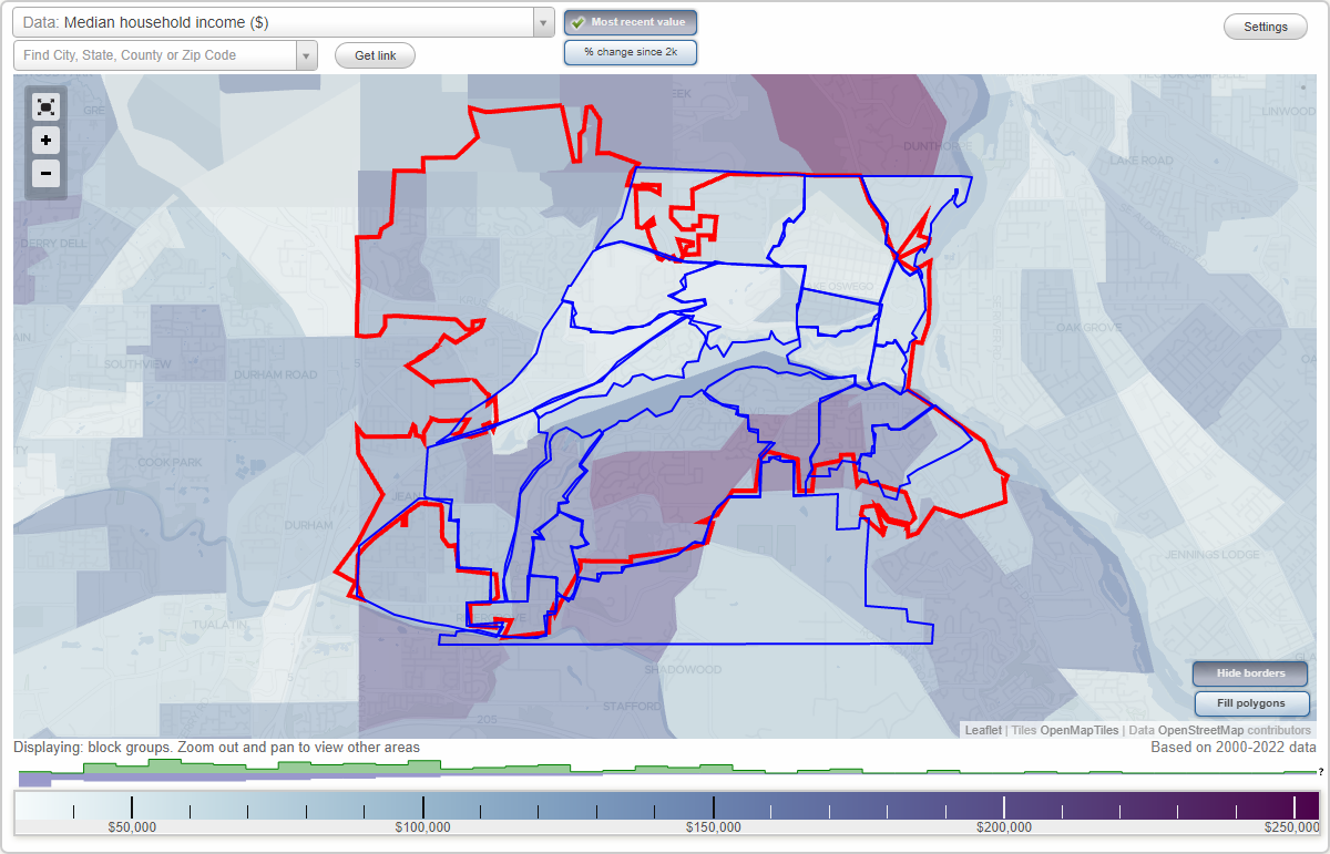
Lake Oswego, Oregon Neighborhood Map - Income, House Prices, Occupations, Boundaries
Settings
X

- City boundary
- Neighborhood boundaries
Business Search - 14 Million verified businesses
Neighborhoods:
Birdshill, Blue Heron, Bryant, Childs, Country Club North Shore, Evergreen, First Addition, Foothills, Forest Highlands, Glenmorrie, Hallinan, Lake Grove, Lakeview Summit, Lakewood, McVey, Old Town, Palisades, Rosewood, Springbrook Park, Stafford, WestridgeBirdshill neighborhood in Lake Oswego statistics: (Find on map)
Area: 0.308 square miles
Population: 480
Population density:
Median household income in 2021:
Median rent in in 2021:
Male vs Females
Median age
Most popular occupations of males: management occupations (except farmers) (23.3%); sales and office occupations (13.6%); service occupations (10.5%); education, training, and library occupations (10.2%); healthcare practitioners and technical occupations (7.6%); legal occupations (6.7%); arts, design, entertainment, sports, and media occupations (5.9%)
Most popular occupations of females: education, training, and library occupations (19.4%); sales and office occupations (18.4%); service occupations (15.0%); business and financial operations occupations (11.7%); healthcare practitioners and technical occupations (7.9%); management occupations (except farmers) (6.0%); transportation occupations (5.4%)
Highways in this neighborhood: SW Riverside Dr (State Hwy 43).
Roads and streets: Fielding Rd; SW Birdshill Rd; SW Midvale Rd; SW Iron Mountain Blvd; Stampher Rd; Briarwood Rd (SW Briarwood Rd); SW Stamphier Rd; Elk Rock Rd; SW Edgecliff Rd; SW Underhill Rd; SW Stonecrest Ln; Stamphor Rd; SW Glen Rd.
Railroad features: Willamette Shore Trolley; Portland & Western RR.
Other features: Tryon Crk.
Birdshill neighborhood detailed profile
Area: 0.308 square miles
Population: 480
Population density:
| Birdshill: | 1,556 people per square mile |
| Lake Oswego: | 3,904 people per square mile |
Median household income in 2021:
| Birdshill: | $192,583 |
| Lake Oswego: | $120,585 |
Median rent in in 2021:
| Birdshill: | $1,726 |
| Lake Oswego: | $1,642 |
Male vs Females
| Males: | 202 |
| Females: | 277 |
Median age
| Males: | 34.4 years |
| Females: | 23.8 years |
Most popular occupations of males: management occupations (except farmers) (23.3%); sales and office occupations (13.6%); service occupations (10.5%); education, training, and library occupations (10.2%); healthcare practitioners and technical occupations (7.6%); legal occupations (6.7%); arts, design, entertainment, sports, and media occupations (5.9%)
Most popular occupations of females: education, training, and library occupations (19.4%); sales and office occupations (18.4%); service occupations (15.0%); business and financial operations occupations (11.7%); healthcare practitioners and technical occupations (7.9%); management occupations (except farmers) (6.0%); transportation occupations (5.4%)
Highways in this neighborhood: SW Riverside Dr (State Hwy 43).
Roads and streets: Fielding Rd; SW Birdshill Rd; SW Midvale Rd; SW Iron Mountain Blvd; Stampher Rd; Briarwood Rd (SW Briarwood Rd); SW Stamphier Rd; Elk Rock Rd; SW Edgecliff Rd; SW Underhill Rd; SW Stonecrest Ln; Stamphor Rd; SW Glen Rd.
Railroad features: Willamette Shore Trolley; Portland & Western RR.
Other features: Tryon Crk.
Birdshill neighborhood detailed profile
Blue Heron neighborhood in Lake Oswego statistics: (Find on map)
Area: 0.318 square miles
Population: 1,276
Population density:
Median household income in 2021:
Median rent in in 2021:
Male vs Females
Median age
Most popular occupations of males: transportation occupations (28.0%); management occupations (except farmers) (23.0%); sales and office occupations (13.8%); business and financial operations occupations (11.4%); architecture and engineering occupations (6.5%); service occupations (5.3%); healthcare practitioners and technical occupations (2.9%)
Most popular occupations of females: business and financial operations occupations (21.2%); sales and office occupations (19.6%); management occupations (except farmers) (10.1%); education, training, and library occupations (9.4%); healthcare practitioners and technical occupations (8.3%); architecture and engineering occupations (7.6%); community and social services occupations (3.8%)
Roads and streets: Kelok Rd; Cardinal Dr; S Shore Blvd; Bryant Rd (SW Bryant Rd); Blue Heron Rd; Maple Cir; Cedar Rd; Blue Heron Dr; Alder Cir; Old Gate Rd; Pioneer Ct (SW Pioneer Ct); Greenbriar Rd; Melissa Dr; Wren St; Canal Rd; Eena Rd; Blue Heron Ct; Canal Woods Ct; Wren Ct; Blue Heron Way; Fir Rd (Fir Ln); Cardinal Pl; Brian Ct; Cardinal Ct; Heather Ann Ct.
Other features: Oswego Cnl.
Blue Heron neighborhood detailed profile
Area: 0.318 square miles
Population: 1,276
Population density:
| Blue Heron: | 4,019 people per square mile |
| Lake Oswego: | 3,904 people per square mile |
Median household income in 2021:
| Blue Heron: | $142,710 |
| Lake Oswego: | $120,585 |
Median rent in in 2021:
| Blue Heron: | $2,291 |
| Lake Oswego: | $1,642 |
Male vs Females
| Males: | 650 |
| Females: | 625 |
Median age
| Males: | 38.9 years |
| Females: | 47.5 years |
Most popular occupations of males: transportation occupations (28.0%); management occupations (except farmers) (23.0%); sales and office occupations (13.8%); business and financial operations occupations (11.4%); architecture and engineering occupations (6.5%); service occupations (5.3%); healthcare practitioners and technical occupations (2.9%)
Most popular occupations of females: business and financial operations occupations (21.2%); sales and office occupations (19.6%); management occupations (except farmers) (10.1%); education, training, and library occupations (9.4%); healthcare practitioners and technical occupations (8.3%); architecture and engineering occupations (7.6%); community and social services occupations (3.8%)
Roads and streets: Kelok Rd; Cardinal Dr; S Shore Blvd; Bryant Rd (SW Bryant Rd); Blue Heron Rd; Maple Cir; Cedar Rd; Blue Heron Dr; Alder Cir; Old Gate Rd; Pioneer Ct (SW Pioneer Ct); Greenbriar Rd; Melissa Dr; Wren St; Canal Rd; Eena Rd; Blue Heron Ct; Canal Woods Ct; Wren Ct; Blue Heron Way; Fir Rd (Fir Ln); Cardinal Pl; Brian Ct; Cardinal Ct; Heather Ann Ct.
Other features: Oswego Cnl.
Blue Heron neighborhood detailed profile
Bryant neighborhood in Lake Oswego statistics: (Find on map)
Area: 0.683 square miles
Population: 2,990
Population density:
Median household income in 2021:
Median rent in in 2021:
Male vs Females
Median age
Housing prices:
Average estimated value of detached houses in 2021 (74.1% of all units):
Average estimated value of townhouses or other attached units in 2021 (7.2% of all units):
Most popular occupations of males: management occupations (except farmers) (28.4%); healthcare practitioners and technical occupations (12.4%); sales and office occupations (11.9%); service occupations (10.7%); transportation occupations (10.3%); business and financial operations occupations (6.7%); architecture and engineering occupations (4.7%)
Most popular occupations of females: business and financial operations occupations (21.0%); education, training, and library occupations (18.5%); sales and office occupations (17.3%); management occupations (except farmers) (13.0%); healthcare practitioners and technical occupations (8.4%); arts, design, entertainment, sports, and media occupations (4.8%); legal occupations (3.4%)
Roads and streets: Lakeview Blvd; Bryant Rd (SW Bryant Rd); Lower Dr; Indian Creek Dr; Deerbrush Ave (SW Deerbrush Ave); Lake Haven Dr; Jean Rd; S Shore Blvd; Westbay Rd (W Bay Rd); Centerwood St; Cobb Way; Chapman Way (SW Chapman Way); Canal Cir; Lamont Way; Woodside Cir; Albert Cir; Hill Way; SW Schalit Way (Schalit Way); Rosewood St; Lords Ln; Wildwood St; Haven St (Haven Way); SW Central Ave (Central Ave); Virginia Way; SW Schalit Cir; Tualatin St; Graef Cir; Mardee Ave; Black Forest Ct; Sarah Hill Ln; Deer Oak Ave; Arbor Ln; Bernard St (SW Bernard St); Redfern Ave; Woodthrush Way; SE Nicole Ln; Waxwing Way; Sandpiper Way; Woodduck Way; Jewell Ln; Allen Rd; Pilkington Rd; Depot St; Rebecca Ln; Warren Ct; Lower Meadows Dr; Lindsay Ct; Sage Hen Way; Ashley Ct; Indian Creek Way (SW Centerwood Way); Lamont Ct; Sage Hen Cir; Deer Oak Cir; Sandpiper Cir; Woodduck Cir; Woodthrush Cir; Mandi Ln; Waxwing Cir.
Railroad features: Portland & Western RR.
Bryant neighborhood detailed profile
Area: 0.683 square miles
Population: 2,990
Population density:
| Bryant: | 4,379 people per square mile |
| Lake Oswego: | 3,904 people per square mile |
Median household income in 2021:
| Bryant: | $137,087 |
| Lake Oswego: | $120,585 |
Median rent in in 2021:
| Bryant: | $1,949 |
| Lake Oswego: | $1,642 |
Male vs Females
| Males: | 1,535 |
| Females: | 1,455 |
Median age
| Males: | 38.7 years |
| Females: | 43.0 years |
Housing prices:
Average estimated value of detached houses in 2021 (74.1% of all units):
| Bryant: | $516,157 |
| Oregon: | $498,099 |
Average estimated value of townhouses or other attached units in 2021 (7.2% of all units):
| This neighborhood: | $361,588 |
| Oregon: | $392,138 |
Most popular occupations of males: management occupations (except farmers) (28.4%); healthcare practitioners and technical occupations (12.4%); sales and office occupations (11.9%); service occupations (10.7%); transportation occupations (10.3%); business and financial operations occupations (6.7%); architecture and engineering occupations (4.7%)
Most popular occupations of females: business and financial operations occupations (21.0%); education, training, and library occupations (18.5%); sales and office occupations (17.3%); management occupations (except farmers) (13.0%); healthcare practitioners and technical occupations (8.4%); arts, design, entertainment, sports, and media occupations (4.8%); legal occupations (3.4%)
Roads and streets: Lakeview Blvd; Bryant Rd (SW Bryant Rd); Lower Dr; Indian Creek Dr; Deerbrush Ave (SW Deerbrush Ave); Lake Haven Dr; Jean Rd; S Shore Blvd; Westbay Rd (W Bay Rd); Centerwood St; Cobb Way; Chapman Way (SW Chapman Way); Canal Cir; Lamont Way; Woodside Cir; Albert Cir; Hill Way; SW Schalit Way (Schalit Way); Rosewood St; Lords Ln; Wildwood St; Haven St (Haven Way); SW Central Ave (Central Ave); Virginia Way; SW Schalit Cir; Tualatin St; Graef Cir; Mardee Ave; Black Forest Ct; Sarah Hill Ln; Deer Oak Ave; Arbor Ln; Bernard St (SW Bernard St); Redfern Ave; Woodthrush Way; SE Nicole Ln; Waxwing Way; Sandpiper Way; Woodduck Way; Jewell Ln; Allen Rd; Pilkington Rd; Depot St; Rebecca Ln; Warren Ct; Lower Meadows Dr; Lindsay Ct; Sage Hen Way; Ashley Ct; Indian Creek Way (SW Centerwood Way); Lamont Ct; Sage Hen Cir; Deer Oak Cir; Sandpiper Cir; Woodduck Cir; Woodthrush Cir; Mandi Ln; Waxwing Cir.
Railroad features: Portland & Western RR.
Bryant neighborhood detailed profile
Childs neighborhood in Lake Oswego statistics: (Find on map)
Area: 0.183 square miles
Population: 704
Population density:
Median household income in 2021:
Median rent in in 2021:
Male vs Females
Median age
Most popular occupations of males: transportation occupations (31.4%); management occupations (except farmers) (21.7%); sales and office occupations (14.5%); business and financial operations occupations (12.2%); architecture and engineering occupations (6.7%); service occupations (4.1%); computer and mathematical occupations (3.1%)
Most popular occupations of females: business and financial operations occupations (20.5%); sales and office occupations (19.7%); management occupations (except farmers) (9.4%); architecture and engineering occupations (8.6%); healthcare practitioners and technical occupations (8.6%); education, training, and library occupations (7.8%); community and social services occupations (4.3%)
Roads and streets: SW Childs Rd; Olson Ave (SW Olson Ave); Rivers Edge Dr; Canal Rd; Bass Ln; River Run Dr; Sycamore Ave; Trout Way; Olson Ct (SW Olson Ct); Megan Pl; 35th Pl (SW 35th Pl); Kokanee Ct; Perch Ct; Coho Ln; SW 35th Ct (35th Ct).
Other features: Oswego Cnl.
Childs neighborhood detailed profile
Area: 0.183 square miles
Population: 704
Population density:
| Childs: | 3,854 people per square mile |
| Lake Oswego: | 3,904 people per square mile |
Median household income in 2021:
| Childs: | $107,569 |
| Lake Oswego: | $120,585 |
Median rent in in 2021:
| Childs: | $2,353 |
| Lake Oswego: | $1,642 |
Male vs Females
| Males: | 358 |
| Females: | 346 |
Median age
| Males: | 37.8 years |
| Females: | 52.1 years |
Most popular occupations of males: transportation occupations (31.4%); management occupations (except farmers) (21.7%); sales and office occupations (14.5%); business and financial operations occupations (12.2%); architecture and engineering occupations (6.7%); service occupations (4.1%); computer and mathematical occupations (3.1%)
Most popular occupations of females: business and financial operations occupations (20.5%); sales and office occupations (19.7%); management occupations (except farmers) (9.4%); architecture and engineering occupations (8.6%); healthcare practitioners and technical occupations (8.6%); education, training, and library occupations (7.8%); community and social services occupations (4.3%)
Roads and streets: SW Childs Rd; Olson Ave (SW Olson Ave); Rivers Edge Dr; Canal Rd; Bass Ln; River Run Dr; Sycamore Ave; Trout Way; Olson Ct (SW Olson Ct); Megan Pl; 35th Pl (SW 35th Pl); Kokanee Ct; Perch Ct; Coho Ln; SW 35th Ct (35th Ct).
Other features: Oswego Cnl.
Childs neighborhood detailed profile
Country Club North Shore neighborhood in Lake Oswego statistics: (Find on map)
Area: 0.468 square miles
Roads and streets: Chandler Rd; Northshore Rd; Iron Mountain Blvd; Country Club Rd (Lake Oswego Country Club, SW Country Club Rd); Pine Valley Rd; Lake Garden Ct; Berwick Rd; Westward Ho Rd; 10th St; Troon Rd; Chandler Pl; Island Rd (Halverson Ln); Mulligan Ln; Country Club Ct; Northshore Pl.
Railroad features: Portland & Western RR.
Country Club North Shore neighborhood detailed profile
Evergreen neighborhood in Lake Oswego statistics: (Find on map)
Area: 0.155 square miles
Roads and streets: Evergreen Rd; Lake Bay Ct; Ellis St (Ellis Ave); Lake Forest Dr; 5th St; Cabana Ln; Berwick Ct; 6th St; 3rd St; 4th St; Berwick Rd.
Railroad features: Portland & Western RR.
Evergreen neighborhood detailed profile
Area: 0.155 square miles
Roads and streets: Evergreen Rd; Lake Bay Ct; Ellis St (Ellis Ave); Lake Forest Dr; 5th St; Cabana Ln; Berwick Ct; 6th St; 3rd St; 4th St; Berwick Rd.
Railroad features: Portland & Western RR.
Evergreen neighborhood detailed profile
First Addition neighborhood in Lake Oswego statistics: (Find on map)
Area: 0.604 square miles
Highways in this neighborhood: State Hwy 43 (N State St).
Roads and streets: C Ave (SW C Ave); SW E Ave (E Ave); D Ave (SW D Ave); B Ave (SW B Ave); SW A Ave (A Ave); G Ave (SW G Ave); 9th St; 8th St; 7th St; 6th St; 5th St; SW Terwilliger Blvd (Tryon Creek State Park); 4th St; 3rd St; Sunningdale Rd; 2nd St; 1st St; F Ave (SW F Ave); Bayberry Rd; 10th St; Andrews Rd; Cumberland Rd; Cumberland Pl; Rye Rd (SW Rye Rd); SW Virginia Ln; Iron Mountain Blvd; Sher Ln; Sun Ct (Sunningdale Ct, SW Sunningdale Ct); Lake Oswego Country Club (SW Country Club Rd, Country Club Rd).
Railroad features: Portland & Western RR.
Other features: Tryon Crk.
First Addition neighborhood detailed profile
Foothills neighborhood in Lake Oswego statistics: (Find on map)
Area: 0.167 square miles
Roads and streets: Foothills Rd; Oswego Pointe Dr; Foothills Dr; Oswego Pointe Rd; View Ct; Durham St (SW Durham St).
Railroad features: Portland & Western RR.
Foothills neighborhood detailed profile
Area: 0.167 square miles
Roads and streets: Foothills Rd; Oswego Pointe Dr; Foothills Dr; Oswego Pointe Rd; View Ct; Durham St (SW Durham St).
Railroad features: Portland & Western RR.
Foothills neighborhood detailed profile
Forest Highlands neighborhood in Lake Oswego statistics: (Find on map)
Area: 0.845 square miles
Population: 1,358
Population density:
Median household income in 2021:
Median rent in in 2021:
Male vs Females
Median age
Most popular occupations of males: management occupations (except farmers) (21.4%); sales and office occupations (19.1%); production occupations (12.8%); computer and mathematical occupations (11.7%); life, physical, and social science occupations (11.4%); material moving occupations (7.9%); community and social services occupations (7.2%)
Most popular occupations of females: sales and office occupations (35.5%); healthcare practitioners and technical occupations (15.7%); education, training, and library occupations (12.1%); community and social services occupations (9.4%); arts, design, entertainment, sports, and media occupations (7.7%); life, physical, and social science occupations (7.4%); computer and mathematical occupations (5.7%)
Roads and streets: Knaus Rd; Country Commons Ln; Goodall Rd; SW Timberline Dr (Timberline Dr); SW Boca Ratan Dr (Boca Ratan Dr); Atwater Rd; Hood View Ln (Hoodview Ln); Bonnie Brae Dr (Bonniebrae Dr); SW Forest Meadows Way (Forest Meadows Way); Hazel Rd; Hideaway Ln (Hide A Way Ln); Atwater Ln; Fox Run; Briercliff Ln; Rockinghorse Ln; Thoma Rd; Lake Oswego Country Club (SW Country Club Rd, Country Club Rd); Leslie Ln; Johnson Ter; Cameo Ct; Carrera Ln; Alto Park Rd; Amber Pl; Goodall Ct; SW Woodmont; Iron Mountain Blvd; Pebble Beach Ct (SW Pebble Beach Ct); Woodway Ct (SW Woodway Ct); SW Adrian Ct; Milburn Ct (SW Milburn Ct); Capilano Ct; Tippecanoe Ct; SW Hideaway Ct; Dapple Grey Ln (Dapplegrey Ln); SW Shireva Ct (Shireva Ct); Englewood Dr (SW Englewood Dr); Leslie Ct; Heathrow Ln.
Other features: Tryon Crk.
Roads and streets: SW Adrian Ct.
Forest Highlands neighborhood detailed profile
Area: 0.845 square miles
Population: 1,358
Population density:
| Forest Highlands: | 1,608 people per square mile |
| Lake Oswego: | 3,904 people per square mile |
Median household income in 2021:
| Forest Highlands: | $163,945 |
| Lake Oswego: | $120,585 |
Median rent in in 2021:
| Forest Highlands: | $1,488 |
| Lake Oswego: | $1,642 |
Male vs Females
| Males: | 613 |
| Females: | 745 |
Median age
| Males: | 47.5 years |
| Females: | 44.3 years |
Most popular occupations of males: management occupations (except farmers) (21.4%); sales and office occupations (19.1%); production occupations (12.8%); computer and mathematical occupations (11.7%); life, physical, and social science occupations (11.4%); material moving occupations (7.9%); community and social services occupations (7.2%)
Most popular occupations of females: sales and office occupations (35.5%); healthcare practitioners and technical occupations (15.7%); education, training, and library occupations (12.1%); community and social services occupations (9.4%); arts, design, entertainment, sports, and media occupations (7.7%); life, physical, and social science occupations (7.4%); computer and mathematical occupations (5.7%)
Roads and streets: Knaus Rd; Country Commons Ln; Goodall Rd; SW Timberline Dr (Timberline Dr); SW Boca Ratan Dr (Boca Ratan Dr); Atwater Rd; Hood View Ln (Hoodview Ln); Bonnie Brae Dr (Bonniebrae Dr); SW Forest Meadows Way (Forest Meadows Way); Hazel Rd; Hideaway Ln (Hide A Way Ln); Atwater Ln; Fox Run; Briercliff Ln; Rockinghorse Ln; Thoma Rd; Lake Oswego Country Club (SW Country Club Rd, Country Club Rd); Leslie Ln; Johnson Ter; Cameo Ct; Carrera Ln; Alto Park Rd; Amber Pl; Goodall Ct; SW Woodmont; Iron Mountain Blvd; Pebble Beach Ct (SW Pebble Beach Ct); Woodway Ct (SW Woodway Ct); SW Adrian Ct; Milburn Ct (SW Milburn Ct); Capilano Ct; Tippecanoe Ct; SW Hideaway Ct; Dapple Grey Ln (Dapplegrey Ln); SW Shireva Ct (Shireva Ct); Englewood Dr (SW Englewood Dr); Leslie Ct; Heathrow Ln.
Other features: Tryon Crk.
Roads and streets: SW Adrian Ct.
Forest Highlands neighborhood detailed profile
Glenmorrie neighborhood in Lake Oswego statistics: (Find on map)
Area: 0.283 square miles
Population: 669
Population density:
Median household income in 2021:
Median rent in in 2021:
Male vs Females
Median age
Housing prices:
Average estimated value of detached houses in 2021 (84.3% of all units):
Average estimated '21 value of housing units in 5-or-more-unit structures (3.0% of all units):
Most popular occupations of males: management occupations (except farmers) (32.8%); legal occupations (13.8%); arts, design, entertainment, sports, and media occupations (12.5%); sales and office occupations (7.7%); education, training, and library occupations (7.1%); business and financial operations occupations (6.8%); computer and mathematical occupations (4.5%)
Most popular occupations of females: sales and office occupations (33.8%); management occupations (except farmers) (28.6%); healthcare practitioners and technical occupations (10.4%); education, training, and library occupations (7.9%); legal occupations (6.5%); architecture and engineering occupations (3.8%); business and financial operations occupations (3.4%)
Highways in this neighborhood: State Hwy 43 (Pacific Hwy).
Roads and streets: Glenmorrie Dr; Chapin Way; Glenmorrie Ln (S Glenmorrie Ln); Cherry Ln (S Cherry Ln); Poplar Way; Glenwood Ct; Stonebridge Way (S Stonebridge Way, S Stone Bridge Way); Grand View Ct (Grandview Ct); Lilli Ln; Greenbluff Dr (S Greenbluff Dr); Viewcrest Ln; Eastview Ct; Ivy Ct (Ivy Ln).
Glenmorrie neighborhood detailed profile
Area: 0.283 square miles
Population: 669
Population density:
| Glenmorrie: | 2,367 people per square mile |
| Lake Oswego: | 3,904 people per square mile |
Median household income in 2021:
| Glenmorrie: | $163,961 |
| Lake Oswego: | $120,585 |
Median rent in in 2021:
| Glenmorrie: | $1,315 |
| Lake Oswego: | $1,642 |
Male vs Females
| Males: | 324 |
| Females: | 344 |
Median age
| Males: | 44.8 years |
| Females: | 48.2 years |
Housing prices:
Average estimated value of detached houses in 2021 (84.3% of all units):
| Glenmorrie: | $1,141,782 |
| Oregon: | $498,099 |
Average estimated '21 value of housing units in 5-or-more-unit structures (3.0% of all units):
| Glenmorrie: | $422,558 |
| Oregon: | $378,730 |
Most popular occupations of males: management occupations (except farmers) (32.8%); legal occupations (13.8%); arts, design, entertainment, sports, and media occupations (12.5%); sales and office occupations (7.7%); education, training, and library occupations (7.1%); business and financial operations occupations (6.8%); computer and mathematical occupations (4.5%)
Most popular occupations of females: sales and office occupations (33.8%); management occupations (except farmers) (28.6%); healthcare practitioners and technical occupations (10.4%); education, training, and library occupations (7.9%); legal occupations (6.5%); architecture and engineering occupations (3.8%); business and financial operations occupations (3.4%)
Highways in this neighborhood: State Hwy 43 (Pacific Hwy).
Roads and streets: Glenmorrie Dr; Chapin Way; Glenmorrie Ln (S Glenmorrie Ln); Cherry Ln (S Cherry Ln); Poplar Way; Glenwood Ct; Stonebridge Way (S Stonebridge Way, S Stone Bridge Way); Grand View Ct (Grandview Ct); Lilli Ln; Greenbluff Dr (S Greenbluff Dr); Viewcrest Ln; Eastview Ct; Ivy Ct (Ivy Ln).
Glenmorrie neighborhood detailed profile
Hallinan neighborhood in Lake Oswego statistics: (Find on map)
Area: 0.336 square miles
Population: 958
Population density:
Median household income in 2021:
Median rent in in 2021:
Male vs Females
Median age
Housing prices:
Average estimated value of detached houses in 2021 (91.8% of all units):
Average estimated '21 value of housing units in 5-or-more-unit structures (2.4% of all units):
Most popular occupations of males: management occupations (except farmers) (35.1%); sales and office occupations (13.4%); legal occupations (8.8%); business and financial operations occupations (6.5%); computer and mathematical occupations (6.4%); arts, design, entertainment, sports, and media occupations (6.2%); life, physical, and social science occupations (4.6%)
Most popular occupations of females: sales and office occupations (42.7%); management occupations (except farmers) (19.3%); healthcare practitioners and technical occupations (12.8%); education, training, and library occupations (4.6%); service occupations (4.6%); business and financial operations occupations (4.0%); life, physical, and social science occupations (3.9%)
Highways in this neighborhood: Pacific Hwy (State Hwy 43).
Roads and streets: SW Laurel St (Laurel St); Ash St; Oak St; Hallinan St; Upper Cherry Ln; Hemlock St; Hallinan Cir; Cornell St (SW Cornell St); Larch St (SW Larch St); Meadows Dr (SW Meadows Dr); Wells St; SW Devon Ln (Devon Ln); SW Cedar St (Cedar St); Upper Devon Ln; Bickner St; Worthington St; SW Burnham Rd (Burnham Rd); Erickson St; SW Oxford Dr (Oxford Dr); Spruce St; Old River Rd; Obrien St (Obrien Rd); Yates St; Yarmouth Cir; Lund St; Bullock St; Pearcy St; Hawthorne Dr; Gans St (Gans Rd); Lexington Ct; Headlee Ln; Cherry Ct; Dyer St; Hallinan Ct (S Hallinan Ct); Bedford Ct; Cherry Ln (S Cherry Ln).
Hallinan neighborhood detailed profile
Area: 0.336 square miles
Population: 958
Population density:
| Hallinan: | 2,849 people per square mile |
| Lake Oswego: | 3,904 people per square mile |
Median household income in 2021:
| Hallinan: | $163,961 |
| Lake Oswego: | $120,585 |
Median rent in in 2021:
| Hallinan: | $1,978 |
| Lake Oswego: | $1,642 |
Male vs Females
| Males: | 478 |
| Females: | 480 |
Median age
| Males: | 44.8 years |
| Females: | 48.2 years |
Housing prices:
Average estimated value of detached houses in 2021 (91.8% of all units):
| Hallinan: | $871,913 |
| Oregon: | $498,099 |
Average estimated '21 value of housing units in 5-or-more-unit structures (2.4% of all units):
| Hallinan: | $422,558 |
| Oregon: | $378,730 |
Most popular occupations of males: management occupations (except farmers) (35.1%); sales and office occupations (13.4%); legal occupations (8.8%); business and financial operations occupations (6.5%); computer and mathematical occupations (6.4%); arts, design, entertainment, sports, and media occupations (6.2%); life, physical, and social science occupations (4.6%)
Most popular occupations of females: sales and office occupations (42.7%); management occupations (except farmers) (19.3%); healthcare practitioners and technical occupations (12.8%); education, training, and library occupations (4.6%); service occupations (4.6%); business and financial operations occupations (4.0%); life, physical, and social science occupations (3.9%)
Highways in this neighborhood: Pacific Hwy (State Hwy 43).
Roads and streets: SW Laurel St (Laurel St); Ash St; Oak St; Hallinan St; Upper Cherry Ln; Hemlock St; Hallinan Cir; Cornell St (SW Cornell St); Larch St (SW Larch St); Meadows Dr (SW Meadows Dr); Wells St; SW Devon Ln (Devon Ln); SW Cedar St (Cedar St); Upper Devon Ln; Bickner St; Worthington St; SW Burnham Rd (Burnham Rd); Erickson St; SW Oxford Dr (Oxford Dr); Spruce St; Old River Rd; Obrien St (Obrien Rd); Yates St; Yarmouth Cir; Lund St; Bullock St; Pearcy St; Hawthorne Dr; Gans St (Gans Rd); Lexington Ct; Headlee Ln; Cherry Ct; Dyer St; Hallinan Ct (S Hallinan Ct); Bedford Ct; Cherry Ln (S Cherry Ln).
Hallinan neighborhood detailed profile
Lake Grove neighborhood in Lake Oswego statistics: (Find on map)
Area: 0.528 square miles
Population: 1,048
Population density:
Median household income in 2021:
Median rent in in 2021:
Male vs Females
Median age
Housing prices:
Average estimated value of detached houses in 2021 (44.9% of all units):
Average estimated value of townhouses or other attached units in 2021 (4.7% of all units):
Most popular occupations of males: sales and office occupations (22.5%); computer and mathematical occupations (22.4%); management occupations (except farmers) (17.5%); service occupations (7.7%); production occupations (7.7%); material moving occupations (6.3%); healthcare practitioners and technical occupations (5.6%)
Most popular occupations of females: education, training, and library occupations (23.0%); service occupations (16.9%); healthcare practitioners and technical occupations (16.7%); sales and office occupations (12.1%); management occupations (except farmers) (8.6%); life, physical, and social science occupations (8.5%); arts, design, entertainment, sports, and media occupations (8.1%)
Roads and streets: Upper Dr; Boones Ferry Rd; Iron Mountain Blvd; Twin Fir Rd; Lake Grove Ave; Boones Way; Douglas Cir; Sunset Dr; Lanewood St (Lanewood Rd); Reese Rd; SW Edgemont Rd (Edgemont Rd); Red Cedar Way; Bryant Rd (SW Bryant Rd); Lakeview Blvd; Brookside Rd; Spring Ln; Summit Dr; Fir Grove Ct; Twin Fir Ct; Division Ct; Nola Ct; Sabina Ct; Sunwood Ct; Brook Ct; Sunrise Ct; Eleanor Ct; Devonshire Dr (SW Devonshire Dr); Murwood Ct.
Railroad features: Portland & Western RR.
Other features: Spring Brook Crk.
Lake Grove neighborhood detailed profile
Area: 0.528 square miles
Population: 1,048
Population density:
| Lake Grove: | 1,985 people per square mile |
| Lake Oswego: | 3,904 people per square mile |
Median household income in 2021:
| Lake Grove: | $124,902 |
| Lake Oswego: | $120,585 |
Median rent in in 2021:
| Lake Grove: | $1,656 |
| Lake Oswego: | $1,642 |
Male vs Females
| Males: | 531 |
| Females: | 516 |
Median age
| Males: | 38.6 years |
| Females: | 40.3 years |
Housing prices:
Average estimated value of detached houses in 2021 (44.9% of all units):
| Lake Grove: | $516,157 |
| Oregon: | $498,099 |
Average estimated value of townhouses or other attached units in 2021 (4.7% of all units):
| This neighborhood: | $361,588 |
| Oregon: | $392,138 |
Most popular occupations of males: sales and office occupations (22.5%); computer and mathematical occupations (22.4%); management occupations (except farmers) (17.5%); service occupations (7.7%); production occupations (7.7%); material moving occupations (6.3%); healthcare practitioners and technical occupations (5.6%)
Most popular occupations of females: education, training, and library occupations (23.0%); service occupations (16.9%); healthcare practitioners and technical occupations (16.7%); sales and office occupations (12.1%); management occupations (except farmers) (8.6%); life, physical, and social science occupations (8.5%); arts, design, entertainment, sports, and media occupations (8.1%)
Roads and streets: Upper Dr; Boones Ferry Rd; Iron Mountain Blvd; Twin Fir Rd; Lake Grove Ave; Boones Way; Douglas Cir; Sunset Dr; Lanewood St (Lanewood Rd); Reese Rd; SW Edgemont Rd (Edgemont Rd); Red Cedar Way; Bryant Rd (SW Bryant Rd); Lakeview Blvd; Brookside Rd; Spring Ln; Summit Dr; Fir Grove Ct; Twin Fir Ct; Division Ct; Nola Ct; Sabina Ct; Sunwood Ct; Brook Ct; Sunrise Ct; Eleanor Ct; Devonshire Dr (SW Devonshire Dr); Murwood Ct.
Railroad features: Portland & Western RR.
Other features: Spring Brook Crk.
Lake Grove neighborhood detailed profile
Lakeview Summit neighborhood in Lake Oswego statistics: (Find on map)
Area: 0.246 square miles
Roads and streets: Summit Dr; Lakeview Blvd; Village Dr; Ridgewood Rd; Twin Points Dr; Ridgewood Ln; Village Park Ln; Springbrook Ct; Indian Trl; Bay View Ln; Oswego Shore Ct; View Lake Ct; Oak Knoll Ct; Village Park Ct; Summit Ct; Lily Bay Ct.
Railroad features: Portland & Western RR.
Lakeview Summit neighborhood detailed profile
Lakewood neighborhood in Lake Oswego statistics: (Find on map)
Area: 0.205 square miles
Population: 484
Population density:
Median household income in 2021:
Median rent in in 2021:
Male vs Females
Median age
Housing prices:
Average estimated value of detached houses in 2021 (84.5% of all units):
Average estimated '21 value of housing units in 5-or-more-unit structures (2.6% of all units):
Most popular occupations of males: management occupations (except farmers) (32.8%); legal occupations (13.8%); arts, design, entertainment, sports, and media occupations (12.5%); sales and office occupations (7.7%); education, training, and library occupations (7.1%); business and financial operations occupations (6.8%); computer and mathematical occupations (4.5%)
Most popular occupations of females: sales and office occupations (33.8%); management occupations (except farmers) (28.6%); healthcare practitioners and technical occupations (10.3%); education, training, and library occupations (7.9%); legal occupations (6.6%); architecture and engineering occupations (3.8%); business and financial operations occupations (3.4%)
Highways in this neighborhood: N State St (State Hwy 43); State Hwy 43 (S State St).
Roads and streets: Northshore Rd; Ridgeway Rd; Lakeshore Rd; Middle Crest Rd (Middlecrest Rd); Greenwood Rd; N Shore Rd; Lakewood Ave (Lakewood Rd); N Shore Cir (Northshore Cir); Kenwood Rd; Southview Rd (S View Rd); Westpoint Rd; Fairmont Rd; S Point Rd (Point Rd); Northpoint Rd.
Lakewood neighborhood detailed profile
Area: 0.205 square miles
Population: 484
Population density:
| Lakewood: | 2,362 people per square mile |
| Lake Oswego: | 3,904 people per square mile |
Median household income in 2021:
| Lakewood: | $161,477 |
| Lake Oswego: | $120,585 |
Median rent in in 2021:
| Lakewood: | $1,313 |
| Lake Oswego: | $1,642 |
Male vs Females
| Males: | 235 |
| Females: | 249 |
Median age
| Males: | 45.8 years |
| Females: | 48.5 years |
Housing prices:
Average estimated value of detached houses in 2021 (84.5% of all units):
| Lakewood: | $1,142,522 |
| Oregon: | $498,099 |
Average estimated '21 value of housing units in 5-or-more-unit structures (2.6% of all units):
| Lakewood: | $422,558 |
| Oregon: | $378,730 |
Most popular occupations of males: management occupations (except farmers) (32.8%); legal occupations (13.8%); arts, design, entertainment, sports, and media occupations (12.5%); sales and office occupations (7.7%); education, training, and library occupations (7.1%); business and financial operations occupations (6.8%); computer and mathematical occupations (4.5%)
Most popular occupations of females: sales and office occupations (33.8%); management occupations (except farmers) (28.6%); healthcare practitioners and technical occupations (10.3%); education, training, and library occupations (7.9%); legal occupations (6.6%); architecture and engineering occupations (3.8%); business and financial operations occupations (3.4%)
Highways in this neighborhood: N State St (State Hwy 43); State Hwy 43 (S State St).
Roads and streets: Northshore Rd; Ridgeway Rd; Lakeshore Rd; Middle Crest Rd (Middlecrest Rd); Greenwood Rd; N Shore Rd; Lakewood Ave (Lakewood Rd); N Shore Cir (Northshore Cir); Kenwood Rd; Southview Rd (S View Rd); Westpoint Rd; Fairmont Rd; S Point Rd (Point Rd); Northpoint Rd.
Lakewood neighborhood detailed profile
McVey neighborhood in Lake Oswego statistics: (Find on map)
Area: 0.461 square miles
Population: 1,518
Population density:
Median household income in 2021:
Median rent in in 2021:
Male vs Females
Median age
Housing prices:
Average estimated value of detached houses in 2021 (97.0% of all units):
Average estimated '21 value of housing units in 5-or-more-unit structures (2.2% of all units):
Most popular occupations of males: management occupations (except farmers) (36.7%); sales and office occupations (17.2%); computer and mathematical occupations (7.6%); life, physical, and social science occupations (6.6%); business and financial operations occupations (6.4%); architecture and engineering occupations (5.6%); legal occupations (5.4%)
Most popular occupations of females: sales and office occupations (48.7%); healthcare practitioners and technical occupations (14.5%); management occupations (except farmers) (13.0%); life, physical, and social science occupations (6.6%); service occupations (5.6%); business and financial operations occupations (4.5%); community and social services occupations (2.8%)
Roads and streets: McVey Ave; Lake Front Rd; Palisades Ter (Palisades Ter Dr); Oak St; Ash St; Lee St; Terrace Dr (SW Terrace Dr); SW Maple St (Maple St); S Shore Blvd; Larch St (SW Larch St); W Oak Ter (Oak Ter); Stafford Rd; Pine St; Parrish St; Aspen St; Parelius Cir; SW Laurel St (Laurel St); Bergis Farm Dr; Patton Rd; Aspen Ct; Cornell Ct; Kilkenny Rd; Kilkenny Dr; Horseshoe Curve (Horseshoe Curv, SW Horseshoe Curve); SW Fern Pl (Fern Pl); SW Cornell St (Cornell St); Southshore Blvd; Cedar St (SW Cedar St); Spruce St; Hemlock St; Palisades Lake Ct; Conifer Dr (Conifer Ter, SW Conifer Ter); SW Bergis Rd (Bergis Rd); Fircrest Dr; Schukart Ln; Madrona Dr; Matthew Ct; Pearcy St; Fircrest Ct; Kenola Ct; Bickner St.
McVey neighborhood detailed profile
Area: 0.461 square miles
Population: 1,518
Population density:
| McVey (South Shore): | 3,295 people per square mile |
| Lake Oswego: | 3,904 people per square mile |
Median household income in 2021:
| McVey (South Shore): | $163,961 |
| Lake Oswego: | $120,585 |
Median rent in in 2021:
| McVey (South Shore): | $2,561 |
| Lake Oswego: | $1,642 |
Male vs Females
| Males: | 771 |
| Females: | 747 |
Median age
| Males: | 44.8 years |
| Females: | 48.2 years |
Housing prices:
Average estimated value of detached houses in 2021 (97.0% of all units):
| McVey (South Shore): | $698,599 |
| Oregon: | $498,099 |
Average estimated '21 value of housing units in 5-or-more-unit structures (2.2% of all units):
| McVey (South Shore): | $422,558 |
| Oregon: | $378,730 |
Most popular occupations of males: management occupations (except farmers) (36.7%); sales and office occupations (17.2%); computer and mathematical occupations (7.6%); life, physical, and social science occupations (6.6%); business and financial operations occupations (6.4%); architecture and engineering occupations (5.6%); legal occupations (5.4%)
Most popular occupations of females: sales and office occupations (48.7%); healthcare practitioners and technical occupations (14.5%); management occupations (except farmers) (13.0%); life, physical, and social science occupations (6.6%); service occupations (5.6%); business and financial operations occupations (4.5%); community and social services occupations (2.8%)
Roads and streets: McVey Ave; Lake Front Rd; Palisades Ter (Palisades Ter Dr); Oak St; Ash St; Lee St; Terrace Dr (SW Terrace Dr); SW Maple St (Maple St); S Shore Blvd; Larch St (SW Larch St); W Oak Ter (Oak Ter); Stafford Rd; Pine St; Parrish St; Aspen St; Parelius Cir; SW Laurel St (Laurel St); Bergis Farm Dr; Patton Rd; Aspen Ct; Cornell Ct; Kilkenny Rd; Kilkenny Dr; Horseshoe Curve (Horseshoe Curv, SW Horseshoe Curve); SW Fern Pl (Fern Pl); SW Cornell St (Cornell St); Southshore Blvd; Cedar St (SW Cedar St); Spruce St; Hemlock St; Palisades Lake Ct; Conifer Dr (Conifer Ter, SW Conifer Ter); SW Bergis Rd (Bergis Rd); Fircrest Dr; Schukart Ln; Madrona Dr; Matthew Ct; Pearcy St; Fircrest Ct; Kenola Ct; Bickner St.
McVey neighborhood detailed profile
Old Town neighborhood in Lake Oswego statistics: (Find on map)
Area: 0.080 square miles
Population: 188
Population density:
Median household income in 2021:
Median rent in in 2021:
Male vs Females
Median age
Housing prices:
Average estimated value of detached houses in 2021 (84.0% of all units):
Average estimated '21 value of housing units in 5-or-more-unit structures (2.7% of all units):
Most popular occupations of males: management occupations (except farmers) (32.8%); legal occupations (13.8%); arts, design, entertainment, sports, and media occupations (12.5%); sales and office occupations (7.7%); education, training, and library occupations (7.1%); business and financial operations occupations (6.8%); computer and mathematical occupations (4.5%)
Most popular occupations of females: sales and office occupations (33.8%); management occupations (except farmers) (28.6%); healthcare practitioners and technical occupations (10.3%); education, training, and library occupations (7.9%); legal occupations (6.6%); architecture and engineering occupations (3.8%); business and financial operations occupations (3.4%)
Highways in this neighborhood: Pacific Hwy (State Hwy 43).
Roads and streets: Furnace St; Green St; SW Church St (Church St); Wilbur St; George Rogers Park (Ladd St); Durham St (SW Durham St).
Other features: Oswego Crk.
Old Town neighborhood detailed profile
Area: 0.080 square miles
Population: 188
Population density:
| Old Town: | 2,353 people per square mile |
| Lake Oswego: | 3,904 people per square mile |
Median household income in 2021:
| Old Town: | $161,477 |
| Lake Oswego: | $120,585 |
Median rent in in 2021:
| Old Town: | $1,313 |
| Lake Oswego: | $1,642 |
Male vs Females
| Males: | 91 |
| Females: | 97 |
Median age
| Males: | 45.8 years |
| Females: | 48.5 years |
Housing prices:
Average estimated value of detached houses in 2021 (84.0% of all units):
| Old Town: | $1,142,522 |
| Oregon: | $498,099 |
Average estimated '21 value of housing units in 5-or-more-unit structures (2.7% of all units):
| Old Town: | $422,558 |
| Oregon: | $378,730 |
Most popular occupations of males: management occupations (except farmers) (32.8%); legal occupations (13.8%); arts, design, entertainment, sports, and media occupations (12.5%); sales and office occupations (7.7%); education, training, and library occupations (7.1%); business and financial operations occupations (6.8%); computer and mathematical occupations (4.5%)
Most popular occupations of females: sales and office occupations (33.8%); management occupations (except farmers) (28.6%); healthcare practitioners and technical occupations (10.3%); education, training, and library occupations (7.9%); legal occupations (6.6%); architecture and engineering occupations (3.8%); business and financial operations occupations (3.4%)
Highways in this neighborhood: Pacific Hwy (State Hwy 43).
Roads and streets: Furnace St; Green St; SW Church St (Church St); Wilbur St; George Rogers Park (Ladd St); Durham St (SW Durham St).
Other features: Oswego Crk.
Old Town neighborhood detailed profile
Palisades neighborhood in Lake Oswego statistics: (Find on map)
Area: 1.341 square miles
Population: 4,438
Population density:
Median household income in 2021:
Median rent in in 2021:
Male vs Females
Median age
Housing prices:
Average estimated value of detached houses in 2021 (97.1% of all units):
Average estimated '21 value of housing units in 5-or-more-unit structures (1.1% of all units):
Most popular occupations of males: management occupations (except farmers) (36.7%); sales and office occupations (17.3%); computer and mathematical occupations (7.7%); life, physical, and social science occupations (6.6%); business and financial operations occupations (6.4%); architecture and engineering occupations (5.6%); legal occupations (5.4%)
Most popular occupations of females: sales and office occupations (48.9%); healthcare practitioners and technical occupations (14.5%); management occupations (except farmers) (12.8%); life, physical, and social science occupations (6.7%); service occupations (5.6%); business and financial operations occupations (4.5%); community and social services occupations (2.8%)
Roads and streets: Greentree Rd; SW Overlook Dr (Overlook Dr); S Shore Blvd; Westview Dr (Westview Rd, W View Dr); Greentree Cir; Fernwood Dr; Palisades Crest Dr; SW Woodland Ter (Woodland Ter); Glenhaven Rd (Glen Haven Rd); Lake Oswego Golf Course (Stafford Rd); Dellwood Dr; Canyon Dr; Park Rd; Meadowlark Ln; Cloverleaf Rd; Wall St; Riven Dell Rd; Sunny Hill Dr; Mapleleaf Rd (Mapleleaf Ct, Mapleleaf Dr); Hillside Dr; Westview Cir; Crestview Dr (SW Crestview Dr); Fernwood Cir; Tolkien Ln; Greentree Ave; Clara Ct; Ridge Pointe Dr; Cherry Crest Ave; Livingood Ln; Delenka Ln (SW Delenka Ln); Tamaway Dr; Overlook Cir; SW Treetop Ln (Tree Top Ln, Treetop Ln); Mayors Ln; SW Highland Dr (Highland Dr); Cedar Ct; Westview Ct; Campus Way; Vale Ct (SW Vale Ct); Bergis Rd (SW Bergis Rd); Hillside Way; SW Phantom Bluff Ct (Phantom Bluff, Phantom Bluff Ct); Lakeridge Dr; Arrowhead Ct; Oak Meadow Ln (Oak Meadows Ln); Edgecliff Ter; Treetop Way (SW Treetop Way, Tree Top Way); Park Forest Ave; SW Anduin Ter (Anduin Ter); Ridge Lake Dr; Hillside Ln; SW Robb Pl (Robb Pl); Tyndall Ct; Cheryl Ct; Atherton Dr; Hillside Ct; Marjorie Ave; Banyon Ln (Lake Oswego Golf Course, SW Banyon Ln); Alpine Way; Lothlorian Way (Lothlorien Way); St Clair Dr; Laburnum Way (Laburnam Way); Sundown Ct; Gimley Ct; Lookout Ct; Koawood Dr; Rosemary Ln; Woodsman Ct; Lowenberg Ter; Mirkwood Dr; Carlson Ct (SW Carlson Ct); Rivendell Ct (Riven Dell Ct); Hofer Ct (SW Hofer Ct); Quail Ct; Ray Ridge Dr; Hazel St; Canyon Ct; SW Barton Rd (Tamaway Dr, Barton Rd); Oak Meadows Ct (Oak Meadow Ct); Scott Ct; Sylvan Ct; Hobbit Ct; Fir Ln; Leafy Ln; Gary Ln (SW Gary Ln); Carter Pl; Bree Ct; Ivy Ct; Overlook Ln; Park Forest Ct; SW Greentree Rd; Moria Ct; SW Stafford Rd; Nelson Ct.
Other features: Pecan Crk.
Palisades neighborhood detailed profile
Area: 1.341 square miles
Population: 4,438
Population density:
| Palisades: | 3,309 people per square mile |
| Lake Oswego: | 3,904 people per square mile |
Median household income in 2021:
| Palisades: | $166,125 |
| Lake Oswego: | $120,585 |
Median rent in in 2021:
| Palisades: | $2,579 |
| Lake Oswego: | $1,642 |
Male vs Females
| Males: | 2,255 |
| Females: | 2,182 |
Median age
| Males: | 43.9 years |
| Females: | 48.0 years |
Housing prices:
Average estimated value of detached houses in 2021 (97.1% of all units):
| Palisades: | $694,049 |
| Oregon: | $498,099 |
Average estimated '21 value of housing units in 5-or-more-unit structures (1.1% of all units):
| Palisades: | $422,558 |
| Oregon: | $378,730 |
Most popular occupations of males: management occupations (except farmers) (36.7%); sales and office occupations (17.3%); computer and mathematical occupations (7.7%); life, physical, and social science occupations (6.6%); business and financial operations occupations (6.4%); architecture and engineering occupations (5.6%); legal occupations (5.4%)
Most popular occupations of females: sales and office occupations (48.9%); healthcare practitioners and technical occupations (14.5%); management occupations (except farmers) (12.8%); life, physical, and social science occupations (6.7%); service occupations (5.6%); business and financial operations occupations (4.5%); community and social services occupations (2.8%)
Roads and streets: Greentree Rd; SW Overlook Dr (Overlook Dr); S Shore Blvd; Westview Dr (Westview Rd, W View Dr); Greentree Cir; Fernwood Dr; Palisades Crest Dr; SW Woodland Ter (Woodland Ter); Glenhaven Rd (Glen Haven Rd); Lake Oswego Golf Course (Stafford Rd); Dellwood Dr; Canyon Dr; Park Rd; Meadowlark Ln; Cloverleaf Rd; Wall St; Riven Dell Rd; Sunny Hill Dr; Mapleleaf Rd (Mapleleaf Ct, Mapleleaf Dr); Hillside Dr; Westview Cir; Crestview Dr (SW Crestview Dr); Fernwood Cir; Tolkien Ln; Greentree Ave; Clara Ct; Ridge Pointe Dr; Cherry Crest Ave; Livingood Ln; Delenka Ln (SW Delenka Ln); Tamaway Dr; Overlook Cir; SW Treetop Ln (Tree Top Ln, Treetop Ln); Mayors Ln; SW Highland Dr (Highland Dr); Cedar Ct; Westview Ct; Campus Way; Vale Ct (SW Vale Ct); Bergis Rd (SW Bergis Rd); Hillside Way; SW Phantom Bluff Ct (Phantom Bluff, Phantom Bluff Ct); Lakeridge Dr; Arrowhead Ct; Oak Meadow Ln (Oak Meadows Ln); Edgecliff Ter; Treetop Way (SW Treetop Way, Tree Top Way); Park Forest Ave; SW Anduin Ter (Anduin Ter); Ridge Lake Dr; Hillside Ln; SW Robb Pl (Robb Pl); Tyndall Ct; Cheryl Ct; Atherton Dr; Hillside Ct; Marjorie Ave; Banyon Ln (Lake Oswego Golf Course, SW Banyon Ln); Alpine Way; Lothlorian Way (Lothlorien Way); St Clair Dr; Laburnum Way (Laburnam Way); Sundown Ct; Gimley Ct; Lookout Ct; Koawood Dr; Rosemary Ln; Woodsman Ct; Lowenberg Ter; Mirkwood Dr; Carlson Ct (SW Carlson Ct); Rivendell Ct (Riven Dell Ct); Hofer Ct (SW Hofer Ct); Quail Ct; Ray Ridge Dr; Hazel St; Canyon Ct; SW Barton Rd (Tamaway Dr, Barton Rd); Oak Meadows Ct (Oak Meadow Ct); Scott Ct; Sylvan Ct; Hobbit Ct; Fir Ln; Leafy Ln; Gary Ln (SW Gary Ln); Carter Pl; Bree Ct; Ivy Ct; Overlook Ln; Park Forest Ct; SW Greentree Rd; Moria Ct; SW Stafford Rd; Nelson Ct.
Other features: Pecan Crk.
Palisades neighborhood detailed profile
Rosewood neighborhood in Lake Oswego statistics: (Find on map)
Area: 0.667 square miles
Population: 2,687
Population density:
Median household income in 2021:
Median rent in in 2021:
Male vs Females
Median age
Average estimated value of detached houses in 2021 (91.8% of all units):
Most popular occupations of males: sales and office occupations (20.7%); transportation occupations (18.6%); management occupations (except farmers) (15.9%); business and financial operations occupations (14.1%); arts, design, entertainment, sports, and media occupations (5.3%); service occupations (4.9%); computer and mathematical occupations (4.4%)
Most popular occupations of females: sales and office occupations (33.2%); education, training, and library occupations (14.1%); service occupations (11.7%); arts, design, entertainment, sports, and media occupations (9.5%); management occupations (except farmers) (9.3%); healthcare practitioners and technical occupations (7.7%); business and financial operations occupations (5.9%)
Roads and streets: SW Childs Rd; Dawn Ave (SW Dawn Ave); Pilkington Rd; Lakeview Blvd; SW McEwan Rd; Kenny St; SW Dogwood Dr (Dogwood Dr); Tualata Ave (SW Tualata Ave); Benfield Ave; SW Longfellow Ave (Longfellow Ave); SW Terry Ave (Terry Ave); Kristi Way; Jean Rd; Tree St; Indian Springs Cir; Indian Creek Ave (SW Indian Creek Ave); Fernbrook Cir (SW Fernbrook Cir); SW Fernbrook Way (Fernbrook Way); SW Edgewood St (Edgewood St); Belmore Ave; Red Wing Way (Redwing Way); Don Lee Way (SW Don Lee Way, Donlee Way); Red Leaf St; Kennycroft Way; SW Meridian Rd (SW 65th Ave); Tualata Ln; SW Arrowwood Ave (Arrowwood Ave); Indian Springs Rd; Centerwood St; Marlin Ave; Timbergrove St; Timbergrove Ct; Tualamere Ave; SW Wayzata Ct (Wayzata Ct); Red Wing Ct (Redwing Ct); Grace St; Tualata Ct; Tamara Ct; Fernbrook St (SW Fernbrook St); Chinook Ct (SW Chinook Ct); Nokomis Ct; Maree Ct; Benfield Ct; SW Colby Ct (Colby Ct); SW Marlin Ct (Marlin Ct); SW Indian Creek Ct (Indian Creek Ct); SW Siletz Ct (Siletz Ct); SW Charleton Ct (Charleton Ct); Hallberg Ct; Hiawatha Ct; Reao Ct (SW Reo Ct); SW Fernbrook Ct (Fernbrook Ct); SW Edgewood Ct (Edgewood Ct); Minnehaha Ct; SW Terry Ct (Terry Ct); SW Childs Ct (Childs Ct); Royal Ct; Belmore Ct; Bickel Ct; Lakeview Ct (SW Lakeview Ct); 65th Ave (SW Meridian Rd, SW 65th Ave).
Roads and streets: SW Meridian Rd (SW 65th Ave); 65th Ave (SW 65th Ave, SW Meridian Rd).
Rosewood neighborhood detailed profile
Area: 0.667 square miles
Population: 2,687
Population density:
| Rosewood: | 4,030 people per square mile |
| Lake Oswego: | 3,904 people per square mile |
Median household income in 2021:
| Rosewood: | $134,545 |
| Lake Oswego: | $120,585 |
Median rent in in 2021:
| Rosewood: | $1,987 |
| Lake Oswego: | $1,642 |
Male vs Females
| Males: | 1,359 |
| Females: | 1,328 |
Median age
| Males: | 50.6 years |
| Females: | 50.5 years |
Average estimated value of detached houses in 2021 (91.8% of all units):
| Rosewood: | $597,266 |
| Oregon: | $498,099 |
Most popular occupations of males: sales and office occupations (20.7%); transportation occupations (18.6%); management occupations (except farmers) (15.9%); business and financial operations occupations (14.1%); arts, design, entertainment, sports, and media occupations (5.3%); service occupations (4.9%); computer and mathematical occupations (4.4%)
Most popular occupations of females: sales and office occupations (33.2%); education, training, and library occupations (14.1%); service occupations (11.7%); arts, design, entertainment, sports, and media occupations (9.5%); management occupations (except farmers) (9.3%); healthcare practitioners and technical occupations (7.7%); business and financial operations occupations (5.9%)
Roads and streets: SW Childs Rd; Dawn Ave (SW Dawn Ave); Pilkington Rd; Lakeview Blvd; SW McEwan Rd; Kenny St; SW Dogwood Dr (Dogwood Dr); Tualata Ave (SW Tualata Ave); Benfield Ave; SW Longfellow Ave (Longfellow Ave); SW Terry Ave (Terry Ave); Kristi Way; Jean Rd; Tree St; Indian Springs Cir; Indian Creek Ave (SW Indian Creek Ave); Fernbrook Cir (SW Fernbrook Cir); SW Fernbrook Way (Fernbrook Way); SW Edgewood St (Edgewood St); Belmore Ave; Red Wing Way (Redwing Way); Don Lee Way (SW Don Lee Way, Donlee Way); Red Leaf St; Kennycroft Way; SW Meridian Rd (SW 65th Ave); Tualata Ln; SW Arrowwood Ave (Arrowwood Ave); Indian Springs Rd; Centerwood St; Marlin Ave; Timbergrove St; Timbergrove Ct; Tualamere Ave; SW Wayzata Ct (Wayzata Ct); Red Wing Ct (Redwing Ct); Grace St; Tualata Ct; Tamara Ct; Fernbrook St (SW Fernbrook St); Chinook Ct (SW Chinook Ct); Nokomis Ct; Maree Ct; Benfield Ct; SW Colby Ct (Colby Ct); SW Marlin Ct (Marlin Ct); SW Indian Creek Ct (Indian Creek Ct); SW Siletz Ct (Siletz Ct); SW Charleton Ct (Charleton Ct); Hallberg Ct; Hiawatha Ct; Reao Ct (SW Reo Ct); SW Fernbrook Ct (Fernbrook Ct); SW Edgewood Ct (Edgewood Ct); Minnehaha Ct; SW Terry Ct (Terry Ct); SW Childs Ct (Childs Ct); Royal Ct; Belmore Ct; Bickel Ct; Lakeview Ct (SW Lakeview Ct); 65th Ave (SW Meridian Rd, SW 65th Ave).
Roads and streets: SW Meridian Rd (SW 65th Ave); 65th Ave (SW 65th Ave, SW Meridian Rd).
Rosewood neighborhood detailed profile
Springbrook Park neighborhood in Lake Oswego statistics: (Find on map)
Area: 0.476 square miles
Population: 2,197
Population density:
Median household income in 2021:
Median rent in in 2021:
Male vs Females
Median age
Housing prices:
Average estimated value of detached houses in 2021 (31.3% of all units):
Average estimated value of townhouses or other attached units in 2021 (13.4% of all units):
Most popular occupations of males: management occupations (except farmers) (26.1%); sales and office occupations (19.3%); service occupations (9.5%); transportation occupations (9.5%); computer and mathematical occupations (9.0%); education, training, and library occupations (7.6%); business and financial operations occupations (7.2%)
Most popular occupations of females: healthcare practitioners and technical occupations (30.0%); sales and office occupations (27.3%); management occupations (except farmers) (13.3%); education, training, and library occupations (11.8%); service occupations (11.6%); arts, design, entertainment, sports, and media occupations (5.9%); business and financial operations occupations (2.5%)
Roads and streets: SW Country Club Rd (Country Club Rd); Wembley Park Rd; Uplands Dr; Ridgecrest Dr; Crest Dr; Glen Eagles Rd (SW Glen Eagles Rd, SW Gleneagles Rd); Prestwick Rd; Rainbow Dr; Glen Eagles Rd (SW Gleneagles Rd, Glen Eagles Pl, SW Glen Eagles Rd); Wembley Pl; Egan Way; Sherbrook Pl; Doris Ave; Diane Dr (SW Diane Dr); Sundeleaf Dr; Dolph Ct; Phyllis Ct; Glen Eagles Ct; Bridge Ct; Wembley Ct (Wembly Park Ct); Doris Ct; Goodall Rd.
Other features: Tryon Crk; Spring Brook Crk.
Springbrook Park neighborhood detailed profile
Area: 0.476 square miles
Population: 2,197
Population density:
| Springbrook Park: | 4,611 people per square mile |
| Lake Oswego: | 3,904 people per square mile |
Median household income in 2021:
| Springbrook Park: | $81,507 |
| Lake Oswego: | $120,585 |
Median rent in in 2021:
| Springbrook Park: | $1,568 |
| Lake Oswego: | $1,642 |
Male vs Females
| Males: | 1,147 |
| Females: | 1,049 |
Median age
| Males: | 37.0 years |
| Females: | 32.9 years |
Housing prices:
Average estimated value of detached houses in 2021 (31.3% of all units):
| Springbrook Park: | $656,549 |
| Oregon: | $498,099 |
Average estimated value of townhouses or other attached units in 2021 (13.4% of all units):
| This neighborhood: | $401,754 |
| Oregon: | $392,138 |
Most popular occupations of males: management occupations (except farmers) (26.1%); sales and office occupations (19.3%); service occupations (9.5%); transportation occupations (9.5%); computer and mathematical occupations (9.0%); education, training, and library occupations (7.6%); business and financial operations occupations (7.2%)
Most popular occupations of females: healthcare practitioners and technical occupations (30.0%); sales and office occupations (27.3%); management occupations (except farmers) (13.3%); education, training, and library occupations (11.8%); service occupations (11.6%); arts, design, entertainment, sports, and media occupations (5.9%); business and financial operations occupations (2.5%)
Roads and streets: SW Country Club Rd (Country Club Rd); Wembley Park Rd; Uplands Dr; Ridgecrest Dr; Crest Dr; Glen Eagles Rd (SW Glen Eagles Rd, SW Gleneagles Rd); Prestwick Rd; Rainbow Dr; Glen Eagles Rd (SW Gleneagles Rd, Glen Eagles Pl, SW Glen Eagles Rd); Wembley Pl; Egan Way; Sherbrook Pl; Doris Ave; Diane Dr (SW Diane Dr); Sundeleaf Dr; Dolph Ct; Phyllis Ct; Glen Eagles Ct; Bridge Ct; Wembley Ct (Wembly Park Ct); Doris Ct; Goodall Rd.
Other features: Tryon Crk; Spring Brook Crk.
Springbrook Park neighborhood detailed profile
Stafford neighborhood in Lake Oswego statistics: (Find on map)
Area: 2.170 square miles
Population: 3,298
Population density:
Median household income in 2021:
Median rent in in 2021:
Male vs Females
Median age
Housing prices:
Average estimated value of detached houses in 2021 (97.0% of all units):
Average estimated '21 value of housing units in 5-or-more-unit structures (1.6% of all units):
Most popular occupations of males: management occupations (except farmers) (37.6%); sales and office occupations (15.9%); computer and mathematical occupations (6.7%); business and financial operations occupations (6.4%); life, physical, and social science occupations (5.8%); service occupations (5.6%); legal occupations (5.5%)
Most popular occupations of females: sales and office occupations (47.0%); healthcare practitioners and technical occupations (14.1%); management occupations (except farmers) (12.2%); service occupations (6.6%); life, physical, and social science occupations (6.0%); arts, design, entertainment, sports, and media occupations (4.9%); business and financial operations occupations (4.2%)
Roads and streets: Rosemont Rd; SW Childs Rd; SW Stafford Rd; S Whitten Ln; Hill Top Rd (Hilltop Rd); Zivney Ln; Eastside Rd; S Wilda Rd; Johnson Rd (SW Johnson Rd); Alder Rd; Willda Rd; S Sunshine Ln; SW Mossy Brae Rd; SW Hilltop Rd; S Sweetbriar Rd; SW Ecotopia Ln; Suncrest Dr; Gallery Pl; Carriage Way; SW Chesapeake Dr; SW Fern Rd; Barton Rd (Tamaway Dr, SW Barton Rd); Gallery Way; Michlin Ave; S Station Ln; Kapteyns St; SW Pattulo Way; Zivney Ave; 35th Ct (SW 35th Ct); SW Nyberg Ln.
Other features: Wilson Crk; Pecan Crk; Saum Crk.
Stafford neighborhood detailed profile
Area: 2.170 square miles
Population: 3,298
Population density:
| Stafford (Tualatin): | 1,520 people per square mile |
| Lake Oswego: | 3,904 people per square mile |
Median household income in 2021:
| Stafford (Tualatin): | $146,164 |
| Lake Oswego: | $120,585 |
Median rent in in 2021:
| Stafford (Tualatin): | $2,576 |
| Lake Oswego: | $1,642 |
Male vs Females
| Males: | 1,664 |
| Females: | 1,633 |
Median age
| Males: | 51.3 years |
| Females: | 52.2 years |
Housing prices:
Average estimated value of detached houses in 2021 (97.0% of all units):
| Stafford (Tualatin): | $759,823 |
| Oregon: | $498,099 |
Average estimated '21 value of housing units in 5-or-more-unit structures (1.6% of all units):
| Stafford (Tualatin): | $422,558 |
| Oregon: | $378,730 |
Most popular occupations of males: management occupations (except farmers) (37.6%); sales and office occupations (15.9%); computer and mathematical occupations (6.7%); business and financial operations occupations (6.4%); life, physical, and social science occupations (5.8%); service occupations (5.6%); legal occupations (5.5%)
Most popular occupations of females: sales and office occupations (47.0%); healthcare practitioners and technical occupations (14.1%); management occupations (except farmers) (12.2%); service occupations (6.6%); life, physical, and social science occupations (6.0%); arts, design, entertainment, sports, and media occupations (4.9%); business and financial operations occupations (4.2%)
Roads and streets: Rosemont Rd; SW Childs Rd; SW Stafford Rd; S Whitten Ln; Hill Top Rd (Hilltop Rd); Zivney Ln; Eastside Rd; S Wilda Rd; Johnson Rd (SW Johnson Rd); Alder Rd; Willda Rd; S Sunshine Ln; SW Mossy Brae Rd; SW Hilltop Rd; S Sweetbriar Rd; SW Ecotopia Ln; Suncrest Dr; Gallery Pl; Carriage Way; SW Chesapeake Dr; SW Fern Rd; Barton Rd (Tamaway Dr, SW Barton Rd); Gallery Way; Michlin Ave; S Station Ln; Kapteyns St; SW Pattulo Way; Zivney Ave; 35th Ct (SW 35th Ct); SW Nyberg Ln.
Other features: Wilson Crk; Pecan Crk; Saum Crk.
Stafford neighborhood detailed profile
Westridge neighborhood in Lake Oswego statistics: (Find on map)
Area: 0.168 square miles
Roads and streets: Hillshire Dr; Westridge Dr; Westminster Dr; Scarborough Dr; Buckingham Ter; Dover Way; Windsor Ct; Royce Way; Marquis Ct; Sherwood Ct (Sherwood Ave, SW Sherwood Ct); Piper Ct; Essex Ct; Camelot Ct.
Westridge neighborhood detailed profile
Area: 0.168 square miles
Roads and streets: Hillshire Dr; Westridge Dr; Westminster Dr; Scarborough Dr; Buckingham Ter; Dover Way; Windsor Ct; Royce Way; Marquis Ct; Sherwood Ct (Sherwood Ave, SW Sherwood Ct); Piper Ct; Essex Ct; Camelot Ct.
Westridge neighborhood detailed profile