Los Gatos, California Neighborhood Map - Income, House Prices, Occupations, Boundaries
Settings
X

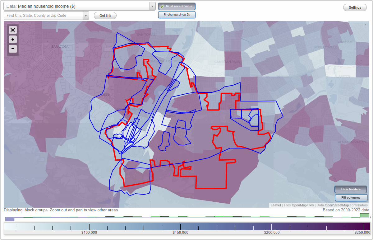
- City boundary
- Neighborhood boundaries
Business Search - 14 Million verified businesses
Neighborhoods:
Belgatos, Belwood, Belwood of Los Gatos, Blossom Hill Manor, Broadway, Central Business District, Downtown Los Gatos, East Los Gatos, Fairview Plaza, Glen Ridge, Highland Oaks, Monte Sereno, Rinconada, Saint Joseph's Hill, Shannon, Surmont, Surrey Farms, The Almond Grove, University, Vasona Junction, Vista Del Monte, West Los GatosBelgatos neighborhood in Los Gatos statistics: (Find on map)
Area: 0.145 square miles
Population: 791
Population density:
Median household income in 2021:
Median rent in in 2021:
Male vs Females
Median age
Housing prices:
Average estimated value of detached houses in 2021 (96.9% of all units):
Average estimated value of townhouses or other attached units in 2021 (5.2% of all units):
Most popular occupations of males: computer and mathematical occupations (20.3%); sales and office occupations (16.1%); management occupations (except farmers) (16.0%); architecture and engineering occupations (14.9%); education, training, and library occupations (7.9%); life, physical, and social science occupations (7.3%); service occupations (7.3%)
Most popular occupations of females: management occupations (except farmers) (16.1%); business and financial operations occupations (16.1%); service occupations (15.1%); healthcare practitioners and technical occupations (14.0%); education, training, and library occupations (12.3%); legal occupations (11.1%); architecture and engineering occupations (7.1%)
Roads and streets: Blossom Hill Rd; Belvue Dr; Belblossom Way (Belblossom Dr); Bacigalupi Dr; Westhill Dr; Belgatos Rd; Belwood Gateway; Belglen Way; Harwood Rd; Jamie Ct; Belglen Ln; Belwood Ln; Belwood Ct.
Belgatos neighborhood detailed profile
Area: 0.145 square miles
Population: 791
Population density:
| Belgatos: | 5,458 people per square mile |
| Los Gatos: | 3,109 people per square mile |
Median household income in 2021:
| Belgatos: | $172,364 |
| Los Gatos: | $166,642 |
Median rent in in 2021:
| Belgatos: | $2,825 |
| Los Gatos: | $2,001 |
Male vs Females
| Males: | 389 |
| Females: | 402 |
Median age
| Males: | 43.2 years |
| Females: | 40.5 years |
Housing prices:
Average estimated value of detached houses in 2021 (96.9% of all units):
| Belgatos: | $1,239,974 |
| Los Gatos: | $2,360,388 |
Average estimated value of townhouses or other attached units in 2021 (5.2% of all units):
| This neighborhood: | $1,255,797 |
| town: | $1,111,839 |
Most popular occupations of males: computer and mathematical occupations (20.3%); sales and office occupations (16.1%); management occupations (except farmers) (16.0%); architecture and engineering occupations (14.9%); education, training, and library occupations (7.9%); life, physical, and social science occupations (7.3%); service occupations (7.3%)
Most popular occupations of females: management occupations (except farmers) (16.1%); business and financial operations occupations (16.1%); service occupations (15.1%); healthcare practitioners and technical occupations (14.0%); education, training, and library occupations (12.3%); legal occupations (11.1%); architecture and engineering occupations (7.1%)
Roads and streets: Blossom Hill Rd; Belvue Dr; Belblossom Way (Belblossom Dr); Bacigalupi Dr; Westhill Dr; Belgatos Rd; Belwood Gateway; Belglen Way; Harwood Rd; Jamie Ct; Belglen Ln; Belwood Ln; Belwood Ct.
Belgatos neighborhood detailed profile
Belwood neighborhood in Los Gatos statistics: (Find on map)
Area: 0.133 square miles
Population: 703
Population density:
Median household income in 2021:
Median rent in in 2021:
Male vs Females
Median age
Housing prices:
Average estimated value of detached houses in 2021 (96.9% of all units):
Average estimated value of townhouses or other attached units in 2021 (5.5% of all units):
Most popular occupations of males: computer and mathematical occupations (20.2%); management occupations (except farmers) (16.2%); sales and office occupations (16.2%); architecture and engineering occupations (15.1%); education, training, and library occupations (7.9%); life, physical, and social science occupations (7.4%); service occupations (7.3%)
Most popular occupations of females: management occupations (except farmers) (16.5%); business and financial operations occupations (16.3%); service occupations (15.6%); healthcare practitioners and technical occupations (14.5%); education, training, and library occupations (12.6%); legal occupations (11.3%); architecture and engineering occupations (6.8%)
Roads and streets: Bacigalupi Dr; Harwood Rd; Belvue Dr; Belcrest Dr; Belhaven Dr; Belwood Gateway; Belridge Dr; Belvale Dr; Blossom Hill Rd; Jamie Ct; Belglen Ln; Belwood Ln; Belwood Ct.
Belwood neighborhood detailed profile
Area: 0.133 square miles
Population: 703
Population density:
| Belwood (Belwood Proper): | 5,304 people per square mile |
| Los Gatos: | 3,109 people per square mile |
Median household income in 2021:
| Belwood (Belwood Proper): | $177,826 |
| Los Gatos: | $166,642 |
Median rent in in 2021:
| Belwood (Belwood Proper): | $3,501 |
| Los Gatos: | $2,001 |
Male vs Females
| Males: | 345 |
| Females: | 357 |
Median age
| Males: | 46.1 years |
| Females: | 44.2 years |
Housing prices:
Average estimated value of detached houses in 2021 (96.9% of all units):
| Belwood (Belwood Proper): | $1,217,264 |
| Los Gatos: | $2,360,388 |
Average estimated value of townhouses or other attached units in 2021 (5.5% of all units):
| This neighborhood: | $1,255,797 |
| town: | $1,111,839 |
Most popular occupations of males: computer and mathematical occupations (20.2%); management occupations (except farmers) (16.2%); sales and office occupations (16.2%); architecture and engineering occupations (15.1%); education, training, and library occupations (7.9%); life, physical, and social science occupations (7.4%); service occupations (7.3%)
Most popular occupations of females: management occupations (except farmers) (16.5%); business and financial operations occupations (16.3%); service occupations (15.6%); healthcare practitioners and technical occupations (14.5%); education, training, and library occupations (12.6%); legal occupations (11.3%); architecture and engineering occupations (6.8%)
Roads and streets: Bacigalupi Dr; Harwood Rd; Belvue Dr; Belcrest Dr; Belhaven Dr; Belwood Gateway; Belridge Dr; Belvale Dr; Blossom Hill Rd; Jamie Ct; Belglen Ln; Belwood Ln; Belwood Ct.
Belwood neighborhood detailed profile
Belwood of Los Gatos neighborhood in Los Gatos statistics: (Find on map)
Area: 0.451 square miles
Population: 1,581
Population density:
Median household income in 2021:
Median rent in in 2021:
Male vs Females
Median age
Housing prices:
Average estimated value of detached houses in 2021 (96.8% of all units):
Average estimated value of townhouses or other attached units in 2021 (9.0% of all units):
Most popular occupations of males: computer and mathematical occupations (19.3%); management occupations (except farmers) (16.7%); sales and office occupations (16.6%); architecture and engineering occupations (15.0%); education, training, and library occupations (6.8%); service occupations (6.7%); life, physical, and social science occupations (6.2%)
Most popular occupations of females: management occupations (except farmers) (15.6%); business and financial operations occupations (15.4%); service occupations (15.2%); healthcare practitioners and technical occupations (13.8%); education, training, and library occupations (11.4%); legal occupations (9.6%); sales and office occupations (8.0%)
Roads and streets: Blossom Hill Rd; Belvue Dr; Westhill Dr; Harwood Rd; Bacigalupi Dr; Belblossom Way (Belblossom Dr); Belwood Gateway; Belcrest Dr; Surmont Dr; Belgatos Rd; Belhaven Dr; Belridge Dr; Belgatos Ln; Old Orchard Dr; Belvale Dr; Belglen Way; Jamie Ct; Surmont Ct; Belglen Ln; Belwood Ln; Belwood Ct; Campos Verde; Old Orchard Ct.
Belwood of Los Gatos neighborhood detailed profile
Area: 0.451 square miles
Population: 1,581
Population density:
| Belwood of Los Gatos (Belwood): | 3,506 people per square mile |
| Los Gatos: | 3,109 people per square mile |
Median household income in 2021:
| Belwood of Los Gatos (Belwood): | $178,803 |
| Los Gatos: | $166,642 |
Median rent in in 2021:
| Belwood of Los Gatos (Belwood): | $3,010 |
| Los Gatos: | $2,001 |
Male vs Females
| Males: | 783 |
| Females: | 798 |
Median age
| Males: | 44.4 years |
| Females: | 42.1 years |
Housing prices:
Average estimated value of detached houses in 2021 (96.8% of all units):
| Belwood of Los Gatos (Belwood): | $1,235,520 |
| Los Gatos: | $2,360,388 |
Average estimated value of townhouses or other attached units in 2021 (9.0% of all units):
| This neighborhood: | $2,664,249 |
| town: | $1,111,839 |
Most popular occupations of males: computer and mathematical occupations (19.3%); management occupations (except farmers) (16.7%); sales and office occupations (16.6%); architecture and engineering occupations (15.0%); education, training, and library occupations (6.8%); service occupations (6.7%); life, physical, and social science occupations (6.2%)
Most popular occupations of females: management occupations (except farmers) (15.6%); business and financial operations occupations (15.4%); service occupations (15.2%); healthcare practitioners and technical occupations (13.8%); education, training, and library occupations (11.4%); legal occupations (9.6%); sales and office occupations (8.0%)
Roads and streets: Blossom Hill Rd; Belvue Dr; Westhill Dr; Harwood Rd; Bacigalupi Dr; Belblossom Way (Belblossom Dr); Belwood Gateway; Belcrest Dr; Surmont Dr; Belgatos Rd; Belhaven Dr; Belridge Dr; Belgatos Ln; Old Orchard Dr; Belvale Dr; Belglen Way; Jamie Ct; Surmont Ct; Belglen Ln; Belwood Ln; Belwood Ct; Campos Verde; Old Orchard Ct.
Belwood of Los Gatos neighborhood detailed profile
Blossom Hill Manor neighborhood in Los Gatos statistics: (Find on map)
Area: 0.533 square miles
Population: 3,112
Population density:
Median household income in 2021:
Median rent in in 2021:
Male vs Females
Median age
Housing prices:
Average estimated value of detached houses in 2021 (83.1% of all units):
Average estimated value of townhouses or other attached units in 2021 (14.6% of all units):
Most popular occupations of males: management occupations (except farmers) (23.2%); computer and mathematical occupations (17.6%); sales and office occupations (17.6%); architecture and engineering occupations (14.4%); service occupations (9.5%); healthcare practitioners and technical occupations (4.0%); business and financial operations occupations (3.2%)
Most popular occupations of females: education, training, and library occupations (19.2%); sales and office occupations (16.4%); business and financial operations occupations (16.1%); management occupations (except farmers) (12.6%); architecture and engineering occupations (11.1%); service occupations (8.5%); healthcare practitioners and technical occupations (5.2%)
Roads and streets: Blossom Hill Rd; Los Gatos Almaden Rd; Camellia Ter; Cherrystone Dr; Oleander Ave; Escobar Ave; Linda Ave; Cam del Cerro; Cherry Blossom Ln; Longwood Dr; Los Gatos Blvd; Azalea Way; Loma Vista Ave; el Gato Ln; Jacaranda Way; Orange Blossom Ln; Lu Ray Dr; Farley Rd; Lilac Ln; Gardenia Way; Lilac Way; Roseleaf Ln; Lavender Ln; Jasmine Way; Appleblossom Ln; Verde Ct; Rochin Ter; Edmund Dr; Roseleaf Ct; Winterbrook Rd; Sierra Morena Ct; Peach Blossom Ln; Stephenie Ln; del Cerro Ct; Dahlia Way; Milmar Way; Maria Teresa Ct; Cherrystone Ct; Old Blossom Hill Rd; Rochin Ct.
Other features: Ross Crk.
Blossom Hill Manor neighborhood detailed profile
Area: 0.533 square miles
Population: 3,112
Population density:
| Blossom Hill Manor (Blossom Manor): | 5,838 people per square mile |
| Los Gatos: | 3,109 people per square mile |
Median household income in 2021:
| Blossom Hill Manor (Blossom Manor): | $183,107 |
| Los Gatos: | $166,642 |
Median rent in in 2021:
| Blossom Hill Manor (Blossom Manor): | $3,182 |
| Los Gatos: | $2,001 |
Male vs Females
| Males: | 1,549 |
| Females: | 1,562 |
Median age
| Males: | 43.7 years |
| Females: | 46.1 years |
Housing prices:
Average estimated value of detached houses in 2021 (83.1% of all units):
| Blossom Hill Manor (Blossom Manor): | $2,333,282 |
| Los Gatos: | $2,360,388 |
Average estimated value of townhouses or other attached units in 2021 (14.6% of all units):
| This neighborhood: | $844,615 |
| town: | $1,111,839 |
Most popular occupations of males: management occupations (except farmers) (23.2%); computer and mathematical occupations (17.6%); sales and office occupations (17.6%); architecture and engineering occupations (14.4%); service occupations (9.5%); healthcare practitioners and technical occupations (4.0%); business and financial operations occupations (3.2%)
Most popular occupations of females: education, training, and library occupations (19.2%); sales and office occupations (16.4%); business and financial operations occupations (16.1%); management occupations (except farmers) (12.6%); architecture and engineering occupations (11.1%); service occupations (8.5%); healthcare practitioners and technical occupations (5.2%)
Roads and streets: Blossom Hill Rd; Los Gatos Almaden Rd; Camellia Ter; Cherrystone Dr; Oleander Ave; Escobar Ave; Linda Ave; Cam del Cerro; Cherry Blossom Ln; Longwood Dr; Los Gatos Blvd; Azalea Way; Loma Vista Ave; el Gato Ln; Jacaranda Way; Orange Blossom Ln; Lu Ray Dr; Farley Rd; Lilac Ln; Gardenia Way; Lilac Way; Roseleaf Ln; Lavender Ln; Jasmine Way; Appleblossom Ln; Verde Ct; Rochin Ter; Edmund Dr; Roseleaf Ct; Winterbrook Rd; Sierra Morena Ct; Peach Blossom Ln; Stephenie Ln; del Cerro Ct; Dahlia Way; Milmar Way; Maria Teresa Ct; Cherrystone Ct; Old Blossom Hill Rd; Rochin Ct.
Other features: Ross Crk.
Blossom Hill Manor neighborhood detailed profile
Broadway neighborhood in Los Gatos statistics: (Find on map)
Area: 0.205 square miles
Limited-access highways (interstate or state) in this neighborhood: State Hwy 17.
Roads and streets: Wood Rd; Broadway; W Main St; S Santa Cruz Ave; Montebello Way; Park Ave; Clifton Ave; Bayview Ct.
Other features: Los Gatos Crk.
Broadway neighborhood detailed profile
Area: 0.205 square miles
Limited-access highways (interstate or state) in this neighborhood: State Hwy 17.
Roads and streets: Wood Rd; Broadway; W Main St; S Santa Cruz Ave; Montebello Way; Park Ave; Clifton Ave; Bayview Ct.
Other features: Los Gatos Crk.
Broadway neighborhood detailed profile
Central Business District neighborhood in Los Gatos statistics: (Find on map)
Area: 0.088 square miles
Population: 852
Population density:
Median household income in 2021:
Median rent in in 2021:
Male vs Females
Median age
Most popular occupations of males: management occupations (except farmers) (20.8%); architecture and engineering occupations (13.8%); business and financial operations occupations (9.6%); construction, extraction, and maintenance occupations (9.3%); sales and office occupations (7.2%); computer and mathematical occupations (6.6%); service occupations (6.4%)
Most popular occupations of females: sales and office occupations (27.8%); service occupations (17.9%); management occupations (except farmers) (14.6%); education, training, and library occupations (10.5%); business and financial operations occupations (8.8%); healthcare practitioners and technical occupations (5.8%); legal occupations (5.3%)
Highways in this neighborhood: Saratoga Los Gatos Rd (Los Gatos Saratoga Rd, State Hwy 9).
Roads and streets: N Santa Cruz Ave; University Ave; Victory Ln; Station Way; W Main St; Village Ln; Elm St; Boone Ln; Royce St; Andrews St; Bachman Ave; S Santa Cruz Ave; Lundy Ln; Montebello Way; Broadway; Grays Ln; Nicholson Ave; Bean Ave.
Other features: Los Gatos Crk.
Central Business District neighborhood detailed profile
Area: 0.088 square miles
Population: 852
Population density:
| Central Business District: | 9,712 people per square mile |
| Los Gatos: | 3,109 people per square mile |
Median household income in 2021:
| Central Business District: | $146,570 |
| Los Gatos: | $166,642 |
Median rent in in 2021:
| Central Business District: | $2,338 |
| Los Gatos: | $2,001 |
Male vs Females
| Males: | 452 |
| Females: | 400 |
Median age
| Males: | 41.7 years |
| Females: | 35.5 years |
Most popular occupations of males: management occupations (except farmers) (20.8%); architecture and engineering occupations (13.8%); business and financial operations occupations (9.6%); construction, extraction, and maintenance occupations (9.3%); sales and office occupations (7.2%); computer and mathematical occupations (6.6%); service occupations (6.4%)
Most popular occupations of females: sales and office occupations (27.8%); service occupations (17.9%); management occupations (except farmers) (14.6%); education, training, and library occupations (10.5%); business and financial operations occupations (8.8%); healthcare practitioners and technical occupations (5.8%); legal occupations (5.3%)
Highways in this neighborhood: Saratoga Los Gatos Rd (Los Gatos Saratoga Rd, State Hwy 9).
Roads and streets: N Santa Cruz Ave; University Ave; Victory Ln; Station Way; W Main St; Village Ln; Elm St; Boone Ln; Royce St; Andrews St; Bachman Ave; S Santa Cruz Ave; Lundy Ln; Montebello Way; Broadway; Grays Ln; Nicholson Ave; Bean Ave.
Other features: Los Gatos Crk.
Central Business District neighborhood detailed profile
Downtown Los Gatos neighborhood in Los Gatos statistics: (Find on map)
Area: 0.701 square miles
Population: 5,653
Population density:
Median household income in 2021:
Median rent in in 2021:
Male vs Females
Median age
Most popular occupations of males: management occupations (except farmers) (21.5%); architecture and engineering occupations (13.3%); business and financial operations occupations (9.5%); construction, extraction, and maintenance occupations (8.9%); sales and office occupations (8.1%); computer and mathematical occupations (6.8%); service occupations (6.1%)
Most popular occupations of females: sales and office occupations (28.5%); service occupations (16.7%); management occupations (except farmers) (15.1%); education, training, and library occupations (10.3%); business and financial operations occupations (9.0%); healthcare practitioners and technical occupations (5.9%); legal occupations (5.2%)
Limited-access highways (interstate or state) in this neighborhood: State Hwy 17.
Highways in this neighborhood: Saratoga Los Gatos Rd (State Hwy 9, Los Gatos Saratoga Rd).
Roads and streets: University Ave; N Santa Cruz Ave; E Main St; Roberts Rd; Blossom Hill Rd; Villa Ave; Miles Ave; Tait Ave; Victory Ln; Alberto Way; W Main St; Industrial Rd (Industrial Way); Saratoga Ave; Bella Vista Ave; Bachman Ave; Towne Ter; New York Ave; Woodland Ave; Park Ave; Pleasant St; Edelen Ave; Wilder Ave; Ohlone Ct; Oak Meadow Dr; Monterey Ave; Chester St; Andrews St; S Santa Cruz Ave; Church St; Wraight Ave; Riviera Dr; Nicholson Ave; Pageant Way; Bean Ave; Jackson St; Maggi Ct; Terrace Ct; Royce St; Mullen Ave; Grays Ln; Station Way; Cuesta de Los Gatos (Cuesta de Los Gatos Way); Village Ln; Hubbell Way; Elm St; Boone Ln; Brickway Ct; Brooklyn Ave; Forrest Ave (Forest Ave); Bird Ave; Lyndon Ave; High School Ct; Milbrae Ln; Los Gatos Blvd; Avery Ln; Fiesta Way; Bentley Ave; Rushmore Ln; Maple Pl; Dittos Ln; College Ave; Lundy Ln; Montebello Way; Broadway; Treseder Ct.
Other features: Los Gatos Crk.
Downtown Los Gatos neighborhood detailed profile
Area: 0.701 square miles
Population: 5,653
Population density:
| Downtown Los Gatos (Downtown): | 8,067 people per square mile |
| Los Gatos: | 3,109 people per square mile |
Median household income in 2021:
| Downtown Los Gatos (Downtown): | $192,303 |
| Los Gatos: | $166,642 |
Median rent in in 2021:
| Downtown Los Gatos (Downtown): | $2,312 |
| Los Gatos: | $2,001 |
Male vs Females
| Males: | 2,973 |
| Females: | 2,679 |
Median age
| Males: | 43.5 years |
| Females: | 40.2 years |
Most popular occupations of males: management occupations (except farmers) (21.5%); architecture and engineering occupations (13.3%); business and financial operations occupations (9.5%); construction, extraction, and maintenance occupations (8.9%); sales and office occupations (8.1%); computer and mathematical occupations (6.8%); service occupations (6.1%)
Most popular occupations of females: sales and office occupations (28.5%); service occupations (16.7%); management occupations (except farmers) (15.1%); education, training, and library occupations (10.3%); business and financial operations occupations (9.0%); healthcare practitioners and technical occupations (5.9%); legal occupations (5.2%)
Limited-access highways (interstate or state) in this neighborhood: State Hwy 17.
Highways in this neighborhood: Saratoga Los Gatos Rd (State Hwy 9, Los Gatos Saratoga Rd).
Roads and streets: University Ave; N Santa Cruz Ave; E Main St; Roberts Rd; Blossom Hill Rd; Villa Ave; Miles Ave; Tait Ave; Victory Ln; Alberto Way; W Main St; Industrial Rd (Industrial Way); Saratoga Ave; Bella Vista Ave; Bachman Ave; Towne Ter; New York Ave; Woodland Ave; Park Ave; Pleasant St; Edelen Ave; Wilder Ave; Ohlone Ct; Oak Meadow Dr; Monterey Ave; Chester St; Andrews St; S Santa Cruz Ave; Church St; Wraight Ave; Riviera Dr; Nicholson Ave; Pageant Way; Bean Ave; Jackson St; Maggi Ct; Terrace Ct; Royce St; Mullen Ave; Grays Ln; Station Way; Cuesta de Los Gatos (Cuesta de Los Gatos Way); Village Ln; Hubbell Way; Elm St; Boone Ln; Brickway Ct; Brooklyn Ave; Forrest Ave (Forest Ave); Bird Ave; Lyndon Ave; High School Ct; Milbrae Ln; Los Gatos Blvd; Avery Ln; Fiesta Way; Bentley Ave; Rushmore Ln; Maple Pl; Dittos Ln; College Ave; Lundy Ln; Montebello Way; Broadway; Treseder Ct.
Other features: Los Gatos Crk.
Downtown Los Gatos neighborhood detailed profile
East Los Gatos neighborhood in Los Gatos statistics: (Find on map)
Area: 8.561 square miles
Population: 30,589
Population density:
Median household income in 2021:
Median rent in in 2021:
Male vs Females
Median age
Housing prices:
Average estimated value of detached houses in 2021 (76.9% of all units):
Average estimated value of townhouses or other attached units in 2021 (18.1% of all units):
Most popular occupations of males: management occupations (except farmers) (22.8%); computer and mathematical occupations (14.9%); sales and office occupations (14.7%); architecture and engineering occupations (12.6%); service occupations (10.0%); business and financial operations occupations (5.5%); education, training, and library occupations (4.0%)
Most popular occupations of females: sales and office occupations (17.6%); business and financial operations occupations (15.6%); management occupations (except farmers) (14.3%); education, training, and library occupations (11.8%); service occupations (11.6%); healthcare practitioners and technical occupations (8.6%); architecture and engineering occupations (4.5%)
Limited-access highways (interstate or state) in this neighborhood: State Hwy 17; W Valley Fwy (State Hwy 85); State Hwy 17 (Santa Cruz Hwy).
Highways in this neighborhood: Teresita Way (Big Basin Way, State Hwy 9); State Hwy 9 (Big Basin Way); Los Gatos Saratoga Rd (Saratoga Los Gatos Rd, State Hwy 9); Ravinia Way.
Roads and streets: Blossom Hill Rd; Shannon Rd; Kennedy Rd; Los Gatos Blvd; Los Gatos Almaden Rd; Cypress Way; College Ave; Santa Rosa Dr; Carlton Ave; Camden Ave; Escobar Ave; Happy Acres Rd; Camellia Ter; Anne Way; Cam del Cerro; Harwood Rd; Forrester Rd; Blossom Valley Dr; Leigh Ave; Sky Ln; National Ave; Shannon Heights Rd (Shannon Hts); Belvue Dr; Marchmont Dr; Francis Oaks Way; Westhill Dr; Vista Loop; Vis del Monte; Cherry Blossom Ln; Jackson St; Farley Rd; Almond Blossom Ln; Cherrystone Dr; Union Ave; Westchester Dr; Clovis Ave; Oleander Ave; Madera Ct; Drysdale Dr; Suview Dr; Kimble Ave; Loma Alta Ave; Begonia Dr; Phillips Ave; Rudy Dr; Ave Cresta; Gum Tree Ln; Bacigalupi Dr; Johnson Ave; S Kennedy Rd; High St; Diduca Way; Highland Oaks Dr; Linda Ave; Hollywood Ave; Wooded View Dr; Canna Ln; E Main St; Foster Rd; Harding Ave; Hicks Rd; Larga Vista Dr; Belblossom Way (Belblossom Dr); Englewood Ave; Frank Ave; Longwood Dr; Hershner Dr; Lester Ln; Pinehurst Ave; Taft Dr; Longmeadow Dr; Quarry Rd; Bella Vista Ave; Kathy Ln; Hyacinth Ln; Nimrick Ln; Ave Lago; Mireval Rd; Nino Ave; Garden Hill Dr; Alerche Dr; Crescent Dr; Belwood Gateway; Saratoga Ave; Hicks Rd (Burke Rd); Villa Ave; Penn Way; Hilltop Dr; Kensington Way; Coronet Dr; Howes Dr; Azalea Way; Tourney Rd; Cleland Ave; Pso Carmelo; Placer Oaks Rd (Placer Oaks Ave); Hilow Rd; Greenridge Ter; Alpine Ave; Los Cerritos Dr; Camden Village Cir; Samaritan Dr; Cam del Sol; Blossom Crest Way; Laurinda Dr; Blossom Glen Way; Shady View Ln; Loma Vista Ave; Vis de Sierra; Alberto Way; Oak Hill Way; Cerro Vista Ct; Miles Ave; Belcrest Dr; Worcester Loop; Short Rd; Surmont Dr; Highland Ave; Topping Way; Belgatos Rd; Roberts Rd; Top of the Hill Rd; New York Ave; Stacia St; Longridge Rd; Garden Ln; el Gato Ln; Jacaranda Way; Kilkenny Rd; Burton Rd; Belhaven Dr; Chirco Dr; Orange Blossom Ln; Lu Ray Dr; Reservoir Rd; Cerro Vista Dr; Lilac Ln; Ann Arbor Dr; Old Blossom Hill Rd; Fillmer Ave; Gardenia Way; Lynn Ave; Euclid Ave; Shady Ln; Cowell Rd (Cypress Way); Whitney Ave; Magneson Loop; Belridge Dr; Gilda Way; Central Ave; el Nido Ave; Belgatos Ln; E la Chiquita Ave; Dishman Dr; Dover St; Emiline Dr; Lark Ave; Zinnia Ln; Lilac Way; Lilac Blossom Ln; Leroy Ave; Gregg Dr; S Santa Cruz Ave; Benedict Ln; Old Orchard Dr; Lost Oaks Dr; Kinghurst Dr (Kinghurst Way); Las Flores Ln; Blackwell Dr; Drakes Bay Ave; Prospect Ave; Cll de Prospero; Park Ave; Pleasant St; Roseleaf Ln; Mary Jo Way; Thomas Dr; Sandy Ln; Alta Tierra Ct; Sierra Azule; Blossom Dale Dr; del Oro Dr; Brooke Acres Dr; Forest Hill Dr; Fisher Ave; Ferris Ave; Twin Oaks Dr; Hillbrook Dr; Kennedy Ct; Meadowbrook Dr; Barbara Dr; W la Chiquita Ave; Izorah Way; Copeland Ln; Vis del Mar; Dittos Ln; Los Robles Way; Bonnie Ln; Belvale Dr; Kennedy Knolls Ln; Amby Dr; de Soto Dr; Lavender Ln; Harlow Way; Jo Dr; Heather Dr; Brooke Acres Ct; Mary Alice Dr; Carlester Dr; Charles St; Caldwell Ave; Adelaide Way; Clarinda Way; Orchard View Dr; Serra Ct; Pinta Ct; Bobbywood Ave; Hosta Ln; Cerro Chico; Milmar Way; Jones Rd; Kentfield Dr; Oak Grove Ave; Church St; Warwick Rd; Preston Dr; de Flores Ln; Lansberry Ct; Keene Dr; Pine Ave; Belglen Way; Fawndale Rd (Fawndale Dr); Robie Ln; Corinne Dr; Wheeler Ave; Baron Dr; Danville Dr; Tourney Loop; Clover Way; Jasmine Way; Appleblossom Ln; Blossom Wood Dr; Pageant Way; Kingbrook Dr; Bennett Way; Downing Oak Ct; Loma St; Hollycrest Dr; Mitchell Ave; Laura Dr; Noddin Ave; Littlefield Ln; Cardinal Ln; University Ave; Sharon Ln; Spreckels Ave; Jared Ln; Blossom Acres Dr; Cll de Amor; Kunkel Dr; Harwood Ct; Sund Ave; Wollin Way; Peony Ln; Cambrian View Way; Morning Glory Ln; Maggi Ct; Lobelia Ln; Myra Dr; Highland Ter; Kevin Dr; Hydrangea Ln (Hydrangia Ln); Oak Rim Way; Albert Dr; Vis del Campo; Kay Dr; Quail Hill Rd; Blossom Terrace Ct; Blossom Vista Ave; Verde Ct; Blossom Tree Ln; Pso Roble; Fern Dr; Milligan Dr; Rosswood Dr; Lauren Dr; Grove St; Gable Ln; Muir Dr; Herbert Dr; Adalina Ct; Riding Ct; Mary Way; Rogers Rd (Rogers St); Worcester Ln; Arroyo del Rancho; Terrace Ct; Briarwood Way; Cll de Rico; Spring St; Rochin Ter; Flintridge Dr; Ixias Ct; Greendale Dr; W Main St; Amanda Ln; Maricopa Dr; Oak Park Dr; Kingridge Dr; Central Ct; Blossom Park Ln; Cll de Felice; Fairmead Ln; Mullen Ave; Panorama Way; Flower Garden Ln; Olde Dr; Mill Rise Way; Via Santa Maria; Spencer Ave; Stonybrook Rd; Brooke Ave; Colorado Ct; Camden Oaks Ct; Edmund Dr; Cuesta de Los Gatos (Cuesta de Los Gatos Way); Terreno de Flores Ln; Thureson Way; Calfhill Ct; Blossom Villa Way; Angel Ct; Top of the Hill Ct; Sharon Ct; Blueberry Hill Dr; Robin Way; Potomac Dr; Malpas Dr; Magneson Ter; Nino Way; Jamie Ct; Roseleaf Ct; Brooklyn Ave; Vis del Prado; Ross Creek Ct; Craig Way; Orchard St; Gem Ave; Forrester Rd (Forrester Ct); del Carlo Ct; Gemini Dr; Winterbrook Rd; Oak Rim Ct; Surmont Ct; Copeland Pl; Tesoro Ct; Panighetti Pl; Albert Ct; Campanula Pl; W Central Ave; Ramel Way; Ixias Ln; George St; Andre Ct; Hilow Ct; Edelen Ave; Guadalupe Mines Rd; Sunray Dr; Lasuen Ct; Sierra Morena Ct; Escobar Ct; Potter Ct; Atwood Ct; High School Ct; Read Head Ln; Nina Ct; del Oro Ct; Yosemite Way; Kingfield Way; Cross Way; Twelve Oaks Rd; Milbrae Ln; Gregg Ct; Peach Blossom Ln; Magnolia Blossom Ln; Arbor Dell Way; Corcel Ct; Piedmont Ct; Gateway Dr; Nerissa Way; Ave Privado; Leila Ct; Loma Vista Ct; Frank Ct; Stephenie Ln; Clematis Dr; Fiesta Way; Johnson Hollow; Los Aluras Rd (Los Gatos Almaden Rd); Maple Pl; Copeland Ct; del Cerro Ct; Augustine Ave; Bella Vista Ct; Gemini Ct; del Oro Pl; Crider Ct; Glenrock Ct; Camden Village Way; Simons Way; Oxbow Ct; Bond Ct; Adrian Pl; Drakes Ct; Sebastian Ct; Peacock Ln; Ishimatsu Pl; Leewood Ct; Riviera Dr; Lundy Ln; Vista Real Ct; Howes Ct; Belglen Ln; S Bascom Ave; Belwood Ln; Montebello Way; Hershner Ct; Eastridge Dr; Samaritan Ct; Heather Ct; Anne Ct; Dahlia Way; Ambassador Ct; Grey Ct; Sycamore Ct; Oakdale Dr; Kozo Pl; Belwood Ct; Cll de Suerte; Auzerais Ct; College Ter; Oakwood Way; Rosalie Ct; Aurora Ln; Leotar Ct; Alta Heights Ct; Camden Village Ct; Ann Arbor Ct; Treseder Ct; Stevens; Kozo Ct; Maria Teresa Ct; Almond Blossom Ct; National Way; Noble Ct; Drysdale Ct; Campos Verde; la Croix Ct; Vista del Monte Ct; Old Orchard Ct; Carlton Ct; Dover Ct; Carlton Way; Cherrystone Ct; Chirco Ct; Catrina Ct; Karen Ct; Marchmont Ct; Rochin Ct; Prospect Ct; Rudy Ct; Hershner Way; Deerland Ct; Highland Oaks Way; Mary Jo Ct; Marla Ct.
Other features: Ross Crk; Los Gatos Crk; Guadalupe Crk.
East Los Gatos neighborhood detailed profile
Area: 8.561 square miles
Population: 30,589
Population density:
| East Los Gatos (East): | 3,573 people per square mile |
| Los Gatos: | 3,109 people per square mile |
Median household income in 2021:
| East Los Gatos (East): | $184,207 |
| Los Gatos: | $166,642 |
Median rent in in 2021:
| East Los Gatos (East): | $2,837 |
| Los Gatos: | $2,001 |
Male vs Females
| Males: | 15,452 |
| Females: | 15,136 |
Median age
| Males: | 43.0 years |
| Females: | 42.4 years |
Housing prices:
Average estimated value of detached houses in 2021 (76.9% of all units):
| East Los Gatos (East): | $1,941,745 |
| Los Gatos: | $2,360,388 |
Average estimated value of townhouses or other attached units in 2021 (18.1% of all units):
| This neighborhood: | $842,534 |
| town: | $1,111,839 |
Most popular occupations of males: management occupations (except farmers) (22.8%); computer and mathematical occupations (14.9%); sales and office occupations (14.7%); architecture and engineering occupations (12.6%); service occupations (10.0%); business and financial operations occupations (5.5%); education, training, and library occupations (4.0%)
Most popular occupations of females: sales and office occupations (17.6%); business and financial operations occupations (15.6%); management occupations (except farmers) (14.3%); education, training, and library occupations (11.8%); service occupations (11.6%); healthcare practitioners and technical occupations (8.6%); architecture and engineering occupations (4.5%)
Limited-access highways (interstate or state) in this neighborhood: State Hwy 17; W Valley Fwy (State Hwy 85); State Hwy 17 (Santa Cruz Hwy).
Highways in this neighborhood: Teresita Way (Big Basin Way, State Hwy 9); State Hwy 9 (Big Basin Way); Los Gatos Saratoga Rd (Saratoga Los Gatos Rd, State Hwy 9); Ravinia Way.
Roads and streets: Blossom Hill Rd; Shannon Rd; Kennedy Rd; Los Gatos Blvd; Los Gatos Almaden Rd; Cypress Way; College Ave; Santa Rosa Dr; Carlton Ave; Camden Ave; Escobar Ave; Happy Acres Rd; Camellia Ter; Anne Way; Cam del Cerro; Harwood Rd; Forrester Rd; Blossom Valley Dr; Leigh Ave; Sky Ln; National Ave; Shannon Heights Rd (Shannon Hts); Belvue Dr; Marchmont Dr; Francis Oaks Way; Westhill Dr; Vista Loop; Vis del Monte; Cherry Blossom Ln; Jackson St; Farley Rd; Almond Blossom Ln; Cherrystone Dr; Union Ave; Westchester Dr; Clovis Ave; Oleander Ave; Madera Ct; Drysdale Dr; Suview Dr; Kimble Ave; Loma Alta Ave; Begonia Dr; Phillips Ave; Rudy Dr; Ave Cresta; Gum Tree Ln; Bacigalupi Dr; Johnson Ave; S Kennedy Rd; High St; Diduca Way; Highland Oaks Dr; Linda Ave; Hollywood Ave; Wooded View Dr; Canna Ln; E Main St; Foster Rd; Harding Ave; Hicks Rd; Larga Vista Dr; Belblossom Way (Belblossom Dr); Englewood Ave; Frank Ave; Longwood Dr; Hershner Dr; Lester Ln; Pinehurst Ave; Taft Dr; Longmeadow Dr; Quarry Rd; Bella Vista Ave; Kathy Ln; Hyacinth Ln; Nimrick Ln; Ave Lago; Mireval Rd; Nino Ave; Garden Hill Dr; Alerche Dr; Crescent Dr; Belwood Gateway; Saratoga Ave; Hicks Rd (Burke Rd); Villa Ave; Penn Way; Hilltop Dr; Kensington Way; Coronet Dr; Howes Dr; Azalea Way; Tourney Rd; Cleland Ave; Pso Carmelo; Placer Oaks Rd (Placer Oaks Ave); Hilow Rd; Greenridge Ter; Alpine Ave; Los Cerritos Dr; Camden Village Cir; Samaritan Dr; Cam del Sol; Blossom Crest Way; Laurinda Dr; Blossom Glen Way; Shady View Ln; Loma Vista Ave; Vis de Sierra; Alberto Way; Oak Hill Way; Cerro Vista Ct; Miles Ave; Belcrest Dr; Worcester Loop; Short Rd; Surmont Dr; Highland Ave; Topping Way; Belgatos Rd; Roberts Rd; Top of the Hill Rd; New York Ave; Stacia St; Longridge Rd; Garden Ln; el Gato Ln; Jacaranda Way; Kilkenny Rd; Burton Rd; Belhaven Dr; Chirco Dr; Orange Blossom Ln; Lu Ray Dr; Reservoir Rd; Cerro Vista Dr; Lilac Ln; Ann Arbor Dr; Old Blossom Hill Rd; Fillmer Ave; Gardenia Way; Lynn Ave; Euclid Ave; Shady Ln; Cowell Rd (Cypress Way); Whitney Ave; Magneson Loop; Belridge Dr; Gilda Way; Central Ave; el Nido Ave; Belgatos Ln; E la Chiquita Ave; Dishman Dr; Dover St; Emiline Dr; Lark Ave; Zinnia Ln; Lilac Way; Lilac Blossom Ln; Leroy Ave; Gregg Dr; S Santa Cruz Ave; Benedict Ln; Old Orchard Dr; Lost Oaks Dr; Kinghurst Dr (Kinghurst Way); Las Flores Ln; Blackwell Dr; Drakes Bay Ave; Prospect Ave; Cll de Prospero; Park Ave; Pleasant St; Roseleaf Ln; Mary Jo Way; Thomas Dr; Sandy Ln; Alta Tierra Ct; Sierra Azule; Blossom Dale Dr; del Oro Dr; Brooke Acres Dr; Forest Hill Dr; Fisher Ave; Ferris Ave; Twin Oaks Dr; Hillbrook Dr; Kennedy Ct; Meadowbrook Dr; Barbara Dr; W la Chiquita Ave; Izorah Way; Copeland Ln; Vis del Mar; Dittos Ln; Los Robles Way; Bonnie Ln; Belvale Dr; Kennedy Knolls Ln; Amby Dr; de Soto Dr; Lavender Ln; Harlow Way; Jo Dr; Heather Dr; Brooke Acres Ct; Mary Alice Dr; Carlester Dr; Charles St; Caldwell Ave; Adelaide Way; Clarinda Way; Orchard View Dr; Serra Ct; Pinta Ct; Bobbywood Ave; Hosta Ln; Cerro Chico; Milmar Way; Jones Rd; Kentfield Dr; Oak Grove Ave; Church St; Warwick Rd; Preston Dr; de Flores Ln; Lansberry Ct; Keene Dr; Pine Ave; Belglen Way; Fawndale Rd (Fawndale Dr); Robie Ln; Corinne Dr; Wheeler Ave; Baron Dr; Danville Dr; Tourney Loop; Clover Way; Jasmine Way; Appleblossom Ln; Blossom Wood Dr; Pageant Way; Kingbrook Dr; Bennett Way; Downing Oak Ct; Loma St; Hollycrest Dr; Mitchell Ave; Laura Dr; Noddin Ave; Littlefield Ln; Cardinal Ln; University Ave; Sharon Ln; Spreckels Ave; Jared Ln; Blossom Acres Dr; Cll de Amor; Kunkel Dr; Harwood Ct; Sund Ave; Wollin Way; Peony Ln; Cambrian View Way; Morning Glory Ln; Maggi Ct; Lobelia Ln; Myra Dr; Highland Ter; Kevin Dr; Hydrangea Ln (Hydrangia Ln); Oak Rim Way; Albert Dr; Vis del Campo; Kay Dr; Quail Hill Rd; Blossom Terrace Ct; Blossom Vista Ave; Verde Ct; Blossom Tree Ln; Pso Roble; Fern Dr; Milligan Dr; Rosswood Dr; Lauren Dr; Grove St; Gable Ln; Muir Dr; Herbert Dr; Adalina Ct; Riding Ct; Mary Way; Rogers Rd (Rogers St); Worcester Ln; Arroyo del Rancho; Terrace Ct; Briarwood Way; Cll de Rico; Spring St; Rochin Ter; Flintridge Dr; Ixias Ct; Greendale Dr; W Main St; Amanda Ln; Maricopa Dr; Oak Park Dr; Kingridge Dr; Central Ct; Blossom Park Ln; Cll de Felice; Fairmead Ln; Mullen Ave; Panorama Way; Flower Garden Ln; Olde Dr; Mill Rise Way; Via Santa Maria; Spencer Ave; Stonybrook Rd; Brooke Ave; Colorado Ct; Camden Oaks Ct; Edmund Dr; Cuesta de Los Gatos (Cuesta de Los Gatos Way); Terreno de Flores Ln; Thureson Way; Calfhill Ct; Blossom Villa Way; Angel Ct; Top of the Hill Ct; Sharon Ct; Blueberry Hill Dr; Robin Way; Potomac Dr; Malpas Dr; Magneson Ter; Nino Way; Jamie Ct; Roseleaf Ct; Brooklyn Ave; Vis del Prado; Ross Creek Ct; Craig Way; Orchard St; Gem Ave; Forrester Rd (Forrester Ct); del Carlo Ct; Gemini Dr; Winterbrook Rd; Oak Rim Ct; Surmont Ct; Copeland Pl; Tesoro Ct; Panighetti Pl; Albert Ct; Campanula Pl; W Central Ave; Ramel Way; Ixias Ln; George St; Andre Ct; Hilow Ct; Edelen Ave; Guadalupe Mines Rd; Sunray Dr; Lasuen Ct; Sierra Morena Ct; Escobar Ct; Potter Ct; Atwood Ct; High School Ct; Read Head Ln; Nina Ct; del Oro Ct; Yosemite Way; Kingfield Way; Cross Way; Twelve Oaks Rd; Milbrae Ln; Gregg Ct; Peach Blossom Ln; Magnolia Blossom Ln; Arbor Dell Way; Corcel Ct; Piedmont Ct; Gateway Dr; Nerissa Way; Ave Privado; Leila Ct; Loma Vista Ct; Frank Ct; Stephenie Ln; Clematis Dr; Fiesta Way; Johnson Hollow; Los Aluras Rd (Los Gatos Almaden Rd); Maple Pl; Copeland Ct; del Cerro Ct; Augustine Ave; Bella Vista Ct; Gemini Ct; del Oro Pl; Crider Ct; Glenrock Ct; Camden Village Way; Simons Way; Oxbow Ct; Bond Ct; Adrian Pl; Drakes Ct; Sebastian Ct; Peacock Ln; Ishimatsu Pl; Leewood Ct; Riviera Dr; Lundy Ln; Vista Real Ct; Howes Ct; Belglen Ln; S Bascom Ave; Belwood Ln; Montebello Way; Hershner Ct; Eastridge Dr; Samaritan Ct; Heather Ct; Anne Ct; Dahlia Way; Ambassador Ct; Grey Ct; Sycamore Ct; Oakdale Dr; Kozo Pl; Belwood Ct; Cll de Suerte; Auzerais Ct; College Ter; Oakwood Way; Rosalie Ct; Aurora Ln; Leotar Ct; Alta Heights Ct; Camden Village Ct; Ann Arbor Ct; Treseder Ct; Stevens; Kozo Ct; Maria Teresa Ct; Almond Blossom Ct; National Way; Noble Ct; Drysdale Ct; Campos Verde; la Croix Ct; Vista del Monte Ct; Old Orchard Ct; Carlton Ct; Dover Ct; Carlton Way; Cherrystone Ct; Chirco Ct; Catrina Ct; Karen Ct; Marchmont Ct; Rochin Ct; Prospect Ct; Rudy Ct; Hershner Way; Deerland Ct; Highland Oaks Way; Mary Jo Ct; Marla Ct.
Other features: Ross Crk; Los Gatos Crk; Guadalupe Crk.
East Los Gatos neighborhood detailed profile
Fairview Plaza neighborhood in Los Gatos statistics: (Find on map)
Area: 0.034 square miles
Roads and streets: Fairview Plz; Fairview Ave; Pennsylvania Ave.
Fairview Plaza neighborhood detailed profile
Area: 0.034 square miles
Roads and streets: Fairview Plz; Fairview Ave; Pennsylvania Ave.
Fairview Plaza neighborhood detailed profile
Glen Ridge neighborhood in Los Gatos statistics: (Find on map)
Area: 0.222 square miles
Roads and streets: Ellenwood Ave; Pennsylvania Ave; Hernandez Ave; Glen Ridge Ave; Manzanita Ave; Apricot Ln; Overlook Rd; Laurel Ave; Bachman Ave; Alexander Ave; Wissahickon Ave; Madrone Ave; Wadsworth Ave; Fairview Ave; Chestnut Ave; Belmont Ave; Walnut Ave; Peralta Ave; Palm Ave; Belmont Ct; Alexander Ct (W Ellenwood Ave); Nicholson Ave; Bachman Ct.
Glen Ridge neighborhood detailed profile
Highland Oaks neighborhood in Los Gatos statistics: (Find on map)
Area: 0.059 square miles
Population: 339
Population density:
Median household income in 2021:
Median rent in in 2021:
Male vs Females
Median age
Housing prices:
Average estimated value of detached houses in 2021 (52.0% of all units):
Average estimated value of townhouses or other attached units in 2021 (10.4% of all units):
Most popular occupations of males: computer and mathematical occupations (35.7%); management occupations (except farmers) (20.8%); sales and office occupations (8.6%); arts, design, entertainment, sports, and media occupations (7.3%); architecture and engineering occupations (5.7%); business and financial operations occupations (4.4%); service occupations (3.4%)
Most popular occupations of females: business and financial operations occupations (21.1%); education, training, and library occupations (20.2%); management occupations (except farmers) (18.6%); sales and office occupations (13.0%); computer and mathematical occupations (7.8%); life, physical, and social science occupations (6.2%); service occupations (4.6%)
Limited-access highways (interstate or state) in this neighborhood: State Hwy 17.
Roads and streets: Highland Oaks Dr; Garden Ln; Lark Ave; Los Gatos Blvd; Oak Park Dr; Oakdale Dr; Oakwood Way; Oakmont Way.
Highland Oaks neighborhood detailed profile
Area: 0.059 square miles
Population: 339
Population density:
| Highland Oaks: | 5,742 people per square mile |
| Los Gatos: | 3,109 people per square mile |
Median household income in 2021:
| Highland Oaks: | $161,648 |
| Los Gatos: | $166,642 |
Median rent in in 2021:
| Highland Oaks: | $2,571 |
| Los Gatos: | $2,001 |
Male vs Females
| Males: | 157 |
| Females: | 182 |
Median age
| Males: | 43.0 years |
| Females: | 44.2 years |
Housing prices:
Average estimated value of detached houses in 2021 (52.0% of all units):
| Highland Oaks: | $1,287,525 |
| Los Gatos: | $2,360,388 |
Average estimated value of townhouses or other attached units in 2021 (10.4% of all units):
| This neighborhood: | $710,276 |
| town: | $1,111,839 |
Most popular occupations of males: computer and mathematical occupations (35.7%); management occupations (except farmers) (20.8%); sales and office occupations (8.6%); arts, design, entertainment, sports, and media occupations (7.3%); architecture and engineering occupations (5.7%); business and financial operations occupations (4.4%); service occupations (3.4%)
Most popular occupations of females: business and financial operations occupations (21.1%); education, training, and library occupations (20.2%); management occupations (except farmers) (18.6%); sales and office occupations (13.0%); computer and mathematical occupations (7.8%); life, physical, and social science occupations (6.2%); service occupations (4.6%)
Limited-access highways (interstate or state) in this neighborhood: State Hwy 17.
Roads and streets: Highland Oaks Dr; Garden Ln; Lark Ave; Los Gatos Blvd; Oak Park Dr; Oakdale Dr; Oakwood Way; Oakmont Way.
Highland Oaks neighborhood detailed profile
Monte Sereno neighborhood in Los Gatos statistics: (Find on map)
Area: 1.853 square miles
Population: 4,036
Population density:
Median household income in 2021:
Median rent in in 2021:
Male vs Females
Median age
Average estimated value of detached houses in 2021 (94.3% of all units):
Most popular occupations of males: management occupations (except farmers) (33.3%); architecture and engineering occupations (11.2%); business and financial operations occupations (10.8%); arts, design, entertainment, sports, and media occupations (8.9%); sales and office occupations (6.5%); computer and mathematical occupations (6.3%); healthcare practitioners and technical occupations (4.9%)
Most popular occupations of females: sales and office occupations (20.6%); management occupations (except farmers) (18.8%); business and financial operations occupations (16.7%); education, training, and library occupations (10.1%); healthcare practitioners and technical occupations (9.8%); legal occupations (6.0%); life, physical, and social science occupations (3.9%)
Highways in this neighborhood: State Hwy 9 (Saratoga Los Gatos Rd, Los Gatos Saratoga Rd).
Roads and streets: Daves Ave; Greenwood Ln; Quito Rd; Withey Rd; Winchester Blvd; Vineland Ave; Ridgecrest Ave; Bicknell Rd; Twin Creeks Rd; Blythswood Dr; Greenwood Ave; Greenwood Rd; Via Palomino; Toyon Dr; Austin Way; Grandview Ave (Grandview Dr); Oak Dr; Hillview Dr; Karl Ave; Kavin Ln; Matilija Dr; Constitution Ave; Viewfield Rd; Blanchard Dr; Eucalyptus Dr; Decatur Dr (Decatur Rd); Elm Park; Bancroft Ave; Hillvale Ave; Via Lomita; Becky Ln; Laurel Dr; Serramonte Dr; Palos Verdes Dr; Robin Ann Ln; Farragut Ln; Chadbourne Ln; Lexington Dr; Via Pinto; Farvue Ln (Far-Vue Ln, Withey Heights Rd); Oak Knoll Dr; Oakhurst Dr; Eaton Ln; Via Caballero; Beck Ave; Drummond Dr; Via del Sur; Alma Jo Ct; Via Bonita; Vasona Ter; Via Encantada; Oak Knoll Ct; Poppy Ln; Top of the Hill; Denevi Ln; Robles del Oro; One Oak Ln; Grosvenor Ct; Lexington Ct; Avon Ln; Ojai Dr; Via Sereno; Stratford Ct; Nagpal Ct; Elaine Ct; Sereno Ct; Valley Oak Dr; Dorado Ln; Romita Ct; Hernandez Ln; Withey Heights Rd; Deodar Ln; Banyan Ln; Millrich Dr; Brigham Rd (Greenwood Ln); Parkside Ct; Equestrian Way; Via Vaquero; Seramonte Dr; Kirkorian Way; Carril Ct; Seebree Ln; Vineland Ct; Scott Dr; Danielle Pl; Gregory Pl; Creekside Ct; Withey Rd (Lucky Rd); Tamson Ct; Serena Vista Ct; Michael Ln; Oak Glenn Dr; Elm Ct (Elm Park Ct); Janor Ct; Fairway Cir.
Other features: San Tomas Aquino Crk; Smith Crk.
Monte Sereno neighborhood detailed profile
Area: 1.853 square miles
Population: 4,036
Population density:
| Monte Sereno: | 2,178 people per square mile |
| Los Gatos: | 3,109 people per square mile |
Median household income in 2021:
| Monte Sereno: | $208,909 |
| Los Gatos: | $166,642 |
Median rent in in 2021:
| Monte Sereno: | $3,323 |
| Los Gatos: | $2,001 |
Male vs Females
| Males: | 1,958 |
| Females: | 2,077 |
Median age
| Males: | 49.1 years |
| Females: | 49.0 years |
Average estimated value of detached houses in 2021 (94.3% of all units):
| Monte Sereno: | $2,720,725 |
| Los Gatos: | $2,360,388 |
Most popular occupations of males: management occupations (except farmers) (33.3%); architecture and engineering occupations (11.2%); business and financial operations occupations (10.8%); arts, design, entertainment, sports, and media occupations (8.9%); sales and office occupations (6.5%); computer and mathematical occupations (6.3%); healthcare practitioners and technical occupations (4.9%)
Most popular occupations of females: sales and office occupations (20.6%); management occupations (except farmers) (18.8%); business and financial operations occupations (16.7%); education, training, and library occupations (10.1%); healthcare practitioners and technical occupations (9.8%); legal occupations (6.0%); life, physical, and social science occupations (3.9%)
Highways in this neighborhood: State Hwy 9 (Saratoga Los Gatos Rd, Los Gatos Saratoga Rd).
Roads and streets: Daves Ave; Greenwood Ln; Quito Rd; Withey Rd; Winchester Blvd; Vineland Ave; Ridgecrest Ave; Bicknell Rd; Twin Creeks Rd; Blythswood Dr; Greenwood Ave; Greenwood Rd; Via Palomino; Toyon Dr; Austin Way; Grandview Ave (Grandview Dr); Oak Dr; Hillview Dr; Karl Ave; Kavin Ln; Matilija Dr; Constitution Ave; Viewfield Rd; Blanchard Dr; Eucalyptus Dr; Decatur Dr (Decatur Rd); Elm Park; Bancroft Ave; Hillvale Ave; Via Lomita; Becky Ln; Laurel Dr; Serramonte Dr; Palos Verdes Dr; Robin Ann Ln; Farragut Ln; Chadbourne Ln; Lexington Dr; Via Pinto; Farvue Ln (Far-Vue Ln, Withey Heights Rd); Oak Knoll Dr; Oakhurst Dr; Eaton Ln; Via Caballero; Beck Ave; Drummond Dr; Via del Sur; Alma Jo Ct; Via Bonita; Vasona Ter; Via Encantada; Oak Knoll Ct; Poppy Ln; Top of the Hill; Denevi Ln; Robles del Oro; One Oak Ln; Grosvenor Ct; Lexington Ct; Avon Ln; Ojai Dr; Via Sereno; Stratford Ct; Nagpal Ct; Elaine Ct; Sereno Ct; Valley Oak Dr; Dorado Ln; Romita Ct; Hernandez Ln; Withey Heights Rd; Deodar Ln; Banyan Ln; Millrich Dr; Brigham Rd (Greenwood Ln); Parkside Ct; Equestrian Way; Via Vaquero; Seramonte Dr; Kirkorian Way; Carril Ct; Seebree Ln; Vineland Ct; Scott Dr; Danielle Pl; Gregory Pl; Creekside Ct; Withey Rd (Lucky Rd); Tamson Ct; Serena Vista Ct; Michael Ln; Oak Glenn Dr; Elm Ct (Elm Park Ct); Janor Ct; Fairway Cir.
Other features: San Tomas Aquino Crk; Smith Crk.
Monte Sereno neighborhood detailed profile
Rinconada neighborhood in Los Gatos statistics: (Find on map)
Area: 0.651 square miles
Population: 2,746
Population density:
Median household income in 2021:
Median rent in in 2021:
Male vs Females
Median age
Average estimated value of detached houses in 2021 (55.2% of all units):
Most popular occupations of males: management occupations (except farmers) (22.9%); sales and office occupations (19.6%); computer and mathematical occupations (16.2%); business and financial operations occupations (10.8%); architecture and engineering occupations (8.9%); life, physical, and social science occupations (5.1%); service occupations (2.7%)
Most popular occupations of females: sales and office occupations (18.7%); management occupations (except farmers) (18.4%); healthcare practitioners and technical occupations (15.6%); business and financial operations occupations (9.0%); computer and mathematical occupations (8.4%); education, training, and library occupations (7.8%); transportation occupations (6.6%)
Limited-access highways (interstate or state) in this neighborhood: W Valley Fwy (State Hwy 85).
Roads and streets: Casitas Blvd (Casitas Bulevar); Pollard Rd; More Ave; Wedgewood Ave; Granada Way; Cll Marguerita; Altura Vis; Elwood Dr; Newville Dr; Hyde Dr; Prince St; Cll Larga; Mattson Ave; Roxbury Ln; la Corona Dr; Vis del Lago; Quito Rd; Bearden Dr; Los Patios; el Olivar; Casa Grande; Lora Dr; Puesta del Sol; Roundtree Dr; Cll el Padre; Ave del Sol; Capistrano Pl; Los Alturas; Sierra Linda; Cll Estoria; Las Uvas Ct; Via Lago; el Altillo; el Porton; el Pinar; Las Piedras Ct; Las Encinas Ct; Cll Lolita; Cll Nivel; Cll Corta; Pollard Ct; Las Joyas Ct; Callecita; Los Encantos Ct; la Corona Ct; Naramore Ln; Rio Vis; Hyde Ct; Plazoleta.
Railroad features: Union Pacific RR.
Other features: San Tomas Aquino Crk; Smith Crk.
Rinconada neighborhood detailed profile
Area: 0.651 square miles
Population: 2,746
Population density:
| Rinconada (Rinconada): | 4,220 people per square mile |
| Los Gatos: | 3,109 people per square mile |
Median household income in 2021:
| Rinconada (Rinconada): | $190,694 |
| Los Gatos: | $166,642 |
Median rent in in 2021:
| Rinconada (Rinconada): | $3,396 |
| Los Gatos: | $2,001 |
Male vs Females
| Males: | 1,468 |
| Females: | 1,278 |
Median age
| Males: | 46.7 years |
| Females: | 45.2 years |
Average estimated value of detached houses in 2021 (55.2% of all units):
| Rinconada (Rinconada): | $1,890,989 |
| Los Gatos: | $2,360,388 |
Most popular occupations of males: management occupations (except farmers) (22.9%); sales and office occupations (19.6%); computer and mathematical occupations (16.2%); business and financial operations occupations (10.8%); architecture and engineering occupations (8.9%); life, physical, and social science occupations (5.1%); service occupations (2.7%)
Most popular occupations of females: sales and office occupations (18.7%); management occupations (except farmers) (18.4%); healthcare practitioners and technical occupations (15.6%); business and financial operations occupations (9.0%); computer and mathematical occupations (8.4%); education, training, and library occupations (7.8%); transportation occupations (6.6%)
Limited-access highways (interstate or state) in this neighborhood: W Valley Fwy (State Hwy 85).
Roads and streets: Casitas Blvd (Casitas Bulevar); Pollard Rd; More Ave; Wedgewood Ave; Granada Way; Cll Marguerita; Altura Vis; Elwood Dr; Newville Dr; Hyde Dr; Prince St; Cll Larga; Mattson Ave; Roxbury Ln; la Corona Dr; Vis del Lago; Quito Rd; Bearden Dr; Los Patios; el Olivar; Casa Grande; Lora Dr; Puesta del Sol; Roundtree Dr; Cll el Padre; Ave del Sol; Capistrano Pl; Los Alturas; Sierra Linda; Cll Estoria; Las Uvas Ct; Via Lago; el Altillo; el Porton; el Pinar; Las Piedras Ct; Las Encinas Ct; Cll Lolita; Cll Nivel; Cll Corta; Pollard Ct; Las Joyas Ct; Callecita; Los Encantos Ct; la Corona Ct; Naramore Ln; Rio Vis; Hyde Ct; Plazoleta.
Railroad features: Union Pacific RR.
Other features: San Tomas Aquino Crk; Smith Crk.
Rinconada neighborhood detailed profile
Saint Joseph's Hill neighborhood in Los Gatos statistics: (Find on map)
Area: 1.118 square miles
Population: 272
Population density:
Median household income in 2021:
Median rent in in 2021:
Male vs Females
Median age
Average estimated value of detached houses in 2021 (100.0% of all units):
Most popular occupations of males: business and financial operations occupations (35.8%); management occupations (except farmers) (18.3%); education, training, and library occupations (12.7%); service occupations (7.0%); computer and mathematical occupations (5.1%); construction, extraction, and maintenance occupations (5.1%); sales and office occupations (4.0%)
Most popular occupations of females: sales and office occupations (27.8%); management occupations (except farmers) (23.5%); education, training, and library occupations (13.0%); legal occupations (12.2%); architecture and engineering occupations (8.8%); healthcare practitioners and technical occupations (8.3%); business and financial operations occupations (4.9%)
Limited-access highways (interstate or state) in this neighborhood: Santa Cruz Hwy (State Hwy 17).
Roads and streets: Alma Bridge Rd; Foster Rd.
Other features: Los Gatos Crk.
Saint Joseph's Hill neighborhood detailed profile
Area: 1.118 square miles
Population: 272
Population density:
| Saint Joseph's Hill (St. Joseph's Hill): | 243 people per square mile |
| Los Gatos: | 3,109 people per square mile |
Median household income in 2021:
| Saint Joseph's Hill (St. Joseph's Hill): | $197,335 |
| Los Gatos: | $166,642 |
Median rent in in 2021:
| Saint Joseph's Hill (St. Joseph's Hill): | $2,058 |
| Los Gatos: | $2,001 |
Male vs Females
| Males: | 144 |
| Females: | 128 |
Median age
| Males: | 51.9 years |
| Females: | 48.0 years |
Average estimated value of detached houses in 2021 (100.0% of all units):
| Saint Joseph's Hill (St. Joseph's Hill): | $3,933,107 |
| Los Gatos: | $2,360,388 |
Most popular occupations of males: business and financial operations occupations (35.8%); management occupations (except farmers) (18.3%); education, training, and library occupations (12.7%); service occupations (7.0%); computer and mathematical occupations (5.1%); construction, extraction, and maintenance occupations (5.1%); sales and office occupations (4.0%)
Most popular occupations of females: sales and office occupations (27.8%); management occupations (except farmers) (23.5%); education, training, and library occupations (13.0%); legal occupations (12.2%); architecture and engineering occupations (8.8%); healthcare practitioners and technical occupations (8.3%); business and financial operations occupations (4.9%)
Limited-access highways (interstate or state) in this neighborhood: Santa Cruz Hwy (State Hwy 17).
Roads and streets: Alma Bridge Rd; Foster Rd.
Other features: Los Gatos Crk.
Saint Joseph's Hill neighborhood detailed profile
Shannon neighborhood in Los Gatos statistics: (Find on map)
Area: 0.425 square miles
Population: 1,922
Population density:
Median household income in 2021:
Median rent in in 2021:
Male vs Females
Median age
Average estimated value of detached houses in 2021 (75.1% of all units):
Most popular occupations of males: management occupations (except farmers) (50.8%); sales and office occupations (18.2%); computer and mathematical occupations (7.3%); architecture and engineering occupations (7.3%); service occupations (5.8%); education, training, and library occupations (4.0%); arts, design, entertainment, sports, and media occupations (3.1%)
Most popular occupations of females: sales and office occupations (30.1%); service occupations (15.6%); management occupations (except farmers) (15.0%); business and financial operations occupations (13.9%); arts, design, entertainment, sports, and media occupations (10.9%); education, training, and library occupations (8.0%); architecture and engineering occupations (3.5%)
Roads and streets: Blossom Hill Rd; Shannon Rd; Los Gatos Blvd; Shady View Ln; Short Rd; Topping Way; Old Blossom Hill Rd; Hilow Rd; Magneson Loop; Englewood Ave; E la Chiquita Ave; Cherry Blossom Ln; Hillbrook Dr; W la Chiquita Ave; Bonnie Ln; Lansberry Ct; Robie Ln; Loma St; Wollin Way; Ann Arbor Dr; Mary Way; Amanda Ln; Fairmead Ln; Magneson Ter; del Carlo Ct; Hilow Ct; Atwood Ct; Peacock Ln; Eastridge Dr; Ann Arbor Ct; Noble Ct; la Croix Ct.
Other features: Ross Crk.
Shannon neighborhood detailed profile
Area: 0.425 square miles
Population: 1,922
Population density:
| Shannon: | 4,523 people per square mile |
| Los Gatos: | 3,109 people per square mile |
Median household income in 2021:
| Shannon: | $199,724 |
| Los Gatos: | $166,642 |
Median rent in in 2021:
| Shannon: | $2,510 |
| Los Gatos: | $2,001 |
Male vs Females
| Males: | 975 |
| Females: | 947 |
Median age
| Males: | 43.7 years |
| Females: | 47.4 years |
Average estimated value of detached houses in 2021 (75.1% of all units):
| Shannon: | $2,691,441 |
| Los Gatos: | $2,360,388 |
Most popular occupations of males: management occupations (except farmers) (50.8%); sales and office occupations (18.2%); computer and mathematical occupations (7.3%); architecture and engineering occupations (7.3%); service occupations (5.8%); education, training, and library occupations (4.0%); arts, design, entertainment, sports, and media occupations (3.1%)
Most popular occupations of females: sales and office occupations (30.1%); service occupations (15.6%); management occupations (except farmers) (15.0%); business and financial operations occupations (13.9%); arts, design, entertainment, sports, and media occupations (10.9%); education, training, and library occupations (8.0%); architecture and engineering occupations (3.5%)
Roads and streets: Blossom Hill Rd; Shannon Rd; Los Gatos Blvd; Shady View Ln; Short Rd; Topping Way; Old Blossom Hill Rd; Hilow Rd; Magneson Loop; Englewood Ave; E la Chiquita Ave; Cherry Blossom Ln; Hillbrook Dr; W la Chiquita Ave; Bonnie Ln; Lansberry Ct; Robie Ln; Loma St; Wollin Way; Ann Arbor Dr; Mary Way; Amanda Ln; Fairmead Ln; Magneson Ter; del Carlo Ct; Hilow Ct; Atwood Ct; Peacock Ln; Eastridge Dr; Ann Arbor Ct; Noble Ct; la Croix Ct.
Other features: Ross Crk.
Shannon neighborhood detailed profile
Surmont neighborhood in Los Gatos statistics: (Find on map)
Area: 0.088 square miles
Population: 227
Population density:
Median household income in 2021:
Median rent in in 2021:
Male vs Females
Median age
Housing prices:
Average estimated value of detached houses in 2021 (97.5% of all units):
Average estimated value of townhouses or other attached units in 2021 (12.5% of all units):
Most popular occupations of males: sales and office occupations (18.3%); computer and mathematical occupations (17.9%); management occupations (except farmers) (17.0%); architecture and engineering occupations (15.6%); service occupations (6.7%); education, training, and library occupations (6.0%); life, physical, and social science occupations (5.3%)
Most popular occupations of females: business and financial operations occupations (15.8%); service occupations (14.9%); management occupations (except farmers) (14.3%); healthcare practitioners and technical occupations (13.4%); education, training, and library occupations (10.3%); sales and office occupations (9.8%); legal occupations (8.3%)
Roads and streets: Westhill Dr; Blossom Hill Rd; Old Orchard Dr; Surmont Ct; Surmont Dr; Campos Verde; Old Orchard Ct.
Surmont neighborhood detailed profile
Area: 0.088 square miles
Population: 227
Population density:
| Surmont: | 2,581 people per square mile |
| Los Gatos: | 3,109 people per square mile |
Median household income in 2021:
| Surmont: | $177,008 |
| Los Gatos: | $166,642 |
Median rent in in 2021:
| Surmont: | $3,337 |
| Los Gatos: | $2,001 |
Male vs Females
| Males: | 113 |
| Females: | 113 |
Median age
| Males: | 44.5 years |
| Females: | 41.7 years |
Housing prices:
Average estimated value of detached houses in 2021 (97.5% of all units):
| Surmont: | $1,291,469 |
| Los Gatos: | $2,360,388 |
Average estimated value of townhouses or other attached units in 2021 (12.5% of all units):
| This neighborhood: | $3,066,639 |
| town: | $1,111,839 |
Most popular occupations of males: sales and office occupations (18.3%); computer and mathematical occupations (17.9%); management occupations (except farmers) (17.0%); architecture and engineering occupations (15.6%); service occupations (6.7%); education, training, and library occupations (6.0%); life, physical, and social science occupations (5.3%)
Most popular occupations of females: business and financial operations occupations (15.8%); service occupations (14.9%); management occupations (except farmers) (14.3%); healthcare practitioners and technical occupations (13.4%); education, training, and library occupations (10.3%); sales and office occupations (9.8%); legal occupations (8.3%)
Roads and streets: Westhill Dr; Blossom Hill Rd; Old Orchard Dr; Surmont Ct; Surmont Dr; Campos Verde; Old Orchard Ct.
Surmont neighborhood detailed profile
Surrey Farms neighborhood in Los Gatos statistics: (Find on map)
Area: 0.251 square miles
Population: 1,051
Population density:
Median household income in 2021:
Median rent in in 2021:
Male vs Females
Median age
Average estimated value of detached houses in 2021 (80.5% of all units):
Most popular occupations of males: management occupations (except farmers) (53.6%); sales and office occupations (16.5%); architecture and engineering occupations (7.0%); computer and mathematical occupations (5.7%); service occupations (4.9%); arts, design, entertainment, sports, and media occupations (2.8%); production occupations (2.8%)
Most popular occupations of females: sales and office occupations (30.0%); service occupations (20.1%); management occupations (except farmers) (13.7%); business and financial operations occupations (11.6%); arts, design, entertainment, sports, and media occupations (10.9%); education, training, and library occupations (6.3%); healthcare practitioners and technical occupations (2.8%)
Roads and streets: S Kennedy Rd; Kennedy Rd; Longmeadow Dr; Marchmont Dr; Shady View Ln; Twin Oaks Dr; Bonnie Ln; Kennedy Knolls Ln; Hilow Rd; Shannon Rd; Clover Way; Olde Dr; Brooke Ave; Blueberry Hill Dr; Brooke Acres Dr; Rosalie Ct; la Croix Ct; Karen Ct; Marchmont Ct.
Other features: Ross Crk.
Surrey Farms neighborhood detailed profile
Area: 0.251 square miles
Population: 1,051
Population density:
| Surrey Farms: | 4,188 people per square mile |
| Los Gatos: | 3,109 people per square mile |
Median household income in 2021:
| Surrey Farms: | $224,815 |
| Los Gatos: | $166,642 |
Median rent in in 2021:
| Surrey Farms: | $2,645 |
| Los Gatos: | $2,001 |
Male vs Females
| Males: | 523 |
| Females: | 527 |
Median age
| Males: | 49.7 years |
| Females: | 51.3 years |
Average estimated value of detached houses in 2021 (80.5% of all units):
| Surrey Farms: | $2,697,081 |
| Los Gatos: | $2,360,388 |
Most popular occupations of males: management occupations (except farmers) (53.6%); sales and office occupations (16.5%); architecture and engineering occupations (7.0%); computer and mathematical occupations (5.7%); service occupations (4.9%); arts, design, entertainment, sports, and media occupations (2.8%); production occupations (2.8%)
Most popular occupations of females: sales and office occupations (30.0%); service occupations (20.1%); management occupations (except farmers) (13.7%); business and financial operations occupations (11.6%); arts, design, entertainment, sports, and media occupations (10.9%); education, training, and library occupations (6.3%); healthcare practitioners and technical occupations (2.8%)
Roads and streets: S Kennedy Rd; Kennedy Rd; Longmeadow Dr; Marchmont Dr; Shady View Ln; Twin Oaks Dr; Bonnie Ln; Kennedy Knolls Ln; Hilow Rd; Shannon Rd; Clover Way; Olde Dr; Brooke Ave; Blueberry Hill Dr; Brooke Acres Dr; Rosalie Ct; la Croix Ct; Karen Ct; Marchmont Ct.
Other features: Ross Crk.
Surrey Farms neighborhood detailed profile
The Almond Grove neighborhood in Los Gatos statistics: (Find on map)
Area: 0.135 square miles
Population: 1,306
Population density:
Median household income in 2021:
Median rent in in 2021:
Male vs Females
Median age
Most popular occupations of males: management occupations (except farmers) (20.8%); architecture and engineering occupations (13.8%); business and financial operations occupations (9.6%); construction, extraction, and maintenance occupations (9.3%); sales and office occupations (7.2%); computer and mathematical occupations (6.6%); service occupations (6.4%)
Most popular occupations of females: sales and office occupations (27.8%); service occupations (17.9%); management occupations (except farmers) (14.6%); education, training, and library occupations (10.5%); business and financial operations occupations (8.8%); healthcare practitioners and technical occupations (5.8%); legal occupations (5.3%)
Highways in this neighborhood: Saratoga Los Gatos Rd (Los Gatos Saratoga Rd, State Hwy 9).
Roads and streets: Tait Ave; N Santa Cruz Ave; Massol Ct (Massol Ave); Victory Ln; Nicholson Ave; Bean Ave; Bachman Ave; Wilder Ave; Almendra Ave; W Main St; Bayview Ave; Glen Ridge Ave; Pennsylvania Ave; Lyndon Ave.
The Almond Grove neighborhood detailed profile
Area: 0.135 square miles
Population: 1,306
Population density:
| The Almond Grove (The Almond Grove Historic District): | 9,695 people per square mile |
| Los Gatos: | 3,109 people per square mile |
Median household income in 2021:
| The Almond Grove (The Almond Grove Historic District): | $146,570 |
| Los Gatos: | $166,642 |
Median rent in in 2021:
| The Almond Grove (The Almond Grove Historic District): | $2,338 |
| Los Gatos: | $2,001 |
Male vs Females
| Males: | 693 |
| Females: | 613 |
Median age
| Males: | 41.7 years |
| Females: | 35.5 years |
Most popular occupations of males: management occupations (except farmers) (20.8%); architecture and engineering occupations (13.8%); business and financial operations occupations (9.6%); construction, extraction, and maintenance occupations (9.3%); sales and office occupations (7.2%); computer and mathematical occupations (6.6%); service occupations (6.4%)
Most popular occupations of females: sales and office occupations (27.8%); service occupations (17.9%); management occupations (except farmers) (14.6%); education, training, and library occupations (10.5%); business and financial operations occupations (8.8%); healthcare practitioners and technical occupations (5.8%); legal occupations (5.3%)
Highways in this neighborhood: Saratoga Los Gatos Rd (Los Gatos Saratoga Rd, State Hwy 9).
Roads and streets: Tait Ave; N Santa Cruz Ave; Massol Ct (Massol Ave); Victory Ln; Nicholson Ave; Bean Ave; Bachman Ave; Wilder Ave; Almendra Ave; W Main St; Bayview Ave; Glen Ridge Ave; Pennsylvania Ave; Lyndon Ave.
The Almond Grove neighborhood detailed profile
University neighborhood in Los Gatos statistics: (Find on map)
Area: 0.069 square miles
Population: 664
Population density:
Median household income in 2021:
Median rent in in 2021:
Male vs Females
Median age
Most popular occupations of males: management occupations (except farmers) (20.8%); architecture and engineering occupations (13.8%); business and financial operations occupations (9.6%); construction, extraction, and maintenance occupations (9.3%); sales and office occupations (7.2%); computer and mathematical occupations (6.6%); service occupations (6.4%)
Most popular occupations of females: sales and office occupations (27.8%); service occupations (17.9%); management occupations (except farmers) (14.6%); education, training, and library occupations (10.5%); business and financial operations occupations (8.8%); healthcare practitioners and technical occupations (5.8%); legal occupations (5.3%)
Highways in this neighborhood: State Hwy 9 (Saratoga Los Gatos Rd, Los Gatos Saratoga Rd).
Roads and streets: University Ave; Edelen Ave; Miles Ave; Mullen Ave; Bentley Ave; Royce St.
Other features: Los Gatos Crk.
University neighborhood detailed profile
Area: 0.069 square miles
Population: 664
Population density:
| University (Edelen): | 9,688 people per square mile |
| Los Gatos: | 3,109 people per square mile |
Median household income in 2021:
| University (Edelen): | $146,570 |
| Los Gatos: | $166,642 |
Median rent in in 2021:
| University (Edelen): | $2,338 |
| Los Gatos: | $2,001 |
Male vs Females
| Males: | 352 |
| Females: | 312 |
Median age
| Males: | 41.7 years |
| Females: | 35.5 years |
Most popular occupations of males: management occupations (except farmers) (20.8%); architecture and engineering occupations (13.8%); business and financial operations occupations (9.6%); construction, extraction, and maintenance occupations (9.3%); sales and office occupations (7.2%); computer and mathematical occupations (6.6%); service occupations (6.4%)
Most popular occupations of females: sales and office occupations (27.8%); service occupations (17.9%); management occupations (except farmers) (14.6%); education, training, and library occupations (10.5%); business and financial operations occupations (8.8%); healthcare practitioners and technical occupations (5.8%); legal occupations (5.3%)
Highways in this neighborhood: State Hwy 9 (Saratoga Los Gatos Rd, Los Gatos Saratoga Rd).
Roads and streets: University Ave; Edelen Ave; Miles Ave; Mullen Ave; Bentley Ave; Royce St.
Other features: Los Gatos Crk.
University neighborhood detailed profile
Vasona Junction neighborhood in Los Gatos statistics: (Find on map)
Area: 0.290 square miles
Population: 1,492
Population density:
Median household income in 2021:
Median rent in in 2021:
Male vs Females
Median age
Housing prices:
Average estimated value of detached houses in 2021 (20.6% of all units):
Average estimated value of townhouses or other attached units in 2021 (23.7% of all units):
Average estimated '21 value of housing units in 3-to-4-unit structures (5.4% of all units):
Average estimated '21 value of housing units in 5-or-more-unit structures (25.2% of all units):
Average estimated value of mobile home in 2021 (3.7% of all units):
Most popular occupations of males: management occupations (except farmers) (24.6%); computer and mathematical occupations (16.0%); architecture and engineering occupations (12.0%); sales and office occupations (10.6%); service occupations (7.2%); business and financial operations occupations (5.4%); community and social services occupations (3.7%)
Most popular occupations of females: sales and office occupations (23.2%); management occupations (except farmers) (16.3%); service occupations (13.8%); computer and mathematical occupations (10.9%); education, training, and library occupations (10.4%); business and financial operations occupations (5.7%); healthcare practitioners and technical occupations (5.0%)
Limited-access highways (interstate or state) in this neighborhood: W Valley Fwy (State Hwy 85).
Roads and streets: Knowles Dr; Winchester Blvd; Albright Way; Vasona Ave; Charter Oaks Cir; Charter Oaks Dr; Willow Hill Ct; Almond Hill Ct; Lark Ave; Palmer Dr; Capri Dr; Pollard Rd; Smith Ranch Ct; Spruce Hill Ct; Dardanelli Ln; Vasona Ct; Wedgewood Ave; Henning Ct; la Montagne Ct; Cherry Hill Ct; Hooke Ln; Perkins Ct; Walnut Hill Ct.
Railroad features: Union Pacific RR.
Other features: Los Gatos Crk.
Vasona Junction neighborhood detailed profile
Area: 0.290 square miles
Population: 1,492
Population density:
| Vasona Junction: | 5,146 people per square mile |
| Los Gatos: | 3,109 people per square mile |
Median household income in 2021:
| Vasona Junction: | $152,093 |
| Los Gatos: | $166,642 |
Median rent in in 2021:
| Vasona Junction: | $1,997 |
| Los Gatos: | $2,001 |
Male vs Females
| Males: | 769 |
| Females: | 722 |
Median age
| Males: | 43.0 years |
| Females: | 44.0 years |
Housing prices:
Average estimated value of detached houses in 2021 (20.6% of all units):
| Vasona Junction: | $1,501,026 |
| Los Gatos: | $2,360,388 |
Average estimated value of townhouses or other attached units in 2021 (23.7% of all units):
| This neighborhood: | $72,598 |
| town: | $1,111,839 |
Average estimated '21 value of housing units in 3-to-4-unit structures (5.4% of all units):
| Vasona Junction: | $579,153 |
| town: | $1,218,929 |
Average estimated '21 value of housing units in 5-or-more-unit structures (25.2% of all units):
| Vasona Junction: | $953,429 |
| Los Gatos: | $695,505 |
Average estimated value of mobile home in 2021 (3.7% of all units):
| Vasona Junction: | $263,113 |
| Los Gatos: | $221,458 |
Most popular occupations of males: management occupations (except farmers) (24.6%); computer and mathematical occupations (16.0%); architecture and engineering occupations (12.0%); sales and office occupations (10.6%); service occupations (7.2%); business and financial operations occupations (5.4%); community and social services occupations (3.7%)
Most popular occupations of females: sales and office occupations (23.2%); management occupations (except farmers) (16.3%); service occupations (13.8%); computer and mathematical occupations (10.9%); education, training, and library occupations (10.4%); business and financial operations occupations (5.7%); healthcare practitioners and technical occupations (5.0%)
Limited-access highways (interstate or state) in this neighborhood: W Valley Fwy (State Hwy 85).
Roads and streets: Knowles Dr; Winchester Blvd; Albright Way; Vasona Ave; Charter Oaks Cir; Charter Oaks Dr; Willow Hill Ct; Almond Hill Ct; Lark Ave; Palmer Dr; Capri Dr; Pollard Rd; Smith Ranch Ct; Spruce Hill Ct; Dardanelli Ln; Vasona Ct; Wedgewood Ave; Henning Ct; la Montagne Ct; Cherry Hill Ct; Hooke Ln; Perkins Ct; Walnut Hill Ct.
Railroad features: Union Pacific RR.
Other features: Los Gatos Crk.
Vasona Junction neighborhood detailed profile
Vista Del Monte neighborhood in Los Gatos statistics: (Find on map)
Area: 0.119 square miles
Population: 506
Population density:
Median household income in 2021:
Median rent in in 2021:
Male vs Females
Median age
Average estimated value of detached houses in 2021 (96.3% of all units):
Most popular occupations of males: management occupations (except farmers) (56.6%); sales and office occupations (8.2%); business and financial operations occupations (6.2%); computer and mathematical occupations (6.2%); architecture and engineering occupations (5.8%); education, training, and library occupations (5.6%); service occupations (3.4%)
Most popular occupations of females: service occupations (32.1%); sales and office occupations (23.3%); management occupations (except farmers) (10.0%); healthcare practitioners and technical occupations (10.0%); education, training, and library occupations (6.3%); business and financial operations occupations (5.2%); arts, design, entertainment, sports, and media occupations (5.2%)
Roads and streets: Vis del Monte; Vis de Sierra; Harding Ave; Cerro Chico; Vis del Campo; Worcester Loop; Worcester Ln; Ramel Way; Vis del Prado; Vis del Mar; Vista del Monte Ct; Kennedy Rd.
Vista Del Monte neighborhood detailed profile
Area: 0.119 square miles
Population: 506
Population density:
| Vista Del Monte: | 4,262 people per square mile |
| Los Gatos: | 3,109 people per square mile |
Median household income in 2021:
| Vista Del Monte: | $227,630 |
| Los Gatos: | $166,642 |
Median rent in in 2021:
| Vista Del Monte: | $3,053 |
| Los Gatos: | $2,001 |
Male vs Females
| Males: | 233 |
| Females: | 272 |
Median age
| Males: | 49.2 years |
| Females: | 50.6 years |
Average estimated value of detached houses in 2021 (96.3% of all units):
| Vista Del Monte: | $2,696,611 |
| Los Gatos: | $2,360,388 |
Most popular occupations of males: management occupations (except farmers) (56.6%); sales and office occupations (8.2%); business and financial operations occupations (6.2%); computer and mathematical occupations (6.2%); architecture and engineering occupations (5.8%); education, training, and library occupations (5.6%); service occupations (3.4%)
Most popular occupations of females: service occupations (32.1%); sales and office occupations (23.3%); management occupations (except farmers) (10.0%); healthcare practitioners and technical occupations (10.0%); education, training, and library occupations (6.3%); business and financial operations occupations (5.2%); arts, design, entertainment, sports, and media occupations (5.2%)
Roads and streets: Vis del Monte; Vis de Sierra; Harding Ave; Cerro Chico; Vis del Campo; Worcester Loop; Worcester Ln; Ramel Way; Vis del Prado; Vis del Mar; Vista del Monte Ct; Kennedy Rd.
Vista Del Monte neighborhood detailed profile
West Los Gatos neighborhood in Los Gatos statistics: (Find on map)
Area: 4.358 square miles
Population: 18,474
Population density:
Median household income in 2021:
Median rent in in 2021:
Male vs Females
Median age
Housing prices:
Average estimated value of detached houses in 2021 (47.3% of all units):
Average estimated value of townhouses or other attached units in 2021 (24.1% of all units):
Average estimated '21 value of housing units in 3-to-4-unit structures (6.4% of all units):
Average estimated '21 value of housing units in 5-or-more-unit structures (14.8% of all units):
Average estimated value of mobile home in 2021 (3.3% of all units):
Most popular occupations of males: management occupations (except farmers) (23.6%); sales and office occupations (15.1%); computer and mathematical occupations (13.8%); business and financial operations occupations (9.1%); architecture and engineering occupations (9.0%); service occupations (5.0%); construction, extraction, and maintenance occupations (3.6%)
Most popular occupations of females: sales and office occupations (24.8%); management occupations (except farmers) (16.3%); education, training, and library occupations (11.2%); business and financial operations occupations (10.2%); service occupations (10.1%); healthcare practitioners and technical occupations (6.6%); computer and mathematical occupations (6.5%)
Limited-access highways (interstate or state) in this neighborhood: State Hwy 17; W Valley Fwy (State Hwy 85).
Highways in this neighborhood: Los Gatos Saratoga Rd (Saratoga Los Gatos Rd, State Hwy 9).
Roads and streets: University Ave; Winchester Blvd; Pollard Rd; Wedgewood Ave; Bicknell Rd; Casitas Blvd (Casitas Bulevar); More Ave; N Santa Cruz Ave; Garden Hill Dr; Montclair Rd; Fairview Plz; la Rinconada Dr; Knowles Dr; Clearview Dr; Hernandez Ave; Ridgecrest Ave; Lark Ave; Old Adobe Rd; Oka Rd; Bachman Ave; Pine Wood Ln; Wood Rd; Vasona Ter; Granada Way; Quito Rd; Pennsylvania Ave; Broadway; Tait Ave; Overlook Rd; Roberts Rd; Cll Marguerita; Blossom Hill Rd; Altura Vis; la Mirado Rd (la Mirada Rd); Wimbledon Dr; Rose Ave; Golf Links Dr; Ellenwood Ave; San Benito Ave; Albright Way; W Main St; Newell Ave; S Santa Cruz Ave; Manzanita Ave; Vasona Park Rd; Massol Ct (Massol Ave); Arroyo Grande Way; Zena Ave; Bruce Ave; Daves Ave; Glen Ridge Ave; Mozart Ave; Wild Way; Miles Ave; Vasona Ave; Victory Ln; Nicholson Ave; Eastview Dr; Charter Oaks Cir; Pepper Tree Ln; Charter Oaks Dr; Montebello Way; Mariposa Ave; Willow Hill Ct; Las Astas Dr; Industrial Rd (Industrial Way); Almond Hill Ct; Bean Ave; Newville Dr; Bancroft Ave; Withey Rd; Apricot Ln; Monterey Ave; Las Miradas Dr; Andrews St; Clara St; Via de Tesoros; Prince St; Towne Ter; Mistletoe Rd; Andrews St (Andrews Ave); Poppy Ln; Cll Larga; No Name St; Laurel Ave; Woodland Ave; Olive St; Park Ave; Edelen Ave; Wilder Ave; Ohlone Ct; Oak Meadow Dr; Clifton Ave; Mattson Ave; el Rancho Ave; Almendra Ave; Highland Oaks Dr; Vista Ave; Roxbury Ln; Castlewood Dr; Chester St; Alexander Ave; Wissahickon Ave; Madrone Ave; Fremont Ct; Smith Creek Dr; Vineland Ave; Oakhurst Dr; Farley Rd W; Summit Way; San Benito Way; Vis del Lago; Oak Ridge Way; Wadsworth Ave; Montgomery St; Buena Vista Ave; Beck Ave; Chippendale Ct; Thurston St; San Mateo Ave; Ashler Ave; E Vineland Ave; Via Bonita; Wraight Ave; Riviera Dr; Arlee Dr; Palmer Dr; Fairview Ave; Los Patios; Chestnut Ave; Lorain Pl; Pleasant View Ave; Kavin Ln; el Olivar; Belmont Ave; Vineyard Ct; Dittos Ln; Oka Ln; Mulberry Ave; Fancher Ct; Bayview Ave; Karl Ave; Shellburne Way; Casa Grande; Lora Dr; el Cajon Way; Capri Dr; Bayview Ct; Milani Ct; Mays Ave; Griffith Pl; Grosvenor Ct; Elm Wood Ct; Puesta del Sol; Natalye Rd; Creffield Hts (Creffield Heights Cir); Bachman Ct; Walnut Ave; Flintridge Dr; Mozart Way; Cll el Padre; Baintree Pl; Peralta Ave; Vasona Oaks Dr; Rose Ct; Via Sereno; Royce St; Ave del Sol; Mullen Ave; Grays Ln; Station Way; Verona Ct; Capistrano Pl; Nagpal Ct; Alberto Way; Elaine Ct; Plz la Posada; Smith Ranch Ct; Village Ln; Sereno Ct; Los Alturas; Hubbell Way; Sierra Linda; Elm St; Spruce Hill Ct; Valley Oak Dr; Boone Ln; Dorado Ln; Via la Posada; Cedarcrest Pl; Dardanelli Ln; Cll Estoria; Brickway Ct; Nino Way; Shire Ct; Frank Ave; Las Uvas Ct; Palm Ave; Vasona Ct; Hernandez Ln; Forrest Ave (Forest Ave); Bird Ave; Ash Ct; la Mirada Way; Millrich Dr; Smith Creek; Lyndon Ave; Henning Ct; Brocastle Way; Farley Rd; Belmont Ct; Parkside Ct; Louise Ct; Via Lago; el Altillo; Lancewood Pl; Alexander Ct (W Ellenwood Ave); Milbrae Ln; Greenfield Ct (Greenfield Pl); el Porton; Kathy Ct; la Canada Ct; Teakwood Ave (Teakwood Dr); Frank Ct; Avery Ln; Weldwood Ave; Bentley Ave; Rushmore Ln; Maple Pl; Oakland Pl; el Pinar; E Main St; Mojonera Ct; la Montagne Ct; Ivy Hill Way; Pso Laura; Barry Ln; Vallecitos Way; Privada Luisita Ave (Privada Luisita); Carril Ct; Hepplewhite Ct; Vineland Ct; Cll Lolita; Strathmore Pl; de Flores Ln; Scott Dr; Kingston Hill Way; Cll Nivel; Cll Corta; Nob Hill Way; Lundy Ln; Weldwood Ct; Elena Way; Browns Ln; Verdes Robles; Creekside Ct; Scarsborough Way; Teakwood Ct; Augusta Ct; Pollard Ct; Old Adobe Way; Birch Wood Ct; Callecita; Rinconada Oaks Ct; Newell Ct; la Corona Ct; Via Teresa; Francesca Ct; Serena Vista Ct; Hancock Ct; la Cienega Ct; Andrews Ct; Naramore Ln; Holly Hill Way; Michael Ln; Nalor Ct; Solita Ct; la Corona Dr; Rio Vis; Cherry Hill Ct; Saratoga Ave; Hooke Ln; Mill Rd; Perkins Ct; Walnut Hill Ct; Bruce Ct; Oka Ct; Highland Oaks Way; Pine Wood Ct; Montclair Ct; Green Hill Way; Mill Ct; Plazoleta; Cooper Ct.
Railroad features: Union Pacific RR.
Other features: Los Gatos Crk; Smith Crk; San Tomas Aquino Crk.
West Los Gatos neighborhood detailed profile
Area: 4.358 square miles
Population: 18,474
Population density:
| West Los Gatos (West): | 4,239 people per square mile |
| Los Gatos: | 3,109 people per square mile |
Median household income in 2021:
| West Los Gatos (West): | $179,002 |
| Los Gatos: | $166,642 |
Median rent in in 2021:
| West Los Gatos (West): | $2,480 |
| Los Gatos: | $2,001 |
Male vs Females
| Males: | 9,483 |
| Females: | 8,990 |
Median age
| Males: | 44.5 years |
| Females: | 45.7 years |
Housing prices:
Average estimated value of detached houses in 2021 (47.3% of all units):
| West Los Gatos (West): | $2,199,275 |
| Los Gatos: | $2,360,388 |
Average estimated value of townhouses or other attached units in 2021 (24.1% of all units):
| This neighborhood: | $725,332 |
| town: | $1,111,839 |
Average estimated '21 value of housing units in 3-to-4-unit structures (6.4% of all units):
| West Los Gatos (West): | $579,153 |
| town: | $1,218,929 |
Average estimated '21 value of housing units in 5-or-more-unit structures (14.8% of all units):
| West Los Gatos (West): | $953,429 |
| Los Gatos: | $695,505 |
Average estimated value of mobile home in 2021 (3.3% of all units):
| West Los Gatos (West): | $263,113 |
| Los Gatos: | $221,458 |
Most popular occupations of males: management occupations (except farmers) (23.6%); sales and office occupations (15.1%); computer and mathematical occupations (13.8%); business and financial operations occupations (9.1%); architecture and engineering occupations (9.0%); service occupations (5.0%); construction, extraction, and maintenance occupations (3.6%)
Most popular occupations of females: sales and office occupations (24.8%); management occupations (except farmers) (16.3%); education, training, and library occupations (11.2%); business and financial operations occupations (10.2%); service occupations (10.1%); healthcare practitioners and technical occupations (6.6%); computer and mathematical occupations (6.5%)
Limited-access highways (interstate or state) in this neighborhood: State Hwy 17; W Valley Fwy (State Hwy 85).
Highways in this neighborhood: Los Gatos Saratoga Rd (Saratoga Los Gatos Rd, State Hwy 9).
Roads and streets: University Ave; Winchester Blvd; Pollard Rd; Wedgewood Ave; Bicknell Rd; Casitas Blvd (Casitas Bulevar); More Ave; N Santa Cruz Ave; Garden Hill Dr; Montclair Rd; Fairview Plz; la Rinconada Dr; Knowles Dr; Clearview Dr; Hernandez Ave; Ridgecrest Ave; Lark Ave; Old Adobe Rd; Oka Rd; Bachman Ave; Pine Wood Ln; Wood Rd; Vasona Ter; Granada Way; Quito Rd; Pennsylvania Ave; Broadway; Tait Ave; Overlook Rd; Roberts Rd; Cll Marguerita; Blossom Hill Rd; Altura Vis; la Mirado Rd (la Mirada Rd); Wimbledon Dr; Rose Ave; Golf Links Dr; Ellenwood Ave; San Benito Ave; Albright Way; W Main St; Newell Ave; S Santa Cruz Ave; Manzanita Ave; Vasona Park Rd; Massol Ct (Massol Ave); Arroyo Grande Way; Zena Ave; Bruce Ave; Daves Ave; Glen Ridge Ave; Mozart Ave; Wild Way; Miles Ave; Vasona Ave; Victory Ln; Nicholson Ave; Eastview Dr; Charter Oaks Cir; Pepper Tree Ln; Charter Oaks Dr; Montebello Way; Mariposa Ave; Willow Hill Ct; Las Astas Dr; Industrial Rd (Industrial Way); Almond Hill Ct; Bean Ave; Newville Dr; Bancroft Ave; Withey Rd; Apricot Ln; Monterey Ave; Las Miradas Dr; Andrews St; Clara St; Via de Tesoros; Prince St; Towne Ter; Mistletoe Rd; Andrews St (Andrews Ave); Poppy Ln; Cll Larga; No Name St; Laurel Ave; Woodland Ave; Olive St; Park Ave; Edelen Ave; Wilder Ave; Ohlone Ct; Oak Meadow Dr; Clifton Ave; Mattson Ave; el Rancho Ave; Almendra Ave; Highland Oaks Dr; Vista Ave; Roxbury Ln; Castlewood Dr; Chester St; Alexander Ave; Wissahickon Ave; Madrone Ave; Fremont Ct; Smith Creek Dr; Vineland Ave; Oakhurst Dr; Farley Rd W; Summit Way; San Benito Way; Vis del Lago; Oak Ridge Way; Wadsworth Ave; Montgomery St; Buena Vista Ave; Beck Ave; Chippendale Ct; Thurston St; San Mateo Ave; Ashler Ave; E Vineland Ave; Via Bonita; Wraight Ave; Riviera Dr; Arlee Dr; Palmer Dr; Fairview Ave; Los Patios; Chestnut Ave; Lorain Pl; Pleasant View Ave; Kavin Ln; el Olivar; Belmont Ave; Vineyard Ct; Dittos Ln; Oka Ln; Mulberry Ave; Fancher Ct; Bayview Ave; Karl Ave; Shellburne Way; Casa Grande; Lora Dr; el Cajon Way; Capri Dr; Bayview Ct; Milani Ct; Mays Ave; Griffith Pl; Grosvenor Ct; Elm Wood Ct; Puesta del Sol; Natalye Rd; Creffield Hts (Creffield Heights Cir); Bachman Ct; Walnut Ave; Flintridge Dr; Mozart Way; Cll el Padre; Baintree Pl; Peralta Ave; Vasona Oaks Dr; Rose Ct; Via Sereno; Royce St; Ave del Sol; Mullen Ave; Grays Ln; Station Way; Verona Ct; Capistrano Pl; Nagpal Ct; Alberto Way; Elaine Ct; Plz la Posada; Smith Ranch Ct; Village Ln; Sereno Ct; Los Alturas; Hubbell Way; Sierra Linda; Elm St; Spruce Hill Ct; Valley Oak Dr; Boone Ln; Dorado Ln; Via la Posada; Cedarcrest Pl; Dardanelli Ln; Cll Estoria; Brickway Ct; Nino Way; Shire Ct; Frank Ave; Las Uvas Ct; Palm Ave; Vasona Ct; Hernandez Ln; Forrest Ave (Forest Ave); Bird Ave; Ash Ct; la Mirada Way; Millrich Dr; Smith Creek; Lyndon Ave; Henning Ct; Brocastle Way; Farley Rd; Belmont Ct; Parkside Ct; Louise Ct; Via Lago; el Altillo; Lancewood Pl; Alexander Ct (W Ellenwood Ave); Milbrae Ln; Greenfield Ct (Greenfield Pl); el Porton; Kathy Ct; la Canada Ct; Teakwood Ave (Teakwood Dr); Frank Ct; Avery Ln; Weldwood Ave; Bentley Ave; Rushmore Ln; Maple Pl; Oakland Pl; el Pinar; E Main St; Mojonera Ct; la Montagne Ct; Ivy Hill Way; Pso Laura; Barry Ln; Vallecitos Way; Privada Luisita Ave (Privada Luisita); Carril Ct; Hepplewhite Ct; Vineland Ct; Cll Lolita; Strathmore Pl; de Flores Ln; Scott Dr; Kingston Hill Way; Cll Nivel; Cll Corta; Nob Hill Way; Lundy Ln; Weldwood Ct; Elena Way; Browns Ln; Verdes Robles; Creekside Ct; Scarsborough Way; Teakwood Ct; Augusta Ct; Pollard Ct; Old Adobe Way; Birch Wood Ct; Callecita; Rinconada Oaks Ct; Newell Ct; la Corona Ct; Via Teresa; Francesca Ct; Serena Vista Ct; Hancock Ct; la Cienega Ct; Andrews Ct; Naramore Ln; Holly Hill Way; Michael Ln; Nalor Ct; Solita Ct; la Corona Dr; Rio Vis; Cherry Hill Ct; Saratoga Ave; Hooke Ln; Mill Rd; Perkins Ct; Walnut Hill Ct; Bruce Ct; Oka Ct; Highland Oaks Way; Pine Wood Ct; Montclair Ct; Green Hill Way; Mill Ct; Plazoleta; Cooper Ct.
Railroad features: Union Pacific RR.
Other features: Los Gatos Crk; Smith Crk; San Tomas Aquino Crk.
West Los Gatos neighborhood detailed profile