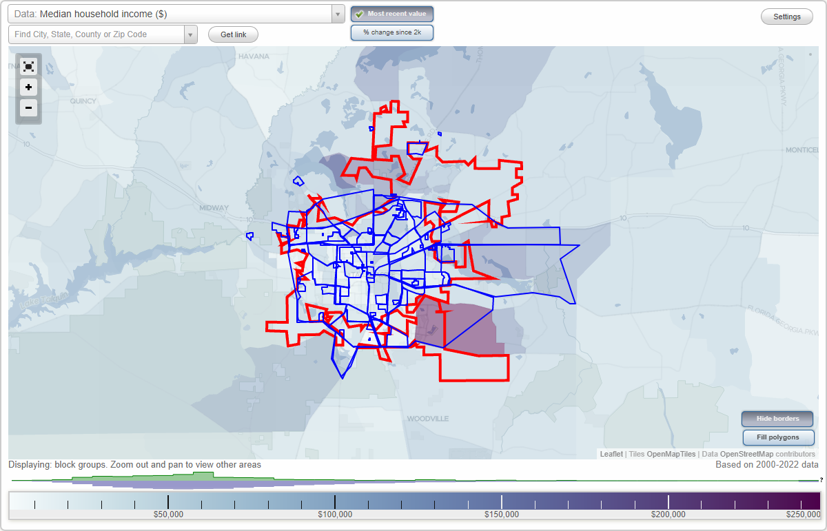
Tallahassee, Florida Neighborhood Map - Income, House Prices, Occupations, Boundaries
Settings
X

- City boundary
- Neighborhood boundaries
Business Search - 14 Million verified businesses
Neighborhoods:
Airport Commerce Center, All Saints, Apalachee East, Apalachee Ridge, Astoria Park, Belair, Betton Hills, Blairstone Forest, Bull Run, Capitol Cascades, Central District, College Park Commons, Commonwealth Business Center, Commonwealth Center, Cottages of Miccosukee Hills, Cross Creek, Delta Industrial Park, Delta Office Park, East Tallahassee, Eastgate, Eastwood, Eastwood Office Plaza, El Destinado, Evening Rose Village Center, Fairgrounds, Falls Chase, Forest Heights, Four Corners, Frenchtown, Frenchtown Renaissance, Georgia Street, Governor's Square, Gramercy Place, Greater Frenchtown, Hancock Street Condominiums, Hartsfield Green Condominiums, Heritage Grove, Hidden Pond, Hillcrest Office Park, Holly Hills, Hopkins Crossing, Huntington Woods, Innovation Park, Kirkman, Kleman Plaza, Koger Center, Lafayette, Lafayette Park, Lake Bradford, Lakeside, Lucern at Woodlands, Macon, Magnolia Heights, Magnolia Trace, Maryland Oaks Crossing, Metropolitan, Miccosukee Hills, Miracle Hill, North Tallahassee, Northeast Tallahassee, Northwest Tallahassee, Oak Ridge, Perkins, Providence, Richland, Saint Peter, South Monroe, Southbrook, Southeast Tallahassee, Southwest Tallahassee, Springwood, Summerfield, Sunnyland, Terrance Heights, The Gardens at Westlake, The Hermitage, The Village, The Villas of Westridge, Timberlane Park Centre, Velda Oaks Plantation, Wellington Place, West Minster Oaks, West Pensecola, Windsor Trace, Winewood, Woodgate, Zion HillAirport Commerce Center neighborhood in Tallahassee statistics: (Find on map)
Area: 0.121 square miles
Airport Commerce Center neighborhood detailed profile
Area: 0.121 square miles
Airport Commerce Center neighborhood detailed profile
All Saints neighborhood in Tallahassee statistics: (Find on map)
Area: 0.207 square miles
Population: 284
Population density:
Median household income in 2021:
Median rent in in 2021:
Male vs Females
Median age
Average estimated value of detached houses in 2021 (48.0% of all units):
Most popular occupations of males: sales and office occupations (29.0%); service occupations (26.1%); management occupations (except farmers) (18.9%); production occupations (15.7%); arts, design, entertainment, sports, and media occupations (7.0%); material moving occupations (1.8%); healthcare practitioners and technical occupations (1.4%)
Most popular occupations of females: sales and office occupations (43.7%); education, training, and library occupations (13.4%); life, physical, and social science occupations (11.3%); service occupations (8.9%); management occupations (except farmers) (6.2%); arts, design, entertainment, sports, and media occupations (5.7%); business and financial operations occupations (5.5%)
Highways in this neighborhood: S Adams St (State Hwy 363); Apalachee Pkwy (US Hwy 27).
Roads and streets: S Monroe St; S Duval St; S Gadsden St; E Gaines St; E Bloxham St; E Madison St; S Calhoun St; E St Augustine St; W St Augustine St; E Van Buren St; W Van Buren St; W Madison St; W Bloxham St; W Gaines St; Blount St; S Meridian St.
Railroad features: Seaboard Coast Line RR.
All Saints neighborhood detailed profile
Area: 0.207 square miles
Population: 284
Population density:
| All Saints: | 1,375 people per square mile |
| Tallahassee: | 2,059 people per square mile |
Median household income in 2021:
| All Saints: | $64,627 |
| Tallahassee: | $51,224 |
Median rent in in 2021:
| All Saints: | $1,044 |
| Tallahassee: | $956 |
Male vs Females
| Males: | 119 |
| Females: | 165 |
Median age
| Males: | 31.3 years |
| Females: | 33.4 years |
Average estimated value of detached houses in 2021 (48.0% of all units):
| All Saints: | $204,591 |
| Florida: | $399,750 |
Most popular occupations of males: sales and office occupations (29.0%); service occupations (26.1%); management occupations (except farmers) (18.9%); production occupations (15.7%); arts, design, entertainment, sports, and media occupations (7.0%); material moving occupations (1.8%); healthcare practitioners and technical occupations (1.4%)
Most popular occupations of females: sales and office occupations (43.7%); education, training, and library occupations (13.4%); life, physical, and social science occupations (11.3%); service occupations (8.9%); management occupations (except farmers) (6.2%); arts, design, entertainment, sports, and media occupations (5.7%); business and financial operations occupations (5.5%)
Highways in this neighborhood: S Adams St (State Hwy 363); Apalachee Pkwy (US Hwy 27).
Roads and streets: S Monroe St; S Duval St; S Gadsden St; E Gaines St; E Bloxham St; E Madison St; S Calhoun St; E St Augustine St; W St Augustine St; E Van Buren St; W Van Buren St; W Madison St; W Bloxham St; W Gaines St; Blount St; S Meridian St.
Railroad features: Seaboard Coast Line RR.
All Saints neighborhood detailed profile
Apalachee East neighborhood in Tallahassee statistics: (Find on map)
Area: 0.263 square miles
Highways in this neighborhood: US Hwy 27 (Apalachee Pkwy).
Apalachee East neighborhood detailed profile
Area: 0.263 square miles
Highways in this neighborhood: US Hwy 27 (Apalachee Pkwy).
Apalachee East neighborhood detailed profile
Apalachee Ridge neighborhood in Tallahassee statistics: (Find on map)
Area: 0.176 square miles
Population: 834
Population density:
Median household income in 2021:
Median rent in in 2021:
Male vs Females
Median age
Average estimated value of detached houses in 2021 (61.0% of all units):
Most popular occupations of males: service occupations (29.5%); material moving occupations (22.1%); sales and office occupations (14.7%); transportation occupations (10.5%); management occupations (except farmers) (9.8%); computer and mathematical occupations (3.6%); construction, extraction, and maintenance occupations (3.3%)
Most popular occupations of females: sales and office occupations (29.2%); service occupations (15.0%); business and financial operations occupations (11.0%); management occupations (except farmers) (8.1%); transportation occupations (8.1%); healthcare practitioners and technical occupations (7.7%); community and social services occupations (6.4%)
Roads and streets: Apache St; Cochran Dr; Millard St; Kendall Dr; Pontiac Dr; Coble Dr; Harwood St; Webster St; Pierson Dr.
Apalachee Ridge neighborhood detailed profile
Area: 0.176 square miles
Population: 834
Population density:
| Apalachee Ridge: | 4,726 people per square mile |
| Tallahassee: | 2,059 people per square mile |
Median household income in 2021:
| Apalachee Ridge: | $58,757 |
| Tallahassee: | $51,224 |
Median rent in in 2021:
| Apalachee Ridge: | $939 |
| Tallahassee: | $956 |
Male vs Females
| Males: | 387 |
| Females: | 447 |
Median age
| Males: | 33.9 years |
| Females: | 38.0 years |
Average estimated value of detached houses in 2021 (61.0% of all units):
| Apalachee Ridge: | $107,792 |
| Florida: | $399,750 |
Most popular occupations of males: service occupations (29.5%); material moving occupations (22.1%); sales and office occupations (14.7%); transportation occupations (10.5%); management occupations (except farmers) (9.8%); computer and mathematical occupations (3.6%); construction, extraction, and maintenance occupations (3.3%)
Most popular occupations of females: sales and office occupations (29.2%); service occupations (15.0%); business and financial operations occupations (11.0%); management occupations (except farmers) (8.1%); transportation occupations (8.1%); healthcare practitioners and technical occupations (7.7%); community and social services occupations (6.4%)
Roads and streets: Apache St; Cochran Dr; Millard St; Kendall Dr; Pontiac Dr; Coble Dr; Harwood St; Webster St; Pierson Dr.
Apalachee Ridge neighborhood detailed profile
Astoria Park neighborhood in Tallahassee statistics: (Find on map)
Area: 1.311 square miles
Population: 4,776
Population density:
Median household income in 2021:
Median rent in in 2021:
Male vs Females
Median age
Most popular occupations of males: service occupations (28.3%); sales and office occupations (16.5%); architecture and engineering occupations (15.3%); construction, extraction, and maintenance occupations (8.2%); management occupations (except farmers) (7.9%); education, training, and library occupations (6.2%); transportation occupations (4.2%)
Most popular occupations of females: service occupations (26.5%); healthcare practitioners and technical occupations (21.1%); sales and office occupations (15.3%); management occupations (except farmers) (13.1%); business and financial operations occupations (6.1%); education, training, and library occupations (5.8%); arts, design, entertainment, sports, and media occupations (3.4%)
Roads and streets: Hartsfield Rd; Pecan Rd; Mayfair Rd; Portland Ave; Trimble Rd; Mary Ellen Dr; Hartsfield Way; Salmon Dr; Gina Dr; Skyland Dr; Foster Dr; Darnell Cir; Wille Vause Rd; Talley Ln; Nannas Loop; Doric Dr; Emerald Ridge Loop; Atlas Rd; Nugget Ln; Talco Hills Dr; Hollyhock Hill; Lanrell Dr; Via Sardina St; Via Milano Ave; Wales Dr; Alton Rd; Wanda Ct; Moon Ln; Cumberland Ct; Rob Way; Gothic Dr; Ian Dr; Brynmahr Dr; Fox Pass Ln; Pecan Ln; Travis Cir; Gloria Dr; Hideaway Ct; Leary Ln; Devra Dr; Colleen Dr; Astoria Ct; Pecan Ct; Garland Ct; Jolene Ln; Holly Hill Ct; Geri Ann Ln; Cumberland Dr; Foster Ct; Meriadoc Rd; Willamette Rd; Myrick Rd; Fanta St; Castor Ct; la Rue Ct; Cherry Grove Ln (Harbor Dr); Patsy Ann Ln; Ionic Ct; Veda St; Rufus Ln; Patsy Ann Ct N; Idyllic Ter; Loyal Ln; Patsy Ann Ct S; Blue Trial; Tamarind Ct; Heidi Ln; Via Milano Ct; Meriadoc Ct; Mary Ellen Ct; Ptree Top Ct; Loyal Ln (Loyal).
Astoria Park neighborhood detailed profile
Area: 1.311 square miles
Population: 4,776
Population density:
| Astoria Park: | 3,644 people per square mile |
| Tallahassee: | 2,059 people per square mile |
Median household income in 2021:
| Astoria Park: | $39,406 |
| Tallahassee: | $51,224 |
Median rent in in 2021:
| Astoria Park: | $732 |
| Tallahassee: | $956 |
Male vs Females
| Males: | 2,536 |
| Females: | 2,239 |
Median age
| Males: | 29.1 years |
| Females: | 24.2 years |
Most popular occupations of males: service occupations (28.3%); sales and office occupations (16.5%); architecture and engineering occupations (15.3%); construction, extraction, and maintenance occupations (8.2%); management occupations (except farmers) (7.9%); education, training, and library occupations (6.2%); transportation occupations (4.2%)
Most popular occupations of females: service occupations (26.5%); healthcare practitioners and technical occupations (21.1%); sales and office occupations (15.3%); management occupations (except farmers) (13.1%); business and financial operations occupations (6.1%); education, training, and library occupations (5.8%); arts, design, entertainment, sports, and media occupations (3.4%)
Roads and streets: Hartsfield Rd; Pecan Rd; Mayfair Rd; Portland Ave; Trimble Rd; Mary Ellen Dr; Hartsfield Way; Salmon Dr; Gina Dr; Skyland Dr; Foster Dr; Darnell Cir; Wille Vause Rd; Talley Ln; Nannas Loop; Doric Dr; Emerald Ridge Loop; Atlas Rd; Nugget Ln; Talco Hills Dr; Hollyhock Hill; Lanrell Dr; Via Sardina St; Via Milano Ave; Wales Dr; Alton Rd; Wanda Ct; Moon Ln; Cumberland Ct; Rob Way; Gothic Dr; Ian Dr; Brynmahr Dr; Fox Pass Ln; Pecan Ln; Travis Cir; Gloria Dr; Hideaway Ct; Leary Ln; Devra Dr; Colleen Dr; Astoria Ct; Pecan Ct; Garland Ct; Jolene Ln; Holly Hill Ct; Geri Ann Ln; Cumberland Dr; Foster Ct; Meriadoc Rd; Willamette Rd; Myrick Rd; Fanta St; Castor Ct; la Rue Ct; Cherry Grove Ln (Harbor Dr); Patsy Ann Ln; Ionic Ct; Veda St; Rufus Ln; Patsy Ann Ct N; Idyllic Ter; Loyal Ln; Patsy Ann Ct S; Blue Trial; Tamarind Ct; Heidi Ln; Via Milano Ct; Meriadoc Ct; Mary Ellen Ct; Ptree Top Ct; Loyal Ln (Loyal).
Astoria Park neighborhood detailed profile
Belair neighborhood in Tallahassee statistics: (Find on map)
Area: 2.210 square miles
Highways in this neighborhood: State Hwy 261A (Tram Rd); Capital Cir SE (US Hwy 319).
Roads and streets: Belair Rd; Cooks Rd; Frankie Dr; Gaile Ave; Tram Ct; Woodman of the World Rd (Wow Rd); Shoreline Dr; Eire St; Lindgren Ave; Brent Dr; Greenleaf Dr; S Maxwell Blvd; Flagg St; Shannon St; Briandav St; S Lewis Blvd; Gunda Rd; Peggy Dr; Curtis Rd; Fairfield Ave; Annawood Dr; Lakewood Dr; Evans St; Piney Rd; Falcon Dr; Susan Ave; S Lakewood Dr; Robinwood Ave; Margo St; Sophie Ln; Skylark Ave; Kent Ct; Judys Cir; Jay Ct; Ridgecrest St; Iowa Ln; Florence Ave; Southland Dr; Sunday Ct; Martha Dr; Lillian Rd; Duren St; Wheeler Dr; Ada Ct; Drury St; Amy St; Chaucey Rd (Chauncey Rd); Iowa Ct; Cornelia St; S Meridian St; Wood Dr.
Belair neighborhood detailed profile
Betton Hills neighborhood in Tallahassee statistics: (Find on map)
Area: 0.441 square miles
Population: 1,261
Population density:
Median household income in 2021:
Median rent in in 2021:
Male vs Females
Median age
Most popular occupations of males: education, training, and library occupations (30.7%); management occupations (except farmers) (20.2%); legal occupations (20.2%); business and financial operations occupations (11.6%); service occupations (11.1%); construction, extraction, and maintenance occupations (8.0%); architecture and engineering occupations (6.8%)
Most popular occupations of females: legal occupations (13.9%); sales and office occupations (13.4%); service occupations (12.5%); healthcare practitioners and technical occupations (9.3%); community and social services occupations (8.8%); life, physical, and social science occupations (8.1%); education, training, and library occupations (7.9%)
Highways in this neighborhood: State Hwy 151 (Centerville Rd).
Roads and streets: Trescott Dr; W Randolph Cir; Lee Ave; E Randolph Cir; Argonne Rd; Betton Rd; Belleau Wood Dr; Spence Ave; Dillard St; N Randolph Cir; Laguna Dr; Lemond St; Jeanette St; Blythe St; Cline St.
Betton Hills neighborhood detailed profile
Area: 0.441 square miles
Population: 1,261
Population density:
| Betton Hills: | 2,857 people per square mile |
| Tallahassee: | 2,059 people per square mile |
Median household income in 2021:
| Betton Hills: | $61,458 |
| Tallahassee: | $51,224 |
Median rent in in 2021:
| Betton Hills: | $924 |
| Tallahassee: | $956 |
Male vs Females
| Males: | 579 |
| Females: | 681 |
Median age
| Males: | 45.5 years |
| Females: | 54.7 years |
Most popular occupations of males: education, training, and library occupations (30.7%); management occupations (except farmers) (20.2%); legal occupations (20.2%); business and financial operations occupations (11.6%); service occupations (11.1%); construction, extraction, and maintenance occupations (8.0%); architecture and engineering occupations (6.8%)
Most popular occupations of females: legal occupations (13.9%); sales and office occupations (13.4%); service occupations (12.5%); healthcare practitioners and technical occupations (9.3%); community and social services occupations (8.8%); life, physical, and social science occupations (8.1%); education, training, and library occupations (7.9%)
Highways in this neighborhood: State Hwy 151 (Centerville Rd).
Roads and streets: Trescott Dr; W Randolph Cir; Lee Ave; E Randolph Cir; Argonne Rd; Betton Rd; Belleau Wood Dr; Spence Ave; Dillard St; N Randolph Cir; Laguna Dr; Lemond St; Jeanette St; Blythe St; Cline St.
Betton Hills neighborhood detailed profile
Blairstone Forest neighborhood in Tallahassee statistics: (Find on map)
Area: 0.080 square miles
Population: 112
Population density:
Median household income in 2021:
Median rent in in 2021:
Male vs Females
Median age
Average estimated value of detached houses in 2021 (95.3% of all units):
Most popular occupations of males: service occupations (15.5%); sales and office occupations (13.9%); education, training, and library occupations (10.4%); production occupations (9.6%); material moving occupations (9.2%); healthcare practitioners and technical occupations (5.2%); arts, design, entertainment, sports, and media occupations (4.4%)
Most popular occupations of females: sales and office occupations (25.2%); healthcare practitioners and technical occupations (17.1%); management occupations (except farmers) (16.7%); education, training, and library occupations (13.5%); computer and mathematical occupations (7.2%); business and financial operations occupations (6.3%); life, physical, and social science occupations (3.6%)
Roads and streets: Brookside Blvd; Silverwood Dr; Red Maple Ridge; Nestlewood Ln; Harvest Pl; Silverwood Ct.
Blairstone Forest neighborhood detailed profile
Area: 0.080 square miles
Population: 112
Population density:
| Blairstone Forest: | 1,399 people per square mile |
| Tallahassee: | 2,059 people per square mile |
Median household income in 2021:
| Blairstone Forest: | $63,672 |
| Tallahassee: | $51,224 |
Median rent in in 2021:
| Blairstone Forest: | $1,038 |
| Tallahassee: | $956 |
Male vs Females
| Males: | 56 |
| Females: | 55 |
Median age
| Males: | 52.3 years |
| Females: | 61.0 years |
Average estimated value of detached houses in 2021 (95.3% of all units):
| Blairstone Forest: | $193,729 |
| Florida: | $399,750 |
Most popular occupations of males: service occupations (15.5%); sales and office occupations (13.9%); education, training, and library occupations (10.4%); production occupations (9.6%); material moving occupations (9.2%); healthcare practitioners and technical occupations (5.2%); arts, design, entertainment, sports, and media occupations (4.4%)
Most popular occupations of females: sales and office occupations (25.2%); healthcare practitioners and technical occupations (17.1%); management occupations (except farmers) (16.7%); education, training, and library occupations (13.5%); computer and mathematical occupations (7.2%); business and financial operations occupations (6.3%); life, physical, and social science occupations (3.6%)
Roads and streets: Brookside Blvd; Silverwood Dr; Red Maple Ridge; Nestlewood Ln; Harvest Pl; Silverwood Ct.
Blairstone Forest neighborhood detailed profile
Bull Run neighborhood in Tallahassee statistics: (Find on map)
Area: 0.676 square miles
Bull Run neighborhood detailed profile
Area: 0.676 square miles
Bull Run neighborhood detailed profile
Capitol Cascades neighborhood in Tallahassee statistics: (Find on map)
Area: 5.602 square miles
Population: 16,247
Population density:
Median household income in 2021:
Median rent in in 2021:
Male vs Females
Median age
Housing prices:
Average estimated value of detached houses in 2021 (46.7% of all units):
Average estimated value of townhouses or other attached units in 2021 (7.6% of all units):
Average estimated value of mobile home in 2021 (13.1% of all units):
Most popular occupations of males: service occupations (25.2%); sales and office occupations (16.6%); education, training, and library occupations (9.3%); transportation occupations (8.1%); management occupations (except farmers) (6.1%); construction, extraction, and maintenance occupations (6.0%); business and financial operations occupations (5.7%)
Most popular occupations of females: sales and office occupations (33.8%); service occupations (25.1%); education, training, and library occupations (7.5%); management occupations (except farmers) (6.3%); business and financial operations occupations (5.7%); life, physical, and social science occupations (4.4%); healthcare practitioners and technical occupations (3.6%)
Highways in this neighborhood: State Hwy 146 (Miccosukee Rd); N Lake Bradford Rd (State Hwy 371); State Hwy 373 (W Orange Ave); US Hwy 27 (N Monroe St, State Hwy 63); State Hwy 10 (US Hwy 90, E Tennessee St); S Adams St (State Hwy 363); N Meridian St (State Hwy 146); Thomasville Rd (State Hwy 61, US Hwy 319); Apalachee Pkwy (US Hwy 27); W Tennessee St (State Hwy 10, US Hwy 90); State Hwy 151 (N Magnolia Dr).
Roads and streets: Wahnish Way; Pasco St; E 6th Ave; N Gadsden St; Gamble St; Holton St; Saxon St; Mills St; N Duval St; N Bronough St; S Bronough St; E Georgia St; Bragg Dr; Kissimmee St; E Park Ave; E 7th Ave; N Adams St; Ingleside Ave; S Martin Luther King Jr Blvd; Terrace St; Keith St; Beard St; Four Points Way; W Park Ave; N Martin Luther King Jr Blvd; Levy Ave; W 6th Ave; W 4th Ave; E Brevard St; S Martin Luther King Jr Blvd (S Boulevard St); N Calhoun St; Cherry St; N Macomb St; Springsax Rd; E Call St; Osceola St; Palm Beach St; Campbell St; Stuckey Ave; Mc Caskill Ave; Lake Ave; Americana St; Eugenia St; W Madison St; Okaloosa St; Perry St; Great Lakes St; Central St; E Carolina St; McDaniel St; Cleveland St; W 5th Ave; W Osceola St; S Calhoun St; S Gadsden St; S Meridian St; E College Ave; Tanner Dr; W Jefferson St; W Call St; W College Ave; W Brevard St; Tucker St; Martin St; Famu Way; Coleman St; Alachua Ave; Hillsborough St; Holmes St; Williams St; Stearns St; E Jefferson St; Mercury Dr; Notre Dame St; Lucy St; Hillcrest St; Dupont Dr; S Duval St; S Monroe St; Callen St; S Macomb St; W 7th Ave; Tropicaire St; Carver St; W Pensacola St; Talaflo St; Fleetwood Ave; E 5th Ave; Pine St; E Virginia St; E Madison St; Roy Ln; Floral St; Sunnyside Dr; W St Augustine St; Creek Rd; Melvin St; E Pensacola St; Brookridge Dr; S Franklin Blvd; Wailes St; Manatee St; Liberty St; Nassau St; Short St; Shepard St; Gore Ave; Famcee Ave; Hampton Ave; Taylor St; Howard Ave; Hutchinson St; Walcott St; Hastie Rd; Gibbs Dr; All Saints St; Mc Donnell Dr; W Gaines St; Iamonia St; Mitchell Ave; Springhill Rd; Saint Marks St; Victoria St; Maude St; Daniels St; N Franklin Blvd; Cherry Laurel St; Wilson Ave; Highland St; Moore Dr; W Van Buren St; E St Augustine St; Main St; St Francis St; James St; Bethune St; West Carolina St; W Georgia St; West Virginia St; Flipper St (Rose St); Daisy St; Railroad Ave; Crenshaw Dr; Herlong Dr; Crestview Ave; Ford St; Wheatley Rd; Seaboard St; Blue Jay Dr; Sykes Dr; Warwick St; Washington St; Medical Commons Ct; Gaither Dr; Disston St; Russell St; Gilchrist St; Mosley St; Rackley Dr; Indian River St; Poppy St; Marion Ave; E 3rd Ave; Bliss Dr; Stafford St; Tuskegee St; Parkridge Dr; W Palmer Ave; Industrial Dr; Broad St; Owens St; Glynwood Dr; Goodbread Ln; E Gaines St; Sayers Dr; Pinellas St; Georgetown Dr; Brittain Dr; E Seaboard St; Harbert St; Gallimore Dr; St Michael St; Palmetto St; Lincoln St; Young St; Silver Ridge Dr; Culpepper Dr; Lee Ave; W 1st Ave; Miles St; Hillcrest Ct; Ardelia Ct; Bellaire Ave; Edgewood St; Shell St; Johnston St; Hawkins St; Ryco Dr; Wies St; Lafayette Cir; Atlas St; S Boulevard St S; Hyman Myers Dr; Dianne St (Snellings Dr); Bunche Ave; Pasco Ct; W 3rd Ave; Frazier Ave; Beverly Ct; W Harrison St; Gunter St; W Bloxham St; Oliver St; Lindsey Ct; Wakulla St; Walnut St; Clara St; Renfroe Valley St; Emory Ct; W Jennings St; Still Ct; Chancey Ln; Milton St; Jackson St; Conklin St; Branch St; Lively St; Beverly St; Blount St; Hutchingson Ct; Hudson St; McLendon Dr; Wahnish Ct; E 1st Ave; Lennox Dr; E Lafayette St; Shalom Ln; Gallies Aly; W 2nd St; W Van Buren Loop; Old Bainbridge Rd; Doctors Dr; W Pershing St; Gene St; E 4th Ave; Baker St; Pine Ridge Blvd; Moore Ct; Crenshaw Ct; Colonial Dr; King Solomon St (King Soloman Dr); Joes Ln; Lowell St; Dart St; Sir William St; Parkwood Ave; Ritz Croft Ave; Washington Ct; Hirt Ct; Commercial St (Commercial Dr); S Disston St; Lyndon Dr; Ward St; Baltzell St; Reid St; Crowder Ln; N Ridge Rd; Aintree Ln; Star Ave; Joes Rd; Wolverine Ave; Armor Ave; New Moon Ave; Mosley St Exd; McDonnell Dr (Industrial Dr); Franklin Blvd; Chancy Ln.
Railroad features: Seaboard Coast Line RR; Csx RR.
Capitol Cascades neighborhood detailed profile
Area: 5.602 square miles
Population: 16,247
Population density:
| Capitol Cascades: | 2,900 people per square mile |
| Tallahassee: | 2,059 people per square mile |
Median household income in 2021:
| Capitol Cascades: | $46,468 |
| Tallahassee: | $51,224 |
Median rent in in 2021:
| Capitol Cascades: | $737 |
| Tallahassee: | $956 |
Male vs Females
| Males: | 7,269 |
| Females: | 8,978 |
Median age
| Males: | 29.0 years |
| Females: | 30.6 years |
Housing prices:
Average estimated value of detached houses in 2021 (46.7% of all units):
| Capitol Cascades: | $172,624 |
| Florida: | $399,750 |
Average estimated value of townhouses or other attached units in 2021 (7.6% of all units):
| This neighborhood: | $141,500 |
| Florida: | $293,437 |
Average estimated value of mobile home in 2021 (13.1% of all units):
| Capitol Cascades: | $229,217 |
| Florida: | $101,985 |
Most popular occupations of males: service occupations (25.2%); sales and office occupations (16.6%); education, training, and library occupations (9.3%); transportation occupations (8.1%); management occupations (except farmers) (6.1%); construction, extraction, and maintenance occupations (6.0%); business and financial operations occupations (5.7%)
Most popular occupations of females: sales and office occupations (33.8%); service occupations (25.1%); education, training, and library occupations (7.5%); management occupations (except farmers) (6.3%); business and financial operations occupations (5.7%); life, physical, and social science occupations (4.4%); healthcare practitioners and technical occupations (3.6%)
Highways in this neighborhood: State Hwy 146 (Miccosukee Rd); N Lake Bradford Rd (State Hwy 371); State Hwy 373 (W Orange Ave); US Hwy 27 (N Monroe St, State Hwy 63); State Hwy 10 (US Hwy 90, E Tennessee St); S Adams St (State Hwy 363); N Meridian St (State Hwy 146); Thomasville Rd (State Hwy 61, US Hwy 319); Apalachee Pkwy (US Hwy 27); W Tennessee St (State Hwy 10, US Hwy 90); State Hwy 151 (N Magnolia Dr).
Roads and streets: Wahnish Way; Pasco St; E 6th Ave; N Gadsden St; Gamble St; Holton St; Saxon St; Mills St; N Duval St; N Bronough St; S Bronough St; E Georgia St; Bragg Dr; Kissimmee St; E Park Ave; E 7th Ave; N Adams St; Ingleside Ave; S Martin Luther King Jr Blvd; Terrace St; Keith St; Beard St; Four Points Way; W Park Ave; N Martin Luther King Jr Blvd; Levy Ave; W 6th Ave; W 4th Ave; E Brevard St; S Martin Luther King Jr Blvd (S Boulevard St); N Calhoun St; Cherry St; N Macomb St; Springsax Rd; E Call St; Osceola St; Palm Beach St; Campbell St; Stuckey Ave; Mc Caskill Ave; Lake Ave; Americana St; Eugenia St; W Madison St; Okaloosa St; Perry St; Great Lakes St; Central St; E Carolina St; McDaniel St; Cleveland St; W 5th Ave; W Osceola St; S Calhoun St; S Gadsden St; S Meridian St; E College Ave; Tanner Dr; W Jefferson St; W Call St; W College Ave; W Brevard St; Tucker St; Martin St; Famu Way; Coleman St; Alachua Ave; Hillsborough St; Holmes St; Williams St; Stearns St; E Jefferson St; Mercury Dr; Notre Dame St; Lucy St; Hillcrest St; Dupont Dr; S Duval St; S Monroe St; Callen St; S Macomb St; W 7th Ave; Tropicaire St; Carver St; W Pensacola St; Talaflo St; Fleetwood Ave; E 5th Ave; Pine St; E Virginia St; E Madison St; Roy Ln; Floral St; Sunnyside Dr; W St Augustine St; Creek Rd; Melvin St; E Pensacola St; Brookridge Dr; S Franklin Blvd; Wailes St; Manatee St; Liberty St; Nassau St; Short St; Shepard St; Gore Ave; Famcee Ave; Hampton Ave; Taylor St; Howard Ave; Hutchinson St; Walcott St; Hastie Rd; Gibbs Dr; All Saints St; Mc Donnell Dr; W Gaines St; Iamonia St; Mitchell Ave; Springhill Rd; Saint Marks St; Victoria St; Maude St; Daniels St; N Franklin Blvd; Cherry Laurel St; Wilson Ave; Highland St; Moore Dr; W Van Buren St; E St Augustine St; Main St; St Francis St; James St; Bethune St; West Carolina St; W Georgia St; West Virginia St; Flipper St (Rose St); Daisy St; Railroad Ave; Crenshaw Dr; Herlong Dr; Crestview Ave; Ford St; Wheatley Rd; Seaboard St; Blue Jay Dr; Sykes Dr; Warwick St; Washington St; Medical Commons Ct; Gaither Dr; Disston St; Russell St; Gilchrist St; Mosley St; Rackley Dr; Indian River St; Poppy St; Marion Ave; E 3rd Ave; Bliss Dr; Stafford St; Tuskegee St; Parkridge Dr; W Palmer Ave; Industrial Dr; Broad St; Owens St; Glynwood Dr; Goodbread Ln; E Gaines St; Sayers Dr; Pinellas St; Georgetown Dr; Brittain Dr; E Seaboard St; Harbert St; Gallimore Dr; St Michael St; Palmetto St; Lincoln St; Young St; Silver Ridge Dr; Culpepper Dr; Lee Ave; W 1st Ave; Miles St; Hillcrest Ct; Ardelia Ct; Bellaire Ave; Edgewood St; Shell St; Johnston St; Hawkins St; Ryco Dr; Wies St; Lafayette Cir; Atlas St; S Boulevard St S; Hyman Myers Dr; Dianne St (Snellings Dr); Bunche Ave; Pasco Ct; W 3rd Ave; Frazier Ave; Beverly Ct; W Harrison St; Gunter St; W Bloxham St; Oliver St; Lindsey Ct; Wakulla St; Walnut St; Clara St; Renfroe Valley St; Emory Ct; W Jennings St; Still Ct; Chancey Ln; Milton St; Jackson St; Conklin St; Branch St; Lively St; Beverly St; Blount St; Hutchingson Ct; Hudson St; McLendon Dr; Wahnish Ct; E 1st Ave; Lennox Dr; E Lafayette St; Shalom Ln; Gallies Aly; W 2nd St; W Van Buren Loop; Old Bainbridge Rd; Doctors Dr; W Pershing St; Gene St; E 4th Ave; Baker St; Pine Ridge Blvd; Moore Ct; Crenshaw Ct; Colonial Dr; King Solomon St (King Soloman Dr); Joes Ln; Lowell St; Dart St; Sir William St; Parkwood Ave; Ritz Croft Ave; Washington Ct; Hirt Ct; Commercial St (Commercial Dr); S Disston St; Lyndon Dr; Ward St; Baltzell St; Reid St; Crowder Ln; N Ridge Rd; Aintree Ln; Star Ave; Joes Rd; Wolverine Ave; Armor Ave; New Moon Ave; Mosley St Exd; McDonnell Dr (Industrial Dr); Franklin Blvd; Chancy Ln.
Railroad features: Seaboard Coast Line RR; Csx RR.
Capitol Cascades neighborhood detailed profile
Central District neighborhood in Tallahassee statistics: (Find on map)
Area: 14.378 square miles
Population: 51,201
Population density:
Median household income in 2021:
Median rent in in 2021:
Male vs Females
Median age
Housing prices:
Average estimated value of detached houses in 2021 (45.5% of all units):
Average estimated value of townhouses or other attached units in 2021 (7.3% of all units):
Average estimated value of mobile home in 2021 (1.5% of all units):
Most popular occupations of males: service occupations (22.8%); sales and office occupations (14.5%); education, training, and library occupations (9.2%); management occupations (except farmers) (9.0%); material moving occupations (5.7%); business and financial operations occupations (5.6%); computer and mathematical occupations (5.2%)
Most popular occupations of females: sales and office occupations (29.2%); service occupations (23.7%); education, training, and library occupations (9.8%); management occupations (except farmers) (7.7%); business and financial operations occupations (5.9%); life, physical, and social science occupations (3.8%); community and social services occupations (3.7%)
Highways in this neighborhood: State Hwy 363 (S Adams St); W Tennessee St (US Hwy 90, State Hwy 10); Thomasville Rd (State Hwy 61, US Hwy 319); N Lake Bradford Rd (State Hwy 371); US Hwy 27 (N Monroe St, State Hwy 63); W Orange Ave (State Hwy 373); State Hwy 10 (US Hwy 90, E Tennessee St); Apalachee Pkwy (US Hwy 27); State Hwy 146 (Miccosukee Rd); Tram Rd (State Hwy 261A); W Tharpe St (State Hwy 158); N Meridian St (State Hwy 146); State Hwy 364 (Old St Augustine Rd); State Hwy 151 (N Magnolia Dr); N Meridian Rd (State Hwy 155); State Hwy 371 (N Stadium Dr); Centerville Rd (State Hwy 151).
Roads and streets: S Monroe St; W Pensacola St; S Meridian St; W Gaines St; W Call St; Wahnish Way; E Park Ave; E Lafayette St; W Brevard St; E Orange Ave; Paul Russell Rd; S Gadsden St; N Duval St; Chowkeebin Nene; S Bronough St; Jim Lee Rd; Blairstone Rd; N Bronough St; W Jefferson St; E 7th Ave; Pasco St; Country Club Dr; Circle Dr; E Magnolia Dr; Old Bainbridge Rd; W Park Ave; E 6th Ave; Gamble St; E Indianhead Dr; N Gadsden St; E Call St; S Magnolia Dr; W Indianhead Dr; Seminole Dr; Terrace St; W Georgia St; W Madison St; West Virginia St; Levy Ave; N Martin Luther King Jr Blvd; W St Augustine St; Alabama St; Pontiac Dr; Golf Terrace Dr; Holton St; Saxon St; Mills St; Putnam Dr; West Carolina St; N Adams St; Pennell Cir; N Macomb St; Chuli Nene; E College Ave; Preston St; W 6th Ave; W 4th Ave; E Jefferson St; W 7th Ave; E Georgia St; Joe Louis St; Myers Park Dr; Pepper Dr; Old Fort Dr; N Woodward St; Mitchell Ave; Palmetto Dr; Bill Campbell Rd (Jackson Bluff Rd); Atapha Nene; Kissimmee St; Ingleside Ave; S Duval St; S Martin Luther King Jr Blvd; Airport Dr; Keith St; Beard St; Marion Ave; S Calhoun St; Dewey St; High Rd; Crestview Ave; Atkamire Dr; W College Ave; Winewood Blvd; Dover St; S Macomb St; Mayhew St; Polk Dr; S Lipona Rd; Cherry St; Westridge Dr; E Brevard St; W 8th Ave; Lee Ave; S Martin Luther King Jr Blvd (S Boulevard St); Callen St; N Calhoun St; Dunn St; Pine St; E Oakland Ave; Colorado St; Wallis St; California St; Dent St; Gibbs Dr; Statium Dr W; W 5th Ave; Coleman St; Alban Ave; Volusia St; Osceola St; Palm Beach St; Campbell St; Stuckey Ave; Laura Lee Ave; Mc Caskill Ave; Lake Ave; W 10th Ave; Richmond St; Eugenia St; Famu Way; Elberta Dr; Hernando Dr; Brookside Blvd; Zillah St; Okaloosa St; Wekewa Nene; Hillcrest St; W Osceola St; Fernando Dr; Apache St; Stadium Dr; Arkansas St; Cochran Dr; Lake Ella Dr; Delaware St; Brighton Rd; Millard St; Kendall Dr; N Copeland St; Chocksacka Nene; E Jennings St; Basin St; Dade St; Perry St; E Gaines St; Central St; Briarcliff Rd; E Carolina St; McDaniel St; Belle Vue Way; Cleveland St; Wahalaw Nene; Coble Dr; Chieftan Way; Sarasota Dr; Commercial Park Dr; Springhill Rd; Bahama Dr; Buena Vista Dr; E Bradford Rd; Arizona St; Tucker St; Colonial Dr; Campus Cir; Martin St; Lola Dr; Calloway St; Brewer St; E Pershing St; Daniels St; E Pensacola St; Chapel Dr; Alachua Ave; E Bloxham St; Hillsborough St; Holmes St; Williams St; Hokolin Nene; Stearns St; Eleanor Dr; Mercury Dr; Collins Dr; Indiana St; Lucy St; Cherokee Dr; Dupont Dr; E Harrison St; S Woodward St; Maple Dr; W 9th Ave; E Palmer Ave; E 9th Ave; Clay St; Abraham St; Hayden Rd; Birmingham St; Carver St; W Lafayette St; Glenview Dr; W Van Buren St; Yaeger St; Talaflo St; Sharkey St; Truett Dr; S Copeland St; Milton St; E 5th Ave; Nancy Dr; Jackson St; Branch St; Silverwood Dr; Merritt Dr; E Virginia St; E Madison St; E 8th Ave; Roy Ln; Goodbody Ln; Perkins Rd (Perkins St); Cristobal Dr; Hull St; Hasosaw Nene; Azalea Dr; Grape St; Camellia Dr; Omega Ave; Rollins St; Floral St; Dozier Dr; Harlem St; Cherry Laurel St; Westminister Dr; University Way; Glenda Dr; Sumter Dr (Sumter Ave); E Van Buren St; Railroad Ave; Melvin St; Marriott Dr; S Franklin Blvd; Wailes St; Conradi St; Manatee St; Liberty St; Nassau St; Lehigh Dr; Short St; Shepard St; Chinnapakin Nene; Gore Ave; Famcee Ave; Hampton Ave; Taylor St; Howard Ave; E Seaboard St; Blairstone Pines Dr; Eppes Dr; Hutchinson St; Walcott St; de Soto St; W Forest Dr; All Saints St; Mc Donnell Dr; W Bloxham St; Laurel St; Alpha Ave; Iamonia St; Nylic St; Hays St; Saint Marks St; Victoria St; Maude St; N Lipona Rd; N Forest Dr; Charlotte St; N Franklin Blvd; Carlton Dr; Mock Dr; Atlas St; Wilson Ave; Connecticut St; Spruce Ave; Dean St; Highland St; Moore Dr; W Harrison St; W Palmer Ave; Mountbatten Rd; E St Augustine St; Main St; St Francis St; James St; Bethune St; E Chouteau Ave; Barbourville Dr; Clark Ave; Gay St; Murat St; Flipper St (Rose St); Young St; Daisy St; Lewis St; Dacron Dr; Green St; Lincoln St; Florida Ave; Edwards St; Palmetto St; Kolopakin Nene; Hemlock St (Hemlock Dr); Crenshaw Dr; Broward St; Laura St; Harwood St; Dogwood Way; Herlong Dr; Hudson St; Blount St; Ford St; Texas St; Heechee Nene; Prospect St; Garfield St; Seaboard St; Griffin St; Champions Way; Santa Rosa Dr; Magnolia Way; Mexico Ln; Wadsworth St; Ivy Way; Delores Dr; Tartary Dr; Warwick St; Dantzler Dr; Beechwood Cir N; Washington St; Greentree Ln; Medical Commons Ct; Gaither Dr; Betton Rd; Disston St; Russell St; S Hurst Dr; Holland Dr; Gilchrist St; Bass St; Mosley St; Fairview Dr; S Lake Ella Dr; Suwannee St; Indian River St; Fairway Dr; Poppy St; Wahalaw Ct; Otis St; Mizell St; E 3rd Ave; Bliss Dr; Toochin Nene; Tuskegee St; Forest Glenn Ct; Pope St; Yancey St; Industrial Dr; Broad St; Owens St; Payne St; Proctor St; Goodbread Ln; N Hurst Dr; Slusher St; Tyndall Dr; Pinellas St; Georgetown Dr; Crest St; Diamond St; Brittain Dr; W Ostin Nene; Harbert St; St Michael St; W Jennings St; Greentree Ct; S Bahama Dr; E Forest Dr; Gold Nugget Trl; Myrtle Dr; Idaho St; Murphree St; Doctors Dr; Red Arrow Rd; Culpepper Dr; Sunshine Dr; Lynndale St; Lovelace Dr; Gwen St; Blairstone Ct; Governors Square Blvd; Bryan St; W 1st Ave; Pottsdamer St; Miles St; Beacon St; Kevin St; Drury St; Grove St; Hillcrest Ct; Ardelia Ct; Edgewood St; Warrior Way; N Wildwood Dr; Prince St; Shell St; W Indian Head Dr; Rivoli Rd; Johnston St; Hawkins St; Wies St; Ellington Ct; Hancock St; Lafayette Cir; Champion Way; Isabel Ct; Officer Ponce Way; Lorene St; Winchester Ln; Windward Ln; Castlewood Dr; Hart St; S Boulevard St S; Hyman Myers Dr; Splendor Rd (Thompson St); Pasco Ct; Efferson St; Barbara St; Atchena Nene; W 3rd Ave; Legion St; Myrtle Dr (Doris St, Kolopakin Nene); Beechwood Knolls; Beverly Ct; Fleming St; Cornelia St; Webster St; Broome St; Westcott St; Drew St; Johns Dr; Mavis Cir; Temple Dr; Bradford Ct; Bates Dr; Fairbanks Dr; Oak St; Statuim Dr; Satsuma St; S Chapel Dr; Bradford Rd; Gunter St; Sebring Ct; S Wildwood Dr; Crate St; Southwood Dr; Old Plank Rd; Oliver St; Lindsey Ct; Bennett St; Wakulla St; Walnut St; Overstreet St; Ohbah Nene; Kux Ave; Clara St; Palm Ct; Renfroe Valley St; Red Barber Plz; Gladiola Ter; Botany Pl; Emory Ct; Citrus Ct (Citrus Way); King St; Vantage Point Ln; Whitehall St; Still Ct; Ashlyn Forest Dr; Chancey Ln; Red Barber Way; Harper St; Simmons St; Ponce St; Conklin St; Red Maple Ridge; Cortez St; Pricilla Ln; Lively St; Tamiami Dr; Semalachee Dr; Desota Park Dr; Beverly St; Norma St; Hutchingson Ct; Marvin St; Florida Dr; Dogwood St; Hunter St; Leon Ln; Wood Grove Ct (Lang Ct); Ashburn Dr; Caliark St; Governors Dr; Smith St; McLendon Dr; Kestner St; Pauls Dr; Wahnish Ct; Ivy Ln; Cordell Dr; Rhodes Way; Atlantis Pl; Chowkeebin Ct; Devils Dip; Sycamore St; E 1st Ave; Cadiz St; Anderson Ave; Sunburst Pl; Eppes Dr E; Shalom Ln; Gallies Aly; Magnolia Cir; Westwood Ln; Mayo St; W 2nd St; Yuma Dr (Yuma Rd); Limbo Ln (Old Plank Rd); Indian Village Trl; W Van Buren Loop; Graythorn Ln (Stoutamire Dr); Kitt St; Collegiate Way; W Eppes Dr; E Indian Head Dr; W Pershing St; Myers Park Ln; Gene St; Daniel Ave; Indian Village Path; E 4th Ave; Britt St; Dunwoody St; Walker St; S Cheeke Nene; Mor Bihan St; Flagler St; Ostapakin Nene; Baker St; Creek Run Way; Kyle St; Moore Ct; Raven St; Hiawatha Dr; Atkinson Dr; Honeysuckle Dr; Lois Ln; Crenshaw Ct; Varsity Dr; Willow Dr; Ostin Nene; Grace St; King Solomon St (King Soloman Dr); Teague Dr; Eastwood Dr; Lowell St; Dalton Ct; Hardee St; Gables Ct (Carlton Ct); Idalou St; Rowell Dr; Kansas St; Elizabeth Dr; Spanish St; Jamestown Ct; Compass Ln; Dart St; Knots Ln; Vanderbilt Ct; Lenora Dr; Sir William St; Bamboo Dr; Thomas St (Bruce Ln); Blair Stone Ct; Fifield Ln; Gray St; Thornall St; Rich St; J G Ln; Collier St; Antartic Cir; Ellis St; Union St; Roberts Ave; Cristobal Ct; Washington Ct; Hirt Ct; Summitt St; Commercial St (Commercial Dr); S Disston St; Jersey St; Glendale Ct; Golden St; Lyndon Dr; Ward St; Baltzell St; Mike St; Reid St; Micco Dr; Bryan Ct; Crowder Ln; Linton St; Hillside Rd (Hillside Dr); 6th Ave; Nestlewood Ln; Point Ct; Marion Ct; Olive Ave; Cameo Ct; Golfview Dr; Aintree Ln; Globe Ct; Harvest Pl; Carolina Ct; Ann St; Carol Pl; Terraace Hollow Ct; Iris Cir; Lora St; Julia Ct; Mosley St Exd; Braxton St; Idaho Ct; Franklin Ct; Sellers Dr; Kilpatrick Ct; McDonnell Dr (Industrial Dr); Franklin Blvd; Beechwood Cir S; Montgomery Dr; Pierson Dr; Wood Grove Ct; Chancy Ln.
Railroad features: Seaboard Coast Line RR; Csx RR.
Central District neighborhood detailed profile
Area: 14.378 square miles
Population: 51,201
Population density:
| Central District: | 3,561 people per square mile |
| Tallahassee: | 2,059 people per square mile |
Median household income in 2021:
| Central District: | $42,896 |
| Tallahassee: | $51,224 |
Median rent in in 2021:
| Central District: | $791 |
| Tallahassee: | $956 |
Male vs Females
| Males: | 23,468 |
| Females: | 27,732 |
Median age
| Males: | 29.2 years |
| Females: | 30.6 years |
Housing prices:
Average estimated value of detached houses in 2021 (45.5% of all units):
| Central District: | $152,420 |
| Florida: | $399,750 |
Average estimated value of townhouses or other attached units in 2021 (7.3% of all units):
| This neighborhood: | $141,500 |
| Florida: | $293,437 |
Average estimated value of mobile home in 2021 (1.5% of all units):
| Central District: | $229,256 |
| Florida: | $101,985 |
Most popular occupations of males: service occupations (22.8%); sales and office occupations (14.5%); education, training, and library occupations (9.2%); management occupations (except farmers) (9.0%); material moving occupations (5.7%); business and financial operations occupations (5.6%); computer and mathematical occupations (5.2%)
Most popular occupations of females: sales and office occupations (29.2%); service occupations (23.7%); education, training, and library occupations (9.8%); management occupations (except farmers) (7.7%); business and financial operations occupations (5.9%); life, physical, and social science occupations (3.8%); community and social services occupations (3.7%)
Highways in this neighborhood: State Hwy 363 (S Adams St); W Tennessee St (US Hwy 90, State Hwy 10); Thomasville Rd (State Hwy 61, US Hwy 319); N Lake Bradford Rd (State Hwy 371); US Hwy 27 (N Monroe St, State Hwy 63); W Orange Ave (State Hwy 373); State Hwy 10 (US Hwy 90, E Tennessee St); Apalachee Pkwy (US Hwy 27); State Hwy 146 (Miccosukee Rd); Tram Rd (State Hwy 261A); W Tharpe St (State Hwy 158); N Meridian St (State Hwy 146); State Hwy 364 (Old St Augustine Rd); State Hwy 151 (N Magnolia Dr); N Meridian Rd (State Hwy 155); State Hwy 371 (N Stadium Dr); Centerville Rd (State Hwy 151).
Roads and streets: S Monroe St; W Pensacola St; S Meridian St; W Gaines St; W Call St; Wahnish Way; E Park Ave; E Lafayette St; W Brevard St; E Orange Ave; Paul Russell Rd; S Gadsden St; N Duval St; Chowkeebin Nene; S Bronough St; Jim Lee Rd; Blairstone Rd; N Bronough St; W Jefferson St; E 7th Ave; Pasco St; Country Club Dr; Circle Dr; E Magnolia Dr; Old Bainbridge Rd; W Park Ave; E 6th Ave; Gamble St; E Indianhead Dr; N Gadsden St; E Call St; S Magnolia Dr; W Indianhead Dr; Seminole Dr; Terrace St; W Georgia St; W Madison St; West Virginia St; Levy Ave; N Martin Luther King Jr Blvd; W St Augustine St; Alabama St; Pontiac Dr; Golf Terrace Dr; Holton St; Saxon St; Mills St; Putnam Dr; West Carolina St; N Adams St; Pennell Cir; N Macomb St; Chuli Nene; E College Ave; Preston St; W 6th Ave; W 4th Ave; E Jefferson St; W 7th Ave; E Georgia St; Joe Louis St; Myers Park Dr; Pepper Dr; Old Fort Dr; N Woodward St; Mitchell Ave; Palmetto Dr; Bill Campbell Rd (Jackson Bluff Rd); Atapha Nene; Kissimmee St; Ingleside Ave; S Duval St; S Martin Luther King Jr Blvd; Airport Dr; Keith St; Beard St; Marion Ave; S Calhoun St; Dewey St; High Rd; Crestview Ave; Atkamire Dr; W College Ave; Winewood Blvd; Dover St; S Macomb St; Mayhew St; Polk Dr; S Lipona Rd; Cherry St; Westridge Dr; E Brevard St; W 8th Ave; Lee Ave; S Martin Luther King Jr Blvd (S Boulevard St); Callen St; N Calhoun St; Dunn St; Pine St; E Oakland Ave; Colorado St; Wallis St; California St; Dent St; Gibbs Dr; Statium Dr W; W 5th Ave; Coleman St; Alban Ave; Volusia St; Osceola St; Palm Beach St; Campbell St; Stuckey Ave; Laura Lee Ave; Mc Caskill Ave; Lake Ave; W 10th Ave; Richmond St; Eugenia St; Famu Way; Elberta Dr; Hernando Dr; Brookside Blvd; Zillah St; Okaloosa St; Wekewa Nene; Hillcrest St; W Osceola St; Fernando Dr; Apache St; Stadium Dr; Arkansas St; Cochran Dr; Lake Ella Dr; Delaware St; Brighton Rd; Millard St; Kendall Dr; N Copeland St; Chocksacka Nene; E Jennings St; Basin St; Dade St; Perry St; E Gaines St; Central St; Briarcliff Rd; E Carolina St; McDaniel St; Belle Vue Way; Cleveland St; Wahalaw Nene; Coble Dr; Chieftan Way; Sarasota Dr; Commercial Park Dr; Springhill Rd; Bahama Dr; Buena Vista Dr; E Bradford Rd; Arizona St; Tucker St; Colonial Dr; Campus Cir; Martin St; Lola Dr; Calloway St; Brewer St; E Pershing St; Daniels St; E Pensacola St; Chapel Dr; Alachua Ave; E Bloxham St; Hillsborough St; Holmes St; Williams St; Hokolin Nene; Stearns St; Eleanor Dr; Mercury Dr; Collins Dr; Indiana St; Lucy St; Cherokee Dr; Dupont Dr; E Harrison St; S Woodward St; Maple Dr; W 9th Ave; E Palmer Ave; E 9th Ave; Clay St; Abraham St; Hayden Rd; Birmingham St; Carver St; W Lafayette St; Glenview Dr; W Van Buren St; Yaeger St; Talaflo St; Sharkey St; Truett Dr; S Copeland St; Milton St; E 5th Ave; Nancy Dr; Jackson St; Branch St; Silverwood Dr; Merritt Dr; E Virginia St; E Madison St; E 8th Ave; Roy Ln; Goodbody Ln; Perkins Rd (Perkins St); Cristobal Dr; Hull St; Hasosaw Nene; Azalea Dr; Grape St; Camellia Dr; Omega Ave; Rollins St; Floral St; Dozier Dr; Harlem St; Cherry Laurel St; Westminister Dr; University Way; Glenda Dr; Sumter Dr (Sumter Ave); E Van Buren St; Railroad Ave; Melvin St; Marriott Dr; S Franklin Blvd; Wailes St; Conradi St; Manatee St; Liberty St; Nassau St; Lehigh Dr; Short St; Shepard St; Chinnapakin Nene; Gore Ave; Famcee Ave; Hampton Ave; Taylor St; Howard Ave; E Seaboard St; Blairstone Pines Dr; Eppes Dr; Hutchinson St; Walcott St; de Soto St; W Forest Dr; All Saints St; Mc Donnell Dr; W Bloxham St; Laurel St; Alpha Ave; Iamonia St; Nylic St; Hays St; Saint Marks St; Victoria St; Maude St; N Lipona Rd; N Forest Dr; Charlotte St; N Franklin Blvd; Carlton Dr; Mock Dr; Atlas St; Wilson Ave; Connecticut St; Spruce Ave; Dean St; Highland St; Moore Dr; W Harrison St; W Palmer Ave; Mountbatten Rd; E St Augustine St; Main St; St Francis St; James St; Bethune St; E Chouteau Ave; Barbourville Dr; Clark Ave; Gay St; Murat St; Flipper St (Rose St); Young St; Daisy St; Lewis St; Dacron Dr; Green St; Lincoln St; Florida Ave; Edwards St; Palmetto St; Kolopakin Nene; Hemlock St (Hemlock Dr); Crenshaw Dr; Broward St; Laura St; Harwood St; Dogwood Way; Herlong Dr; Hudson St; Blount St; Ford St; Texas St; Heechee Nene; Prospect St; Garfield St; Seaboard St; Griffin St; Champions Way; Santa Rosa Dr; Magnolia Way; Mexico Ln; Wadsworth St; Ivy Way; Delores Dr; Tartary Dr; Warwick St; Dantzler Dr; Beechwood Cir N; Washington St; Greentree Ln; Medical Commons Ct; Gaither Dr; Betton Rd; Disston St; Russell St; S Hurst Dr; Holland Dr; Gilchrist St; Bass St; Mosley St; Fairview Dr; S Lake Ella Dr; Suwannee St; Indian River St; Fairway Dr; Poppy St; Wahalaw Ct; Otis St; Mizell St; E 3rd Ave; Bliss Dr; Toochin Nene; Tuskegee St; Forest Glenn Ct; Pope St; Yancey St; Industrial Dr; Broad St; Owens St; Payne St; Proctor St; Goodbread Ln; N Hurst Dr; Slusher St; Tyndall Dr; Pinellas St; Georgetown Dr; Crest St; Diamond St; Brittain Dr; W Ostin Nene; Harbert St; St Michael St; W Jennings St; Greentree Ct; S Bahama Dr; E Forest Dr; Gold Nugget Trl; Myrtle Dr; Idaho St; Murphree St; Doctors Dr; Red Arrow Rd; Culpepper Dr; Sunshine Dr; Lynndale St; Lovelace Dr; Gwen St; Blairstone Ct; Governors Square Blvd; Bryan St; W 1st Ave; Pottsdamer St; Miles St; Beacon St; Kevin St; Drury St; Grove St; Hillcrest Ct; Ardelia Ct; Edgewood St; Warrior Way; N Wildwood Dr; Prince St; Shell St; W Indian Head Dr; Rivoli Rd; Johnston St; Hawkins St; Wies St; Ellington Ct; Hancock St; Lafayette Cir; Champion Way; Isabel Ct; Officer Ponce Way; Lorene St; Winchester Ln; Windward Ln; Castlewood Dr; Hart St; S Boulevard St S; Hyman Myers Dr; Splendor Rd (Thompson St); Pasco Ct; Efferson St; Barbara St; Atchena Nene; W 3rd Ave; Legion St; Myrtle Dr (Doris St, Kolopakin Nene); Beechwood Knolls; Beverly Ct; Fleming St; Cornelia St; Webster St; Broome St; Westcott St; Drew St; Johns Dr; Mavis Cir; Temple Dr; Bradford Ct; Bates Dr; Fairbanks Dr; Oak St; Statuim Dr; Satsuma St; S Chapel Dr; Bradford Rd; Gunter St; Sebring Ct; S Wildwood Dr; Crate St; Southwood Dr; Old Plank Rd; Oliver St; Lindsey Ct; Bennett St; Wakulla St; Walnut St; Overstreet St; Ohbah Nene; Kux Ave; Clara St; Palm Ct; Renfroe Valley St; Red Barber Plz; Gladiola Ter; Botany Pl; Emory Ct; Citrus Ct (Citrus Way); King St; Vantage Point Ln; Whitehall St; Still Ct; Ashlyn Forest Dr; Chancey Ln; Red Barber Way; Harper St; Simmons St; Ponce St; Conklin St; Red Maple Ridge; Cortez St; Pricilla Ln; Lively St; Tamiami Dr; Semalachee Dr; Desota Park Dr; Beverly St; Norma St; Hutchingson Ct; Marvin St; Florida Dr; Dogwood St; Hunter St; Leon Ln; Wood Grove Ct (Lang Ct); Ashburn Dr; Caliark St; Governors Dr; Smith St; McLendon Dr; Kestner St; Pauls Dr; Wahnish Ct; Ivy Ln; Cordell Dr; Rhodes Way; Atlantis Pl; Chowkeebin Ct; Devils Dip; Sycamore St; E 1st Ave; Cadiz St; Anderson Ave; Sunburst Pl; Eppes Dr E; Shalom Ln; Gallies Aly; Magnolia Cir; Westwood Ln; Mayo St; W 2nd St; Yuma Dr (Yuma Rd); Limbo Ln (Old Plank Rd); Indian Village Trl; W Van Buren Loop; Graythorn Ln (Stoutamire Dr); Kitt St; Collegiate Way; W Eppes Dr; E Indian Head Dr; W Pershing St; Myers Park Ln; Gene St; Daniel Ave; Indian Village Path; E 4th Ave; Britt St; Dunwoody St; Walker St; S Cheeke Nene; Mor Bihan St; Flagler St; Ostapakin Nene; Baker St; Creek Run Way; Kyle St; Moore Ct; Raven St; Hiawatha Dr; Atkinson Dr; Honeysuckle Dr; Lois Ln; Crenshaw Ct; Varsity Dr; Willow Dr; Ostin Nene; Grace St; King Solomon St (King Soloman Dr); Teague Dr; Eastwood Dr; Lowell St; Dalton Ct; Hardee St; Gables Ct (Carlton Ct); Idalou St; Rowell Dr; Kansas St; Elizabeth Dr; Spanish St; Jamestown Ct; Compass Ln; Dart St; Knots Ln; Vanderbilt Ct; Lenora Dr; Sir William St; Bamboo Dr; Thomas St (Bruce Ln); Blair Stone Ct; Fifield Ln; Gray St; Thornall St; Rich St; J G Ln; Collier St; Antartic Cir; Ellis St; Union St; Roberts Ave; Cristobal Ct; Washington Ct; Hirt Ct; Summitt St; Commercial St (Commercial Dr); S Disston St; Jersey St; Glendale Ct; Golden St; Lyndon Dr; Ward St; Baltzell St; Mike St; Reid St; Micco Dr; Bryan Ct; Crowder Ln; Linton St; Hillside Rd (Hillside Dr); 6th Ave; Nestlewood Ln; Point Ct; Marion Ct; Olive Ave; Cameo Ct; Golfview Dr; Aintree Ln; Globe Ct; Harvest Pl; Carolina Ct; Ann St; Carol Pl; Terraace Hollow Ct; Iris Cir; Lora St; Julia Ct; Mosley St Exd; Braxton St; Idaho Ct; Franklin Ct; Sellers Dr; Kilpatrick Ct; McDonnell Dr (Industrial Dr); Franklin Blvd; Beechwood Cir S; Montgomery Dr; Pierson Dr; Wood Grove Ct; Chancy Ln.
Railroad features: Seaboard Coast Line RR; Csx RR.
Central District neighborhood detailed profile
College Park Commons neighborhood in Tallahassee statistics: (Find on map)
Area: 0.004 square miles
College Park Commons neighborhood detailed profile
Area: 0.004 square miles
College Park Commons neighborhood detailed profile
Commonwealth Business Center neighborhood in Tallahassee statistics: (Find on map)
Area: 0.089 square miles
Population: 71
Population density:
Median household income in 2021:
Median rent in in 2021:
Male vs Females
Median age
Housing prices:
Average estimated value of detached houses in 2021 (22.2% of all units):
Average estimated value of townhouses or other attached units in 2021 (36.1% of all units):
Most popular occupations of males: service occupations (25.0%); construction, extraction, and maintenance occupations (18.6%); sales and office occupations (12.8%); management occupations (except farmers) (12.5%); life, physical, and social science occupations (9.6%); education, training, and library occupations (8.7%); business and financial operations occupations (8.1%)
Most popular occupations of females: sales and office occupations (33.0%); management occupations (except farmers) (18.6%); service occupations (15.2%); community and social services occupations (11.9%); business and financial operations occupations (10.5%); education, training, and library occupations (8.2%); healthcare practitioners and technical occupations (6.3%)
Commonwealth Business Center neighborhood detailed profile
Area: 0.089 square miles
Population: 71
Population density:
| Commonwealth Business Center: | 802 people per square mile |
| Tallahassee: | 2,059 people per square mile |
Median household income in 2021:
| Commonwealth Business Center: | $50,604 |
| Tallahassee: | $51,224 |
Median rent in in 2021:
| Commonwealth Business Center: | $920 |
| Tallahassee: | $956 |
Male vs Females
| Males: | 32 |
| Females: | 38 |
Median age
| Males: | 35.1 years |
| Females: | 34.6 years |
Housing prices:
Average estimated value of detached houses in 2021 (22.2% of all units):
| Commonwealth Business Center: | $144,752 |
| Florida: | $399,750 |
Average estimated value of townhouses or other attached units in 2021 (36.1% of all units):
| This neighborhood: | $116,144 |
| Florida: | $293,437 |
Most popular occupations of males: service occupations (25.0%); construction, extraction, and maintenance occupations (18.6%); sales and office occupations (12.8%); management occupations (except farmers) (12.5%); life, physical, and social science occupations (9.6%); education, training, and library occupations (8.7%); business and financial operations occupations (8.1%)
Most popular occupations of females: sales and office occupations (33.0%); management occupations (except farmers) (18.6%); service occupations (15.2%); community and social services occupations (11.9%); business and financial operations occupations (10.5%); education, training, and library occupations (8.2%); healthcare practitioners and technical occupations (6.3%)
Commonwealth Business Center neighborhood detailed profile
Commonwealth Center neighborhood in Tallahassee statistics: (Find on map)
Area: 1.032 square miles
Population: 1,823
Population density:
Median household income in 2021:
Median rent in in 2021:
Male vs Females
Median age
Housing prices:
Average estimated value of detached houses in 2021 (35.4% of all units):
Average estimated value of townhouses or other attached units in 2021 (32.2% of all units):
Average estimated value of mobile home in 2021 (6.2% of all units):
Most popular occupations of males: service occupations (28.6%); construction, extraction, and maintenance occupations (16.2%); management occupations (except farmers) (12.6%); sales and office occupations (11.8%); education, training, and library occupations (8.8%); life, physical, and social science occupations (6.5%); business and financial operations occupations (6.3%)
Most popular occupations of females: sales and office occupations (29.7%); management occupations (except farmers) (19.1%); service occupations (15.3%); community and social services occupations (9.6%); business and financial operations occupations (9.3%); education, training, and library occupations (8.5%); healthcare practitioners and technical occupations (5.4%)
Limited-access highways (interstate or state) in this neighborhood: I- 10 (State Hwy 8).
Roads and streets: Hartsfield Rd; Commonwealth Blvd; Garber Dr; N Mission Rd; Maryland Cir; Wacker Dr; Max Dr; Commonwealth Business Dr; Commonwealth Ln; Brittany Blvd; Gulfwind Dr; Peddie Dr; Edison Dr; Normandy Blvd; Dauphine Blvd; Grenoble Blvd; Lyons; Desaix Blvd; Marseilles Blvd; Quality Way (Clark Dr); Verdun; Burgandy Blvd; Lasalle Blvd; Flanders Blvd; St Germain Blvd; Bordeaux Blvd; Bernay Blvd; Biscay Blvd; Moselle Blvd; Carp Ln; Chalmette Blvd; Navarre Blvd; Herring Dr; St Armand Blvd; Sail Ct; Sun Valley Ct; Herring Ct (Secret Harbor Ct); Baywind Ct.
Railroad features: Seaboard Coast Line RR.
Commonwealth Center neighborhood detailed profile
Area: 1.032 square miles
Population: 1,823
Population density:
| Commonwealth Center: | 1,766 people per square mile |
| Tallahassee: | 2,059 people per square mile |
Median household income in 2021:
| Commonwealth Center: | $40,979 |
| Tallahassee: | $51,224 |
Median rent in in 2021:
| Commonwealth Center: | $809 |
| Tallahassee: | $956 |
Male vs Females
| Males: | 851 |
| Females: | 971 |
Median age
| Males: | 25.4 years |
| Females: | 24.9 years |
Housing prices:
Average estimated value of detached houses in 2021 (35.4% of all units):
| Commonwealth Center: | $144,752 |
| Florida: | $399,750 |
Average estimated value of townhouses or other attached units in 2021 (32.2% of all units):
| This neighborhood: | $116,144 |
| Florida: | $293,437 |
Average estimated value of mobile home in 2021 (6.2% of all units):
| Commonwealth Center: | $63,306 |
| Florida: | $101,985 |
Most popular occupations of males: service occupations (28.6%); construction, extraction, and maintenance occupations (16.2%); management occupations (except farmers) (12.6%); sales and office occupations (11.8%); education, training, and library occupations (8.8%); life, physical, and social science occupations (6.5%); business and financial operations occupations (6.3%)
Most popular occupations of females: sales and office occupations (29.7%); management occupations (except farmers) (19.1%); service occupations (15.3%); community and social services occupations (9.6%); business and financial operations occupations (9.3%); education, training, and library occupations (8.5%); healthcare practitioners and technical occupations (5.4%)
Limited-access highways (interstate or state) in this neighborhood: I- 10 (State Hwy 8).
Roads and streets: Hartsfield Rd; Commonwealth Blvd; Garber Dr; N Mission Rd; Maryland Cir; Wacker Dr; Max Dr; Commonwealth Business Dr; Commonwealth Ln; Brittany Blvd; Gulfwind Dr; Peddie Dr; Edison Dr; Normandy Blvd; Dauphine Blvd; Grenoble Blvd; Lyons; Desaix Blvd; Marseilles Blvd; Quality Way (Clark Dr); Verdun; Burgandy Blvd; Lasalle Blvd; Flanders Blvd; St Germain Blvd; Bordeaux Blvd; Bernay Blvd; Biscay Blvd; Moselle Blvd; Carp Ln; Chalmette Blvd; Navarre Blvd; Herring Dr; St Armand Blvd; Sail Ct; Sun Valley Ct; Herring Ct (Secret Harbor Ct); Baywind Ct.
Railroad features: Seaboard Coast Line RR.
Commonwealth Center neighborhood detailed profile
Cottages of Miccosukee Hills neighborhood in Tallahassee statistics: (Find on map)
Area: 0.042 square miles
Population: 150
Population density:
Median household income in 2021:
Median rent in in 2021:
Male vs Females
Median age
Most popular occupations of males: computer and mathematical occupations (30.6%); management occupations (except farmers) (13.8%); material moving occupations (8.1%); healthcare practitioners and technical occupations (7.9%); production occupations (6.3%); education, training, and library occupations (5.7%); transportation occupations (4.6%)
Most popular occupations of females: sales and office occupations (29.1%); education, training, and library occupations (15.4%); service occupations (12.6%); legal occupations (11.6%); management occupations (except farmers) (10.0%); computer and mathematical occupations (6.8%); community and social services occupations (4.8%)
Roads and streets: Miccosukee Hills Rd.
Cottages of Miccosukee Hills neighborhood detailed profile
Area: 0.042 square miles
Population: 150
Population density:
| Cottages of Miccosukee Hills: | 3,610 people per square mile |
| Tallahassee: | 2,059 people per square mile |
Median household income in 2021:
| Cottages of Miccosukee Hills: | $60,043 |
| Tallahassee: | $51,224 |
Median rent in in 2021:
| Cottages of Miccosukee Hills: | $830 |
| Tallahassee: | $956 |
Male vs Females
| Males: | 69 |
| Females: | 81 |
Median age
| Males: | 41.3 years |
| Females: | 46.0 years |
Most popular occupations of males: computer and mathematical occupations (30.6%); management occupations (except farmers) (13.8%); material moving occupations (8.1%); healthcare practitioners and technical occupations (7.9%); production occupations (6.3%); education, training, and library occupations (5.7%); transportation occupations (4.6%)
Most popular occupations of females: sales and office occupations (29.1%); education, training, and library occupations (15.4%); service occupations (12.6%); legal occupations (11.6%); management occupations (except farmers) (10.0%); computer and mathematical occupations (6.8%); community and social services occupations (4.8%)
Roads and streets: Miccosukee Hills Rd.
Cottages of Miccosukee Hills neighborhood detailed profile
Cross Creek neighborhood in Tallahassee statistics: (Find on map)
Area: 0.080 square miles
Roads and streets: Cross Creek Cir; Woodrich Dr; Cross Creek Way; Cross Creek Ct; Battle Mountain Way.
Cross Creek neighborhood detailed profile
Area: 0.080 square miles
Roads and streets: Cross Creek Cir; Woodrich Dr; Cross Creek Way; Cross Creek Ct; Battle Mountain Way.
Cross Creek neighborhood detailed profile
Delta Industrial Park neighborhood in Tallahassee statistics: (Find on map)
Area: 0.206 square miles
Delta Industrial Park neighborhood detailed profile
Area: 0.206 square miles
Delta Industrial Park neighborhood detailed profile
Delta Office Park neighborhood in Tallahassee statistics: (Find on map)
Area: 0.016 square miles
Population: 83
Population density:
Median household income in 2021:
Median rent in in 2021:
Male vs Females
Median age
Most popular occupations of males: management occupations (except farmers) (20.8%); business and financial operations occupations (17.3%); production occupations (16.8%); sales and office occupations (9.8%); service occupations (9.4%); material moving occupations (8.9%); computer and mathematical occupations (6.5%)
Most popular occupations of females: sales and office occupations (41.1%); service occupations (15.6%); education, training, and library occupations (15.2%); management occupations (except farmers) (11.8%); healthcare practitioners and technical occupations (9.2%); arts, design, entertainment, sports, and media occupations (2.9%); business and financial operations occupations (2.5%)
Roads and streets: Delta Blvd.
Delta Office Park neighborhood detailed profile
Area: 0.016 square miles
Population: 83
Population density:
| Delta Office Park: | 5,161 people per square mile |
| Tallahassee: | 2,059 people per square mile |
Median household income in 2021:
| Delta Office Park: | $49,747 |
| Tallahassee: | $51,224 |
Median rent in in 2021:
| Delta Office Park: | $997 |
| Tallahassee: | $956 |
Male vs Females
| Males: | 42 |
| Females: | 41 |
Median age
| Males: | 31.4 years |
| Females: | 30.6 years |
Most popular occupations of males: management occupations (except farmers) (20.8%); business and financial operations occupations (17.3%); production occupations (16.8%); sales and office occupations (9.8%); service occupations (9.4%); material moving occupations (8.9%); computer and mathematical occupations (6.5%)
Most popular occupations of females: sales and office occupations (41.1%); service occupations (15.6%); education, training, and library occupations (15.2%); management occupations (except farmers) (11.8%); healthcare practitioners and technical occupations (9.2%); arts, design, entertainment, sports, and media occupations (2.9%); business and financial operations occupations (2.5%)
Roads and streets: Delta Blvd.
Delta Office Park neighborhood detailed profile
East Tallahassee neighborhood in Tallahassee statistics: (Find on map)
Area: 27.374 square miles
Population: 10,267
Population density:
Median household income in 2021:
Median rent in in 2021:
Male vs Females
Median age
Most popular occupations of males: service occupations (30.2%); business and financial operations occupations (22.6%); education, training, and library occupations (13.6%); legal occupations (11.9%); production occupations (11.8%); management occupations (except farmers) (3.7%); sales and office occupations (2.4%)
Most popular occupations of females: sales and office occupations (47.3%); healthcare practitioners and technical occupations (12.4%); management occupations (except farmers) (11.0%); business and financial operations occupations (10.9%); computer and mathematical occupations (9.6%); legal occupations (5.3%); architecture and engineering occupations (4.8%)
Highways in this neighborhood: US Hwy 27 (Apalachee Pkwy); State Hwy 154; State Hwy 261 (Capital Cir NE, US Hwy 319); State Hwy 364 (Baum Rd); State Hwy 261 (US Hwy 319, Capital Cir SE); State Hwy 364 (Old St Augustine Rd).
Roads and streets: Co Rd 158 (Buck Lake Rd); Capitola Rd; Conner Blvd; Pedrick Rd; Easterwood Dr; Benjamin Chaires Rd; Fallschase Blvd; Ellis Rd; Skipper Ln; Rutledge Rd; Road To the Lake Rd; Eagle View Dr; Old Dirt Rd; Groveland Hills Dr; E Park Ave; Tunghill Dr; Chevy Way; Victory Garden Dr; Park Ave; Raymond Tucker Rd; Boykin Rd; Weems Rd; Hanging Vine Way; Parkhill Rd; Bud Spence Rd; Avondale Way; Violet St; Richview Rd; Trojan Trl; Parkview Dr; Road To the Lake Rd (Lafayette Cove Rd, Jackson Rd); Celtic Rd; E Windwood Way; Faraway Farm Rd; Countryside Dr; Richardson Rd; Davis Dr; Mount Sinai Rd; Morningside Dr; Collinsford Rd; Sperrit Boundin; Heritage Park Blvd; Blairstone Rd; Burning Tree Way (Braveheart Way); Old Farm Rd; Stone House Rd; Deepwood Trl; Planters Ridge Dr; Rodeo Dr; Weeping Willow Way; Industrial Plaza Dr; Gateshead Cir; Murdock Martin Ln; Buckhunter Trl; Piney Z Plantation Rd; Henry Moss Cir; Lukes Trl; Green Oak Dr; Mill Pond Loop; Vernon Rd; Sutor Rd; Bodmin Moor Dr; Whetherbine Way E; Sioux Dr; Landings Loop; N Horseshoe Rd; Dawn Lauren Ln; Whetherbine Way W; March Rd; Dartmouth Dr; Victory Garden Ln; Valley Rd; E Lafayette St; Lupine Ln; High Meadow Dr; Glenway Dr; Cross Creek Cir; Trout Trl; Davie Conner Blvd; N Blairstone Rd; Belmont Rd; Reserve Blvd; Village Ln; Riggins Rd; Brafforton Dr; Gardenbrook Ln; Buckfield Dr; Sand Dollar Ln; Piney Village Loop; Fci Village Rd; Wintergreen Rd; Concord Rd; Burning Tree Way; Parkbrook Cir; Spring Forest Rd; Copper Creek Dr; Idlewild Dr; Wagon Wheel Cir W (Wagon Wheel Cir E); Forest Green Dr; Easton Forest Dr; Christie Ln; Winter Ln; Boyette Ln; Medallion Way; Lester Rd; Rockbrook Ct; Grazing Buck Ln; Governors Court Dr; Alford Way; Albritton Dr; Buck Hunter Trl; Longhorn Dr; Claremont Ln; Lake Park Dr; Office Plz; W Horseshoe Rd; Green Acorn Ln; Simpson Ave; Hilo Way; Eliza Rd; Tabb Ln; Woodrich Dr; Addison Ln; Reece Park Ln; Longstreet Dr; Blockford Ct W; Bc Homes Way; Olivia Dr; Merlin Way; Glennridge Dr; Emma Ln; S Horseshoe Rd; Castletower Rd; Wagon Wheel Cir W; Crooked Creek Rd; Nabb Rd; Emerson Ln; Haven Ln; Laurel Kay Ln; Dansby Pl; Goose Creek Trl; Nabb Rd (Mabb Rd); Buttermilk Pike; Primrose Ln; Reserve Dr; Hays Mill Rd; McElhaney Ln; Red Fern Rd; Alshire Ct N; Easton Glen Dr; Ferndale Dr; Kingsway Rd; Brandy Ln; Nabb Ct; Blakemore Ct E; Barnstaple Dr; Evangeline Way; Grail Dr; Chestnut Dr; Capital Park Dr; Inglewood Dr; Rich Farm Rd; Tanya Ct; Belmont Trce; Apalachee Trl; Marigold Ln; Governors Square Blvd; Little Wood Ln; S Magnolia Dr; Blockford Ct E; Silver Maple Dr; Willowbrook Ln; Devonshire Dr; Pauline Trl (Mount Sinai Rd); Torrington Way; Glenwood Ln; Pinecrest Dr; Kingdom Ct; Paces Pl; Prock Dr; Meeks Rd; Malachi Ln; Pinderton Way; Ashanti Way; Orlando Dr; Hidden Oak Ct; Arthurs Court Ln; Gypsum Dr; Richview Park Cir S; Easton Pointe Way; Avondale Ct; Cross Creek Way; Quail Rd; Dove Rd; Oak Dr; Crescent Dr; Redwood Dr; Medallion Rd; Deerfield Dr; Modred Ln; Sequoia Dr; Pickett Ct; Huron Trl; Northcutt Ter; Hawks View Ln; Piccadilly Cir (Picadilly Cir); Bay Tree Ln; Annie Thompson Ln; Ty Ty Ct; Irish Oaks Ln; Camellawood Ln; Alshire Ct S; Newton Abbott Dr; Angels Hollow; C Tom Trl; Rodeo Ct; S Windwood Hills Cir; Beachum Dr; Rosewood Dr; Tumbleweed Run; Pedlers Aly; Breckenridge Run; Nugent Dr; Big Oak St (Maxwell St); Highland Oaks Ter; Panorama Dr (Plantation View Dr); Grazing Buck Ct; Shirley Ann Ct; Joel Brown Dr; Gentle Wind Way; Saltash Ln (Terriwood Way); Pichard Dr (Louise Dr); Rock Brook Dr; Tina Dr; Exmouth Ln (Dartmouth Ln); Ferndale Pl; David & Sibbie Ln; Basswood Ln; Richview Park Cir E; Ash Ct (Glenway Dr); Shirley Dr; Devon Dr; Flossie Way; Willaura Cir; Chase Wood Trl; Camelliawood Cir W; Ty Ty Rd; Cross Creek Ct; Gateshead Ct; Old Buck Lake Ct; Limestone St; Richview Park Cir N; Gawain Ln; Waynard Way; Sutor Ct; Eastfield Trl; Hawkeye Trl; Lancewood Thill; High Point Ln; Buttonbush Ct; Soaring Way; Pepperidge Way; Hays St; Lawton Ct; Richview Park Cir W; Wagon Wheel Cir N; Morningside Ct; Wandering Creek Ln; Margaret Ct; E Call St; Timberview Dr; Polaris Ct; Lands End Way; Miami Dr; Parkbrook Dr; Ashton Ct; Jason Pl; Poser Ct; Crofton Ct; Aksarben Dr; Audrey Ct; Beautyberry Ct; Green Pasture Dr; Mohican Trl; Power Mill Ct; Piccadilly Cir; Sioux Trce; Watersview Dr; Formosa Dr; W Bugle Vw; Birch Ln; Apalachee Bend; Powell Rd; Nesting Trl; Millstone Burr; Fledgling Dr; Buck Lake Cir; Lone Feather Dr; White Ash Way; Virgil Rd; Gray Birch Way; Sugar Maple Ct; Parkbrook Ct; Boardwalk Ln; Prest Ct; Goodview Ln; Nathan Ln; Mar Ct; Canter Ct; Leah Martin Ct; Quick Dr; Camelliawood Cir E; Chevy Dr; Peyton Ct; Alford Dr; Longhorn Ct; Park Ct; Misty Blue Ln; Chisholm Ct W; Cals Ln; Natchez Ct; Salem Ct; Justice Ln; Aster Way; Myddelton Trce; Chisolm Ct E; Plow Trl; Supreme Pl; Meeting Street Dr; Crossing Brook Way; Woods Hole; Millbank Dr; Gypsum Ct; Santa Fe Ct; Honor Dr; Parkbrook Way; Barnway S; Battle Mountain Way; Buckner Ct; Devonshire Ct; Fernside Farm; Parkbrook Ln; Stone House Ct; Whetherbine Way S; Eton Way; Retriever Way; Guinevere Ln; Copper Creek Ct; Honor Ln; Brookwood Dr; Buckwood Dr; Spring Gate Walk; Pellinor Pl; Downhill Rd; Carol Ann Trl; Mayapple Ct; Florenzia Ter; Tampa Dr; Tavistock Dr; Norcross Ln; Crossing Brook Villa; Pitkin Ter; Bluebell Pl; Hahnslim Kerridge; Thorough Brace; Cay Ln; Round Table Pl; Hood Ct; Maize Ct; Longknife Ct; Milkweed Down; Split Rail; Mini Maxi Blvd; Deland Dr; Supreme Ct; Park View Ct; Garner Ct; Stillwell Ln; Brafforton Way; Coppercreek Dr; Vernon Ct; O'Fallin Down; Tanbark Pl; Mill House Dr; Gardens End; Reed Ln; Squire Trl; Staghorn Pl; Chelsea Dr; Gawain Ct; McCain Ct; Hidden Nest; Mansion Ln; Medieval Pl; Wild Fox Ln; Wood Creek Ln; Brackett Ln; Merlin Ct; Paces Ct; Cedar Creek Ln; Grail Ct; Duneagle Ct; Governors Court Pl; Holyoke Ct (Holyoke St); Celtic Ct; Brafforton Ct; Falmouth Ct; Mossy Bough; Claremont Ct; Chicopee Ct; Parkhill St; Totem Trl; Kaylee Ct; Windswill Rd; Easton Glen Ct; Plymouth Ct; Lands End Ln; Copper Beech Ct; Mitchell Brothers Rd; Willow Trce; Thrush Dr; Kennelly Ct; Ibis Dr; E Indian Head Dr.
Railroad features: Seaboard Coast Line RR; Csx RR.
Other features: St Marks Riv; Hall Br.
Other features: Buttonwood Ln.
East Tallahassee neighborhood detailed profile
Area: 27.374 square miles
Population: 10,267
Population density:
| East Tallahassee: | 375 people per square mile |
| Tallahassee: | 2,059 people per square mile |
Median household income in 2021:
| East Tallahassee: | $62,301 |
| Tallahassee: | $51,224 |
Median rent in in 2021:
| East Tallahassee: | $1,183 |
| Tallahassee: | $956 |
Male vs Females
| Males: | 4,680 |
| Females: | 5,587 |
Median age
| Males: | 43.0 years |
| Females: | 35.6 years |
Most popular occupations of males: service occupations (30.2%); business and financial operations occupations (22.6%); education, training, and library occupations (13.6%); legal occupations (11.9%); production occupations (11.8%); management occupations (except farmers) (3.7%); sales and office occupations (2.4%)
Most popular occupations of females: sales and office occupations (47.3%); healthcare practitioners and technical occupations (12.4%); management occupations (except farmers) (11.0%); business and financial operations occupations (10.9%); computer and mathematical occupations (9.6%); legal occupations (5.3%); architecture and engineering occupations (4.8%)
Highways in this neighborhood: US Hwy 27 (Apalachee Pkwy); State Hwy 154; State Hwy 261 (Capital Cir NE, US Hwy 319); State Hwy 364 (Baum Rd); State Hwy 261 (US Hwy 319, Capital Cir SE); State Hwy 364 (Old St Augustine Rd).
Roads and streets: Co Rd 158 (Buck Lake Rd); Capitola Rd; Conner Blvd; Pedrick Rd; Easterwood Dr; Benjamin Chaires Rd; Fallschase Blvd; Ellis Rd; Skipper Ln; Rutledge Rd; Road To the Lake Rd; Eagle View Dr; Old Dirt Rd; Groveland Hills Dr; E Park Ave; Tunghill Dr; Chevy Way; Victory Garden Dr; Park Ave; Raymond Tucker Rd; Boykin Rd; Weems Rd; Hanging Vine Way; Parkhill Rd; Bud Spence Rd; Avondale Way; Violet St; Richview Rd; Trojan Trl; Parkview Dr; Road To the Lake Rd (Lafayette Cove Rd, Jackson Rd); Celtic Rd; E Windwood Way; Faraway Farm Rd; Countryside Dr; Richardson Rd; Davis Dr; Mount Sinai Rd; Morningside Dr; Collinsford Rd; Sperrit Boundin; Heritage Park Blvd; Blairstone Rd; Burning Tree Way (Braveheart Way); Old Farm Rd; Stone House Rd; Deepwood Trl; Planters Ridge Dr; Rodeo Dr; Weeping Willow Way; Industrial Plaza Dr; Gateshead Cir; Murdock Martin Ln; Buckhunter Trl; Piney Z Plantation Rd; Henry Moss Cir; Lukes Trl; Green Oak Dr; Mill Pond Loop; Vernon Rd; Sutor Rd; Bodmin Moor Dr; Whetherbine Way E; Sioux Dr; Landings Loop; N Horseshoe Rd; Dawn Lauren Ln; Whetherbine Way W; March Rd; Dartmouth Dr; Victory Garden Ln; Valley Rd; E Lafayette St; Lupine Ln; High Meadow Dr; Glenway Dr; Cross Creek Cir; Trout Trl; Davie Conner Blvd; N Blairstone Rd; Belmont Rd; Reserve Blvd; Village Ln; Riggins Rd; Brafforton Dr; Gardenbrook Ln; Buckfield Dr; Sand Dollar Ln; Piney Village Loop; Fci Village Rd; Wintergreen Rd; Concord Rd; Burning Tree Way; Parkbrook Cir; Spring Forest Rd; Copper Creek Dr; Idlewild Dr; Wagon Wheel Cir W (Wagon Wheel Cir E); Forest Green Dr; Easton Forest Dr; Christie Ln; Winter Ln; Boyette Ln; Medallion Way; Lester Rd; Rockbrook Ct; Grazing Buck Ln; Governors Court Dr; Alford Way; Albritton Dr; Buck Hunter Trl; Longhorn Dr; Claremont Ln; Lake Park Dr; Office Plz; W Horseshoe Rd; Green Acorn Ln; Simpson Ave; Hilo Way; Eliza Rd; Tabb Ln; Woodrich Dr; Addison Ln; Reece Park Ln; Longstreet Dr; Blockford Ct W; Bc Homes Way; Olivia Dr; Merlin Way; Glennridge Dr; Emma Ln; S Horseshoe Rd; Castletower Rd; Wagon Wheel Cir W; Crooked Creek Rd; Nabb Rd; Emerson Ln; Haven Ln; Laurel Kay Ln; Dansby Pl; Goose Creek Trl; Nabb Rd (Mabb Rd); Buttermilk Pike; Primrose Ln; Reserve Dr; Hays Mill Rd; McElhaney Ln; Red Fern Rd; Alshire Ct N; Easton Glen Dr; Ferndale Dr; Kingsway Rd; Brandy Ln; Nabb Ct; Blakemore Ct E; Barnstaple Dr; Evangeline Way; Grail Dr; Chestnut Dr; Capital Park Dr; Inglewood Dr; Rich Farm Rd; Tanya Ct; Belmont Trce; Apalachee Trl; Marigold Ln; Governors Square Blvd; Little Wood Ln; S Magnolia Dr; Blockford Ct E; Silver Maple Dr; Willowbrook Ln; Devonshire Dr; Pauline Trl (Mount Sinai Rd); Torrington Way; Glenwood Ln; Pinecrest Dr; Kingdom Ct; Paces Pl; Prock Dr; Meeks Rd; Malachi Ln; Pinderton Way; Ashanti Way; Orlando Dr; Hidden Oak Ct; Arthurs Court Ln; Gypsum Dr; Richview Park Cir S; Easton Pointe Way; Avondale Ct; Cross Creek Way; Quail Rd; Dove Rd; Oak Dr; Crescent Dr; Redwood Dr; Medallion Rd; Deerfield Dr; Modred Ln; Sequoia Dr; Pickett Ct; Huron Trl; Northcutt Ter; Hawks View Ln; Piccadilly Cir (Picadilly Cir); Bay Tree Ln; Annie Thompson Ln; Ty Ty Ct; Irish Oaks Ln; Camellawood Ln; Alshire Ct S; Newton Abbott Dr; Angels Hollow; C Tom Trl; Rodeo Ct; S Windwood Hills Cir; Beachum Dr; Rosewood Dr; Tumbleweed Run; Pedlers Aly; Breckenridge Run; Nugent Dr; Big Oak St (Maxwell St); Highland Oaks Ter; Panorama Dr (Plantation View Dr); Grazing Buck Ct; Shirley Ann Ct; Joel Brown Dr; Gentle Wind Way; Saltash Ln (Terriwood Way); Pichard Dr (Louise Dr); Rock Brook Dr; Tina Dr; Exmouth Ln (Dartmouth Ln); Ferndale Pl; David & Sibbie Ln; Basswood Ln; Richview Park Cir E; Ash Ct (Glenway Dr); Shirley Dr; Devon Dr; Flossie Way; Willaura Cir; Chase Wood Trl; Camelliawood Cir W; Ty Ty Rd; Cross Creek Ct; Gateshead Ct; Old Buck Lake Ct; Limestone St; Richview Park Cir N; Gawain Ln; Waynard Way; Sutor Ct; Eastfield Trl; Hawkeye Trl; Lancewood Thill; High Point Ln; Buttonbush Ct; Soaring Way; Pepperidge Way; Hays St; Lawton Ct; Richview Park Cir W; Wagon Wheel Cir N; Morningside Ct; Wandering Creek Ln; Margaret Ct; E Call St; Timberview Dr; Polaris Ct; Lands End Way; Miami Dr; Parkbrook Dr; Ashton Ct; Jason Pl; Poser Ct; Crofton Ct; Aksarben Dr; Audrey Ct; Beautyberry Ct; Green Pasture Dr; Mohican Trl; Power Mill Ct; Piccadilly Cir; Sioux Trce; Watersview Dr; Formosa Dr; W Bugle Vw; Birch Ln; Apalachee Bend; Powell Rd; Nesting Trl; Millstone Burr; Fledgling Dr; Buck Lake Cir; Lone Feather Dr; White Ash Way; Virgil Rd; Gray Birch Way; Sugar Maple Ct; Parkbrook Ct; Boardwalk Ln; Prest Ct; Goodview Ln; Nathan Ln; Mar Ct; Canter Ct; Leah Martin Ct; Quick Dr; Camelliawood Cir E; Chevy Dr; Peyton Ct; Alford Dr; Longhorn Ct; Park Ct; Misty Blue Ln; Chisholm Ct W; Cals Ln; Natchez Ct; Salem Ct; Justice Ln; Aster Way; Myddelton Trce; Chisolm Ct E; Plow Trl; Supreme Pl; Meeting Street Dr; Crossing Brook Way; Woods Hole; Millbank Dr; Gypsum Ct; Santa Fe Ct; Honor Dr; Parkbrook Way; Barnway S; Battle Mountain Way; Buckner Ct; Devonshire Ct; Fernside Farm; Parkbrook Ln; Stone House Ct; Whetherbine Way S; Eton Way; Retriever Way; Guinevere Ln; Copper Creek Ct; Honor Ln; Brookwood Dr; Buckwood Dr; Spring Gate Walk; Pellinor Pl; Downhill Rd; Carol Ann Trl; Mayapple Ct; Florenzia Ter; Tampa Dr; Tavistock Dr; Norcross Ln; Crossing Brook Villa; Pitkin Ter; Bluebell Pl; Hahnslim Kerridge; Thorough Brace; Cay Ln; Round Table Pl; Hood Ct; Maize Ct; Longknife Ct; Milkweed Down; Split Rail; Mini Maxi Blvd; Deland Dr; Supreme Ct; Park View Ct; Garner Ct; Stillwell Ln; Brafforton Way; Coppercreek Dr; Vernon Ct; O'Fallin Down; Tanbark Pl; Mill House Dr; Gardens End; Reed Ln; Squire Trl; Staghorn Pl; Chelsea Dr; Gawain Ct; McCain Ct; Hidden Nest; Mansion Ln; Medieval Pl; Wild Fox Ln; Wood Creek Ln; Brackett Ln; Merlin Ct; Paces Ct; Cedar Creek Ln; Grail Ct; Duneagle Ct; Governors Court Pl; Holyoke Ct (Holyoke St); Celtic Ct; Brafforton Ct; Falmouth Ct; Mossy Bough; Claremont Ct; Chicopee Ct; Parkhill St; Totem Trl; Kaylee Ct; Windswill Rd; Easton Glen Ct; Plymouth Ct; Lands End Ln; Copper Beech Ct; Mitchell Brothers Rd; Willow Trce; Thrush Dr; Kennelly Ct; Ibis Dr; E Indian Head Dr.
Railroad features: Seaboard Coast Line RR; Csx RR.
Other features: St Marks Riv; Hall Br.
Other features: Buttonwood Ln.
East Tallahassee neighborhood detailed profile
Eastgate neighborhood in Tallahassee statistics: (Find on map)
Area: 0.809 square miles
Population: 1,310
Population density:
Median household income in 2021:
Median rent in in 2021:
Male vs Females
Median age
Most popular occupations of males: management occupations (except farmers) (34.3%); service occupations (20.6%); sales and office occupations (13.9%); computer and mathematical occupations (9.2%); construction, extraction, and maintenance occupations (6.7%); business and financial operations occupations (4.4%); legal occupations (3.5%)
Most popular occupations of females: sales and office occupations (41.4%); computer and mathematical occupations (13.7%); management occupations (except farmers) (11.8%); service occupations (10.8%); business and financial operations occupations (8.2%); education, training, and library occupations (6.9%); community and social services occupations (5.6%)
Limited-access highways (interstate or state) in this neighborhood: I- 10 (State Hwy 8).
Roads and streets: Eastgate Way; Bedford Way; Danshire Dr; Dundee Dr; Raintree Cir; Lonnbladh Rd; Raymond Diehl Rd; Eugene Bailey Rd; James Duhard Way; Byron Cir; Whisper Way; Laurelwood Ln; Wembley Way; Little Deal Rd; Greenwich Way; Branbury Ln; Diehl Dr; Shimmy Ln; Eddie Rd; Admiral Ct; Lemon Ln; Raymond Diehl Business Lane Rd; Pablo Ave; Lytham Ln; Laurelwood Ct; Greenwich Ct; Dundee Ct; Lytham Ct; Eastgate Ct; Whisper Ct; Little Deal Ct.
Eastgate neighborhood detailed profile
Area: 0.809 square miles
Population: 1,310
Population density:
| Eastgate: | 1,619 people per square mile |
| Tallahassee: | 2,059 people per square mile |
Median household income in 2021:
| Eastgate: | $57,737 |
| Tallahassee: | $51,224 |
Median rent in in 2021:
| Eastgate: | $858 |
| Tallahassee: | $956 |
Male vs Females
| Males: | 662 |
| Females: | 647 |
Median age
| Males: | 34.1 years |
| Females: | 48.1 years |
Most popular occupations of males: management occupations (except farmers) (34.3%); service occupations (20.6%); sales and office occupations (13.9%); computer and mathematical occupations (9.2%); construction, extraction, and maintenance occupations (6.7%); business and financial operations occupations (4.4%); legal occupations (3.5%)
Most popular occupations of females: sales and office occupations (41.4%); computer and mathematical occupations (13.7%); management occupations (except farmers) (11.8%); service occupations (10.8%); business and financial operations occupations (8.2%); education, training, and library occupations (6.9%); community and social services occupations (5.6%)
Limited-access highways (interstate or state) in this neighborhood: I- 10 (State Hwy 8).
Roads and streets: Eastgate Way; Bedford Way; Danshire Dr; Dundee Dr; Raintree Cir; Lonnbladh Rd; Raymond Diehl Rd; Eugene Bailey Rd; James Duhard Way; Byron Cir; Whisper Way; Laurelwood Ln; Wembley Way; Little Deal Rd; Greenwich Way; Branbury Ln; Diehl Dr; Shimmy Ln; Eddie Rd; Admiral Ct; Lemon Ln; Raymond Diehl Business Lane Rd; Pablo Ave; Lytham Ln; Laurelwood Ct; Greenwich Ct; Dundee Ct; Lytham Ct; Eastgate Ct; Whisper Ct; Little Deal Ct.
Eastgate neighborhood detailed profile
Eastwood neighborhood in Tallahassee statistics: (Find on map)
Area: 0.612 square miles
Population: 2,215
Population density:
Median household income in 2021:
Median rent in in 2021:
Male vs Females
Median age
Most popular occupations of males: computer and mathematical occupations (30.6%); management occupations (except farmers) (13.8%); material moving occupations (8.1%); healthcare practitioners and technical occupations (7.9%); production occupations (6.3%); education, training, and library occupations (5.7%); transportation occupations (4.6%)
Most popular occupations of females: sales and office occupations (29.1%); education, training, and library occupations (15.4%); service occupations (12.6%); legal occupations (11.6%); management occupations (except farmers) (10.0%); computer and mathematical occupations (6.8%); community and social services occupations (4.8%)
Highways in this neighborhood: State Hwy 10 (US Hwy 90, Mahan Dr); Miccosukee Rd (State Hwy 146); US Hwy 319 (State Hwy 261, Capital Cir NE).
Roads and streets: Riggins Rd; Mahan Center Blvd; Jaydell Cir; Easter Stanley Ct; Rerosa Trl; Mitcham Dr; N Plaza Dr; Evening Rose Ln; E Plaza Dr; W Plaza Dr; St James Ct; Chase Cir; Phillips Rd; Exeter Rd.
Eastwood neighborhood detailed profile
Area: 0.612 square miles
Population: 2,215
Population density:
| Eastwood: | 3,620 people per square mile |
| Tallahassee: | 2,059 people per square mile |
Median household income in 2021:
| Eastwood: | $60,212 |
| Tallahassee: | $51,224 |
Median rent in in 2021:
| Eastwood: | $830 |
| Tallahassee: | $956 |
Male vs Females
| Males: | 1,018 |
| Females: | 1,196 |
Median age
| Males: | 39.4 years |
| Females: | 41.9 years |
Most popular occupations of males: computer and mathematical occupations (30.6%); management occupations (except farmers) (13.8%); material moving occupations (8.1%); healthcare practitioners and technical occupations (7.9%); production occupations (6.3%); education, training, and library occupations (5.7%); transportation occupations (4.6%)
Most popular occupations of females: sales and office occupations (29.1%); education, training, and library occupations (15.4%); service occupations (12.6%); legal occupations (11.6%); management occupations (except farmers) (10.0%); computer and mathematical occupations (6.8%); community and social services occupations (4.8%)
Highways in this neighborhood: State Hwy 10 (US Hwy 90, Mahan Dr); Miccosukee Rd (State Hwy 146); US Hwy 319 (State Hwy 261, Capital Cir NE).
Roads and streets: Riggins Rd; Mahan Center Blvd; Jaydell Cir; Easter Stanley Ct; Rerosa Trl; Mitcham Dr; N Plaza Dr; Evening Rose Ln; E Plaza Dr; W Plaza Dr; St James Ct; Chase Cir; Phillips Rd; Exeter Rd.
Eastwood neighborhood detailed profile
Eastwood Office Plaza neighborhood in Tallahassee statistics: (Find on map)
Area: 0.031 square miles
Highways in this neighborhood: Mahan Dr (US Hwy 90, State Hwy 10).
Roads and streets: Riggins Rd; N Plaza Dr; E Plaza Dr; W Plaza Dr.
Eastwood Office Plaza neighborhood detailed profile
Area: 0.031 square miles
Highways in this neighborhood: Mahan Dr (US Hwy 90, State Hwy 10).
Roads and streets: Riggins Rd; N Plaza Dr; E Plaza Dr; W Plaza Dr.
Eastwood Office Plaza neighborhood detailed profile
El Destinado neighborhood in Tallahassee statistics: (Find on map)
Area: 0.715 square miles
Population: 809
Population density:
Median household income in 2021:
Median rent in in 2021:
Male vs Females
Median age
Housing prices:
Average estimated value of detached houses in 2021 (95.4% of all units):
Average estimated value of townhouses or other attached units in 2021 (4.6% of all units):
Most popular occupations of males: healthcare practitioners and technical occupations (30.8%); computer and mathematical occupations (15.8%); management occupations (except farmers) (8.4%); business and financial operations occupations (7.8%); service occupations (7.2%); sales and office occupations (7.1%); transportation occupations (5.4%)
Most popular occupations of females: sales and office occupations (33.7%); business and financial operations occupations (20.4%); service occupations (10.5%); management occupations (except farmers) (6.8%); healthcare practitioners and technical occupations (6.7%); education, training, and library occupations (6.4%); community and social services occupations (5.0%)
Limited-access highways (interstate or state) in this neighborhood: State Hwy 8 (I- 10).
Highways in this neighborhood: N Meridian Rd (State Hwy 155).
Roads and streets: Timberlane Rd; Audubon Dr; Trillium Ct; Remington Run; Woodley Rd; Rob Roy Trl; Cloverdale Dr; Shantilly Ter; Timberlane School Rd; Deer Lane Dr; el Destinado Dr; Remington Run Loop; Martin Hurst Rd; Woodley Ct; Deer Lane Rd; Remington Run Ct.
El Destinado neighborhood detailed profile
Area: 0.715 square miles
Population: 809
Population density:
| El Destinado: | 1,132 people per square mile |
| Tallahassee: | 2,059 people per square mile |
Median household income in 2021:
| El Destinado: | $94,661 |
| Tallahassee: | $51,224 |
Median rent in in 2021:
| El Destinado: | $794 |
| Tallahassee: | $956 |
Male vs Females
| Males: | 369 |
| Females: | 440 |
Median age
| Males: | 43.5 years |
| Females: | 42.8 years |
Housing prices:
Average estimated value of detached houses in 2021 (95.4% of all units):
| El Destinado: | $292,558 |
| Florida: | $399,750 |
Average estimated value of townhouses or other attached units in 2021 (4.6% of all units):
| This neighborhood: | $187,692 |
| Florida: | $293,437 |
Most popular occupations of males: healthcare practitioners and technical occupations (30.8%); computer and mathematical occupations (15.8%); management occupations (except farmers) (8.4%); business and financial operations occupations (7.8%); service occupations (7.2%); sales and office occupations (7.1%); transportation occupations (5.4%)
Most popular occupations of females: sales and office occupations (33.7%); business and financial operations occupations (20.4%); service occupations (10.5%); management occupations (except farmers) (6.8%); healthcare practitioners and technical occupations (6.7%); education, training, and library occupations (6.4%); community and social services occupations (5.0%)
Limited-access highways (interstate or state) in this neighborhood: State Hwy 8 (I- 10).
Highways in this neighborhood: N Meridian Rd (State Hwy 155).
Roads and streets: Timberlane Rd; Audubon Dr; Trillium Ct; Remington Run; Woodley Rd; Rob Roy Trl; Cloverdale Dr; Shantilly Ter; Timberlane School Rd; Deer Lane Dr; el Destinado Dr; Remington Run Loop; Martin Hurst Rd; Woodley Ct; Deer Lane Rd; Remington Run Ct.
El Destinado neighborhood detailed profile
Evening Rose Village Center neighborhood in Tallahassee statistics: (Find on map)
Area: 0.022 square miles
Evening Rose Village Center neighborhood detailed profile
Area: 0.022 square miles
Evening Rose Village Center neighborhood detailed profile
Fairgrounds neighborhood in Tallahassee statistics: (Find on map)
Area: 0.056 square miles
Population: 268
Population density:
Median household income in 2021:
Median rent in in 2021:
Male vs Females
Median age
Average estimated value of detached houses in 2021 (60.4% of all units):
Most popular occupations of males: service occupations (29.6%); material moving occupations (22.2%); sales and office occupations (14.7%); transportation occupations (10.5%); management occupations (except farmers) (9.9%); computer and mathematical occupations (3.7%); construction, extraction, and maintenance occupations (3.3%)
Most popular occupations of females: sales and office occupations (29.2%); service occupations (15.1%); business and financial operations occupations (11.0%); transportation occupations (8.2%); management occupations (except farmers) (8.0%); healthcare practitioners and technical occupations (7.6%); community and social services occupations (6.4%)
Fairgrounds neighborhood detailed profile
Area: 0.056 square miles
Population: 268
Population density:
| Fairgrounds: | 4,803 people per square mile |
| Tallahassee: | 2,059 people per square mile |
Median household income in 2021:
| Fairgrounds: | $55,486 |
| Tallahassee: | $51,224 |
Median rent in in 2021:
| Fairgrounds: | $938 |
| Tallahassee: | $956 |
Male vs Females
| Males: | 124 |
| Females: | 144 |
Median age
| Males: | 21.6 years |
| Females: | 22.7 years |
Average estimated value of detached houses in 2021 (60.4% of all units):
| Fairgrounds: | $105,655 |
| Florida: | $399,750 |
Most popular occupations of males: service occupations (29.6%); material moving occupations (22.2%); sales and office occupations (14.7%); transportation occupations (10.5%); management occupations (except farmers) (9.9%); computer and mathematical occupations (3.7%); construction, extraction, and maintenance occupations (3.3%)
Most popular occupations of females: sales and office occupations (29.2%); service occupations (15.1%); business and financial operations occupations (11.0%); transportation occupations (8.2%); management occupations (except farmers) (8.0%); healthcare practitioners and technical occupations (7.6%); community and social services occupations (6.4%)
Fairgrounds neighborhood detailed profile
Falls Chase neighborhood in Tallahassee statistics: (Find on map)
Area: 0.984 square miles
Population: 349
Population density:
Median household income in 2021:
Median rent in in 2021:
Male vs Females
Median age
Most popular occupations of males: service occupations (32.1%); business and financial operations occupations (25.4%); production occupations (13.6%); legal occupations (13.4%); education, training, and library occupations (12.8%); life, physical, and social science occupations (10.4%); community and social services occupations (3.1%)
Most popular occupations of females: sales and office occupations (49.4%); healthcare practitioners and technical occupations (13.2%); business and financial operations occupations (11.2%); computer and mathematical occupations (9.7%); management occupations (except farmers) (9.5%); legal occupations (5.9%); architecture and engineering occupations (2.8%)
Roads and streets: Fallschase Blvd; Davis Dr; Lancewood Thill; Woods Hole; Buttermilk Pike; Hahnslim Kerridge; Thorough Brace; Milkweed Down; O'Fallin Down; Gardens End; Hidden Nest; Mossy Bough; Windswill Rd; Willow Trce; Co Rd 158 (Buck Lake Rd).
Falls Chase neighborhood detailed profile
Area: 0.984 square miles
Population: 349
Population density:
| Falls Chase: | 355 people per square mile |
| Tallahassee: | 2,059 people per square mile |
Median household income in 2021:
| Falls Chase: | $66,097 |
| Tallahassee: | $51,224 |
Median rent in in 2021:
| Falls Chase: | $1,209 |
| Tallahassee: | $956 |
Male vs Females
| Males: | 156 |
| Females: | 192 |
Median age
| Males: | 41.6 years |
| Females: | 35.8 years |
Most popular occupations of males: service occupations (32.1%); business and financial operations occupations (25.4%); production occupations (13.6%); legal occupations (13.4%); education, training, and library occupations (12.8%); life, physical, and social science occupations (10.4%); community and social services occupations (3.1%)
Most popular occupations of females: sales and office occupations (49.4%); healthcare practitioners and technical occupations (13.2%); business and financial operations occupations (11.2%); computer and mathematical occupations (9.7%); management occupations (except farmers) (9.5%); legal occupations (5.9%); architecture and engineering occupations (2.8%)
Roads and streets: Fallschase Blvd; Davis Dr; Lancewood Thill; Woods Hole; Buttermilk Pike; Hahnslim Kerridge; Thorough Brace; Milkweed Down; O'Fallin Down; Gardens End; Hidden Nest; Mossy Bough; Windswill Rd; Willow Trce; Co Rd 158 (Buck Lake Rd).
Falls Chase neighborhood detailed profile
Forest Heights neighborhood in Tallahassee statistics: (Find on map)
Area: 3.145 square miles
Population: 10,886
Population density:
Median household income in 2021:
Median rent in in 2021:
Male vs Females
Median age
Average estimated value of detached houses in 2021 (52.2% of all units):
Most popular occupations of males: sales and office occupations (23.1%); service occupations (19.5%); transportation occupations (11.7%); legal occupations (9.5%); arts, design, entertainment, sports, and media occupations (8.9%); production occupations (3.8%); community and social services occupations (3.7%)
Most popular occupations of females: service occupations (28.5%); sales and office occupations (22.4%); education, training, and library occupations (14.2%); legal occupations (8.3%); transportation occupations (7.1%); management occupations (except farmers) (5.8%); healthcare practitioners and technical occupations (4.1%)
Highways in this neighborhood: W Tharpe St (State Hwy 158); W Tennessee St (US Hwy 90, State Hwy 10).
Roads and streets: Sharon Rd; W Mission Rd; Alabama St; High Rd; Sunset Ln; Joe Louis St; San Luis Rd; Mission Rd; Peachtree Dr; Appleyard Dr; N Ocala Rd; Sherwood Dr; Colorado St; California St; Trimble Rd; Domingo Dr; Preston St; Volusia St; Continental Ave; Richmond St; Old Bainbridge Rd; Arkansas St; Basin St; Trade Center Ct; Ocala Rd; Arizona St; Campus Cir; Calloway St; Indiana St; San Pedro Ave; Bonnie Dr; Vega Dr; Clay St; Abraham St; Birmingham St; Vis Rise; Linwood Dr; Delgado Dr; Harlem St; Botany Dr; Miranda Ave; Commercial Park Dr; Buena Vista Dr; Millers Dr; Brewer St; Sandpiper St; Nylic St; Charlotte St; Francisco Dr; San Luis Dr; Connecticut St; White Dr; Croydon Dr; Sheridan Rd; Scenic Rd; Dixie Dr; Fairlane Rd; N Westwood Dr; Rosedale Dr; Silkwood Ln; Wadsworth St; Leigh Way; Dura Cir; Perez Ave; Rexwood Dr; Greentree Ln; S Hurst Dr; Solana Ave; Mexia Ave; Reeves Ln; Hilltop Dr; Rumba Ln; Oakwood Dr; Skyland Dr; W Brevard St; N Hurst Dr; Valley Green Dr; Timberwood Cir S; Greentree Ct; Parrot Ln; Beechnut Ln; Gold Nugget Trl; Idaho St; Rhumba Ct; Firebird Cir; Missionwood Ln; Delaware St; Dover St; Griffin St; Yonview Dr; Cook Ln; Ellington Ct; Hancock St; Don Andres Ave; Holly St; Cuerno St; Mendoza Ave; War Chant Dr; Rumbo Way S; Regent Dr; Woodbern Ln; Parga St; Rumbo Way N (Rhumba Ln); Falconcrest St; Deer Haven Ln; Timberwood Cir N; N Woodward St; Lions Gate Ln; Majestic Ave; Viscount Ave; Timberwood Cir E; San Luis Ln; Stuart St; Schley St; Elliott St; Fritz Ln; Helene Ln; Don Patricio Dr; Burns Dr; Caliark St; Waldemar Ln; Adelaide Dr; High Ct; Westwood Ln; Horne Ave; Abbeywood Ln; Kitt St; Lilac Dr; Seay Ct; Holder Ln; Timberway Ct; Chee Ln; Sue Ln; Dixie Dr W; Devra Dr; N Mission Rd; Idalou St; Kansas St; Fogle Ct; Westwood Dr; Dot Ln; Ivan Dr; Ann Ln; Jersey St; Poco St; Avocado Dr; Goldenrod Ln; Crane Dr (Crane St); Timbers Ct; Continental Ct; Inwood St; Conradi St; Miller Dr; Hidden Pl; Idaho Ct; Godlenrod Ln; Velvet Ct; Night Owl Ct; River Walk Ct; Secret Woods Ct; Clubview Ct; Yellow Pine Ct; Pear Ridge Ct; Tallywood Ct; Sugar Ridge Ct; Huntmaster Ct; Otter Tail Ct; Lockraven Ct; Kiwi Ct.
Railroad features: Seaboard Coast Line RR.
Other features: Drainage Ditch.
Forest Heights neighborhood detailed profile
Area: 3.145 square miles
Population: 10,886
Population density:
| Forest Heights: | 3,461 people per square mile |
| Tallahassee: | 2,059 people per square mile |
Median household income in 2021:
| Forest Heights: | $42,063 |
| Tallahassee: | $51,224 |
Median rent in in 2021:
| Forest Heights: | $751 |
| Tallahassee: | $956 |
Male vs Females
| Males: | 5,504 |
| Females: | 5,382 |
Median age
| Males: | 27.2 years |
| Females: | 28.3 years |
Average estimated value of detached houses in 2021 (52.2% of all units):
| Forest Heights: | $182,636 |
| Florida: | $399,750 |
Most popular occupations of males: sales and office occupations (23.1%); service occupations (19.5%); transportation occupations (11.7%); legal occupations (9.5%); arts, design, entertainment, sports, and media occupations (8.9%); production occupations (3.8%); community and social services occupations (3.7%)
Most popular occupations of females: service occupations (28.5%); sales and office occupations (22.4%); education, training, and library occupations (14.2%); legal occupations (8.3%); transportation occupations (7.1%); management occupations (except farmers) (5.8%); healthcare practitioners and technical occupations (4.1%)
Highways in this neighborhood: W Tharpe St (State Hwy 158); W Tennessee St (US Hwy 90, State Hwy 10).
Roads and streets: Sharon Rd; W Mission Rd; Alabama St; High Rd; Sunset Ln; Joe Louis St; San Luis Rd; Mission Rd; Peachtree Dr; Appleyard Dr; N Ocala Rd; Sherwood Dr; Colorado St; California St; Trimble Rd; Domingo Dr; Preston St; Volusia St; Continental Ave; Richmond St; Old Bainbridge Rd; Arkansas St; Basin St; Trade Center Ct; Ocala Rd; Arizona St; Campus Cir; Calloway St; Indiana St; San Pedro Ave; Bonnie Dr; Vega Dr; Clay St; Abraham St; Birmingham St; Vis Rise; Linwood Dr; Delgado Dr; Harlem St; Botany Dr; Miranda Ave; Commercial Park Dr; Buena Vista Dr; Millers Dr; Brewer St; Sandpiper St; Nylic St; Charlotte St; Francisco Dr; San Luis Dr; Connecticut St; White Dr; Croydon Dr; Sheridan Rd; Scenic Rd; Dixie Dr; Fairlane Rd; N Westwood Dr; Rosedale Dr; Silkwood Ln; Wadsworth St; Leigh Way; Dura Cir; Perez Ave; Rexwood Dr; Greentree Ln; S Hurst Dr; Solana Ave; Mexia Ave; Reeves Ln; Hilltop Dr; Rumba Ln; Oakwood Dr; Skyland Dr; W Brevard St; N Hurst Dr; Valley Green Dr; Timberwood Cir S; Greentree Ct; Parrot Ln; Beechnut Ln; Gold Nugget Trl; Idaho St; Rhumba Ct; Firebird Cir; Missionwood Ln; Delaware St; Dover St; Griffin St; Yonview Dr; Cook Ln; Ellington Ct; Hancock St; Don Andres Ave; Holly St; Cuerno St; Mendoza Ave; War Chant Dr; Rumbo Way S; Regent Dr; Woodbern Ln; Parga St; Rumbo Way N (Rhumba Ln); Falconcrest St; Deer Haven Ln; Timberwood Cir N; N Woodward St; Lions Gate Ln; Majestic Ave; Viscount Ave; Timberwood Cir E; San Luis Ln; Stuart St; Schley St; Elliott St; Fritz Ln; Helene Ln; Don Patricio Dr; Burns Dr; Caliark St; Waldemar Ln; Adelaide Dr; High Ct; Westwood Ln; Horne Ave; Abbeywood Ln; Kitt St; Lilac Dr; Seay Ct; Holder Ln; Timberway Ct; Chee Ln; Sue Ln; Dixie Dr W; Devra Dr; N Mission Rd; Idalou St; Kansas St; Fogle Ct; Westwood Dr; Dot Ln; Ivan Dr; Ann Ln; Jersey St; Poco St; Avocado Dr; Goldenrod Ln; Crane Dr (Crane St); Timbers Ct; Continental Ct; Inwood St; Conradi St; Miller Dr; Hidden Pl; Idaho Ct; Godlenrod Ln; Velvet Ct; Night Owl Ct; River Walk Ct; Secret Woods Ct; Clubview Ct; Yellow Pine Ct; Pear Ridge Ct; Tallywood Ct; Sugar Ridge Ct; Huntmaster Ct; Otter Tail Ct; Lockraven Ct; Kiwi Ct.
Railroad features: Seaboard Coast Line RR.
Other features: Drainage Ditch.
Forest Heights neighborhood detailed profile
Four Corners neighborhood in Tallahassee statistics: (Find on map)
Area: 0.131 square miles
Highways in this neighborhood: Woodville Hwy (State Hwy 363).
Roads and streets: Hannon Mill Rd.
Railroad features: Seaboard Coast Line RR.
Four Corners neighborhood detailed profile
Area: 0.131 square miles
Highways in this neighborhood: Woodville Hwy (State Hwy 363).
Roads and streets: Hannon Mill Rd.
Railroad features: Seaboard Coast Line RR.
Four Corners neighborhood detailed profile
Frenchtown neighborhood in Tallahassee statistics: (Find on map)
Area: 0.706 square miles
Population: 4,602
Population density:
Median household income in 2021:
Median rent in in 2021:
Male vs Females
Median age
Housing prices:
Average estimated value of detached houses in 2021 (47.3% of all units):
Average estimated value of townhouses or other attached units in 2021 (3.0% of all units):
Most popular occupations of males: service occupations (30.6%); sales and office occupations (13.6%); material moving occupations (11.3%); management occupations (except farmers) (10.1%); computer and mathematical occupations (8.8%); arts, design, entertainment, sports, and media occupations (7.8%); production occupations (4.3%)
Most popular occupations of females: service occupations (25.9%); sales and office occupations (22.5%); business and financial operations occupations (13.2%); legal occupations (10.4%); education, training, and library occupations (7.2%); life, physical, and social science occupations (5.3%); management occupations (except farmers) (4.8%)
Roads and streets: W Georgia St; W Brevard St; West Virginia St; W 4th Ave; Old Bainbridge Rd; West Carolina St; W 6th Ave; N Macomb St; Dewey St; Dunn St; Dent St; Central St; Dade St; W 5th Ave; N Martin Luther King Jr Blvd; Dover St; Preston St; N Woodward St; Shepard St; Rollins St; Dean St; N Copeland St; Pope St; Delaware St; Gibbs Dr; Ford St; Goodbread Ln; Westcott St; Bennett St; Spanish St; Dart St; Brewer St; Golden St; Crowder Ln; 6th Ave; Aintree Ln; Braxton St.
Frenchtown neighborhood detailed profile
Area: 0.706 square miles
Population: 4,602
Population density:
| Frenchtown: | 6,516 people per square mile |
| Tallahassee: | 2,059 people per square mile |
Median household income in 2021:
| Frenchtown: | $33,112 |
| Tallahassee: | $51,224 |
Median rent in in 2021:
| Frenchtown: | $757 |
| Tallahassee: | $956 |
Male vs Females
| Males: | 2,540 |
| Females: | 2,062 |
Median age
| Males: | 26.2 years |
| Females: | 27.6 years |
Housing prices:
Average estimated value of detached houses in 2021 (47.3% of all units):
| Frenchtown: | $152,750 |
| Florida: | $399,750 |
Average estimated value of townhouses or other attached units in 2021 (3.0% of all units):
| This neighborhood: | $141,500 |
| Florida: | $293,437 |
Most popular occupations of males: service occupations (30.6%); sales and office occupations (13.6%); material moving occupations (11.3%); management occupations (except farmers) (10.1%); computer and mathematical occupations (8.8%); arts, design, entertainment, sports, and media occupations (7.8%); production occupations (4.3%)
Most popular occupations of females: service occupations (25.9%); sales and office occupations (22.5%); business and financial operations occupations (13.2%); legal occupations (10.4%); education, training, and library occupations (7.2%); life, physical, and social science occupations (5.3%); management occupations (except farmers) (4.8%)
Roads and streets: W Georgia St; W Brevard St; West Virginia St; W 4th Ave; Old Bainbridge Rd; West Carolina St; W 6th Ave; N Macomb St; Dewey St; Dunn St; Dent St; Central St; Dade St; W 5th Ave; N Martin Luther King Jr Blvd; Dover St; Preston St; N Woodward St; Shepard St; Rollins St; Dean St; N Copeland St; Pope St; Delaware St; Gibbs Dr; Ford St; Goodbread Ln; Westcott St; Bennett St; Spanish St; Dart St; Brewer St; Golden St; Crowder Ln; 6th Ave; Aintree Ln; Braxton St.
Frenchtown neighborhood detailed profile
Frenchtown Renaissance neighborhood in Tallahassee statistics: (Find on map)
Area: 0.008 square miles
Population: 36
Population density:
Median household income in 2021:
Median rent in in 2021:
Male vs Females
Median age
Most popular occupations of males: service occupations (38.7%); material moving occupations (28.4%); sales and office occupations (22.2%); computer and mathematical occupations (15.6%); arts, design, entertainment, sports, and media occupations (10.8%); production occupations (9.0%); management occupations (except farmers) (5.7%)
Most popular occupations of females: service occupations (59.5%); business and financial operations occupations (26.7%); sales and office occupations (23.3%); legal occupations (21.1%); education, training, and library occupations (12.7%); management occupations (except farmers) (7.4%); arts, design, entertainment, sports, and media occupations (7.3%)
Frenchtown Renaissance neighborhood detailed profile
Area: 0.008 square miles
Population: 36
Population density:
| Frenchtown Renaissance: | 4,500 people per square mile |
| Tallahassee: | 2,059 people per square mile |
Median household income in 2021:
| Frenchtown Renaissance: | $20,462 |
| Tallahassee: | $51,224 |
Median rent in in 2021:
| Frenchtown Renaissance: | $681 |
| Tallahassee: | $956 |
Male vs Females
| Males: | 13 |
| Females: | 22 |
Median age
| Males: | 20.9 years |
| Females: | 23.1 years |
Most popular occupations of males: service occupations (38.7%); material moving occupations (28.4%); sales and office occupations (22.2%); computer and mathematical occupations (15.6%); arts, design, entertainment, sports, and media occupations (10.8%); production occupations (9.0%); management occupations (except farmers) (5.7%)
Most popular occupations of females: service occupations (59.5%); business and financial operations occupations (26.7%); sales and office occupations (23.3%); legal occupations (21.1%); education, training, and library occupations (12.7%); management occupations (except farmers) (7.4%); arts, design, entertainment, sports, and media occupations (7.3%)
Frenchtown Renaissance neighborhood detailed profile
Georgia Street neighborhood in Tallahassee statistics: (Find on map)
Area: 0.008 square miles
Population: 10
Population density:
Median household income in 2021:
Median rent in in 2021:
Male vs Females
Median age
Housing prices:
Average estimated value of detached houses in 2021 (40.0% of all units):
Average estimated value of townhouses or other attached units in 2021 (20.0% of all units):
Most popular occupations of males: service occupations (25.4%); management occupations (except farmers) (21.8%); sales and office occupations (21.7%); production occupations (18.1%); arts, design, entertainment, sports, and media occupations (8.2%); healthcare practitioners and technical occupations (1.4%)
Most popular occupations of females: sales and office occupations (41.2%); education, training, and library occupations (15.1%); life, physical, and social science occupations (12.7%); management occupations (except farmers) (7.2%); business and financial operations occupations (6.5%); arts, design, entertainment, sports, and media occupations (6.5%); construction, extraction, and maintenance occupations (6.0%)
Roads and streets: E Georgia St.
Georgia Street neighborhood detailed profile
Area: 0.008 square miles
Population: 10
Population density:
| Georgia Street: | 1,237 people per square mile |
| Tallahassee: | 2,059 people per square mile |
Median household income in 2021:
| Georgia Street: | $59,004 |
| Tallahassee: | $51,224 |
Median rent in in 2021:
| Georgia Street: | $1,039 |
| Tallahassee: | $956 |
Male vs Females
| Males: | 4 |
| Females: | 5 |
Median age
| Males: | 36.9 years |
| Females: | 27.9 years |
Housing prices:
Average estimated value of detached houses in 2021 (40.0% of all units):
| Georgia Street: | $204,626 |
| Florida: | $399,750 |
Average estimated value of townhouses or other attached units in 2021 (20.0% of all units):
| This neighborhood: | $141,500 |
| Florida: | $293,437 |
Most popular occupations of males: service occupations (25.4%); management occupations (except farmers) (21.8%); sales and office occupations (21.7%); production occupations (18.1%); arts, design, entertainment, sports, and media occupations (8.2%); healthcare practitioners and technical occupations (1.4%)
Most popular occupations of females: sales and office occupations (41.2%); education, training, and library occupations (15.1%); life, physical, and social science occupations (12.7%); management occupations (except farmers) (7.2%); business and financial operations occupations (6.5%); arts, design, entertainment, sports, and media occupations (6.5%); construction, extraction, and maintenance occupations (6.0%)
Roads and streets: E Georgia St.
Georgia Street neighborhood detailed profile
Governor's Square neighborhood in Tallahassee statistics: (Find on map)
Area: 0.357 square miles
Population: 1,030
Population density:
Median household income in 2021:
Median rent in in 2021:
Male vs Females
Median age
Most popular occupations of males: education, training, and library occupations (29.3%); service occupations (17.9%); computer and mathematical occupations (14.5%); management occupations (except farmers) (9.3%); sales and office occupations (8.9%); transportation occupations (5.2%); healthcare practitioners and technical occupations (4.9%)
Most popular occupations of females: sales and office occupations (27.2%); education, training, and library occupations (19.7%); management occupations (except farmers) (13.1%); life, physical, and social science occupations (8.3%); community and social services occupations (8.0%); computer and mathematical occupations (7.3%); legal occupations (4.8%)
Highways in this neighborhood: US Hwy 27 (Apalachee Pkwy).
Roads and streets: S Magnolia Dr; Simpson Ave.
Governor's Square neighborhood detailed profile
Area: 0.357 square miles
Population: 1,030
Population density:
| Governor's Square: | 2,884 people per square mile |
| Tallahassee: | 2,059 people per square mile |
Median household income in 2021:
| Governor's Square: | $56,529 |
| Tallahassee: | $51,224 |
Median rent in in 2021:
| Governor's Square: | $703 |
| Tallahassee: | $956 |
Male vs Females
| Males: | 504 |
| Females: | 525 |
Median age
| Males: | 42.1 years |
| Females: | 39.8 years |
Most popular occupations of males: education, training, and library occupations (29.3%); service occupations (17.9%); computer and mathematical occupations (14.5%); management occupations (except farmers) (9.3%); sales and office occupations (8.9%); transportation occupations (5.2%); healthcare practitioners and technical occupations (4.9%)
Most popular occupations of females: sales and office occupations (27.2%); education, training, and library occupations (19.7%); management occupations (except farmers) (13.1%); life, physical, and social science occupations (8.3%); community and social services occupations (8.0%); computer and mathematical occupations (7.3%); legal occupations (4.8%)
Highways in this neighborhood: US Hwy 27 (Apalachee Pkwy).
Roads and streets: S Magnolia Dr; Simpson Ave.
Governor's Square neighborhood detailed profile
Gramercy Place neighborhood in Tallahassee statistics: (Find on map)
Area: 0.008 square miles
Population: 26
Population density:
Median household income in 2021:
Median rent in in 2021:
Male vs Females
Median age
Most popular occupations of males: computer and mathematical occupations (30.6%); management occupations (except farmers) (13.8%); material moving occupations (8.1%); healthcare practitioners and technical occupations (7.9%); production occupations (6.3%); education, training, and library occupations (5.7%); life, physical, and social science occupations (4.7%)
Most popular occupations of females: sales and office occupations (29.1%); education, training, and library occupations (15.4%); service occupations (12.6%); legal occupations (11.6%); management occupations (except farmers) (10.0%); computer and mathematical occupations (6.8%); community and social services occupations (4.8%)
Gramercy Place neighborhood detailed profile
Area: 0.008 square miles
Population: 26
Population density:
| Gramercy Place: | 3,455 people per square mile |
| Tallahassee: | 2,059 people per square mile |
Median household income in 2021:
| Gramercy Place: | $60,212 |
| Tallahassee: | $51,224 |
Median rent in in 2021:
| Gramercy Place: | $830 |
| Tallahassee: | $956 |
Male vs Females
| Males: | 12 |
| Females: | 14 |
Median age
| Males: | 39.4 years |
| Females: | 41.9 years |
Most popular occupations of males: computer and mathematical occupations (30.6%); management occupations (except farmers) (13.8%); material moving occupations (8.1%); healthcare practitioners and technical occupations (7.9%); production occupations (6.3%); education, training, and library occupations (5.7%); life, physical, and social science occupations (4.7%)
Most popular occupations of females: sales and office occupations (29.1%); education, training, and library occupations (15.4%); service occupations (12.6%); legal occupations (11.6%); management occupations (except farmers) (10.0%); computer and mathematical occupations (6.8%); community and social services occupations (4.8%)
Gramercy Place neighborhood detailed profile
Greater Frenchtown neighborhood in Tallahassee statistics: (Find on map)
Area: 1.581 square miles
Population: 9,713
Population density:
Median household income in 2021:
Median rent in in 2021:
Male vs Females
Median age
Housing prices:
Average estimated value of detached houses in 2021 (44.9% of all units):
Average estimated value of townhouses or other attached units in 2021 (2.8% of all units):
Most popular occupations of males: service occupations (30.8%); sales and office occupations (14.2%); material moving occupations (10.5%); management occupations (except farmers) (9.9%); computer and mathematical occupations (8.8%); arts, design, entertainment, sports, and media occupations (7.9%); production occupations (4.3%)
Most popular occupations of females: service occupations (27.6%); sales and office occupations (23.2%); business and financial operations occupations (11.9%); legal occupations (9.3%); education, training, and library occupations (6.6%); life, physical, and social science occupations (5.6%); management occupations (except farmers) (4.5%)
Highways in this neighborhood: US Hwy 90 (State Hwy 10, W Tennessee St).
Roads and streets: W Brevard St; Old Bainbridge Rd; Alabama St; Preston St; W Georgia St; West Virginia St; Joe Louis St; N Macomb St; West Carolina St; W 6th Ave; Dover St; W 4th Ave; N Woodward St; Dewey St; Dunn St; Dent St; Volusia St; Richmond St; Gibbs Dr; Delaware St; Dade St; N Martin Luther King Jr Blvd; Central St; Arizona St; Campus Cir; Colorado St; Calloway St; Brewer St; W 5th Ave; Indiana St; Clay St; Abraham St; Birmingham St; Basin St; W 7th Ave; Rollins St; Harlem St; California St; N Copeland St; Shepard St; Nylic St; Charlotte St; Connecticut St; Dean St; Griffin St; W 10th Ave; Arkansas St; S Hurst Dr; Pope St; Yancey St; Proctor St; Ford St; Goodbread Ln; N Hurst Dr; Idaho St; Ellington Ct; Hancock St; Efferson St; Westcott St; Wadsworth St; Bennett St; Gladiola Ter; W 8th Ave; Simmons St; Branch St; Kitt St; N Bronough St; Raven St; Lowell St; Idalou St; Kansas St; Spanish St; Dart St; Rich St; Jersey St; Golden St; Crowder Ln; 6th Ave; Cameo Ct; Aintree Ln; Globe Ct; Braxton St; Idaho Ct.
Greater Frenchtown neighborhood detailed profile
Area: 1.581 square miles
Population: 9,713
Population density:
| Greater Frenchtown: | 6,142 people per square mile |
| Tallahassee: | 2,059 people per square mile |
Median household income in 2021:
| Greater Frenchtown: | $33,112 |
| Tallahassee: | $51,224 |
Median rent in in 2021:
| Greater Frenchtown: | $755 |
| Tallahassee: | $956 |
Male vs Females
| Males: | 5,237 |
| Females: | 4,475 |
Median age
| Males: | 26.2 years |
| Females: | 27.6 years |
Housing prices:
Average estimated value of detached houses in 2021 (44.9% of all units):
| Greater Frenchtown: | $152,817 |
| Florida: | $399,750 |
Average estimated value of townhouses or other attached units in 2021 (2.8% of all units):
| This neighborhood: | $141,500 |
| Florida: | $293,437 |
Most popular occupations of males: service occupations (30.8%); sales and office occupations (14.2%); material moving occupations (10.5%); management occupations (except farmers) (9.9%); computer and mathematical occupations (8.8%); arts, design, entertainment, sports, and media occupations (7.9%); production occupations (4.3%)
Most popular occupations of females: service occupations (27.6%); sales and office occupations (23.2%); business and financial operations occupations (11.9%); legal occupations (9.3%); education, training, and library occupations (6.6%); life, physical, and social science occupations (5.6%); management occupations (except farmers) (4.5%)
Highways in this neighborhood: US Hwy 90 (State Hwy 10, W Tennessee St).
Roads and streets: W Brevard St; Old Bainbridge Rd; Alabama St; Preston St; W Georgia St; West Virginia St; Joe Louis St; N Macomb St; West Carolina St; W 6th Ave; Dover St; W 4th Ave; N Woodward St; Dewey St; Dunn St; Dent St; Volusia St; Richmond St; Gibbs Dr; Delaware St; Dade St; N Martin Luther King Jr Blvd; Central St; Arizona St; Campus Cir; Colorado St; Calloway St; Brewer St; W 5th Ave; Indiana St; Clay St; Abraham St; Birmingham St; Basin St; W 7th Ave; Rollins St; Harlem St; California St; N Copeland St; Shepard St; Nylic St; Charlotte St; Connecticut St; Dean St; Griffin St; W 10th Ave; Arkansas St; S Hurst Dr; Pope St; Yancey St; Proctor St; Ford St; Goodbread Ln; N Hurst Dr; Idaho St; Ellington Ct; Hancock St; Efferson St; Westcott St; Wadsworth St; Bennett St; Gladiola Ter; W 8th Ave; Simmons St; Branch St; Kitt St; N Bronough St; Raven St; Lowell St; Idalou St; Kansas St; Spanish St; Dart St; Rich St; Jersey St; Golden St; Crowder Ln; 6th Ave; Cameo Ct; Aintree Ln; Globe Ct; Braxton St; Idaho Ct.
Greater Frenchtown neighborhood detailed profile
Hancock Street Condominiums neighborhood in Tallahassee statistics: (Find on map)
Area: 0.001 square miles
Hancock Street Condominiums neighborhood detailed profile
Area: 0.001 square miles
Hancock Street Condominiums neighborhood detailed profile
Hartsfield Green Condominiums neighborhood in Tallahassee statistics: (Find on map)
Area: 0.008 square miles
Population: 18
Population density:
Median household income in 2021:
Median rent in in 2021:
Male vs Females
Median age
Most popular occupations of males: architecture and engineering occupations (37.7%); sales and office occupations (17.2%); service occupations (10.0%); education, training, and library occupations (8.4%); transportation occupations (8.1%); healthcare practitioners and technical occupations (6.2%); community and social services occupations (5.7%)
Most popular occupations of females: education, training, and library occupations (24.8%); service occupations (22.4%); sales and office occupations (19.9%); business and financial operations occupations (13.2%); management occupations (except farmers) (8.9%); arts, design, entertainment, sports, and media occupations (8.9%); healthcare practitioners and technical occupations (7.6%)
Hartsfield Green Condominiums neighborhood detailed profile
Area: 0.008 square miles
Population: 18
Population density:
| Hartsfield Green Condominiums: | 2,292 people per square mile |
| Tallahassee: | 2,059 people per square mile |
Median household income in 2021:
| Hartsfield Green Condominiums: | $33,047 |
| Tallahassee: | $51,224 |
Median rent in in 2021:
| Hartsfield Green Condominiums: | $641 |
| Tallahassee: | $956 |
Male vs Females
| Males: | 10 |
| Females: | 8 |
Median age
| Males: | 24.7 years |
| Females: | 23.2 years |
Most popular occupations of males: architecture and engineering occupations (37.7%); sales and office occupations (17.2%); service occupations (10.0%); education, training, and library occupations (8.4%); transportation occupations (8.1%); healthcare practitioners and technical occupations (6.2%); community and social services occupations (5.7%)
Most popular occupations of females: education, training, and library occupations (24.8%); service occupations (22.4%); sales and office occupations (19.9%); business and financial operations occupations (13.2%); management occupations (except farmers) (8.9%); arts, design, entertainment, sports, and media occupations (8.9%); healthcare practitioners and technical occupations (7.6%)
Hartsfield Green Condominiums neighborhood detailed profile
Heritage Grove neighborhood in Tallahassee statistics: (Find on map)
Area: 0.065 square miles
Heritage Grove neighborhood detailed profile
Area: 0.065 square miles
Heritage Grove neighborhood detailed profile
Hidden Pond neighborhood in Tallahassee statistics: (Find on map)
Area: 0.044 square miles
Population: 5
Population density:
Median household income in 2021:
Male vs Females
Median age
Most popular occupations of males: service occupations (24.6%); sales and office occupations (15.2%); construction, extraction, and maintenance occupations (10.7%); education, training, and library occupations (6.1%); management occupations (except farmers) (5.3%); transportation occupations (5.3%); business and financial operations occupations (4.5%)
Most popular occupations of females: sales and office occupations (38.3%); service occupations (19.6%); community and social services occupations (15.3%); arts, design, entertainment, sports, and media occupations (10.5%); transportation occupations (9.6%); legal occupations (7.3%); management occupations (except farmers) (6.2%)
Hidden Pond neighborhood detailed profile
Area: 0.044 square miles
Population: 5
Population density:
| Hidden Pond: | 114 people per square mile |
| Tallahassee: | 2,059 people per square mile |
Median household income in 2021:
| Hidden Pond: | $71,654 |
| Tallahassee: | $51,224 |
Male vs Females
| Males: | 2 |
| Females: | 2 |
Median age
| Males: | 52.4 years |
| Females: | 48.4 years |
Most popular occupations of males: service occupations (24.6%); sales and office occupations (15.2%); construction, extraction, and maintenance occupations (10.7%); education, training, and library occupations (6.1%); management occupations (except farmers) (5.3%); transportation occupations (5.3%); business and financial operations occupations (4.5%)
Most popular occupations of females: sales and office occupations (38.3%); service occupations (19.6%); community and social services occupations (15.3%); arts, design, entertainment, sports, and media occupations (10.5%); transportation occupations (9.6%); legal occupations (7.3%); management occupations (except farmers) (6.2%)
Hidden Pond neighborhood detailed profile
Hillcrest Office Park neighborhood in Tallahassee statistics: (Find on map)
Area: 0.046 square miles
Population: 87
Population density:
Median household income in 2021:
Median rent in in 2021:
Male vs Females
Median age
Most popular occupations of males: service occupations (32.1%); business and financial operations occupations (27.9%); sales and office occupations (25.4%); production occupations (22.9%); management occupations (except farmers) (20.0%); material moving occupations (15.4%); healthcare practitioners and technical occupations (14.5%)
Most popular occupations of females: sales and office occupations (27.2%); service occupations (24.9%); healthcare practitioners and technical occupations (14.9%); production occupations (13.3%); education, training, and library occupations (12.6%); business and financial operations occupations (12.1%); community and social services occupations (8.8%)
Roads and streets: Delta Blvd; John Knox Rd; Delta Way.
Hillcrest Office Park neighborhood detailed profile
Area: 0.046 square miles
Population: 87
Population density:
| Hillcrest Office Park: | 1,910 people per square mile |
| Tallahassee: | 2,059 people per square mile |
Median household income in 2021:
| Hillcrest Office Park: | $51,193 |
| Tallahassee: | $51,224 |
Median rent in in 2021:
| Hillcrest Office Park: | $882 |
| Tallahassee: | $956 |
Male vs Females
| Males: | 41 |
| Females: | 45 |
Median age
| Males: | 33.9 years |
| Females: | 31.8 years |
Most popular occupations of males: service occupations (32.1%); business and financial operations occupations (27.9%); sales and office occupations (25.4%); production occupations (22.9%); management occupations (except farmers) (20.0%); material moving occupations (15.4%); healthcare practitioners and technical occupations (14.5%)
Most popular occupations of females: sales and office occupations (27.2%); service occupations (24.9%); healthcare practitioners and technical occupations (14.9%); production occupations (13.3%); education, training, and library occupations (12.6%); business and financial operations occupations (12.1%); community and social services occupations (8.8%)
Roads and streets: Delta Blvd; John Knox Rd; Delta Way.
Hillcrest Office Park neighborhood detailed profile
Holly Hills neighborhood in Tallahassee statistics: (Find on map)
Area: 0.356 square miles
Population: 1,316
Population density:
Median household income in 2021:
Median rent in in 2021:
Male vs Females
Median age
Average estimated value of detached houses in 2021 (44.6% of all units):
Most popular occupations of males: sales and office occupations (24.6%); service occupations (19.6%); transportation occupations (13.1%); legal occupations (11.6%); arts, design, entertainment, sports, and media occupations (7.2%); production occupations (4.7%); life, physical, and social science occupations (3.1%)
Most popular occupations of females: service occupations (33.5%); sales and office occupations (20.6%); education, training, and library occupations (15.3%); legal occupations (7.1%); transportation occupations (6.3%); healthcare practitioners and technical occupations (4.6%); management occupations (except farmers) (4.5%)
Roads and streets: Raa Ave; Myrick Rd; Old Bainbridge Rd; High Rd; Croydon Dr; Hartsfield Rd; Great Oak Dr; Sylvan Ct; Evergreen Dr; Ridgetop Dr; W Nelson Cir; Augusta Dr; Aljonias Pl; Nanticoke Cir; E Nelson Cir; Tamerlane Dr; Vernia Ct; San Mateo Ct; Hartsfield Ct; Hawk Trce.
Holly Hills neighborhood detailed profile
Area: 0.356 square miles
Population: 1,316
Population density:
| Holly Hills: | 3,698 people per square mile |
| Tallahassee: | 2,059 people per square mile |
Median household income in 2021:
| Holly Hills: | $44,003 |
| Tallahassee: | $51,224 |
Median rent in in 2021:
| Holly Hills: | $788 |
| Tallahassee: | $956 |
Male vs Females
| Males: | 692 |
| Females: | 623 |
Median age
| Males: | 28.1 years |
| Females: | 27.4 years |
Average estimated value of detached houses in 2021 (44.6% of all units):
| Holly Hills: | $182,446 |
| Florida: | $399,750 |
Most popular occupations of males: sales and office occupations (24.6%); service occupations (19.6%); transportation occupations (13.1%); legal occupations (11.6%); arts, design, entertainment, sports, and media occupations (7.2%); production occupations (4.7%); life, physical, and social science occupations (3.1%)
Most popular occupations of females: service occupations (33.5%); sales and office occupations (20.6%); education, training, and library occupations (15.3%); legal occupations (7.1%); transportation occupations (6.3%); healthcare practitioners and technical occupations (4.6%); management occupations (except farmers) (4.5%)
Roads and streets: Raa Ave; Myrick Rd; Old Bainbridge Rd; High Rd; Croydon Dr; Hartsfield Rd; Great Oak Dr; Sylvan Ct; Evergreen Dr; Ridgetop Dr; W Nelson Cir; Augusta Dr; Aljonias Pl; Nanticoke Cir; E Nelson Cir; Tamerlane Dr; Vernia Ct; San Mateo Ct; Hartsfield Ct; Hawk Trce.
Holly Hills neighborhood detailed profile
Hopkins Crossing neighborhood in Tallahassee statistics: (Find on map)
Area: 0.499 square miles
Population: 207
Population density:
Median household income in 2021:
Median rent in in 2021:
Male vs Females
Median age
Housing prices:
Average estimated value of detached houses in 2021 (3.2% of all units):
Average estimated value of townhouses or other attached units in 2021 (5.4% of all units):
Average estimated value of mobile home in 2021 (43.0% of all units):
Most popular occupations of males: material moving occupations (22.2%); management occupations (except farmers) (13.0%); service occupations (10.9%); construction, extraction, and maintenance occupations (8.8%); healthcare practitioners and technical occupations (7.9%); transportation occupations (7.3%); computer and mathematical occupations (7.1%)
Most popular occupations of females: education, training, and library occupations (51.8%); community and social services occupations (15.0%); healthcare practitioners and technical occupations (10.0%); production occupations (9.5%); life, physical, and social science occupations (5.1%); material moving occupations (3.5%); arts, design, entertainment, sports, and media occupations (3.0%)
Roads and streets: Oregon Trl; Commonwealth Blvd.
Hopkins Crossing neighborhood detailed profile
Area: 0.499 square miles
Population: 207
Population density:
| Hopkins Crossing: | 415 people per square mile |
| Tallahassee: | 2,059 people per square mile |
Median household income in 2021:
| Hopkins Crossing: | $63,049 |
| Tallahassee: | $51,224 |
Median rent in in 2021:
| Hopkins Crossing: | $1,041 |
| Tallahassee: | $956 |
Male vs Females
| Males: | 101 |
| Females: | 106 |
Median age
| Males: | 37.7 years |
| Females: | 29.6 years |
Housing prices:
Average estimated value of detached houses in 2021 (3.2% of all units):
| Hopkins Crossing: | $144,752 |
| Florida: | $399,750 |
Average estimated value of townhouses or other attached units in 2021 (5.4% of all units):
| This neighborhood: | $116,144 |
| Florida: | $293,437 |
Average estimated value of mobile home in 2021 (43.0% of all units):
| Hopkins Crossing: | $63,306 |
| Florida: | $101,985 |
Most popular occupations of males: material moving occupations (22.2%); management occupations (except farmers) (13.0%); service occupations (10.9%); construction, extraction, and maintenance occupations (8.8%); healthcare practitioners and technical occupations (7.9%); transportation occupations (7.3%); computer and mathematical occupations (7.1%)
Most popular occupations of females: education, training, and library occupations (51.8%); community and social services occupations (15.0%); healthcare practitioners and technical occupations (10.0%); production occupations (9.5%); life, physical, and social science occupations (5.1%); material moving occupations (3.5%); arts, design, entertainment, sports, and media occupations (3.0%)
Roads and streets: Oregon Trl; Commonwealth Blvd.
Hopkins Crossing neighborhood detailed profile
Huntington Woods neighborhood in Tallahassee statistics: (Find on map)
Area: 1.447 square miles
Population: 7,348
Population density:
Median household income in 2021:
Median rent in in 2021:
Male vs Females
Median age
Most popular occupations of males: service occupations (42.9%); sales and office occupations (16.3%); construction, extraction, and maintenance occupations (15.4%); management occupations (except farmers) (11.4%); education, training, and library occupations (4.5%); healthcare practitioners and technical occupations (2.3%); arts, design, entertainment, sports, and media occupations (2.1%)
Most popular occupations of females: healthcare practitioners and technical occupations (31.2%); service occupations (28.9%); management occupations (except farmers) (15.5%); sales and office occupations (11.5%); education, training, and library occupations (8.5%); production occupations (2.9%); community and social services occupations (2.6%)
Limited-access highways (interstate or state) in this neighborhood: I- 10 (State Hwy 8).
Highways in this neighborhood: Fred George Rd (State Hwy 263A).
Roads and streets: Old Bainbridge Rd; San Damien Rd; Teton Trl; Settingsun Trl; Huntington Woods Blvd; Duffton Loop; N Settlers Blvd; Faringdon Dr; McCord Blvd; Magellan Trl; Byington Cir; Huttersfield Cir; S Fulmer Cir; Duffton Ct; Tanager Trl; Hickory Tree Ln; N Fulmer Cir; Faversham Dr; Saddle Brooke Dr; Cavanaugh Ct; Brentshire Dr; Gaffney Loop; Byington Ct; Faringdon Ct; Indian Springs Ct; Stoneridge Dr; Laredo Dr; Dunkeld Pl; Pinta Ct; Hotchkiss Ln; Magellan Ct; Setter Pl; S Carnation Ct; Indian Springs Ln; Hunters Glen; Canmore Pl; Chalfont Ln; Brecon Ln; Joree Ln; Mayflower Ct; Brian Way; Saddle Brooke Ct; Kennesaw Pl; Grantham Ln; N Carnation Ct; Fox Run Ct; Setting Sun Blvd; Crockett Ct; Ambrister Pl; Setting Sun Trl; Abbington Ln; Vergie Ct; Aldenwood Ln; Stewart Way; Columbus Ct; Byington Pl; Ellonford Pl; Bellac Rd; Dufton Pl; Evanshire Pl; Setter Ct.
Huntington Woods neighborhood detailed profile
Area: 1.447 square miles
Population: 7,348
Population density:
| Huntington Woods: | 5,078 people per square mile |
| Tallahassee: | 2,059 people per square mile |
Median household income in 2021:
| Huntington Woods: | $42,868 |
| Tallahassee: | $51,224 |
Median rent in in 2021:
| Huntington Woods: | $863 |
| Tallahassee: | $956 |
Male vs Females
| Males: | 3,835 |
| Females: | 3,513 |
Median age
| Males: | 35.9 years |
| Females: | 25.6 years |
Most popular occupations of males: service occupations (42.9%); sales and office occupations (16.3%); construction, extraction, and maintenance occupations (15.4%); management occupations (except farmers) (11.4%); education, training, and library occupations (4.5%); healthcare practitioners and technical occupations (2.3%); arts, design, entertainment, sports, and media occupations (2.1%)
Most popular occupations of females: healthcare practitioners and technical occupations (31.2%); service occupations (28.9%); management occupations (except farmers) (15.5%); sales and office occupations (11.5%); education, training, and library occupations (8.5%); production occupations (2.9%); community and social services occupations (2.6%)
Limited-access highways (interstate or state) in this neighborhood: I- 10 (State Hwy 8).
Highways in this neighborhood: Fred George Rd (State Hwy 263A).
Roads and streets: Old Bainbridge Rd; San Damien Rd; Teton Trl; Settingsun Trl; Huntington Woods Blvd; Duffton Loop; N Settlers Blvd; Faringdon Dr; McCord Blvd; Magellan Trl; Byington Cir; Huttersfield Cir; S Fulmer Cir; Duffton Ct; Tanager Trl; Hickory Tree Ln; N Fulmer Cir; Faversham Dr; Saddle Brooke Dr; Cavanaugh Ct; Brentshire Dr; Gaffney Loop; Byington Ct; Faringdon Ct; Indian Springs Ct; Stoneridge Dr; Laredo Dr; Dunkeld Pl; Pinta Ct; Hotchkiss Ln; Magellan Ct; Setter Pl; S Carnation Ct; Indian Springs Ln; Hunters Glen; Canmore Pl; Chalfont Ln; Brecon Ln; Joree Ln; Mayflower Ct; Brian Way; Saddle Brooke Ct; Kennesaw Pl; Grantham Ln; N Carnation Ct; Fox Run Ct; Setting Sun Blvd; Crockett Ct; Ambrister Pl; Setting Sun Trl; Abbington Ln; Vergie Ct; Aldenwood Ln; Stewart Way; Columbus Ct; Byington Pl; Ellonford Pl; Bellac Rd; Dufton Pl; Evanshire Pl; Setter Ct.
Huntington Woods neighborhood detailed profile
Innovation Park neighborhood in Tallahassee statistics: (Find on map)
Area: 0.329 square miles
Roads and streets: E Paul Dirac Dr; W Paul Dirac Dr; Levy Ave; Paul Dirac Dr; Malcolm Johnson Rd (Paul Driac E); Van Ness Ct; Famu-Fsu Con (University Farm Rd).
Innovation Park neighborhood detailed profile
Area: 0.329 square miles
Roads and streets: E Paul Dirac Dr; W Paul Dirac Dr; Levy Ave; Paul Dirac Dr; Malcolm Johnson Rd (Paul Driac E); Van Ness Ct; Famu-Fsu Con (University Farm Rd).
Innovation Park neighborhood detailed profile
Kirkman neighborhood in Tallahassee statistics: (Find on map)
Area: 0.537 square miles
Roads and streets: Morningside Dr; Cross Creek Cir; Governors Court Dr; Richview Rd; Woodrich Dr; Primrose Ln; Pinecrest Dr; Cross Creek Way; Bay Tree Ln; Camellawood Ln; Richardson Rd; Beachum Dr; Rosewood Dr; Tina Dr; Camelliawood Cir W; Cross Creek Ct; Morningside Ct; Camelliawood Cir E; Cals Ln; Justice Ln; Supreme Pl; Victory Garden Dr; Honor Dr; Battle Mountain Way; Honor Ln; Supreme Ct; Stillwell Ln; Albritton Dr; Reed Ln; Mansion Ln; Governors Court Pl; Governor S Court Pl.
Kirkman neighborhood detailed profile
Kleman Plaza neighborhood in Tallahassee statistics: (Find on map)
Area: 0.008 square miles
Population: 10
Population density:
Median household income in 2021:
Median rent in in 2021:
Male vs Females
Median age
Average estimated value of detached houses in 2021 (40.0% of all units):
Most popular occupations of males: service occupations (25.5%); management occupations (except farmers) (22.1%); sales and office occupations (22.1%); production occupations (18.4%); education, training, and library occupations (14.1%); arts, design, entertainment, sports, and media occupations (8.2%); computer and mathematical occupations (5.7%)
Most popular occupations of females: sales and office occupations (41.5%); education, training, and library occupations (15.3%); life, physical, and social science occupations (12.9%); management occupations (except farmers) (7.0%); arts, design, entertainment, sports, and media occupations (6.6%); business and financial operations occupations (6.3%); construction, extraction, and maintenance occupations (6.1%)
Kleman Plaza neighborhood detailed profile
Area: 0.008 square miles
Population: 10
Population density:
| Kleman Plaza: | 1,236 people per square mile |
| Tallahassee: | 2,059 people per square mile |
Median household income in 2021:
| Kleman Plaza: | $49,107 |
| Tallahassee: | $51,224 |
Median rent in in 2021:
| Kleman Plaza: | $1,044 |
| Tallahassee: | $956 |
Male vs Females
| Males: | 4 |
| Females: | 5 |
Median age
| Males: | 32.2 years |
| Females: | 34.5 years |
Average estimated value of detached houses in 2021 (40.0% of all units):
| Kleman Plaza: | $204,591 |
| Florida: | $399,750 |
Most popular occupations of males: service occupations (25.5%); management occupations (except farmers) (22.1%); sales and office occupations (22.1%); production occupations (18.4%); education, training, and library occupations (14.1%); arts, design, entertainment, sports, and media occupations (8.2%); computer and mathematical occupations (5.7%)
Most popular occupations of females: sales and office occupations (41.5%); education, training, and library occupations (15.3%); life, physical, and social science occupations (12.9%); management occupations (except farmers) (7.0%); arts, design, entertainment, sports, and media occupations (6.6%); business and financial operations occupations (6.3%); construction, extraction, and maintenance occupations (6.1%)
Kleman Plaza neighborhood detailed profile
Koger Center neighborhood in Tallahassee statistics: (Find on map)
Area: 0.485 square miles
Population: 2,628
Population density:
Median household income in 2021:
Median rent in in 2021:
Male vs Females
Median age
Most popular occupations of males: sales and office occupations (27.1%); service occupations (22.2%); transportation occupations (13.0%); management occupations (except farmers) (11.9%); community and social services occupations (11.4%); computer and mathematical occupations (8.4%); construction, extraction, and maintenance occupations (2.7%)
Most popular occupations of females: sales and office occupations (33.4%); service occupations (23.9%); management occupations (except farmers) (11.3%); healthcare practitioners and technical occupations (8.5%); education, training, and library occupations (8.2%); life, physical, and social science occupations (5.4%); computer and mathematical occupations (4.4%)
Highways in this neighborhood: US Hwy 27 (Apalachee Pkwy); Old St Augustine Rd (State Hwy 364).
Roads and streets: Hendrix Rd; Forest Tower Dr; Linda Ann Dr; Executive Center Cir W; Kings Dr; Cedar Center Dr; N Paul Russell Rd; Executive Center Cir E; Seagate Dr; Fisher Ln; Stevenson Dr; Executive Center Dr; Hansen Ln; Live Oak Dr; Castelnau Ct; Richardson Rd; Executive Center Cir N.
Koger Center neighborhood detailed profile
Area: 0.485 square miles
Population: 2,628
Population density:
| Koger Center: | 5,413 people per square mile |
| Tallahassee: | 2,059 people per square mile |
Median household income in 2021:
| Koger Center: | $38,880 |
| Tallahassee: | $51,224 |
Median rent in in 2021:
| Koger Center: | $928 |
| Tallahassee: | $956 |
Male vs Females
| Males: | 1,265 |
| Females: | 1,363 |
Median age
| Males: | 20.9 years |
| Females: | 26.7 years |
Most popular occupations of males: sales and office occupations (27.1%); service occupations (22.2%); transportation occupations (13.0%); management occupations (except farmers) (11.9%); community and social services occupations (11.4%); computer and mathematical occupations (8.4%); construction, extraction, and maintenance occupations (2.7%)
Most popular occupations of females: sales and office occupations (33.4%); service occupations (23.9%); management occupations (except farmers) (11.3%); healthcare practitioners and technical occupations (8.5%); education, training, and library occupations (8.2%); life, physical, and social science occupations (5.4%); computer and mathematical occupations (4.4%)
Highways in this neighborhood: US Hwy 27 (Apalachee Pkwy); Old St Augustine Rd (State Hwy 364).
Roads and streets: Hendrix Rd; Forest Tower Dr; Linda Ann Dr; Executive Center Cir W; Kings Dr; Cedar Center Dr; N Paul Russell Rd; Executive Center Cir E; Seagate Dr; Fisher Ln; Stevenson Dr; Executive Center Dr; Hansen Ln; Live Oak Dr; Castelnau Ct; Richardson Rd; Executive Center Cir N.
Koger Center neighborhood detailed profile
Lafayette neighborhood in Tallahassee statistics: (Find on map)
Area: 1.189 square miles
Roads and streets: Conner Blvd; Trojan Trl; Sutor Rd; Copper Creek Dr; Idlewild Dr; Rockbrook Ct; Longstreet Dr; Reserve Dr; Prock Dr; Orlando Dr; Pickett Ct; Piccadilly Cir (Picadilly Cir); Tumbleweed Run; Breckenridge Run; Big Oak St (Maxwell St); Pichard Dr (Louise Dr); Rock Brook Dr; Shirley Dr; Limestone St; Sutor Ct; Miami Dr; Aksarben Dr; Piccadilly Cir; Apalachee Bend; Quick Dr; Crossing Brook Way; Buckner Ct; Copper Creek Ct; Tampa Dr; Crossing Brook Villa; Cay Ln; Hood Ct; Coppercreek Dr; Mill House Dr; Wild Fox Ln; Wood Creek Ln; Cedar Creek Ln; Davie Conner Blvd.
Lafayette neighborhood detailed profile
Lafayette Park neighborhood in Tallahassee statistics: (Find on map)
Area: 1.676 square miles
Population: 4,817
Population density:
Median household income in 2021:
Median rent in in 2021:
Male vs Females
Median age
Housing prices:
Average estimated value of detached houses in 2021 (62.6% of all units):
Average estimated value of townhouses or other attached units in 2021 (11.2% of all units):
Most popular occupations of males: management occupations (except farmers) (18.7%); legal occupations (18.7%); business and financial operations occupations (12.8%); service occupations (10.8%); construction, extraction, and maintenance occupations (7.8%); architecture and engineering occupations (6.2%); material moving occupations (4.5%)
Most popular occupations of females: sales and office occupations (14.0%); legal occupations (13.0%); service occupations (12.7%); healthcare practitioners and technical occupations (8.5%); education, training, and library occupations (8.1%); community and social services occupations (7.9%); management occupations (except farmers) (7.4%)
Highways in this neighborhood: Miccosukee Rd (State Hwy 146); State Hwy 61 (US Hwy 319, Thomasville Rd); Centerville Rd (State Hwy 151); Capital Cir NE (State Hwy 261, US Hwy 319).
Roads and streets: E 6th Ave; E 7th Ave; Mitchell Ave; Centre Pointe Blvd; Betton Rd; Marion Ave; Crestview Ave; Lee Ave; Coombs Dr; Doomar Dr; Lawson Rd; Spruce Ave; Ted Hines Dr; Goodwood Dr; Teal Ln; Colonial Dr; Terrace St; E 9th Ave; Medical Dr; Brown St; Grape St; Sandcastle Dr; Pine St; Akridge Dr; Ermine Dr; Rickards Rd; Hickory Ave; Mallory Sq; Tim Gamble Pl; E Chouteau Ave; Physicians Dr; Care Dr; Town Bridge Rd; Corinne St; Bowman Dr; E 8th Ave; Kessel Dr; Surgeons Dr; Payne St; Hodges Dr; Owenby Dr; Gwen St; Goodwood Ct; Centre Pointe Ln; Wells St; Cherry St; Ted Hines Ct; Teddy Ln; Ashlyn Forest Dr; Harper St; Crosspoint Way; Dogwood St; Hunter St; Sycamore St; Pink Flamingo Ln; Sandpebble Ct; Shelby Ct; Garden Park Ln; Pat's Pl; Higdon St; Leone Dr; Sandpiper Ct; Sand Dune Ct; Watson Way; Elizabeth Dr; Jamestown Ct; Jeffrey Lee Ln; Carollwood Ct; Brown Ct; Marion Ct; Ermine Ct; Ann St; Terraace Hollow Ct; Hill Lake Dr.
Lafayette Park neighborhood detailed profile
Area: 1.676 square miles
Population: 4,817
Population density:
| Lafayette Park: | 2,874 people per square mile |
| Tallahassee: | 2,059 people per square mile |
Median household income in 2021:
| Lafayette Park: | $56,148 |
| Tallahassee: | $51,224 |
Median rent in in 2021:
| Lafayette Park: | $933 |
| Tallahassee: | $956 |
Male vs Females
| Males: | 2,218 |
| Females: | 2,598 |
Median age
| Males: | 38.9 years |
| Females: | 38.0 years |
Housing prices:
Average estimated value of detached houses in 2021 (62.6% of all units):
| Lafayette Park: | $217,850 |
| Florida: | $399,750 |
Average estimated value of townhouses or other attached units in 2021 (11.2% of all units):
| This neighborhood: | $141,500 |
| Florida: | $293,437 |
Most popular occupations of males: management occupations (except farmers) (18.7%); legal occupations (18.7%); business and financial operations occupations (12.8%); service occupations (10.8%); construction, extraction, and maintenance occupations (7.8%); architecture and engineering occupations (6.2%); material moving occupations (4.5%)
Most popular occupations of females: sales and office occupations (14.0%); legal occupations (13.0%); service occupations (12.7%); healthcare practitioners and technical occupations (8.5%); education, training, and library occupations (8.1%); community and social services occupations (7.9%); management occupations (except farmers) (7.4%)
Highways in this neighborhood: Miccosukee Rd (State Hwy 146); State Hwy 61 (US Hwy 319, Thomasville Rd); Centerville Rd (State Hwy 151); Capital Cir NE (State Hwy 261, US Hwy 319).
Roads and streets: E 6th Ave; E 7th Ave; Mitchell Ave; Centre Pointe Blvd; Betton Rd; Marion Ave; Crestview Ave; Lee Ave; Coombs Dr; Doomar Dr; Lawson Rd; Spruce Ave; Ted Hines Dr; Goodwood Dr; Teal Ln; Colonial Dr; Terrace St; E 9th Ave; Medical Dr; Brown St; Grape St; Sandcastle Dr; Pine St; Akridge Dr; Ermine Dr; Rickards Rd; Hickory Ave; Mallory Sq; Tim Gamble Pl; E Chouteau Ave; Physicians Dr; Care Dr; Town Bridge Rd; Corinne St; Bowman Dr; E 8th Ave; Kessel Dr; Surgeons Dr; Payne St; Hodges Dr; Owenby Dr; Gwen St; Goodwood Ct; Centre Pointe Ln; Wells St; Cherry St; Ted Hines Ct; Teddy Ln; Ashlyn Forest Dr; Harper St; Crosspoint Way; Dogwood St; Hunter St; Sycamore St; Pink Flamingo Ln; Sandpebble Ct; Shelby Ct; Garden Park Ln; Pat's Pl; Higdon St; Leone Dr; Sandpiper Ct; Sand Dune Ct; Watson Way; Elizabeth Dr; Jamestown Ct; Jeffrey Lee Ln; Carollwood Ct; Brown Ct; Marion Ct; Ermine Ct; Ann St; Terraace Hollow Ct; Hill Lake Dr.
Lafayette Park neighborhood detailed profile
Lake Bradford neighborhood in Tallahassee statistics: (Find on map)
Area: 6.194 square miles
Population: 16,056
Population density:
Median household income in 2021:
Median rent in in 2021:
Male vs Females
Median age
Housing prices:
Average estimated value of detached houses in 2021 (68.8% of all units):
Average estimated value of mobile home in 2021 (31.2% of all units):
Most popular occupations of males: service occupations (31.4%); construction, extraction, and maintenance occupations (17.8%); education, training, and library occupations (16.8%); transportation occupations (9.3%); material moving occupations (9.3%); farming, fishing, and forestry occupations (7.1%); business and financial operations occupations (6.0%)
Most popular occupations of females: sales and office occupations (47.6%); healthcare practitioners and technical occupations (24.2%); service occupations (10.6%); transportation occupations (9.7%); business and financial operations occupations (7.9%); community and social services occupations (6.7%); education, training, and library occupations (3.5%)
Highways in this neighborhood: S Lake Bradford Rd (State Hwy 371); State Hwy 263 (Capital Cir SW); State Hwy 373 (Springhill Rd).
Roads and streets: W Orange Ave; Roberts Ave; Rankin Ave; Eisenhower St; E Paul Dirac Dr; Pottsdamer St; Longleaf Rd; Paul Dirac Dr; Lakeview Dr; Ridgeway St; Roswell Dr; Levy Ave; Cathedral Dr; Bill Campbell Rd (Jackson Bluff Rd); Tyson Rd; Wainwright St; Mc Elroy St; Mc Arthur St; Dale St; Gerald Dr; Flastacowo Rd; Kelly St (Kelley St); Pineknoll Dr; Windy Pine Way; W Paul Dirac Dr; Jewell Dr; Saturday Rd; Harris St; Cypress Cove Dr; Van Fleet St; Seasons Ln; Longleaf Ct; Famu Fsu; Autumn Ln; Caldwell Dr; Mabry St; Villamore Ave; Entrepot Blvd; Orange Ave Exd; Manufacturer Ct; Patrick Ave; Doolittle Ave; Boatner St; Kennedy Dr; Jackson Bluff Rd; Marcia Ave; Cates Ave; Arrowwood Ln; Callen St; Half Track Darby; Plant St; Malcolm Johnson Rd (Paul Driac E); Yulee St; Liberty Ave (Kingford Ave); Echo Point Ln; Gunn St; Cox Ln; Hals Cir; Shaddowwood Dr; Floam Ave; Ronellis Dr; Surburban Blvd; Lake Palm Dr (Silver Lake Dr); Entrepot Ct; Production Ct; Brook St; Nininger St; Wood Dr; Pearl Ter; Museum Rd; Lake Mary St; Halftrack St; Cypress Lake Rd; Catherine Ross Ln; Pioneer Dr; Arnold St; Stanley Ave; Keator St; Van Ness Ct; Cypress Cove Ct; Red Barber Plz; Pond Cypress Ct; Windy Pine Ct; Cypress Hawk Ln; Capital Cir Acc Rd; Red Barber Way; George St; Marise St; Famu-Fsu Con (University Farm Rd); Sherman Rd; McPherson Dr; Darby Dr; Jewell Ter; Nina Rd; Trapnell St; Rubey St; Welch St; Patton St; Autumn Ct; Assembly Ct; Melody Cir (McElroy St); Philbrick Dr; Cypress Ct; Bantam Ln; Chipley St; Weaver Dr; Suburban Blvd; Mabry Manor Ct; Seasons Ct; Waxwood Way; Hals Ct; Pineknot Ct; Lake Bradford Rd.
Railroad features: Seaboard Coast Line RR.
Lake Bradford neighborhood detailed profile
Area: 6.194 square miles
Population: 16,056
Population density:
| Lake Bradford: | 2,592 people per square mile |
| Tallahassee: | 2,059 people per square mile |
Median household income in 2021:
| Lake Bradford: | $28,352 |
| Tallahassee: | $51,224 |
Median rent in in 2021:
| Lake Bradford: | $548 |
| Tallahassee: | $956 |
Male vs Females
| Males: | 9,065 |
| Females: | 6,990 |
Median age
| Males: | 39.6 years |
| Females: | 53.1 years |
Housing prices:
Average estimated value of detached houses in 2021 (68.8% of all units):
| Lake Bradford: | $211,879 |
| Florida: | $399,750 |
Average estimated value of mobile home in 2021 (31.2% of all units):
| Lake Bradford: | $229,256 |
| Florida: | $101,985 |
Most popular occupations of males: service occupations (31.4%); construction, extraction, and maintenance occupations (17.8%); education, training, and library occupations (16.8%); transportation occupations (9.3%); material moving occupations (9.3%); farming, fishing, and forestry occupations (7.1%); business and financial operations occupations (6.0%)
Most popular occupations of females: sales and office occupations (47.6%); healthcare practitioners and technical occupations (24.2%); service occupations (10.6%); transportation occupations (9.7%); business and financial operations occupations (7.9%); community and social services occupations (6.7%); education, training, and library occupations (3.5%)
Highways in this neighborhood: S Lake Bradford Rd (State Hwy 371); State Hwy 263 (Capital Cir SW); State Hwy 373 (Springhill Rd).
Roads and streets: W Orange Ave; Roberts Ave; Rankin Ave; Eisenhower St; E Paul Dirac Dr; Pottsdamer St; Longleaf Rd; Paul Dirac Dr; Lakeview Dr; Ridgeway St; Roswell Dr; Levy Ave; Cathedral Dr; Bill Campbell Rd (Jackson Bluff Rd); Tyson Rd; Wainwright St; Mc Elroy St; Mc Arthur St; Dale St; Gerald Dr; Flastacowo Rd; Kelly St (Kelley St); Pineknoll Dr; Windy Pine Way; W Paul Dirac Dr; Jewell Dr; Saturday Rd; Harris St; Cypress Cove Dr; Van Fleet St; Seasons Ln; Longleaf Ct; Famu Fsu; Autumn Ln; Caldwell Dr; Mabry St; Villamore Ave; Entrepot Blvd; Orange Ave Exd; Manufacturer Ct; Patrick Ave; Doolittle Ave; Boatner St; Kennedy Dr; Jackson Bluff Rd; Marcia Ave; Cates Ave; Arrowwood Ln; Callen St; Half Track Darby; Plant St; Malcolm Johnson Rd (Paul Driac E); Yulee St; Liberty Ave (Kingford Ave); Echo Point Ln; Gunn St; Cox Ln; Hals Cir; Shaddowwood Dr; Floam Ave; Ronellis Dr; Surburban Blvd; Lake Palm Dr (Silver Lake Dr); Entrepot Ct; Production Ct; Brook St; Nininger St; Wood Dr; Pearl Ter; Museum Rd; Lake Mary St; Halftrack St; Cypress Lake Rd; Catherine Ross Ln; Pioneer Dr; Arnold St; Stanley Ave; Keator St; Van Ness Ct; Cypress Cove Ct; Red Barber Plz; Pond Cypress Ct; Windy Pine Ct; Cypress Hawk Ln; Capital Cir Acc Rd; Red Barber Way; George St; Marise St; Famu-Fsu Con (University Farm Rd); Sherman Rd; McPherson Dr; Darby Dr; Jewell Ter; Nina Rd; Trapnell St; Rubey St; Welch St; Patton St; Autumn Ct; Assembly Ct; Melody Cir (McElroy St); Philbrick Dr; Cypress Ct; Bantam Ln; Chipley St; Weaver Dr; Suburban Blvd; Mabry Manor Ct; Seasons Ct; Waxwood Way; Hals Ct; Pineknot Ct; Lake Bradford Rd.
Railroad features: Seaboard Coast Line RR.
Lake Bradford neighborhood detailed profile
Lakeside neighborhood in Tallahassee statistics: (Find on map)
Area: 2.183 square miles
Population: 2,143
Population density:
Median household income in 2021:
Median rent in in 2021:
Male vs Females
Median age
Housing prices:
Average estimated value of detached houses in 2021 (47.3% of all units):
Average estimated value of mobile home in 2021 (51.7% of all units):
Most popular occupations of males: sales and office occupations (23.6%); service occupations (18.4%); management occupations (except farmers) (18.2%); production occupations (18.1%); construction, extraction, and maintenance occupations (12.1%); community and social services occupations (8.8%); transportation occupations (8.1%)
Most popular occupations of females: architecture and engineering occupations (43.0%); service occupations (29.5%); sales and office occupations (23.3%); computer and mathematical occupations (20.9%); farming, fishing, and forestry occupations (13.0%); management occupations (except farmers) (12.6%); production occupations (10.4%)
Highways in this neighborhood: US Hwy 319 (State Hwy 61, Crawfordville Rd); Capital Cir SW (State Hwy 263); State Hwy 61 (Wakulla Springs Rd).
Roads and streets: la France Rd; Isabelle Dr; Rivers Rd; la France Trl; Ruthenia Rd; Tillie Ln; Munson Blvd; Dawson Rd; Southern Dr; Palawan Rd; Fox Rd; Old Briar Trl; Jackson Moody Pl; Trinidad Dr; la France Cir; Eastern Rd; W Bellarosa St; E Bellarosa St; Oleander Dr; Tom Still Rd; Woodhaven Dr; Starnes Dr; Saray Way; Munson Landing Rd; Priest Ln; Mar Adon Ct; Madrone Ave; Center Dr; Parallel St; Sand Rd; Ivy Chase Ln; Catalina Ave; East Pl; Carson Dr; Grassy Lake Dr; West Pl; Wright Dr; Lemonwood Ct; Triangle St; Yons Pl; Westway Rd (Ruthenia Rd); Water St.
Lakeside neighborhood detailed profile
Area: 2.183 square miles
Population: 2,143
Population density:
| Lakeside: | 982 people per square mile |
| Tallahassee: | 2,059 people per square mile |
Median household income in 2021:
| Lakeside: | $71,758 |
| Tallahassee: | $51,224 |
Median rent in in 2021:
| Lakeside: | $836 |
| Tallahassee: | $956 |
Male vs Females
| Males: | 1,084 |
| Females: | 1,059 |
Median age
| Males: | 33.8 years |
| Females: | 37.6 years |
Housing prices:
Average estimated value of detached houses in 2021 (47.3% of all units):
| Lakeside: | $120,000 |
| Florida: | $399,750 |
Average estimated value of mobile home in 2021 (51.7% of all units):
| Lakeside: | $41,902 |
| Florida: | $101,985 |
Most popular occupations of males: sales and office occupations (23.6%); service occupations (18.4%); management occupations (except farmers) (18.2%); production occupations (18.1%); construction, extraction, and maintenance occupations (12.1%); community and social services occupations (8.8%); transportation occupations (8.1%)
Most popular occupations of females: architecture and engineering occupations (43.0%); service occupations (29.5%); sales and office occupations (23.3%); computer and mathematical occupations (20.9%); farming, fishing, and forestry occupations (13.0%); management occupations (except farmers) (12.6%); production occupations (10.4%)
Highways in this neighborhood: US Hwy 319 (State Hwy 61, Crawfordville Rd); Capital Cir SW (State Hwy 263); State Hwy 61 (Wakulla Springs Rd).
Roads and streets: la France Rd; Isabelle Dr; Rivers Rd; la France Trl; Ruthenia Rd; Tillie Ln; Munson Blvd; Dawson Rd; Southern Dr; Palawan Rd; Fox Rd; Old Briar Trl; Jackson Moody Pl; Trinidad Dr; la France Cir; Eastern Rd; W Bellarosa St; E Bellarosa St; Oleander Dr; Tom Still Rd; Woodhaven Dr; Starnes Dr; Saray Way; Munson Landing Rd; Priest Ln; Mar Adon Ct; Madrone Ave; Center Dr; Parallel St; Sand Rd; Ivy Chase Ln; Catalina Ave; East Pl; Carson Dr; Grassy Lake Dr; West Pl; Wright Dr; Lemonwood Ct; Triangle St; Yons Pl; Westway Rd (Ruthenia Rd); Water St.
Lakeside neighborhood detailed profile
Lucern at Woodlands neighborhood in Tallahassee statistics: (Find on map)
Area: 0.016 square miles
Roads and streets: Denholm Dr; Rosa Ct.
Lucern at Woodlands neighborhood detailed profile
Area: 0.016 square miles
Roads and streets: Denholm Dr; Rosa Ct.
Lucern at Woodlands neighborhood detailed profile
Macon neighborhood in Tallahassee statistics: (Find on map)
Area: 0.545 square miles
Population: 1,161
Population density:
Median household income in 2021:
Median rent in in 2021:
Male vs Females
Median age
Average estimated value of detached houses in 2021 (24.9% of all units):
Most popular occupations of males: business and financial operations occupations (22.1%); sales and office occupations (18.3%); service occupations (15.7%); material moving occupations (13.4%); production occupations (13.1%); arts, design, entertainment, sports, and media occupations (9.3%); management occupations (except farmers) (8.4%)
Most popular occupations of females: sales and office occupations (31.5%); service occupations (20.5%); education, training, and library occupations (19.7%); business and financial operations occupations (9.7%); material moving occupations (8.2%); healthcare practitioners and technical occupations (6.1%); farming, fishing, and forestry occupations (6.0%)
Highways in this neighborhood: State Hwy 61 (US Hwy 319, Thomasville Rd); N Meridian Rd (State Hwy 155).
Roads and streets: Live Oak Plantation Rd; Millstream Rd; Middlewood Dr; Middlebrooks Cir; Live Oak Forest Dr; Martin Hurst Rd; Middlebrooks Ct.
Macon neighborhood detailed profile
Area: 0.545 square miles
Population: 1,161
Population density:
| Macon: | 2,129 people per square mile |
| Tallahassee: | 2,059 people per square mile |
Median household income in 2021:
| Macon: | $48,198 |
| Tallahassee: | $51,224 |
Median rent in in 2021:
| Macon: | $1,112 |
| Tallahassee: | $956 |
Male vs Females
| Males: | 428 |
| Females: | 733 |
Median age
| Males: | 32.2 years |
| Females: | 20.7 years |
Average estimated value of detached houses in 2021 (24.9% of all units):
| Macon: | $175,330 |
| Florida: | $399,750 |
Most popular occupations of males: business and financial operations occupations (22.1%); sales and office occupations (18.3%); service occupations (15.7%); material moving occupations (13.4%); production occupations (13.1%); arts, design, entertainment, sports, and media occupations (9.3%); management occupations (except farmers) (8.4%)
Most popular occupations of females: sales and office occupations (31.5%); service occupations (20.5%); education, training, and library occupations (19.7%); business and financial operations occupations (9.7%); material moving occupations (8.2%); healthcare practitioners and technical occupations (6.1%); farming, fishing, and forestry occupations (6.0%)
Highways in this neighborhood: State Hwy 61 (US Hwy 319, Thomasville Rd); N Meridian Rd (State Hwy 155).
Roads and streets: Live Oak Plantation Rd; Millstream Rd; Middlewood Dr; Middlebrooks Cir; Live Oak Forest Dr; Martin Hurst Rd; Middlebrooks Ct.
Macon neighborhood detailed profile
Magnolia Heights neighborhood in Tallahassee statistics: (Find on map)
Area: 0.337 square miles
Population: 1,907
Population density:
Median household income in 2021:
Median rent in in 2021:
Male vs Females
Median age
Average estimated value of detached houses in 2021 (29.1% of all units):
Most popular occupations of males: service occupations (33.3%); business and financial operations occupations (13.2%); sales and office occupations (10.9%); material moving occupations (8.1%); management occupations (except farmers) (6.7%); architecture and engineering occupations (6.0%); life, physical, and social science occupations (5.6%)
Most popular occupations of females: service occupations (40.0%); sales and office occupations (21.3%); education, training, and library occupations (12.2%); community and social services occupations (8.6%); healthcare practitioners and technical occupations (7.3%); material moving occupations (4.3%); business and financial operations occupations (2.3%)
Roads and streets: E Magnolia Dr; Country Club Dr; Putnam Dr; Brighton Rd; Pontiac Dr; Mexico Ln; Dantzler Dr; Splendor Rd (Thompson St); Bates Dr; Sebring Ct; Wallis St; King St; Pricilla Ln; Ashburn Dr; Yuma Dr (Yuma Rd); S Cheeke Nene; Hiawatha Dr; Compass Ln; Dozier Dr; Hillside Rd (Hillside Dr); Olive Ave; Golfview Dr; Julia Ct; Kilpatrick Ct.
Magnolia Heights neighborhood detailed profile
Area: 0.337 square miles
Population: 1,907
Population density:
| Magnolia Heights: | 5,653 people per square mile |
| Tallahassee: | 2,059 people per square mile |
Median household income in 2021:
| Magnolia Heights: | $37,396 |
| Tallahassee: | $51,224 |
Median rent in in 2021:
| Magnolia Heights: | $631 |
| Tallahassee: | $956 |
Male vs Females
| Males: | 790 |
| Females: | 1,117 |
Median age
| Males: | 26.7 years |
| Females: | 33.3 years |
Average estimated value of detached houses in 2021 (29.1% of all units):
| Magnolia Heights: | $106,439 |
| Florida: | $399,750 |
Most popular occupations of males: service occupations (33.3%); business and financial operations occupations (13.2%); sales and office occupations (10.9%); material moving occupations (8.1%); management occupations (except farmers) (6.7%); architecture and engineering occupations (6.0%); life, physical, and social science occupations (5.6%)
Most popular occupations of females: service occupations (40.0%); sales and office occupations (21.3%); education, training, and library occupations (12.2%); community and social services occupations (8.6%); healthcare practitioners and technical occupations (7.3%); material moving occupations (4.3%); business and financial operations occupations (2.3%)
Roads and streets: E Magnolia Dr; Country Club Dr; Putnam Dr; Brighton Rd; Pontiac Dr; Mexico Ln; Dantzler Dr; Splendor Rd (Thompson St); Bates Dr; Sebring Ct; Wallis St; King St; Pricilla Ln; Ashburn Dr; Yuma Dr (Yuma Rd); S Cheeke Nene; Hiawatha Dr; Compass Ln; Dozier Dr; Hillside Rd (Hillside Dr); Olive Ave; Golfview Dr; Julia Ct; Kilpatrick Ct.
Magnolia Heights neighborhood detailed profile
Magnolia Trace neighborhood in Tallahassee statistics: (Find on map)
Area: 0.008 square miles
Population: 26
Population density:
Median household income in 2021:
Median rent in in 2021:
Male vs Females
Median age
Most popular occupations of males: sales and office occupations (18.9%); service occupations (17.1%); arts, design, entertainment, sports, and media occupations (15.8%); material moving occupations (15.0%); education, training, and library occupations (11.1%); business and financial operations occupations (8.0%); production occupations (7.0%)
Most popular occupations of females: service occupations (43.5%); education, training, and library occupations (29.9%); sales and office occupations (20.7%); healthcare practitioners and technical occupations (7.0%); legal occupations (3.1%); management occupations (except farmers) (2.8%); business and financial operations occupations (1.7%)
Magnolia Trace neighborhood detailed profile
Area: 0.008 square miles
Population: 26
Population density:
| Magnolia Trace: | 3,312 people per square mile |
| Tallahassee: | 2,059 people per square mile |
Median household income in 2021:
| Magnolia Trace: | $33,697 |
| Tallahassee: | $51,224 |
Median rent in in 2021:
| Magnolia Trace: | $1,291 |
| Tallahassee: | $956 |
Male vs Females
| Males: | 15 |
| Females: | 11 |
Median age
| Males: | 23.3 years |
| Females: | 23.2 years |
Most popular occupations of males: sales and office occupations (18.9%); service occupations (17.1%); arts, design, entertainment, sports, and media occupations (15.8%); material moving occupations (15.0%); education, training, and library occupations (11.1%); business and financial operations occupations (8.0%); production occupations (7.0%)
Most popular occupations of females: service occupations (43.5%); education, training, and library occupations (29.9%); sales and office occupations (20.7%); healthcare practitioners and technical occupations (7.0%); legal occupations (3.1%); management occupations (except farmers) (2.8%); business and financial operations occupations (1.7%)
Magnolia Trace neighborhood detailed profile
Maryland Oaks Crossing neighborhood in Tallahassee statistics: (Find on map)
Area: 0.008 square miles
Population: 25
Population density:
Median household income in 2021:
Median rent in in 2021:
Male vs Females
Median age
Most popular occupations of males: sales and office occupations (18.9%); service occupations (17.1%); arts, design, entertainment, sports, and media occupations (15.8%); material moving occupations (15.0%); education, training, and library occupations (11.1%); business and financial operations occupations (8.0%); production occupations (7.0%)
Most popular occupations of females: service occupations (43.5%); education, training, and library occupations (29.9%); sales and office occupations (20.7%); healthcare practitioners and technical occupations (7.1%); legal occupations (3.1%); management occupations (except farmers) (2.8%); business and financial operations occupations (1.7%)
Maryland Oaks Crossing neighborhood detailed profile
Area: 0.008 square miles
Population: 25
Population density:
| Maryland Oaks Crossing: | 3,331 people per square mile |
| Tallahassee: | 2,059 people per square mile |
Median household income in 2021:
| Maryland Oaks Crossing: | $33,697 |
| Tallahassee: | $51,224 |
Median rent in in 2021:
| Maryland Oaks Crossing: | $1,291 |
| Tallahassee: | $956 |
Male vs Females
| Males: | 14 |
| Females: | 11 |
Median age
| Males: | 23.3 years |
| Females: | 23.2 years |
Most popular occupations of males: sales and office occupations (18.9%); service occupations (17.1%); arts, design, entertainment, sports, and media occupations (15.8%); material moving occupations (15.0%); education, training, and library occupations (11.1%); business and financial operations occupations (8.0%); production occupations (7.0%)
Most popular occupations of females: service occupations (43.5%); education, training, and library occupations (29.9%); sales and office occupations (20.7%); healthcare practitioners and technical occupations (7.1%); legal occupations (3.1%); management occupations (except farmers) (2.8%); business and financial operations occupations (1.7%)
Maryland Oaks Crossing neighborhood detailed profile
Metropolitan neighborhood in Tallahassee statistics: (Find on map)
Area: 0.038 square miles
Roads and streets: Metropolitan Cir; Metropolitan Blvd.
Metropolitan neighborhood detailed profile
Area: 0.038 square miles
Roads and streets: Metropolitan Cir; Metropolitan Blvd.
Metropolitan neighborhood detailed profile
Miccosukee Hills neighborhood in Tallahassee statistics: (Find on map)
Area: 0.971 square miles
Population: 2,898
Population density:
Median household income in 2021:
Median rent in in 2021:
Male vs Females
Median age
Most popular occupations of males: computer and mathematical occupations (27.2%); management occupations (except farmers) (12.8%); service occupations (10.4%); material moving occupations (6.8%); healthcare practitioners and technical occupations (6.6%); business and financial operations occupations (5.8%); production occupations (5.4%)
Most popular occupations of females: sales and office occupations (29.9%); education, training, and library occupations (14.6%); service occupations (13.6%); legal occupations (11.0%); management occupations (except farmers) (9.5%); computer and mathematical occupations (6.4%); healthcare practitioners and technical occupations (5.2%)
Highways in this neighborhood: Mahan Dr (US Hwy 90, State Hwy 10); US Hwy 319 (State Hwy 261, Capital Cir NE).
Roads and streets: Miccosukee Hills Rd; Lonnie Rd; Dempsey Mayo Rd; Alexis Ln; Lana Cir; Brewster Rd; River Birch Hollow; Bear Creek Rd; Panther Creek Rd; Silkbay Dr (Silkbay Ct); Chatelaine Ct; Daylily Ct (Daylily Ln); Clifford Hill Rd; Forest Oak Ln; Maggie Ln; Torchmark Ln; Osprey Pointe Dr; Harbor Club Dr; Emerald Chase Dr; Tansey Ct; Nutmeg Ct; Castellan Dr; Joe Joe Ct; Gone Fishin Ln; Hallie Ln; Shadowmoss Dr; Crooked Oaks Ln; Torulusa Ct; Grovehill Ct; Swanbrooke Ct; Crepe Ct; Leyland Ct; Briar Ct; Braddock Ct; Chatelaine Dr.
Miccosukee Hills neighborhood detailed profile
Area: 0.971 square miles
Population: 2,898
Population density:
| Miccosukee Hills: | 2,984 people per square mile |
| Tallahassee: | 2,059 people per square mile |
Median household income in 2021:
| Miccosukee Hills: | $72,064 |
| Tallahassee: | $51,224 |
Median rent in in 2021:
| Miccosukee Hills: | $904 |
| Tallahassee: | $956 |
Male vs Females
| Males: | 1,317 |
| Females: | 1,580 |
Median age
| Males: | 48.0 years |
| Females: | 43.5 years |
Most popular occupations of males: computer and mathematical occupations (27.2%); management occupations (except farmers) (12.8%); service occupations (10.4%); material moving occupations (6.8%); healthcare practitioners and technical occupations (6.6%); business and financial operations occupations (5.8%); production occupations (5.4%)
Most popular occupations of females: sales and office occupations (29.9%); education, training, and library occupations (14.6%); service occupations (13.6%); legal occupations (11.0%); management occupations (except farmers) (9.5%); computer and mathematical occupations (6.4%); healthcare practitioners and technical occupations (5.2%)
Highways in this neighborhood: Mahan Dr (US Hwy 90, State Hwy 10); US Hwy 319 (State Hwy 261, Capital Cir NE).
Roads and streets: Miccosukee Hills Rd; Lonnie Rd; Dempsey Mayo Rd; Alexis Ln; Lana Cir; Brewster Rd; River Birch Hollow; Bear Creek Rd; Panther Creek Rd; Silkbay Dr (Silkbay Ct); Chatelaine Ct; Daylily Ct (Daylily Ln); Clifford Hill Rd; Forest Oak Ln; Maggie Ln; Torchmark Ln; Osprey Pointe Dr; Harbor Club Dr; Emerald Chase Dr; Tansey Ct; Nutmeg Ct; Castellan Dr; Joe Joe Ct; Gone Fishin Ln; Hallie Ln; Shadowmoss Dr; Crooked Oaks Ln; Torulusa Ct; Grovehill Ct; Swanbrooke Ct; Crepe Ct; Leyland Ct; Briar Ct; Braddock Ct; Chatelaine Dr.
Miccosukee Hills neighborhood detailed profile
Miracle Hill neighborhood in Tallahassee statistics: (Find on map)
Area: 0.014 square miles
Miracle Hill neighborhood detailed profile
Area: 0.014 square miles
Miracle Hill neighborhood detailed profile
North Tallahassee neighborhood in Tallahassee statistics: (Find on map)
Area: 5.698 square miles
Population: 17,041
Population density:
Median household income in 2021:
Median rent in in 2021:
Male vs Females
Median age
Housing prices:
Average estimated value of detached houses in 2021 (32.9% of all units):
Average estimated value of townhouses or other attached units in 2021 (11.0% of all units):
Most popular occupations of males: sales and office occupations (18.4%); service occupations (15.2%); management occupations (except farmers) (9.6%); construction, extraction, and maintenance occupations (9.6%); business and financial operations occupations (7.8%); production occupations (6.9%); computer and mathematical occupations (5.5%)
Most popular occupations of females: sales and office occupations (27.0%); service occupations (18.2%); education, training, and library occupations (13.9%); healthcare practitioners and technical occupations (9.5%); management occupations (except farmers) (8.3%); business and financial operations occupations (7.2%); community and social services occupations (4.2%)
Limited-access highways (interstate or state) in this neighborhood: I- 10 (State Hwy 8).
Highways in this neighborhood: US Hwy 27 (State Hwy 63, N Monroe St); N Meridian Rd (State Hwy 155); Thomasville Rd (US Hwy 319, State Hwy 61); US Hwy 319 (State Hwy 261, Capital Cir NE).
Roads and streets: Piedmont Dr; Live Oak Plantation Rd; Middlebrooks Cir; Waverly Rd; Lothian Dr; John Knox Rd; Henderson Rd; Sharer Rd; S Ride; N Ride; Lonnbladh Rd; Lasswade Dr; Ivanhoe Rd; Allen Rd; W Lakeshore Dr; Kenilworth Rd; Tupelo Ter; Old Bainbridge Rd; Chestwood Ave; Bermuda Rd; Brandemere Dr; Monticello Dr; Rosemary Ter; Grady Rd; Boone Blvd; Stone Rd; Abbiegail Dr; Pullen Rd; Bradford Rd; Barrie Ave; Delta Blvd; Plantation Rd; Hoffman Dr; Dellwood Dr; Millstream Rd; Voncile Ave; Starmount Dr; Cold Stream Dr; Viex Carre Dr; Woodside Dr; Glenview Dr; Middlewood Dr; Willow Ave; Meginnis Arm Rd; Vinnedge Ride; Fulton Rd; Sinclair Rd; Sandhurst Dr; Gibbs Dr; Brockton Way; Mimosa Dr; Watt Dr; Hollywood Dr; Redbud Ave; Greenwood Dr; Tamarack Ave; McGuire Ave; Stiles Ave; Blackwood Ave; Maplewood Ave; Pound Dr; Windsor Way; Shadowlawn Dr; Metropolitan Blvd; Winn Cay Dr; Alliegood Ave; Leewood Dr; Mercer Dr; Shalimar Dr; Woodlawn Dr; Mulberry Blvd; Pinewood Dr; Yaupon Dr; Meridianna Dr; Tanglewood Ter; Acorn Grove Ct; Denholm Dr; Macon Rd; Fred Smith Rd; Sweetbriar Dr; Avon Cir; Delta Way; Scottys Ln; Rebecca Dr; Balsam Ter; Gardenia Dr; Carriage Rd; Spoonwood Dr; Mark Dr; Walton Dr; Abbotsford Way; Raymond Diehl Rd; Hospitality St; St Leonard Dr; Thomas Rd; Covington Dr; Joyner Dr; Brookmont Dr; Marianna Dr; Sharer Ct; N Martin Luther King Jr Blvd; W Meridianna Dr; Hermitage Blvd; Piedmont Dr E; Steele Dr; Graves Rd; Windsong Dr; Middlebrooks Ct; Beech Dr; Venture Blvd; Banyan Dr; Vann Cir; N Dellview Dr; E Dellview Dr; Metropolitan Cir; Callaway Rd; Delta Ct; Adwood Dr; Willis Rd; Thomaswood Dr; Diddie Rd; Merry Oaks Ct; Charter Oak Dr; Sterling Dr; Clemons Rd; Live Oak Forest Dr; Hagan Dr; Universal Dr; Talwood Dr; Chesley Dr; Bay Dr; Cormorant Dr; Ruadh Ride; Bilbrey Dr; Martin Hurst Rd; Bivins Ave; Meridian Pl; Starmount Ln; Terry Rd; Heather Ln; Arbor Station Ln; Hillcrest Cir E; Fontaine Dr; Wisteria Dr; Aberdeen Dr; Walter Scott St; Ramsey Dr; W Sinclair Rd; Locke St; Alliegood Ct; Oven Park Dr; Lowry Dr; Spruce Creek Rd; Golden Park Ln; Eagles Landing Blvd; Springwood Dr; Golden Park Ct; Leewood Hollow; E Thundell Dr; Lotus Dr; Wren Hollow Dr; St Charles Ln; Mae Rd; Almond Dr; SE Villa Ct; NE Villas Ct; Torreya Dr; Piedmont Way; Trebark Dr; Ramblewood Ct; Buckeye Ter; Summerwood Ave; Durwood St; Charles Ct; Gregory Dr; Lisa Ct; Mary Beth Ave; Brocten Way; W Dellview Dr; Parker Dr; Cabot Dr; Oakbridge Ct; Tryon Dr; Altamont Dr; Pearl Dr; Dawsey St; Prine Dr; Un Diet Rd; Nannette Dr; Ford Ln; Kirk Ln; Twin Oaks Ln; Rue Royale; N Villas Ct; Allen Way; Tilden Ln; Villas Ct S; St Dunston Ct; Scoggin Rd; Stone Greene St; Sharon Rd; Tanger Ct; Longmeg Dr; Windy Ridge Dr; W Thundell Dr; Northwood Center Blvd; Stone Green Ct; Muriel Ct; Bivins Ct; Steele Dr (Cindy Dr); Carmelian Dr; Alder Dr; Cormoran Dr; Oriole Ct; Sturbridge Pl; Hadam Ct; Canopy Villa Ct; Rosa Ct; Spruce Creek Dr.
North Tallahassee neighborhood detailed profile
Area: 5.698 square miles
Population: 17,041
Population density:
| North Tallahassee: | 2,990 people per square mile |
| Tallahassee: | 2,059 people per square mile |
Median household income in 2021:
| North Tallahassee: | $53,972 |
| Tallahassee: | $51,224 |
Median rent in in 2021:
| North Tallahassee: | $946 |
| Tallahassee: | $956 |
Male vs Females
| Males: | 8,057 |
| Females: | 8,984 |
Median age
| Males: | 33.8 years |
| Females: | 35.1 years |
Housing prices:
Average estimated value of detached houses in 2021 (32.9% of all units):
| North Tallahassee: | $242,816 |
| Florida: | $399,750 |
Average estimated value of townhouses or other attached units in 2021 (11.0% of all units):
| This neighborhood: | $187,692 |
| Florida: | $293,437 |
Most popular occupations of males: sales and office occupations (18.4%); service occupations (15.2%); management occupations (except farmers) (9.6%); construction, extraction, and maintenance occupations (9.6%); business and financial operations occupations (7.8%); production occupations (6.9%); computer and mathematical occupations (5.5%)
Most popular occupations of females: sales and office occupations (27.0%); service occupations (18.2%); education, training, and library occupations (13.9%); healthcare practitioners and technical occupations (9.5%); management occupations (except farmers) (8.3%); business and financial operations occupations (7.2%); community and social services occupations (4.2%)
Limited-access highways (interstate or state) in this neighborhood: I- 10 (State Hwy 8).
Highways in this neighborhood: US Hwy 27 (State Hwy 63, N Monroe St); N Meridian Rd (State Hwy 155); Thomasville Rd (US Hwy 319, State Hwy 61); US Hwy 319 (State Hwy 261, Capital Cir NE).
Roads and streets: Piedmont Dr; Live Oak Plantation Rd; Middlebrooks Cir; Waverly Rd; Lothian Dr; John Knox Rd; Henderson Rd; Sharer Rd; S Ride; N Ride; Lonnbladh Rd; Lasswade Dr; Ivanhoe Rd; Allen Rd; W Lakeshore Dr; Kenilworth Rd; Tupelo Ter; Old Bainbridge Rd; Chestwood Ave; Bermuda Rd; Brandemere Dr; Monticello Dr; Rosemary Ter; Grady Rd; Boone Blvd; Stone Rd; Abbiegail Dr; Pullen Rd; Bradford Rd; Barrie Ave; Delta Blvd; Plantation Rd; Hoffman Dr; Dellwood Dr; Millstream Rd; Voncile Ave; Starmount Dr; Cold Stream Dr; Viex Carre Dr; Woodside Dr; Glenview Dr; Middlewood Dr; Willow Ave; Meginnis Arm Rd; Vinnedge Ride; Fulton Rd; Sinclair Rd; Sandhurst Dr; Gibbs Dr; Brockton Way; Mimosa Dr; Watt Dr; Hollywood Dr; Redbud Ave; Greenwood Dr; Tamarack Ave; McGuire Ave; Stiles Ave; Blackwood Ave; Maplewood Ave; Pound Dr; Windsor Way; Shadowlawn Dr; Metropolitan Blvd; Winn Cay Dr; Alliegood Ave; Leewood Dr; Mercer Dr; Shalimar Dr; Woodlawn Dr; Mulberry Blvd; Pinewood Dr; Yaupon Dr; Meridianna Dr; Tanglewood Ter; Acorn Grove Ct; Denholm Dr; Macon Rd; Fred Smith Rd; Sweetbriar Dr; Avon Cir; Delta Way; Scottys Ln; Rebecca Dr; Balsam Ter; Gardenia Dr; Carriage Rd; Spoonwood Dr; Mark Dr; Walton Dr; Abbotsford Way; Raymond Diehl Rd; Hospitality St; St Leonard Dr; Thomas Rd; Covington Dr; Joyner Dr; Brookmont Dr; Marianna Dr; Sharer Ct; N Martin Luther King Jr Blvd; W Meridianna Dr; Hermitage Blvd; Piedmont Dr E; Steele Dr; Graves Rd; Windsong Dr; Middlebrooks Ct; Beech Dr; Venture Blvd; Banyan Dr; Vann Cir; N Dellview Dr; E Dellview Dr; Metropolitan Cir; Callaway Rd; Delta Ct; Adwood Dr; Willis Rd; Thomaswood Dr; Diddie Rd; Merry Oaks Ct; Charter Oak Dr; Sterling Dr; Clemons Rd; Live Oak Forest Dr; Hagan Dr; Universal Dr; Talwood Dr; Chesley Dr; Bay Dr; Cormorant Dr; Ruadh Ride; Bilbrey Dr; Martin Hurst Rd; Bivins Ave; Meridian Pl; Starmount Ln; Terry Rd; Heather Ln; Arbor Station Ln; Hillcrest Cir E; Fontaine Dr; Wisteria Dr; Aberdeen Dr; Walter Scott St; Ramsey Dr; W Sinclair Rd; Locke St; Alliegood Ct; Oven Park Dr; Lowry Dr; Spruce Creek Rd; Golden Park Ln; Eagles Landing Blvd; Springwood Dr; Golden Park Ct; Leewood Hollow; E Thundell Dr; Lotus Dr; Wren Hollow Dr; St Charles Ln; Mae Rd; Almond Dr; SE Villa Ct; NE Villas Ct; Torreya Dr; Piedmont Way; Trebark Dr; Ramblewood Ct; Buckeye Ter; Summerwood Ave; Durwood St; Charles Ct; Gregory Dr; Lisa Ct; Mary Beth Ave; Brocten Way; W Dellview Dr; Parker Dr; Cabot Dr; Oakbridge Ct; Tryon Dr; Altamont Dr; Pearl Dr; Dawsey St; Prine Dr; Un Diet Rd; Nannette Dr; Ford Ln; Kirk Ln; Twin Oaks Ln; Rue Royale; N Villas Ct; Allen Way; Tilden Ln; Villas Ct S; St Dunston Ct; Scoggin Rd; Stone Greene St; Sharon Rd; Tanger Ct; Longmeg Dr; Windy Ridge Dr; W Thundell Dr; Northwood Center Blvd; Stone Green Ct; Muriel Ct; Bivins Ct; Steele Dr (Cindy Dr); Carmelian Dr; Alder Dr; Cormoran Dr; Oriole Ct; Sturbridge Pl; Hadam Ct; Canopy Villa Ct; Rosa Ct; Spruce Creek Dr.
North Tallahassee neighborhood detailed profile
Northeast Tallahassee neighborhood in Tallahassee statistics: (Find on map)
Area: 23.120 square miles
Population: 36,317
Population density:
Median household income in 2021:
Median rent in in 2021:
Male vs Females
Median age
Housing prices:
Average estimated value of detached houses in 2021 (49.4% of all units):
Average estimated value of townhouses or other attached units in 2021 (24.9% of all units):
Most popular occupations of males: management occupations (except farmers) (19.0%); service occupations (18.8%); computer and mathematical occupations (16.3%); sales and office occupations (10.5%); business and financial operations occupations (6.6%); education, training, and library occupations (4.7%); healthcare practitioners and technical occupations (3.7%)
Most popular occupations of females: sales and office occupations (33.5%); service occupations (12.5%); management occupations (except farmers) (9.9%); education, training, and library occupations (9.4%); computer and mathematical occupations (7.1%); business and financial operations occupations (6.7%); legal occupations (6.3%)
Limited-access highways (interstate or state) in this neighborhood: State Hwy 8 (I- 10).
Highways in this neighborhood: State Hwy 10 (US Hwy 90, Mahan Dr); Miccosukee Rd (State Hwy 146); State Hwy 151 (Centerville Rd); US Hwy 319 (State Hwy 261, Capital Cir NE); State Hwy 61 (Thomasville Rd, US Hwy 319); State Hwy 154 (S Chaires Cross Roads); State Hwy 364 (Baum Rd); N Meridian Rd (State Hwy 155).
Roads and streets: Walden Rd; Live Oak Plantation Rd; Piedmont Dr; Lonnbladh Rd; Woodgate Way; Vineyard Way; Winfield Forest Dr; Trescott Dr; Miccosukee Hills Rd; Middlebrooks Cir; Armistead Rd; Waverly Rd; Pemberton Rd; Thornton Rd; Touraine Dr; Fleischmann Rd; Lothian Dr; Valentine Rd S; Arendell Way; Olson Rd; Lonnie Rd; Timberlane Rd; Napoleon Bonaparte Dr; Hidden Pond Rd; N Ride; Meandering Way; Potts Rd; Maylor Rd; Edenfield Rd; Hermitage Blvd; Dempsey Mayo Rd; Plantation Cir; Noble Dr; Doomar Dr; Orleans Dr; Riggins Ln; Landover Cir; Kenilworth Rd; Dogwood Hill Rd; Capital Medical Blvd; Raymond Diehl Rd; Centre Pointe Blvd; Alexis Ln; Pedrick Rd; Eastgate Way; Monaco Dr; Marston Rd; Lasswade Dr; Ellicott Dr; Ivanhoe Rd; Valentine Rd N; Atascadero Ln; Riggins Rd; Pine Ridge Rd; Highland Dr; Phillips Rd; Winery Way; Co Rd 158 (Buck Lake Rd); Hill N Dale St S; Stonegate Dr; Hickory Ridge Rd; Huntington Dr; Coombs Dr; Barfield Rd; Harpers Ferry Dr; Brandemere Dr; Timberlane School Rd; Casanova Dr; Trillium Ct; Bedford Way; Tour Eiffel Dr; Lana Cir; Brewster Rd; Vineland Ln; Goodwood Dr; Bourgogne Dr; Vineland Dr; Ile de France Dr; Plantation Rd; Teal Ln; Eddie Rd; Smoke Rise Ln; Lawson Rd; Bernard Ave; Centennial Oaks Cir; Millstream Rd; Rabbit Hills Rd; Mimosa Dr; Ted Hines Dr; Hall N Barnes Ln (Hill N Barnes Ln); Harriman Cir; Ginger Dr; Walden Cir; Redfield Cir; Canadian Geese Trl; Dennis St; Viex Carre Dr; Jaydell Cir; Woodside Dr; Charlais St; High Colony Dr; Delridge Ave (Delride Ave); Wednesday St; Oldfield Dr; Shenandoah Dr S; Woodley Rd; Benard Lomas Dr; Chamberlin Dr; Middlewood Dr; Pablo Ave; Brandt Dr; Care Dr; Mahan Center Blvd; Settlement Rd; Buford Blvd; E Randolph Cir; Spottswood Dr; Hawthorne St; Alameda Dr; Cordova Cir; Danshire Dr; Carraway St; Cline St; Pedrick Crossing Dr; Yearling Trl; Taylor Rd; S Ride; River Birch Hollow; Attoway Dr; Canopy Ln; Dundee Dr; Rush Ln; Sandhurst Dr; Hereford Chase; Gardenia Dr; Brockton Way; Oakdale St; Fairhaven Loop; Medical Dr; Sedona Loop; Bear Creek Rd; Brown St; Raintree Cir; Argonne Rd; Terry Ln; Greer Rd; Remington Run; Daylily Ct (Daylily Ln); Elmwood Rd; Sahano Acres; Pasadena Dr; Lee Ave; Berklie Dr; Windsor Way; Bell Grove Dr; Pedrick Plantation Cir; Chardonnay Pl; Shadowlawn Dr; Metropolitan Blvd; la Rochelle Dr; Leewood Dr; Winifred Dr; Audubon Dr; Alhambra Dr; High Hill Ranch Ln; Thomas Butler Rd; Remington Green Cir; Pintail Dr; Panther Creek Rd; Mitcham Dr; Goose Pond Ln; Mercer Dr; Shakespeare Dr; Village Green Way (Micosukee Cmns); Demeron Rd; Littleton Cir; Belleau Wood Dr; Constitution Pl E; Sandcastle Dr; Shalimar Dr; Buckwood Dr; Eugene Bailey Rd; Everett Ln; Visalia Pl; Azusa Rd; Easter Stanley Ct; Crestdale Dr; Marys Dr; Silkbay Dr (Silkbay Ct); Willie Gaphney Ln; Martin Hurst Rd; Denholm Dr; Cozy Ln; Shiloh Way; Winthrop Way; Miccosukee Commons Dr; Avon Cir; Covey Rise; Hollow Oak Cir; Logan Dr; Corinth Dr (Stirling Dr); Lochinvar Ln; Rebecca Dr; Spence Ave; Akridge Dr; Carriage Rd; Ermine Dr; Benchmark Trce; Lawndale Rd; Betton Woods Dr; Marston Pl; Rerosa Trl; Rickards Rd; Walton Dr; James Duhard Way; Kuhlacres Dr; Shantilly Ter; Abbotsford Way; Byron Cir; Browning Dr; Mallory Sq; Tim Gamble Pl; St Leonard Dr; Whisper Way; Chatelaine Ct; Thornton Ln; Covington Dr; Laurelwood Ln; Dillard St; N Randolph Cir; Brandywine Dr; Brookmont Dr; Sedgefield Rd; Hedgefield Ct; Physicians Dr; Oaks Edge Rd; Brim Ln; Piedmont Dr E; Hillgate Ct; Laguna Dr; N Point Blvd; Covenant Ln; Town Bridge Rd; Halstead Blvd; Corinne St; Redfield Rd; Bowman Dr; Stillwood Ct; Betton Rd; Windsong Dr; Kessel Dr; Dora Ave; Middlebrooks Ct; Pemberton Ct; Perker Ln; Lemond St; Wembley Way; Little Deal Rd; Cornelius Dr; Buckingham Dr; Telford Trce; Oak Park Ct; Savannah Trce; Christopher Pl; Bothwell Ter; Surgeons Dr; Lansdowne Rd; Clifford Hill Rd; Limoges Dr; Armstrong Rd; Champagne Dr; Winthrop Rd; Peacefield Pl; Fleischman Ln; Layton Ct; Egret Ln; Forest Oak Ln; Venture Blvd; Timbertrail Cir; Greer Ct; Penny Ln; Maggie Ln; Wednesday Ct; McCauley Rd; Talbot Ave; Metropolitan Cir; Welby Way; Napa Ct; Katherine Speed Ct (Kathryn Dr); Briarwood Dr; Glenmeadow Ln; N Plaza Dr; Tarpon Dr; Adwood Dr; Rain Valley Ct; Lovers Ln N; Tony Willis Ln; Brookhollow Ln; Thornton Earley Trl; Thomaswood Dr; Hidden Valley Rd; John Braxton Ln; Carissa Dr; Asbury Hill Dr; Sterling Dr; Candlewyck Ct; Angus St; Oak Ln (Oak Lane Dr); Cold Stream Dr; Live Oak Forest Dr; Owenby Dr; Jeanette St; Willow Wick Dr; Greenwich Way; Trellis Ln; Jean Ave; Branbury Ln; Grassland Rd; Deer Lane Dr; Landover Pl; Brandons Rd; Ruadh Ride; Normandy Dr; Mayfield Ave; John Branton Cir; Windy Hill Ln; Rockinghorse Ln; Wyntree Ln; Evening Rose Ln; Tinney Ln; Montebello Ct; Belvedere St; Sam Governor Ln; E Rachel Ln; Heartwood Hills Blvd; Centerville Pl; Wilbur Ln; Mae Walter Ln; Drake Dr; Patos Dr; Fontaine Dr; Goodwood Ct; Wisteria Dr; Broadtree Ct; Lovers Ln S; Leichester Way; Maylor Ln; Fairmount Ln; Whitfield Way; Centre Pointe Ln; Wells St; Halifax Ct; Aberdeen Dr; Walter Scott St; Pathology Ln; E Plaza Dr; Centerville Ct; Ardley Ln; Quarter Boys Rd; Torchmark Ln; Viking Way; Fremont Ave; Canterbury St; Rain Valley Cir; Ramsey Dr; Eider Ct; Shiloh Way E; Neshaminy Dr; Fieldstone Ln; Professional Park Cir; Osprey Pointe Dr; Stover Ln; Cornexus Dr; Armistead Pl; Baltic Ave; Jaclif Ct; Meadow Hill Rd; Riviera Dr; Gilliam Ln; Carruthers St; Sedona Rd; Oven Park Dr; Jasmine Dr; Lowry Dr; E Bugle Vw; W Plaza Dr; N Barn Way; Eagles Landing Blvd; Dax Ct; Sedgefield Ct; Springwood Dr; Amber Fern Way; Chambord Dr; Leewood Hollow; Sauls St; Lotus Dr; Capital Medical Ct; Rachel Ln; Hill Lake Dr; St Charles Ln; St James Ct; Remington Run Loop; Anaheim Ct; Ted Hines Ct; Harbor Club Dr; Millcreek Ct; Soloman Ct; Chase Cir; Sandringham Dr; Diehl Dr; N Point Cir; Greenbriar; Teddy Ln; Hobbit Hollow Ln; Shimmy Ln; Solomon Ct; Wedsdney Ct; Piedmont Way; Bernard St; Junwin Ct; Ox Hill Ct; N Point Ct; Ww Joner Ln; Glenbrook Dr; Cherith Ct; Amboise Ct; Hillwood Way; Atascadero Ct; Faye Way; Crosspoint Way; Durwood St; Emerald Chase Dr; Glenncrest Ln; Charles Ct; Noble Ct; Redfield Ct; Debussy Ct; W Randolph Cir; Linden Ln; Exeter Rd; Lisa Ct; W Bugle Vw; Cathay Ct; Admiral Ct; Nandina Ct; Parsonage Ct; Brocten Way; Hodges Dr; Mullins Pl; Quince Dr; Tansey Ct; Pink Flamingo Ln; Burnwell Rd; Lawndale Ct; Fiddler Ct; Paul's Pine Ln; Sandpebble Ct; Lemon Ln; Vence Dr; Shelby Ct; Nutmeg Ct; Garden Park Ln; Lee Gardner Ests; Glenside Rd; Lompoc Ct; Shiloh Way W; Constitution Pl W; Redfield Ln; Pat's Pl; Parker Dr; Raymond Diehl Business Lane Rd; Cabot Dr; Oakbridge Ct; Highlands Pl; Mill Creek Ln; Castellan Dr; Troland Dr; W Rachel Ln; Joe Joe Ct; Pomona Ct; Reddenton Rd; Glenbrook Ct; Altamont Dr; William Jones Ln; Garrison St; Blythe St; Sugar Mill Rd; Gone Fishin Ln; Remington Green Ln; Higdon St; Shiloh Cir; Leone Dr; Valley Brook Rd; Constitution Cir; Liberation Ln; Sandpiper Ct; Renae Way; Fairhaven Way; Capital Oaks Dr; M D Ln; Permon Rd; Woodley Ct; Monmouth Ct; Deer Lane Rd; Sand Dune Ct; Kirk Ln; Lytham Ln; Stenton Ave; Kinsley Ln; Ashley Ln; Twin Oaks Ln; Rue Royale; Greens Battery Ct; Olson Landing Rd; Watson Way; Victor Hugo Dr; Remington Green St; Brandons Ct; Versaillies; Hobbit Holloway Ln; Valkyrie Ct; Jeffrey Lee Ln; Carefree Cove; N Point Ln; Verlaine Ct; Merganser Rd (Merganzer Ct); Vineyard Dr; Bellington Ct; Waltrip Way; Hallie Ln; Benton Dr; Lodi Ct; Loon Ct; Tech Pl; Tanger Ct; Laurelwood Ct; Eureka Ct; Carollwood Ct; Old Forge Ct; Kiawah Dr; Brown Ct; Mill Creek Ct; Remington Green N; Crosswinds Dr; Stirling Dr; Hickory Hollow; Stirling Ct; Shadowmoss Dr; Molly Pitcher Ct; Greenwich Ct; Crestdale Ct; Hidden Cir; Crooked Oaks Ln; Buckingham Ct; Dundee Ct; Marys Ct; Remington Run Ct; Fallbrooke Ct; Ermine Ct; Buck Lake Cir; Lovers Ct; Lytham Ct; Craigs House Ct; Buford Ct; Troland Rd; Eastgate Ct; Oriole Ct; Sturbridge Pl; Landover Ct; Colony Ct; Vicksburg Ct; Whisper Ct; Torulusa Ct; Bagatelle Ct; Charleston Ct; Harpers Ferry Ct; Grovehill Ct; Rugby Rd; Vieux Carre Dr; Egret Ct; Gettysburg Ct; Swanbrooke Ct; Goose Pond Ct; Betton Woods Ct; Chantilly Ct; Crepe Ct; Fort Knox Blvd; Leyland Ct; Canvasback Ct; Trianon Ct; Bramblewood Dr; Hadam Ct; Briar Ct; Braddock Ct; Sedona Ln; Charleston Rd; Rosa Ct.
Other features: St Marks Riv.
Northeast Tallahassee neighborhood detailed profile
Area: 23.120 square miles
Population: 36,317
Population density:
| Northeast Tallahassee: | 1,571 people per square mile |
| Tallahassee: | 2,059 people per square mile |
Median household income in 2021:
| Northeast Tallahassee: | $62,257 |
| Tallahassee: | $51,224 |
Median rent in in 2021:
| Northeast Tallahassee: | $969 |
| Tallahassee: | $956 |
Male vs Females
| Males: | 16,398 |
| Females: | 19,918 |
Median age
| Males: | 39.8 years |
| Females: | 42.9 years |
Housing prices:
Average estimated value of detached houses in 2021 (49.4% of all units):
| Northeast Tallahassee: | $259,308 |
| Florida: | $399,750 |
Average estimated value of townhouses or other attached units in 2021 (24.9% of all units):
| This neighborhood: | $118,538 |
| Florida: | $293,437 |
Most popular occupations of males: management occupations (except farmers) (19.0%); service occupations (18.8%); computer and mathematical occupations (16.3%); sales and office occupations (10.5%); business and financial operations occupations (6.6%); education, training, and library occupations (4.7%); healthcare practitioners and technical occupations (3.7%)
Most popular occupations of females: sales and office occupations (33.5%); service occupations (12.5%); management occupations (except farmers) (9.9%); education, training, and library occupations (9.4%); computer and mathematical occupations (7.1%); business and financial operations occupations (6.7%); legal occupations (6.3%)
Limited-access highways (interstate or state) in this neighborhood: State Hwy 8 (I- 10).
Highways in this neighborhood: State Hwy 10 (US Hwy 90, Mahan Dr); Miccosukee Rd (State Hwy 146); State Hwy 151 (Centerville Rd); US Hwy 319 (State Hwy 261, Capital Cir NE); State Hwy 61 (Thomasville Rd, US Hwy 319); State Hwy 154 (S Chaires Cross Roads); State Hwy 364 (Baum Rd); N Meridian Rd (State Hwy 155).
Roads and streets: Walden Rd; Live Oak Plantation Rd; Piedmont Dr; Lonnbladh Rd; Woodgate Way; Vineyard Way; Winfield Forest Dr; Trescott Dr; Miccosukee Hills Rd; Middlebrooks Cir; Armistead Rd; Waverly Rd; Pemberton Rd; Thornton Rd; Touraine Dr; Fleischmann Rd; Lothian Dr; Valentine Rd S; Arendell Way; Olson Rd; Lonnie Rd; Timberlane Rd; Napoleon Bonaparte Dr; Hidden Pond Rd; N Ride; Meandering Way; Potts Rd; Maylor Rd; Edenfield Rd; Hermitage Blvd; Dempsey Mayo Rd; Plantation Cir; Noble Dr; Doomar Dr; Orleans Dr; Riggins Ln; Landover Cir; Kenilworth Rd; Dogwood Hill Rd; Capital Medical Blvd; Raymond Diehl Rd; Centre Pointe Blvd; Alexis Ln; Pedrick Rd; Eastgate Way; Monaco Dr; Marston Rd; Lasswade Dr; Ellicott Dr; Ivanhoe Rd; Valentine Rd N; Atascadero Ln; Riggins Rd; Pine Ridge Rd; Highland Dr; Phillips Rd; Winery Way; Co Rd 158 (Buck Lake Rd); Hill N Dale St S; Stonegate Dr; Hickory Ridge Rd; Huntington Dr; Coombs Dr; Barfield Rd; Harpers Ferry Dr; Brandemere Dr; Timberlane School Rd; Casanova Dr; Trillium Ct; Bedford Way; Tour Eiffel Dr; Lana Cir; Brewster Rd; Vineland Ln; Goodwood Dr; Bourgogne Dr; Vineland Dr; Ile de France Dr; Plantation Rd; Teal Ln; Eddie Rd; Smoke Rise Ln; Lawson Rd; Bernard Ave; Centennial Oaks Cir; Millstream Rd; Rabbit Hills Rd; Mimosa Dr; Ted Hines Dr; Hall N Barnes Ln (Hill N Barnes Ln); Harriman Cir; Ginger Dr; Walden Cir; Redfield Cir; Canadian Geese Trl; Dennis St; Viex Carre Dr; Jaydell Cir; Woodside Dr; Charlais St; High Colony Dr; Delridge Ave (Delride Ave); Wednesday St; Oldfield Dr; Shenandoah Dr S; Woodley Rd; Benard Lomas Dr; Chamberlin Dr; Middlewood Dr; Pablo Ave; Brandt Dr; Care Dr; Mahan Center Blvd; Settlement Rd; Buford Blvd; E Randolph Cir; Spottswood Dr; Hawthorne St; Alameda Dr; Cordova Cir; Danshire Dr; Carraway St; Cline St; Pedrick Crossing Dr; Yearling Trl; Taylor Rd; S Ride; River Birch Hollow; Attoway Dr; Canopy Ln; Dundee Dr; Rush Ln; Sandhurst Dr; Hereford Chase; Gardenia Dr; Brockton Way; Oakdale St; Fairhaven Loop; Medical Dr; Sedona Loop; Bear Creek Rd; Brown St; Raintree Cir; Argonne Rd; Terry Ln; Greer Rd; Remington Run; Daylily Ct (Daylily Ln); Elmwood Rd; Sahano Acres; Pasadena Dr; Lee Ave; Berklie Dr; Windsor Way; Bell Grove Dr; Pedrick Plantation Cir; Chardonnay Pl; Shadowlawn Dr; Metropolitan Blvd; la Rochelle Dr; Leewood Dr; Winifred Dr; Audubon Dr; Alhambra Dr; High Hill Ranch Ln; Thomas Butler Rd; Remington Green Cir; Pintail Dr; Panther Creek Rd; Mitcham Dr; Goose Pond Ln; Mercer Dr; Shakespeare Dr; Village Green Way (Micosukee Cmns); Demeron Rd; Littleton Cir; Belleau Wood Dr; Constitution Pl E; Sandcastle Dr; Shalimar Dr; Buckwood Dr; Eugene Bailey Rd; Everett Ln; Visalia Pl; Azusa Rd; Easter Stanley Ct; Crestdale Dr; Marys Dr; Silkbay Dr (Silkbay Ct); Willie Gaphney Ln; Martin Hurst Rd; Denholm Dr; Cozy Ln; Shiloh Way; Winthrop Way; Miccosukee Commons Dr; Avon Cir; Covey Rise; Hollow Oak Cir; Logan Dr; Corinth Dr (Stirling Dr); Lochinvar Ln; Rebecca Dr; Spence Ave; Akridge Dr; Carriage Rd; Ermine Dr; Benchmark Trce; Lawndale Rd; Betton Woods Dr; Marston Pl; Rerosa Trl; Rickards Rd; Walton Dr; James Duhard Way; Kuhlacres Dr; Shantilly Ter; Abbotsford Way; Byron Cir; Browning Dr; Mallory Sq; Tim Gamble Pl; St Leonard Dr; Whisper Way; Chatelaine Ct; Thornton Ln; Covington Dr; Laurelwood Ln; Dillard St; N Randolph Cir; Brandywine Dr; Brookmont Dr; Sedgefield Rd; Hedgefield Ct; Physicians Dr; Oaks Edge Rd; Brim Ln; Piedmont Dr E; Hillgate Ct; Laguna Dr; N Point Blvd; Covenant Ln; Town Bridge Rd; Halstead Blvd; Corinne St; Redfield Rd; Bowman Dr; Stillwood Ct; Betton Rd; Windsong Dr; Kessel Dr; Dora Ave; Middlebrooks Ct; Pemberton Ct; Perker Ln; Lemond St; Wembley Way; Little Deal Rd; Cornelius Dr; Buckingham Dr; Telford Trce; Oak Park Ct; Savannah Trce; Christopher Pl; Bothwell Ter; Surgeons Dr; Lansdowne Rd; Clifford Hill Rd; Limoges Dr; Armstrong Rd; Champagne Dr; Winthrop Rd; Peacefield Pl; Fleischman Ln; Layton Ct; Egret Ln; Forest Oak Ln; Venture Blvd; Timbertrail Cir; Greer Ct; Penny Ln; Maggie Ln; Wednesday Ct; McCauley Rd; Talbot Ave; Metropolitan Cir; Welby Way; Napa Ct; Katherine Speed Ct (Kathryn Dr); Briarwood Dr; Glenmeadow Ln; N Plaza Dr; Tarpon Dr; Adwood Dr; Rain Valley Ct; Lovers Ln N; Tony Willis Ln; Brookhollow Ln; Thornton Earley Trl; Thomaswood Dr; Hidden Valley Rd; John Braxton Ln; Carissa Dr; Asbury Hill Dr; Sterling Dr; Candlewyck Ct; Angus St; Oak Ln (Oak Lane Dr); Cold Stream Dr; Live Oak Forest Dr; Owenby Dr; Jeanette St; Willow Wick Dr; Greenwich Way; Trellis Ln; Jean Ave; Branbury Ln; Grassland Rd; Deer Lane Dr; Landover Pl; Brandons Rd; Ruadh Ride; Normandy Dr; Mayfield Ave; John Branton Cir; Windy Hill Ln; Rockinghorse Ln; Wyntree Ln; Evening Rose Ln; Tinney Ln; Montebello Ct; Belvedere St; Sam Governor Ln; E Rachel Ln; Heartwood Hills Blvd; Centerville Pl; Wilbur Ln; Mae Walter Ln; Drake Dr; Patos Dr; Fontaine Dr; Goodwood Ct; Wisteria Dr; Broadtree Ct; Lovers Ln S; Leichester Way; Maylor Ln; Fairmount Ln; Whitfield Way; Centre Pointe Ln; Wells St; Halifax Ct; Aberdeen Dr; Walter Scott St; Pathology Ln; E Plaza Dr; Centerville Ct; Ardley Ln; Quarter Boys Rd; Torchmark Ln; Viking Way; Fremont Ave; Canterbury St; Rain Valley Cir; Ramsey Dr; Eider Ct; Shiloh Way E; Neshaminy Dr; Fieldstone Ln; Professional Park Cir; Osprey Pointe Dr; Stover Ln; Cornexus Dr; Armistead Pl; Baltic Ave; Jaclif Ct; Meadow Hill Rd; Riviera Dr; Gilliam Ln; Carruthers St; Sedona Rd; Oven Park Dr; Jasmine Dr; Lowry Dr; E Bugle Vw; W Plaza Dr; N Barn Way; Eagles Landing Blvd; Dax Ct; Sedgefield Ct; Springwood Dr; Amber Fern Way; Chambord Dr; Leewood Hollow; Sauls St; Lotus Dr; Capital Medical Ct; Rachel Ln; Hill Lake Dr; St Charles Ln; St James Ct; Remington Run Loop; Anaheim Ct; Ted Hines Ct; Harbor Club Dr; Millcreek Ct; Soloman Ct; Chase Cir; Sandringham Dr; Diehl Dr; N Point Cir; Greenbriar; Teddy Ln; Hobbit Hollow Ln; Shimmy Ln; Solomon Ct; Wedsdney Ct; Piedmont Way; Bernard St; Junwin Ct; Ox Hill Ct; N Point Ct; Ww Joner Ln; Glenbrook Dr; Cherith Ct; Amboise Ct; Hillwood Way; Atascadero Ct; Faye Way; Crosspoint Way; Durwood St; Emerald Chase Dr; Glenncrest Ln; Charles Ct; Noble Ct; Redfield Ct; Debussy Ct; W Randolph Cir; Linden Ln; Exeter Rd; Lisa Ct; W Bugle Vw; Cathay Ct; Admiral Ct; Nandina Ct; Parsonage Ct; Brocten Way; Hodges Dr; Mullins Pl; Quince Dr; Tansey Ct; Pink Flamingo Ln; Burnwell Rd; Lawndale Ct; Fiddler Ct; Paul's Pine Ln; Sandpebble Ct; Lemon Ln; Vence Dr; Shelby Ct; Nutmeg Ct; Garden Park Ln; Lee Gardner Ests; Glenside Rd; Lompoc Ct; Shiloh Way W; Constitution Pl W; Redfield Ln; Pat's Pl; Parker Dr; Raymond Diehl Business Lane Rd; Cabot Dr; Oakbridge Ct; Highlands Pl; Mill Creek Ln; Castellan Dr; Troland Dr; W Rachel Ln; Joe Joe Ct; Pomona Ct; Reddenton Rd; Glenbrook Ct; Altamont Dr; William Jones Ln; Garrison St; Blythe St; Sugar Mill Rd; Gone Fishin Ln; Remington Green Ln; Higdon St; Shiloh Cir; Leone Dr; Valley Brook Rd; Constitution Cir; Liberation Ln; Sandpiper Ct; Renae Way; Fairhaven Way; Capital Oaks Dr; M D Ln; Permon Rd; Woodley Ct; Monmouth Ct; Deer Lane Rd; Sand Dune Ct; Kirk Ln; Lytham Ln; Stenton Ave; Kinsley Ln; Ashley Ln; Twin Oaks Ln; Rue Royale; Greens Battery Ct; Olson Landing Rd; Watson Way; Victor Hugo Dr; Remington Green St; Brandons Ct; Versaillies; Hobbit Holloway Ln; Valkyrie Ct; Jeffrey Lee Ln; Carefree Cove; N Point Ln; Verlaine Ct; Merganser Rd (Merganzer Ct); Vineyard Dr; Bellington Ct; Waltrip Way; Hallie Ln; Benton Dr; Lodi Ct; Loon Ct; Tech Pl; Tanger Ct; Laurelwood Ct; Eureka Ct; Carollwood Ct; Old Forge Ct; Kiawah Dr; Brown Ct; Mill Creek Ct; Remington Green N; Crosswinds Dr; Stirling Dr; Hickory Hollow; Stirling Ct; Shadowmoss Dr; Molly Pitcher Ct; Greenwich Ct; Crestdale Ct; Hidden Cir; Crooked Oaks Ln; Buckingham Ct; Dundee Ct; Marys Ct; Remington Run Ct; Fallbrooke Ct; Ermine Ct; Buck Lake Cir; Lovers Ct; Lytham Ct; Craigs House Ct; Buford Ct; Troland Rd; Eastgate Ct; Oriole Ct; Sturbridge Pl; Landover Ct; Colony Ct; Vicksburg Ct; Whisper Ct; Torulusa Ct; Bagatelle Ct; Charleston Ct; Harpers Ferry Ct; Grovehill Ct; Rugby Rd; Vieux Carre Dr; Egret Ct; Gettysburg Ct; Swanbrooke Ct; Goose Pond Ct; Betton Woods Ct; Chantilly Ct; Crepe Ct; Fort Knox Blvd; Leyland Ct; Canvasback Ct; Trianon Ct; Bramblewood Dr; Hadam Ct; Briar Ct; Braddock Ct; Sedona Ln; Charleston Rd; Rosa Ct.
Other features: St Marks Riv.
Northeast Tallahassee neighborhood detailed profile
Northwest Tallahassee neighborhood in Tallahassee statistics: (Find on map)
Area: 13.334 square miles
Population: 32,188
Population density:
Median household income in 2021:
Median rent in in 2021:
Male vs Females
Median age
Housing prices:
Average estimated value of detached houses in 2021 (46.0% of all units):
Average estimated value of townhouses or other attached units in 2021 (18.0% of all units):
Average estimated value of mobile home in 2021 (19.0% of all units):
Most popular occupations of males: service occupations (19.2%); sales and office occupations (17.5%); management occupations (except farmers) (9.5%); construction, extraction, and maintenance occupations (8.6%); business and financial operations occupations (5.1%); architecture and engineering occupations (4.7%); healthcare practitioners and technical occupations (4.7%)
Most popular occupations of females: sales and office occupations (23.8%); service occupations (20.0%); education, training, and library occupations (11.5%); healthcare practitioners and technical occupations (11.1%); management occupations (except farmers) (10.4%); business and financial operations occupations (7.2%); community and social services occupations (4.1%)
Limited-access highways (interstate or state) in this neighborhood: State Hwy 8 (I- 10).
Highways in this neighborhood: US Hwy 27 (N Monroe St, State Hwy 63); Capital Cir NW (State Hwy 263); W Tharpe St (State Hwy 158); State Hwy 155 (N Meridian Rd); Fred George Rd (State Hwy 263A).
Roads and streets: Hartsfield Rd; Old Bainbridge Rd; Sharer Rd; W Lakeshore Dr; N Mission Rd; Sharon Rd; E Lakeshore Dr; Gearhart Rd; Doris Dr; Raa Ave; Commonwealth Blvd; Robinhood Rd; Myrick Rd; Lakeshore Dr N; Sunset Ln; Talpeco Rd; Trimble Rd; Livingston Rd; John Knox Rd; John Hancock Dr; San Damien Rd; Teton Trl; Huntington Woods Blvd; Bellac Rd; Pecan Rd; Peddie Dr; Settingsun Trl; Mill Branch Rd; Allen Rd; High Rd; Mayfair Rd; Pullen Rd; Fuller Rd; Henderson Rd; Tupelo Ter; Skyland Dr; Sherwood Dr; Chestwood Ave; Garber Dr; Timberlane Rd; Portland Ave; Duffton Loop; Remington Run; Maderia Cir; Ridgeland Dr; Stone Rd; Locksley Ln; Croydon Dr; N Settlers Blvd; Monticello Dr; Westover Dr; Rosemary Ter; Faringdon Dr; Grady Rd; McCord Blvd; Boone Blvd; Abbiegail Dr; Barrie Ave; Maryland Cir; Graves Rd; Swatts Rd; Delta Blvd; Hoffman Dr; Castleton Cir; Ortega Dr; Dellwood Dr; Crowder Loop; Mary Ellen Dr; Dartmoor Dr; Voncile Ave; Salmon Dr; Nanticoke Cir; Derbyshire Rd; Sessions Rd; Wesley Dr; Meginnis Arm Rd; Skate Dr; Hartsfield Way; Paula Dr; Springdale Dr; Northshore Cir; Bermuda Rd; Willow Ave; Devra Dr; Magellan Trl; Wacker Dr; Lexington Rd; Bradford Rd; Byington Cir; Okeeheepkee Rd; Fulton Rd; Homewood Rd; Yorktown Dr; Gibbs Dr; Watt Dr; Hollywood Dr; Redbud Ave; Greenwood Dr; Commonwealth Business Dr; Rue de Lafitte Dr; Tamarack Ave; McGuire Ave; Huttersfield Cir; S Fulmer Cir; Commonwealth Ln; Stiles Ave; Blackwood Ave; Maplewood Ave; Pound Dr; Green Forest Ln; Winn Cay Dr; Alliegood Ave; Gina Dr; Brittany Blvd; Duffton Ct; Botany Dr; Crowder Rd; Gaffney Loop; Mays Rd; Moon Ln; Woodstock Ln; Brookforest Dr; Cayuga St; Max Dr; Foster Dr; Cloudland Dr; Woodlawn Dr; Mulberry Blvd; Hibbard Way; Great Oak Dr; Rhonda Dr; Glenview Dr; Yaupon Dr; Tanager Trl; Darnell Cir; Huntington Dr (Nottingham Dr); Tanglewood Ter; Acorn Grove Ct; Fred Smith Rd; Fannie Dr; Gloria Dr; Wille Vause Rd; Sweetbriar Dr; Hickory Tree Ln; Coffee Ln; Delta Way; Talley Ln; Cottage Grove Rd; Nannas Loop; Scottys Ln; del Rio Ter; Balsam Ter; N Fulmer Cir; Litchfield Rd; Willamette Rd; Arlington Rd; Spoonwood Dr; Mission Trace Blvd; Faversham Dr; Doric Dr; Emerald Ridge Loop; Mark Dr; Saddle Brooke Dr; Sinclair Rd; Atlas Rd; Cangrove Rd; Nugget Ln; Talco Hills Dr; Victor Brown Trl; Hollyhock Hill; Cavanaugh Ct; Lanrell Dr; Monitor Ln; Hospitality St; Ivernia Loop; Lang Dr; Aaron Rd; Gulfwind Dr; Via Sardina St; Meriadoc Rd; Via Milano Ave; Lucille Loop; Thomas Rd; Wiggington Rd; Hopkins Dr; Joyner Dr; Scenic Rd; Marianna Dr; Wales Dr; Sharer Ct; N Martin Luther King Jr Blvd; W Meridianna Dr; Medart Dr; Merrimac Dr; Reservation Trl; Edison Dr; Ivan Dr; Steele Dr; Kathryn Speed Ct (Katherine Speed Ct); Pinewood Dr; Spaulding Rd; Alton Rd; Waterline Dr; Wanda Ct; Sylvan Ct; Hunters Xing; Beech Dr; Rutland Loop; Sabra Dr; Fairlane Rd; Emanuel Ln; Hilltop Dr; Maymeadow Ln; Cumberland Ct; Brentshire Dr; Argonaut Dr; Rob Way; Southshore Cir; Banyan Dr; Vann Cir; Gothic Dr; N Dellview Dr; E Dellview Dr; Ruby Rd; Ian Dr; Evergreen Dr; Normandy Blvd; Clarence Ln; Callaway Rd; Brynmahr Dr; Lakeshore Ln (Riedel Ln); Ridgetop Dr; Delta Ct; Homewood Pl; Fox Pass Ln; Jacobs Rd; Livingston Ct; Pecan Ln; Catawba St; Victor Brown Rd; Diddie Rd; Merry Oaks Ct; Charter Oak Dr; Robinson Oak Dr; Clemons Rd; Starmount Dr; Saratoga Dr; Hagan Dr; Meridianna Dr; Universal Dr; W Nelson Cir; Talwood Dr; Chesley Dr; Mc Kee Rd; Bay Dr; Anton Dr; Laris Dr; Ingress Rd; Travis Cir; Canewood Ct; Hanover Ct; Thresher Dr; Wimbelton Ct; Cormorant Dr; Wiltshire Rd; Sandy Dr; Bilbrey Dr; Nani Dr; Bivins Ave; Enterprise Dr; Vinkara Dr; Hideaway Ct; Starmount Ln; Terry Rd; Heather Ln; Leary Ln; Ashby Hill Rd; Arbor Station Ln; Colleen Dr; Hillcrest Cir E; Byington Ct; Rob Roy Trl; Rosedale Dr; Faringdon Ct; Holly St; Misty Garden Cir; Copper Axe Trl; Victor Brown Ln; Victor Brown Ct; Grimes Ln; Augusta Dr; Wakefield Ln (Ashby Hill Rd); Astoria Ct; Eltham Park; Vickers Rd; Dauphine Blvd; Pecan Ct; Grenoble Blvd; Kara Dr; Lyons; Firethorne Ln; Old Carrouth Path; Ray Rd; W Sinclair Rd; Casa Linda Ct; Old Bainbridge Pl; Indian Springs Ct; Stoneridge Dr; Alliegood Ct; Sea Wolf Dr; Garland Ct; Desaix Blvd; Aljonias Pl; Marseilles Blvd; Robinhood Ct; Vincent Dr; Jolene Ln; Holly Hill Ct; Golden Park Ln; Chinook St; Sturgen Dr; Golden Park Ct; Lakeside Dr; E Thundell Dr; Mandrell Ct; Wren Hollow Dr; Quality Way (Clark Dr); Mary Ellen Dr (Maryellen Dr); E Nelson Cir; Misty Garden Way; Geri Ann Ln; Mae Rd; Cumberland Dr; Meginnis Ln; Verdun; Burgandy Blvd; Almond Dr; Laredo Dr; Lasalle Blvd; Flanders Blvd; Chipola St; Constellation Ct; SE Villa Ct; NE Villas Ct; Blountstown Hwy; Torreya Dr; Trebark Dr; St Germain Blvd; Bordeaux Blvd; Bernay Blvd; Ramblewood Ct; Biscay Blvd; Buckeye Ter; Summerwood Ave; Minuet Ln; Folsom Rd; Dunkeld Pl; Tamerlane Dr; Elwell Dr; Pinta Ct; Moss Point Rd; Tradeing Post Rd; Northmont Dr; Camberwell Dr; Gregory Dr; Remer Ct; Sherry Ln; Trading Post Rd; Wyoming Ct; Mary Beth Ave; Wesley Ct; Bellwood Dr; Linchfield Rd; William Reeves Rd; Remington Run Loop; Hotchkiss Ln; Magellan Ct; Foster Ct; Setter Pl; W Dellview Dr; Kami Creek Trl; Derbyshire Ct; Hemley Loop; Moselle Blvd; Invernia Loop; Carp Ln; Tryon Dr; Dorchester Ct; Pearl Dr; Glenhaven Ter; Dawsey St; Prine Dr; Macon Rd; Hunters Crossing Ct; Un Diet Rd; Fern Hollow Rd; Big Lake Rd; Fanta St; William Reaves Rd; Reading Ln; Castor Ct; Ty Cobb Rd; Vernia Ct; Nannette Dr; la Rue Ct; Ford Ln; Cherry Grove Ln (Harbor Dr); Mary Cedar; S Carnation Ct; Remmington Run; Patsy Ann Ln; Little John Trl; Indian Springs Ln; Chalmette Blvd; Hunters Glen; Canmore Pl; Chalfont Ln; Eleazer Pl; Brecon Ln; N Villas Ct; Allen Way; Hawkbill Ct; Tilden Ln; Villas Ct S; Scoggin Rd; Ionic Ct; Stone Greene St; Teridan Way; Fogle Ct; Spruce Creek Rd; Lemoyne Ct; Sea Wolf Ct; Joree Ln; Veda St; Nottingham Ct; Mayflower Ct; Brian Way; Dreadnaught Ct; Mirjana Ct; Narwhal Ct; Saddle Brooke Ct; Vaillan Ct; Kennesaw Pl; Navarre Blvd; Rufus Ln; Grantham Ln; Remington Loop; N Carnation Ct; Intrepid Ct; Patsy Ann Ct N; Idyllic Ter; Longmeg Dr; Fox Run Ct; Windy Ridge Dr; Astro Ct; Loyal Ln; W Thundell Dr; Dolphin Ct; Patsy Ann Ct S; Setting Sun Blvd; San Mateo Ct; Eloise St; Northwood Center Blvd; Crockett Ct; Ambrister Pl; Setting Sun Trl; Westover Ct; Abbington Ln; Stone Green Ct; Vergie Ct; Ruger Ct; Independence Ct; Muriel Ct; Blue Trial; Tree Top Ct; Aldenwood Ln; Herring Dr; Bivins Ct; Tamarind Ct; Colt Ct; Fred Brown Rd; Litchfield Ct; St Armand Blvd; Steele Dr (Cindy Dr); Ridgeland Ct; Vause Dr; Carmelian Dr; Alder Dr; Coral Sea Ct; Cormoran Dr; Mise Rd; Remington Run Way; Glennis Ct; Claiborne Ct; Remington Run Ct; Heidi Ln; Stewart Way; Hartsfield Ct; Hawk Trce; Columbus Ct; Byington Pl; Teridan Ct; Sail Ct; Ellonford Pl; Rear Dr; Via Milano Ct; Argonaut Ct; Meriadoc Ct; Sun Valley Ct; Mary Ellen Ct; Triton Cir; Nautilus Cir; Herring Ct (Secret Harbor Ct); Country Ln; Ptree Top Ct; Baywind Ct; Dufton Pl; Langley Cir; Dartmoor Ct; Evanshire Pl; Canopy Villa Ct.
Railroad features: Seaboard Coast Line RR.
Northwest Tallahassee neighborhood detailed profile
Area: 13.334 square miles
Population: 32,188
Population density:
| Northwest Tallahassee: | 2,414 people per square mile |
| Tallahassee: | 2,059 people per square mile |
Median household income in 2021:
| Northwest Tallahassee: | $55,534 |
| Tallahassee: | $51,224 |
Median rent in in 2021:
| Northwest Tallahassee: | $888 |
| Tallahassee: | $956 |
Male vs Females
| Males: | 15,629 |
| Females: | 16,559 |
Median age
| Males: | 33.1 years |
| Females: | 31.1 years |
Housing prices:
Average estimated value of detached houses in 2021 (46.0% of all units):
| Northwest Tallahassee: | $266,434 |
| Florida: | $399,750 |
Average estimated value of townhouses or other attached units in 2021 (18.0% of all units):
| This neighborhood: | $127,207 |
| Florida: | $293,437 |
Average estimated value of mobile home in 2021 (19.0% of all units):
| Northwest Tallahassee: | $64,179 |
| Florida: | $101,985 |
Most popular occupations of males: service occupations (19.2%); sales and office occupations (17.5%); management occupations (except farmers) (9.5%); construction, extraction, and maintenance occupations (8.6%); business and financial operations occupations (5.1%); architecture and engineering occupations (4.7%); healthcare practitioners and technical occupations (4.7%)
Most popular occupations of females: sales and office occupations (23.8%); service occupations (20.0%); education, training, and library occupations (11.5%); healthcare practitioners and technical occupations (11.1%); management occupations (except farmers) (10.4%); business and financial operations occupations (7.2%); community and social services occupations (4.1%)
Limited-access highways (interstate or state) in this neighborhood: State Hwy 8 (I- 10).
Highways in this neighborhood: US Hwy 27 (N Monroe St, State Hwy 63); Capital Cir NW (State Hwy 263); W Tharpe St (State Hwy 158); State Hwy 155 (N Meridian Rd); Fred George Rd (State Hwy 263A).
Roads and streets: Hartsfield Rd; Old Bainbridge Rd; Sharer Rd; W Lakeshore Dr; N Mission Rd; Sharon Rd; E Lakeshore Dr; Gearhart Rd; Doris Dr; Raa Ave; Commonwealth Blvd; Robinhood Rd; Myrick Rd; Lakeshore Dr N; Sunset Ln; Talpeco Rd; Trimble Rd; Livingston Rd; John Knox Rd; John Hancock Dr; San Damien Rd; Teton Trl; Huntington Woods Blvd; Bellac Rd; Pecan Rd; Peddie Dr; Settingsun Trl; Mill Branch Rd; Allen Rd; High Rd; Mayfair Rd; Pullen Rd; Fuller Rd; Henderson Rd; Tupelo Ter; Skyland Dr; Sherwood Dr; Chestwood Ave; Garber Dr; Timberlane Rd; Portland Ave; Duffton Loop; Remington Run; Maderia Cir; Ridgeland Dr; Stone Rd; Locksley Ln; Croydon Dr; N Settlers Blvd; Monticello Dr; Westover Dr; Rosemary Ter; Faringdon Dr; Grady Rd; McCord Blvd; Boone Blvd; Abbiegail Dr; Barrie Ave; Maryland Cir; Graves Rd; Swatts Rd; Delta Blvd; Hoffman Dr; Castleton Cir; Ortega Dr; Dellwood Dr; Crowder Loop; Mary Ellen Dr; Dartmoor Dr; Voncile Ave; Salmon Dr; Nanticoke Cir; Derbyshire Rd; Sessions Rd; Wesley Dr; Meginnis Arm Rd; Skate Dr; Hartsfield Way; Paula Dr; Springdale Dr; Northshore Cir; Bermuda Rd; Willow Ave; Devra Dr; Magellan Trl; Wacker Dr; Lexington Rd; Bradford Rd; Byington Cir; Okeeheepkee Rd; Fulton Rd; Homewood Rd; Yorktown Dr; Gibbs Dr; Watt Dr; Hollywood Dr; Redbud Ave; Greenwood Dr; Commonwealth Business Dr; Rue de Lafitte Dr; Tamarack Ave; McGuire Ave; Huttersfield Cir; S Fulmer Cir; Commonwealth Ln; Stiles Ave; Blackwood Ave; Maplewood Ave; Pound Dr; Green Forest Ln; Winn Cay Dr; Alliegood Ave; Gina Dr; Brittany Blvd; Duffton Ct; Botany Dr; Crowder Rd; Gaffney Loop; Mays Rd; Moon Ln; Woodstock Ln; Brookforest Dr; Cayuga St; Max Dr; Foster Dr; Cloudland Dr; Woodlawn Dr; Mulberry Blvd; Hibbard Way; Great Oak Dr; Rhonda Dr; Glenview Dr; Yaupon Dr; Tanager Trl; Darnell Cir; Huntington Dr (Nottingham Dr); Tanglewood Ter; Acorn Grove Ct; Fred Smith Rd; Fannie Dr; Gloria Dr; Wille Vause Rd; Sweetbriar Dr; Hickory Tree Ln; Coffee Ln; Delta Way; Talley Ln; Cottage Grove Rd; Nannas Loop; Scottys Ln; del Rio Ter; Balsam Ter; N Fulmer Cir; Litchfield Rd; Willamette Rd; Arlington Rd; Spoonwood Dr; Mission Trace Blvd; Faversham Dr; Doric Dr; Emerald Ridge Loop; Mark Dr; Saddle Brooke Dr; Sinclair Rd; Atlas Rd; Cangrove Rd; Nugget Ln; Talco Hills Dr; Victor Brown Trl; Hollyhock Hill; Cavanaugh Ct; Lanrell Dr; Monitor Ln; Hospitality St; Ivernia Loop; Lang Dr; Aaron Rd; Gulfwind Dr; Via Sardina St; Meriadoc Rd; Via Milano Ave; Lucille Loop; Thomas Rd; Wiggington Rd; Hopkins Dr; Joyner Dr; Scenic Rd; Marianna Dr; Wales Dr; Sharer Ct; N Martin Luther King Jr Blvd; W Meridianna Dr; Medart Dr; Merrimac Dr; Reservation Trl; Edison Dr; Ivan Dr; Steele Dr; Kathryn Speed Ct (Katherine Speed Ct); Pinewood Dr; Spaulding Rd; Alton Rd; Waterline Dr; Wanda Ct; Sylvan Ct; Hunters Xing; Beech Dr; Rutland Loop; Sabra Dr; Fairlane Rd; Emanuel Ln; Hilltop Dr; Maymeadow Ln; Cumberland Ct; Brentshire Dr; Argonaut Dr; Rob Way; Southshore Cir; Banyan Dr; Vann Cir; Gothic Dr; N Dellview Dr; E Dellview Dr; Ruby Rd; Ian Dr; Evergreen Dr; Normandy Blvd; Clarence Ln; Callaway Rd; Brynmahr Dr; Lakeshore Ln (Riedel Ln); Ridgetop Dr; Delta Ct; Homewood Pl; Fox Pass Ln; Jacobs Rd; Livingston Ct; Pecan Ln; Catawba St; Victor Brown Rd; Diddie Rd; Merry Oaks Ct; Charter Oak Dr; Robinson Oak Dr; Clemons Rd; Starmount Dr; Saratoga Dr; Hagan Dr; Meridianna Dr; Universal Dr; W Nelson Cir; Talwood Dr; Chesley Dr; Mc Kee Rd; Bay Dr; Anton Dr; Laris Dr; Ingress Rd; Travis Cir; Canewood Ct; Hanover Ct; Thresher Dr; Wimbelton Ct; Cormorant Dr; Wiltshire Rd; Sandy Dr; Bilbrey Dr; Nani Dr; Bivins Ave; Enterprise Dr; Vinkara Dr; Hideaway Ct; Starmount Ln; Terry Rd; Heather Ln; Leary Ln; Ashby Hill Rd; Arbor Station Ln; Colleen Dr; Hillcrest Cir E; Byington Ct; Rob Roy Trl; Rosedale Dr; Faringdon Ct; Holly St; Misty Garden Cir; Copper Axe Trl; Victor Brown Ln; Victor Brown Ct; Grimes Ln; Augusta Dr; Wakefield Ln (Ashby Hill Rd); Astoria Ct; Eltham Park; Vickers Rd; Dauphine Blvd; Pecan Ct; Grenoble Blvd; Kara Dr; Lyons; Firethorne Ln; Old Carrouth Path; Ray Rd; W Sinclair Rd; Casa Linda Ct; Old Bainbridge Pl; Indian Springs Ct; Stoneridge Dr; Alliegood Ct; Sea Wolf Dr; Garland Ct; Desaix Blvd; Aljonias Pl; Marseilles Blvd; Robinhood Ct; Vincent Dr; Jolene Ln; Holly Hill Ct; Golden Park Ln; Chinook St; Sturgen Dr; Golden Park Ct; Lakeside Dr; E Thundell Dr; Mandrell Ct; Wren Hollow Dr; Quality Way (Clark Dr); Mary Ellen Dr (Maryellen Dr); E Nelson Cir; Misty Garden Way; Geri Ann Ln; Mae Rd; Cumberland Dr; Meginnis Ln; Verdun; Burgandy Blvd; Almond Dr; Laredo Dr; Lasalle Blvd; Flanders Blvd; Chipola St; Constellation Ct; SE Villa Ct; NE Villas Ct; Blountstown Hwy; Torreya Dr; Trebark Dr; St Germain Blvd; Bordeaux Blvd; Bernay Blvd; Ramblewood Ct; Biscay Blvd; Buckeye Ter; Summerwood Ave; Minuet Ln; Folsom Rd; Dunkeld Pl; Tamerlane Dr; Elwell Dr; Pinta Ct; Moss Point Rd; Tradeing Post Rd; Northmont Dr; Camberwell Dr; Gregory Dr; Remer Ct; Sherry Ln; Trading Post Rd; Wyoming Ct; Mary Beth Ave; Wesley Ct; Bellwood Dr; Linchfield Rd; William Reeves Rd; Remington Run Loop; Hotchkiss Ln; Magellan Ct; Foster Ct; Setter Pl; W Dellview Dr; Kami Creek Trl; Derbyshire Ct; Hemley Loop; Moselle Blvd; Invernia Loop; Carp Ln; Tryon Dr; Dorchester Ct; Pearl Dr; Glenhaven Ter; Dawsey St; Prine Dr; Macon Rd; Hunters Crossing Ct; Un Diet Rd; Fern Hollow Rd; Big Lake Rd; Fanta St; William Reaves Rd; Reading Ln; Castor Ct; Ty Cobb Rd; Vernia Ct; Nannette Dr; la Rue Ct; Ford Ln; Cherry Grove Ln (Harbor Dr); Mary Cedar; S Carnation Ct; Remmington Run; Patsy Ann Ln; Little John Trl; Indian Springs Ln; Chalmette Blvd; Hunters Glen; Canmore Pl; Chalfont Ln; Eleazer Pl; Brecon Ln; N Villas Ct; Allen Way; Hawkbill Ct; Tilden Ln; Villas Ct S; Scoggin Rd; Ionic Ct; Stone Greene St; Teridan Way; Fogle Ct; Spruce Creek Rd; Lemoyne Ct; Sea Wolf Ct; Joree Ln; Veda St; Nottingham Ct; Mayflower Ct; Brian Way; Dreadnaught Ct; Mirjana Ct; Narwhal Ct; Saddle Brooke Ct; Vaillan Ct; Kennesaw Pl; Navarre Blvd; Rufus Ln; Grantham Ln; Remington Loop; N Carnation Ct; Intrepid Ct; Patsy Ann Ct N; Idyllic Ter; Longmeg Dr; Fox Run Ct; Windy Ridge Dr; Astro Ct; Loyal Ln; W Thundell Dr; Dolphin Ct; Patsy Ann Ct S; Setting Sun Blvd; San Mateo Ct; Eloise St; Northwood Center Blvd; Crockett Ct; Ambrister Pl; Setting Sun Trl; Westover Ct; Abbington Ln; Stone Green Ct; Vergie Ct; Ruger Ct; Independence Ct; Muriel Ct; Blue Trial; Tree Top Ct; Aldenwood Ln; Herring Dr; Bivins Ct; Tamarind Ct; Colt Ct; Fred Brown Rd; Litchfield Ct; St Armand Blvd; Steele Dr (Cindy Dr); Ridgeland Ct; Vause Dr; Carmelian Dr; Alder Dr; Coral Sea Ct; Cormoran Dr; Mise Rd; Remington Run Way; Glennis Ct; Claiborne Ct; Remington Run Ct; Heidi Ln; Stewart Way; Hartsfield Ct; Hawk Trce; Columbus Ct; Byington Pl; Teridan Ct; Sail Ct; Ellonford Pl; Rear Dr; Via Milano Ct; Argonaut Ct; Meriadoc Ct; Sun Valley Ct; Mary Ellen Ct; Triton Cir; Nautilus Cir; Herring Ct (Secret Harbor Ct); Country Ln; Ptree Top Ct; Baywind Ct; Dufton Pl; Langley Cir; Dartmoor Ct; Evanshire Pl; Canopy Villa Ct.
Railroad features: Seaboard Coast Line RR.
Northwest Tallahassee neighborhood detailed profile
Oak Ridge neighborhood in Tallahassee statistics: (Find on map)
Area: 4.663 square miles
Population: 4,915
Population density:
Median household income in 2021:
Median rent in in 2021:
Male vs Females
Median age
Housing prices:
Average estimated value of detached houses in 2021 (48.5% of all units):
Average estimated value of mobile home in 2021 (50.6% of all units):
Most popular occupations of males: service occupations (21.0%); sales and office occupations (19.8%); production occupations (14.8%); construction, extraction, and maintenance occupations (13.3%); transportation occupations (8.3%); material moving occupations (7.1%); management occupations (except farmers) (4.6%)
Most popular occupations of females: service occupations (27.8%); sales and office occupations (25.7%); architecture and engineering occupations (12.2%); management occupations (except farmers) (11.5%); legal occupations (8.2%); healthcare practitioners and technical occupations (7.4%); computer and mathematical occupations (6.4%)
Highways in this neighborhood: Woodville Hwy (State Hwy 363); State Hwy 61 (Crawfordville Rd); State Hwy 261A (Tram Rd); Woodville Hwy (State Hwy 363, Bussman).
Roads and streets: Crossway Rd; Balkin Rd; Ross Rd; Belair Rd; Shelfer Rd; Ballard Rd; Ridge Rd; Slash Pine Ln; Gaile Ave; Lake Dr; Estates Rd; Cooks Rd; Flagg St; Frankie Dr; Tram Ct; Sundown Rd; Westway Rd; Ellington Blvd S (McNeill Blvd); Briandav St; Novey Cir; Shoreline Dr; Hannon Mill Rd; Arden Rd; Greenleaf Dr; Woodman of the World Rd (Wow Rd); Sprinil Rd; Robin Rd; Brent Dr; Shannon St; Long Pine Dr; Center Dr; Woodland Dr; Ponce de Leon Blvd; Buster Rd; Eire St; Lost Pine Dr; Balboa Dr; Desert Dr; Bishop Rd; Baron Ln; S Lewis Blvd; Rainbow Rd; Bark Dr W; Morgan Rd; Lindgren Ave; Tall Top Dr; Bluebird Rd; Jake Dr; Breck Dr; Craft St; Wilson Green Blvd; Oakview Dr; Straw Ln; S Maxwell Blvd; Penelope Rd; Crown Ridge Rd; McKenzie Dr; Gem Ter; Patty Lynn Dr; Howard Rd; Moonstone Way; Success Way; Southview Dr; Sunburst Loop; Gunda Rd; Sunkissed Rd; Sunridge Rd; Bobwhite Dr; Peggy Dr; Curtis Rd; Whittaker Rd; Hibiscus Ave; Fairfield Ave; Annawood Dr; Sunday Ct; Ayers Ct; Lakewood Dr; Sand Pine Ln; Sunnyside Dr; Seville St; Evans St; Moonlit Trce; Toucan Dr; Sparrow Rd; Partridge Rd; Piney Rd; Orchid Dr; Falcon Dr; Cowan Dr; Susan Ave; Rehwinkle Dr; Crawfordville Trce; S Tuskegee Blvd; Sandtrail Ln; Carterwood Dr; Carver Blvd S; Meredith Dr; Night Heron Ln; Cane Rd; Bahia Dr; Briley Ct; Oleander Dr; S Lakewood Dr; Leek Ln; Calloway Blvd S; Eagle Rd; Long Pine; Robinwood Ave; Tall Oak Dr; Water Oak Dr; Margo St; C St; Sophie Ln; A St; Loro Ln; Larkway St; Oak Crest Blvd (Oakcrest Blvd S); Joseph St; Sloe Dr; Coastal St; Skylark Ave; Big Pine Dr; Kent Ct; Jane St; Lilly Rd; Judys Cir; Jay Ct; Kreisch Way; Dry Gulch Ct; Poinsetta Ave; Warehouse Rd; Ridgecrest St; Twin Oak Dr; Iowa Ln; Florence Ave; Tucker Dr; Dust Bowl Ln; Sundown Ln; Crossway Ct; Sand Ridge Dr; Fall Ln; N Ridge Rd; Sandridge Rd; O St; Julia St; Goshawk Way; Spring Oaks Ln; Summer Ln; Southland Dr; Bark Dr E; Sandefur Ln; F St; Joe Lewis St; D St; Timothy Fountain Cir; Martha Dr; Trim Stables Rd; Lillian Rd; Duren St; Wheeler Dr; Judy St; Orchid Seed Ln; Kestrel Way; Blackjack Rd; White Oak Dr; Dry Glulch Rd; Gillette Rd; Ada Ct; Lorraine; Granada Blvd; Amy St; Alcorn Rd; Omally Ct; Cone Dr; Strong Pine Ct; E St; Tangelo Dr; Slash Pine Ct; Harden Rd; Balkin Ct; Twin Pine Ln; Iowa Ct; P Ct; Cornelia St; S Meridian St; Big Limb Ct; B St; Wilford Rd; J St; Saplin Ct; Boswell Rd; Wood Dr; Springview Trl; Kilowatt Rd; Q Ct; Brock Dr; M Ct; Dottie Lee Dr; I St; Lietz Rd; Bark Dr; G St; Sundown Way; Carroll St; H St; K Ct; Sunburst Ct; Cowan St; Tall Top Ct; L Ct.
Railroad features: Seaboard Coast Line RR.
Other features: Silver Lake Ditch.
Oak Ridge neighborhood detailed profile
Area: 4.663 square miles
Population: 4,915
Population density:
| Oak Ridge: | 1,054 people per square mile |
| Tallahassee: | 2,059 people per square mile |
Median household income in 2021:
| Oak Ridge: | $61,390 |
| Tallahassee: | $51,224 |
Median rent in in 2021:
| Oak Ridge: | $781 |
| Tallahassee: | $956 |
Male vs Females
| Males: | 2,519 |
| Females: | 2,395 |
Median age
| Males: | 33.6 years |
| Females: | 39.0 years |
Housing prices:
Average estimated value of detached houses in 2021 (48.5% of all units):
| Oak Ridge: | $156,418 |
| Florida: | $399,750 |
Average estimated value of mobile home in 2021 (50.6% of all units):
| Oak Ridge: | $57,186 |
| Florida: | $101,985 |
Most popular occupations of males: service occupations (21.0%); sales and office occupations (19.8%); production occupations (14.8%); construction, extraction, and maintenance occupations (13.3%); transportation occupations (8.3%); material moving occupations (7.1%); management occupations (except farmers) (4.6%)
Most popular occupations of females: service occupations (27.8%); sales and office occupations (25.7%); architecture and engineering occupations (12.2%); management occupations (except farmers) (11.5%); legal occupations (8.2%); healthcare practitioners and technical occupations (7.4%); computer and mathematical occupations (6.4%)
Highways in this neighborhood: Woodville Hwy (State Hwy 363); State Hwy 61 (Crawfordville Rd); State Hwy 261A (Tram Rd); Woodville Hwy (State Hwy 363, Bussman).
Roads and streets: Crossway Rd; Balkin Rd; Ross Rd; Belair Rd; Shelfer Rd; Ballard Rd; Ridge Rd; Slash Pine Ln; Gaile Ave; Lake Dr; Estates Rd; Cooks Rd; Flagg St; Frankie Dr; Tram Ct; Sundown Rd; Westway Rd; Ellington Blvd S (McNeill Blvd); Briandav St; Novey Cir; Shoreline Dr; Hannon Mill Rd; Arden Rd; Greenleaf Dr; Woodman of the World Rd (Wow Rd); Sprinil Rd; Robin Rd; Brent Dr; Shannon St; Long Pine Dr; Center Dr; Woodland Dr; Ponce de Leon Blvd; Buster Rd; Eire St; Lost Pine Dr; Balboa Dr; Desert Dr; Bishop Rd; Baron Ln; S Lewis Blvd; Rainbow Rd; Bark Dr W; Morgan Rd; Lindgren Ave; Tall Top Dr; Bluebird Rd; Jake Dr; Breck Dr; Craft St; Wilson Green Blvd; Oakview Dr; Straw Ln; S Maxwell Blvd; Penelope Rd; Crown Ridge Rd; McKenzie Dr; Gem Ter; Patty Lynn Dr; Howard Rd; Moonstone Way; Success Way; Southview Dr; Sunburst Loop; Gunda Rd; Sunkissed Rd; Sunridge Rd; Bobwhite Dr; Peggy Dr; Curtis Rd; Whittaker Rd; Hibiscus Ave; Fairfield Ave; Annawood Dr; Sunday Ct; Ayers Ct; Lakewood Dr; Sand Pine Ln; Sunnyside Dr; Seville St; Evans St; Moonlit Trce; Toucan Dr; Sparrow Rd; Partridge Rd; Piney Rd; Orchid Dr; Falcon Dr; Cowan Dr; Susan Ave; Rehwinkle Dr; Crawfordville Trce; S Tuskegee Blvd; Sandtrail Ln; Carterwood Dr; Carver Blvd S; Meredith Dr; Night Heron Ln; Cane Rd; Bahia Dr; Briley Ct; Oleander Dr; S Lakewood Dr; Leek Ln; Calloway Blvd S; Eagle Rd; Long Pine; Robinwood Ave; Tall Oak Dr; Water Oak Dr; Margo St; C St; Sophie Ln; A St; Loro Ln; Larkway St; Oak Crest Blvd (Oakcrest Blvd S); Joseph St; Sloe Dr; Coastal St; Skylark Ave; Big Pine Dr; Kent Ct; Jane St; Lilly Rd; Judys Cir; Jay Ct; Kreisch Way; Dry Gulch Ct; Poinsetta Ave; Warehouse Rd; Ridgecrest St; Twin Oak Dr; Iowa Ln; Florence Ave; Tucker Dr; Dust Bowl Ln; Sundown Ln; Crossway Ct; Sand Ridge Dr; Fall Ln; N Ridge Rd; Sandridge Rd; O St; Julia St; Goshawk Way; Spring Oaks Ln; Summer Ln; Southland Dr; Bark Dr E; Sandefur Ln; F St; Joe Lewis St; D St; Timothy Fountain Cir; Martha Dr; Trim Stables Rd; Lillian Rd; Duren St; Wheeler Dr; Judy St; Orchid Seed Ln; Kestrel Way; Blackjack Rd; White Oak Dr; Dry Glulch Rd; Gillette Rd; Ada Ct; Lorraine; Granada Blvd; Amy St; Alcorn Rd; Omally Ct; Cone Dr; Strong Pine Ct; E St; Tangelo Dr; Slash Pine Ct; Harden Rd; Balkin Ct; Twin Pine Ln; Iowa Ct; P Ct; Cornelia St; S Meridian St; Big Limb Ct; B St; Wilford Rd; J St; Saplin Ct; Boswell Rd; Wood Dr; Springview Trl; Kilowatt Rd; Q Ct; Brock Dr; M Ct; Dottie Lee Dr; I St; Lietz Rd; Bark Dr; G St; Sundown Way; Carroll St; H St; K Ct; Sunburst Ct; Cowan St; Tall Top Ct; L Ct.
Railroad features: Seaboard Coast Line RR.
Other features: Silver Lake Ditch.
Oak Ridge neighborhood detailed profile
Perkins neighborhood in Tallahassee statistics: (Find on map)
Area: 1.538 square miles
Population: 532
Population density:
Median household income in 2021:
Median rent in in 2021:
Male vs Females
Median age
Most popular occupations of males: service occupations (33.0%); business and financial operations occupations (26.1%); life, physical, and social science occupations (16.7%); legal occupations (13.8%); production occupations (13.8%); education, training, and library occupations (13.1%); community and social services occupations (5.0%)
Most popular occupations of females: sales and office occupations (50.0%); healthcare practitioners and technical occupations (13.5%); business and financial operations occupations (11.5%); computer and mathematical occupations (9.8%); management occupations (except farmers) (9.5%); legal occupations (5.7%); architecture and engineering occupations (4.6%)
Roads and streets: Easterwood Dr; Weems Rd; Fallschase Blvd; Sperrit Boundin; Bodmin Moor Dr; Dartmouth Dr; Eliza Rd; Addison Ln; Emerson Ln; Buttermilk Pike; Barnstaple Dr; Torrington Way; Gypsum Dr; Newton Abbott Dr; Gentle Wind Way; Saltash Ln (Terriwood Way); Exmouth Ln (Dartmouth Ln); Old Buck Lake Ct; Lancewood Thill; Lands End Way; Powell Rd; Millstone Burr; Nathan Ln; Woods Hole; Gypsum Ct; Fernside Farm; Tavistock Dr; Norcross Ln; Hahnslim Kerridge; Thorough Brace; Milkweed Down; O'Fallin Down; Gardens End; Hidden Nest; Falmouth Ct; Mossy Bough; Kaylee Ct; Windswill Rd; Lands End Ln; Co Rd 158 (Buck Lake Rd).
Railroad features: Seaboard Coast Line RR.
Perkins neighborhood detailed profile
Area: 1.538 square miles
Population: 532
Population density:
| Perkins: | 346 people per square mile |
| Tallahassee: | 2,059 people per square mile |
Median household income in 2021:
| Perkins: | $66,097 |
| Tallahassee: | $51,224 |
Median rent in in 2021:
| Perkins: | $1,215 |
| Tallahassee: | $956 |
Male vs Females
| Males: | 239 |
| Females: | 293 |
Median age
| Males: | 41.6 years |
| Females: | 35.8 years |
Most popular occupations of males: service occupations (33.0%); business and financial operations occupations (26.1%); life, physical, and social science occupations (16.7%); legal occupations (13.8%); production occupations (13.8%); education, training, and library occupations (13.1%); community and social services occupations (5.0%)
Most popular occupations of females: sales and office occupations (50.0%); healthcare practitioners and technical occupations (13.5%); business and financial operations occupations (11.5%); computer and mathematical occupations (9.8%); management occupations (except farmers) (9.5%); legal occupations (5.7%); architecture and engineering occupations (4.6%)
Roads and streets: Easterwood Dr; Weems Rd; Fallschase Blvd; Sperrit Boundin; Bodmin Moor Dr; Dartmouth Dr; Eliza Rd; Addison Ln; Emerson Ln; Buttermilk Pike; Barnstaple Dr; Torrington Way; Gypsum Dr; Newton Abbott Dr; Gentle Wind Way; Saltash Ln (Terriwood Way); Exmouth Ln (Dartmouth Ln); Old Buck Lake Ct; Lancewood Thill; Lands End Way; Powell Rd; Millstone Burr; Nathan Ln; Woods Hole; Gypsum Ct; Fernside Farm; Tavistock Dr; Norcross Ln; Hahnslim Kerridge; Thorough Brace; Milkweed Down; O'Fallin Down; Gardens End; Hidden Nest; Falmouth Ct; Mossy Bough; Kaylee Ct; Windswill Rd; Lands End Ln; Co Rd 158 (Buck Lake Rd).
Railroad features: Seaboard Coast Line RR.
Perkins neighborhood detailed profile
Providence neighborhood in Tallahassee statistics: (Find on map)
Area: 0.279 square miles
Population: 735
Population density:
Median household income in 2021:
Median rent in in 2021:
Male vs Females
Median age
Average estimated value of detached houses in 2021 (42.0% of all units):
Most popular occupations of males: sales and office occupations (42.2%); transportation occupations (35.0%); construction, extraction, and maintenance occupations (23.7%); education, training, and library occupations (15.9%); service occupations (12.0%); material moving occupations (9.6%); production occupations (3.8%)
Most popular occupations of females: sales and office occupations (39.9%); service occupations (26.2%); education, training, and library occupations (7.5%); life, physical, and social science occupations (6.4%); healthcare practitioners and technical occupations (6.0%); transportation occupations (4.2%); construction, extraction, and maintenance occupations (4.1%)
Highways in this neighborhood: State Hwy 371 (N Lake Bradford Rd).
Roads and streets: Stuckey Ave; Mc Caskill Ave; Levy Ave; Lake Ave; Hillsborough St; Holmes St; Hutchinson St; Highland St; Moore Dr; Crenshaw Dr; Herlong Dr; Warwick St; Indian River St; Iamonia St; Bliss Dr; Brittain Dr; Moore Ct; Crenshaw Ct.
Providence neighborhood detailed profile
Area: 0.279 square miles
Population: 735
Population density:
| Providence: | 2,638 people per square mile |
| Tallahassee: | 2,059 people per square mile |
Median household income in 2021:
| Providence: | $23,239 |
| Tallahassee: | $51,224 |
Median rent in in 2021:
| Providence: | $583 |
| Tallahassee: | $956 |
Male vs Females
| Males: | 358 |
| Females: | 377 |
Median age
| Males: | 22.4 years |
| Females: | 22.4 years |
Average estimated value of detached houses in 2021 (42.0% of all units):
| Providence: | $107,066 |
| Florida: | $399,750 |
Most popular occupations of males: sales and office occupations (42.2%); transportation occupations (35.0%); construction, extraction, and maintenance occupations (23.7%); education, training, and library occupations (15.9%); service occupations (12.0%); material moving occupations (9.6%); production occupations (3.8%)
Most popular occupations of females: sales and office occupations (39.9%); service occupations (26.2%); education, training, and library occupations (7.5%); life, physical, and social science occupations (6.4%); healthcare practitioners and technical occupations (6.0%); transportation occupations (4.2%); construction, extraction, and maintenance occupations (4.1%)
Highways in this neighborhood: State Hwy 371 (N Lake Bradford Rd).
Roads and streets: Stuckey Ave; Mc Caskill Ave; Levy Ave; Lake Ave; Hillsborough St; Holmes St; Hutchinson St; Highland St; Moore Dr; Crenshaw Dr; Herlong Dr; Warwick St; Indian River St; Iamonia St; Bliss Dr; Brittain Dr; Moore Ct; Crenshaw Ct.
Providence neighborhood detailed profile
Richland neighborhood in Tallahassee statistics: (Find on map)
Area: 0.667 square miles
Highways in this neighborhood: State Hwy 261 (Capital Cir SE, US Hwy 319).
Roads and streets: Collinsford Rd; Stone House Rd; Richview Rd; Victory Garden Dr; Gardenbrook Ln; Spring Forest Rd; Park Ave; Claremont Ln; Merlin Way; Castletower Rd; Richardson Rd; Hays Mill Rd; Kingsway Rd; Grail Dr; Arthurs Court Ln; Richview Park Cir S; Modred Ln; Highland Oaks Ter; Richview Park Cir E; Richview Park Cir N; Gawain Ln; High Point Ln; Richview Park Cir W; Wandering Creek Ln; Boardwalk Ln; Prest Ct; Mar Ct; Meeting Street Dr; Millbank Dr; Stone House Ct; Whetherbine Way S; Guinevere Ln; Pellinor Pl; Round Table Pl; Tanbark Pl; Staghorn Pl; Gawain Ct; McCain Ct; Medieval Pl; Brackett Ln; Merlin Ct; Grail Ct; Holyoke Ct (Holyoke St); Claremont Ct; Chicopee Ct; Plymouth Ct.
Richland neighborhood detailed profile
Saint Peter neighborhood in Tallahassee statistics: (Find on map)
Area: 1.338 square miles
Population: 1,478
Population density:
Median household income in 2021:
Median rent in in 2021:
Male vs Females
Median age
Most popular occupations of males: management occupations (except farmers) (24.2%); computer and mathematical occupations (22.6%); service occupations (22.3%); life, physical, and social science occupations (10.0%)
Most popular occupations of females: sales and office occupations (59.7%); business and financial operations occupations (18.8%); architecture and engineering occupations (15.4%); education, training, and library occupations (1.2%); service occupations (1.2%); management occupations (except farmers) (1.0%)
Highways in this neighborhood: State Hwy 146 (Miccosukee Rd); Centerville Rd (State Hwy 151).
Roads and streets: Fleischmann Rd; Capital Medical Blvd; Ginger Dr; Buford Blvd; Sedona Loop; Settlement Rd; Rush Ln; Thomas Butler Rd; Rain Valley Ct; John Braxton Ln; John Branton Cir; Pathology Ln; Care Dr; Quarter Boys Rd; Willie Gaphney Ln; Rain Valley Cir; Eider Ct; Professional Park Cir; Jaclif Ct; Sedona Rd; Capital Medical Ct; Junwin Ct; Glenncrest Ln; Fiddler Ct; Capital Oaks Dr; Hidden Valley Rd; Hickory Hollow; Hidden Cir; Buford Ct; Sedona Ln.
Saint Peter neighborhood detailed profile
Area: 1.338 square miles
Population: 1,478
Population density:
| Saint Peter: | 1,105 people per square mile |
| Tallahassee: | 2,059 people per square mile |
Median household income in 2021:
| Saint Peter: | $69,295 |
| Tallahassee: | $51,224 |
Median rent in in 2021:
| Saint Peter: | $789 |
| Tallahassee: | $956 |
Male vs Females
| Males: | 454 |
| Females: | 1,023 |
Median age
| Males: | 47.1 years |
| Females: | 52.8 years |
Most popular occupations of males: management occupations (except farmers) (24.2%); computer and mathematical occupations (22.6%); service occupations (22.3%); life, physical, and social science occupations (10.0%)
Most popular occupations of females: sales and office occupations (59.7%); business and financial operations occupations (18.8%); architecture and engineering occupations (15.4%); education, training, and library occupations (1.2%); service occupations (1.2%); management occupations (except farmers) (1.0%)
Highways in this neighborhood: State Hwy 146 (Miccosukee Rd); Centerville Rd (State Hwy 151).
Roads and streets: Fleischmann Rd; Capital Medical Blvd; Ginger Dr; Buford Blvd; Sedona Loop; Settlement Rd; Rush Ln; Thomas Butler Rd; Rain Valley Ct; John Braxton Ln; John Branton Cir; Pathology Ln; Care Dr; Quarter Boys Rd; Willie Gaphney Ln; Rain Valley Cir; Eider Ct; Professional Park Cir; Jaclif Ct; Sedona Rd; Capital Medical Ct; Junwin Ct; Glenncrest Ln; Fiddler Ct; Capital Oaks Dr; Hidden Valley Rd; Hickory Hollow; Hidden Cir; Buford Ct; Sedona Ln.
Saint Peter neighborhood detailed profile
South Monroe neighborhood in Tallahassee statistics: (Find on map)
Area: 3.365 square miles
Population: 11,096
Population density:
Median household income in 2021:
Median rent in in 2021:
Male vs Females
Median age
Average estimated value of detached houses in 2021 (50.3% of all units):
Most popular occupations of males: service occupations (23.8%); sales and office occupations (16.0%); management occupations (except farmers) (11.2%); material moving occupations (9.9%); business and financial operations occupations (6.4%); transportation occupations (5.1%); computer and mathematical occupations (3.6%)
Most popular occupations of females: sales and office occupations (31.2%); service occupations (23.1%); education, training, and library occupations (9.0%); management occupations (except farmers) (6.5%); healthcare practitioners and technical occupations (6.2%); business and financial operations occupations (6.1%); community and social services occupations (4.5%)
Highways in this neighborhood: State Hwy 363 (S Adams St); State Hwy 261A (Tram Rd); Apalachee Pkwy (US Hwy 27); N Monroe St (US Hwy 27, State Hwy 63); W Tennessee St (State Hwy 10, US Hwy 90); N Meridian St (State Hwy 146).
Roads and streets: S Monroe St; S Meridian St; S Gadsden St; Jim Lee Rd; Country Club Dr; E Magnolia Dr; Paul Russell Rd; E Orange Ave; Seminole Dr; E Lafayette St; Pontiac Dr; Golf Terrace Dr; Putnam Dr; Old Fort Dr; Myers Park Dr; S Calhoun St; S Duval St; E Park Ave; Circle Dr; E Oakland Ave; Wallis St; Alban Ave; Laura Lee Ave; Polk Dr; Apache St; Cochran Dr; Brighton Rd; Millard St; Kendall Dr; E Gaines St; Coble Dr; Sarasota Dr; Bahama Dr; E Pershing St; E Bloxham St; E Jennings St; Cherokee Dr; E Harrison St; Maple Dr; Yaeger St; Zillah St; Merritt Dr; E Madison St; E College Ave; Perkins Rd (Perkins St); Azalea Dr; E Jefferson St; Camellia Dr; Omega Ave; Dozier Dr; Sumter Dr (Sumter Ave); E Van Buren St; E Palmer Ave; Alpha Ave; Carlton Dr; Mock Dr; E Call St; E St Augustine St; Clark Ave; Lewis St; E Pensacola St; Harwood St; Texas St; Prospect St; Garfield St; Santa Rosa Dr; Mexico Ln; Tartary Dr; Dantzler Dr; Holland Dr; Fairview Dr; Suwannee St; Fairway Dr; W Pensacola St; N Adams St; N Duval St; S Bahama Dr; S Magnolia Dr; Red Arrow Rd; Lynndale St; Beacon St; Kevin St; Drury St; Grove St; W Park Ave; Hemlock St (Hemlock Dr); Windward Ln; Castlewood Dr; Hart St; Splendor Rd (Thompson St); W St Augustine St; Cornelia St; Webster St; Broome St; Drew St; Bates Dr; Sebring Ct; Southwood Dr; Old Plank Rd; Kux Ave; E Seaboard St; King St; N Gadsden St; N Calhoun St; Pricilla Ln; Desota Park Dr; Norma St; Marvin St; Ashburn Dr; Governors Dr; Kestner St; Goodbody Ln; Gallies Aly; Magnolia Cir; Yuma Dr (Yuma Rd); Mizell St; Limbo Ln (Old Plank Rd); Laura St; Graythorn Ln (Stoutamire Dr); Myers Park Ln; S Cheeke Nene; Mor Bihan St; Flagler St; W Jefferson St; W Call St; W College Ave; W Van Buren St; Hiawatha Dr; W Madison St; W Bloxham St; W Gaines St; Lois Ln; Willow Dr; Famu Way; Eastwood Dr; Rowell Dr; Compass Ln; Blount St; Thornall St; J G Ln; Ellis St; Union St; Hillside Rd (Hillside Dr); Olive Ave; Golfview Dr; Lora St; Julia Ct; Sellers Dr; Kilpatrick Ct; Montgomery Dr; Pierson Dr.
Railroad features: Seaboard Coast Line RR.
South Monroe neighborhood detailed profile
Area: 3.365 square miles
Population: 11,096
Population density:
| South Monroe: | 3,298 people per square mile |
| Tallahassee: | 2,059 people per square mile |
Median household income in 2021:
| South Monroe: | $45,474 |
| Tallahassee: | $51,224 |
Median rent in in 2021:
| South Monroe: | $812 |
| Tallahassee: | $956 |
Male vs Females
| Males: | 5,048 |
| Females: | 6,048 |
Median age
| Males: | 27.9 years |
| Females: | 30.5 years |
Average estimated value of detached houses in 2021 (50.3% of all units):
| South Monroe: | $124,311 |
| Florida: | $399,750 |
Most popular occupations of males: service occupations (23.8%); sales and office occupations (16.0%); management occupations (except farmers) (11.2%); material moving occupations (9.9%); business and financial operations occupations (6.4%); transportation occupations (5.1%); computer and mathematical occupations (3.6%)
Most popular occupations of females: sales and office occupations (31.2%); service occupations (23.1%); education, training, and library occupations (9.0%); management occupations (except farmers) (6.5%); healthcare practitioners and technical occupations (6.2%); business and financial operations occupations (6.1%); community and social services occupations (4.5%)
Highways in this neighborhood: State Hwy 363 (S Adams St); State Hwy 261A (Tram Rd); Apalachee Pkwy (US Hwy 27); N Monroe St (US Hwy 27, State Hwy 63); W Tennessee St (State Hwy 10, US Hwy 90); N Meridian St (State Hwy 146).
Roads and streets: S Monroe St; S Meridian St; S Gadsden St; Jim Lee Rd; Country Club Dr; E Magnolia Dr; Paul Russell Rd; E Orange Ave; Seminole Dr; E Lafayette St; Pontiac Dr; Golf Terrace Dr; Putnam Dr; Old Fort Dr; Myers Park Dr; S Calhoun St; S Duval St; E Park Ave; Circle Dr; E Oakland Ave; Wallis St; Alban Ave; Laura Lee Ave; Polk Dr; Apache St; Cochran Dr; Brighton Rd; Millard St; Kendall Dr; E Gaines St; Coble Dr; Sarasota Dr; Bahama Dr; E Pershing St; E Bloxham St; E Jennings St; Cherokee Dr; E Harrison St; Maple Dr; Yaeger St; Zillah St; Merritt Dr; E Madison St; E College Ave; Perkins Rd (Perkins St); Azalea Dr; E Jefferson St; Camellia Dr; Omega Ave; Dozier Dr; Sumter Dr (Sumter Ave); E Van Buren St; E Palmer Ave; Alpha Ave; Carlton Dr; Mock Dr; E Call St; E St Augustine St; Clark Ave; Lewis St; E Pensacola St; Harwood St; Texas St; Prospect St; Garfield St; Santa Rosa Dr; Mexico Ln; Tartary Dr; Dantzler Dr; Holland Dr; Fairview Dr; Suwannee St; Fairway Dr; W Pensacola St; N Adams St; N Duval St; S Bahama Dr; S Magnolia Dr; Red Arrow Rd; Lynndale St; Beacon St; Kevin St; Drury St; Grove St; W Park Ave; Hemlock St (Hemlock Dr); Windward Ln; Castlewood Dr; Hart St; Splendor Rd (Thompson St); W St Augustine St; Cornelia St; Webster St; Broome St; Drew St; Bates Dr; Sebring Ct; Southwood Dr; Old Plank Rd; Kux Ave; E Seaboard St; King St; N Gadsden St; N Calhoun St; Pricilla Ln; Desota Park Dr; Norma St; Marvin St; Ashburn Dr; Governors Dr; Kestner St; Goodbody Ln; Gallies Aly; Magnolia Cir; Yuma Dr (Yuma Rd); Mizell St; Limbo Ln (Old Plank Rd); Laura St; Graythorn Ln (Stoutamire Dr); Myers Park Ln; S Cheeke Nene; Mor Bihan St; Flagler St; W Jefferson St; W Call St; W College Ave; W Van Buren St; Hiawatha Dr; W Madison St; W Bloxham St; W Gaines St; Lois Ln; Willow Dr; Famu Way; Eastwood Dr; Rowell Dr; Compass Ln; Blount St; Thornall St; J G Ln; Ellis St; Union St; Hillside Rd (Hillside Dr); Olive Ave; Golfview Dr; Lora St; Julia Ct; Sellers Dr; Kilpatrick Ct; Montgomery Dr; Pierson Dr.
Railroad features: Seaboard Coast Line RR.
South Monroe neighborhood detailed profile
Southbrook neighborhood in Tallahassee statistics: (Find on map)
Area: 0.112 square miles
Population: 186
Population density:
Median household income in 2021:
Median rent in in 2021:
Male vs Females
Median age
Housing prices:
Average estimated value of detached houses in 2021 (18.4% of all units):
Average estimated value of mobile home in 2021 (78.9% of all units):
Most popular occupations of males: service occupations (36.8%); construction, extraction, and maintenance occupations (26.9%); production occupations (9.6%); transportation occupations (9.5%); sales and office occupations (7.0%); material moving occupations (6.5%); education, training, and library occupations (4.0%)
Most popular occupations of females: service occupations (34.1%); sales and office occupations (27.0%); management occupations (except farmers) (18.3%); healthcare practitioners and technical occupations (14.3%); education, training, and library occupations (8.6%); business and financial operations occupations (8.4%); arts, design, entertainment, sports, and media occupations (6.5%)
Southbrook neighborhood detailed profile
Area: 0.112 square miles
Population: 186
Population density:
| Southbrook: | 1,663 people per square mile |
| Tallahassee: | 2,059 people per square mile |
Median household income in 2021:
| Southbrook: | $31,536 |
| Tallahassee: | $51,224 |
Median rent in in 2021:
| Southbrook: | $385 |
| Tallahassee: | $956 |
Male vs Females
| Males: | 104 |
| Females: | 82 |
Median age
| Males: | 38.3 years |
| Females: | 53.7 years |
Housing prices:
Average estimated value of detached houses in 2021 (18.4% of all units):
| Southbrook: | $120,000 |
| Florida: | $399,750 |
Average estimated value of mobile home in 2021 (78.9% of all units):
| Southbrook: | $41,902 |
| Florida: | $101,985 |
Most popular occupations of males: service occupations (36.8%); construction, extraction, and maintenance occupations (26.9%); production occupations (9.6%); transportation occupations (9.5%); sales and office occupations (7.0%); material moving occupations (6.5%); education, training, and library occupations (4.0%)
Most popular occupations of females: service occupations (34.1%); sales and office occupations (27.0%); management occupations (except farmers) (18.3%); healthcare practitioners and technical occupations (14.3%); education, training, and library occupations (8.6%); business and financial operations occupations (8.4%); arts, design, entertainment, sports, and media occupations (6.5%)
Southbrook neighborhood detailed profile
Southeast Tallahassee neighborhood in Tallahassee statistics: (Find on map)
Area: 18.250 square miles
Population: 91,930
Population density:
Median household income in 2021:
Median rent in in 2021:
Male vs Females
Median age
Average estimated value of detached houses in 2021 (10.3% of all units):
Most popular occupations of males: sales and office occupations (24.0%); service occupations (19.9%); transportation occupations (13.2%); management occupations (except farmers) (10.8%); community and social services occupations (10.1%); computer and mathematical occupations (8.6%); construction, extraction, and maintenance occupations (4.9%)
Most popular occupations of females: service occupations (31.2%); sales and office occupations (30.7%); management occupations (except farmers) (8.7%); education, training, and library occupations (7.9%); healthcare practitioners and technical occupations (7.6%); community and social services occupations (4.3%); business and financial operations occupations (2.5%)
Highways in this neighborhood: Old St Augustine Rd (State Hwy 364); State Hwy 261 (US Hwy 319, Capital Cir SE); State Hwy 261A (Tram Rd); US Hwy 27 (Apalachee Pkwy); Woodville Hwy (State Hwy 363).
Roads and streets: Grove Park Dr; Southwood Plantation Rd; Blair Stone Rd; Biltmore Ave; N Paul Russell Rd; English Ln; Paul Russell Rd; Four Oaks Blvd; Shumard Oak Blvd; Overlook Dr; Merchants Row Blvd; Belair Rd; Esplanade Way; Twin Lakes Cir; Faulkner Dr; Monday St; Longfellow Rd; Salinger Way; School House Rd; Grassroots Way; Midyette Rd; Newberry Blvd; Cooks Rd; Frankie Dr; Thoreau Ave; Tram Ct; Harrison Hill Way; Briandav St; Drayton Dr; Duchaine Dr; Greenleaf Dr; Woodman of the World Rd (Wow Rd); Brent Dr; Shoreline Dr; Live Oak Dr; Ajax Rd; Shannon St; Bald Cypress Way; Connie Dr; Monday Ct; Ivy Green Trl; Endicott Dr; Appleton Dr; Terebone Dr; Gaile Ave; Gordon Ave; Quazar St; Verdura Way; Hemingway Blvd; Belle Meade Trl; Mulberry Park Blvd; Red Oak Dr; Eire St; Piney Grove Dr; Paul Russell Cir; Barringer Hill Dr; Carollton Dr; Bent Willow Dr; Pine Forest Dr; Executive Center Cir W; China Grove Trl; Cottage Wood Trl; Tiffany St; Colleton Ct; Centerview Dr; Updike Ave; Williams Rd; Augustine Creek Trce; S Maxwell Blvd; Flagg St; Pine View Dr; Hill Ln; Cedar Center Dr; Beckett Rd; Stanhope Dr; S Lewis Blvd; Hill Ct; Hendrix Rd; Gunda Rd; Peggy Dr; Curtis Rd; Buckhead Trce; Executive Center Cir E; Fairfield Ave; Annawood Dr; Kay Ave; Wind Drift Ct; Grey Fox Rn; Larette Dr; Seagate Dr; Vanishing Pointe Ln; Lakewood Dr; Adkins Forest Ln; Laga Way; Kipling Ct; Evans St; Miracle Ct; Keily Run; Piney Rd; Tami Trl; Falcon Dr; Susan Ave; Chanticleer Ct; Timber Ridge Dr; Rabitaille Ln; Verdura Point Dr; Dunleith Ln; Fisher Ln; Barcelona Ln; Pompeys Ln S; Cinnamon Bear Cir; Pompeys Ln N; Fitzgerald Rd; Tony James Trl; Treeo Ln; Brookhaven Ct; Andalusia Ave; Swain Trce; Par Ln; Darryl Dr; S Lakewood Dr; Ajax Ln; Bird Haven Ln; Morgan Woods Trce; Oak Hammock Ct; Laurel Oak Cir; Overlook Dr (Fielding Way); China Berry Ln; Vogue Dr; Janet Dr; Stevenson Dr; Lynn Ln; New Dawn Rd; Jacks Dr; Rita Rd; Royal Ln; Fernleigh Dr; Cunard Dr; Poe Pl; Augustine Pl; Robinwood Ave; March Rd; Hansen Ln; Margo St; J S Dillon Ave; Sophie Ln; Oak Hammock Ln; Castelnau Ct; Skylark Ave; Kent Ct; Judys Cir; Nicklaus Dr; Tavo Trce; Forest Tower Dr; Wentworth Way; Acacia Ln; Jay Ct; Raven Moon Trl; Ridgecrest St; Tremont Dr; Kings Dr; Iowa Ln; Florence Ave; Greyfield Dr; Bancroft Ln; Sugar Bear Dr; White Pine Ct; Red Cedar Ct; Vedura Oaks Trl; Mulberry Park Ct; High Ridge Park; Stag Run Ct; Southland Dr; Ct 6; Sunday Ct; View Ln; Barcelona Ct; Martha Dr; Trafalgar Sq; Iberville Way; Duren St; Wheeler Dr; Moon Dance Trl; Ct 1; Sunlight Ter; Ct 2; Bird Haven Ln (Bluebay Ln); Midyette Ct; Ct 4; Ada Ct; Alcott Dr; Ct 5; Riverton Trl; Ct 3; Amy St; Executive Center Cir N; Climbing Way; Copacetic Way; Sprucewood Trl; Sweet Basil Jane St; Mock Rd; Blairstone Pines Dr (Blair Stone Ln); Greenwood Trailer Park; Iowa Ct; Snow Ball Way; S Meridian St; Augustine Creek Ct; Snowball Ln; Wood Dr; Schoolhouse Rd; High Ridge Rd (High Ridge Park); Winding Creek Ct; Jacks Ct; Par Ln (Diamondhead E); Nicklaus Ct; Morgan Woods Ct; Willow Bend Way.
Other features: Shepherd Br.
Southeast Tallahassee neighborhood detailed profile
Area: 18.250 square miles
Population: 91,930
Population density:
| Southeast Tallahassee: | 5,037 people per square mile |
| Tallahassee: | 2,059 people per square mile |
Median household income in 2021:
| Southeast Tallahassee: | $44,722 |
| Tallahassee: | $51,224 |
Median rent in in 2021:
| Southeast Tallahassee: | $892 |
| Tallahassee: | $956 |
Male vs Females
| Males: | 42,031 |
| Females: | 49,899 |
Median age
| Males: | 28.3 years |
| Females: | 34.8 years |
Average estimated value of detached houses in 2021 (10.3% of all units):
| Southeast Tallahassee: | $193,729 |
| Florida: | $399,750 |
Most popular occupations of males: sales and office occupations (24.0%); service occupations (19.9%); transportation occupations (13.2%); management occupations (except farmers) (10.8%); community and social services occupations (10.1%); computer and mathematical occupations (8.6%); construction, extraction, and maintenance occupations (4.9%)
Most popular occupations of females: service occupations (31.2%); sales and office occupations (30.7%); management occupations (except farmers) (8.7%); education, training, and library occupations (7.9%); healthcare practitioners and technical occupations (7.6%); community and social services occupations (4.3%); business and financial operations occupations (2.5%)
Highways in this neighborhood: Old St Augustine Rd (State Hwy 364); State Hwy 261 (US Hwy 319, Capital Cir SE); State Hwy 261A (Tram Rd); US Hwy 27 (Apalachee Pkwy); Woodville Hwy (State Hwy 363).
Roads and streets: Grove Park Dr; Southwood Plantation Rd; Blair Stone Rd; Biltmore Ave; N Paul Russell Rd; English Ln; Paul Russell Rd; Four Oaks Blvd; Shumard Oak Blvd; Overlook Dr; Merchants Row Blvd; Belair Rd; Esplanade Way; Twin Lakes Cir; Faulkner Dr; Monday St; Longfellow Rd; Salinger Way; School House Rd; Grassroots Way; Midyette Rd; Newberry Blvd; Cooks Rd; Frankie Dr; Thoreau Ave; Tram Ct; Harrison Hill Way; Briandav St; Drayton Dr; Duchaine Dr; Greenleaf Dr; Woodman of the World Rd (Wow Rd); Brent Dr; Shoreline Dr; Live Oak Dr; Ajax Rd; Shannon St; Bald Cypress Way; Connie Dr; Monday Ct; Ivy Green Trl; Endicott Dr; Appleton Dr; Terebone Dr; Gaile Ave; Gordon Ave; Quazar St; Verdura Way; Hemingway Blvd; Belle Meade Trl; Mulberry Park Blvd; Red Oak Dr; Eire St; Piney Grove Dr; Paul Russell Cir; Barringer Hill Dr; Carollton Dr; Bent Willow Dr; Pine Forest Dr; Executive Center Cir W; China Grove Trl; Cottage Wood Trl; Tiffany St; Colleton Ct; Centerview Dr; Updike Ave; Williams Rd; Augustine Creek Trce; S Maxwell Blvd; Flagg St; Pine View Dr; Hill Ln; Cedar Center Dr; Beckett Rd; Stanhope Dr; S Lewis Blvd; Hill Ct; Hendrix Rd; Gunda Rd; Peggy Dr; Curtis Rd; Buckhead Trce; Executive Center Cir E; Fairfield Ave; Annawood Dr; Kay Ave; Wind Drift Ct; Grey Fox Rn; Larette Dr; Seagate Dr; Vanishing Pointe Ln; Lakewood Dr; Adkins Forest Ln; Laga Way; Kipling Ct; Evans St; Miracle Ct; Keily Run; Piney Rd; Tami Trl; Falcon Dr; Susan Ave; Chanticleer Ct; Timber Ridge Dr; Rabitaille Ln; Verdura Point Dr; Dunleith Ln; Fisher Ln; Barcelona Ln; Pompeys Ln S; Cinnamon Bear Cir; Pompeys Ln N; Fitzgerald Rd; Tony James Trl; Treeo Ln; Brookhaven Ct; Andalusia Ave; Swain Trce; Par Ln; Darryl Dr; S Lakewood Dr; Ajax Ln; Bird Haven Ln; Morgan Woods Trce; Oak Hammock Ct; Laurel Oak Cir; Overlook Dr (Fielding Way); China Berry Ln; Vogue Dr; Janet Dr; Stevenson Dr; Lynn Ln; New Dawn Rd; Jacks Dr; Rita Rd; Royal Ln; Fernleigh Dr; Cunard Dr; Poe Pl; Augustine Pl; Robinwood Ave; March Rd; Hansen Ln; Margo St; J S Dillon Ave; Sophie Ln; Oak Hammock Ln; Castelnau Ct; Skylark Ave; Kent Ct; Judys Cir; Nicklaus Dr; Tavo Trce; Forest Tower Dr; Wentworth Way; Acacia Ln; Jay Ct; Raven Moon Trl; Ridgecrest St; Tremont Dr; Kings Dr; Iowa Ln; Florence Ave; Greyfield Dr; Bancroft Ln; Sugar Bear Dr; White Pine Ct; Red Cedar Ct; Vedura Oaks Trl; Mulberry Park Ct; High Ridge Park; Stag Run Ct; Southland Dr; Ct 6; Sunday Ct; View Ln; Barcelona Ct; Martha Dr; Trafalgar Sq; Iberville Way; Duren St; Wheeler Dr; Moon Dance Trl; Ct 1; Sunlight Ter; Ct 2; Bird Haven Ln (Bluebay Ln); Midyette Ct; Ct 4; Ada Ct; Alcott Dr; Ct 5; Riverton Trl; Ct 3; Amy St; Executive Center Cir N; Climbing Way; Copacetic Way; Sprucewood Trl; Sweet Basil Jane St; Mock Rd; Blairstone Pines Dr (Blair Stone Ln); Greenwood Trailer Park; Iowa Ct; Snow Ball Way; S Meridian St; Augustine Creek Ct; Snowball Ln; Wood Dr; Schoolhouse Rd; High Ridge Rd (High Ridge Park); Winding Creek Ct; Jacks Ct; Par Ln (Diamondhead E); Nicklaus Ct; Morgan Woods Ct; Willow Bend Way.
Other features: Shepherd Br.
Southeast Tallahassee neighborhood detailed profile
Southwest Tallahassee neighborhood in Tallahassee statistics: (Find on map)
Area: 18.923 square miles
Population: 30,603
Population density:
Median household income in 2021:
Median rent in in 2021:
Male vs Females
Median age
Housing prices:
Average estimated value of detached houses in 2021 (37.4% of all units):
Average estimated value of townhouses or other attached units in 2021 (74.8% of all units):
Average estimated value of mobile home in 2021 (29.5% of all units):
Most popular occupations of males: service occupations (23.0%); sales and office occupations (14.1%); construction, extraction, and maintenance occupations (10.7%); education, training, and library occupations (9.7%); material moving occupations (9.4%); production occupations (7.4%); transportation occupations (6.4%)
Most popular occupations of females: service occupations (30.2%); sales and office occupations (28.8%); education, training, and library occupations (13.8%); healthcare practitioners and technical occupations (7.3%); management occupations (except farmers) (5.6%); legal occupations (4.0%); business and financial operations occupations (3.7%)
Highways in this neighborhood: State Hwy 263 (Capital Cir SW); W Tennessee St (State Hwy 10, US Hwy 90); W Pensacola St (State Hwy 20, Blountstown Hwy, State Hwy 366); US Hwy 319 (State Hwy 61, Crawfordville Rd); State Hwy 263 (Capital Cir NW); Springhill Rd (State Hwy 373); State Hwy 20 (Blountstown Hwy); S Lake Bradford Rd (State Hwy 371); US Hwy 319 (Capital Cir SE); W Tharpe St (State Hwy 158); State Hwy 61 (Wakulla Springs Rd).
Roads and streets: W Orange Ave; Bill Campbell Rd (Jackson Bluff Rd); Appleyard Dr; Crossway Rd; Roberts Ave; Rankin Ave; W Mission Rd; Ridge Rd; Balkin Rd; Mabry St; N Ocala Rd; Eisenhower St; Ross Rd; E Paul Dirac Dr; Shelfer Rd; Belle Vue Way; Longleaf Rd; San Luis Rd; Paul Dirac Dr; Rivers Rd; Westway Rd (Ruthenia Rd); Bragg Dr; Lakeview Dr; la France Rd; Ballard Rd; White Dr; Springsax Rd; Senator Pat Thomas Blvd; Mission Rd; Dixie Dr; Peachtree Dr; Slash Pine Ln; N Ridge Rd; Sunnyside Dr; Ridgeway St; Roswell Dr; Cactus St; Center Dr; Country Ln; Cathedral Dr; Plant St; Four Points Way; Ausley Rd; Seasons Ln; Isabelle Dr; Sprinil Rd; Domingo Dr; Wainwright St; Entrepot Blvd; Tyson Rd; Bayberry Ln; Lake Dr; Jackson Bluff Rd; Municipal Way; Blountstown St; Americana St; Estates Rd; Royal Forest Cir; Dale St; Mc Elroy St; S Lipona Rd; Hamilton Park Dr; Mc Arthur St; Great Lakes St; Sundown Rd; Windy Pine Way; Gerald Dr; Pottsdamer St; Trade Center Ct; W Dupree St; Ocala Rd; Flastacowo Rd; Arden Rd; Kelly St (Kelley St); Pineknoll Dr; Greenon Ln; Tanner Dr; la France Trl; Robin Rd; Trimble Rd; Progress Dr; W Paul Dirac Dr; Ellington Blvd S (McNeill Blvd); Amelia Cir; Moore Cir; Jewell Dr; Saturday Rd; Notre Dame St; Hannon Mill Rd; N Mission Rd; Ruthenia Rd; San Pedro Ave; Bonnie Dr; Creek Rd; Harris St; Vega Dr; Cypress Cove Dr; Tillie Ln; Leisure Ln; Long Pine Dr; Tropicaire St; Oleander Dr; Vis Rise; Escambia Dr; Linwood Dr; Delgado Dr; Van Fleet St; Fleetwood Ave; Novey Cir; Aster Lake Blvd; Longleaf Ct; Famu Fsu; Dawson Rd; Woodland Dr; Autumn Ln; Ponce de Leon Blvd; Karen Ln; Buster Rd; Southern Dr; Century Park Dr; Lost Pine Dr; Balboa Dr; Caldwell Dr; Villamore Ave; Berkshire Dr; Brookridge Dr; Fox Rd; Desert Dr; Bishop Rd; Baron Ln; Chrystal Ln; Oxford Rd; Carriage Manor Cir; Mc Keithan St; Essex Dr; Rainbow Rd; Bark Dr W; Morgan Rd; Columbia Dr; Miranda Ave; Valencia Dr; Tall Top Dr; Continental Ave; Bluebird Rd; Levy Ave; Rexwood Dr; Jake Dr; Breck Dr; Hastie Rd; Merchants Ct; Old Briar Trl; Millers Dr; Bicycle Rd; Craft St; Orange Ave Exd; Manufacturer Ct; Nina Rd; Wilson Green Blvd; Patrick Ave; Sandpiper St; Blue Jay Dr; Springview Trl; Oakview Dr; Francisco Dr; Straw Ln; Burgess Dr; San Luis Dr; Chipley St; Munson Blvd; Doolittle Ave; Orchid Dr; Poinsetta Ave; Boatner St; Joes Rd; Kennedy Dr; Penelope Rd; Tomahawk Trl; Marcia Ave; Melanie Dr; Crown Ridge Rd; McKenzie Dr; Cates Ave; Empire Way; Trinidad Dr; Gum Rd; Gem Ter; la France Cir; Norman Dr; Arrowwood Ln; Patty Lynn Dr; Wheatley Rd; Leonard Gray Way; Howard Rd; Moonstone Way; Success Way; Yorkshire Dr; War Chant Dr; Pasco St; Herty St; Southview Dr; N Westwood Dr; Half Track Darby; Conifer St; Sunburst Loop; Mallard Cir; Silkwood Ln; November Cir; Leigh Way; Dian Rd; Malcolm Johnson Rd (Paul Driac E); Sunkissed Rd; Yulee St; Sunridge Rd; Bobwhite Dr; Sykes Dr; Dura Cir; Perez Ave; Whittaker Rd; Hibiscus Ave; W Bellarosa St; Liberty Ave (Kingford Ave); Blossom Cir; Solana Ave; E Bellarosa St; Echo Point Ln; Cambridge Dr; Flamingo Way; Mexia Ave; Reeves Ln; Cox Ln; Rumba Ln; Hals Cir; Ayers Ct; Rackley Dr; Oakwood Dr; Tom Still Rd; Woodhaven Dr; Starnes Dr; Shaddowwood Dr; Sand Pine Ln; Blue Heron Cir; Stafford St; Parkridge Dr; Block Dr; Seville St; Moonlit Trce; Toucan Dr; Glynwood Dr; Sparrow Rd; Crabapple Dr; S Ocala Rd; Partridge Rd; Sayers Dr; Timberwood Cir S; Cowan Dr; Louise St; Floam Ave; Rehwinkle Dr; Gallimore Dr; Crawfordville Trce; Honeysuckle Dr; S Tuskegee Blvd; Silver Ridge Dr; Parrot Ln; Beechnut Ln; Saray Way; Sandtrail Ln; Carterwood Dr; Ronellis Dr; Rhumba Ct; Surburban Blvd; Carver Blvd S; Firebird Cir; Century Park Circle Dr; Napier Dr; Meredith Dr; Night Heron Ln; Cane Rd; Bahia Dr; Missionwood Ln; Briley Ct; Katherine St (Parklawn St); Priest Ln; Entrepot Ct; Bellaire Ave; Production Ct; Leek Ln; Madrone Ave; Brook St; Calloway Blvd S; Nininger St; Yonview Dr; Ryco Dr; Wood Dr; Cook Ln; Wahnish Way; Don Andres Ave; N Century Park Cir; Eagle Rd; Don Price Way; Dianne St (Snellings Dr); Bunche Ave; Cuerno St; Midflow St; Long Pine; Parallel St; Druid Ln; Pearl Ter; Museum Rd; Tall Oak Dr; Halftrack St; Tess Cir; Frazier Ave; Mendoza Ave; Catherine Ross Ln; Water Oak Dr; Pioneer Dr; Hayward Dr; Valley Green Dr; Arnold St; Sand Rd; C St; Rumbo Way S; Regent Dr; A St; Woodbern Ln; Jackson Moody Pl; Parga St; Sawmill Rd; Loro Ln; Rumbo Way N (Rhumba Ln); Larkway St; Oak Crest Blvd (Oakcrest Blvd S); Capital Commons Blvd; Stanley Ave; Deer Haven Ln; Blackburn Ave; Ivy Chase Ln; Shores Dr; Joseph St; Nekoma Ln; Catalina Ave; Timberwood Cir N; Sloe Dr; Eastern Rd; Westpark Industrial Dr; East Pl; Coastal St; Big Pine Dr; Keator St; Jane St; Lilly Rd; Van Ness Ct; Lions Gate Ln; Cypress Cove Ct; Majestic Ave; Viscount Ave; Timberwood Cir E; Lee Ann Ln; Kreisch Way; Lipona Rd; Dry Gulch Ct; Warehouse Rd; Pond Cypress Ct; Twin Oak Dr; Carson Dr; Windy Pine Ct; Tucker Dr; Dust Bowl Ln; Clark St; San Luis Ln; Pintail Ln; Sabal Ct; Sundown Ln; N Lipona Rd; Cypress Hawk Ln; Capital Cir Acc Rd; Crossway Ct; Stuart St; Day St; Schley St; George St; Elliott St; Fritz Ln; Fall Ln; Helene Ln; Don Patricio Dr; Meadowbrook Ln; Marise St; Famu-Fsu Con (University Farm Rd); Sherman Rd; Fla State Boundary; O St; S Century Park Cir; Julia St; McPherson Dr; Goshawk Way; Darby Dr; Jewell Ter; Falconcrest St; Friday St; Eddiew Boone Way; Spring Oaks Ln; Summer Ln; Gun Club Rd; Dahlia Dr; Devoe St; Waldemar Ln; Trapnell St; Jacqueline Ln; Cardinal Ct; Lennox Dr; Rubey St; Welch St; Parklawn Ct; Bark Dr E; Grassy Lake Dr; Sandefur Ln; F St; Joe Lewis St; D St; Lancaster Dr; Timothy Fountain Cir; W Century Park Cir; Trim Stables Rd; Car City Dr; Horne Ave; Patton St; Abbeywood Ln; West Pl; Autumn Ct; Judy St; Roseberry Ct; Pine Ridge Blvd; Orchid Seed Ln; Kestrel Way; Revell St; Blackjack Rd; Trade Center Dr; Surrey St; White Oak Dr; Nekoma Ct; Holder Ln; Assembly Ct; Timberway Ct; Chee Ln; Melody Cir (McElroy St); Sue Ln; Brave Trl; Dry Glulch Rd; Gillette Rd; Dixie Dr W; Joes Ln; Philbrick Dr; Columbia Ct; Cypress Ct; Lorraine; Wright Dr; State St; Maurice St; Granada Blvd; Alcorn Rd; Pow Wow Trl; Bantam Ln; L St; Lemonwood Ct; Omally Ct; Cone Dr; Bamboo Dr; Westwood Dr; Parkwood Ave; Strong Pine Ct; Triangle St; Red Hill Ln; Juniper Dr; Dot Ln; Ritz Croft Ave; E St; Tangelo Dr; Slash Pine Ct; Harden Rd; Stratford Pl; Ann Ln; Balkin Ct; Twin Pine Ln; Poco St; Avocado Dr; P Ct; Goldenrod Ln; Bald Eagle Run; Crane Dr (Crane St); Timbers Ct; Continental Ct; Inwood St; Big Limb Ct; Weaver Dr; B St; Wilford Rd; Tate St; J St; Saplin Ct; Boswell Rd; Soupe St; Yons Pl; Kilowatt Rd; Q Ct; Suburban Blvd; Brock Dr; Mabry Manor Ct; M Ct; Dottie Lee Dr; Block Ct; Miller Dr; Marilyn Ct; Evelyn Ct; Sand Ridge Dr; Star Ave; Sandridge Rd; Hidden Pl; Wolverine Ave; I St; Lietz Rd; Armor Ave; Seasons Ct; Crosby Ct; New Moon Ave; Blountstown Ct; Bark Dr; G St; Tomahawk Ct; Sundown Way; Coventry Ct; Carol Ct (Desiree Ct); Waxwood Way; Harold Ct; Hals Ct; Carroll St; Water St; Godlenrod Ln; H St; K Ct; Sunburst Ct; Pineknot Ct; Velvet Ct; Cowan St; Night Owl Ct; River Walk Ct; Secret Woods Ct; Tall Top Ct; Clubview Ct; Yellow Pine Ct; Pear Ridge Ct; Tallywood Ct; Sugar Ridge Ct; Huntmaster Ct; L Ct; Otter Tail Ct; Lockraven Ct; Kiwi Ct.
Railroad features: Seaboard Coast Line RR; Csx RR.
Other features: Silver Lake Ditch; Drainage Ditch.
Southwest Tallahassee neighborhood detailed profile
Area: 18.923 square miles
Population: 30,603
Population density:
| Southwest Tallahassee: | 1,617 people per square mile |
| Tallahassee: | 2,059 people per square mile |
Median household income in 2021:
| Southwest Tallahassee: | $51,381 |
| Tallahassee: | $51,224 |
Median rent in in 2021:
| Southwest Tallahassee: | $787 |
| Tallahassee: | $956 |
Male vs Females
| Males: | 16,502 |
| Females: | 14,101 |
Median age
| Males: | 30.1 years |
| Females: | 31.6 years |
Housing prices:
Average estimated value of detached houses in 2021 (37.4% of all units):
| Southwest Tallahassee: | $196,391 |
| Florida: | $399,750 |
Average estimated value of townhouses or other attached units in 2021 (74.8% of all units):
| This neighborhood: | $116,144 |
| Florida: | $293,437 |
Average estimated value of mobile home in 2021 (29.5% of all units):
| Southwest Tallahassee: | $105,090 |
| Florida: | $101,985 |
Most popular occupations of males: service occupations (23.0%); sales and office occupations (14.1%); construction, extraction, and maintenance occupations (10.7%); education, training, and library occupations (9.7%); material moving occupations (9.4%); production occupations (7.4%); transportation occupations (6.4%)
Most popular occupations of females: service occupations (30.2%); sales and office occupations (28.8%); education, training, and library occupations (13.8%); healthcare practitioners and technical occupations (7.3%); management occupations (except farmers) (5.6%); legal occupations (4.0%); business and financial operations occupations (3.7%)
Highways in this neighborhood: State Hwy 263 (Capital Cir SW); W Tennessee St (State Hwy 10, US Hwy 90); W Pensacola St (State Hwy 20, Blountstown Hwy, State Hwy 366); US Hwy 319 (State Hwy 61, Crawfordville Rd); State Hwy 263 (Capital Cir NW); Springhill Rd (State Hwy 373); State Hwy 20 (Blountstown Hwy); S Lake Bradford Rd (State Hwy 371); US Hwy 319 (Capital Cir SE); W Tharpe St (State Hwy 158); State Hwy 61 (Wakulla Springs Rd).
Roads and streets: W Orange Ave; Bill Campbell Rd (Jackson Bluff Rd); Appleyard Dr; Crossway Rd; Roberts Ave; Rankin Ave; W Mission Rd; Ridge Rd; Balkin Rd; Mabry St; N Ocala Rd; Eisenhower St; Ross Rd; E Paul Dirac Dr; Shelfer Rd; Belle Vue Way; Longleaf Rd; San Luis Rd; Paul Dirac Dr; Rivers Rd; Westway Rd (Ruthenia Rd); Bragg Dr; Lakeview Dr; la France Rd; Ballard Rd; White Dr; Springsax Rd; Senator Pat Thomas Blvd; Mission Rd; Dixie Dr; Peachtree Dr; Slash Pine Ln; N Ridge Rd; Sunnyside Dr; Ridgeway St; Roswell Dr; Cactus St; Center Dr; Country Ln; Cathedral Dr; Plant St; Four Points Way; Ausley Rd; Seasons Ln; Isabelle Dr; Sprinil Rd; Domingo Dr; Wainwright St; Entrepot Blvd; Tyson Rd; Bayberry Ln; Lake Dr; Jackson Bluff Rd; Municipal Way; Blountstown St; Americana St; Estates Rd; Royal Forest Cir; Dale St; Mc Elroy St; S Lipona Rd; Hamilton Park Dr; Mc Arthur St; Great Lakes St; Sundown Rd; Windy Pine Way; Gerald Dr; Pottsdamer St; Trade Center Ct; W Dupree St; Ocala Rd; Flastacowo Rd; Arden Rd; Kelly St (Kelley St); Pineknoll Dr; Greenon Ln; Tanner Dr; la France Trl; Robin Rd; Trimble Rd; Progress Dr; W Paul Dirac Dr; Ellington Blvd S (McNeill Blvd); Amelia Cir; Moore Cir; Jewell Dr; Saturday Rd; Notre Dame St; Hannon Mill Rd; N Mission Rd; Ruthenia Rd; San Pedro Ave; Bonnie Dr; Creek Rd; Harris St; Vega Dr; Cypress Cove Dr; Tillie Ln; Leisure Ln; Long Pine Dr; Tropicaire St; Oleander Dr; Vis Rise; Escambia Dr; Linwood Dr; Delgado Dr; Van Fleet St; Fleetwood Ave; Novey Cir; Aster Lake Blvd; Longleaf Ct; Famu Fsu; Dawson Rd; Woodland Dr; Autumn Ln; Ponce de Leon Blvd; Karen Ln; Buster Rd; Southern Dr; Century Park Dr; Lost Pine Dr; Balboa Dr; Caldwell Dr; Villamore Ave; Berkshire Dr; Brookridge Dr; Fox Rd; Desert Dr; Bishop Rd; Baron Ln; Chrystal Ln; Oxford Rd; Carriage Manor Cir; Mc Keithan St; Essex Dr; Rainbow Rd; Bark Dr W; Morgan Rd; Columbia Dr; Miranda Ave; Valencia Dr; Tall Top Dr; Continental Ave; Bluebird Rd; Levy Ave; Rexwood Dr; Jake Dr; Breck Dr; Hastie Rd; Merchants Ct; Old Briar Trl; Millers Dr; Bicycle Rd; Craft St; Orange Ave Exd; Manufacturer Ct; Nina Rd; Wilson Green Blvd; Patrick Ave; Sandpiper St; Blue Jay Dr; Springview Trl; Oakview Dr; Francisco Dr; Straw Ln; Burgess Dr; San Luis Dr; Chipley St; Munson Blvd; Doolittle Ave; Orchid Dr; Poinsetta Ave; Boatner St; Joes Rd; Kennedy Dr; Penelope Rd; Tomahawk Trl; Marcia Ave; Melanie Dr; Crown Ridge Rd; McKenzie Dr; Cates Ave; Empire Way; Trinidad Dr; Gum Rd; Gem Ter; la France Cir; Norman Dr; Arrowwood Ln; Patty Lynn Dr; Wheatley Rd; Leonard Gray Way; Howard Rd; Moonstone Way; Success Way; Yorkshire Dr; War Chant Dr; Pasco St; Herty St; Southview Dr; N Westwood Dr; Half Track Darby; Conifer St; Sunburst Loop; Mallard Cir; Silkwood Ln; November Cir; Leigh Way; Dian Rd; Malcolm Johnson Rd (Paul Driac E); Sunkissed Rd; Yulee St; Sunridge Rd; Bobwhite Dr; Sykes Dr; Dura Cir; Perez Ave; Whittaker Rd; Hibiscus Ave; W Bellarosa St; Liberty Ave (Kingford Ave); Blossom Cir; Solana Ave; E Bellarosa St; Echo Point Ln; Cambridge Dr; Flamingo Way; Mexia Ave; Reeves Ln; Cox Ln; Rumba Ln; Hals Cir; Ayers Ct; Rackley Dr; Oakwood Dr; Tom Still Rd; Woodhaven Dr; Starnes Dr; Shaddowwood Dr; Sand Pine Ln; Blue Heron Cir; Stafford St; Parkridge Dr; Block Dr; Seville St; Moonlit Trce; Toucan Dr; Glynwood Dr; Sparrow Rd; Crabapple Dr; S Ocala Rd; Partridge Rd; Sayers Dr; Timberwood Cir S; Cowan Dr; Louise St; Floam Ave; Rehwinkle Dr; Gallimore Dr; Crawfordville Trce; Honeysuckle Dr; S Tuskegee Blvd; Silver Ridge Dr; Parrot Ln; Beechnut Ln; Saray Way; Sandtrail Ln; Carterwood Dr; Ronellis Dr; Rhumba Ct; Surburban Blvd; Carver Blvd S; Firebird Cir; Century Park Circle Dr; Napier Dr; Meredith Dr; Night Heron Ln; Cane Rd; Bahia Dr; Missionwood Ln; Briley Ct; Katherine St (Parklawn St); Priest Ln; Entrepot Ct; Bellaire Ave; Production Ct; Leek Ln; Madrone Ave; Brook St; Calloway Blvd S; Nininger St; Yonview Dr; Ryco Dr; Wood Dr; Cook Ln; Wahnish Way; Don Andres Ave; N Century Park Cir; Eagle Rd; Don Price Way; Dianne St (Snellings Dr); Bunche Ave; Cuerno St; Midflow St; Long Pine; Parallel St; Druid Ln; Pearl Ter; Museum Rd; Tall Oak Dr; Halftrack St; Tess Cir; Frazier Ave; Mendoza Ave; Catherine Ross Ln; Water Oak Dr; Pioneer Dr; Hayward Dr; Valley Green Dr; Arnold St; Sand Rd; C St; Rumbo Way S; Regent Dr; A St; Woodbern Ln; Jackson Moody Pl; Parga St; Sawmill Rd; Loro Ln; Rumbo Way N (Rhumba Ln); Larkway St; Oak Crest Blvd (Oakcrest Blvd S); Capital Commons Blvd; Stanley Ave; Deer Haven Ln; Blackburn Ave; Ivy Chase Ln; Shores Dr; Joseph St; Nekoma Ln; Catalina Ave; Timberwood Cir N; Sloe Dr; Eastern Rd; Westpark Industrial Dr; East Pl; Coastal St; Big Pine Dr; Keator St; Jane St; Lilly Rd; Van Ness Ct; Lions Gate Ln; Cypress Cove Ct; Majestic Ave; Viscount Ave; Timberwood Cir E; Lee Ann Ln; Kreisch Way; Lipona Rd; Dry Gulch Ct; Warehouse Rd; Pond Cypress Ct; Twin Oak Dr; Carson Dr; Windy Pine Ct; Tucker Dr; Dust Bowl Ln; Clark St; San Luis Ln; Pintail Ln; Sabal Ct; Sundown Ln; N Lipona Rd; Cypress Hawk Ln; Capital Cir Acc Rd; Crossway Ct; Stuart St; Day St; Schley St; George St; Elliott St; Fritz Ln; Fall Ln; Helene Ln; Don Patricio Dr; Meadowbrook Ln; Marise St; Famu-Fsu Con (University Farm Rd); Sherman Rd; Fla State Boundary; O St; S Century Park Cir; Julia St; McPherson Dr; Goshawk Way; Darby Dr; Jewell Ter; Falconcrest St; Friday St; Eddiew Boone Way; Spring Oaks Ln; Summer Ln; Gun Club Rd; Dahlia Dr; Devoe St; Waldemar Ln; Trapnell St; Jacqueline Ln; Cardinal Ct; Lennox Dr; Rubey St; Welch St; Parklawn Ct; Bark Dr E; Grassy Lake Dr; Sandefur Ln; F St; Joe Lewis St; D St; Lancaster Dr; Timothy Fountain Cir; W Century Park Cir; Trim Stables Rd; Car City Dr; Horne Ave; Patton St; Abbeywood Ln; West Pl; Autumn Ct; Judy St; Roseberry Ct; Pine Ridge Blvd; Orchid Seed Ln; Kestrel Way; Revell St; Blackjack Rd; Trade Center Dr; Surrey St; White Oak Dr; Nekoma Ct; Holder Ln; Assembly Ct; Timberway Ct; Chee Ln; Melody Cir (McElroy St); Sue Ln; Brave Trl; Dry Glulch Rd; Gillette Rd; Dixie Dr W; Joes Ln; Philbrick Dr; Columbia Ct; Cypress Ct; Lorraine; Wright Dr; State St; Maurice St; Granada Blvd; Alcorn Rd; Pow Wow Trl; Bantam Ln; L St; Lemonwood Ct; Omally Ct; Cone Dr; Bamboo Dr; Westwood Dr; Parkwood Ave; Strong Pine Ct; Triangle St; Red Hill Ln; Juniper Dr; Dot Ln; Ritz Croft Ave; E St; Tangelo Dr; Slash Pine Ct; Harden Rd; Stratford Pl; Ann Ln; Balkin Ct; Twin Pine Ln; Poco St; Avocado Dr; P Ct; Goldenrod Ln; Bald Eagle Run; Crane Dr (Crane St); Timbers Ct; Continental Ct; Inwood St; Big Limb Ct; Weaver Dr; B St; Wilford Rd; Tate St; J St; Saplin Ct; Boswell Rd; Soupe St; Yons Pl; Kilowatt Rd; Q Ct; Suburban Blvd; Brock Dr; Mabry Manor Ct; M Ct; Dottie Lee Dr; Block Ct; Miller Dr; Marilyn Ct; Evelyn Ct; Sand Ridge Dr; Star Ave; Sandridge Rd; Hidden Pl; Wolverine Ave; I St; Lietz Rd; Armor Ave; Seasons Ct; Crosby Ct; New Moon Ave; Blountstown Ct; Bark Dr; G St; Tomahawk Ct; Sundown Way; Coventry Ct; Carol Ct (Desiree Ct); Waxwood Way; Harold Ct; Hals Ct; Carroll St; Water St; Godlenrod Ln; H St; K Ct; Sunburst Ct; Pineknot Ct; Velvet Ct; Cowan St; Night Owl Ct; River Walk Ct; Secret Woods Ct; Tall Top Ct; Clubview Ct; Yellow Pine Ct; Pear Ridge Ct; Tallywood Ct; Sugar Ridge Ct; Huntmaster Ct; L Ct; Otter Tail Ct; Lockraven Ct; Kiwi Ct.
Railroad features: Seaboard Coast Line RR; Csx RR.
Other features: Silver Lake Ditch; Drainage Ditch.
Southwest Tallahassee neighborhood detailed profile
Springwood neighborhood in Tallahassee statistics: (Find on map)
Area: 0.016 square miles
Roads and streets: Windsong Dr; Springwood Dr; Lonnbladh Rd; Tanger Ct; Oriole Ct.
Springwood neighborhood detailed profile
Area: 0.016 square miles
Roads and streets: Windsong Dr; Springwood Dr; Lonnbladh Rd; Tanger Ct; Oriole Ct.
Springwood neighborhood detailed profile
Summerfield neighborhood in Tallahassee statistics: (Find on map)
Area: 0.179 square miles
Highways in this neighborhood: N Monroe St (US Hwy 27, State Hwy 63).
Roads and streets: Old Bainbridge Rd.
Summerfield neighborhood detailed profile
Area: 0.179 square miles
Highways in this neighborhood: N Monroe St (US Hwy 27, State Hwy 63).
Roads and streets: Old Bainbridge Rd.
Summerfield neighborhood detailed profile
Sunnyland neighborhood in Tallahassee statistics: (Find on map)
Area: 0.657 square miles
Population: 2,642
Population density:
Median household income in 2021:
Median rent in in 2021:
Male vs Females
Median age
Average estimated value of detached houses in 2021 (27.0% of all units):
Most popular occupations of males: management occupations (except farmers) (17.6%); production occupations (15.0%); business and financial operations occupations (14.9%); sales and office occupations (10.9%); service occupations (9.0%); material moving occupations (7.3%); construction, extraction, and maintenance occupations (7.0%)
Most popular occupations of females: sales and office occupations (35.6%); service occupations (20.1%); education, training, and library occupations (16.3%); management occupations (except farmers) (12.4%); healthcare practitioners and technical occupations (8.9%); arts, design, entertainment, sports, and media occupations (2.4%); material moving occupations (2.2%)
Highways in this neighborhood: State Hwy 63 (US Hwy 27, N Monroe St).
Roads and streets: Dellwood Dr; Bradford Rd; Hollywood Dr; Greenwood Dr; Gibbs Dr; Glenview Dr; Scottys Ln; Marianna Dr; N Martin Luther King Jr Blvd; Voncile Ave; Pinewood Dr; Delta Way; N Dellview Dr; E Dellview Dr; Stiles Ave; Delta Ct; Charter Oak Dr; Hagan Dr; Universal Dr; Bay Dr; Boone Blvd; SE Villa Ct; NE Villas Ct; Delta Blvd; Mary Beth Ave; W Dellview Dr; Dawsey St; Nannette Dr; N Villas Ct; Villas Ct S; Northwood Center Blvd; Muriel Ct.
Sunnyland neighborhood detailed profile
Area: 0.657 square miles
Population: 2,642
Population density:
| Sunnyland: | 4,020 people per square mile |
| Tallahassee: | 2,059 people per square mile |
Median household income in 2021:
| Sunnyland: | $51,450 |
| Tallahassee: | $51,224 |
Median rent in in 2021:
| Sunnyland: | $920 |
| Tallahassee: | $956 |
Male vs Females
| Males: | 1,308 |
| Females: | 1,333 |
Median age
| Males: | 34.1 years |
| Females: | 35.1 years |
Average estimated value of detached houses in 2021 (27.0% of all units):
| Sunnyland: | $267,686 |
| Florida: | $399,750 |
Most popular occupations of males: management occupations (except farmers) (17.6%); production occupations (15.0%); business and financial operations occupations (14.9%); sales and office occupations (10.9%); service occupations (9.0%); material moving occupations (7.3%); construction, extraction, and maintenance occupations (7.0%)
Most popular occupations of females: sales and office occupations (35.6%); service occupations (20.1%); education, training, and library occupations (16.3%); management occupations (except farmers) (12.4%); healthcare practitioners and technical occupations (8.9%); arts, design, entertainment, sports, and media occupations (2.4%); material moving occupations (2.2%)
Highways in this neighborhood: State Hwy 63 (US Hwy 27, N Monroe St).
Roads and streets: Dellwood Dr; Bradford Rd; Hollywood Dr; Greenwood Dr; Gibbs Dr; Glenview Dr; Scottys Ln; Marianna Dr; N Martin Luther King Jr Blvd; Voncile Ave; Pinewood Dr; Delta Way; N Dellview Dr; E Dellview Dr; Stiles Ave; Delta Ct; Charter Oak Dr; Hagan Dr; Universal Dr; Bay Dr; Boone Blvd; SE Villa Ct; NE Villas Ct; Delta Blvd; Mary Beth Ave; W Dellview Dr; Dawsey St; Nannette Dr; N Villas Ct; Villas Ct S; Northwood Center Blvd; Muriel Ct.
Sunnyland neighborhood detailed profile
Terrance Heights neighborhood in Tallahassee statistics: (Find on map)
Area: 0.544 square miles
Population: 1,354
Population density:
Median household income in 2021:
Median rent in in 2021:
Male vs Females
Median age
Average estimated value of detached houses in 2021 (73.3% of all units):
Most popular occupations of males: construction, extraction, and maintenance occupations (27.9%); sales and office occupations (17.3%); healthcare practitioners and technical occupations (10.3%); service occupations (8.5%); arts, design, entertainment, sports, and media occupations (8.1%); computer and mathematical occupations (6.9%); production occupations (4.0%)
Most popular occupations of females: service occupations (22.5%); education, training, and library occupations (22.1%); management occupations (except farmers) (19.8%); sales and office occupations (14.1%); healthcare practitioners and technical occupations (6.8%); computer and mathematical occupations (5.2%); business and financial operations occupations (4.1%)
Highways in this neighborhood: State Hwy 63 (N Monroe St, US Hwy 27).
Roads and streets: Chestwood Ave; Monticello Dr; Abbiegail Dr; Barrie Ave; Tupelo Ter; Willow Ave; Watt Dr; Tamarack Ave; McGuire Ave; Blackwood Ave; Maplewood Ave; Alliegood Ave; Woodlawn Dr; Tanglewood Ter; Balsam Ter; Spoonwood Dr; Joyner Dr; Boone Blvd; Voncile Ave; Mulberry Blvd; Chesley Dr; Allen Rd; Rosemary Ter; Heather Ln; Alliegood Ct; Redbud Ave; Almond Dr; Torreya Dr; Buckeye Ter; Scoggin Rd; Bivins Ct; Alder Dr; Sharer Rd.
Terrance Heights neighborhood detailed profile
Area: 0.544 square miles
Population: 1,354
Population density:
| Terrance Heights: | 2,488 people per square mile |
| Tallahassee: | 2,059 people per square mile |
Median household income in 2021:
| Terrance Heights: | $52,872 |
| Tallahassee: | $51,224 |
Median rent in in 2021:
| Terrance Heights: | $1,076 |
| Tallahassee: | $956 |
Male vs Females
| Males: | 688 |
| Females: | 665 |
Median age
| Males: | 31.3 years |
| Females: | 31.8 years |
Average estimated value of detached houses in 2021 (73.3% of all units):
| Terrance Heights: | $266,942 |
| Florida: | $399,750 |
Most popular occupations of males: construction, extraction, and maintenance occupations (27.9%); sales and office occupations (17.3%); healthcare practitioners and technical occupations (10.3%); service occupations (8.5%); arts, design, entertainment, sports, and media occupations (8.1%); computer and mathematical occupations (6.9%); production occupations (4.0%)
Most popular occupations of females: service occupations (22.5%); education, training, and library occupations (22.1%); management occupations (except farmers) (19.8%); sales and office occupations (14.1%); healthcare practitioners and technical occupations (6.8%); computer and mathematical occupations (5.2%); business and financial operations occupations (4.1%)
Highways in this neighborhood: State Hwy 63 (N Monroe St, US Hwy 27).
Roads and streets: Chestwood Ave; Monticello Dr; Abbiegail Dr; Barrie Ave; Tupelo Ter; Willow Ave; Watt Dr; Tamarack Ave; McGuire Ave; Blackwood Ave; Maplewood Ave; Alliegood Ave; Woodlawn Dr; Tanglewood Ter; Balsam Ter; Spoonwood Dr; Joyner Dr; Boone Blvd; Voncile Ave; Mulberry Blvd; Chesley Dr; Allen Rd; Rosemary Ter; Heather Ln; Alliegood Ct; Redbud Ave; Almond Dr; Torreya Dr; Buckeye Ter; Scoggin Rd; Bivins Ct; Alder Dr; Sharer Rd.
Terrance Heights neighborhood detailed profile
The Gardens at Westlake neighborhood in Tallahassee statistics: (Find on map)
Area: 0.103 square miles
Population: 42
Population density:
Median household income in 2021:
Median rent in in 2021:
Male vs Females
Median age
Housing prices:
Average estimated value of mobile home in 2021 (42.1% of all units):
Most popular occupations of males: material moving occupations (22.4%); management occupations (except farmers) (13.0%); service occupations (10.8%); construction, extraction, and maintenance occupations (8.8%); healthcare practitioners and technical occupations (7.9%); transportation occupations (7.4%); computer and mathematical occupations (7.1%)
Most popular occupations of females: education, training, and library occupations (52.2%); community and social services occupations (15.1%); healthcare practitioners and technical occupations (10.0%); production occupations (9.6%); life, physical, and social science occupations (5.1%); material moving occupations (3.5%); arts, design, entertainment, sports, and media occupations (3.0%)
The Gardens at Westlake neighborhood detailed profile
Area: 0.103 square miles
Population: 42
Population density:
| The Gardens at Westlake: | 410 people per square mile |
| Tallahassee: | 2,059 people per square mile |
Median household income in 2021:
| The Gardens at Westlake: | $34,238 |
| Tallahassee: | $51,224 |
Median rent in in 2021:
| The Gardens at Westlake: | $1,040 |
| Tallahassee: | $956 |
Male vs Females
| Males: | 20 |
| Females: | 21 |
Median age
| Males: | 40.9 years |
| Females: | 25.8 years |
Housing prices:
Average estimated value of mobile home in 2021 (42.1% of all units):
| The Gardens at Westlake: | $63,306 |
| Florida: | $101,985 |
Most popular occupations of males: material moving occupations (22.4%); management occupations (except farmers) (13.0%); service occupations (10.8%); construction, extraction, and maintenance occupations (8.8%); healthcare practitioners and technical occupations (7.9%); transportation occupations (7.4%); computer and mathematical occupations (7.1%)
Most popular occupations of females: education, training, and library occupations (52.2%); community and social services occupations (15.1%); healthcare practitioners and technical occupations (10.0%); production occupations (9.6%); life, physical, and social science occupations (5.1%); material moving occupations (3.5%); arts, design, entertainment, sports, and media occupations (3.0%)
The Gardens at Westlake neighborhood detailed profile
The Hermitage neighborhood in Tallahassee statistics: (Find on map)
Area: 0.255 square miles
Roads and streets: Hermitage Blvd; Constitution Pl E; Viex Carre Dr; E Rachel Ln; Rachel Ln; St Charles Ln; Constitution Pl W; W Rachel Ln; Constitution Cir; Rue Royale; Lonnbladh Rd; Vieux Carre Dr.
The Hermitage neighborhood detailed profile
Area: 0.255 square miles
Roads and streets: Hermitage Blvd; Constitution Pl E; Viex Carre Dr; E Rachel Ln; Rachel Ln; St Charles Ln; Constitution Pl W; W Rachel Ln; Constitution Cir; Rue Royale; Lonnbladh Rd; Vieux Carre Dr.
The Hermitage neighborhood detailed profile
The Village neighborhood in Tallahassee statistics: (Find on map)
Area: 0.003 square miles
The Village neighborhood detailed profile
Area: 0.003 square miles
The Village neighborhood detailed profile
The Villas of Westridge neighborhood in Tallahassee statistics: (Find on map)
Area: 0.030 square miles
Roads and streets: Sandpiper St; Parrot Ln; Falconcrest St; Crane Dr (Crane St).
The Villas of Westridge neighborhood detailed profile
Area: 0.030 square miles
Roads and streets: Sandpiper St; Parrot Ln; Falconcrest St; Crane Dr (Crane St).
The Villas of Westridge neighborhood detailed profile
Timberlane Park Centre neighborhood in Tallahassee statistics: (Find on map)
Area: 0.016 square miles
Roads and streets: Martin Hurst Rd.
Timberlane Park Centre neighborhood detailed profile
Area: 0.016 square miles
Roads and streets: Martin Hurst Rd.
Timberlane Park Centre neighborhood detailed profile
Velda Oaks Plantation neighborhood in Tallahassee statistics: (Find on map)
Area: 0.021 square miles
Velda Oaks Plantation neighborhood detailed profile
Area: 0.021 square miles
Velda Oaks Plantation neighborhood detailed profile
Wellington Place neighborhood in Tallahassee statistics: (Find on map)
Area: 0.009 square miles
Wellington Place neighborhood detailed profile
Area: 0.009 square miles
Wellington Place neighborhood detailed profile
West Minster Oaks neighborhood in Tallahassee statistics: (Find on map)
Area: 0.186 square miles
Population: 243
Population density:
Median household income in 2021:
Median rent in in 2021:
Male vs Females
Median age
Most popular occupations of males: service occupations (46.1%); business and financial operations occupations (15.9%); life, physical, and social science occupations (12.6%); computer and mathematical occupations (9.0%); sales and office occupations (8.7%); management occupations (except farmers) (7.8%); production occupations (2.7%)
Most popular occupations of females: sales and office occupations (44.7%); service occupations (32.6%); education, training, and library occupations (17.9%); healthcare practitioners and technical occupations (14.2%); legal occupations (12.6%); management occupations (except farmers) (12.3%); business and financial operations occupations (10.7%)
Roads and streets: Meandering Way; Hollow Oak Cir; Covenant Ln; Timbertrail Cir; Carefree Cove.
West Minster Oaks neighborhood detailed profile
Area: 0.186 square miles
Population: 243
Population density:
| West Minster Oaks: | 1,307 people per square mile |
| Tallahassee: | 2,059 people per square mile |
Median household income in 2021:
| West Minster Oaks: | $93,487 |
| Tallahassee: | $51,224 |
Median rent in in 2021:
| West Minster Oaks: | $1,551 |
| Tallahassee: | $956 |
Male vs Females
| Males: | 101 |
| Females: | 142 |
Median age
| Males: | 71.0 years |
| Females: | 71.1 years |
Most popular occupations of males: service occupations (46.1%); business and financial operations occupations (15.9%); life, physical, and social science occupations (12.6%); computer and mathematical occupations (9.0%); sales and office occupations (8.7%); management occupations (except farmers) (7.8%); production occupations (2.7%)
Most popular occupations of females: sales and office occupations (44.7%); service occupations (32.6%); education, training, and library occupations (17.9%); healthcare practitioners and technical occupations (14.2%); legal occupations (12.6%); management occupations (except farmers) (12.3%); business and financial operations occupations (10.7%)
Roads and streets: Meandering Way; Hollow Oak Cir; Covenant Ln; Timbertrail Cir; Carefree Cove.
West Minster Oaks neighborhood detailed profile
West Pensecola neighborhood in Tallahassee statistics: (Find on map)
Area: 2.671 square miles
Population: 9,466
Population density:
Median household income in 2021:
Median rent in in 2021:
Male vs Females
Median age
Most popular occupations of males: service occupations (36.4%); sales and office occupations (29.9%); arts, design, entertainment, sports, and media occupations (14.2%); education, training, and library occupations (11.5%); computer and mathematical occupations (9.0%); community and social services occupations (2.3%)
Most popular occupations of females: service occupations (51.1%); sales and office occupations (37.2%); arts, design, entertainment, sports, and media occupations (7.7%); transportation occupations (3.0%)
Highways in this neighborhood: State Hwy 10 (US Hwy 90, W Tennessee St); N Lake Bradford Rd (State Hwy 371).
Roads and streets: Bill Campbell Rd (Jackson Bluff Rd); W Pensacola St; Belle Vue Way; Pepper Dr; S Lipona Rd; Mabry St; Atkamire Dr; Mayhew St; Westridge Dr; Airport Dr; Cactus St; Ausley Rd; Statium Dr W; Elberta Dr; Hernando Dr; W Gaines St; N Ocala Rd; W Dupree St; Stadium Dr; Municipal Way; Chapel Dr; White Dr; Dixie Dr; Leisure Ln; Hayden Rd; W Call St; Escambia Dr; Sharkey St; Karen Ln; Westminister Dr; Glenda Dr; Berkshire Dr; Oxford Rd; Mc Keithan St; Essex Dr; Columbia Dr; Valencia Dr; Eppes Dr; N Lipona Rd; Murat St; Honeysuckle Dr; Edwards St; Tomahawk Trl; Melanie Dr; Yorkshire Dr; Herty St; Mallard Cir; Conradi St; Cambridge Dr; Flamingo Way; Otis St; Blue Heron Cir; Block Dr; Crabapple Dr; S Ocala Rd; Tyndall Dr; Napier Dr; Lovelace Dr; Warrior Way; Prince St; Rivoli Rd; Champion Way; Midflow St; Barbara St; Hayward Dr; Fairbanks Dr; Slusher St; S Chapel Dr; Blackburn Ave; Bryan St; Crate St; Overstreet St; Lee Ann Ln; Lipona Rd; Pintail Ln; Sabal Ct; Day St; Meadowbrook Ln; Pauls Dr; Eddiew Boone Way; Ivy Ln; Dahlia Dr; Jacqueline Ln; Cardinal Ct; Leonard Gray Way; Eppes Dr E; Mayo St; Lancaster Dr; Indian Village Trl; W Eppes Dr; Daniel Ave; Indian Village Path; Kyle St; Revell St; Surrey St; Atkinson Dr; Brave Trl; Whitehall St; Columbia Ct; Dalton Ct; Gables Ct (Carlton Ct); Vanderbilt Ct; Pow Wow Trl; Lenora Dr; L St; Bamboo Dr; Juniper Dr; Fifield Ln; Stratford Pl; Summitt St; Bald Eagle Run; Mike St; Bryan Ct; Linton St; Block Ct; Marilyn Ct; Evelyn Ct; Plant St; Carol Pl; Iris Cir; Tomahawk Ct; Coventry Ct; Carol Ct (Desiree Ct); Harold Ct.
Railroad features: Seaboard Coast Line RR; Csx RR.
West Pensecola neighborhood detailed profile
Area: 2.671 square miles
Population: 9,466
Population density:
| West Pensecola: | 3,544 people per square mile |
| Tallahassee: | 2,059 people per square mile |
Median household income in 2021:
| West Pensecola: | $21,412 |
| Tallahassee: | $51,224 |
Median rent in in 2021:
| West Pensecola: | $728 |
| Tallahassee: | $956 |
Male vs Females
| Males: | 2,953 |
| Females: | 6,513 |
Median age
| Males: | 20.5 years |
| Females: | 20.0 years |
Most popular occupations of males: service occupations (36.4%); sales and office occupations (29.9%); arts, design, entertainment, sports, and media occupations (14.2%); education, training, and library occupations (11.5%); computer and mathematical occupations (9.0%); community and social services occupations (2.3%)
Most popular occupations of females: service occupations (51.1%); sales and office occupations (37.2%); arts, design, entertainment, sports, and media occupations (7.7%); transportation occupations (3.0%)
Highways in this neighborhood: State Hwy 10 (US Hwy 90, W Tennessee St); N Lake Bradford Rd (State Hwy 371).
Roads and streets: Bill Campbell Rd (Jackson Bluff Rd); W Pensacola St; Belle Vue Way; Pepper Dr; S Lipona Rd; Mabry St; Atkamire Dr; Mayhew St; Westridge Dr; Airport Dr; Cactus St; Ausley Rd; Statium Dr W; Elberta Dr; Hernando Dr; W Gaines St; N Ocala Rd; W Dupree St; Stadium Dr; Municipal Way; Chapel Dr; White Dr; Dixie Dr; Leisure Ln; Hayden Rd; W Call St; Escambia Dr; Sharkey St; Karen Ln; Westminister Dr; Glenda Dr; Berkshire Dr; Oxford Rd; Mc Keithan St; Essex Dr; Columbia Dr; Valencia Dr; Eppes Dr; N Lipona Rd; Murat St; Honeysuckle Dr; Edwards St; Tomahawk Trl; Melanie Dr; Yorkshire Dr; Herty St; Mallard Cir; Conradi St; Cambridge Dr; Flamingo Way; Otis St; Blue Heron Cir; Block Dr; Crabapple Dr; S Ocala Rd; Tyndall Dr; Napier Dr; Lovelace Dr; Warrior Way; Prince St; Rivoli Rd; Champion Way; Midflow St; Barbara St; Hayward Dr; Fairbanks Dr; Slusher St; S Chapel Dr; Blackburn Ave; Bryan St; Crate St; Overstreet St; Lee Ann Ln; Lipona Rd; Pintail Ln; Sabal Ct; Day St; Meadowbrook Ln; Pauls Dr; Eddiew Boone Way; Ivy Ln; Dahlia Dr; Jacqueline Ln; Cardinal Ct; Leonard Gray Way; Eppes Dr E; Mayo St; Lancaster Dr; Indian Village Trl; W Eppes Dr; Daniel Ave; Indian Village Path; Kyle St; Revell St; Surrey St; Atkinson Dr; Brave Trl; Whitehall St; Columbia Ct; Dalton Ct; Gables Ct (Carlton Ct); Vanderbilt Ct; Pow Wow Trl; Lenora Dr; L St; Bamboo Dr; Juniper Dr; Fifield Ln; Stratford Pl; Summitt St; Bald Eagle Run; Mike St; Bryan Ct; Linton St; Block Ct; Marilyn Ct; Evelyn Ct; Plant St; Carol Pl; Iris Cir; Tomahawk Ct; Coventry Ct; Carol Ct (Desiree Ct); Harold Ct.
Railroad features: Seaboard Coast Line RR; Csx RR.
West Pensecola neighborhood detailed profile
Windsor Trace neighborhood in Tallahassee statistics: (Find on map)
Area: 0.006 square miles
Windsor Trace neighborhood detailed profile
Area: 0.006 square miles
Windsor Trace neighborhood detailed profile
Winewood neighborhood in Tallahassee statistics: (Find on map)
Area: 0.389 square miles
Population: 2,215
Population density:
Median household income in 2021:
Median rent in in 2021:
Male vs Females
Median age
Average estimated value of detached houses in 2021 (1.8% of all units):
Most popular occupations of males: sales and office occupations (21.6%); service occupations (17.7%); transportation occupations (14.4%); management occupations (except farmers) (10.5%); computer and mathematical occupations (9.7%); community and social services occupations (9.7%); construction, extraction, and maintenance occupations (7.4%)
Most popular occupations of females: service occupations (37.9%); sales and office occupations (29.0%); education, training, and library occupations (7.4%); community and social services occupations (6.9%); management occupations (except farmers) (6.5%); healthcare practitioners and technical occupations (6.5%); business and financial operations occupations (2.4%)
Roads and streets: Blairstone Rd; Kay Ave; Larette Dr; Keily Run; Par Ln; Jacks Dr; N Paul Russell Rd; Oak Hammock Ln; Darryl Dr; View Ln; Trafalgar Sq; Shallow Brook; Blairstone Pines Dr (Blair Stone Ln); Lazy Brook; Three Latern Ln; Ramble Brook; Nicklaus Dr; Jacks Ct; Par Ln (Diamondhead E); Nicklaus Ct; Willow Bend Way; Cheyenne Ct.
Winewood neighborhood detailed profile
Area: 0.389 square miles
Population: 2,215
Population density:
| Winewood: | 5,694 people per square mile |
| Tallahassee: | 2,059 people per square mile |
Median household income in 2021:
| Winewood: | $44,722 |
| Tallahassee: | $51,224 |
Median rent in in 2021:
| Winewood: | $837 |
| Tallahassee: | $956 |
Male vs Females
| Males: | 923 |
| Females: | 1,292 |
Median age
| Males: | 28.3 years |
| Females: | 34.8 years |
Average estimated value of detached houses in 2021 (1.8% of all units):
| Winewood: | $193,729 |
| Florida: | $399,750 |
Most popular occupations of males: sales and office occupations (21.6%); service occupations (17.7%); transportation occupations (14.4%); management occupations (except farmers) (10.5%); computer and mathematical occupations (9.7%); community and social services occupations (9.7%); construction, extraction, and maintenance occupations (7.4%)
Most popular occupations of females: service occupations (37.9%); sales and office occupations (29.0%); education, training, and library occupations (7.4%); community and social services occupations (6.9%); management occupations (except farmers) (6.5%); healthcare practitioners and technical occupations (6.5%); business and financial operations occupations (2.4%)
Roads and streets: Blairstone Rd; Kay Ave; Larette Dr; Keily Run; Par Ln; Jacks Dr; N Paul Russell Rd; Oak Hammock Ln; Darryl Dr; View Ln; Trafalgar Sq; Shallow Brook; Blairstone Pines Dr (Blair Stone Ln); Lazy Brook; Three Latern Ln; Ramble Brook; Nicklaus Dr; Jacks Ct; Par Ln (Diamondhead E); Nicklaus Ct; Willow Bend Way; Cheyenne Ct.
Winewood neighborhood detailed profile
Woodgate neighborhood in Tallahassee statistics: (Find on map)
Area: 1.522 square miles
Population: 2,450
Population density:
Median household income in 2021:
Median rent in in 2021:
Male vs Females
Median age
Most popular occupations of males: management occupations (except farmers) (34.3%); service occupations (20.6%); sales and office occupations (13.9%); computer and mathematical occupations (9.3%); construction, extraction, and maintenance occupations (6.7%); business and financial operations occupations (4.4%); healthcare practitioners and technical occupations (3.6%)
Most popular occupations of females: sales and office occupations (41.9%); computer and mathematical occupations (13.7%); management occupations (except farmers) (11.8%); service occupations (10.8%); business and financial operations occupations (7.8%); education, training, and library occupations (7.0%); community and social services occupations (5.7%)
Highways in this neighborhood: Centerville Rd (State Hwy 151); Capital Cir NE (US Hwy 319, State Hwy 261).
Roads and streets: Armistead Rd; Woodgate Way; Potts Rd; Noble Dr; Dogwood Hill Rd; Marston Rd; Ellicott Dr; Huntington Dr; Harriman Cir; Dennis St; Wednesday St; Oldfield Dr; Chamberlin Dr; Oakdale St; Remington Green Cir; Goose Pond Ln; Demeron Rd; Constitution Pl E; Everett Ln; Covey Rise; Betton Woods Dr; Cline St; Brandywine Dr; Hedgefield Ct; Stillwood Ct; Christopher Pl; Armstrong Rd; Winthrop Rd; Egret Ln; Wednesday Ct; Briarwood Dr; Tarpon Dr; Winthrop Way; Willow Wick Dr; Mayfield Ave; Centerville Pl; Fieldstone Ln; Armistead Pl; N Point Blvd; N Point Cir; Hobbit Hollow Ln; Wedsdney Ct; N Point Ct; Noble Ct; Linden Ln; Vence Dr; Constitution Pl W; Highlands Pl; Troland Dr; Reddenton Rd; Garrison St; Constitution Cir; Ashley Ln; Remington Green St; Hobbit Holloway Ln; N Point Ln; Merganser Rd (Merganzer Ct); Tech Pl; Remington Green N; Troland Rd; Egret Ct; Goose Pond Ct; Betton Woods Ct; Canvasback Ct; Bramblewood Dr.
Woodgate neighborhood detailed profile
Area: 1.522 square miles
Population: 2,450
Population density:
| Woodgate: | 1,610 people per square mile |
| Tallahassee: | 2,059 people per square mile |
Median household income in 2021:
| Woodgate: | $56,875 |
| Tallahassee: | $51,224 |
Median rent in in 2021:
| Woodgate: | $861 |
| Tallahassee: | $956 |
Male vs Females
| Males: | 1,243 |
| Females: | 1,206 |
Median age
| Males: | 35.0 years |
| Females: | 48.2 years |
Most popular occupations of males: management occupations (except farmers) (34.3%); service occupations (20.6%); sales and office occupations (13.9%); computer and mathematical occupations (9.3%); construction, extraction, and maintenance occupations (6.7%); business and financial operations occupations (4.4%); healthcare practitioners and technical occupations (3.6%)
Most popular occupations of females: sales and office occupations (41.9%); computer and mathematical occupations (13.7%); management occupations (except farmers) (11.8%); service occupations (10.8%); business and financial operations occupations (7.8%); education, training, and library occupations (7.0%); community and social services occupations (5.7%)
Highways in this neighborhood: Centerville Rd (State Hwy 151); Capital Cir NE (US Hwy 319, State Hwy 261).
Roads and streets: Armistead Rd; Woodgate Way; Potts Rd; Noble Dr; Dogwood Hill Rd; Marston Rd; Ellicott Dr; Huntington Dr; Harriman Cir; Dennis St; Wednesday St; Oldfield Dr; Chamberlin Dr; Oakdale St; Remington Green Cir; Goose Pond Ln; Demeron Rd; Constitution Pl E; Everett Ln; Covey Rise; Betton Woods Dr; Cline St; Brandywine Dr; Hedgefield Ct; Stillwood Ct; Christopher Pl; Armstrong Rd; Winthrop Rd; Egret Ln; Wednesday Ct; Briarwood Dr; Tarpon Dr; Winthrop Way; Willow Wick Dr; Mayfield Ave; Centerville Pl; Fieldstone Ln; Armistead Pl; N Point Blvd; N Point Cir; Hobbit Hollow Ln; Wedsdney Ct; N Point Ct; Noble Ct; Linden Ln; Vence Dr; Constitution Pl W; Highlands Pl; Troland Dr; Reddenton Rd; Garrison St; Constitution Cir; Ashley Ln; Remington Green St; Hobbit Holloway Ln; N Point Ln; Merganser Rd (Merganzer Ct); Tech Pl; Remington Green N; Troland Rd; Egret Ct; Goose Pond Ct; Betton Woods Ct; Canvasback Ct; Bramblewood Dr.
Woodgate neighborhood detailed profile
Zion Hill neighborhood in Tallahassee statistics: (Find on map)
Area: 0.442 square miles
Population: 2,370
Population density:
Median household income in 2021:
Median rent in in 2021:
Male vs Females
Median age
Average estimated value of detached houses in 2021 (11.6% of all units):
Most popular occupations of males: sales and office occupations (25.4%); service occupations (19.1%); management occupations (except farmers) (16.4%); construction, extraction, and maintenance occupations (8.7%); healthcare practitioners and technical occupations (6.4%); life, physical, and social science occupations (5.0%); transportation occupations (4.6%)
Most popular occupations of females: service occupations (25.3%); sales and office occupations (19.1%); healthcare practitioners and technical occupations (15.9%); community and social services occupations (11.0%); business and financial operations occupations (10.8%); material moving occupations (7.0%); management occupations (except farmers) (4.3%)
Roads and streets: Stone Rd; Pullen Rd; Fred Smith Rd; Rosemary Ter; Graves Rd; Merry Oaks Ct; Clemons Rd; Cormorant Dr; Bilbrey Dr; Golden Park Ln; Golden Park Ct; E Thundell Dr; Wren Hollow Dr; Tupelo Ter; Ramblewood Ct; Summerwood Ave; Gregory Dr; Callaway Rd (Calloway Rd); Stone Greene St; Yaupon Dr; Banyan Dr; Longmeg Dr; Windy Ridge Dr; W Thundell Dr; Stone Green Ct; Carmelian Dr; Cormoran Dr; Canopy Villa Ct; Carn Galva Dr.
Zion Hill neighborhood detailed profile
Area: 0.442 square miles
Population: 2,370
Population density:
| Zion Hill: | 5,364 people per square mile |
| Tallahassee: | 2,059 people per square mile |
Median household income in 2021:
| Zion Hill: | $51,263 |
| Tallahassee: | $51,224 |
Median rent in in 2021:
| Zion Hill: | $877 |
| Tallahassee: | $956 |
Male vs Females
| Males: | 1,154 |
| Females: | 1,215 |
Median age
| Males: | 30.8 years |
| Females: | 27.9 years |
Average estimated value of detached houses in 2021 (11.6% of all units):
| Zion Hill: | $182,329 |
| Florida: | $399,750 |
Most popular occupations of males: sales and office occupations (25.4%); service occupations (19.1%); management occupations (except farmers) (16.4%); construction, extraction, and maintenance occupations (8.7%); healthcare practitioners and technical occupations (6.4%); life, physical, and social science occupations (5.0%); transportation occupations (4.6%)
Most popular occupations of females: service occupations (25.3%); sales and office occupations (19.1%); healthcare practitioners and technical occupations (15.9%); community and social services occupations (11.0%); business and financial operations occupations (10.8%); material moving occupations (7.0%); management occupations (except farmers) (4.3%)
Roads and streets: Stone Rd; Pullen Rd; Fred Smith Rd; Rosemary Ter; Graves Rd; Merry Oaks Ct; Clemons Rd; Cormorant Dr; Bilbrey Dr; Golden Park Ln; Golden Park Ct; E Thundell Dr; Wren Hollow Dr; Tupelo Ter; Ramblewood Ct; Summerwood Ave; Gregory Dr; Callaway Rd (Calloway Rd); Stone Greene St; Yaupon Dr; Banyan Dr; Longmeg Dr; Windy Ridge Dr; W Thundell Dr; Stone Green Ct; Carmelian Dr; Cormoran Dr; Canopy Villa Ct; Carn Galva Dr.
Zion Hill neighborhood detailed profile