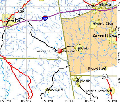
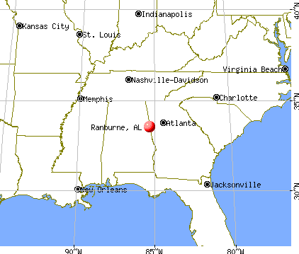
Ranburne, Alabama
Ranburne: North of Ranburne
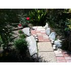
Ranburne: Flowerwood Nursery Cleburne County Road 10
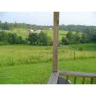
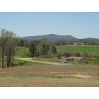
Ranburne: Rural farm just west of Ranburne
Ranburne: Turkey Heaven Mountain
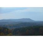
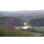
Ranburne: View from Macedonia area of Turkey Heaven Mountain
Ranburne
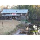
Ranburne: Grist Mill
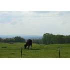
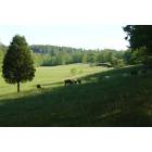
Ranburne: Grazing in God's Country
Ranburne: Between "The Store" and Macedonia
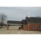
Ranburne: Ranburne Methodist Church
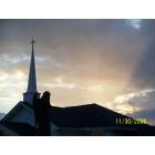
Ranburne: Macedonia Baptist Church
- see
16
more - add
your
Submit your own pictures of this town and show them to the world
- OSM Map
- General Map
- Google Map
- MSN Map
Population change since 2000: -7.2%
 |
| Males: 206 | |
| Females: 220 |
| Median resident age: | 41.0 years |
| Alabama median age: | 39.6 years |
Zip codes: 36273.
| Ranburne: | $75,582 |
| AL: | $59,674 |
Estimated per capita income in 2022: $38,729 (it was $19,708 in 2000)
Ranburne town income, earnings, and wages data
Estimated median house or condo value in 2022: $226,544 (it was $61,500 in 2000)
| Ranburne: | $226,544 |
| AL: | $200,900 |
Mean prices in 2022: all housing units: $234,177; detached houses: $259,436; mobile homes: $27,602
Median gross rent in 2022: $866.
Detailed information about poverty and poor residents in Ranburne, AL
Compare current foreclosures near Ranburne, AL:
| Photo | Address | Area | Beds / Baths | Price | Details |
|---|---|---|---|---|---|

|
#1
County Road 98
Ranburne, AL 36273
|
1,400 sq. feet
|
1 baths 2 beds |
show details | |

|
#2
County Road 720
Ranburne, AL 36273
|
- sq. feet
|
- baths - beds |
show details | |

|
#3
County Road 48
Ranburne, AL 36273
|
- sq. feet
|
- baths - beds |
show details | |

|
#4
County Road 49
Ranburne, AL 36273
|
- sq. feet
|
- baths - beds |
show details | |

|
#5
Highway 46
Ranburne, AL 36273
|
- sq. feet
|
- baths - beds |
show details | |

|
#6
River Rd
Ranburne, AL 36273
|
2,543 sq. feet
|
- baths - beds |
show details | |

|
#7
County Road 611
Ranburne, AL 36273
|
- sq. feet
|
- baths - beds |
show details | |

|
#8
Scarlett Place Dr
Bowdon, GA 30108
|
1,498 sq. feet
|
2 baths 3 beds |
show details | |

|
#9
Martin Luther King Jr St
Carrollton, GA 30117
|
1,092 sq. feet
|
1 baths 3 beds |
show details | |

|
#10
Mountain Creek Rd
Bowdon, GA 30108
|
2,170 sq. feet
|
2 baths 4 beds |
show details |
| Photo | Address | Area | Beds / Baths | Price | Details |
|---|---|---|---|---|---|

|
#11
Boulevard
Tallapoosa, GA 30176
|
816 sq. feet
|
1 baths 3 beds |
show details | |

|
#12
Katherine Ct
Carrollton, GA 30117
|
3,564 sq. feet
|
3 baths 2 beds |
show details | |

|
#13
Pounds Rd
Tallapoosa, GA 30176
|
1 sq. feet
|
2 baths 4 beds |
show details | |

|
#14
Preston Place Ct
Carrollton, GA 30117
|
1,499 sq. feet
|
2 baths 3 beds |
show details | |

|
#15
Oak Grove Rd
Carrollton, GA 30117
|
2,886 sq. feet
|
2 baths 4 beds |
show details | |

|
#16
Goose Creek Rd
Tallapoosa, GA 30176
|
1,796 sq. feet
|
1 baths 3 beds |
show details | |

|
#17
Cumberland Dr
Carrollton, GA 30117
|
2,712 sq. feet
|
2 baths 3 beds |
show details | |

|
#18
Reid St
Roopville, GA 30170
|
1,907 sq. feet
|
3 baths 4 beds |
show details | |

|
#19
Rome St
Carrollton, GA 30117
|
1,880 sq. feet
|
2 baths 3 beds |
show details | |

|
#20
Pine Grove Rd
Tallapoosa, GA 30176
|
912 sq. feet
|
1 baths 2 beds |
show details |
| Photo | Address | Area | Beds / Baths | Price | Details |
|---|---|---|---|---|---|

|
#21
Meadow Cir
Carrollton, GA 30117
|
1,608 sq. feet
|
2 baths 4 beds |
show details | |

|
#22
Camp Ln
Carrollton, GA 30117
|
2,062 sq. feet
|
3 baths 3 beds |
show details | |

|
#23
Mount Zion Rd
Carrollton, GA 30117
|
1,216 sq. feet
|
1 baths 2 beds |
show details | |

|
#24
Mount Zion Rd
Carrollton, GA 30117
|
720 sq. feet
|
1 baths 2 beds |
show details | |

|
#25
Charlcie Ct
Carrollton, GA 30117
|
1,280 sq. feet
|
2 baths 3 beds |
show details | |

|
#26
Lovvorn Rd
Carrollton, GA 30117
|
432 sq. feet
|
5 baths 7 beds |
show details | |

|
#27
Lambert Overlook Cir
Carrollton, GA 30117
|
1,230 sq. feet
|
2 baths 3 beds |
show details | |

|
#28
Tyler Ln
Carrollton, GA 30117
|
1,640 sq. feet
|
2 baths 3 beds |
show details | |

|
#29
Lambert Overlook Cir
Carrollton, GA 30117
|
1,240 sq. feet
|
2 baths 3 beds |
show details | |

|
#30
Yosemite Ct
Carrollton, GA 30117
|
1,500 sq. feet
|
3 baths 4 beds |
show details |
| Photo | Address | Area | Beds / Baths | Price | Details |
|---|---|---|---|---|---|

|
#31
Roosterville Rd
Franklin, GA 30217
|
1,600 sq. feet
|
1 baths 3 beds |
show details | |

|
#32
Maple St
Carrollton, GA 30117
|
1,486 sq. feet
|
2 baths 3 beds |
show details | |

|
#33
Mandeville Rd
Carrollton, GA 30117
|
1,016 sq. feet
|
2 baths 2 beds |
show details | |

|
#34
County School Rd
Tallapoosa, GA 30176
|
2,550 sq. feet
|
1 baths 3 beds |
show details | |

|
#35
Connecticut Ave
Tallapoosa, GA 30176
|
1,131 sq. feet
|
1 baths 2 beds |
show details | |

|
#36
Oak Grove Rd
Carrollton, GA 30117
|
1,874 sq. feet
|
2 baths 3 beds |
show details | |

|
#37
Wingo Rd
Tallapoosa, GA 30176
|
1,129 sq. feet
|
1 baths 2 beds |
show details | |

|
#38
Simonton Mill Rd
Carrollton, GA 30117
|
1,352 sq. feet
|
1 baths 3 beds |
show details | |

|
#39
Henson Cir
Carrollton, GA 30117
|
1,405 sq. feet
|
2 baths 3 beds |
show details | |

|
#40
Tyus Carrollton Rd
Carrollton, GA 30117
|
1,448 sq. feet
|
1 baths 3 beds |
show details |
| Photo | Address | Area | Beds / Baths | Price | Details |
|---|---|---|---|---|---|

|
#41
Cedar St
Carrollton, GA 30117
|
1,902 sq. feet
|
2 baths 3 beds |
show details | |

|
#42
Watts Rd
Bowdon, GA 30108
|
1,906 sq. feet
|
2 baths 3 beds |
show details | |

|
#43
W College St
Bowdon, GA 30108
|
3,096 sq. feet
|
2 baths 3 beds |
show details | |

|
#44
Wedowee St
Bowdon, GA 30108
|
658 sq. feet
|
1 baths 2 beds |
show details | |

|
#45
Copeland St
Bowdon, GA 30108
|
2,354 sq. feet
|
2 baths 3 beds |
show details | |

|
#46
N Carroll St
Bowdon, GA 30108
|
1,370 sq. feet
|
2 baths 3 beds |
show details | |

|
#47
Autumn Glen Dr
Carrollton, GA 30117
|
1,712 sq. feet
|
2 baths 3 beds |
show details | |

|
#48
Kuglar Rd
Bowdon, GA 30108
|
1,276 sq. feet
|
1 baths 3 beds |
show details | |

|
#49
Davenport Mill Rd
Carrollton, GA 30117
|
1,389 sq. feet
|
1 baths 3 beds |
show details | |

|
Check over 1 million property listings on Foreclosure.com!
|
browse all offers | |||


- 50691.7%White alone
- 213.8%Hispanic
- 132.4%Two or more races
- 61.1%Black alone
- 30.5%American Indian alone

According to our research of Alabama and other state lists, there were 9 registered sex offenders living in Ranburne, Alabama as of June 02, 2024.
The ratio of all residents to sex offenders in Ranburne is 51 to 1.
Type |
2009 |
2010 |
2011 |
2012 |
2013 |
2014 |
2015 |
2016 |
2017 |
2018 |
2019 |
2020 |
2021 |
2022 |
|---|---|---|---|---|---|---|---|---|---|---|---|---|---|---|
| Murders (per 100,000) | 0 (0.0) | 0 (0.0) | 0 (0.0) | 0 (0.0) | 0 (0.0) | 0 (0.0) | 0 (0.0) | 0 (0.0) | 0 (0.0) | 0 (0.0) | 0 (0.0) | 0 (0.0) | 0 (0.0) | 0 (0.0) |
| Rapes (per 100,000) | 0 (0.0) | 0 (0.0) | 0 (0.0) | 0 (0.0) | 0 (0.0) | 0 (0.0) | 0 (0.0) | 0 (0.0) | 0 (0.0) | 0 (0.0) | 0 (0.0) | 0 (0.0) | 0 (0.0) | 0 (0.0) |
| Robberies (per 100,000) | 0 (0.0) | 0 (0.0) | 0 (0.0) | 0 (0.0) | 0 (0.0) | 0 (0.0) | 0 (0.0) | 0 (0.0) | 0 (0.0) | 0 (0.0) | 0 (0.0) | 0 (0.0) | 0 (0.0) | 0 (0.0) |
| Assaults (per 100,000) | 3 (616.0) | 3 (733.5) | 3 (729.9) | 3 (735.3) | 0 (0.0) | 1 (246.9) | 3 (728.2) | 0 (0.0) | 1 (245.7) | 2 (495.0) | 3 (740.7) | 0 (0.0) | 3 (767.3) | 2 (476.2) |
| Burglaries (per 100,000) | 1 (205.3) | 7 (1,711) | 0 (0.0) | 2 (490.2) | 2 (493.8) | 4 (987.7) | 2 (485.4) | 3 (731.7) | 7 (1,720) | 2 (495.0) | 2 (493.8) | 0 (0.0) | 1 (255.8) | 1 (238.1) |
| Thefts (per 100,000) | 14 (2,875) | 5 (1,222) | 18 (4,380) | 9 (2,206) | 11 (2,716) | 4 (987.7) | 7 (1,699) | 17 (4,146) | 11 (2,703) | 10 (2,475) | 12 (2,963) | 3 (755.7) | 3 (767.3) | 5 (1,190) |
| Auto thefts (per 100,000) | 1 (205.3) | 1 (244.5) | 0 (0.0) | 0 (0.0) | 1 (246.9) | 1 (246.9) | 1 (242.7) | 1 (243.9) | 0 (0.0) | 2 (495.0) | 0 (0.0) | 2 (503.8) | 4 (1,023) | 0 (0.0) |
| Arson (per 100,000) | 0 (0.0) | 0 (0.0) | 0 (0.0) | 0 (0.0) | 0 (0.0) | 0 (0.0) | 0 (0.0) | 0 (0.0) | 0 (0.0) | 0 (0.0) | 0 (0.0) | 0 (0.0) | 0 (0.0) | 0 (0.0) |
| City-Data.com crime index | 269.0 | 335.0 | 321.2 | 269.6 | 163.0 | 177.8 | 267.0 | 236.6 | 277.6 | 272.3 | 301.2 | 70.5 | 283.9 | 159.5 |
The City-Data.com crime index weighs serious crimes and violent crimes more heavily. Higher means more crime, U.S. average is 246.1. It adjusts for the number of visitors and daily workers commuting into cities.

Crime rate in Ranburne detailed stats: murders, rapes, robberies, assaults, burglaries, thefts, arson
Full-time law enforcement employees in 2021, including police officers: 2 (1 officers - 1 male; 0 female).
| Officers per 1,000 residents here: | 2.56 |
| Alabama average: | 2.40 |
 Recent articles from our blog. Our writers, many of them Ph.D. graduates or candidates, create easy-to-read articles on a wide variety of topics.

 | Looking For Home Wherever (13 replies) |
Latest news from Ranburne, AL collected exclusively by city-data.com from local newspapers, TV, and radio stations
Ancestries: English (36.3%), American (24.1%), Irish (14.7%), German (5.7%), Italian (1.7%), European (1.2%).
Current Local Time: CST time zone
Elevation: 1020 feet
Land area: 1.58 square miles.
Population density: 269 people per square mile (very low).
6 residents are foreign born
| This town: | 1.1% |
| Alabama: | 3.5% |
Median real estate property taxes paid for housing units with mortgages in 2022: $893 (0.2%)
Median real estate property taxes paid for housing units with no mortgage in 2022: $566 (0.3%)
Nearest city with pop. 50,000+: Marietta, GA  (54.8 miles , pop. 58,748).
Nearest city with pop. 200,000+: Atlanta, GA (56.5 miles , pop. 416,474).
Nearest city with pop. 1,000,000+: Chicago, IL (589.1 miles , pop. 2,896,016).
Nearest cities:
), ), ), Latitude: 33.53 N, Longitude: 85.34 W
Area code: 256


| Here: | 2.4% |
| Alabama: | 2.6% |

- Construction (12.9%)
- Metal & metal products (11.3%)
- Apparel (10.9%)
- Agriculture, forestry, fishing & hunting (6.9%)
- Educational services (6.5%)
- Truck transportation (6.0%)
- Accommodation & food services (4.0%)

- Construction (20.8%)
- Metal & metal products (19.4%)
- Agriculture, forestry, fishing & hunting (11.1%)
- Truck transportation (10.4%)
- Administrative & support & waste management services (6.2%)
- Repair & maintenance (4.9%)
- Printing & related support activities (2.8%)

- Apparel (23.1%)
- Educational services (12.5%)
- Accommodation & food services (9.6%)
- Public administration (8.7%)
- Gasoline stations (5.8%)
- Finance & insurance (3.8%)
- Social assistance (3.8%)

- Driver/sales workers and truck drivers (7.3%)
- Other production occupations, including supervisors (6.0%)
- Textile, apparel, and furnishings workers (6.0%)
- Other management occupations, except farmers and farm managers (5.2%)
- Metal workers and plastic workers (5.2%)
- Preschool, kindergarten, elementary, and middle school teachers (4.8%)
- Building and grounds cleaning and maintenance occupations (4.8%)

- Driver/sales workers and truck drivers (12.5%)
- Metal workers and plastic workers (9.0%)
- Other production occupations, including supervisors (7.6%)
- Other management occupations, except farmers and farm managers (6.2%)
- Construction traders workers except carpenters, electricians, painters, plumbers, and construction laborers (6.2%)
- Agricultural workers, including supervisors (4.9%)
- Electrical equipment mechanics and other installation, maintenance, and repair workers, including supervisors (4.9%)

- Textile, apparel, and furnishings workers (11.5%)
- Secretaries and administrative assistants (9.6%)
- Preschool, kindergarten, elementary, and middle school teachers (8.7%)
- Building and grounds cleaning and maintenance occupations (5.8%)
- Cooks and food preparation workers (4.8%)
- Customer service representatives (4.8%)
- Other management occupations, except farmers and farm managers (3.8%)
Average climate in Ranburne, Alabama
Based on data reported by over 4,000 weather stations


Tornado activity:
Ranburne-area historical tornado activity is near Alabama state average. It is 92% greater than the overall U.S. average.
On 5/27/1973, a category F4 (max. wind speeds 207-260 mph) tornado 23.5 miles away from the Ranburne town center killed 7 people and injured 199 people and caused between $5,000,000 and $50,000,000 in damages.
On 5/1/1953, a category F4 tornado 28.2 miles away from the town center killed 7 people and injured 12 people and caused between $50,000 and $500,000 in damages.
Earthquake activity:
Ranburne-area historical earthquake activity is significantly above Alabama state average. It is 77% greater than the overall U.S. average.On 4/29/2003 at 08:59:39, a magnitude 4.9 (4.4 MB, 4.6 MW, 4.9 LG, Class: Light, Intensity: IV - V) earthquake occurred 69.0 miles away from Ranburne center
On 1/18/1999 at 07:00:53, a magnitude 4.8 (4.8 MB, 4.0 LG, Depth: 0.6 mi) earthquake occurred 110.6 miles away from the city center
On 4/29/2003 at 08:59:39, a magnitude 4.6 (4.6 MW, Depth: 12.3 mi) earthquake occurred 69.0 miles away from Ranburne center
On 8/2/1974 at 08:52:09, a magnitude 4.9 (4.3 MB, 4.9 LG) earthquake occurred 166.0 miles away from Ranburne center
On 10/24/1997 at 08:35:17, a magnitude 4.9 (4.8 MB, 4.2 MS, 4.9 LG, Depth: 6.2 mi) earthquake occurred 200.8 miles away from the city center
On 11/30/1973 at 07:48:41, a magnitude 4.7 (4.7 MB, 4.6 ML) earthquake occurred 175.8 miles away from the city center
Magnitude types: regional Lg-wave magnitude (LG), body-wave magnitude (MB), local magnitude (ML), surface-wave magnitude (MS), moment magnitude (MW)
Natural disasters:
The number of natural disasters in Cleburne County (16) is near the US average (15).Major Disasters (Presidential) Declared: 9
Emergencies Declared: 6
Causes of natural disasters: Storms: 6, Tornadoes: 6, Floods: 5, Hurricanes: 5, Winds: 2, Drought: 1, Snowfall: 1, Winter Storm: 1, Other: 1 (Note: some incidents may be assigned to more than one category).

Hospitals and medical centers near Ranburne:
- BOWDON AREA HOSPITAL (Hospital, about 5 miles away; BOWDON, GA)
- BAGWELL NH (Nursing Home, about 15 miles away; CARROLLTON, GA)
- CARROLLTON MANOR, INCORPORATED (Nursing Home, about 15 miles away; CARROLLTON, GA)
- CARROLLTON MANOR (Nursing Home, about 15 miles away; CARROLLTON, GA)
- CARROLL CONVALESCENT CENTER (Nursing Home, about 16 miles away; CARROLLTON, GA)
- CARROLLTON NURSING AND REHAB CTR (Nursing Home, about 16 miles away; CARROLLTON, GA)
- FRESENIUS MEDICAL CARE CARROL COUNTY (Dialysis Facility, about 16 miles away; CARROLLTON, GA)
Colleges/universities with over 2000 students nearest to Ranburne:
- University of West Georgia (about 15 miles; Carrollton, GA; Full-time enrollment: 10,358)
- West Georgia Technical College (about 15 miles; Waco, GA; FT enrollment: 4,768)
- Southern Union State Community College (about 31 miles; Wadley, AL; FT enrollment: 4,120)
- Jacksonville State University (about 32 miles; Jacksonville, AL; FT enrollment: 7,566)
- Georgia Highlands College (about 46 miles; Rome, GA; FT enrollment: 4,071)
- Gadsden State Community College (about 50 miles; Gadsden, AL; FT enrollment: 4,650)
- Georgia Northwestern Technical College (about 50 miles; Rome, GA; FT enrollment: 4,629)
Public high school in Ranburne:
- RANBURNE HIGH SCH (Students: 530, Location: 21045 MAIN ST, Grades: 5-12)
Public elementary/middle school in Ranburne:
- RANBURNE ELEM SCH (Students: 313, Location: 181 YOUNG DR, Grades: KG-4)
Points of interest:
Notable location: Ranburne Fire and Rescue (A). Display/hide its location on the map
Park in Ranburne: Bulldog Stadium (1). Display/hide its location on the map
Drinking water stations with addresses in Ranburne and their reported violations in the past:
RANBURNE WATER & SEWER DEPARTMENT (Population served: 1,791, Purch surface water):Past health violations:
- MCL, Average - Between OCT-2010 and DEC-2010, Contaminant: Total Haloacetic Acids (HAA5). Follow-up actions: St AO (w/o penalty) issued (NOV-04-2010), St Public Notif requested (JAN-11-2011), St Violation/Reminder Notice (JAN-11-2011), St Public Notif received (FEB-07-2011), St Compliance achieved (DEC-12-2011)
- MCL, Average - Between JUL-2010 and SEP-2010, Contaminant: Total Haloacetic Acids (HAA5). Follow-up actions: St Public Notif requested (NOV-04-2010), St AO (w/o penalty) issued (NOV-04-2010), St Violation/Reminder Notice (NOV-04-2010), St Public Notif received (DEC-13-2010), St Compliance achieved (DEC-12-2011)
- MCL, Average - Between APR-2010 and JUN-2010, Contaminant: Total Haloacetic Acids (HAA5). Follow-up actions: St Public Notif requested (JUL-12-2010), St Violation/Reminder Notice (JUL-12-2010), St Public Notif received (AUG-16-2010), St AO (w/o penalty) issued (NOV-04-2010), St Compliance achieved (DEC-12-2011)
- MCL, Average - Between JAN-2010 and MAR-2010, Contaminant: Total Haloacetic Acids (HAA5). Follow-up actions: St Public Notif requested (APR-12-2010), St Violation/Reminder Notice (APR-12-2010), St Public Notif received (MAY-25-2010), St AO (w/o penalty) issued (NOV-04-2010), St Compliance achieved (DEC-12-2011)
| This town: | 2.4 people |
| Alabama: | 2.5 people |
| This town: | 74.7% |
| Whole state: | 67.8% |
| This town: | 0.6% |
| Whole state: | 4.7% |
No gay or lesbian households reported
Banks with branches in Ranburne (2011 data):
- Branch Banking and Trust Company: Ranburne Branch at 21454 Main Street, branch established on 1967/01/03. Info updated 2010/03/29: Bank assets: $168,867.6 mil, Deposits: $127,549.5 mil, headquarters in Winston Salem, NC, positive income, Commercial Lending Specialization, 1793 total offices, Holding Company: Bb&T Corporation
- Small Town Bank: Ranburne Branch at 21044 Main Street, branch established on 2003/02/10. Info updated 2011/02/24: Bank assets: $236.7 mil, Deposits: $196.0 mil, headquarters in Wedowee, AL, positive income, 4 total offices, Holding Company: East Alabama Financial Group, Inc.
For population 15 years and over in Ranburne:

- Never married: 24.6%
- Now married: 57.1%
- Separated: 0.4%
- Widowed: 9.5%
- Divorced: 8.4%
For population 25 years and over in Ranburne:
- High school or higher: 86.2%
- Bachelor's degree or higher: 27.6%
- Graduate or professional degree: 13.0%
- Unemployed: 1.6%
- Mean travel time to work (commute): 37.0 minutes


| Here: | 10.2 |
| Alabama average: | 11.5 |
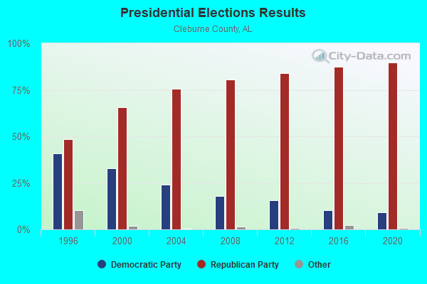
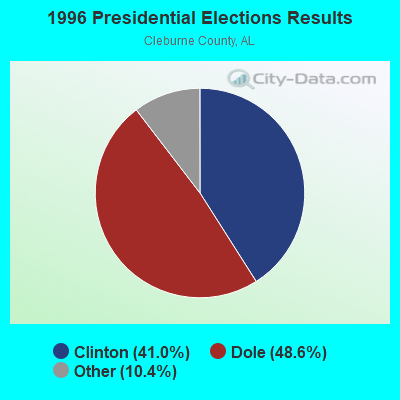
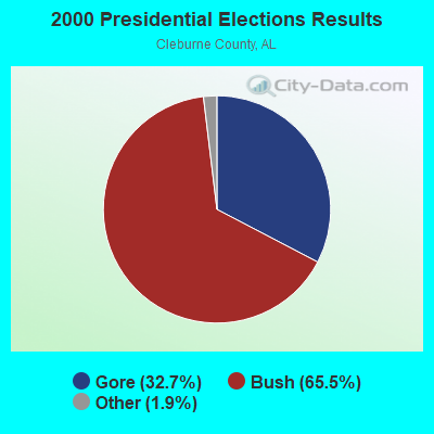
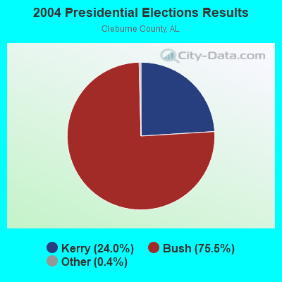
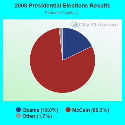
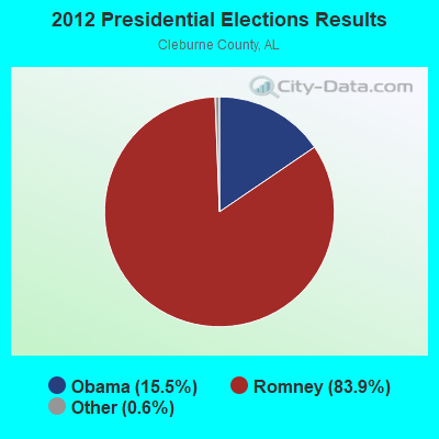
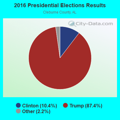
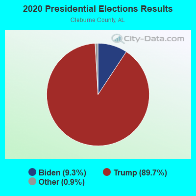
Graphs represent county-level data. Detailed 2008 Election Results
Religion statistics for Ranburne, AL (based on Cleburne County data)
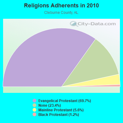
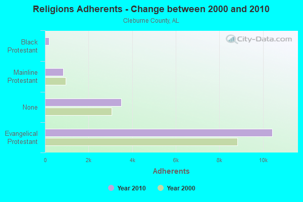
| Religion | Adherents | Congregations |
|---|---|---|
| Evangelical Protestant | 10,435 | 48 |
| Mainline Protestant | 844 | 17 |
| Black Protestant | 183 | 1 |
| Other | 1 | - |
| None | 3,509 | - |
Food Environment Statistics:
| Here: | 2.72 / 10,000 pop. |
| Alabama: | 1.89 / 10,000 pop. |
| Cleburne County: | 6.80 / 10,000 pop. |
| Alabama: | 6.32 / 10,000 pop. |
| Here: | 3.40 / 10,000 pop. |
| State: | 5.75 / 10,000 pop. |
| Cleburne County: | 10.1% |
| State: | 11.8% |
| Cleburne County: | 29.3% |
| Alabama: | 31.7% |
| Cleburne County: | 10.2% |
| Alabama: | 13.5% |
Health and Nutrition:
| Here: | 59.5% |
| State: | 49.0% |
| Ranburne: | 61.0% |
| Alabama: | 45.7% |
| Ranburne: | 27.9 |
| Alabama: | 28.9 |
| Ranburne: | 16.5% |
| Alabama: | 20.7% |
| This city: | 7.8% |
| Alabama: | 11.0% |
| Ranburne: | 7.0 |
| Alabama: | 6.8 |
| Ranburne: | 34.5% |
| Alabama: | 34.4% |
| This city: | 65.4% |
| Alabama: | 55.2% |
| Ranburne: | 81.3% |
| Alabama: | 79.3% |
More about Health and Nutrition of Ranburne, AL Residents
| Local government employment and payroll (March 2022) | |||||
| Function | Full-time employees | Monthly full-time payroll | Average yearly full-time wage | Part-time employees | Monthly part-time payroll |
|---|---|---|---|---|---|
| Other and Unallocable | 0 | $0 | 0 | $0 | |
| Totals for Government | 0 | $0 | 0 | $0 | |
Ranburne government finances - Expenditure in 2017 (per resident):
- Current Operations - Financial Administration: $74,000 ($173.71)
Police Protection: $57,000 ($133.80)
Judicial and Legal Services: $22,000 ($51.64)
General - Other: $13,000 ($30.52)
Regular Highways: $13,000 ($30.52)
Local Fire Protection: $8,000 ($18.78)
- General - Interest on Debt: $1,000 ($2.35)
- Other Capital Outlay - Financial Administration: $17,000 ($39.91)
Local Fire Protection: $7,000 ($16.43)
- Total Salaries and Wages: $66,000 ($154.93)
Ranburne government finances - Revenue in 2017 (per resident):
- Local Intergovernmental - Other: $12,000 ($28.17)
General Local Government Support: $3,000 ($7.04)
- Miscellaneous - Fines and Forfeits: $25,000 ($58.69)
Interest Earnings: $3,000 ($7.04)
Rents: $2,000 ($4.69)
- State Intergovernmental - Other: $4,000 ($9.39)
- Tax - General Sales and Gross Receipts: $90,000 ($211.27)
Other License: $35,000 ($82.16)
Motor Fuels Sales: $12,000 ($28.17)
Property: $9,000 ($21.13)
Alcoholic Beverage Sales: $5,000 ($11.74)
Public Utility License: $4,000 ($9.39)
Other: $3,000 ($7.04)
Tobacco Products Sales: $1,000 ($2.35)
Ranburne government finances - Debt in 2017 (per resident):
- Long Term Debt - Beginning Outstanding - Unspecified Public Purpose: $10,000 ($23.47)
Retired Unspecified Public Purpose: $10,000 ($23.47)
Ranburne government finances - Cash and Securities in 2017 (per resident):
- Other Funds - Cash and Securities: $83,000 ($194.84)
Businesses in Ranburne, AL
- U-Haul: 1
Strongest AM radio stations in Ranburne:
- WKNG (1060 AM; daytime; 50 kW; TALLAPOOSA, GA; Owner: WKNG, INC.)
- WNSI (810 AM; 50 kW; JACKSONVILLE, AL; Owner: UNITED BROADCASTING NETWORK, INC.)
- WGST (640 AM; 50 kW; ATLANTA, GA; Owner: CITICASTERS LICENSES, L.P.)
- WMLB (1160 AM; 50 kW; EAST POINT, GA; Owner: ATLANTA AREA BROADCASTING, INC.)
- WFTD (1080 AM; daytime; 50 kW; MARIETTA, GA; Owner: PRIETO ENTERPRISES, INC.)
- WCNN (680 AM; 50 kW; NORTH ATLANTA, GA; Owner: DICKEY BROADCASTING COMPANY)
- WSB (750 AM; 50 kW; ATLANTA, GA; Owner: CXR HOLDINGS, INC.)
- WAOK (1380 AM; 50 kW; ATLANTA, GA; Owner: INFINITY BROADCASTING OPERATIONS, INC.)
- WGUN (1010 AM; 50 kW; ATLANTA, GA; Owner: WGUN, INC.)
- WAZX (1550 AM; 50 kW; SMYRNA, GA; Owner: GA-MEX BROADCASTING, INC.)
- WQXI (790 AM; 28 kW; ATLANTA, GA; Owner: JEFFERSON-PILOT COMMUNICATIONS COMPANY OF GEORGIA)
- WDJC (850 AM; 50 kW; BIRMINGHAM, AL; Owner: KIMTRON, INC.)
- WJOX (690 AM; 50 kW; BIRMINGHAM, AL; Owner: CITADEL BROADCASTING COMPANY)
Strongest FM radio stations in Ranburne:
- WMAX-FM (105.3 FM; BOWDON, GA; Owner: CLEAR CHANNEL BROADCASTING LICENSES, INC.)
- WTBJ (91.3 FM; OXFORD, AL; Owner: TRINITY CHRISTIAN ACADEMY)
- WCKS (102.7 FM; FRUITHURST, AL; Owner: WCKS, INC.)
- WALR-FM (104.1 FM; LA GRANGE, GA; Owner: CXR HOLDINGS, INC.)
- WBTR-FM (92.1 FM; CARROLLTON, GA; Owner: WYAI, INC.)
- WVOK-FM (97.9 FM; OXFORD, AL; Owner: WOODARD BROADCASTING CO. INC.)
- WLJS-FM (91.9 FM; JACKSONVILLE, AL; Owner: BD. OF TRUSTEES/JACKSONVILLE STATE UNIVERSITY)
- WUWG (90.7 FM; CARROLLTON, GA; Owner: WEST GEORGIA COLLEGE)
- WELR-FM (102.3 FM; ROANOKE, AL; Owner: EAGLE'S NEST, INC.)
- WJCK (88.3 FM; PIEDMONT, AL; Owner: IMMANUEL BROADCASTING NETWORK, INC.)
- W269AX (101.7 FM; ANNISTON, AL; Owner: BIBLE BROADCASTING NETWORK, INC.)
- WASZ (95.5 FM; ASHLAND, AL; Owner: WILLIAMS COMMUNICATIONS, INC.)
TV broadcast stations around Ranburne:
- W04DB (Channel 4; ATLANTA, GA; Owner: VVILPTV, INC.)
- WCIQ (Channel 7; MOUNT CHEAHA, AL; Owner: ALABAMA EDUCATIONAL TELEVISION COMMISSION)
- W49AD (Channel 49; CARROLLTON, GA; Owner: GEORGIA PUBLIC TELECOMMUNICATIONS COMMISSION)
Ranburne fatal accident list:
Mar 9, 1997 07:21 PM, 46, Vehicles: 1, Persons: 2, Fatalities: 2
- National Bridge Inventory (NBI) Statistics
- 12Number of bridges
- 125ft / 37.8mTotal length
- $10,755,000Total costs
- 10,055Total average daily traffic
- 760Total average daily truck traffic
- 14,343Total future (year 2030) average daily traffic

- New bridges - historical statistics
- 21940-1949
- 11950-1959
- 21960-1969
- 51970-1979
- 11990-1999
- 12000-2009
FCC Registered Antenna Towers:
28 (See the full list of FCC Registered Antenna Towers in Ranburne)FCC Registered Microwave Towers:
4- STATION, On Turkey Heaven Mtn 3 Mi From Cr 35 (Lat: 33.547861 Lon: -85.466056), Overall height: 48.8 m, Call Sign: WNEM556,
Assigned Frequencies: 957.150 MHz, Grant Date: 12/04/1996, Expiration Date: 01/31/2001, Cancellation Date: 12/05/2000, Phone: (205) 325-3804
- On Turkey Heaven Mountain 3 Mi From Cr 35 (Lat: 33.547861 Lon: -85.466056), Overall height: 48.8 m, Call Sign: WPNC915,
Assigned Frequencies: 1985.00 MHz, Grant Date: 03/27/1997, Expiration Date: 03/27/2002, Cancellation Date: 05/22/1997, Phone: (202) 416-6516
- On Turkey Heaven Mountain 3 Mi From Cr 35 (Lat: 33.547861 Lon: -85.466056), Overall height: 48.8 m, Call Sign: WPND814,
Assigned Frequencies: 1965.00 MHz, Grant Date: 03/28/1997, Expiration Date: 03/28/2002, Cancellation Date: 10/17/1997, Phone: (202) 328-4500
- RANBURNE, 2142 County Road 63 (021445 / Hightower) (Lat: 33.524944 Lon: -85.393417), Type: Mast, Structure height: 76.5 m, Overall height: 78.9 m, Call Sign: WQQS804,
Assigned Frequencies: 6004.50 MHz, 6063.80 MHz, 6078.62 MHz, 6078.62 MHz, 6078.62 MHz, 6078.62 MHz, 6078.62 MHz, 6078.62 MHz, 6078.62 MHz, 6137.92 MHz... (+6 more), Grant Date: 01/24/2023, Expiration Date: 02/25/2033, Certifier: Gregory M Romano, Registrant: Verizon, 5055 Northpointe Pkwy, Alpharetta, GA 30022, Phone: (770) 797-1070, Email:
FCC Registered Amateur Radio Licenses:
14 (See the full list of FCC Registered Amateur Radio Licenses in Ranburne)2004 - 2018 National Fire Incident Reporting System (NFIRS) incidents
- Fire incident types reported to NFIRS in Ranburne, AL
- 10346.4%Outside Fires
- 8638.7%Structure Fires
- 198.6%Mobile Property/Vehicle Fires
- 146.3%Other
 Based on the data from the years 2004 - 2018 the average number of fire incidents per year is 15. The highest number of reported fires - 43 took place in 2007, and the least - 0 in 2017. The data has a decreasing trend.
 When looking into fire subcategories, the most reports belonged to: Outside Fires (46.4%), and Structure Fires (38.7%).
| Most common first names in Ranburne, AL among deceased individuals | ||
| Name | Count | Lived (average) |
|---|---|---|
| James | 17 | 66.1 years |
| Robert | 15 | 75.8 years |
| John | 15 | 78.1 years |
| William | 15 | 72.9 years |
| Mary | 12 | 75.8 years |
| Henry | 8 | 79.8 years |
| Walter | 7 | 73.4 years |
| Essie | 6 | 87.2 years |
| Willie | 6 | 82.5 years |
| Thomas | 5 | 82.0 years |
| Most common last names in Ranburne, AL among deceased individuals | ||
| Last name | Count | Lived (average) |
|---|---|---|
| Smith | 43 | 75.1 years |
| Gibbs | 17 | 80.8 years |
| Wiggins | 13 | 77.4 years |
| Ledbetter | 9 | 66.7 years |
| Brown | 9 | 79.4 years |
| Skinner | 9 | 73.9 years |
| Pollard | 7 | 80.3 years |
| Estes | 7 | 78.0 years |
| Alewine | 7 | 83.0 years |
| Johnson | 7 | 76.6 years |

- 63.6%Electricity
- 33.1%Bottled, tank, or LP gas
- 1.3%Utility gas
- 1.3%Wood
- 0.6%Other fuel

- 83.3%Electricity
- 16.7%Bottled, tank, or LP gas
Ranburne compared to Alabama state average:
- Unemployed percentage significantly below state average.
- Black race population percentage significantly below state average.
- Foreign-born population percentage significantly below state average.
- Renting percentage below state average.
- Length of stay since moving in significantly above state average.

|
Total of 1 patent application in 2008-2024.