Please register to participate in our discussions with 2 million other members - it's free and quick! Some forums can only be seen by registered members. After you create your account, you'll be able to customize options and access all our 15,000 new posts/day with fewer ads.
Also, there's quite a few rider meetups around town. For more info call the guys at Trek in either West Ashley or Mt. Pleasant. https://www.trekbikesofmountpleasant.com/
So it doesn't show the lanes on the Johnny Dodds frontage roads or any others in MP ... I'm guessing it's because the map is only for the city of Charleston and not MP.
So it doesn't show the lanes on the Johnny Dodds frontage roads or any others in MP ... I'm guessing it's because the map is only for the city of Charleston and not MP.
So it doesn't show the lanes on the Johnny Dodds frontage roads or any others in MP ... I'm guessing it's because the map is only for the city of Charleston and not MP.
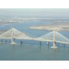
The "Mount Pleasant Way" concept map (p.37 of the Draft Comprehensive Plan) shows existing bike/multi-purpose/sidewalk infrastructure (haven't seen a better resolution map - you can probably email the Transportation Department & ask for a higher-res version).
Please register to post and access all features of our very popular forum. It is free and quick. Over $68,000 in prizes has already been given out to active posters on our forum. Additional giveaways are planned.
Detailed information about all U.S. cities, counties, and zip codes on our site: City-data.com.

 Please register to participate in our discussions with 2 million other members - it's free and quick! Some forums can only be seen by registered members. After you create your account, you'll be able to customize options and access all our 15,000 new posts/day with fewer ads.