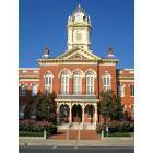
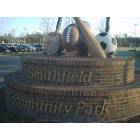
Neighborhoods in Charlotte (Monroe, Smithfield, Davidson: quality of life, live, shop)
Please register to participate in our discussions with 2 million other members - it's free and quick! Some forums can only be seen by registered members. After you create your account, you'll be able to customize options and access all our 15,000 new posts/day with fewer ads.
Hello,
I hear a lot of references to the different neighborhoods/areas within Charlotte (Elizabeth, Dilworth, South Park, Steele Creek, etc.) And while I have a vague idea of where each of these places are on the map, I was wondering if there was a good website I could go to that showed me the boundaries of each of the neighborhoods, or if some helpful Charlottean wouldn't mind putting together a post describing them? I'll be visiting Charlotte in a couple weeks, and I'd like to have as much information as I can before then. Thanks!
(Elizabeth, Dilworth, South Park, Steele Creek, etc.)
I'll try to give you some rough boundaries. Some of the lines are fuzzy, so this is just a general idea.
Elizabeth = Just SE of uptown. Boundaries: N - Kings, W - Randolph, S - 5th & 7th, E - Independence. It revolves around 7th Street, which becomes Monroe.
Dilworth = just SSW of uptown- N - uptown /Caldwell, W - East Blvd, S - Ideal Way, E - Morehead/Queens.
SouthPark = the area around SouthPark Mall which is at the intersection of Sharon Rd. and Fairview. N - Wendover, W - Park Road, S - Smithfield Church, E - Providence
Myers Park = the grand old area just S of uptown. N - uptown, W - Morehead/Queens, S - Wendover, E - Randolph.
Cotswold = SSE of uptown. N - Wendover, W - Randolph, S - Rama, E - Monroe
Steele Creek = South of the airport. N - Shopton , W - Shopton, S - Tryon, E - I485/Tryon
NoDa = the funky area NE of uptown around 36th and Davidson. I don't know boundaries up there.
Plaza Midwood = Just SE of uptown, E of Elizabeth. N - Pecan, W - Central, S - Morningside, E - Mecklenburg Ave.
Ballantyne = Southern edge of Charlotte city. N - I485, W - Lancaster Highway, S - Ardrey Kell, E - Rea Road
Anyone know what you call the area south of the SouthPark area down to Pineville - around the Park Road corridor? I struggled there. Quail Hollow is part of it, but that's not all encompassing.
Phew, that taxed my brain. I'm sure others can provide some other neighborhoods you may see referenced on the board. Maybe someone could define what's currently considered Waxhaw, Marvin and Wesley Chapel, since the real world definitions aren't exactly the same as the map depicts. I'd be interested to see that since I know more and more people who live down there and I don't know the area well.
That area you aren't sure of IS south Charlotte; Park Road all the way down to Park Rd Extension. At Park Rd Ext it becomes Pineville. Good job on your info
Please register to post and access all features of our very popular forum. It is free and quick. Over $68,000 in prizes has already been given out to active posters on our forum. Additional giveaways are planned.
Detailed information about all U.S. cities, counties, and zip codes on our site: City-data.com.

 Please register to participate in our discussions with 2 million other members - it's free and quick! Some forums can only be seen by registered members. After you create your account, you'll be able to customize options and access all our 15,000 new posts/day with fewer ads.