Please register to participate in our discussions with 2 million other members - it's free and quick! Some forums can only be seen by registered members. After you create your account, you'll be able to customize options and access all our 15,000 new posts/day with fewer ads.
In Hawaiian Kailua means "two seas" or "two currents," so like Waiamea, it's a name that was used in several place names on different islands, such as Kailua Bay and the town of Kailua on Oahu. And again, like Waimea, the US Postal Service is responsible for the name of the little town on the west coast of the Island of Hawai'i being changed to Kailua-Kona to avoid confusion of the mail delivery when the first Post Office was built there in the early 1900s, because it was in the part of the island referred to as Kona.
Kona is the Hawiian word for the leeward, or dry side of an island, as opposed to ko'olau, which is what the windward or wet side is called. Because the prevailing trade winds blow from the Northeast, this means the northeast and east sides of all the Hawaiian islands are are referred to as the ko'olau sides, while the west and southwest sides are referred to as the kona sides. In traditional Hawaiian culture, each of the islands had an area known locally as Kona.
Today the County of Hawai'i is divided into 9 moku, or administrative districts, and Kailua-Kona is in middle of the one called North Kona, which extends from near Waikoloa down the coast to Kealakekua, while South Kona District continues south to the start of Ka'u district at Manuka Bay.
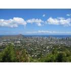
If you're checking out restaurants on Yelp, or just checking out addresses online, be sure to specify that you're searching for Kailua if you want the town on Oahu, and Kailua-Kona if you want the town on the Big Island. And Kona has become familiar slang for the Kailua-Kona area, as in "I got it at Costco in Kona."
In Hawaiian Kailua means "two seas" or "two currents," so like Waiamea, it's a name that was used in several place names on different islands, such as Kailua Bay and the town of Kailua on Oahu.
Where the heck is "Waiamea?"
Since you already covered "Waimea" and "Kailua", I might as well mention "Waialua" ("two waters"). There's a "Waialua" on Molokaʻi and another one on Oʻahu.
Since you already covered "Waimea" and "Kailua", I might as well mention "Waialua" ("two waters"). There's a "Waialua" on Molokaʻi and another one on Oʻahu.
Oh, yeah, look at that! The one with the Post Office is on Oahu, not far from Waiamea... errrkkk... Waimea Bay!
Hey, JJ, that reminds me, whaddya think about this recipe for Kilauea Pig and Cabbage?... oops, no, I mean Kailua Pig... errrkkk, I mean Kālua Pig... yeah, that's it, Kālua Pig and Cabbage. So good!
I mean, if I cubed up some Spam and added it, wouldn't that be a complete and balanced meal, Maui style? Or am I missing something?
Another native Idahoan here (expatriated to Texas) who knows a little about the Owyhee name. But, Wikipedia has as good an explanation as any. The story always caught my imagination to think of Native Hawaiians brought to the Northwest (in 1819) well before it was settled by any anglos (let alone before it was solely part of the U.S.) and meeting their fate in an unforgiving desert wilderness.
Here is the explanation from Wikipedia's Owyhee County article:
"...In 1819, three Owyhees joined Donald Mackenzie's Snake (River) expedition, which went out annually into the Snake country for the North West Company, a Montreal-based organization of Canadian fur traders. The three Hawaiians left the main party during the winter of 1819-20 to explore the then unknown terrain of what since has been called the Owyhee River and mountains and disappeared. They were presumed dead and no further information regarding their whereabouts has been found. In memory of these Native Hawaiians, British fur trappers started to call the region "Owyhee" and the name stuck...."
Owyhee county was the first county organized under Idaho territory (there were a few older organized when it was part of Washington territory) and is the second largest county in the state (Idaho county is larger). At close to 7,700 square miles, it is larger than several states, including Hawaii. It is composed of mostly remote desert wilderness, the Owyhee mountains, and Owyhee canyonlands, which continue to receive some support to be incorporated as a national monument. A ghost town, Silver City, was once the largest town in the Pacific Northwest, and many of its buildings still remain. Once the mining panned out, the town died.
Mahalo for the interesting thread. Hope to make it back to your lovely islands some day. Hawaii was my 50th and last state to visit and I enjoyed my time there.
Can't argue with anything previously written. However, just finished reading a series of books about the Oregon Territory. In one volume, the author, Gale Ontko, writes that Peter Skene Ogden named the Owyhee due to two Hawaiians having been murdered there in 1819. The name extends from Owyhee County, Idaho, to the Owyhee River that crosses into Oregon and forms the Owyhee Reservoir behind the Owyhee Dam, also called Lake Owyhee. The reservoir provides irrigation water to about 110,000 acres of farm land along the western side of the Snake River. Some Idaho acreage is also irrigated in the Adrian,Oregon and Homedale, Idaho area. The Dam also provides electrical power to the grid. The Owyhee River joins the Snake in the area of Nyssa, Oregon.
I was in Silver City in Owyhee County last week. It was the County Seat until the mid-1930's, when it was moved to Murphy, which is just a few buildings, mostly of the government type and an interesting museum of the frontier type. Silver City is still mostly a ghost town, but some people reside there in the summer. They brag that there is no aluminum or mobile homes allowed in the city. It is 4WD country, except that passenger cars can make the trip in in good weather if you're willling to subject your car to the beating. From US 95 in Oregon, the sign reads that Silver City is 25 miles. Be prepared for up to two hours of driving time. From the Idaho side, the trip is about 20 miles from near Murphy, and not quite so difficult, but terribly dangerous, slow and dirty. Noteworthy is that some of the old building in Idaho City have doors out the second story but no deck or porch. It is said that they were winter doors for when the snow was twelve feet deep. Get the idea?
Can't argue with anything previously written. Noteworthy is that some of the old building in Idaho City have doors out the second story but no deck or porch. It is said that they were winter doors for when the snow was twelve feet deep. Get the idea?
A set of stairs would have been handy in case the snow was only 3 feet deep.
This may be the most obscure story I've found yet. In 1911 Iosepa (pronounced yo see pa) was a neat little village with yellow rose bushes planted along the streets, with about 200 residents, in Skull Valley Utah, roughly 70 miles west of Salt Lake City. But by 1917 it was abandoned, and today it is a ghost town, without even a geographical location marker on most maps. The remaining small cemetery, with gravestones and memorial markers, is the site of an annual celebration of this unique community, and of the Hawaiians who once lived there.
Iosepa was founded in 1889 by about 100 kanaka Mormons from Hawai'i, who had been converted by American missionaries, but who had no temple to worship at. So they traveled to Utah, to be near the Salt Lake City temple, and were scattered around the area until an organized effort found a large ranch property they could buy, and they named the village they formed there Iosepa, after Joseph F. Smith, a Mormon missionary to Hawai'i, and nephew of THE Joseph F. Smith, Jr., founder of the Mormon Church.
How did they get Iosepa from Joseph? The same way they got Kamuela from Samuel, and Mele Kalikimaka from Merry Christmas, by making sound substitutions that fit the Hawaiian language and way of speaking. There is no "J" sound in Hawaiian, so "I" replaced it, which combined with the following "O" to make an "ee o" sound which blended to a kind of "yo." Also there's no "F" or "Ph" sound in Hawaiian so "P" had to carry the day, and finally, consonant sounds are nearly always followed by a vowel, so the final "A" was added.
To the neighboring locals, though, it was commonly referred to as Kanaka Ranch, a name which still persists in the local area. But the residents of Iosepa had quite a hard time, including several very bad crop years, and bouts of illness, including three cases of Leprosy, which led to a lot of fear of contact with the people who lived there. Finally, in 1917 the first Mormon Temple outside mainland US was built in Lā'ie, Hawai'i, on the Island of Oahu, and most of the kanakas in the area moved to Lā'ie at that time. The property was sold to a ranching corporation and the village became a ghost town. But each year islanders from all over come to the Iosepa cemetary, now under the care of the Bureau of Land management, to celebrate these early pioneers. See this story for some interesting pics, including depictions of native Hawaiians in traditional helmets found in the cemetery.
Here's a fascinating detail... photos of the petroglyphs carved in the Utah rocks by Hawaiians living in Iosepa, and a photo of the memorial, with a flower lei around the bust.
Please register to post and access all features of our very popular forum. It is free and quick. Over $68,000 in prizes has already been given out to active posters on our forum. Additional giveaways are planned.
Detailed information about all U.S. cities, counties, and zip codes on our site: City-data.com.

 Please register to participate in our discussions with 2 million other members - it's free and quick! Some forums can only be seen by registered members. After you create your account, you'll be able to customize options and access all our 15,000 new posts/day with fewer ads.