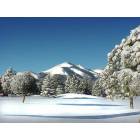
Access easements and shenanigans... Bonito Falls. (airport, location, photos)
Please register to participate in our discussions with 2 million other members - it's free and quick! Some forums can only be seen by registered members. After you create your account, you'll be able to customize options and access all our 15,000 new posts/day with fewer ads.
I don't believe NM water rights allow public access to waterways. I can thin of other examples where that's not the case in addition to the one I mentioned where we had to purchase access to a stream. If the stream runs through private property you don't necessarily have access to it, high water mark aside.
Interesting, but that isn't the way I'm reading this page.
Ok... I just got back from visiting the area again. Still no one home at the trailer, but I left a note with my phone # and email address.
I met a guy walking through on his way to the petroglyphs (something he does regularly) and we had a nice conversation. He lives close by but in a different development. His understanding is that road shown in the first photo below (this is looking east from the cul-de-sac at the end of Santiago) is a state-owned easement. I don't know if this means anything, though. He has talked to the owner of Tract 1 and has verbal permission to walk through there anyway. This is also the easement for VRB owners to access the Falls. He is aware of the guy in the trailer and knows of several people who have been threatened by him. He also claimed that the owner of the property directly north of the cul-de-sac is also calling the cops and harassing anyone he sees. I think I can verify this now, because I met this man while I was leaving. I'd met him a couple of times previously and he didn't question me, but this time I was met with "can't you read the sign!?". He mellowed when I told him who I was.
So I guess it might be a joint initiative to prevent access to people who don't really have *legal* access by perpetual harassment and threats. Since they don't know who has legal access, they just harass and call the cops on anyone they see. I haven't talked to the trailer guy yet though... he might be hoping to keep everyone out.
So far I still haven't gotten a hold of the owner of the development, who has controlling interest... and as such, the rest of us can't organize an association.
BTW Jaxart, the petroglyph man said that the ranch where all this land is located was originally specified to be a park forever via a will. Unfortunately, they did not do it the proper legal way, and the person who inherited it got a lawyer to break it... and so it goes.
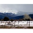
Well, it's nice to at least see there is a good bit of water in that stretch of the creek. I wonder if that was the ranch once owned by the man who long was the major electrical contractor in the area - name of Callahan? I saw the dining table he made from a huge slab of black walnut taken from trees that once grew along the Bonito on his land. Not sure if anything other than cottonwoods grow there today. Nogal = walnut tree and is the name given to at least two canyons in the Sac range - the one at the community of Nogal on NM-37, and the other to the south of Bent (near Tularosa).
Have you been to the petroglyph rock? There was once a "park" laid out in that area that was open to the public but the easier access to it was eventually posted by developers. Now the only access that I'm aware of (from the south side of the creek) is by a very rocky road that is 4-wheel drive only, and high clearance at that, from a point on Airport Rd. I don't think the park is any longer maintained. There is a bridge (perhaps not usable) across the creek at that point.
The petroglyph rock itself is something of a disappointment since it's been vandalized and even before that the petroglyphs were badly weathered. But I have found both pottery shards and arrow heads in the area, but that was many years ago.
That stretch of the Bonito on the very western edge of the Fort Stanton BLM is pretty nice. I've never driven down... probably don't have a vehicle that could do it... but I ride my bike through there sometimes. I've looked for, but never seen the petroglyphs... maybe I was looking right at them and didn't notice, if they are badly weathered.
Navigable River? You're reaching with that and I'm all for your being able to enjoy that aarea nd don't want to be a killjoy, but that's not going to applicable IMO. I stand by my take.
I've looked for, but never seen the petroglyphs... maybe I was looking right at them and didn't notice, if they are badly weathered.
It's the only large rock - that large - in that section of the creek. It's on the north side of the creek. And it's nothing like the rocks in Three Rivers where the rocks have a blackish patina that makes the petroglyphs stand out. The Bonito rock is more - um - rock colored (grey as I recall).
ATB bicycle is how I have accessed the area. Not by car or SUV.
Once upon a time there was a plaque in the "park" area that had a crude map showing the trail system that had been developed - it paralleled the creek - and the location of that rock. There is a bluff directly behind the rock that may make it blend in and not be all that noticeable - if memory serves(???).
Navigable River? You're reaching with that and I'm all for your being able to enjoy that aarea nd don't want to be a killjoy, but that's not going to applicable IMO. I stand by my take.
"This is a general overview of the laws allowing use of rivers in New Mexico.
The constitution of New Mexico declares water in a stream to be public. The public has the right to use this water for recreational purposes, subject to the right of appropriators to remove water from the stream (e.g. for irrigation).
New Mexico, a state that follows the doctrine of prior appropriation, has taken a different approach to determining public rights in streams where the streambed is privately owned. New Mexico is one of the few states that have used the appropriation doctrine, and not common law navigability tests, to determine which waters are public. In New Mexico, while title to streambeds may be held by a private entity, appropriators hold only a usufructuary right in the water, and title to the water remains in the state. All unappropriated waters from every natural stream, perennial or torrential, are public waters in the public domain. In fact, navigability is but one criterion in determining whether there exists public rights to use a body of water.
No case or statute discusses portaging on private land around obstructions in the stream. While the public doctrine gives the public the right to use the zone between the high and low water marks, the New Mexico attorney general's office expressed doubts about the right to portage above this zone. "
I still think it is saying that waterways are public property and can be used for recreational purposes up to the high water mark.
I'm attaching a couple of aerial photos from Google Maps that explain better what I've been saying in this thread. The first one is the alternate access to the falls that I mentioned, with the little road at the end that goes nowhere - just to the edge of the chasm.
The other photo is of the bluff that is the prominent feature by which the location of the petroglyph rock can be found. It's just to the right of the point where the rocky access road from Airport Rd. hits the bottom of the hills and flattens out at the creek level.
I believe you're correct but only once their in the center of the water, how you get there from land is the real question. This law was made to allow people to float through places on a river where both banks are privately held. It's doesn't give you permission to go through the private property to get there you must start upstream somewhere where there is legal/public access.
I'm hoping that the portage law that allows use of the land up to the high water line, plus the expansion to allow recreational use besides boating, will apply. But it's probably interpreted differently depending on the judges and lawyers involved. And really, people who are out having a good time will tend to go elsewhere if they are yelled at and threatened, so even if something is lawful it doesn't mean it can't be prevented 99% of the time.
I finally talked to someone who is slowly working on the "case". Apparently the trailer man on Tract 10 is claiming to everyone that he owns the Falls and sicking the cops on anybody who comes out there. A lawyer in the development is looking at legal options. That will be the most difficult case. We are also looking into getting the easement re-surveyed and and a better gate and fence put up with a lock that can be opened by land owners in VRB. Hopefully that will satisfy the person who lives at the end of the cul-de-sac who calls the cops on everyone he sees, assuming that they don't have legal access.
Please register to post and access all features of our very popular forum. It is free and quick. Over $68,000 in prizes has already been given out to active posters on our forum. Additional giveaways are planned.
Detailed information about all U.S. cities, counties, and zip codes on our site: City-data.com.

 Please register to participate in our discussions with 2 million other members - it's free and quick! Some forums can only be seen by registered members. After you create your account, you'll be able to customize options and access all our 15,000 new posts/day with fewer ads.