This one I'm becoming confident on, unlike the hyped up Thanksgiving storm.
")
Sometimes you hear something too many times and you start to believe it. I have to tune other parties out and listen to myself more often.
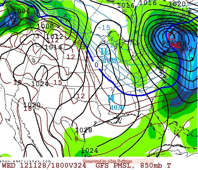
Here's a storm that continues to show up and the area of large amounts of snow continues to be northern NY, VT, NH, ME with snows dropping as far south as PA and the coast and higher elevations of TN, North Carolina and Ketucky and Virginia..
But lets not get ahead of outselves here... Forget the who and how much snow... Lets see if this pattern continues to be shown.
I like the idea of major blocking at the end of the month, I like the idea that the Trough goes on a negative tilt, and I like the idea a storm blows up as it rounds the base of the trough.
The overall pattern is setting up to be volitle going into winter and I believe the East will get the snows and cold, not the West this year just from the setup lately..
This one should be fun to track, Time frame is around November 28th right now.
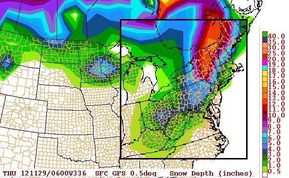
Snow totals from this run are up to a foot of snow for the northern tier.

 Please register to participate in our discussions with 2 million other members - it's free and quick! Some forums can only be seen by registered members. After you create your account, you'll be able to customize options and access all our 15,000 new posts/day with fewer ads.


 Going to be an interesting and busy winter.
