Please register to participate in our discussions with 2 million other members - it's free and quick! Some forums can only be seen by registered members. After you create your account, you'll be able to customize options and access all our 15,000 new posts/day with fewer ads.
Koppen defined the boundary between Subarctic and Tundra climates as having at least 1 month with a daily mean of 10C.
I personally think this is too low, and should be raised to 12C. Within Canada, this causes the Subarctic zone to expand past the tree line. Or maybe an average of 10C for the 3 warmest months. Churchill is right on the tree line with only scattered stunted trees and it comfortably clears 10C for 2 months. Even Wekweeti is quite close to the tree line and it has 3 months over 13C so it very comfortably meets Koppen's subarctic criteria. The forest begins to get sparse within about 25km of the community - mainly to the east since the north still benefits from the moderating effect of Great Bear Lake it seems? Lac de Gras (home to the Diavik mining complex) is largely treeless.
Here are some photos (the 2 photos with trees are probably from Yellowknife where the float planes are stationed) https://www.samkelley.net/gallery/lac-de-gras-region
Warmest month of various communities, with the mean of the three warmest months in brackets
17.0C Yellowknife, NT (14.8C) - "subarctic" (Sept is 7.2C)
16.9C Tampere, FIN (15.3C) - "subarctic bordering on humid continental"
16C Wekweeti, NT (14C) - "subarctic" (Sept is 5.5C so it's not close),
15.8C Moosonee, ON (14.3C) - "humid continental bordering on subarctic"
15.3C Wawa, ON (14.3C) - "humid continental"
15.2 Fort McPherson, NT (13.3C)
14.6C Old Crow, YT (12.8C)
14.6C Kiana, AK (12.9C)
14.3C Arctic Village, AK (12.1C)
14.1C Inuvik, NT (12.2C)
Variable tree cover
~14C Lac de Gras, NT (~11C) - largely treeless
13.7C King Salmon, AK (12.8C)
13.7C Kotzebue, AK (11.6C) - deciduous shrubbery reaching no more than shoulder height (Bethel's shrubs seem about twice as tall)
13.5C Bethel, AK (12.5C) - mostly deciduous shrubbery rather than conifers
~13C Noatak, AK (~12C)
12.9C St Mary's, AK (11.7C) - a few evergreen trees, mostly deciduous shrubbery
12.8C Dillingham, AK (11.6C)
12.7C Churchill, MB (10.7C)
12.5C Russian Mission, AK (11.4C)
12.3C Elim, AK (11.1C)
12.2C Schefferville, QC (10.6C)
11.8C Kuujjuaq, QC (10.1C)
11.8C Kuujjuarapik, QC (10.0C)
11.0C Nain, NL (9.5C) - fair bit of tree cover near the shore, but only tree line is at only about 150-300m ASL
Full on tundra:
12.1C Deering, AK (10.1C)
11.6C Baker Lake, NU (8.8C)
11.5C Kivalina, AK (9.8C) *may have low lying deciduous shrubs?
11.1C Nome, AK (10.1C)
11.1C Arviat, NU (8.8C)
11.0C Tuktoyaktuk, NT (8.8C)
10.9C Kugluktuk, NT (8.5C)
10.5C Rankin Inlet, NU (8.1C)
10.1C Paulatuk, NT (8.1C)
10.0C Anaktuvuk Pass, AK (8.3C)
9.4C Inukjuak, QC (7.7C)
Kuujjuaq and Kuujjuarapik in Quebec, and especially Nain in Labrador seem to have more trees than Lac de Gras and western Alaska, so perhaps the higher rainfall there helps trees to take advantage of the short growing season better.
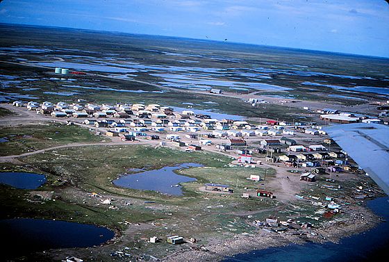
This is Arviat, Nunavut. It's still warm enough in summer for some perennial grasses and other tundra plants, but not for anything woody it seems, and certainly no trees.
I believe some people will consider biomes warm enough to support low lying woody shrubs but not trees to still be "tundra".
The Koppen boundary for Subarctic climate not only includes Arviat (11.1C July mean) but areas 300-600km north of it such as Baker Lake, Chesterfield Inlet and in the most extreme case, Coral Harbour on Southampton Island at the north end of the Hudson's Bay. This is about 900km away from the tree line for continuous forest in far northern Quebec and Manitoba, and probably 500km from the closest isolated little tree on some south facing slope in a low lying valley in southern Nunavut.
I do think that if you want to have a subarctic/tundra boundary that approximately matches the tree line, you want to look at summer temperatures though, rather than annual or winter temperatures. This is the vegetation of Yakutsk, Russia; Coral Harbour, Nunavut; and Inuvik, Northwest Territories.
Yakutsk
Inuvik
Coral Harbour
Yakutsk honestly looks hemiboreal in the summer... I'd go as far as to say that the landscape more closely resembles Sault Ste Marie, ON than Wawa, ON.
In contrast to lower latitudes, where the difference between continental vs subtropical vs tropical vegetation is more closely tied to the temperatures of the coolest month, with the tundra vs subarctic, it's much more about the summer temperatures.
I don't have much to add except to say this was a very well researched post and I agree with your suggestion. Well done!
I wonder where the lowest-latitude low-altitude subarctic climate is found. Looks to be somewhere in Quebec? Or maybe along the shores of Lake Superior?
I don't have much to add except to say this was a very well researched post and I agree with your suggestion. Well done!
I wonder where the lowest-latitude low-altitude subarctic climate is found. Looks to be somewhere in Quebec? Or maybe along the shores of Lake Superior?
I think that climate map might be a bit dated. I am not going off of the subarctic area around Lake Superior because climate map data for that area is hazy, but the much better documented subtropical US area - it does not extend to its present limits around places like Wichita, St. Louis, and New York, so I'm thinking that may be the case for all the climates in that continuum, including of course the humid continental and subarctic climates.
All things considered that would probably mean Lake Superior is overall surrounded by humid continental climates, although maybe a bit thin towards the north.
I agree completely with the rest of your comment about this being a great thread, and a big thumbs up for Memph. North American subarctic climates are almost as fascinating to me as the subtropical climates, especially the mentioned Quebec areas and Ontario areas north of Lake Superior.
Checked out this thread many times, gave it a hell of a lot of thought, and the only reason I have not made a big comment aside from being uncertain of my opinion is the PITA device.
I don't have much to add except to say this was a very well researched post and I agree with your suggestion. Well done!
I wonder where the lowest-latitude low-altitude subarctic climate is found. Looks to be somewhere in Quebec? Or maybe along the shores of Lake Superior?
The 3 months vs 4 months over 10C way of separating subarctic from humid continental means at least some of it comes down to what the seasonal lag is like. If a climate's 122/123 warmest days are May 16-Sept 15, it's more likely to have 3 months above 10C than a climate where the 4 warmest months are May 1-Aug 31 or June 1-Sept 30.
For example, the summer/growing season of Sept-Iles is about 1C cooler than High Level, AB's. But Sept-Iles has a much better shot of warming into continental while High Level wills stay subarctic. In fact, Sept-Iles has a growing season that's comparably warm to Yellowknife's.
Since September is the 4th warmest month almost everywhere in Canada, that means that maximizing the seasonal lag so that the temperature difference between September and May is as big as possible will make a place less likely to be sub-Arctic. So Terrace Bay, ON which has strong seasonal lag due to Lake Superior is humid continental, but with a more "typical" seasonal lag, it might not be.
"Peace River Country" is the area that has its continental (ie non-subarctic) features underestimated the most, due to September and May being largely on par. Even Fort Liard, NT is borderline continental with May and September both very close to 10C.
I think White River might be close to subarctic, it feels like it's always snowing there when in Wawa and Terrace Bay it's not. I remember leaving southern Ontario in early October - shortly before I left (Oct 1, 2019) it was 30C there, and then on Oct 4 it was snowing heavily around 11am-2pm in White River...
So if it's not White River, I believe it's Cochrane, ON using 1980-2010 normals. If the 2020 normals bump it out, then it will probably still be in the Clay Belt/Matagami area. Matagami is still a long way from hitting 10C in September. It seems like the eastern part of the continent is cooler in the summer, except for the Atlantic Coast which gets more influences from the Gulf Stream? And it seems like the Hudson's Bay has cool ocean currents flowing into it + frozen into late spring causing albedo effects + moderating (cooling) effect when it's thawed? Cochrane is definitely warmer than "continental" Moosonee, it's just that seasonal lag makes Moosonee's Septembers a bit warmer while May-August are warmer in Cochrane by a good margin.
Western Canada doesn't have anything subarctic further south than Cochrane. Even if Western Canada had cooler summers... south of Cochrane is not southern Alberta, it's Montana, since it sits on the 49th parallel. Fort Liard is distinctly warmer in the summer, and it's north of 60, about 1250km further north than Cochrane.
Russia's Pacific coast might have something sub-Arctic at a similar latitude, Poronaysk is barely north of Cochrane and June is only 9.5C. Not much weather data due to limited settlements though.
Siberia is further north, except for the Amur region, but Amur and Mongolia despite frigid winters have continental type summers.
Koppen defined the boundary between Subarctic and Tundra climates as having at least 1 month with a daily mean of 10C.
I personally think this is too low, and should be raised to 12C. Within Canada, this causes the Subarctic zone to expand past the tree line. Or maybe an average of 10C for the 3 warmest months.
Warmest month of various communities, with the mean of the three warmest months in brackets
Variable tree cover
~14C Lac de Gras, NT (~11C) - largely treeless
13.7C King Salmon, AK (12.8C)
13.7C Kotzebue, AK (11.6C) - deciduous shrubbery reaching no more than shoulder height (Bethel's shrubs seem about twice as tall)
13.5C Bethel, AK (12.5C) - mostly deciduous shrubbery rather than conifers
~13C Noatak, AK (~12C)
12.9C St Mary's, AK (11.7C) - a few evergreen trees, mostly deciduous shrubbery
12.8C Dillingham, AK (11.6C)
12.7C Churchill, MB (10.7C)
12.5C Russian Mission, AK (11.4C)
12.3C Elim, AK (11.1C)
12.2C Schefferville, QC (10.6C)
11.8C Kuujjuaq, QC (10.1C)
11.8C Kuujjuarapik, QC (10.0C)
11.0C Nain, NL (9.5C) - fair bit of tree cover near the shore, but only tree line is at only about 150-300m ASL
Kuujjuaq and Kuujjuarapik in Quebec, and especially Nain in Labrador seem to have more trees than Lac de Gras and western Alaska, so perhaps the higher rainfall there helps trees to take advantage of the short growing season better.
In the most oceanic climates, where there is also some shelter, the treeline can be down to warmest monthly mean 8-9*C. Like in Iceland. Two significantly different tritherm thresholds (mean temperature for the three warmest months of a year) were found for the coastal and the inland part of Iceland, 6.9 and 7.2 °C, respectively for the species line of mountain birch. For the 2 m treeline, the threshold of 7.9 °C was valid for the whole country. https://www.semanticscholar.org/pape...31da2641568f34
I believe this is also the case in the most southern areas of south America, where forest can grow with mean lower than 10C.
Remember that woody plants (trees) will be damaged by freezing lows (below 0C) in the growing season, or even killed, especially if this occures repeated times. In continental climates, like much of Canada and in Siberia, the diurnal range is larger, and freezing lows is common even when mean is 9C, 10C or even 11C. In oceanic climates, this is not so, given their warmer lows/smaller diurnal range.
So maybe the actual definition of the subarctic - tundra border should vary depending on place and climate type, like the treeline itself does.
This isn't true of NZ's Oceanic climate -frost is common in those higher altitude parts of NZ that have summer means of 11-14C, and it isn't enough to stop growth.
This isn't true of NZ's Oceanic climate -frost is common in those higher altitude parts of NZ that have summer means of 11-14C, and it isn't enough to stop growth.
Do any of those spots have weather stations? Curious what the specific data looks like. Within Canada, Nain has very cool summers for a place that has decent sized trees (10-15m tall), but also gets over 900mm of precipitation whereas the northern fringes of the subarctic around the Hudson's Bay and McKenzie River basin get more like 250-350mm.
Last edited by memph; 12-02-2022 at 09:41 AM..
Please register to post and access all features of our very popular forum. It is free and quick. Over $68,000 in prizes has already been given out to active posters on our forum. Additional giveaways are planned.
Detailed information about all U.S. cities, counties, and zip codes on our site: City-data.com.

 Please register to participate in our discussions with 2 million other members - it's free and quick! Some forums can only be seen by registered members. After you create your account, you'll be able to customize options and access all our 15,000 new posts/day with fewer ads.


 . North American subarctic climates are almost as fascinating to me as the subtropical climates, especially the mentioned Quebec areas and Ontario areas north of Lake Superior.

