Please register to participate in our discussions with 2 million other members - it's free and quick! Some forums can only be seen by registered members. After you create your account, you'll be able to customize options and access all our 15,000 new posts/day with fewer ads.
Wow, interesting. Thanks for sharing. I'd usually be all for this, but the 27th would be a very bad day for that much snow. One day later and it'd be great...
Wow, interesting. Thanks for sharing. I'd usually be all for this, but the 27th would be a very bad day for that much snow. One day later and it'd be great...
Yeah, that's the other reason for the thread, I figure its a big travel holiday so the heads up would be worth it.
The models will do a classic flip-flop on this... although it's interesting though that this is the first time it's really pushed this far west. All indications pointed it would stay off the coast and maybe brush eastern N.E. and Maine.
Euro12z Data for Philly.. A little 1-2 White punch after the green liquid? lol
See the cold today? See the warmup? See the crash back down for Thanksgiving?
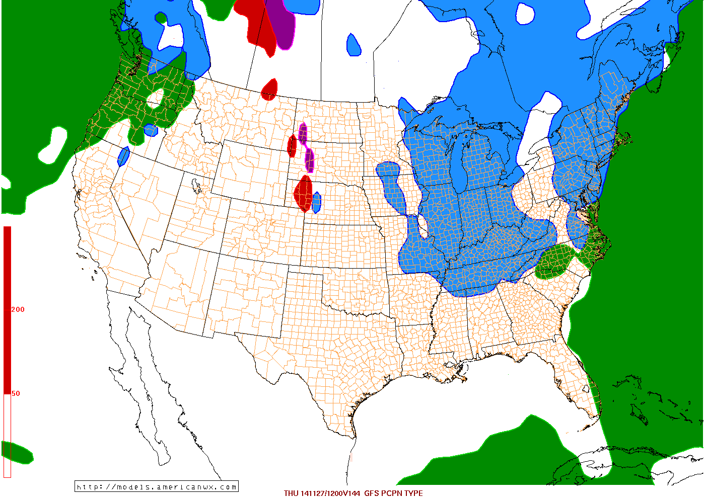
Basically has a wave coming from gulf along a front that affects Florida and develops into a weak storm up the coast with cold air supply to tap. Shows Philly with 0.32" with the first storm mix/snow on Wednesday...
Second one more robust... This data only goes to Friday morning.
Based on your maps I might be on the border of getting snow. Do the snow maps show anything for my area?
Yup, you're on the edge (lol). Each map/model update will show something different but the threat is there and the chance is there.
Take a look at the latest EURO and GFS. Canadian is WAAAAY Out to sea and not even worth showing (has nothing)
EURO on left for Thanksgiving Eve (Wed 1-7pm). Storm stronger and closer to the coast with cold air available. This produced a 6-12 inch snowstorm from DC to Maine!
GFS on right same time frame... Storm much further out over the Atlantic but no precip type issue as its all snow for the coast BUT light. 1-4".
Notice GFS a bit warmer for NC. Basically doesn't dig the trough south as mch as the Euro.
That blue rain/snow line should even be that close to the storm this time of year. Am I still talking about snow?? I feel like we lived through January already. Geesus.
EXTENDED FORECAST DISCUSSION
NWS WEATHER PREDICTION CENTER COLLEGE PARK MD
1220 AM EST SAT NOV 22 2014
VALID 12Z TUE NOV 25 2014 - 12Z SAT NOV 29 2014
THE EVOLUTION OF THE FLOW OVER THE EAST DEPENDS LARGELY ON THE INTERACTION BETWEEN TWO SIGNIFICANT SHORTWAVES.
FIRST, A WAVE EMERGING FROM THE GULF OF MEXICO OFF THE SOUTHEAST COAST.
SECOND, THE VORTEX DRAWING THE ARCTIC AIR INTO THE NATION. BOTH OF THESE SYSTEMS HAVE THE POTENTIAL TO PRODUCE SNOWFALL. THE ATLANTIC WAVE HAS VASTLY MORE MOISTURE AVAILABLE,
BUT AIR COLD ENOUGH FOR SNOW APPEARS AT THIS POINT TO LIKELY BE CONFINED TO THE NORTHWESTERN EDGE OF ITS PRECIPITATION SHIELD. STILL, WITH THE BUSY HOLIDAY TRAVEL TIME NEXT WEDNESDAY, ANY WINTER WEATHER IS A PLANNING CONSIDERATION.
THE COLD VORTEX, ON THE OTHER HAND, IS MOISTURE-STARVED, THOUGH A SWATH OF LIGHT TO MODERATE SNOW ALONG AND NORTH OF ITS TRACK WOULD FALL INTO MUCH LOWER BOUNDARY-LAYER TEMPERATURES--A FACTOR IN ROAD CONDITIONS.
ALSO, THE TRACK OF THE FRIGID AIR ACROSS THE GREAT LAKES WILL NO DOUBT SET THE LAKE-EFFECT MACHINE IN MOTION AGAIN.
Please register to post and access all features of our very popular forum. It is free and quick. Over $68,000 in prizes has already been given out to active posters on our forum. Additional giveaways are planned.
Detailed information about all U.S. cities, counties, and zip codes on our site: City-data.com.

 Please register to participate in our discussions with 2 million other members - it's free and quick! Some forums can only be seen by registered members. After you create your account, you'll be able to customize options and access all our 15,000 new posts/day with fewer ads.


 but playing it safe of course.
