Please register to participate in our discussions with 2 million other members - it's free and quick! Some forums can only be seen by registered members. After you create your account, you'll be able to customize options and access all our 15,000 new posts/day with fewer ads.
There's definitely been a shift in the weather here. The rest of the week is forecast to be dry as a high pressure ridge builds over the area, with stormy weather returning next week at some point. NOAA's forecast discussion yesterday mentioned a shift towards a more classic El Nino pattern next week, right on schedule.
Is it a ridge? It's not particularly warm for California.
November and December have been generally below average here in both temperature and precipitation for us; cold, dry air as opposed to those heat-building ridges. Next week, the cold dry air will be replaced by a cool wet weather pattern that will stick around through the winter with a system every 2-3s accompanied by highs in the 50s with the non-rain day being partly cloudy with highs in 60s.
From the same article I posted, the recent non-rainy Californian weather was partly from the MJO oscillation conditions.
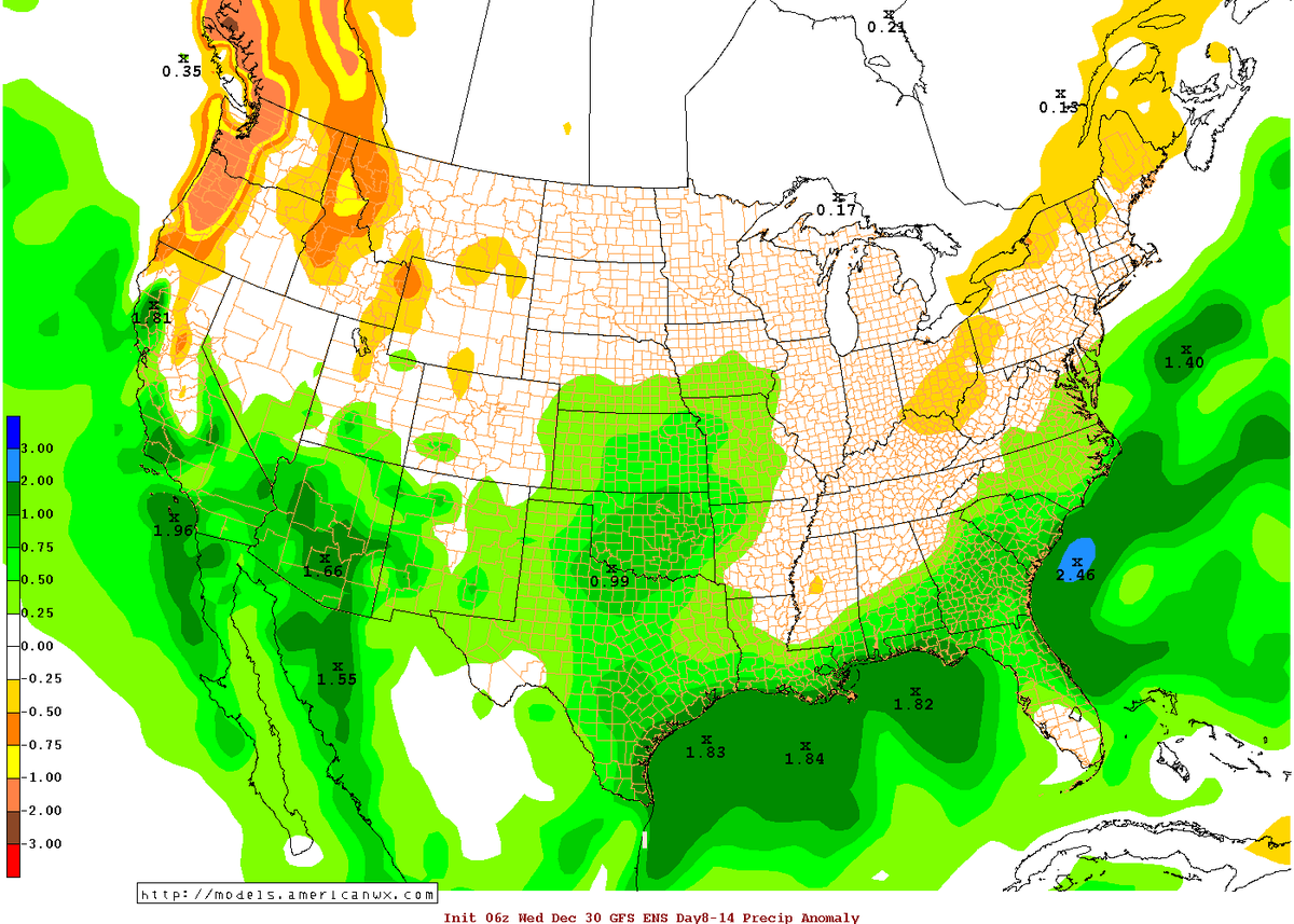
Since both El Niño and the MJO are tropical phenomena that affect the intensity and placement of tropical thunderstorms (which can ultimately affect California weather by injecting energy into the upper atmosphere and strengthening the jet stream), these two phenomena can either reinforce or diminish one another. Over the coming 1-2 weeks, the increasingly active MJO will probably interfere with the ongoing and powerful El Niño forcing, perhaps leading to a strong but relatively short-lived West Coast ridge. After the Christmas storm, conditions will be relatively quiescent over most of California as the jet stream surges northward all the way into British Columbia.
el nino has been linked to efects including a stonrger polar jet steam, stormy conditions in conus, including exceptional thunderstorm and severe weather outbreaks, excessive rain in parts of south america, and exceptionally mild weather in the east usa and europe.
Looks like we can expect 6 inches through Thursday here on the central coast of CA. 10 Day Forecast shows rain on all but two days. Phoenix should be in the path of these storms as well.
This is the upper flow right now. Pretty much straight from Asia to South Western U.S & Mexico Anything in the Central or North Pacific is heading up to Canada.
Where the waters are warmest in the Pacific the Thunderstorms will form and follow this flow.
Please register to post and access all features of our very popular forum. It is free and quick. Over $68,000 in prizes has already been given out to active posters on our forum. Additional giveaways are planned.
Detailed information about all U.S. cities, counties, and zip codes on our site: City-data.com.

 Please register to participate in our discussions with 2 million other members - it's free and quick! Some forums can only be seen by registered members. After you create your account, you'll be able to customize options and access all our 15,000 new posts/day with fewer ads.