Please register to participate in our discussions with 2 million other members - it's free and quick! Some forums can only be seen by registered members. After you create your account, you'll be able to customize options and access all our 15,000 new posts/day with fewer ads.
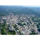
Was on Google Earth mess'in around in Asheville, Loads of fun by the way but cam up on this.
Find it strange in 1994 it has gates or vents of some sort, then in 1998 it gets a concrete flooring over the vents or whatever, then in 2002 it floods up with water, then couple months later its drained and been the same all the way to date. The road going up to it is closed off to...
What is this thing, A old missle silo or Pad for some sort of scope, or is it just some water storage for the buildings above it or some sort of man hole for the Tunnel?
If you can look up the property tax record with the PIN No. or the Property ID No., it may give you further info. Also is that a railroad line to the left of the photo maybe? You've got us curious now.
I think the structure in the photos is on Beaucatcher Mountain (or it's what's left of it) above the tunnel and south of 240. I found this qoute on both Wikipedia and AnswerDotCom. Probably the old head tank reservoir from 1882.
"The original water system in Asheville dates from the 1880s when Asheville constructed a reservoir on Beaucatcher Mountain, collecting water from various springs and branches. Pipes were laid and unfiltered water distributed by gravity flowed down into the town.
Read more: Asheville: Map, History from Answers.com"
If you can look up the property tax record with the PIN No. or the Property ID No., it may give you further info. Also is that a railroad line to the left of the photo maybe? You've got us curious now.
Old storage reservoir, there were a number of them around the city, most taken out of service years ago, some have been demolished as people whined about them being eye sores. The Patton mountain reservoir, near the Governors western residence, about 2 miles north of this one was demolished in the last year or so.
No railroad anywhere near this, too steep.
Please register to post and access all features of our very popular forum. It is free and quick. Over $68,000 in prizes has already been given out to active posters on our forum. Additional giveaways are planned.
Detailed information about all U.S. cities, counties, and zip codes on our site: City-data.com.

 Please register to participate in our discussions with 2 million other members - it's free and quick! Some forums can only be seen by registered members. After you create your account, you'll be able to customize options and access all our 15,000 new posts/day with fewer ads.