Please register to participate in our discussions with 2 million other members - it's free and quick! Some forums can only be seen by registered members. After you create your account, you'll be able to customize options and access all our 15,000 new posts/day with fewer ads.
How do I get to the backside of Sandia? Google maps is worthless. When you put in the Sandia Ski Area, it'll only give directions to the tram. Also, is there an address on the backside of the mountain I could put in for GPS?
Thanks. Also, are their trails on the frontside worth hiking? I know about La Luz, but don't have time for it today. Looking for a hike under 3 hours roundtrip.
I'll add that although Zoidberg recommended an all paved road, you can also take a good
gravel road all the way around the N side into Placitas. It is slow going, but might be fun.
The Piño trail out of Elena Gallegos might be a 3-hour trip.
Note that you can just hike up the La Luz for about 1:45 hours and
then turn around and be back at your car in your 3 hours budget.
Also note that if it is hot, you can hike the crest trail from where you
park your car. If it is 95 in town, it might only be 75 on that trail.
It's clearly marked where the trail crosses the parking area.
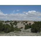
I live in Placitas, and several of my neighbors have hiked from here to the Tram.
If interested in doing this, take Hwy 165 for about 6 miles, then turn right on Tunnel Road. Take Tunnel Road all the way to the end --about a mile-- and start hiking. You should reach the tram area in about 4-5 hours. Trails are well marked.
Get a map. A paper one. They must still make those things. I have one that pre-dates both Googlemaps and GPS.
:-)
Please register to post and access all features of our very popular forum. It is free and quick. Over $68,000 in prizes has already been given out to active posters on our forum. Additional giveaways are planned.
Detailed information about all U.S. cities, counties, and zip codes on our site: City-data.com.

 Please register to participate in our discussions with 2 million other members - it's free and quick! Some forums can only be seen by registered members. After you create your account, you'll be able to customize options and access all our 15,000 new posts/day with fewer ads.