Welcome to City-Data.com Forum!
U.S. CitiesCity-Data Forum Index
Go Back   City-Data Forum > U.S. Forums > North Carolina > Coastal North Carolina
 [Register]
Please register to participate in our discussions with 2 million other members - it's free and quick! Some forums can only be seen by registered members. After you create your account, you'll be able to customize options and access all our 15,000 new posts/day with fewer ads.
View detailed profile (Advanced) or search
site with Google Custom Search

Search Forums  (Advanced)
 
Old 07-10-2010, 10:15 AM
 
45 posts, read 177,919 times
Reputation: 45

Advertisements

I haven't boated in the waterway for about 25 years (when I was a kid), but I fondly remember going to Hammocks Beach to play and picnic.

Well, I'm finally going to get to launch my boat this coming weekend. We'll head out of the Swansboro area. Does anyone have a good update on how to navigate to Hammocks Beach? I recall many years ago following a channel that was close to Huggins Island (?) and we could carefully navigate through at high tide without hitting a sandbar. But, looking on the Google Map, it looks like that's a tough channel to navigate now.

So, any thoughts on the best way to navigate to Hammocks Beach? Can I take the Ferry path these days? I recall in the past that you couldn't navigate from there to get around the island, but it looks possible now if the Google Map is any indication.

Any suggestions? Thanks!

Last edited by RobioAXP; 07-10-2010 at 11:09 AM..
Reply With Quote Quick reply to this message

 
Old 07-10-2010, 03:32 PM
 
3,375 posts, read 6,256,713 times
Reputation: 2453
I haven't been there. But I would get an up to date navigational map and go to a marina and start asking questions. People who go out every day will know the lay of the land better than anyone on here. Unless someone on here goes there a lot
Reply With Quote Quick reply to this message
 
Old 07-10-2010, 05:27 PM
 
Location: Cape Carteret, NC
713 posts, read 3,928,422 times
Reputation: 553
Smile Ferry Channel Works

Quote:
Originally Posted by RobioAXP View Post
I haven't boated in the waterway for about 25 years (when I was a kid), but I fondly remember going to Hammocks Beach to play and picnic.

Well, I'm finally going to get to launch my boat this coming weekend. We'll head out of the Swansboro area. Does anyone have a good update on how to navigate to Hammocks Beach? I recall many years ago following a channel that was close to Huggins Island (?) and we could carefully navigate through at high tide without hitting a sandbar. But, looking on the Google Map, it looks like that's a tough channel to navigate now.

So, any thoughts on the best way to navigate to Hammocks Beach? Can I take the Ferry path these days? I recall in the past that you couldn't navigate from there to get around the island, but it looks possible now if the Google Map is any indication.

Any suggestions? Thanks!
I haven't been over this summer, but I am told you can still follow the ferry channel over. If my memory serves me correctly it is the first marked channel on the ocean side after Swansboro.

If I get a chance I'll take a run down first of the week and get a buoy number for you.
Reply With Quote Quick reply to this message
 
Old 07-10-2010, 09:08 PM
 
45 posts, read 177,919 times
Reputation: 45
Thanks! I'm sure I can navigate to the Ferry side on Hammocks Beach through the same channel as the Ferry takes. But, once I get to the Ferry dock on Hammocks Beach, will I be able to hug the channel around to the east of the island to get closer to the point area? I'm just terrified that I'm going to hit a sandbar and get stuck (as a kid, we lost our prop on a sandbar and had to be towed back after hours of drifting).

I appreciate the insight!
Reply With Quote Quick reply to this message
 
Old 07-11-2010, 04:24 AM
 
Location: Morehead City, NC
1,681 posts, read 6,028,177 times
Reputation: 1277
Please be advised of the following if you plan on boating/exploring the area:

Beware of Brown's Island | island, ordnance, bottom - News - Jacksonville Daily News (http://www.jdnews.com/news/island-63662-ordnance-bottom.html - broken link)
Reply With Quote Quick reply to this message
 
Old 07-12-2010, 05:33 AM
 
Location: Cape Carteret, NC
713 posts, read 3,928,422 times
Reputation: 553
Quote:
Originally Posted by RobioAXP View Post
Thanks! I'm sure I can navigate to the Ferry side on Hammocks Beach through the same channel as the Ferry takes. But, once I get to the Ferry dock on Hammocks Beach, will I be able to hug the channel around to the east of the island to get closer to the point area? I'm just terrified that I'm going to hit a sandbar and get stuck (as a kid, we lost our prop on a sandbar and had to be towed back after hours of drifting).

I appreciate the insight!
I know we did that in the summer of 2007, but you know how things change. I went down to Swansboro yesterday and was going down that way, but the Intercoastal was packed so I headed back up the White Oak.

We will try to go have a look this week, and I will ask one of my neighbors who goes there often. He told me yesterday the Ferry Channel is at Buoy 52.

I'll try to post an answer for you before the weekend.
Reply With Quote Quick reply to this message
 
Old 07-12-2010, 05:21 PM
 
Location: Cape Carteret, NC
713 posts, read 3,928,422 times
Reputation: 553
Smile You can make the trip over to the Point

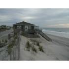
We took advantage of this morning's nice weather to go down the Intracoastal and over to Hammocks Beach.

The channel to the Beach-Bear Island is the next buoy after Buoy 51. It is marked "CC".

The channel is really well marked now which is a big improvement from the occasional white PVC pipes that were there three years ago.

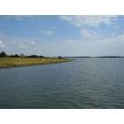
Once we got over to the dock at the beach, we followed the channel behind the island towards the Point. There is lots of water for the most part with depths running from 6 to 10 feet almost all the way behind the beach.

Once you see the last trees on the backside of Hammocks Beach, you have reached the slightly more challenging section. You end up making a hard turn to the (port) left and heading away from Hammocks Beach across a section of shallow water.

We were there at mid-tide and saw depths as low as 2.5 feet. We did not have any trouble making our way through the shallow water area, but when we came back and anchored to fish we saw another boat run aground in that area, but they were able to push off and make their way through.

Eventually after the turn away from the beach, you get back to some deep water that runs parallel along the treeless beaches on the backside of Hammocks Beach. At that point we could see one of the channel buoys and our course was practically straight towards it.

I have a camera mounted on the starboard side of my center console so I took lots of pictures and posted them on my Picasa Web Album site. I added captions to some of them.

You will have no problems until the trees disappear. You just have to be very careful after that part of the journey until you get back to deep water.

My skiff is 20 feet and has a 90 hp motor so it is not a tiny boat, and we made it okay, but I would take it easy in the shallow section. To be safe you could time that section of the trip at high tide. This coming Saturday July 17, high tide in Bogue Inlet is 1:17 PM.

To my knowledge there are no real charts that cover the area well. Things change so much that most of the good information is passed from boater to boater.

Next time I will take my GPS tracker device which lets me overlay trips on a Google map. We have the track on my boat GPS so it won't be difficult to make the trip again.

Hope this has been helpful to you and that you have a fun, safe trip in our little piece of paradise.
Reply With Quote Quick reply to this message
 
Old 07-13-2010, 02:52 PM
 
45 posts, read 177,919 times
Reputation: 45
Wow, I'm extremely impressed and appreciative of your report. This is exactly what I was hoping to find. I can't thank you enough for taking the time to navigate through the channel. The photos were even an added bonus! I will plan to give it a try on Fri/Sat, and will let you know how we fare. I have a very shallow running 16' center console, so I'm hoping it will be a smooth ride.

Thanks again!
Reply With Quote Quick reply to this message
Please register to post and access all features of our very popular forum. It is free and quick. Over $68,000 in prizes has already been given out to active posters on our forum. Additional giveaways are planned.

Detailed information about all U.S. cities, counties, and zip codes on our site: City-data.com.


Reply
Please update this thread with any new information or opinions. This open thread is still read by thousands of people, so we encourage all additional points of view.

Quick Reply
Message:


Over $104,000 in prizes was already given out to active posters on our forum and additional giveaways are planned!

Go Back   City-Data Forum > U.S. Forums > North Carolina > Coastal North Carolina
Similar Threads

All times are GMT -6.

© 2005-2024, Advameg, Inc. · Please obey Forum Rules · Terms of Use and Privacy Policy · Bug Bounty

City-Data.com - Contact Us - Archive 1, 2, 3, 4, 5, 6, 7, 8, 9, 10, 11, 12, 13, 14, 15, 16, 17, 18, 19, 20, 21, 22, 23, 24, 25, 26, 27, 28, 29, 30, 31, 32, 33, 34, 35, 36, 37 - Top