Diversity and charm of Romania, through pictures (train, people, black)
Please register to participate in our discussions with 2 million other members - it's free and quick! Some forums can only be seen by registered members. After you create your account, you'll be able to customize options and access all our 15,000 new posts/day with fewer ads.
Note: these photos are copyright - free, they have been found using Flickr's Advanced Search page.
Bucegi Mountains are by far the most visited mountains in Romania, being the closest to Bucharest and also being perhaps the most spectacular range in country. They are among the smallest ranges in Romania: only 300 km² (there are ~ 70 ranges in Romania, each covering on average 1,000 km²). They are surrounded by all sides of very abrupt, sometimes almost vertical slopes, they have in the upper part a huge plateau, going on most of their surface. This plateau varies in altitude between 1,600 and 2,500 m but most of it is at around 2,000 m. The forests covering the mountains date from prehistorical age, with huge old trees and are populated by a large number of bears, that often descend in Sinaia Resort to search for food. Also chamois are frequently meet by tourists and there are also other wild animals, less visible.
Romanian Carpathians are divided between Eastern Carpathians, Southern Carpathians and Western Carpathians or Apuseni (Apuseni is the plural for western in Romanian).
Apuseni consists of 11 ranges, together covering around 22,000 km²:
The nature park extends on 757 km² and is situated in parts of the ranges of Bihor (where most attractions are), Vlădeasa and smaller parts in Gilău and Pădurea Craiului. The park protects primarily Romania's #1 karst zone, a real underground world of thousands of caves, many communicating with each other and having underground rivers, glaciers and other wonders.
The most remarkable among these caves are:
-the Altar Stone Cave, open only to scientists and speolologists, with exceptionally beautiful crystals which cover everything like a carpet, the cave's walls and rock formations
-Coliboaia Cave, which contains the oldest cave painting in the world (together with a cave in France with paintings from the same period), radiocarbon dated to 32,000 and 35,000 BP
-The ice caves from Scărișoara, Focul Viu, Borțig and others smaller
-Bears' Cave, the most visited in Romania
-Cetățile Ponorului, with the tallest portal in Romania - 70 m
Nevertheless, more attractive than these caves are the wild mountains where they are situated, the very rugged relief and the prehistorical forests that extends everywhere, the pure rivers with their bed and stones covered in moos, the amazing gorges etc.
An episode from Man vs Wild was filmed in the park in 2009, which shows very well the wilderness of the area.
Systematical extraction started during Roman rule in Dacia, the Roman city of Potaissa (situated on the place of today Turda city) living from salt export.
In middle age, the oldest mention of Transylvania is in 11th century, in connection with the salt extracted from Turda. Salt was Transylvania's main export product and Turda was the most important complex of mines and for this reason Turda was one of Transylvania's most important cities, hosting the Diet several times.
The present galleries date mostly from 17th to 19th centuries, with a lake formed in the oldest part of the mine, in a cavity dating from the Roman antiquity. There are conserved many wooden devices, wooden support structures etc, all saltified.
Historically called Țara de Sus "Upper Land", Bukovina was not a separate administrative unit until 1775, when was annexed by the Austrian Empire. Until then was, and still is, the oldest and finest part of the Principality of Moldavia, where have been founded the principality, have been the first capitals (Baia, Siret, Suceava) and have been built the finest monasteries. The landscapes are also among the finest in Romania, most of Bukovina being mountainous and covered in solemn fir forests.
The vegetal exuberance of Bukovina, as of most of Romania as well, is hard to understand for someone who doesn't live in a biologically rich country. The fertility of soil, the geographic configuration with all the relief forms in well balanced ratios (mountains, hills, plains), the low level of human inhabitation until modern era (up to 19th century most of Romania was still covered in prehistorical forests), all have contributed to an unique health and diversity of plants (and as a consequence a high quality of food of animals and humans). On a square meter one can number as high as seventy species of flowering plants, e.g.
In the isolated villages of the province, surrounded by all sides by tens of km of forests, people still live like in middle age, without electricity or money, eating products from their own local agriculture.
Nevertheless, the road infrastructure is among the best in Romania, sometimes at western standards while the cleanliness of the households, even the poorest ones, is "German".
The province, whose northern half is owned by Ukraine, has one of the greatest ethnic diversity in Europe, with Romanians, Ukrainians, Poles, Germans (in past Jews) and other nations living together in fraternity.
Though not very high - only 1907 m, is considered the finest mountain in Eastern Carpathians and is the most visited for this reason. The beauty comes from its cliffs rising above the thick prehistorical forests which go up and cover the massif almost entirely and from its dominant position among the lower ridges of Bistrița Range (of which Ceahlău is part), which extend with their compact forests all around toward the horizon, creating the tableau of an endless mountain jungle. Also, the Izvoru Muntelui Reservoir in nearby contributes to the beauty of the landscape, being the second largest artificial lake in Romania, with a surface of 32 km² and having a narrow, 35 km long, meandrows shape.
Like most mountains in Romania, Ceahlău has a diverse and particularly healthy flora and fauna, with huge centuries old trees and other amazing things.
The villages around are all displaying superb examples of folk architecture, wooden houses and picturesque churches.
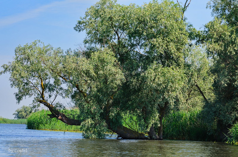
Is described by Unesco as "the largest continuous marshland on Europe and the greatest stretch of reedbeds in the world" and "the last European sanctuary". Practically, is the only place in Europe where one an take on a real safari, in an environment filled with wild animals, like in Africa or other exotic continents.
The Danube Delta Biosphere Reserve is a labyrinth of water and land, made up of countless lakes, channels, islands.
The area is particularly well known for the abundance of birdlife: 312 important bird species are present in the Delta, which is an important stopover and breeding area for many bird species. About 90 fish species are fond here, including populations of sturgeon.
The delta has been classified into 12 habitat types as follows: aquatic, lakes covered with flooded reedbeds; 'plaur', flooded islets; flooded reeds and willows; riverine forest of willows and poplars; cane-fields; sandy and muddy beaches; wet meadows; dry meadows (arid); human settlements; sandy and rocky areas; steep banks; and forests on high ground.
The delta is very important for fish, with 45 fresh water species present. Otter and weasel are to be found on the floating islands.
The approximate surface is 4152 km², of which 3446 km² are in Romania. If one includes the lagoons of Razim-Sinoe (1015 km²), which are located south of the delta proper, but are related to it geologically and ecologically (their combined territory is part of the World Heritage Site), the total area of the Danube Delta reaches 5165 km².
The Danube Delta is perhaps the least inhabited region of temperate Europe. In the Romanian side live about 20,000 people, of which 4,600 in the port of Sulina, which gives an average density of approx. 2 inhabitants per km². The rest is scattered in 27 villages, of which only three, all situated marginally, have more than 500 people (2002).
Click on map to enlarge and find out the distribution of each type of habitat:
Tulcea - population 73.707, is the gateway to the Delta, being situated on Danube, before the bifurcation in the three main branches. The city has 2,400 years of history, being founded by Greeks in 4th century BCE and since then passing through various rules: Scythians, Dacians, Romans, Goths, Byzantines, Bulgars, Kievan Russians, Pechenegs, Cumans, Romanians (Wallachians). Between 1420 and 1878 was under Ottoman rule but the population remained majoritary Romanian, different from rest of Dobruja (the province where Delta and Tulcea is) which became majoritary Turkish - Tatar.
The mosque dates from 1877 and serves the local Turkish community.
Between the three branches, there are two large bodies of sand: the Letea Levee between the northern (Chilia) and middle (Sulina) branch and Caraorman Levee between the middle and the southern branches. Letea Levee is around 20 x 5 km in size and is covered with narrow strips of forests (some tens of m wide and up to some km long) with threes growing directly from sand. This is Letea Forest, the oldest (1938) natural reserve in Romania and one of the most amazing natural zones, of great scientifical value. Letea Forest is the northernmost place in the world where lianas can be found and they give to the place an even more magical feeling.
Sulina is the "capital" of the Delta, meaning the biggest locality. In 19th century it became a free port and the seat of Danube Commission, which ensured a very cosmopolitan population.Witness of this is the cemetery, where graves of people from countless nations can be seen.
The land where Danube meets the Black Sea near Sulina is the youngest in Europe, created by the sediments brought by the river, the land advancing with ~ 40 m each year.
The small heights of Măcin Mountains can be spotted in some areas of the Delta. They are the only mountains in Romania not part of Carpathians but are more richer in plant and animal species.
Hârtibaciu is an 88 km long river flowing through an isolated area in the middle of the Saxon zone of Transylvania, with villages scattered between forests and pastures. The area of Hârtibaciu Plateau was one of the Saxon districts of Transylvania, having its capital at Nocrich.
Most of the villages in Hârtibaciu have peasant fortifications, consisting of a church (often dating from 13th century) which received some defensive additions and in most cases was surrounded by a curtain with the characteristic for Transylvania towers with tall roofs and wooden galleries which resembles the Romanian folk house architecture.
Agnita / Agneteln (population 8,300) is the only settlement with town status from the valley and is not since recent time. Certified in 1280, in 14th century had already many guilds and an intense craftsmanship activity.
The fortress from Agnita consists of a Gothic 15th century church that replaced an older, Romanesque one. The fortified tower of the church reaches 44 m. From the vast surrounding fortress erected at the beginning of 16th century, several towers remains, with or without portions of curtains, each one bearing the name of the guild it belonged: The Tailors’ Tower, The Shoemakers’ Tower, The Carpenters’ Tower.
Hosman / Holzmengen - the church was built in 1270 and surrounded by fortress around 1500. The fortified complex appears in photo against the background of Făgăraș Mountains
Dobruja is the Romanian province at Black Sea, surrounded by two sides by the Danube. A part of Dobruja is in Bulgaria. Both in Romania and Bulgaria, Dobruja is the most arid zone, which is amazing, as one would expect the south of Bulgaria to be more arid than the north.
Dobruja is the area that was used by most migratory people from Eastern Steppes and from Asia in their movement toward the rich and more developed Mediterranean zones since prehistory. For this reason, is continent's zone that have seen the greatest number of nations, cultures and religions and to these days is one of the most ethnically diverse zones in Europe.
Here are some glimpses from Dobruja's history (more on Wikipedia page):
The people of Hamangia Culture (that created the "Thinker of Cernavodă"), of Anatolian origin, arrived here around 5200 BCE. In 8th century BCE the material culture of local Thracians differentiate from the southern Thracians, thus appearing the Getae or Dacians. Greeks from Miletus (in Turkey) founded first colonies in 657 BCE. In the 6th century BC, the first Scythian (Iranian speaking groups) groups began to enter the region. At about 430 BCE, the Odrysian (Thracian) kingdom under Sitalkes extended its rule to the mouths of the Danube. In 339 BC, Dobruja's Scythian King Atheas was defeated by the Macedonians under King Philip II, who afterwards extended his rule over Dobruja. In 3rd century BCE, Celts settled in the north of the region (Noviodunum was founded by them and the name is Celtic). Around 200 BCE, the Bastarnae (a Germanic tribe) settled in the area of the Danube Delta. Around 100 BCE King Mithridates VI of Pontus (A kingdom in northern modern Turkey) extended his authority over the Greek cities in Dobruja. After 55 BCE the Dacians under King Burebista conquered Dobruja and all the Greek colonies on the coast, but their rule ended in 44 BCE. In 46 CE Thracia (Bulgaria) became a Roman province and the territories of present Dobruja were absorbed into the province of Moesia. During Justin I's rule (518-527), Antes and Slavs invaded the region. Kutrigurs (Turkic) and Avars (Turkic) invaded the region several times until 561–562. In 681 Dobruja became part of the First Bulgarian Empire. On Byzantine emperor's demand, Sviatoslav I of Kiev occupied Dobruja in 968. He also moved the capital of Kievan Rus' to Pereyaslavets, now Nufăru, in the north of the region. Beginning with the 10th century, Byzantines accepted the settling of small groups of Pechenegs (Turkic) in Dobruja. In 1064, the great invasion of the Uzes (Turkic) affected the region. Cumans (Turkic) came in Dobruja in 1094 and maintained an important role until the advent of the Ottoman Empire. In 1241, the first Tatar groups invaded Dobruja. In 1263–1264, the Byzantine Emperor gave permission to Sultan Kaykaus II to settle in the area with a group of Seljuk Turks from Anatolia. In 1389 Dobruja came under the control of Mircea the Elder, ruler of Wallachia. Occupied by the Turks in 1420, the region remained under Ottoman control until the late 19th century. Groups of Turks, Arabs and Tatars settled in the region, the latter especially between 1512 and 1514. In 17th-18th centuries Lipovans (Russians) immigrated in the region of the Danube Delta, making the oldest and most characteristic ethnic group of the area to these days. After 1775, Cossacks were settled in the area north of Lake Razim by the Turkish authorities. In the second part of the nineteenth‑century, Ruthenians from the Austrian Empire also settled in the Danube Delta. After the Crimean War (1853), a large number of Crimean Tatars were forcibly driven away from Crimeaand settled in the centre of the region. In 1864, Cherkesses (a Caucasian people) were settled in the wooded region of Măcin Mountains. Germans from Bessarabia also founded colonies in Dobruja between 1840 and 1892. Some villages still preserves Catholic churches of Western architecture. Bulgarians migrated in Dobruja in the first half of 19th century. Romanian shepherd and other economic groups from all principalities (Wallachia, Moldavia and Transylvania) have continous settled the region from middle age and modern time, founding many villages which usually had names identical with villages from Transylvania or other Romanian provinces, from where they came. Greeks, Armenians, Jews, Roma and other ethnic groups have lived here since middle age or even since Antiquity. Between 1926 and 1938, about 30,000 Aromanians from Bulgaria, Macedonia and Greece were settled in Southern Dobruja (now belonging to Bulgaria) but will be relocated in Northern Dobruja during a population exchance in 1940.
In Romania live 64,000 Muslims, most of them Turks and Tatars from Dobruja. They are the oldest surviving Muslim community in Europe, existing since 13th century. The other Muslims from Balkans have came (or appeared through religious conversion) starting with 14th and 15th centuries. While the first Muslim communities on continent were probably those of Spain, they where expelled at the end of Reconquista so no historical Muslim community is today in this country
The Dobrujan villages often have 19th century mosques of modest dimensions. In some cases, some towns have older mosques, from 18th, 17th and one from 16th century.
Mangalia / Mankalia - the city was founded by Greek colonists in 6th century BCE, under the name of Callatis. The mosque is the oldest in Romania, being built in 1575 by Esmahan, daughter of Ottoman sultan Selim II. In the courtyard are picturesque 17th century tombstones with turbans and Arabic inscriptions.
Constanța / Köstence - the city was founded in 6th century BCE by Greeks, under the name Tomis. The Hunchiar mosque (first photo) was built in 1868 by the Ottoman sultan for the Turkish refugees from Crimea. The Carol I Mosque (second and third photos) was built in 1910 by the Romanian king as a gift for the Muslim community of the city.
Please register to post and access all features of our very popular forum. It is free and quick. Over $68,000 in prizes has already been given out to active posters on our forum. Additional giveaways are planned.
Detailed information about all U.S. cities, counties, and zip codes on our site: City-data.com.

 Please register to participate in our discussions with 2 million other members - it's free and quick! Some forums can only be seen by registered members. After you create your account, you'll be able to customize options and access all our 15,000 new posts/day with fewer ads.