Please register to participate in our discussions with 2 million other members - it's free and quick! Some forums can only be seen by registered members. After you create your account, you'll be able to customize options and access all our 15,000 new posts/day with fewer ads.
The completion of the Verrazano Narrows Bridge on November 21st, 1964 eventually led to Staten Island's housing boom, as people primarily from Brooklyn began to move into the borough. Although the population did not necessarily skyrocket overnight, plans were underway in the 1960s to facilitate travel on Staten Island. The completion of several important roads in the 1960s helped shaped the borough in the years to come. Below, I have some stills from a late 1960s film that show remarkable helicopter views of some roads under construction in the borough.
The first view above is the future site of the West Shore Expressway (N.Y. 440) in the Bloomfield section of Staten Island. The Goethals Bridge and New Jersey are in the distance.
First established in 1959, the West Shore Expressway connects with the Staten Island Expressway and ends at the Outerbridge Crossing. Robert Moses, an important man in developing New York City's major roads in the 20th century, anticipated completion of the highway in the mid-1960s, but, due to delays in approvals by the New York City Board of Estimate, construction stalled. Moses received the green light at the end of the 1960s, and work resumed. The first portion of the expressway (Outerbridge Crossing to Arthur Kill Road) opened to traffic in the Winter of 1972. The second portion was completed in 1976. N.Y. 440 was the last major highway built on Staten Island and Robert Moses final highway project prior to his death in the early 1980s.
Above, shows the uncompleted portion of the Richmond Parkway at Richmond Avenue (then only two lanes) and Drumgoole Rd. W. In 1966, construction commenced on the parkway on Staten Island. The original plan called for the road to begin at the Outerbridge Crossing and end at the Staten Island Expressway. With this in mind, the Richmond Parkway was to travel through Staten Island's Greenbelt. Due to heavy opposition from locals and environmentalists, the plan was ultimately abandoned, resulting in the loss of several millions of dollars put into the bridges that meet Arthur Kill Road and Richmond Avenue and the Staten Island Expressway in Todt Hill. After standing unused for nearly 50 years, the abandoned interchange in Todt Hill was finally dismantled several years ago. The two other bridges remain intact to this day and are used for official vehicles that enter and exit the Brookfield landfill.
The first portion of the Richmond Parkway was initially approved and soon took shape. Starting from the Outerbridge Crossing and ending near Arthur Kill Rd, the segment was opened to traffic in Fall, 1972.
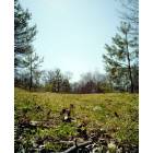
Lastly, a wide view of the end of the Richmond Parkway with Richmond Avenue and Arthur Kill Road in the background.
So crowded here now. Where I grew up we were sourounded by woods. Now it's all houses.
The incompletion of the Richmond Pkwy has handcuffed Staten Island. All the traffic improvements to the highways don't slovenly the problem of the local infrastructure being inadequate to handle the transportation needs of the brough with the most cars per resident.
I wouldn't go that far. I don't mind the shopping and the commerce. I do mind the over crowding and over development of residential areas, however the commerce needs the residents to be shoppers so, I guess it goes hand and hand. The roads, rail, bus situation needs to be overhauled. We need a light rail and a subway line to manhattan and brooklyn.
I wouldn't go that far. I don't mind the shopping and the commerce. I do mind the over crowding and over development of residential areas, however the commerce needs the residents to be shoppers so, I guess it goes hand and hand. The roads, rail, bus situation needs to be overhauled. We need a light rail and a subway line to manhattan and brooklyn.
I don't see that ever happening. The cost of rail to Manhattan would never be offset by any economic gain this would bring to SI. The issue with light rail is that the city would have to utilize eminent domain and knock out some estate to facilitate a light rail line. Should have been done decades ago.
Please register to post and access all features of our very popular forum. It is free and quick. Over $68,000 in prizes has already been given out to active posters on our forum. Additional giveaways are planned.
Detailed information about all U.S. cities, counties, and zip codes on our site: City-data.com.

 Please register to participate in our discussions with 2 million other members - it's free and quick! Some forums can only be seen by registered members. After you create your account, you'll be able to customize options and access all our 15,000 new posts/day with fewer ads.