Milton, Massachusetts Neighborhood Map - Income, House Prices, Occupations, Boundaries
Settings
X

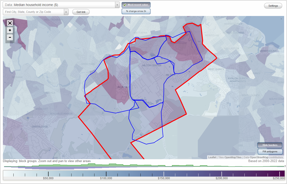
- City boundary
- Neighborhood boundaries
Business Search - 14 Million verified businesses
Neighborhoods:
Brush Hill, Columbine Cliffs, Hillside Street, Milton Center, Milton HillBrush Hill neighborhood in Milton statistics: (Find on map)
Area: 2.981 square miles
Population: 23,119
Population density:
Median household income in 2021:
Median rent in in 2021:
Male vs Females
Median age
Housing prices:
Average estimated value of detached houses in 2021 (58.6% of all units):
Average estimated value of housing units in 2-unit structures in 2021 (43.0% of all units):
Most popular occupations of males: service occupations (20.9%); management occupations (except farmers) (13.9%); sales and office occupations (13.4%); construction, extraction, and maintenance occupations (12.0%); business and financial operations occupations (6.6%); education, training, and library occupations (4.7%); legal occupations (4.6%)
Most popular occupations of females: service occupations (27.5%); sales and office occupations (22.7%); education, training, and library occupations (10.0%); management occupations (except farmers) (9.7%); business and financial operations occupations (8.9%); healthcare practitioners and technical occupations (8.7%); computer and mathematical occupations (3.8%)
Highways in this neighborhood: Blue Hill Ave (State Hwy 138).
Roads and streets: Brush Hill Rd; Atherton St; Canton Ave; Robbins St; Woodland Rd; Blue Hills Pkwy; Loew Cir; Bradlee Rd; Sumner St; Ferncroft Rd; Craig St; Truro Ln; Alfred St; Blue Jay Way; Unquity Rd; Valentine Rd; Harland St; Hollingsworth Rd; Brook Rd; Lafayette St; Smith Rd; Wolcott Rd; Blue Hill Ter; Oak St; Decker St; Truman Pkwy; Amor Rd; Cushing Rd; Metropolitan Ave; Hudson St; Crestview Rd; Beacon Street Cir; Margaret Rd; Big Blue Dr; Victoria St; Meadowview Rd; Cheever St; Trout Brook Ave; Cranmore Rd; Pagoda St; Churchill St; Concord Ave; Lothrop Ave; Crown St; Hills View Rd; Vose Hill Rd; Milton St; Pagoda Cir; Barbara Ln; Mingo St; Aberdeen Rd; Park St; Essex Rd; Beacon St; Meeting House Ln; Prince St; Pope Hill Rd; Norman St; Belvoir Rd; Landon Rd; Brush Hill Ln; Adanac Rd; Dexter St; Tucker St; Myers Ln; Annapolis Rd; Austin St; Kevin Rd; Apple Ln; Lufberry St; The Ledgeway; Fairmount Ave; Truman Hwy; Dana Ave; Quentin St; Verndale Rd; Corey Ln; Gould Ln; Savin St; Elias Ln; Williams Ave; Union Ave; Carlson Rd; Mulberry Rd; Garfield Ave Exd; Crestview Ln; N Cushing Rd; Van Brunt; Faraday St; Atherton Ln.
Other features: Balster Brk; Pine Tree Brk; Trout Brk; Neponset Riv.
Roads and streets: Garfield Ave; Summit St; Fairmount Ave; Beacon St; Milton Ave; Highland St; Washington St; Warren Ave; Williams Ave; Loring St; Metropolitan Ave; Prospect St; Cranmore Rd; Chittick Rd; Truman Hwy; Dana Ave; Neponset Ave; Pleasant St; Glenwood Ave; Tyler St; Faraday St; Needham Rd; Van Brunt St; Farwell Ave; Badger Rd; Norway Park; Woodglen Rd; Bow St; Spring Hill Rd; Pond St; Lochland Rd; Albion St; New Acre Rd; Wakefield Ave; Vose Ave; Halsey Rd; Washington Street Pl; New Bedford St; Mount Pleasant St; Brush Hill Ter; Skyline Rd; Milton Ter; Norris Rd; Aldo Ter; Franklin Ter; Prospect Park; Teresa Ter; Brushwood Cir; Red Pine Rd; Edith St; Warren Park; Rich Hood Ave; Garfield Ave Exd; Robbart Ln; Summit Cir (Summit Ct); Raynes Rd; Corcoran Dr (Corcoran Cir); Loring Pl; Leseur Rd; Prospect Cir; Floral Pl; Corcoran Dr.
Other features: Neponset Riv.
Brush Hill neighborhood detailed profile
Area: 2.981 square miles
Population: 23,119
Population density:
| Brush Hill: | 7,755 people per square mile |
| Milton: | 2,177 people per square mile |
Median household income in 2021:
| Brush Hill: | $114,620 |
| Milton: | $153,971 |
Median rent in in 2021:
| Brush Hill: | $1,139 |
| Milton: | $1,112 |
Male vs Females
| Males: | 11,431 |
| Females: | 11,687 |
Median age
| Males: | 43.5 years |
| Females: | 45.8 years |
Housing prices:
Average estimated value of detached houses in 2021 (58.6% of all units):
| Brush Hill: | $660,048 |
| Milton: | $894,005 |
Average estimated value of housing units in 2-unit structures in 2021 (43.0% of all units):
| This neighborhood: | $448,840 |
| Milton: | $520,770 |
Most popular occupations of males: service occupations (20.9%); management occupations (except farmers) (13.9%); sales and office occupations (13.4%); construction, extraction, and maintenance occupations (12.0%); business and financial operations occupations (6.6%); education, training, and library occupations (4.7%); legal occupations (4.6%)
Most popular occupations of females: service occupations (27.5%); sales and office occupations (22.7%); education, training, and library occupations (10.0%); management occupations (except farmers) (9.7%); business and financial operations occupations (8.9%); healthcare practitioners and technical occupations (8.7%); computer and mathematical occupations (3.8%)
Highways in this neighborhood: Blue Hill Ave (State Hwy 138).
Roads and streets: Brush Hill Rd; Atherton St; Canton Ave; Robbins St; Woodland Rd; Blue Hills Pkwy; Loew Cir; Bradlee Rd; Sumner St; Ferncroft Rd; Craig St; Truro Ln; Alfred St; Blue Jay Way; Unquity Rd; Valentine Rd; Harland St; Hollingsworth Rd; Brook Rd; Lafayette St; Smith Rd; Wolcott Rd; Blue Hill Ter; Oak St; Decker St; Truman Pkwy; Amor Rd; Cushing Rd; Metropolitan Ave; Hudson St; Crestview Rd; Beacon Street Cir; Margaret Rd; Big Blue Dr; Victoria St; Meadowview Rd; Cheever St; Trout Brook Ave; Cranmore Rd; Pagoda St; Churchill St; Concord Ave; Lothrop Ave; Crown St; Hills View Rd; Vose Hill Rd; Milton St; Pagoda Cir; Barbara Ln; Mingo St; Aberdeen Rd; Park St; Essex Rd; Beacon St; Meeting House Ln; Prince St; Pope Hill Rd; Norman St; Belvoir Rd; Landon Rd; Brush Hill Ln; Adanac Rd; Dexter St; Tucker St; Myers Ln; Annapolis Rd; Austin St; Kevin Rd; Apple Ln; Lufberry St; The Ledgeway; Fairmount Ave; Truman Hwy; Dana Ave; Quentin St; Verndale Rd; Corey Ln; Gould Ln; Savin St; Elias Ln; Williams Ave; Union Ave; Carlson Rd; Mulberry Rd; Garfield Ave Exd; Crestview Ln; N Cushing Rd; Van Brunt; Faraday St; Atherton Ln.
Other features: Balster Brk; Pine Tree Brk; Trout Brk; Neponset Riv.
Roads and streets: Garfield Ave; Summit St; Fairmount Ave; Beacon St; Milton Ave; Highland St; Washington St; Warren Ave; Williams Ave; Loring St; Metropolitan Ave; Prospect St; Cranmore Rd; Chittick Rd; Truman Hwy; Dana Ave; Neponset Ave; Pleasant St; Glenwood Ave; Tyler St; Faraday St; Needham Rd; Van Brunt St; Farwell Ave; Badger Rd; Norway Park; Woodglen Rd; Bow St; Spring Hill Rd; Pond St; Lochland Rd; Albion St; New Acre Rd; Wakefield Ave; Vose Ave; Halsey Rd; Washington Street Pl; New Bedford St; Mount Pleasant St; Brush Hill Ter; Skyline Rd; Milton Ter; Norris Rd; Aldo Ter; Franklin Ter; Prospect Park; Teresa Ter; Brushwood Cir; Red Pine Rd; Edith St; Warren Park; Rich Hood Ave; Garfield Ave Exd; Robbart Ln; Summit Cir (Summit Ct); Raynes Rd; Corcoran Dr (Corcoran Cir); Loring Pl; Leseur Rd; Prospect Cir; Floral Pl; Corcoran Dr.
Other features: Neponset Riv.
Brush Hill neighborhood detailed profile
Columbine Cliffs neighborhood in Milton statistics: (Find on map)
Area: 0.773 square miles
Population: 4,004
Population density:
Median household income in 2021:
Median rent in in 2021:
Male vs Females
Median age
Housing prices:
Average estimated value of detached houses in 2021 (59.0% of all units):
Average estimated value of townhouses or other attached units in 2021 (5.9% of all units):
Average estimated value of housing units in 2-unit structures in 2021 (13.1% of all units):
Average estimated '21 value of housing units in 3-to-4-unit structures (4.5% of all units):
Average estimated '21 value of housing units in 5-or-more-unit structures (41.0% of all units):
Most popular occupations of males: management occupations (except farmers) (26.7%); sales and office occupations (18.9%); service occupations (11.7%); business and financial operations occupations (9.7%); computer and mathematical occupations (5.3%); construction, extraction, and maintenance occupations (3.7%); life, physical, and social science occupations (3.6%)
Most popular occupations of females: service occupations (16.6%); sales and office occupations (16.4%); business and financial operations occupations (13.4%); management occupations (except farmers) (12.9%); healthcare practitioners and technical occupations (12.7%); education, training, and library occupations (12.6%); arts, design, entertainment, sports, and media occupations (5.1%)
Highways in this neighborhood: State Hwy 28 (Brook Rd); Blue Hills Pkwy (State Hwy 28).
Roads and streets: Eliot St; Central Ave; Hinckley Rd; Canton Ave; Columbine Rd; Cliff Rd; Maple St; Allerton Rd; Valley Rd; School St; Herrick Dr; Capen St; Ruggles Ln; Morton Rd; Brook Hill Rd; Ridge Rd; Standish Rd; Rustlewood Rd; Avalon Rd; Windsor Rd; Marilyn Rd; Hawthorne Rd; Briarfield Rd; Brandon Rd; Allen Cir; Fairfax Rd; Willoughby Rd; Curtis Rd; Gaskins Rd; W Side Rd; Norway Rd; Oak Rd; Griggs Ln; Longwood Rd; High St; Lancaster Ln; Cantwell Rd; Fieldstone Ln; Adams St; Rock View Rd; Garfield Rd; Morton Ter; Waldo Rd; Virginia St; Byrne Rd; Greenleaf Rd; Heritage Ln; Brookside Park; Eliot Cir; Columbia Park; Francis St; Valley Rd Exd.
Mass transit rail lines: Mbta Red Line RR (Ashmont-Mattapan Trolley).
Other features: Pine Tree Brk; Neponset Riv.
Highways in this neighborhood: .
Mass transit rail lines: Mbta Red Line RR (Ashmont-Mattapan Trolley).
Other features: Neponset Riv.
Columbine Cliffs neighborhood detailed profile
Area: 0.773 square miles
Population: 4,004
Population density:
| Columbine Cliffs (Colombine Cliff): | 5,181 people per square mile |
| Milton: | 2,177 people per square mile |
Median household income in 2021:
| Columbine Cliffs (Colombine Cliff): | $108,430 |
| Milton: | $153,971 |
Median rent in in 2021:
| Columbine Cliffs (Colombine Cliff): | $1,548 |
| Milton: | $1,112 |
Male vs Females
| Males: | 1,883 |
| Females: | 2,120 |
Median age
| Males: | 40.8 years |
| Females: | 41.8 years |
Housing prices:
Average estimated value of detached houses in 2021 (59.0% of all units):
| Columbine Cliffs (Colombine Cliff): | $531,890 |
| Milton: | $894,005 |
Average estimated value of townhouses or other attached units in 2021 (5.9% of all units):
| This neighborhood: | $483,235 |
| place: | $551,657 |
Average estimated value of housing units in 2-unit structures in 2021 (13.1% of all units):
| This neighborhood: | $599,476 |
| Milton: | $520,770 |
Average estimated '21 value of housing units in 3-to-4-unit structures (4.5% of all units):
| Columbine Cliffs (Colombine Cliff): | $389,672 |
| place: | $1,189,890 |
Average estimated '21 value of housing units in 5-or-more-unit structures (41.0% of all units):
| Columbine Cliffs (Colombine Cliff): | $530,424 |
| Milton: | $423,972 |
Most popular occupations of males: management occupations (except farmers) (26.7%); sales and office occupations (18.9%); service occupations (11.7%); business and financial operations occupations (9.7%); computer and mathematical occupations (5.3%); construction, extraction, and maintenance occupations (3.7%); life, physical, and social science occupations (3.6%)
Most popular occupations of females: service occupations (16.6%); sales and office occupations (16.4%); business and financial operations occupations (13.4%); management occupations (except farmers) (12.9%); healthcare practitioners and technical occupations (12.7%); education, training, and library occupations (12.6%); arts, design, entertainment, sports, and media occupations (5.1%)
Highways in this neighborhood: State Hwy 28 (Brook Rd); Blue Hills Pkwy (State Hwy 28).
Roads and streets: Eliot St; Central Ave; Hinckley Rd; Canton Ave; Columbine Rd; Cliff Rd; Maple St; Allerton Rd; Valley Rd; School St; Herrick Dr; Capen St; Ruggles Ln; Morton Rd; Brook Hill Rd; Ridge Rd; Standish Rd; Rustlewood Rd; Avalon Rd; Windsor Rd; Marilyn Rd; Hawthorne Rd; Briarfield Rd; Brandon Rd; Allen Cir; Fairfax Rd; Willoughby Rd; Curtis Rd; Gaskins Rd; W Side Rd; Norway Rd; Oak Rd; Griggs Ln; Longwood Rd; High St; Lancaster Ln; Cantwell Rd; Fieldstone Ln; Adams St; Rock View Rd; Garfield Rd; Morton Ter; Waldo Rd; Virginia St; Byrne Rd; Greenleaf Rd; Heritage Ln; Brookside Park; Eliot Cir; Columbia Park; Francis St; Valley Rd Exd.
Mass transit rail lines: Mbta Red Line RR (Ashmont-Mattapan Trolley).
Other features: Pine Tree Brk; Neponset Riv.
Highways in this neighborhood: .
Mass transit rail lines: Mbta Red Line RR (Ashmont-Mattapan Trolley).
Other features: Neponset Riv.
Columbine Cliffs neighborhood detailed profile
Hillside Street neighborhood in Milton statistics: (Find on map)
Area: 1.594 square miles
Highways in this neighborhood: State Hwy 28 (Randolph Ave).
Roads and streets: Hillside St; Chickataubut Rd; Harland St; Parkwood Dr; Ford Ranch Rd; Forest St; Brierbrook St; Heather Dr; Mark Ln; Stonehill Ln; Barberry Ln; Susi Ln.
Other features: Pine Tree Brk.
Hillside Street neighborhood detailed profile
Milton Center neighborhood in Milton statistics: (Find on map)
Area: 2.380 square miles
Population: 12,905
Population density:
Median household income in 2021:
Median rent in in 2021:
Male vs Females
Median age
Housing prices:
Average estimated value of detached houses in 2021 (46.0% of all units):
Average estimated value of housing units in 2-unit structures in 2021 (75.0% of all units):
Most popular occupations of males: service occupations (23.1%); management occupations (except farmers) (12.4%); education, training, and library occupations (12.0%); sales and office occupations (11.8%); business and financial operations occupations (9.5%); computer and mathematical occupations (7.1%); architecture and engineering occupations (5.1%)
Most popular occupations of females: education, training, and library occupations (25.4%); sales and office occupations (23.2%); healthcare practitioners and technical occupations (13.3%); management occupations (except farmers) (10.2%); service occupations (10.2%); business and financial operations occupations (9.6%); arts, design, entertainment, sports, and media occupations (5.1%)
Highways in this neighborhood: State Hwy 28 (Randolph Ave); Reedsdale Rd (State Hwy 28); State Hwy 28 (Brook Rd).
Roads and streets: Canton Ave; Highland St; Thacher St; Blue Hills Pkwy; Centre St; Old Farm Rd; Houston Ave; Whittier Rd; Wendell Park; Audubon Rd; Woodside Dr; Gun Hill St; Warren Ave; Pleasant St; Indian Spring Rd; Gile Rd; Gulliver St; Countryside Ln; Governor Stoughton Ln; Elm St; Clapp St; Dyer Ave; Channing St; Hallen Ave; Meredith Cir; Clifton Rd; Central Ave; Quisset Brook Rd; Centre Ln; Martin Rd; Sias Ln; Buckingham Rd; Spafford Rd; Colonial Rd; Voses Ln; Kahler Ave; Lodge St; Longmeadow Rd; Parkway Cres; Fairbanks Rd; Marshall Rd; Artwill St; Harold St; Meagher Ave; Walnut St; Revere St; Highland Ln; St Marys Rd; Magnolia Rd; Lincoln St; Pine Tree Brook Rd; Grove St; Coolidge Rd; Laurel Rd; Engine Rd; Saddle Ridge Rd; Winthrop St; Cape Cod Ln; Lantern Ln; Bonad Rd; Deerfield Dr; Pinehurst Dr; Fox Hill Ln; West St; Meadow Ln; Arrowhead Ln; Preacher Rd; Wagon Wheel Dr; Reed St; Catherine Rd; Farmer Rd; Evergreen Trl; Pequot Ln; Maitland St; Gibbons St; Cottage Pl; Maxwell Rd; Stanton Rd; Chilton Park; Frothingham St; Wildwood Rd; Darby Rd; Breck St; Crane Rd; Holmes Ln; Lindbergh Rd; Elm Lawn St; Azalea Dr; Manning Ln; Orono St; Viola St; Pawnee Cir; Woodbine St; Fairlawn Ave; Blacksmith Rd; Taylor Rd; Stoddard Ln; Thompson Ln; Mountain Laurel Path; Cherry Blossom Ln; NE Parkway Cres; Weston St; Unquity Rd; Sugar Maple Ln; Academy Ln; Powder Mill Rd.
Other features: Pine Tree Brk; Unquity Brk.
Milton Center neighborhood detailed profile
Area: 2.380 square miles
Population: 12,905
Population density:
| Milton Center: | 5,422 people per square mile |
| Milton: | 2,177 people per square mile |
Median household income in 2021:
| Milton Center: | $175,398 |
| Milton: | $153,971 |
Median rent in in 2021:
| Milton Center: | $1,799 |
| Milton: | $1,112 |
Male vs Females
| Males: | 6,568 |
| Females: | 6,337 |
Median age
| Males: | 43.9 years |
| Females: | 46.2 years |
Housing prices:
Average estimated value of detached houses in 2021 (46.0% of all units):
| Milton Center: | $510,896 |
| Milton: | $894,005 |
Average estimated value of housing units in 2-unit structures in 2021 (75.0% of all units):
| This neighborhood: | $678,099 |
| Milton: | $520,770 |
Most popular occupations of males: service occupations (23.1%); management occupations (except farmers) (12.4%); education, training, and library occupations (12.0%); sales and office occupations (11.8%); business and financial operations occupations (9.5%); computer and mathematical occupations (7.1%); architecture and engineering occupations (5.1%)
Most popular occupations of females: education, training, and library occupations (25.4%); sales and office occupations (23.2%); healthcare practitioners and technical occupations (13.3%); management occupations (except farmers) (10.2%); service occupations (10.2%); business and financial operations occupations (9.6%); arts, design, entertainment, sports, and media occupations (5.1%)
Highways in this neighborhood: State Hwy 28 (Randolph Ave); Reedsdale Rd (State Hwy 28); State Hwy 28 (Brook Rd).
Roads and streets: Canton Ave; Highland St; Thacher St; Blue Hills Pkwy; Centre St; Old Farm Rd; Houston Ave; Whittier Rd; Wendell Park; Audubon Rd; Woodside Dr; Gun Hill St; Warren Ave; Pleasant St; Indian Spring Rd; Gile Rd; Gulliver St; Countryside Ln; Governor Stoughton Ln; Elm St; Clapp St; Dyer Ave; Channing St; Hallen Ave; Meredith Cir; Clifton Rd; Central Ave; Quisset Brook Rd; Centre Ln; Martin Rd; Sias Ln; Buckingham Rd; Spafford Rd; Colonial Rd; Voses Ln; Kahler Ave; Lodge St; Longmeadow Rd; Parkway Cres; Fairbanks Rd; Marshall Rd; Artwill St; Harold St; Meagher Ave; Walnut St; Revere St; Highland Ln; St Marys Rd; Magnolia Rd; Lincoln St; Pine Tree Brook Rd; Grove St; Coolidge Rd; Laurel Rd; Engine Rd; Saddle Ridge Rd; Winthrop St; Cape Cod Ln; Lantern Ln; Bonad Rd; Deerfield Dr; Pinehurst Dr; Fox Hill Ln; West St; Meadow Ln; Arrowhead Ln; Preacher Rd; Wagon Wheel Dr; Reed St; Catherine Rd; Farmer Rd; Evergreen Trl; Pequot Ln; Maitland St; Gibbons St; Cottage Pl; Maxwell Rd; Stanton Rd; Chilton Park; Frothingham St; Wildwood Rd; Darby Rd; Breck St; Crane Rd; Holmes Ln; Lindbergh Rd; Elm Lawn St; Azalea Dr; Manning Ln; Orono St; Viola St; Pawnee Cir; Woodbine St; Fairlawn Ave; Blacksmith Rd; Taylor Rd; Stoddard Ln; Thompson Ln; Mountain Laurel Path; Cherry Blossom Ln; NE Parkway Cres; Weston St; Unquity Rd; Sugar Maple Ln; Academy Ln; Powder Mill Rd.
Other features: Pine Tree Brk; Unquity Brk.
Milton Center neighborhood detailed profile
Milton Hill neighborhood in Milton statistics: (Find on map)
Area: 1.625 square miles
Population: 3,535
Population density:
Median household income in 2021:
Median rent in in 2021:
Male vs Females
Median age
Housing prices:
Average estimated value of detached houses in 2021 (74.5% of all units):
Average estimated value of housing units in 2-unit structures in 2021 (10.5% of all units):
Most popular occupations of males: management occupations (except farmers) (30.4%); sales and office occupations (18.2%); service occupations (9.1%); business and financial operations occupations (8.1%); computer and mathematical occupations (7.1%); healthcare practitioners and technical occupations (6.9%); legal occupations (5.6%)
Most popular occupations of females: healthcare practitioners and technical occupations (17.2%); education, training, and library occupations (16.3%); management occupations (except farmers) (14.9%); sales and office occupations (13.9%); business and financial operations occupations (12.9%); arts, design, entertainment, sports, and media occupations (7.7%); computer and mathematical occupations (6.3%)
Limited-access highways (interstate or state) in this neighborhood: Southeast Expy (US Hwy 1, I- 93, State Hwy 3).
Roads and streets: Brook Rd; Adams St; Centre St; Edge Hill Rd; Pleasant St; Randolph Ave; Churchills Ln; Dudley Ln; Cabot St; Forbes Rd; Otis St; Reservation Rd; Cary Ave; Rowe St; Squantum St; Waldeck Rd; Governors Rd; Hurlcroft Rd; California Ave; Badger Cir; St Agatha Rd; Voses Ln; Barnard Ave; Pillon Rd; McKinnon Ave; Brae Burn Rd; Lochland St; Christopher Dr; Westvale Rd; Century Ln; Hillcrest Rd; Hoy Ter; Father Carney Dr; Hollis St; Hazel St; Marr Crest Dr; Cheryl Dr; Chesterfield Rd; Lawndale Rd; Gordon Rd; Bradford Rd; Woodward Ct; Kenilworth Rd; Woodchester Dr; Canton Ave; Russell St; Sheridan Dr; N Russell St; Libby Rd; Hutchinson St; Milton Hill Rd; Vinewood Rd; Edward Ave; Murray Ave; Governor Belcher Ln; Augusta Rd; Paradise Rd; Babcock St; Wyndmere Rd; Taff Rd; Brook Dr; Lindbergh Rd; Andrews Rd; Westbourne St; Highfield Cir; Holborn St; Ellsworth Rd; Houghton Rd; Green Hollow Ln; Wharf St; Nash St.
Mass transit rail lines: .
Other features: Unquity Brk; Neponset Riv.
Other features: Neponset Riv.
Milton Hill neighborhood detailed profile
Area: 1.625 square miles
Population: 3,535
Population density:
| Milton Hill: | 2,176 people per square mile |
| Milton: | 2,177 people per square mile |
Median household income in 2021:
| Milton Hill: | $175,912 |
| Milton: | $153,971 |
Median rent in in 2021:
| Milton Hill: | $1,997 |
| Milton: | $1,112 |
Male vs Females
| Males: | 1,699 |
| Females: | 1,835 |
Median age
| Males: | 39.1 years |
| Females: | 39.9 years |
Housing prices:
Average estimated value of detached houses in 2021 (74.5% of all units):
| Milton Hill: | $740,723 |
| Milton: | $894,005 |
Average estimated value of housing units in 2-unit structures in 2021 (10.5% of all units):
| This neighborhood: | $337,083 |
| Milton: | $520,770 |
Most popular occupations of males: management occupations (except farmers) (30.4%); sales and office occupations (18.2%); service occupations (9.1%); business and financial operations occupations (8.1%); computer and mathematical occupations (7.1%); healthcare practitioners and technical occupations (6.9%); legal occupations (5.6%)
Most popular occupations of females: healthcare practitioners and technical occupations (17.2%); education, training, and library occupations (16.3%); management occupations (except farmers) (14.9%); sales and office occupations (13.9%); business and financial operations occupations (12.9%); arts, design, entertainment, sports, and media occupations (7.7%); computer and mathematical occupations (6.3%)
Limited-access highways (interstate or state) in this neighborhood: Southeast Expy (US Hwy 1, I- 93, State Hwy 3).
Roads and streets: Brook Rd; Adams St; Centre St; Edge Hill Rd; Pleasant St; Randolph Ave; Churchills Ln; Dudley Ln; Cabot St; Forbes Rd; Otis St; Reservation Rd; Cary Ave; Rowe St; Squantum St; Waldeck Rd; Governors Rd; Hurlcroft Rd; California Ave; Badger Cir; St Agatha Rd; Voses Ln; Barnard Ave; Pillon Rd; McKinnon Ave; Brae Burn Rd; Lochland St; Christopher Dr; Westvale Rd; Century Ln; Hillcrest Rd; Hoy Ter; Father Carney Dr; Hollis St; Hazel St; Marr Crest Dr; Cheryl Dr; Chesterfield Rd; Lawndale Rd; Gordon Rd; Bradford Rd; Woodward Ct; Kenilworth Rd; Woodchester Dr; Canton Ave; Russell St; Sheridan Dr; N Russell St; Libby Rd; Hutchinson St; Milton Hill Rd; Vinewood Rd; Edward Ave; Murray Ave; Governor Belcher Ln; Augusta Rd; Paradise Rd; Babcock St; Wyndmere Rd; Taff Rd; Brook Dr; Lindbergh Rd; Andrews Rd; Westbourne St; Highfield Cir; Holborn St; Ellsworth Rd; Houghton Rd; Green Hollow Ln; Wharf St; Nash St.
Mass transit rail lines: .
Other features: Unquity Brk; Neponset Riv.
Other features: Neponset Riv.
Milton Hill neighborhood detailed profile