Please register to participate in our discussions with 2 million other members - it's free and quick! Some forums can only be seen by registered members. After you create your account, you'll be able to customize options and access all our 15,000 new posts/day with fewer ads.
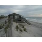
I live about 2 miles from the ICW and about 3 miles from the ocean...Ive never had a problem yet...I specifically bought my home and lot because Im up high...Like four to five feet above the street...I have excellent drainage...The highest part of Carteret county is somewhere down around 9 mile road and HWY 24, or close by...
If you buy smart, buy strategically ( I love that term) you probably wont have any problems....The lower you go above sea level, the higher your chances of problems....
But this is the coast, I wish I would have moved here 22 years ago....
When it comes to coastal flooding, do not think just X axis, think Y axis.
Most folks just think in terms of proximity to water in regards to flooding.
Think elevation (and soil type)
I know of water front properties that have not flooded in 100 plus years. I know of inland property, several miles inland that will flood if you sneeze twice.
Important Note: Most deaths associated with storm flooding occurrs inland-Not coastal
so what areas are most likely to flood? least? or is it kinda just a scattered area?
The Onslow county website has an interactive map, but it's hard to understand. Is there a map anywhere that shows clearly where the flood zones are? I haven't had any luck yet.
During 1 cane I left Kitty Hawk for Raleigh for mandatory evacuation. Next day, they gave the all clear to return. Problem was, no one checked the rain levels and how high or when they would accumulate down stream. It was one of those canes that sweeps inland as well as coastal.
A normal 3 hour tops trip became 10 hours of hell. Every detour we took ended up being detoured. You might remember when Suffolk was flooded out? We got out of there 20 minutes before the flash floods hit. Yes, we had to go all of the way to Va. to get back to Kitty Hawk.
After being forced to evacuate once per year for 10 years, we moved to Las Vegas. And yes, you are right. Our ground level condo 2 blocks from the ocean on high ground, never had a drop inside during those 10 years.
My favorite word: ubiquitous.
Please register to post and access all features of our very popular forum. It is free and quick. Over $68,000 in prizes has already been given out to active posters on our forum. Additional giveaways are planned.
Detailed information about all U.S. cities, counties, and zip codes on our site: City-data.com.

 Please register to participate in our discussions with 2 million other members - it's free and quick! Some forums can only be seen by registered members. After you create your account, you'll be able to customize options and access all our 15,000 new posts/day with fewer ads.