Please register to participate in our discussions with 2 million other members - it's free and quick! Some forums can only be seen by registered members. After you create your account, you'll be able to customize options and access all our 15,000 new posts/day with fewer ads.
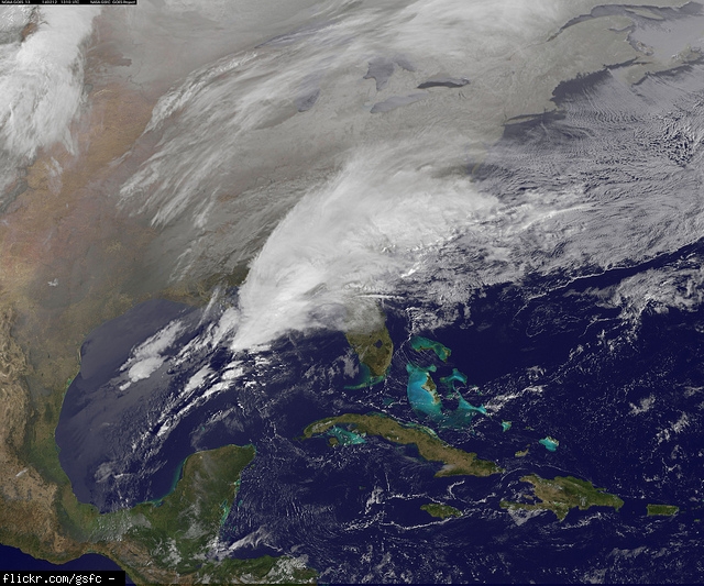
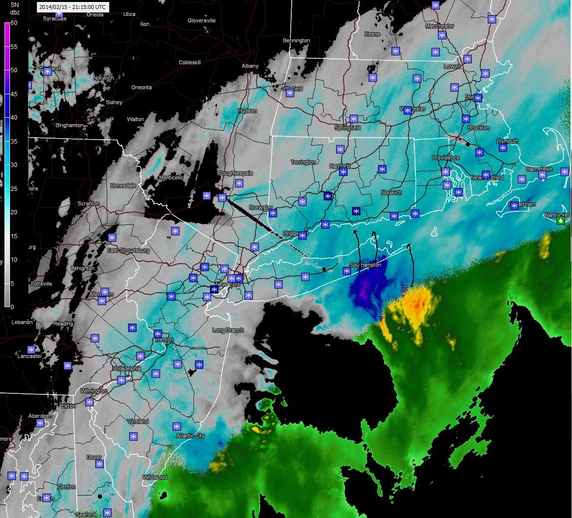
SPC just issued Heavy Snow Discussion for areas outlined in blue with current Radar. get ready for whiteout conditions. It was awesome the other day when I went through it for couple hours straight
Starting to snow harder here. We've had flurries since about 1 PM, and we're supposed to get an inch or so accumulation before the snow stops early this evening. Might start accumulating with this heavier stuff.
We had virga all day now all of a sudden its snowing hard with visibility less than 1/2 mile. 4th day snowing in last 7 days. Lots of shovel and scrape days this year.
Watch the OBS's from Eastern MA. I'll be curious what the winds peak at. Maybe strong Tropical Storm force or weak Hurricane force MAYBE.
329 PM EST SAT FEB 15 2014
...BLIZZARD WARNING REMAINS IN EFFECT UNTIL 5 AM EST SUNDAY...
* LOCATIONS...COASTAL ESSEX COUNTY AND EAST COASTAL PLYMOUTH
COUNTY AND CAPE COD.
* HAZARD TYPES...HEAVY SNOW...BLIZZARD CONDITIONS AND DAMAGING
WINDS.
* ACCUMULATIONS...SNOW ACCUMULATION OF 8 TO 16 INCHES.
* TIMING...SNOW WILL QUICKLY BECOME HEAVY THROUGH EARLY EVENING.
THE PEAK OF THE STORM WILL BE BETWEEN 6 PM AND 2 AM WITH SNOW
COMING TO AN END BY 4 AM. IN ADDITION...POWERFUL WINDS WILL
DEVELOP THIS EVENING AND PEAK NEAR OR JUST AFTER MIDNIGHT.
* TEMPERATURES...IN THE LOWER 30S.
* IMPACTS...HEAVY SNOW WITH 3 INCH PER HOUR SNOWFALL RATES AT
TIMES
Snowfall forecast update from NWS Boston. 1-2 feet out there with high winds!
Please register to post and access all features of our very popular forum. It is free and quick. Over $68,000 in prizes has already been given out to active posters on our forum. Additional giveaways are planned.
Detailed information about all U.S. cities, counties, and zip codes on our site: City-data.com.

 Please register to participate in our discussions with 2 million other members - it's free and quick! Some forums can only be seen by registered members. After you create your account, you'll be able to customize options and access all our 15,000 new posts/day with fewer ads.