Quote:
Originally Posted by RAlex

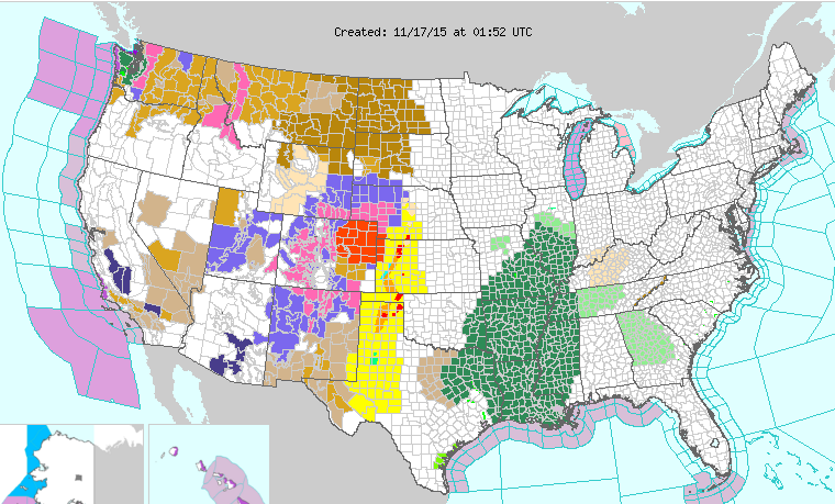
Multiple tornado reports across Kansas and the Texas Panhandle.
Currently there is a warning for a confirmed large tornado moving toward the Dodge City, KS area.
NWS Dodge City
* AT 641 PM CST...A CONFIRMED LARGE AND EXTREMELY DANGEROUS TORNADO
WAS LOCATED 6 MILES SOUTHEAST OF MONTEZUMA...MOVING NORTHEAST AT 40
MPH.
THIS IS A PARTICULARLY DANGEROUS SITUATION.
HAZARD...DAMAGING TORNADO.
SOURCE...LAW ENFORCEMENT CONFIRMED TORNADO.
IMPACT...FLYING DEBRIS WILL BE DANGEROUS TO THOSE CAUGHT WITHOUT
SHELTER. MOBILE HOMES WILL BE DAMAGED OR DESTROYED.
DAMAGE TO ROOFS...WINDOWS AND VEHICLES WILL OCCUR. TREE
DAMAGE IS LIKELY.
* THE TORNADO WILL BE NEAR...
THE HAGGARD ELEV AROUND 650 PM CST.
ENSIGN AROUND 700 PM CST.
HOWELL AROUND 710 PM CST.
DODGE CITY AROUND 715 PM CST.
PRECAUTIONARY/PREPAREDNESS ACTIONS...
TO REPEAT...A LARGE...EXTREMELY DANGEROUS AND POTENTIALLY DEADLY
TORNADO IS ON THE GROUND. TO PROTECT YOUR LIFE...TAKE COVER NOW! MOVE
TO A BASEMENT OR AN INTERIOR ROOM ON THE LOWEST FLOOR OF A STURDY
BUILDING. AVOID WINDOWS. IF IN A MOBILE HOME...A VEHICLE OR
OUTDOORS...MOVE TO THE CLOSEST SUBSTANTIAL SHELTER AND PROTECT
YOURSELF FROM FLYING DEBRIS.
A LARGE AND EXTREMELY DANGEROUS TORNADO IS ON THE GROUND. TAKE
IMMEDIATE TORNADO PRECAUTIONS. THIS IS AN EMERGENCY SITUATION.
|
Sheesh. Meanwhile just to the west there's blizzard warnings:
...DANGEROUS BLIZZARD OVER MOST OF THE NORTHEAST AND EAST CENTRAL
COLORADO PLAINS TONIGHT INTO TUESDAY...
...TRAVEL NOT RECOMMENDED AND MAY BECOME IMPOSSIBLE ON THE PLAINS...
...HEAVY SNOW IN THE MOUNTAINS...
.
A VERY STRONG WINTER STORM WILL MOVE ACROSS COLORADO TONIGHT AND
INTO WESTERN KANSAS BY TUESDAY AFTERNOON. THE STORM WILL PRODUCE
HEAVY SNOW IN THE MOUNTAINS AND THEN SNOW...AND VERY STRONG WINDS
ON THE PLAINS. BLIZZARD CONDITIONS WILL DEVELOP OVER A MAJORITY OF
THE PLAINS TONIGHT...WITH THE WORST CONDITIONS ROUGHLY ALONG AND
SOUTH OF INTERSTATE 76 TONIGHT. CONDITIONS WILL DETERIORATE ALONG
THE FRONT RANGE I-25 CORRIDOR THROUGH THIS EVENING...WITH BLIZZARD
CONDITIONS DEVELOPING AS WINDS STRENGTHEN. THE BLIZZARD WILL
SPREAD EAST ACROSS THE PLAINS THROUGH LATE EVENING. SLOW
IMPROVEMENT FROM WEST TO EAST WILL OCCUR DURING THE DAY TUESDAY.
THE WORST CONDITIONS ARE EXPECTED TO OCCUR FROM THE SOUTHERN AND
EASTERN SECTIONS OF THE DENVER METRO AREA EAST TOWARDS LIMON AND
AKRON. IN THESE AREAS ROAD CLOSURES ARE LIKELY DUE TO WHITEOUT
CONDITIONS AND DRIFTING OF HEAVY SNOW. SOME PLACES WILL RECEIVE
WELL OVER A FOOT OF SNOW ALONG WITH WIND GUSTS TO AROUND 55 MPH.
IN AREAS NORTH OF INTERSTATE 76 SNOWFALL WILL BE LIGHTER...BUT
STRONG NORTHERLY WINDS WILL STILL LIKELY PRODUCE EXTENSIVE BLOWING
AND DRIFTING SNOW AND HAZARDOUS DRIVING CONDITIONS.
TIMING...RAIN AND SNOW WILL CHANGE TO ALL SNOW THROUGH THIS
EVENING AND BECOME HEAVY. HEAVY SNOW WILL CONTINUE INTO EARLY
TUESDAY MORNING...BEFORE TAPERING FROM WEST TO EAST ACROSS THE
PLAINS LATE TUESDAY MORNING INTO THE AFTERNOON.
*
SNOW ACCUMULATIONS...STORM TOTAL ACCUMULATIONS OF 10 TO 18
INCHES...HEAVIEST AMOUNTS FROM THE SOUTHEAST DENVER SUBURBS
TOWARD DEER TRAIL AND LIMON.
* WIND/VISIBILITY...
NORTHERLY WINDS WILL INCREASE TO 25 TO 40 MPH
BY LATE EVENING. GUSTS AS HIGH AS 50 MPH CAN BE EXPECTED ON THE
EAST SIDE OF DENVER WITH GUSTS UP TO 60 MPH IN RURAL AREAS.
VISIBILITIES WILL BE REDUCED TO NEAR ZERO AT TIMES DURING THE
HEAVIER SNOWFALL AND STRONG WINDS FROM THIS EVENING THROUGH
TONIGHT...AND INTO EARLY TUESDAY MORNING.

 Please register to participate in our discussions with 2 million other members - it's free and quick! Some forums can only be seen by registered members. After you create your account, you'll be able to customize options and access all our 15,000 new posts/day with fewer ads.


 At least some rain and wind, I guess. I'm ready for some cool and dry weather though. Doesn't seem to be coming anytime soon.
