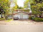
Property valuation of Rogue Valley Highway, Central Point, OR: 5504, 5526, 5709, 5825, 5825 (tax assessments)
Listed properties vs overall distribution of properties in Central Point, OR:
Advertisements
5504 Rogue Valley Highway
Central Point, OR
Find on map >>
Owner: DONALD K BRADSHAW TRUSTEE & DONALD K BRADSHAW TRUST & DOREEN J BRADSHAW TRUSTEE & DOREEN J BRADSHAW TRUST
Land market value: $142,620 (it was $119,350 in 2011)
Improvements market value: $170,660 (it was $117,920 in 2011)
Total market value for property: $313,280 (it was $237,270 in 2011)
Assessments for tax year: 2016
Property use: Residence - One Story
Property class: Improved H&b Use Farm, Rcvg Farm Def, Zoned Efu
Land size: 175,546 square feet
Total improvements area: 2,959 square feet
Zoning: County- Exclusive Farm Use
Improvements:
- Type: Residence
Description: One story
Area: 1,759 square feet
Year built: 1910
Effective year built: 1950
- Type: Farm Bldg
Description: Commercial Greenhouse
Area: 1,200 square feet
Year built: 2006
Effective year built: 2006
5526 Rogue Valley Highway
Central Point, OR
Find on map >>
Owner: SEVEN OAKS FAMILY LLC
Land market value: $254,850 (it was $326,410 in 2011)
Improvements market value: $34,540 (it was $27,000 in 2011)
Total market value for property: $289,390 (it was $353,410 in 2011)
Assessments for tax year: 2016
Property use: Residence - Residential Other Improvements
Property class: Improved H&b Use Farm, Rcvg Farm Def, Zoned Efu
Land size: 1,513,710 square feet
Zoning: County- Exclusive Farm Use
Recent sale: $85,000 (12/26/1995)
Improvements:
- Type: Residence
Description: Residential Other Improvements
Effective year built: 1900
5709 Rogue Valley Highway
Central Point, OR
Find on map >>
Owner: PAUL C ZIESCHE & VICTORIA J ZIESCHE
Land market value: $173,310 (it was $145,880 in 2011)
Improvements market value: $59,170 (it was $79,210 in 2011)
Total market value for property: $232,480 (it was $225,090 in 2011)
Assessments for tax year: 2016
Property use: Residence - One Story
Property class: Improved H&b Use Farm, Rcvg Farm Def, Zoned Efu
Land size: 370,260 square feet
Total improvements area: 1,089 square feet
Zoning: County- Exclusive Farm Use
Recent sale: $80,000 (8/23/1993)
Improvements:
- Type: Residence
Description: One story
Area: 1,089 square feet
Year built: 1958
Effective year built: 1958
5825 Rogue Valley Highway
Central Point, OR
Find on map >>
Owner: PAMELA SARAH GOLDMAN & JEANEAN WEST CRAIG & JOAN WEST
Land market value: $192,160 (it was $157,560 in 2011)
Total market value for property: $192,160 (it was $157,560 in 2011)
Assessments for tax year: 2016
Property use: Residence - Bare Land
Property class: M S H&b Use Tract, Zoning Not Significant
Land size: 505,296 square feet
Zoning: County- Exclusive Farm Use
Recent sale: $120,000 (3/5/2002)
5825 Rogue Valley Highway
Central Point, OR
Find on map >>
Owner: PAMELA S GOLDMAN
Assessments for tax year: 2016
Property class: M S H&b Use Tract, Zoning Not Significant
Total improvements area: 924 square feet
Zoning: County- Exclusive Farm Use
Improvements:
Central Point, OR
Find on map >>
Owner: PAMELA S GOLDMAN
Assessments for tax year: 2016
Property class: M S H&b Use Tract, Zoning Not Significant
Total improvements area: 924 square feet
Zoning: County- Exclusive Farm Use
Improvements:
- Type: Manf Strct
Description: Single wide
Area: 924 square feet
Year built: 1980
Effective year built: 1980

Recent posts about Central Point, Oregon on our local forum with over 2,400,000 registered users. Central Point is mentioned 341 times on our forum:
 | Is the Coos Bay/Florence area the "Last Hidden Gem" of Oregon?? (106 replies) |
 | Commute from Ashland to Central Point Oregon (11 replies) |
 | Best place to live in Oregon (not including Portland) (88 replies) |
 | Grants pass/ roseburg (38 replies) |
 | Grants Pass Oregon/ similar places (38 replies) |
 | Central Point/Medford and driving time to Ashland question (2 replies) |

Settings
X


