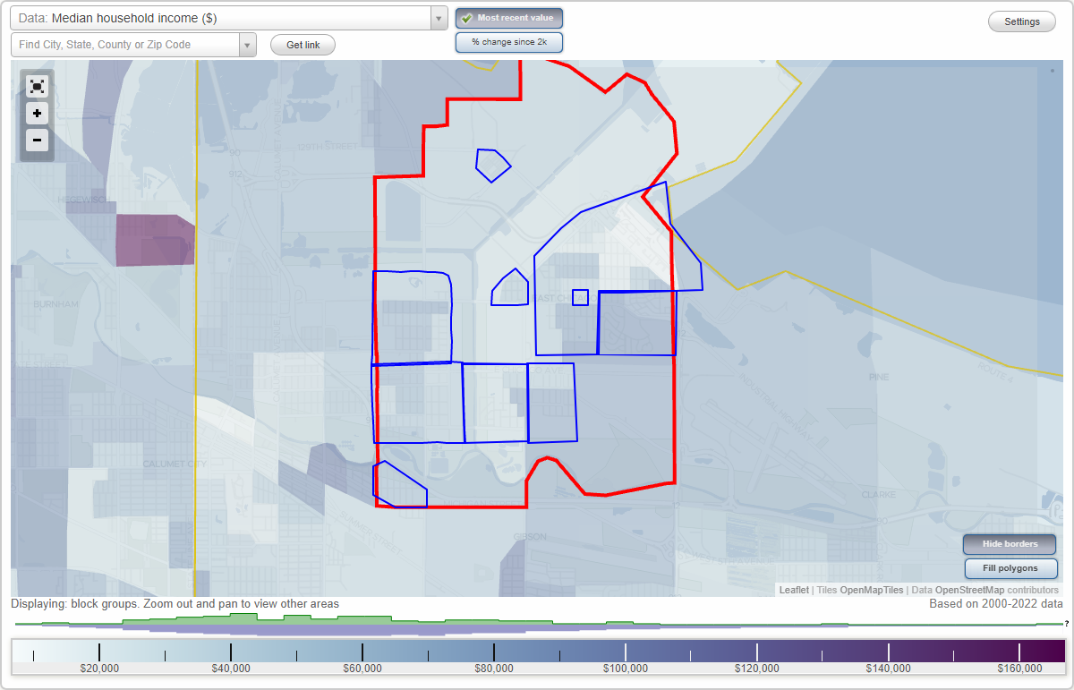
East Chicago, Indiana Neighborhood Map - Income, House Prices, Occupations, Boundaries
Settings
X

- City boundary
- Neighborhood boundaries
Business Search - 14 Million verified businesses
Neighborhoods:
East Calumet, Indiana Harbor, Marktown, New Addition, Northside, Roxana, Southside, Sunnyside, Washington Square, West CalumetEast Calumet neighborhood in East Chicago statistics: (Find on map)
Area: 0.370 square miles
Population: 449
Population density:
Median household income in 2021:
Median rent in in 2021:
Male vs Females
Median age
Housing prices:
Average estimated value of detached houses in 2021 (69.0% of all units):
Average estimated value of housing units in 2-unit structures in 2021 (13.7% of all units):
Average estimated '21 value of housing units in 3-to-4-unit structures (14.2% of all units):
Most popular occupations of males: sales and office occupations (18.4%); transportation occupations (18.1%); service occupations (14.2%); material moving occupations (12.9%); management occupations (except farmers) (8.4%); architecture and engineering occupations (8.4%); construction, extraction, and maintenance occupations (7.0%)
Most popular occupations of females: sales and office occupations (27.8%); service occupations (24.3%); healthcare practitioners and technical occupations (21.1%); education, training, and library occupations (7.7%); production occupations (4.5%); business and financial operations occupations (2.9%); legal occupations (2.0%)
Roads and streets: E 149th St; E 148th St; State Rd 312 (E Chicago Ave); Drummond St; Carey St; Ivy St; Euclid Ave; Parrish Ave; Grasselli Ave; Huish Dr; E 149th Pl; Grasselli St.
Railroad features: Indiana Harbor Belt RR; Soo Line RR; Elgin Joliet and Eastern Rlwy.
East Calumet neighborhood detailed profile
Area: 0.370 square miles
Population: 449
Population density:
| East Calumet: | 1,213 people per square mile |
| East Chicago: | 2,213 people per square mile |
Median household income in 2021:
| East Calumet: | $63,793 |
| East Chicago: | $37,807 |
Median rent in in 2021:
| East Calumet: | $713 |
| East Chicago: | $545 |
Male vs Females
| Males: | 211 |
| Females: | 238 |
Median age
| Males: | 38.0 years |
| Females: | 45.2 years |
Housing prices:
Average estimated value of detached houses in 2021 (69.0% of all units):
| East Calumet: | $73,721 |
| Indiana: | $227,058 |
Average estimated value of housing units in 2-unit structures in 2021 (13.7% of all units):
| This neighborhood: | $78,667 |
| Indiana: | $155,658 |
Average estimated '21 value of housing units in 3-to-4-unit structures (14.2% of all units):
| East Calumet: | $133,556 |
| Indiana: | $181,418 |
Most popular occupations of males: sales and office occupations (18.4%); transportation occupations (18.1%); service occupations (14.2%); material moving occupations (12.9%); management occupations (except farmers) (8.4%); architecture and engineering occupations (8.4%); construction, extraction, and maintenance occupations (7.0%)
Most popular occupations of females: sales and office occupations (27.8%); service occupations (24.3%); healthcare practitioners and technical occupations (21.1%); education, training, and library occupations (7.7%); production occupations (4.5%); business and financial operations occupations (2.9%); legal occupations (2.0%)
Roads and streets: E 149th St; E 148th St; State Rd 312 (E Chicago Ave); Drummond St; Carey St; Ivy St; Euclid Ave; Parrish Ave; Grasselli Ave; Huish Dr; E 149th Pl; Grasselli St.
Railroad features: Indiana Harbor Belt RR; Soo Line RR; Elgin Joliet and Eastern Rlwy.
East Calumet neighborhood detailed profile
Indiana Harbor neighborhood in East Chicago statistics: (Find on map)
Area: 1.633 square miles
Population: 12,618
Population density:
Median household income in 2021:
Median rent in in 2021:
Male vs Females
Median age
Housing prices:
Average estimated value of detached houses in 2021 (33.0% of all units):
Average estimated value of housing units in 2-unit structures in 2021 (13.4% of all units):
Average estimated '21 value of housing units in 3-to-4-unit structures (14.1% of all units):
Most popular occupations of males: production occupations (16.9%); service occupations (15.5%); sales and office occupations (12.9%); construction, extraction, and maintenance occupations (12.4%); transportation occupations (9.5%); material moving occupations (8.9%); management occupations (except farmers) (7.3%)
Most popular occupations of females: service occupations (45.6%); sales and office occupations (19.6%); education, training, and library occupations (6.5%); healthcare practitioners and technical occupations (6.3%); community and social services occupations (4.2%); production occupations (4.2%); management occupations (except farmers) (3.0%)
Highways in this neighborhood: Guthrie St (State Rd 912); State Rd 912 (Dickey Rd).
Roads and streets: E 139th St; E 138th St; Pennsylvania Ave; Parrish Ave; Cline Ave; Grand Blvd; Fir St; Cesar Chavez Memorial Dr (E Columbus Dr); E 140th St; State Hwy 912; Elm St; Euclid Ave; Block Ave; Broadway St; Michigan Ave; Ivy St; Commonwealth Ave; Drummond St; Hemlock St; E 136th St; Carey St; E 142nd St; Deodar St; Main St; E 144th St; Alder St; Pulaski St; Inland Steel Opas; E 143rd St; Aldis Ave; Butternut St; E 135th St; Catalpa St; Aldis St; Buffington Harbor Dr; Deal St; Lincoln St; Watling St; E 145th St; Huron Ct; Sheridan Pl; Washington St; Mc Kinley St; Ontario Ct; Erie Ct; E 138th Pl; Michigan Ct; Evergreen St; Fern St; Superior Ct; James St; Stewart Pl; Dahlia St; Callahan Pl.
Railroad features: Baltimore and Ohio RR; Elgin Joliet and Eastern Rlwy; Norfolk Southern Rlwy (Soo Line RR); Railroad; Elgin Joliet and Eastern Rlwy (Norfolk Southern Rlwy); Conrail RR (Norfolk Southern Rlwy).
Indiana Harbor neighborhood detailed profile
Area: 1.633 square miles
Population: 12,618
Population density:
| Indiana Harbor: | 7,727 people per square mile |
| East Chicago: | 2,213 people per square mile |
Median household income in 2021:
| Indiana Harbor: | $38,743 |
| East Chicago: | $37,807 |
Median rent in in 2021:
| Indiana Harbor: | $519 |
| East Chicago: | $545 |
Male vs Females
| Males: | 5,865 |
| Females: | 6,753 |
Median age
| Males: | 37.1 years |
| Females: | 40.0 years |
Housing prices:
Average estimated value of detached houses in 2021 (33.0% of all units):
| Indiana Harbor: | $73,721 |
| Indiana: | $227,058 |
Average estimated value of housing units in 2-unit structures in 2021 (13.4% of all units):
| This neighborhood: | $78,667 |
| Indiana: | $155,658 |
Average estimated '21 value of housing units in 3-to-4-unit structures (14.1% of all units):
| Indiana Harbor: | $133,556 |
| Indiana: | $181,418 |
Most popular occupations of males: production occupations (16.9%); service occupations (15.5%); sales and office occupations (12.9%); construction, extraction, and maintenance occupations (12.4%); transportation occupations (9.5%); material moving occupations (8.9%); management occupations (except farmers) (7.3%)
Most popular occupations of females: service occupations (45.6%); sales and office occupations (19.6%); education, training, and library occupations (6.5%); healthcare practitioners and technical occupations (6.3%); community and social services occupations (4.2%); production occupations (4.2%); management occupations (except farmers) (3.0%)
Highways in this neighborhood: Guthrie St (State Rd 912); State Rd 912 (Dickey Rd).
Roads and streets: E 139th St; E 138th St; Pennsylvania Ave; Parrish Ave; Cline Ave; Grand Blvd; Fir St; Cesar Chavez Memorial Dr (E Columbus Dr); E 140th St; State Hwy 912; Elm St; Euclid Ave; Block Ave; Broadway St; Michigan Ave; Ivy St; Commonwealth Ave; Drummond St; Hemlock St; E 136th St; Carey St; E 142nd St; Deodar St; Main St; E 144th St; Alder St; Pulaski St; Inland Steel Opas; E 143rd St; Aldis Ave; Butternut St; E 135th St; Catalpa St; Aldis St; Buffington Harbor Dr; Deal St; Lincoln St; Watling St; E 145th St; Huron Ct; Sheridan Pl; Washington St; Mc Kinley St; Ontario Ct; Erie Ct; E 138th Pl; Michigan Ct; Evergreen St; Fern St; Superior Ct; James St; Stewart Pl; Dahlia St; Callahan Pl.
Railroad features: Baltimore and Ohio RR; Elgin Joliet and Eastern Rlwy; Norfolk Southern Rlwy (Soo Line RR); Railroad; Elgin Joliet and Eastern Rlwy (Norfolk Southern Rlwy); Conrail RR (Norfolk Southern Rlwy).
Indiana Harbor neighborhood detailed profile
Marktown neighborhood in East Chicago statistics: (Find on map)
Area: 0.072 square miles
Population: 10
Population density:
Median household income in 2021:
Median rent in in 2021:
Male vs Females
Median age
Most popular occupations of males: construction, extraction, and maintenance occupations (38.6%); production occupations (34.7%); service occupations (22.9%); sales and office occupations (15.2%); material moving occupations (9.0%); business and financial operations occupations (5.5%); management occupations (except farmers) (3.3%)
Most popular occupations of females: sales and office occupations (36.8%); service occupations (29.6%); production occupations (20.4%); healthcare practitioners and technical occupations (13.2%); education, training, and library occupations (3.8%); management occupations (except farmers) (2.3%); material moving occupations (1.6%)
Highways in this neighborhood: State Rd 912 (Dickey Rd); W 129th St.
Roads and streets: Broad St; Spruce Ave; Riley Rd; Pine Ave; Park St; Spring St; Lilac St; Grove St; Liberty St; Oak St; Prospect St; School St.
Marktown neighborhood detailed profile
Area: 0.072 square miles
Population: 10
Population density:
| Marktown: | 139 people per square mile |
| East Chicago: | 2,213 people per square mile |
Median household income in 2021:
| Marktown: | $33,575 |
| East Chicago: | $37,807 |
Median rent in in 2021:
| Marktown: | $432 |
| East Chicago: | $545 |
Male vs Females
| Males: | 5 |
| Females: | 4 |
Median age
| Males: | 18.1 years |
| Females: | 36.1 years |
Most popular occupations of males: construction, extraction, and maintenance occupations (38.6%); production occupations (34.7%); service occupations (22.9%); sales and office occupations (15.2%); material moving occupations (9.0%); business and financial operations occupations (5.5%); management occupations (except farmers) (3.3%)
Most popular occupations of females: sales and office occupations (36.8%); service occupations (29.6%); production occupations (20.4%); healthcare practitioners and technical occupations (13.2%); education, training, and library occupations (3.8%); management occupations (except farmers) (2.3%); material moving occupations (1.6%)
Highways in this neighborhood: State Rd 912 (Dickey Rd); W 129th St.
Roads and streets: Broad St; Spruce Ave; Riley Rd; Pine Ave; Park St; Spring St; Lilac St; Grove St; Liberty St; Oak St; Prospect St; School St.
Marktown neighborhood detailed profile
New Addition neighborhood in East Chicago statistics: (Find on map)
Area: 0.097 square miles
Population: 361
Population density:
Median household income in 2021:
Median rent in in 2021:
Male vs Females
Median age
Most popular occupations of males: sales and office occupations (83.5%); construction, extraction, and maintenance occupations (12.2%); service occupations (5.2%); production occupations (4.3%); material moving occupations (2.0%)
Most popular occupations of females: service occupations (76.9%); sales and office occupations (13.3%); arts, design, entertainment, sports, and media occupations (7.3%); production occupations (2.4%); material moving occupations (2.4%); education, training, and library occupations (1.8%); business and financial operations occupations (1.6%)
Roads and streets: Cesar Chavez Memorial Dr (E Columbus Dr); Canalport Ave; Melville Ave; E 140th St; Alexander Ave; E 139th St; Mc Cook Ave; Kennedy Ave (Michigan Ave); Garfield Pl; Access Road Columbus Dr.
New Addition neighborhood detailed profile
Area: 0.097 square miles
Population: 361
Population density:
| New Addition: | 3,724 people per square mile |
| East Chicago: | 2,213 people per square mile |
Median household income in 2021:
| New Addition: | $47,843 |
| East Chicago: | $37,807 |
Median rent in in 2021:
| New Addition: | $384 |
| East Chicago: | $545 |
Male vs Females
| Males: | 143 |
| Females: | 218 |
Median age
| Males: | 36.4 years |
| Females: | 36.4 years |
Most popular occupations of males: sales and office occupations (83.5%); construction, extraction, and maintenance occupations (12.2%); service occupations (5.2%); production occupations (4.3%); material moving occupations (2.0%)
Most popular occupations of females: service occupations (76.9%); sales and office occupations (13.3%); arts, design, entertainment, sports, and media occupations (7.3%); production occupations (2.4%); material moving occupations (2.4%); education, training, and library occupations (1.8%); business and financial operations occupations (1.6%)
Roads and streets: Cesar Chavez Memorial Dr (E Columbus Dr); Canalport Ave; Melville Ave; E 140th St; Alexander Ave; E 139th St; Mc Cook Ave; Kennedy Ave (Michigan Ave); Garfield Pl; Access Road Columbus Dr.
New Addition neighborhood detailed profile
Northside neighborhood in East Chicago statistics: (Find on map)
Area: 0.716 square miles
Population: 4,420
Population density:
Median household income in 2021:
Median rent in in 2021:
Male vs Females
Median age
Housing prices:
Average estimated value of detached houses in 2021 (53.3% of all units):
Average estimated value of housing units in 2-unit structures in 2021 (28.5% of all units):
Most popular occupations of males: material moving occupations (25.9%); sales and office occupations (18.6%); service occupations (13.4%); production occupations (11.2%); management occupations (except farmers) (6.0%); transportation occupations (5.7%); education, training, and library occupations (5.5%)
Most popular occupations of females: sales and office occupations (37.7%); education, training, and library occupations (17.0%); service occupations (13.2%); production occupations (12.4%); healthcare practitioners and technical occupations (10.3%); community and social services occupations (4.0%); management occupations (except farmers) (2.0%)
Highways in this neighborhood: Indianapolis Blvd (US Hwy 20).
Roads and streets: W Columbus Dr; W 145th St; W 143rd St; W 142nd St; W 144th St; Railroad Ave; Tod Ave; Baring Ave; Magoun Ave; Olcott Ave; Northcote Ave; Homerlee Ave; White Oak Ave; Wegg Ave; Walsh Ave; W 140th St; Lewis Pl; Emlyn Pl; Riga Pl; Narva Pl; Penrhyn Pl; Johnson St.
Railroad features: Baltimore and Ohio RR; Railroad.
Northside neighborhood detailed profile
Area: 0.716 square miles
Population: 4,420
Population density:
| Northside: | 6,173 people per square mile |
| East Chicago: | 2,213 people per square mile |
Median household income in 2021:
| Northside: | $45,982 |
| East Chicago: | $37,807 |
Median rent in in 2021:
| Northside: | $650 |
| East Chicago: | $545 |
Male vs Females
| Males: | 2,405 |
| Females: | 2,014 |
Median age
| Males: | 31.6 years |
| Females: | 40.1 years |
Housing prices:
Average estimated value of detached houses in 2021 (53.3% of all units):
| Northside: | $84,357 |
| Indiana: | $227,058 |
Average estimated value of housing units in 2-unit structures in 2021 (28.5% of all units):
| This neighborhood: | $78,906 |
| Indiana: | $155,658 |
Most popular occupations of males: material moving occupations (25.9%); sales and office occupations (18.6%); service occupations (13.4%); production occupations (11.2%); management occupations (except farmers) (6.0%); transportation occupations (5.7%); education, training, and library occupations (5.5%)
Most popular occupations of females: sales and office occupations (37.7%); education, training, and library occupations (17.0%); service occupations (13.2%); production occupations (12.4%); healthcare practitioners and technical occupations (10.3%); community and social services occupations (4.0%); management occupations (except farmers) (2.0%)
Highways in this neighborhood: Indianapolis Blvd (US Hwy 20).
Roads and streets: W Columbus Dr; W 145th St; W 143rd St; W 142nd St; W 144th St; Railroad Ave; Tod Ave; Baring Ave; Magoun Ave; Olcott Ave; Northcote Ave; Homerlee Ave; White Oak Ave; Wegg Ave; Walsh Ave; W 140th St; Lewis Pl; Emlyn Pl; Riga Pl; Narva Pl; Penrhyn Pl; Johnson St.
Railroad features: Baltimore and Ohio RR; Railroad.
Northside neighborhood detailed profile
Roxana neighborhood in East Chicago statistics: (Find on map)
Area: 0.171 square miles
Population: 323
Population density:
Median household income in 2021:
Median rent in in 2021:
Male vs Females
Median age
Average estimated value of detached houses in 2021 (87.6% of all units):
Most popular occupations of males: service occupations (21.4%); transportation occupations (13.0%); construction, extraction, and maintenance occupations (11.5%); sales and office occupations (10.6%); production occupations (7.9%); management occupations (except farmers) (5.9%); healthcare practitioners and technical occupations (4.0%)
Most popular occupations of females: sales and office occupations (35.8%); service occupations (29.5%); management occupations (except farmers) (13.1%); material moving occupations (8.5%); healthcare practitioners and technical occupations (6.7%); transportation occupations (4.3%); production occupations (1.4%)
Highways in this neighborhood: Indianapolis Blvd (US Hwy 20).
Roads and streets: Michigan St; S Roxanna Dr; Shell St; Reading Ave; Walsh Ave; Wegg Ave; Homerlee Ave; White Oak Ave; Northcote Ave; Baring Ave; Roxana Dr; Magoun Ave.
Railroad features: Chicago South Shore & South Bend RR.
Roxana neighborhood detailed profile
Area: 0.171 square miles
Population: 323
Population density:
| Roxana: | 1,889 people per square mile |
| East Chicago: | 2,213 people per square mile |
Median household income in 2021:
| Roxana: | $47,561 |
| East Chicago: | $37,807 |
Median rent in in 2021:
| Roxana: | $838 |
| East Chicago: | $545 |
Male vs Females
| Males: | 148 |
| Females: | 175 |
Median age
| Males: | 37.5 years |
| Females: | 35.8 years |
Average estimated value of detached houses in 2021 (87.6% of all units):
| Roxana: | $98,231 |
| Indiana: | $227,058 |
Most popular occupations of males: service occupations (21.4%); transportation occupations (13.0%); construction, extraction, and maintenance occupations (11.5%); sales and office occupations (10.6%); production occupations (7.9%); management occupations (except farmers) (5.9%); healthcare practitioners and technical occupations (4.0%)
Most popular occupations of females: sales and office occupations (35.8%); service occupations (29.5%); management occupations (except farmers) (13.1%); material moving occupations (8.5%); healthcare practitioners and technical occupations (6.7%); transportation occupations (4.3%); production occupations (1.4%)
Highways in this neighborhood: Indianapolis Blvd (US Hwy 20).
Roads and streets: Michigan St; S Roxanna Dr; Shell St; Reading Ave; Walsh Ave; Wegg Ave; Homerlee Ave; White Oak Ave; Northcote Ave; Baring Ave; Roxana Dr; Magoun Ave.
Railroad features: Chicago South Shore & South Bend RR.
Roxana neighborhood detailed profile
Southside neighborhood in East Chicago statistics: (Find on map)
Area: 0.719 square miles
Population: 5,563
Population density:
Median household income in 2021:
Median rent in in 2021:
Male vs Females
Median age
Housing prices:
Average estimated value of detached houses in 2021 (32.9% of all units):
Average estimated value of housing units in 2-unit structures in 2021 (23.8% of all units):
Most popular occupations of males: production occupations (21.3%); service occupations (19.5%); material moving occupations (14.8%); construction, extraction, and maintenance occupations (9.0%); education, training, and library occupations (6.4%); business and financial operations occupations (6.0%); transportation occupations (4.6%)
Most popular occupations of females: sales and office occupations (35.5%); service occupations (27.7%); production occupations (14.6%); healthcare practitioners and technical occupations (6.9%); transportation occupations (4.9%); community and social services occupations (3.1%); management occupations (except farmers) (3.0%)
Limited-access highways (interstate or state) in this neighborhood: I- 90.
Highways in this neighborhood: State Rd 312 (W Chicago Ave).
Roads and streets: Indianapolis Blvd; W 151st St; W 149th St; W 148th St; W 150th St; Railroad Ave; White Oak Ave; Exchange Ave; Baring Ave; Tod Ave; Wegg Ave; Northcote Ave; Olcott Ave; Magoun Ave; Walsh Ave; Homerlee Ave; Beacon St; Reading Ave; Kosciusko Blvd; Sophia St; Ruth St; Pulaski Pl; Short St.
Railroad features: Baltimore and Ohio RR; Indiana Harbor Belt RR; Elgin Joliet and Eastern Rlwy.
Southside neighborhood detailed profile
Area: 0.719 square miles
Population: 5,563
Population density:
| Southside: | 7,735 people per square mile |
| East Chicago: | 2,213 people per square mile |
Median household income in 2021:
| Southside: | $44,260 |
| East Chicago: | $37,807 |
Median rent in in 2021:
| Southside: | $611 |
| East Chicago: | $545 |
Male vs Females
| Males: | 2,720 |
| Females: | 2,843 |
Median age
| Males: | 29.2 years |
| Females: | 37.5 years |
Housing prices:
Average estimated value of detached houses in 2021 (32.9% of all units):
| Southside: | $71,281 |
| Indiana: | $227,058 |
Average estimated value of housing units in 2-unit structures in 2021 (23.8% of all units):
| This neighborhood: | $78,906 |
| Indiana: | $155,658 |
Most popular occupations of males: production occupations (21.3%); service occupations (19.5%); material moving occupations (14.8%); construction, extraction, and maintenance occupations (9.0%); education, training, and library occupations (6.4%); business and financial operations occupations (6.0%); transportation occupations (4.6%)
Most popular occupations of females: sales and office occupations (35.5%); service occupations (27.7%); production occupations (14.6%); healthcare practitioners and technical occupations (6.9%); transportation occupations (4.9%); community and social services occupations (3.1%); management occupations (except farmers) (3.0%)
Limited-access highways (interstate or state) in this neighborhood: I- 90.
Highways in this neighborhood: State Rd 312 (W Chicago Ave).
Roads and streets: Indianapolis Blvd; W 151st St; W 149th St; W 148th St; W 150th St; Railroad Ave; White Oak Ave; Exchange Ave; Baring Ave; Tod Ave; Wegg Ave; Northcote Ave; Olcott Ave; Magoun Ave; Walsh Ave; Homerlee Ave; Beacon St; Reading Ave; Kosciusko Blvd; Sophia St; Ruth St; Pulaski Pl; Short St.
Railroad features: Baltimore and Ohio RR; Indiana Harbor Belt RR; Elgin Joliet and Eastern Rlwy.
Southside neighborhood detailed profile
Sunnyside neighborhood in East Chicago statistics: (Find on map)
Area: 0.491 square miles
Population: 2,198
Population density:
Median household income in 2021:
Median rent in in 2021:
Male vs Females
Median age
Most popular occupations of males: production occupations (29.3%); material moving occupations (19.0%); sales and office occupations (12.6%); service occupations (10.9%); transportation occupations (9.8%); management occupations (except farmers) (5.4%); construction, extraction, and maintenance occupations (4.5%)
Most popular occupations of females: production occupations (29.1%); service occupations (18.5%); sales and office occupations (13.4%); healthcare practitioners and technical occupations (9.4%); community and social services occupations (6.5%); transportation occupations (5.3%); material moving occupations (4.4%)
Roads and streets: E Columbus Dr (Cesar Chavez Memorial Dr); E 145th St; E 140th St; Cardinal Dr; Cline Ave; Alder St; Elm St; E 141st St; Deal St; Butternut St; Industrial Hwy; Dearborn St; Franklin St; Joy Ln; Purdue Dr; Lithuanica Ave; E 140th Pl; Jeorse Cir; Hidalgo Ln; E Guadalupe Cir; Grace St; Catalpa St; Guadalupe Dr; Arbutus Ln; E 141st Pl; Ln of the Roses; Deodar St; Pulaski St; Main St; Evergreen Ln; St Joseph Ave; Stewart Ct; Kenny Lofton Ln; W Guadalupe Cir; Lombardy St; Hawthorne St; Indiana Ave; Fern St.
Sunnyside neighborhood detailed profile
Area: 0.491 square miles
Population: 2,198
Population density:
| Sunnyside: | 4,480 people per square mile |
| East Chicago: | 2,213 people per square mile |
Median household income in 2021:
| Sunnyside: | $42,569 |
| East Chicago: | $37,807 |
Median rent in in 2021:
| Sunnyside: | $627 |
| East Chicago: | $545 |
Male vs Females
| Males: | 1,120 |
| Females: | 1,077 |
Median age
| Males: | 39.2 years |
| Females: | 41.0 years |
Most popular occupations of males: production occupations (29.3%); material moving occupations (19.0%); sales and office occupations (12.6%); service occupations (10.9%); transportation occupations (9.8%); management occupations (except farmers) (5.4%); construction, extraction, and maintenance occupations (4.5%)
Most popular occupations of females: production occupations (29.1%); service occupations (18.5%); sales and office occupations (13.4%); healthcare practitioners and technical occupations (9.4%); community and social services occupations (6.5%); transportation occupations (5.3%); material moving occupations (4.4%)
Roads and streets: E Columbus Dr (Cesar Chavez Memorial Dr); E 145th St; E 140th St; Cardinal Dr; Cline Ave; Alder St; Elm St; E 141st St; Deal St; Butternut St; Industrial Hwy; Dearborn St; Franklin St; Joy Ln; Purdue Dr; Lithuanica Ave; E 140th Pl; Jeorse Cir; Hidalgo Ln; E Guadalupe Cir; Grace St; Catalpa St; Guadalupe Dr; Arbutus Ln; E 141st Pl; Ln of the Roses; Deodar St; Pulaski St; Main St; Evergreen Ln; St Joseph Ave; Stewart Ct; Kenny Lofton Ln; W Guadalupe Cir; Lombardy St; Hawthorne St; Indiana Ave; Fern St.
Sunnyside neighborhood detailed profile
Washington Square neighborhood in East Chicago statistics: (Find on map)
Area: 0.022 square miles
Population: 329
Population density:
Median household income in 2021:
Median rent in in 2021:
Male vs Females
Median age
Most popular occupations of males: architecture and engineering occupations (22.9%); material moving occupations (17.3%); transportation occupations (16.3%); business and financial operations occupations (12.9%); sales and office occupations (9.5%); production occupations (5.3%); construction, extraction, and maintenance occupations (4.7%)
Most popular occupations of females: sales and office occupations (44.8%); service occupations (14.1%); material moving occupations (9.8%); education, training, and library occupations (7.3%); production occupations (6.2%); business and financial operations occupations (5.5%); arts, design, entertainment, sports, and media occupations (5.1%)
Roads and streets: Cesar Chavez Memorial Dr (E Columbus Dr); E 140th St; Parrish Ave; Grand Blvd; Hemlock St.
Washington Square neighborhood detailed profile
Area: 0.022 square miles
Population: 329
Population density:
| Washington Square: | 15,003 people per square mile |
| East Chicago: | 2,213 people per square mile |
Median household income in 2021:
| Washington Square: | $33,445 |
| East Chicago: | $37,807 |
Median rent in in 2021:
| Washington Square: | $640 |
| East Chicago: | $545 |
Male vs Females
| Males: | 167 |
| Females: | 162 |
Median age
| Males: | 41.2 years |
| Females: | 35.0 years |
Most popular occupations of males: architecture and engineering occupations (22.9%); material moving occupations (17.3%); transportation occupations (16.3%); business and financial operations occupations (12.9%); sales and office occupations (9.5%); production occupations (5.3%); construction, extraction, and maintenance occupations (4.7%)
Most popular occupations of females: sales and office occupations (44.8%); service occupations (14.1%); material moving occupations (9.8%); education, training, and library occupations (7.3%); production occupations (6.2%); business and financial operations occupations (5.5%); arts, design, entertainment, sports, and media occupations (5.1%)
Roads and streets: Cesar Chavez Memorial Dr (E Columbus Dr); E 140th St; Parrish Ave; Grand Blvd; Hemlock St.
Washington Square neighborhood detailed profile
West Calumet neighborhood in East Chicago statistics: (Find on map)
Area: 0.503 square miles
Population: 515
Population density:
Median household income in 2021:
Median rent in in 2021:
Male vs Females
Median age
Housing prices:
Average estimated value of detached houses in 2021 (39.6% of all units):
Average estimated value of housing units in 2-unit structures in 2021 (24.6% of all units):
Average estimated '21 value of housing units in 3-to-4-unit structures (6.8% of all units):
Most popular occupations of males: service occupations (24.1%); construction, extraction, and maintenance occupations (21.8%); sales and office occupations (12.6%); material moving occupations (11.9%); transportation occupations (9.5%); management occupations (except farmers) (4.3%); business and financial operations occupations (2.9%)
Most popular occupations of females: sales and office occupations (28.2%); production occupations (15.5%); education, training, and library occupations (12.8%); service occupations (12.3%); business and financial operations occupations (9.0%); healthcare practitioners and technical occupations (9.0%); arts, design, entertainment, sports, and media occupations (6.1%)
Highways in this neighborhood: State Rd 312 (W Chicago Ave).
Roads and streets: E 151st St; E Chicago Ave (State Rd 312); Mc Cook Ave; E 148th St; Kennedy Ave; Melville Ave; Alexander Ave; E 149th St; Gladiola Ave; E 150th St; Aster Ave; Vernon Ave; Larkspur St; Jonquil Ln; 151st Pl; Magnolia Ln; 150th Pl; Private St; Huish Dr; W 151st St; E 149th Pl.
Railroad features: Elgin Joliet and Eastern Rlwy; Indiana Harbor Belt RR; Baltimore and Ohio RR; Soo Line RR (Norfolk Southern Rlwy).
Other features: Indiana Harbor Cnl.
West Calumet neighborhood detailed profile
Area: 0.503 square miles
Population: 515
Population density:
| West Calumet: | 1,024 people per square mile |
| East Chicago: | 2,213 people per square mile |
Median household income in 2021:
| West Calumet: | $47,653 |
| East Chicago: | $37,807 |
Median rent in in 2021:
| West Calumet: | $753 |
| East Chicago: | $545 |
Male vs Females
| Males: | 215 |
| Females: | 299 |
Median age
| Males: | 37.5 years |
| Females: | 49.3 years |
Housing prices:
Average estimated value of detached houses in 2021 (39.6% of all units):
| West Calumet: | $73,721 |
| Indiana: | $227,058 |
Average estimated value of housing units in 2-unit structures in 2021 (24.6% of all units):
| This neighborhood: | $60,842 |
| Indiana: | $155,658 |
Average estimated '21 value of housing units in 3-to-4-unit structures (6.8% of all units):
| West Calumet: | $133,556 |
| Indiana: | $181,418 |
Most popular occupations of males: service occupations (24.1%); construction, extraction, and maintenance occupations (21.8%); sales and office occupations (12.6%); material moving occupations (11.9%); transportation occupations (9.5%); management occupations (except farmers) (4.3%); business and financial operations occupations (2.9%)
Most popular occupations of females: sales and office occupations (28.2%); production occupations (15.5%); education, training, and library occupations (12.8%); service occupations (12.3%); business and financial operations occupations (9.0%); healthcare practitioners and technical occupations (9.0%); arts, design, entertainment, sports, and media occupations (6.1%)
Highways in this neighborhood: State Rd 312 (W Chicago Ave).
Roads and streets: E 151st St; E Chicago Ave (State Rd 312); Mc Cook Ave; E 148th St; Kennedy Ave; Melville Ave; Alexander Ave; E 149th St; Gladiola Ave; E 150th St; Aster Ave; Vernon Ave; Larkspur St; Jonquil Ln; 151st Pl; Magnolia Ln; 150th Pl; Private St; Huish Dr; W 151st St; E 149th Pl.
Railroad features: Elgin Joliet and Eastern Rlwy; Indiana Harbor Belt RR; Baltimore and Ohio RR; Soo Line RR (Norfolk Southern Rlwy).
Other features: Indiana Harbor Cnl.
West Calumet neighborhood detailed profile