Edmonds, Washington Neighborhood Map - Income, House Prices, Occupations, Boundaries
Settings
X

- City boundary
- Neighborhood boundaries
Business Search - 14 Million verified businesses
Neighborhoods:
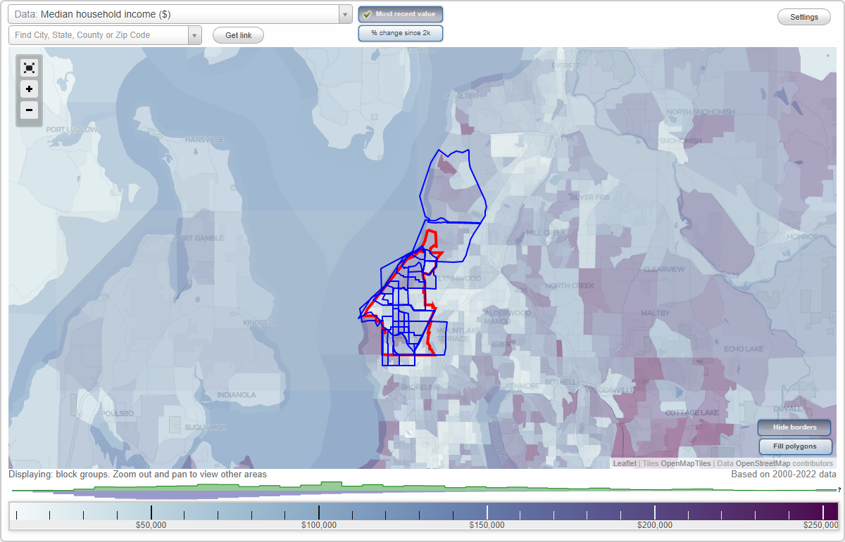
Aurora Marketplace, Chase Lake, College Place, Downtown, Edmonds Bowl, Firdale, Lake Ballinger, Madrona, Maplewood, Meadowdale, Olympic View, Perrinville, Picnic Point, Port of Edmonds, Seaview Park, Sherwood, South County Park, Talbot Park, Westgate, Yost ParkAurora Marketplace neighborhood in Edmonds statistics: (Find on map)
Area: 1.051 square miles
Population: 6,825
Population density:
Median household income in 2021:
Median rent in in 2021:
Male vs Females
Median age
Average estimated value of detached houses in 2021 (53.5% of all units):
Most popular occupations of males: sales and office occupations (13.0%); construction, extraction, and maintenance occupations (12.3%); architecture and engineering occupations (12.0%); service occupations (11.7%); computer and mathematical occupations (11.5%); management occupations (except farmers) (7.1%); business and financial operations occupations (7.0%)
Most popular occupations of females: sales and office occupations (24.3%); service occupations (15.2%); healthcare practitioners and technical occupations (13.3%); management occupations (except farmers) (11.6%); education, training, and library occupations (10.6%); business and financial operations occupations (10.3%); arts, design, entertainment, sports, and media occupations (2.4%)
Roads and streets: NW 205th St (244th St SW); N 205th St (244th St SW, NW 205th St).
Highways in this neighborhood: Edmonds Way (State Hwy 104); Hwy 99 (Pacific Hwy, State Hwy 99).
Roads and streets: 236th St SW; 238th St SW; 240th St SW; 232nd St SW; 234th St SW; 84th Ave W; 228th St SW; 244th St SW (N 205th St, NW 205th St); 242nd St SW; 92nd Ave W; 231st St SW; 232nd Pl SW; 88th Ave W; 233rd Pl SW; 234th Pl SW; N 205th St (244th St SW); 97th Pl W; 241st Pl SW; 231st Pl SW; 90th Ave W; Firdale Ave; 96th Ave W; 97th Ave W; 94th Pl W; 96th Pl W; 94th Ave W; 235th Pl SW; 82nd Pl W; 237th Pl SW; 81st Pl W; 95th Pl W; 239th St SW; 86th Pl W; 242nd Pl SW; 93rd Ave W; 87th Ave W; 86th Ave W; 91st Ave W; Lotus Ln; 239th Pl SW; 85th Pl W; 91st Pl W; 89th Pl W; 229th St SW; 236th Pl SW; 87th Pl W; 80th Pl W; 229th Pl SW; 88th Pl W; 99th Ave W; 235th St SW; 99th Pl W; (State Rte 99); 92 Ave W; 89th Ave W; 233rd St SW; 230th St SW; 97th Ave SW; 82nd Ave W; 100th Ave W; 85th Ave W; 90th Pl W; 98th Ave W; Winkler Ave W; 234 St SW.
Aurora Marketplace neighborhood detailed profile
Area: 1.051 square miles
Population: 6,825
Population density:
| Aurora Marketplace: | 6,496 people per square mile |
| Edmonds: | 4,786 people per square mile |
Median household income in 2021:
| Aurora Marketplace: | $106,721 |
| Edmonds: | $96,775 |
Median rent in in 2021:
| Aurora Marketplace: | $1,604 |
| Edmonds: | $1,484 |
Male vs Females
| Males: | 3,062 |
| Females: | 3,762 |
Median age
| Males: | 40.6 years |
| Females: | 44.5 years |
Average estimated value of detached houses in 2021 (53.5% of all units):
| Aurora Marketplace: | $609,233 |
| Edmonds: | $786,298 |
Most popular occupations of males: sales and office occupations (13.0%); construction, extraction, and maintenance occupations (12.3%); architecture and engineering occupations (12.0%); service occupations (11.7%); computer and mathematical occupations (11.5%); management occupations (except farmers) (7.1%); business and financial operations occupations (7.0%)
Most popular occupations of females: sales and office occupations (24.3%); service occupations (15.2%); healthcare practitioners and technical occupations (13.3%); management occupations (except farmers) (11.6%); education, training, and library occupations (10.6%); business and financial operations occupations (10.3%); arts, design, entertainment, sports, and media occupations (2.4%)
Roads and streets: NW 205th St (244th St SW); N 205th St (244th St SW, NW 205th St).
Highways in this neighborhood: Edmonds Way (State Hwy 104); Hwy 99 (Pacific Hwy, State Hwy 99).
Roads and streets: 236th St SW; 238th St SW; 240th St SW; 232nd St SW; 234th St SW; 84th Ave W; 228th St SW; 244th St SW (N 205th St, NW 205th St); 242nd St SW; 92nd Ave W; 231st St SW; 232nd Pl SW; 88th Ave W; 233rd Pl SW; 234th Pl SW; N 205th St (244th St SW); 97th Pl W; 241st Pl SW; 231st Pl SW; 90th Ave W; Firdale Ave; 96th Ave W; 97th Ave W; 94th Pl W; 96th Pl W; 94th Ave W; 235th Pl SW; 82nd Pl W; 237th Pl SW; 81st Pl W; 95th Pl W; 239th St SW; 86th Pl W; 242nd Pl SW; 93rd Ave W; 87th Ave W; 86th Ave W; 91st Ave W; Lotus Ln; 239th Pl SW; 85th Pl W; 91st Pl W; 89th Pl W; 229th St SW; 236th Pl SW; 87th Pl W; 80th Pl W; 229th Pl SW; 88th Pl W; 99th Ave W; 235th St SW; 99th Pl W; (State Rte 99); 92 Ave W; 89th Ave W; 233rd St SW; 230th St SW; 97th Ave SW; 82nd Ave W; 100th Ave W; 85th Ave W; 90th Pl W; 98th Ave W; Winkler Ave W; 234 St SW.
Aurora Marketplace neighborhood detailed profile
Chase Lake neighborhood in Edmonds statistics: (Find on map)
Area: 1.938 square miles
Population: 10,516
Population density:
Median household income in 2021:
Median rent in in 2021:
Male vs Females
Median age
Average estimated value of detached houses in 2021 (60.1% of all units):
Most popular occupations of males: management occupations (except farmers) (23.0%); sales and office occupations (15.7%); service occupations (11.8%); construction, extraction, and maintenance occupations (7.2%); business and financial operations occupations (6.7%); transportation occupations (6.0%); computer and mathematical occupations (4.3%)
Most popular occupations of females: sales and office occupations (30.0%); service occupations (13.4%); management occupations (except farmers) (11.7%); business and financial operations occupations (11.2%); healthcare practitioners and technical occupations (10.0%); education, training, and library occupations (7.0%); community and social services occupations (4.3%)
Highways in this neighborhood: Pacific Hwy (Hwy 99, State Hwy 99); State Hwy 104 (Edmonds Way).
Roads and streets: 216th St SW; 220th St SW; 224th St SW; 228th St SW; 218th St SW; 84th Ave W; 88th Ave W; Bowdoin Way; 215th St SW; 92nd Ave W; 80th Ave W; 76th Ave W; 226th St SW; 90th Ave W; 222nd St SW; 86th Pl W; 93rd Pl W; 95th Pl W; Main St; 217th St SW; 230th St SW; 82nd Ave W; 96th Ave W; 232nd Pl SW; 91st Ave W; 233rd Pl SW; Pioneer Way; 231st St SW; 82nd Pl W; 214th Pl SW; 234th St SW; 234th Pl SW (Madrona Ln); 236th St SW; 86th Ave W; 223rd St SW; 225th Pl SW; 78th Ave W; 95th Ave W; 81st Pl W; Shell Valley Rd; 229th St SW; 221st Pl SW; 80th Pl W; 72nd Ave W; (State Rte 99); 85th Pl W; 90th Pl W; 87th Pl W; Hospital Driveway; 227th Pl SW; 232nd St SW; 88th Pl W; 224th Pl SW; 221st St SW; 215th Pl SW; 83rd Ave W; 81st Ave W; 219th St SW; 213th Pl SW; 87th Ave W; 213th St SW; 89th Ave W; 85th Ave W; Hillcrest Pl; Park Rd; 218th Pl SW; Lotus Ln; 77th Ave W; 92nd Pl W; 78th Pl W; 209th Pl SW; 73rd Pl W; 229th Pl SW; 93rd Ave W; 77th Pl W; 231st Pl SW; 227th St SW; 220th Pl SW; Park Pl; 235th Pl SW; Shell Valley Way; Shell Pl; 94th Pl W; Summit Ln; 226th Pl SW; 79th Ave W; 76th Pl W; 217th Pl SW; 84th Pl W; Winkler Ave W; Spruce Way.
Other features: Shell Crk.
Chase Lake neighborhood detailed profile
Area: 1.938 square miles
Population: 10,516
Population density:
| Chase Lake: | 5,426 people per square mile |
| Edmonds: | 4,786 people per square mile |
Median household income in 2021:
| Chase Lake: | $99,323 |
| Edmonds: | $96,775 |
Median rent in in 2021:
| Chase Lake: | $1,513 |
| Edmonds: | $1,484 |
Male vs Females
| Males: | 4,838 |
| Females: | 5,678 |
Median age
| Males: | 41.5 years |
| Females: | 42.2 years |
Average estimated value of detached houses in 2021 (60.1% of all units):
| Chase Lake: | $831,505 |
| Edmonds: | $786,298 |
Most popular occupations of males: management occupations (except farmers) (23.0%); sales and office occupations (15.7%); service occupations (11.8%); construction, extraction, and maintenance occupations (7.2%); business and financial operations occupations (6.7%); transportation occupations (6.0%); computer and mathematical occupations (4.3%)
Most popular occupations of females: sales and office occupations (30.0%); service occupations (13.4%); management occupations (except farmers) (11.7%); business and financial operations occupations (11.2%); healthcare practitioners and technical occupations (10.0%); education, training, and library occupations (7.0%); community and social services occupations (4.3%)
Highways in this neighborhood: Pacific Hwy (Hwy 99, State Hwy 99); State Hwy 104 (Edmonds Way).
Roads and streets: 216th St SW; 220th St SW; 224th St SW; 228th St SW; 218th St SW; 84th Ave W; 88th Ave W; Bowdoin Way; 215th St SW; 92nd Ave W; 80th Ave W; 76th Ave W; 226th St SW; 90th Ave W; 222nd St SW; 86th Pl W; 93rd Pl W; 95th Pl W; Main St; 217th St SW; 230th St SW; 82nd Ave W; 96th Ave W; 232nd Pl SW; 91st Ave W; 233rd Pl SW; Pioneer Way; 231st St SW; 82nd Pl W; 214th Pl SW; 234th St SW; 234th Pl SW (Madrona Ln); 236th St SW; 86th Ave W; 223rd St SW; 225th Pl SW; 78th Ave W; 95th Ave W; 81st Pl W; Shell Valley Rd; 229th St SW; 221st Pl SW; 80th Pl W; 72nd Ave W; (State Rte 99); 85th Pl W; 90th Pl W; 87th Pl W; Hospital Driveway; 227th Pl SW; 232nd St SW; 88th Pl W; 224th Pl SW; 221st St SW; 215th Pl SW; 83rd Ave W; 81st Ave W; 219th St SW; 213th Pl SW; 87th Ave W; 213th St SW; 89th Ave W; 85th Ave W; Hillcrest Pl; Park Rd; 218th Pl SW; Lotus Ln; 77th Ave W; 92nd Pl W; 78th Pl W; 209th Pl SW; 73rd Pl W; 229th Pl SW; 93rd Ave W; 77th Pl W; 231st Pl SW; 227th St SW; 220th Pl SW; Park Pl; 235th Pl SW; Shell Valley Way; Shell Pl; 94th Pl W; Summit Ln; 226th Pl SW; 79th Ave W; 76th Pl W; 217th Pl SW; 84th Pl W; Winkler Ave W; Spruce Way.
Other features: Shell Crk.
Chase Lake neighborhood detailed profile
College Place neighborhood in Edmonds statistics: (Find on map)
Area: 0.748 square miles
Population: 2,770
Population density:
Median household income in 2021:
Median rent in in 2021:
Male vs Females
Median age
Most popular occupations of males: service occupations (19.8%); management occupations (except farmers) (16.4%); transportation occupations (11.1%); construction, extraction, and maintenance occupations (10.7%); sales and office occupations (10.2%); architecture and engineering occupations (8.7%); material moving occupations (8.2%)
Most popular occupations of females: sales and office occupations (30.3%); service occupations (12.6%); management occupations (except farmers) (12.5%); business and financial operations occupations (10.9%); arts, design, entertainment, sports, and media occupations (9.4%); education, training, and library occupations (8.2%); production occupations (5.2%)
Highways in this neighborhood: State Hwy 524 (196th St SW).
Roads and streets: 200th St SW; 76th Ave W; 80th Ave W; 212th St SW; 206th St SW; 81st Ave W; 83rd Ave W; 202nd St SW; 199th St SW; 82nd Ave W; Maplewood Ln; 81st Pl W; 84th Ave W; 202nd Pl SW; 80th Pl W; 86th Pl W; 203rd St SW; 77th Pl W; 198th St SW; 88th Ave W; Main St; 85th Pl W; 201st St SW; 204th St SW; 82nd Pl W; 77th Ave W; 198th Pl SW; 78th Pl W; 78th Ave W; 208th Pl SW; 204th Pl SW; 83rd Pl W; 209th St SW; 207th St SW; 84th Pl W; 203rd Pl SW; Woodlake Dr; 79th Ave W; 87th Ave W; 208th St SW; 207th Pl SW; 210th Pl SW; 196th Pl SW; 199th Pl SW; 205th Pl SW; 205th St SW; 211th Pl SW; 206th Pl SW; 197th St SW; 210th St SW.
College Place neighborhood detailed profile
Area: 0.748 square miles
Population: 2,770
Population density:
| College Place: | 3,703 people per square mile |
| Edmonds: | 4,786 people per square mile |
Median household income in 2021:
| College Place: | $101,550 |
| Edmonds: | $96,775 |
Median rent in in 2021:
| College Place: | $1,506 |
| Edmonds: | $1,484 |
Male vs Females
| Males: | 1,471 |
| Females: | 1,299 |
Median age
| Males: | 42.4 years |
| Females: | 41.9 years |
Most popular occupations of males: service occupations (19.8%); management occupations (except farmers) (16.4%); transportation occupations (11.1%); construction, extraction, and maintenance occupations (10.7%); sales and office occupations (10.2%); architecture and engineering occupations (8.7%); material moving occupations (8.2%)
Most popular occupations of females: sales and office occupations (30.3%); service occupations (12.6%); management occupations (except farmers) (12.5%); business and financial operations occupations (10.9%); arts, design, entertainment, sports, and media occupations (9.4%); education, training, and library occupations (8.2%); production occupations (5.2%)
Highways in this neighborhood: State Hwy 524 (196th St SW).
Roads and streets: 200th St SW; 76th Ave W; 80th Ave W; 212th St SW; 206th St SW; 81st Ave W; 83rd Ave W; 202nd St SW; 199th St SW; 82nd Ave W; Maplewood Ln; 81st Pl W; 84th Ave W; 202nd Pl SW; 80th Pl W; 86th Pl W; 203rd St SW; 77th Pl W; 198th St SW; 88th Ave W; Main St; 85th Pl W; 201st St SW; 204th St SW; 82nd Pl W; 77th Ave W; 198th Pl SW; 78th Pl W; 78th Ave W; 208th Pl SW; 204th Pl SW; 83rd Pl W; 209th St SW; 207th St SW; 84th Pl W; 203rd Pl SW; Woodlake Dr; 79th Ave W; 87th Ave W; 208th St SW; 207th Pl SW; 210th Pl SW; 196th Pl SW; 199th Pl SW; 205th Pl SW; 205th St SW; 211th Pl SW; 206th Pl SW; 197th St SW; 210th St SW.
College Place neighborhood detailed profile
Downtown neighborhood in Edmonds statistics: (Find on map)
Area: 2.636 square miles
Population: 12,521
Population density:
Median household income in 2021:
Median rent in in 2021:
Male vs Females
Median age
Average estimated value of detached houses in 2021 (93.5% of all units):
Most popular occupations of males: management occupations (except farmers) (28.9%); sales and office occupations (21.8%); construction, extraction, and maintenance occupations (11.2%); architecture and engineering occupations (8.4%); business and financial operations occupations (6.2%); computer and mathematical occupations (5.9%); transportation occupations (5.0%)
Most popular occupations of females: sales and office occupations (31.8%); management occupations (except farmers) (16.0%); healthcare practitioners and technical occupations (12.7%); business and financial operations occupations (12.2%); service occupations (9.6%); education, training, and library occupations (8.7%); legal occupations (2.9%)
Highways in this neighborhood: State Hwy 104 (Edmonds Way); State Hwy 524.
Roads and streets: Main St (State Hwy 104); Walnut St; Dayton St; Pine St; Alder St; 9th Ave N; Bell St; Maple St; 96th Ave W; Daley St; 8th Ave S; 6th Ave S; 98th Ave W; 92nd Ave W; Olympic Ave; 5th Ave S; Edmonds St; 7th Ave S; 9th Ave S; Sprague St; 3rd Ave S; 224th St SW; 220th St SW; Caspers St (State Hwy 524); 95th Pl W; 4th Ave S; 100th Ave W; 7th Ave N; 524 (Puget Dr); State Hwy 524 (3rd Ave N); Spruce St; Fir St; Cedar St; 2nd Ave N; 8th Ave N; Glen St; Sunset Ave N; Brookmere Dr; 93rd Pl W; Hemlock Way; Elm Way; Bowdoin Way; Admiral Way; Olympic View Dr; 10th Ave N; 6th Ave N; 15th St SW; Beck Ln; 216th St SW; 215th St SW; 217th St SW; 2nd Ave S; Cherry St; 4th Ave N; Elm St; Elm Pl; 97th Ave W; Hindley Ln; 14th Way SW; Railroad Ave; 228th St SW; Carol Way; 95th Ave W; C Ave S; Birch St; Paradise Ln; W Dayton St; 195th Pl SW; 13th Way SW; Sea Vista Pl; A Ave S; Puget Way; Northstream Ln; 227th Pl SW; James St; State Hwy 104 (Sunset Ave S); 10th Pl N; B Ave S; Howell Way; 214th Pl SW; Forsyth Ln; Maple Way; 5th Ave N; Mountain Ln; 216th Pl SW; Puget Ln; 14th St SW; Laurel St; 7th Pl S; Hemlock St; Cary Rd; 226th Pl SW; Aloha St; 6th Pl S; Coronado Pl; Ferry Dock; Viewland Way; Homeland Dr; Melody Ln; Somerset Ln; 10th Ave S; Driftwood Ln; Seamont Ln; Holly Dr; Euclid Ave; 8th Pl S; Grandview St; Erben Dr; 218th Pl SW; Aloha Pl (Aloha St); Cascade Dr; 225th Pl SW; Vista Pl; Giltner Ln; 228th Pl SW; Sater Ln; Fir Pl; 99th Pl W; Poplar Way; 98th Pl W; Railroad St; 93rd Ave W; 219th St SW; Driftwood Pl; Aloha Way; 4th Ave S (4th Ave); Vista Way; Cascade Ln; Cedar Pl; Hanna Park Rd; Laurel Ln; 222nd St SW; Magnolia Ln; Laurel Way; Viewmoor Pl; 99th Ave W; Durbin Dr; 94th Pl W; Birch Pl (Birch Way); Spruce Pl; 10th Pl S; 92nd Pl W; 15th Way SW; View Pl; 7 Pl S; Beach Pl; 217th Pl SW; Spruce Way.
Railroad features: Burlington Northern Santa Fe Rlwy.
Other features: Shell Crk.
Other features: Edmonds-Kingston Ferry Crossing.
Downtown neighborhood detailed profile
Area: 2.636 square miles
Population: 12,521
Population density:
| Downtown: | 4,751 people per square mile |
| Edmonds: | 4,786 people per square mile |
Median household income in 2021:
| Downtown: | $129,255 |
| Edmonds: | $96,775 |
Median rent in in 2021:
| Downtown: | $1,933 |
| Edmonds: | $1,484 |
Male vs Females
| Males: | 5,763 |
| Females: | 6,757 |
Median age
| Males: | 43.7 years |
| Females: | 44.8 years |
Average estimated value of detached houses in 2021 (93.5% of all units):
| Downtown: | $721,512 |
| Edmonds: | $786,298 |
Most popular occupations of males: management occupations (except farmers) (28.9%); sales and office occupations (21.8%); construction, extraction, and maintenance occupations (11.2%); architecture and engineering occupations (8.4%); business and financial operations occupations (6.2%); computer and mathematical occupations (5.9%); transportation occupations (5.0%)
Most popular occupations of females: sales and office occupations (31.8%); management occupations (except farmers) (16.0%); healthcare practitioners and technical occupations (12.7%); business and financial operations occupations (12.2%); service occupations (9.6%); education, training, and library occupations (8.7%); legal occupations (2.9%)
Highways in this neighborhood: State Hwy 104 (Edmonds Way); State Hwy 524.
Roads and streets: Main St (State Hwy 104); Walnut St; Dayton St; Pine St; Alder St; 9th Ave N; Bell St; Maple St; 96th Ave W; Daley St; 8th Ave S; 6th Ave S; 98th Ave W; 92nd Ave W; Olympic Ave; 5th Ave S; Edmonds St; 7th Ave S; 9th Ave S; Sprague St; 3rd Ave S; 224th St SW; 220th St SW; Caspers St (State Hwy 524); 95th Pl W; 4th Ave S; 100th Ave W; 7th Ave N; 524 (Puget Dr); State Hwy 524 (3rd Ave N); Spruce St; Fir St; Cedar St; 2nd Ave N; 8th Ave N; Glen St; Sunset Ave N; Brookmere Dr; 93rd Pl W; Hemlock Way; Elm Way; Bowdoin Way; Admiral Way; Olympic View Dr; 10th Ave N; 6th Ave N; 15th St SW; Beck Ln; 216th St SW; 215th St SW; 217th St SW; 2nd Ave S; Cherry St; 4th Ave N; Elm St; Elm Pl; 97th Ave W; Hindley Ln; 14th Way SW; Railroad Ave; 228th St SW; Carol Way; 95th Ave W; C Ave S; Birch St; Paradise Ln; W Dayton St; 195th Pl SW; 13th Way SW; Sea Vista Pl; A Ave S; Puget Way; Northstream Ln; 227th Pl SW; James St; State Hwy 104 (Sunset Ave S); 10th Pl N; B Ave S; Howell Way; 214th Pl SW; Forsyth Ln; Maple Way; 5th Ave N; Mountain Ln; 216th Pl SW; Puget Ln; 14th St SW; Laurel St; 7th Pl S; Hemlock St; Cary Rd; 226th Pl SW; Aloha St; 6th Pl S; Coronado Pl; Ferry Dock; Viewland Way; Homeland Dr; Melody Ln; Somerset Ln; 10th Ave S; Driftwood Ln; Seamont Ln; Holly Dr; Euclid Ave; 8th Pl S; Grandview St; Erben Dr; 218th Pl SW; Aloha Pl (Aloha St); Cascade Dr; 225th Pl SW; Vista Pl; Giltner Ln; 228th Pl SW; Sater Ln; Fir Pl; 99th Pl W; Poplar Way; 98th Pl W; Railroad St; 93rd Ave W; 219th St SW; Driftwood Pl; Aloha Way; 4th Ave S (4th Ave); Vista Way; Cascade Ln; Cedar Pl; Hanna Park Rd; Laurel Ln; 222nd St SW; Magnolia Ln; Laurel Way; Viewmoor Pl; 99th Ave W; Durbin Dr; 94th Pl W; Birch Pl (Birch Way); Spruce Pl; 10th Pl S; 92nd Pl W; 15th Way SW; View Pl; 7 Pl S; Beach Pl; 217th Pl SW; Spruce Way.
Railroad features: Burlington Northern Santa Fe Rlwy.
Other features: Shell Crk.
Other features: Edmonds-Kingston Ferry Crossing.
Downtown neighborhood detailed profile
Edmonds Bowl neighborhood in Edmonds statistics: (Find on map)
Area: 0.852 square miles
Population: 3,480
Population density:
Median household income in 2021:
Median rent in in 2021:
Male vs Females
Median age
Most popular occupations of males: construction, extraction, and maintenance occupations (55.7%); management occupations (except farmers) (42.6%); transportation occupations (24.4%); healthcare practitioners and technical occupations (15.3%); life, physical, and social science occupations (14.1%); sales and office occupations (12.3%); arts, design, entertainment, sports, and media occupations (10.9%)
Most popular occupations of females: management occupations (except farmers) (36.8%); architecture and engineering occupations (14.0%); sales and office occupations (14.0%); education, training, and library occupations (13.9%); service occupations (10.3%); arts, design, entertainment, sports, and media occupations (9.2%); construction, extraction, and maintenance occupations (8.8%)
Highways in this neighborhood: State Hwy 524.
Roads and streets: Main St (State Hwy 104); Bell St; Daley St; 9th Ave N; Olympic Ave; Edmonds St; Sprague St; Caspers St (State Hwy 524); 7th Ave N; 524 (Puget Dr); State Hwy 524 (3rd Ave N); 2nd Ave N; 8th Ave N; Glen St; Sunset Ave N; Brookmere Dr; Olympic View Dr; 10th Ave N; 6th Ave N; 4th Ave N; Hindley Ln; Carol Way; 195th Pl SW; Puget Way; Northstream Ln; 10th Pl N; Mountain Ln; Puget Ln; Cary Rd; Aloha St; Ferry Dock; Viewland Way; Melody Ln; Somerset Ln; Driftwood Ln; Euclid Ave; Grandview St; Aloha Pl (Aloha St); 5th Ave N; Cascade Dr; Vista Pl; Giltner Ln; Sater Ln; Driftwood Pl; Aloha Way; Vista Way; Cascade Ln; Hanna Park Rd; Viewmoor Pl.
Railroad features: Burlington Northern Santa Fe Rlwy.
Other features: Shell Crk.
Edmonds Bowl neighborhood detailed profile
Area: 0.852 square miles
Population: 3,480
Population density:
| Edmonds Bowl (the Bowl Area): | 4,086 people per square mile |
| Edmonds: | 4,786 people per square mile |
Median household income in 2021:
| Edmonds Bowl (the Bowl Area): | $102,583 |
| Edmonds: | $96,775 |
Median rent in in 2021:
| Edmonds Bowl (the Bowl Area): | $1,603 |
| Edmonds: | $1,484 |
Male vs Females
| Males: | 1,769 |
| Females: | 1,711 |
Median age
| Males: | 43.8 years |
| Females: | 44.5 years |
Most popular occupations of males: construction, extraction, and maintenance occupations (55.7%); management occupations (except farmers) (42.6%); transportation occupations (24.4%); healthcare practitioners and technical occupations (15.3%); life, physical, and social science occupations (14.1%); sales and office occupations (12.3%); arts, design, entertainment, sports, and media occupations (10.9%)
Most popular occupations of females: management occupations (except farmers) (36.8%); architecture and engineering occupations (14.0%); sales and office occupations (14.0%); education, training, and library occupations (13.9%); service occupations (10.3%); arts, design, entertainment, sports, and media occupations (9.2%); construction, extraction, and maintenance occupations (8.8%)
Highways in this neighborhood: State Hwy 524.
Roads and streets: Main St (State Hwy 104); Bell St; Daley St; 9th Ave N; Olympic Ave; Edmonds St; Sprague St; Caspers St (State Hwy 524); 7th Ave N; 524 (Puget Dr); State Hwy 524 (3rd Ave N); 2nd Ave N; 8th Ave N; Glen St; Sunset Ave N; Brookmere Dr; Olympic View Dr; 10th Ave N; 6th Ave N; 4th Ave N; Hindley Ln; Carol Way; 195th Pl SW; Puget Way; Northstream Ln; 10th Pl N; Mountain Ln; Puget Ln; Cary Rd; Aloha St; Ferry Dock; Viewland Way; Melody Ln; Somerset Ln; Driftwood Ln; Euclid Ave; Grandview St; Aloha Pl (Aloha St); 5th Ave N; Cascade Dr; Vista Pl; Giltner Ln; Sater Ln; Driftwood Pl; Aloha Way; Vista Way; Cascade Ln; Hanna Park Rd; Viewmoor Pl.
Railroad features: Burlington Northern Santa Fe Rlwy.
Other features: Shell Crk.
Edmonds Bowl neighborhood detailed profile
Firdale neighborhood in Edmonds statistics: (Find on map)
Area: 1.920 square miles
Population: 10,787
Population density:
Median household income in 2021:
Median rent in in 2021:
Male vs Females
Median age
Average estimated value of detached houses in 2021 (70.3% of all units):
Most popular occupations of males: sales and office occupations (15.0%); computer and mathematical occupations (12.4%); management occupations (except farmers) (12.0%); architecture and engineering occupations (11.7%); construction, extraction, and maintenance occupations (11.5%); service occupations (10.0%); material moving occupations (5.4%)
Most popular occupations of females: sales and office occupations (25.3%); healthcare practitioners and technical occupations (14.8%); service occupations (14.6%); education, training, and library occupations (11.5%); management occupations (except farmers) (10.2%); business and financial operations occupations (9.1%); community and social services occupations (2.7%)
Highways in this neighborhood: State Rte 99 (Aurora Ave N).
Roads and streets: NW 205th St (244th St SW); N 200th St; NW 200th St; NW 203rd St; N 198th St; NW 198th St; Fremont Ave N; 8th Ave NW; 5th Ave NW; N 201st St; 3rd Ave NW; Dayton Ave N; Greenwood Ave N (Greenwood Pl N); N 202nd St; Whitman Ave N; N 205th St (244th St SW, NW 205th St); N 199th St; N 203rd St; NW 196th Pl; 10th Ave NW; NW 201st St; Linden Ave N; N 204th St; NW 201st Pl; NW 197th St; 1st Ave NW; N Park Ave N; Phinney Ave N; NW 202nd St; N 195th St; 11th Ave NW; NW 197th Pl; NW 199th St; Palatine Ave N; 6th Pl NW; Greenwood Pl N; NW 196th St; N 196th Ct; N 203rd Ct; NW 201st Ct (NW 201st St); Firlands Way N; 4th Ave NW; 2nd Ave NW; NW 195th Pl; NW 195th St; 10th Ter NW; NW 203rd Pl; N 203rd Ln; N 201st Ln; N 196th Pl; N 203rd Pl; 10th Pl NW; N 197th Ct; N 198th Pl; N 195th Ct; NW 198th Pl; Dayton Pl N.
Highways in this neighborhood: Edmonds Way (State Hwy 104); Hwy 99 (Pacific Hwy, State Hwy 99).
Roads and streets: NW 205th St (244th St SW); 100th Ave W; 238th St SW; 240th St SW; 224th St SW; 232nd St SW; 228th St SW; 92nd Ave W; 88th Ave W; 234th St SW; 242nd St SW; 236th St SW; 102nd Pl W; 241st Pl SW; 90th Ave W; Firdale Ave; 242nd Pl SW; 96th Ave W; 240th Pl SW; 95th Pl W; 101st Ave W; N 205th St (244th St SW); 98th Ave W; 232nd Pl SW; 91st Ave W; 97th Pl W; 97th Ave W; 231st Pl SW; 243rd Pl SW; 93rd Pl W; 94th Pl W; 226th Pl SW; 84th Ave W; 96th Pl W; 227th Pl SW; 94th Ave W; 236th Pl SW; 237th Pl SW; 101st Pl W; 15th St SW; 239th St SW; 225th Pl SW; 244th St SW; 14th St SW; 102nd Ave W; 8th Pl S; 231st St SW; 99th Ave W; 93rd Ave W; 87th Ave W; 235th Pl SW; 239th Pl SW; 91st Pl W; 228th Pl SW; 89th Pl W; 229th St SW; 227th St SW; 88th Pl W; 233rd Pl SW; 235th St SW; 99th Pl W; 86th Ave W; 92 Ave W; 89th Ave W; 7th Pl S; 233rd St SW; 230th St SW; 97th Ave SW; 234th Pl SW; 15th Way SW; 90th Pl W; 87th Pl W; 229th Pl SW; 234 St SW.
Firdale neighborhood detailed profile
Area: 1.920 square miles
Population: 10,787
Population density:
| Firdale: | 5,618 people per square mile |
| Edmonds: | 4,786 people per square mile |
Median household income in 2021:
| Firdale: | $106,452 |
| Edmonds: | $96,775 |
Median rent in in 2021:
| Firdale: | $1,633 |
| Edmonds: | $1,484 |
Male vs Females
| Males: | 5,077 |
| Females: | 5,709 |
Median age
| Males: | 41.6 years |
| Females: | 46.2 years |
Average estimated value of detached houses in 2021 (70.3% of all units):
| Firdale: | $683,448 |
| Edmonds: | $786,298 |
Most popular occupations of males: sales and office occupations (15.0%); computer and mathematical occupations (12.4%); management occupations (except farmers) (12.0%); architecture and engineering occupations (11.7%); construction, extraction, and maintenance occupations (11.5%); service occupations (10.0%); material moving occupations (5.4%)
Most popular occupations of females: sales and office occupations (25.3%); healthcare practitioners and technical occupations (14.8%); service occupations (14.6%); education, training, and library occupations (11.5%); management occupations (except farmers) (10.2%); business and financial operations occupations (9.1%); community and social services occupations (2.7%)
Highways in this neighborhood: State Rte 99 (Aurora Ave N).
Roads and streets: NW 205th St (244th St SW); N 200th St; NW 200th St; NW 203rd St; N 198th St; NW 198th St; Fremont Ave N; 8th Ave NW; 5th Ave NW; N 201st St; 3rd Ave NW; Dayton Ave N; Greenwood Ave N (Greenwood Pl N); N 202nd St; Whitman Ave N; N 205th St (244th St SW, NW 205th St); N 199th St; N 203rd St; NW 196th Pl; 10th Ave NW; NW 201st St; Linden Ave N; N 204th St; NW 201st Pl; NW 197th St; 1st Ave NW; N Park Ave N; Phinney Ave N; NW 202nd St; N 195th St; 11th Ave NW; NW 197th Pl; NW 199th St; Palatine Ave N; 6th Pl NW; Greenwood Pl N; NW 196th St; N 196th Ct; N 203rd Ct; NW 201st Ct (NW 201st St); Firlands Way N; 4th Ave NW; 2nd Ave NW; NW 195th Pl; NW 195th St; 10th Ter NW; NW 203rd Pl; N 203rd Ln; N 201st Ln; N 196th Pl; N 203rd Pl; 10th Pl NW; N 197th Ct; N 198th Pl; N 195th Ct; NW 198th Pl; Dayton Pl N.
Highways in this neighborhood: Edmonds Way (State Hwy 104); Hwy 99 (Pacific Hwy, State Hwy 99).
Roads and streets: NW 205th St (244th St SW); 100th Ave W; 238th St SW; 240th St SW; 224th St SW; 232nd St SW; 228th St SW; 92nd Ave W; 88th Ave W; 234th St SW; 242nd St SW; 236th St SW; 102nd Pl W; 241st Pl SW; 90th Ave W; Firdale Ave; 242nd Pl SW; 96th Ave W; 240th Pl SW; 95th Pl W; 101st Ave W; N 205th St (244th St SW); 98th Ave W; 232nd Pl SW; 91st Ave W; 97th Pl W; 97th Ave W; 231st Pl SW; 243rd Pl SW; 93rd Pl W; 94th Pl W; 226th Pl SW; 84th Ave W; 96th Pl W; 227th Pl SW; 94th Ave W; 236th Pl SW; 237th Pl SW; 101st Pl W; 15th St SW; 239th St SW; 225th Pl SW; 244th St SW; 14th St SW; 102nd Ave W; 8th Pl S; 231st St SW; 99th Ave W; 93rd Ave W; 87th Ave W; 235th Pl SW; 239th Pl SW; 91st Pl W; 228th Pl SW; 89th Pl W; 229th St SW; 227th St SW; 88th Pl W; 233rd Pl SW; 235th St SW; 99th Pl W; 86th Ave W; 92 Ave W; 89th Ave W; 7th Pl S; 233rd St SW; 230th St SW; 97th Ave SW; 234th Pl SW; 15th Way SW; 90th Pl W; 87th Pl W; 229th Pl SW; 234 St SW.
Firdale neighborhood detailed profile
Lake Ballinger neighborhood in Edmonds statistics: (Find on map)
Area: 1.709 square miles
Population: 9,376
Population density:
Median household income in 2021:
Median rent in in 2021:
Male vs Females
Median age
Housing prices:
Average estimated value of detached houses in 2021 (39.8% of all units):
Average estimated value of townhouses or other attached units in 2021 (2.9% of all units):
Average estimated '21 value of housing units in 3-to-4-unit structures (3.5% of all units):
Average estimated '21 value of housing units in 5-or-more-unit structures (19.1% of all units):
Average estimated value of mobile home in 2021 (7.1% of all units):
Most popular occupations of males: service occupations (17.8%); sales and office occupations (16.9%); management occupations (except farmers) (15.2%); construction, extraction, and maintenance occupations (9.9%); transportation occupations (8.6%); business and financial operations occupations (5.4%); computer and mathematical occupations (4.9%)
Most popular occupations of females: sales and office occupations (24.9%); service occupations (20.8%); management occupations (except farmers) (14.7%); business and financial operations occupations (13.6%); education, training, and library occupations (6.5%); arts, design, entertainment, sports, and media occupations (4.7%); healthcare practitioners and technical occupations (4.7%)
Roads and streets: NW 205th St (244th St SW, N 205th St, Lake Ballinger Way, State Hwy 104); NW 205th St (State Hwy 104, NE 205th St, 244th St SW, Lake Ballinger Way); 244th St SW (Lake Ballinger Way, NW 205th St, State Hwy 104).
Limited-access highways (interstate or state) in this neighborhood: I- 5.
Highways in this neighborhood: Hwy 99 (State Hwy 99, Pacific Hwy); Edmonds Way (State Hwy 104).
Roads and streets: 76th Ave W; 220th St SW; 66th Ave W; 228th St SW; Lakeview Dr; 230th St SW; NW 205th St (Lake Ballinger Way, N 205th St, 244th St SW); 244th St SW (Lake Ballinger Way, State Hwy 104, NW 205th St, NE 205th St); 236th St SW; 224th St SW; 64th Ave W; 74th Ave W; 222nd St SW; 242nd St SW; 234th St SW; 226th Pl SW; 75th Ave W; 63rd Ave W; 240th St SW; 227th St SW; 238th St SW; 232nd St SW; 78th Ave W; 72nd Pl W; 62nd Ave W; 67th Pl W; 70th Ave W; 73rd Pl W; 77th Pl W; Exit 177; 65th Pl W; 78th Pl W; 225th Pl SW; 238th Pl SW; 67th Ave W; (State Rte 99); 235th St SW; 68th Ave W; 229th St SW; 241st St SW; 231st St SW; 233rd Pl SW; 226th St SW; 234th Pl SW; 75th Pl W; 79th Pl W; 223rd Pl SW; 229th Pl SW; 68th Pl W; 242nd Pl SW; 63rd Pl W; 77th Ave W; 74th Pl W (Oliver Ln); 239th Pl SW; 79th Ave W; 80th Ct W; 80th Ln W; 65th Ave W; 80th Ave W; McAleer Way; 232nd Pl SW; 237th St SW; 66th Pl W; 220th Pl SW; 65th Pl; 221st Pl SW; 221st St SW; 80 Way; 235th Pl SW; 64th Pl W; 80th Pl W; 76th Pl W; 240th Pl SW; 225th St SW; 72nd Ave W; State Hwy 104 (244th St SW, NW 205th St, Lake Ballinger Way); 227th Pl SW; Beeson Pl W (Beeson Pl); 80th Way W; 244th St SW (Ballinger Way NE).
Other features: Hall Crk; Mc Aleer Crk.
Lake Ballinger neighborhood detailed profile
Area: 1.709 square miles
Population: 9,376
Population density:
| Lake Ballinger (Ballinger): | 5,488 people per square mile |
| Edmonds: | 4,786 people per square mile |
Median household income in 2021:
| Lake Ballinger (Ballinger): | $90,110 |
| Edmonds: | $96,775 |
Median rent in in 2021:
| Lake Ballinger (Ballinger): | $1,443 |
| Edmonds: | $1,484 |
Male vs Females
| Males: | 4,737 |
| Females: | 4,639 |
Median age
| Males: | 40.8 years |
| Females: | 41.5 years |
Housing prices:
Average estimated value of detached houses in 2021 (39.8% of all units):
| Lake Ballinger (Ballinger): | $606,158 |
| Edmonds: | $786,298 |
Average estimated value of townhouses or other attached units in 2021 (2.9% of all units):
| This neighborhood: | $371,250 |
| city: | $472,845 |
Average estimated '21 value of housing units in 3-to-4-unit structures (3.5% of all units):
| Lake Ballinger (Ballinger): | $384,883 |
| city: | $503,616 |
Average estimated '21 value of housing units in 5-or-more-unit structures (19.1% of all units):
| Lake Ballinger (Ballinger): | $356,802 |
| Edmonds: | $472,053 |
Average estimated value of mobile home in 2021 (7.1% of all units):
| Lake Ballinger (Ballinger): | $32,344 |
| Edmonds: | $94,106 |
Most popular occupations of males: service occupations (17.8%); sales and office occupations (16.9%); management occupations (except farmers) (15.2%); construction, extraction, and maintenance occupations (9.9%); transportation occupations (8.6%); business and financial operations occupations (5.4%); computer and mathematical occupations (4.9%)
Most popular occupations of females: sales and office occupations (24.9%); service occupations (20.8%); management occupations (except farmers) (14.7%); business and financial operations occupations (13.6%); education, training, and library occupations (6.5%); arts, design, entertainment, sports, and media occupations (4.7%); healthcare practitioners and technical occupations (4.7%)
Roads and streets: NW 205th St (244th St SW, N 205th St, Lake Ballinger Way, State Hwy 104); NW 205th St (State Hwy 104, NE 205th St, 244th St SW, Lake Ballinger Way); 244th St SW (Lake Ballinger Way, NW 205th St, State Hwy 104).
Limited-access highways (interstate or state) in this neighborhood: I- 5.
Highways in this neighborhood: Hwy 99 (State Hwy 99, Pacific Hwy); Edmonds Way (State Hwy 104).
Roads and streets: 76th Ave W; 220th St SW; 66th Ave W; 228th St SW; Lakeview Dr; 230th St SW; NW 205th St (Lake Ballinger Way, N 205th St, 244th St SW); 244th St SW (Lake Ballinger Way, State Hwy 104, NW 205th St, NE 205th St); 236th St SW; 224th St SW; 64th Ave W; 74th Ave W; 222nd St SW; 242nd St SW; 234th St SW; 226th Pl SW; 75th Ave W; 63rd Ave W; 240th St SW; 227th St SW; 238th St SW; 232nd St SW; 78th Ave W; 72nd Pl W; 62nd Ave W; 67th Pl W; 70th Ave W; 73rd Pl W; 77th Pl W; Exit 177; 65th Pl W; 78th Pl W; 225th Pl SW; 238th Pl SW; 67th Ave W; (State Rte 99); 235th St SW; 68th Ave W; 229th St SW; 241st St SW; 231st St SW; 233rd Pl SW; 226th St SW; 234th Pl SW; 75th Pl W; 79th Pl W; 223rd Pl SW; 229th Pl SW; 68th Pl W; 242nd Pl SW; 63rd Pl W; 77th Ave W; 74th Pl W (Oliver Ln); 239th Pl SW; 79th Ave W; 80th Ct W; 80th Ln W; 65th Ave W; 80th Ave W; McAleer Way; 232nd Pl SW; 237th St SW; 66th Pl W; 220th Pl SW; 65th Pl; 221st Pl SW; 221st St SW; 80 Way; 235th Pl SW; 64th Pl W; 80th Pl W; 76th Pl W; 240th Pl SW; 225th St SW; 72nd Ave W; State Hwy 104 (244th St SW, NW 205th St, Lake Ballinger Way); 227th Pl SW; Beeson Pl W (Beeson Pl); 80th Way W; 244th St SW (Ballinger Way NE).
Other features: Hall Crk; Mc Aleer Crk.
Lake Ballinger neighborhood detailed profile
Madrona neighborhood in Edmonds statistics: (Find on map)
Area: 0.659 square miles
Population: 4,022
Population density:
Median household income in 2021:
Median rent in in 2021:
Male vs Females
Median age
Average estimated value of detached houses in 2021 (56.0% of all units):
Most popular occupations of males: architecture and engineering occupations (17.3%); computer and mathematical occupations (13.7%); service occupations (13.5%); construction, extraction, and maintenance occupations (13.1%); sales and office occupations (12.7%); material moving occupations (6.6%); business and financial operations occupations (5.0%)
Most popular occupations of females: sales and office occupations (25.1%); service occupations (16.2%); education, training, and library occupations (12.7%); healthcare practitioners and technical occupations (11.6%); business and financial operations occupations (11.1%); management occupations (except farmers) (7.8%); material moving occupations (3.3%)
Roads and streets: NW 205th St (244th St SW); N 205th St (244th St SW, NW 205th St).
Highways in this neighborhood: Edmonds Way (State Hwy 104); Hwy 99 (Pacific Hwy, State Hwy 99).
Roads and streets: 240th St SW; 232nd St SW; 244th St SW (N 205th St, NW 205th St); 234th St SW; 242nd St SW; 238th St SW; Firdale Ave; 92nd Ave W; 236th St SW; N 205th St (244th St SW); 97th Pl W; 241st Pl SW; 242nd Pl SW; 240th Pl SW; 96th Ave W; 97th Ave W; 94th Pl W; 96th Pl W; 231st Pl SW; 94th Ave W; 237th Pl SW; 100th Ave W; 95th Pl W; 239th St SW; 93rd Ave W; 87th Ave W; 235th Pl SW; 91st Ave W; 239th Pl SW; 91st Pl W; 243rd Pl SW; 89th Pl W; 236th Pl SW; 88th Pl W; 231st St SW; 99th Ave W; 235th St SW; 99th Pl W; 92 Ave W; 90th Ave W; 233rd St SW; 97th Ave SW; 234th Pl SW; 90th Pl W; 98th Ave W; 87th Pl W; 86th Ave W; 234 St SW.
Madrona neighborhood detailed profile
Area: 0.659 square miles
Population: 4,022
Population density:
| Madrona: | 6,103 people per square mile |
| Edmonds: | 4,786 people per square mile |
Median household income in 2021:
| Madrona: | $111,852 |
| Edmonds: | $96,775 |
Median rent in in 2021:
| Madrona: | $1,681 |
| Edmonds: | $1,484 |
Male vs Females
| Males: | 1,845 |
| Females: | 2,177 |
Median age
| Males: | 41.1 years |
| Females: | 45.1 years |
Average estimated value of detached houses in 2021 (56.0% of all units):
| Madrona: | $607,428 |
| Edmonds: | $786,298 |
Most popular occupations of males: architecture and engineering occupations (17.3%); computer and mathematical occupations (13.7%); service occupations (13.5%); construction, extraction, and maintenance occupations (13.1%); sales and office occupations (12.7%); material moving occupations (6.6%); business and financial operations occupations (5.0%)
Most popular occupations of females: sales and office occupations (25.1%); service occupations (16.2%); education, training, and library occupations (12.7%); healthcare practitioners and technical occupations (11.6%); business and financial operations occupations (11.1%); management occupations (except farmers) (7.8%); material moving occupations (3.3%)
Roads and streets: NW 205th St (244th St SW); N 205th St (244th St SW, NW 205th St).
Highways in this neighborhood: Edmonds Way (State Hwy 104); Hwy 99 (Pacific Hwy, State Hwy 99).
Roads and streets: 240th St SW; 232nd St SW; 244th St SW (N 205th St, NW 205th St); 234th St SW; 242nd St SW; 238th St SW; Firdale Ave; 92nd Ave W; 236th St SW; N 205th St (244th St SW); 97th Pl W; 241st Pl SW; 242nd Pl SW; 240th Pl SW; 96th Ave W; 97th Ave W; 94th Pl W; 96th Pl W; 231st Pl SW; 94th Ave W; 237th Pl SW; 100th Ave W; 95th Pl W; 239th St SW; 93rd Ave W; 87th Ave W; 235th Pl SW; 91st Ave W; 239th Pl SW; 91st Pl W; 243rd Pl SW; 89th Pl W; 236th Pl SW; 88th Pl W; 231st St SW; 99th Ave W; 235th St SW; 99th Pl W; 92 Ave W; 90th Ave W; 233rd St SW; 97th Ave SW; 234th Pl SW; 90th Pl W; 98th Ave W; 87th Pl W; 86th Ave W; 234 St SW.
Madrona neighborhood detailed profile
Maplewood neighborhood in Edmonds statistics: (Find on map)
Area: 1.244 square miles
Population: 4,613
Population density:
Median household income in 2021:
Median rent in in 2021:
Male vs Females
Median age
Most popular occupations of males: management occupations (except farmers) (19.4%); service occupations (18.2%); construction, extraction, and maintenance occupations (10.6%); transportation occupations (10.5%); sales and office occupations (10.1%); architecture and engineering occupations (8.4%); material moving occupations (7.7%)
Most popular occupations of females: sales and office occupations (29.9%); management occupations (except farmers) (16.3%); service occupations (10.9%); arts, design, entertainment, sports, and media occupations (9.1%); business and financial operations occupations (8.9%); education, training, and library occupations (8.1%); production occupations (5.6%)
Highways in this neighborhood: State Hwy 524 (196th St SW).
Roads and streets: 200th St SW; Main St; 76th Ave W; 80th Ave W; 12th Ave N; 88th Ave W; Maplewood Dr; Olympic Ave; 212th St SW; 206th St SW; 81st Ave W; 202nd Pl SW; 199th St SW; 83rd Ave W; Viewland Way; Maplewood Ln; 202nd St SW; 204th St SW; 82nd Ave W; 81st Pl W; 10th Ave N; 80th Pl W; 86th Pl W; 203rd St SW; Sprague St; Daley St; 77th Pl W; 198th St SW; 9th Ave N; Edmonds St; Highland Dr; Glen St; 207th Pl SW; 84th Ave W; 85th Pl W; 201st St SW; Carol Way; 82nd Pl W; 77th Ave W; Cascade Dr; 205th Pl SW; 198th Pl SW; 78th Pl W; 78th Ave W; Emerald Hills Dr; 208th Pl SW; 12th Pl N; Skyline Dr; Vista Pl; 204th Pl SW; Sierra St; 92nd Ave W; 83rd Pl W; 209th St SW; Vista Way; Bell St; 207th St SW; Daley Pl; 84th Pl W; 11th Pl N; 203rd Pl SW; 201st Pl SW; Woodlake Dr; Sierra Pl; 79th Ave W; 87th Ave W; 89th Pl W; 208th St SW; Cascade Ln; 210th Pl SW; Viewmoor Pl; 196th Pl SW; 199th Pl SW; Puget Way; 12 Ave N; 205th St SW; 211th Pl SW; 206th Pl SW; 197th St SW; 10th Pl N.
Other features: Shell Crk.
Maplewood neighborhood detailed profile
Area: 1.244 square miles
Population: 4,613
Population density:
| Maplewood: | 3,708 people per square mile |
| Edmonds: | 4,786 people per square mile |
Median household income in 2021:
| Maplewood: | $101,828 |
| Edmonds: | $96,775 |
Median rent in in 2021:
| Maplewood: | $1,527 |
| Edmonds: | $1,484 |
Male vs Females
| Males: | 2,451 |
| Females: | 2,161 |
Median age
| Males: | 44.0 years |
| Females: | 42.2 years |
Most popular occupations of males: management occupations (except farmers) (19.4%); service occupations (18.2%); construction, extraction, and maintenance occupations (10.6%); transportation occupations (10.5%); sales and office occupations (10.1%); architecture and engineering occupations (8.4%); material moving occupations (7.7%)
Most popular occupations of females: sales and office occupations (29.9%); management occupations (except farmers) (16.3%); service occupations (10.9%); arts, design, entertainment, sports, and media occupations (9.1%); business and financial operations occupations (8.9%); education, training, and library occupations (8.1%); production occupations (5.6%)
Highways in this neighborhood: State Hwy 524 (196th St SW).
Roads and streets: 200th St SW; Main St; 76th Ave W; 80th Ave W; 12th Ave N; 88th Ave W; Maplewood Dr; Olympic Ave; 212th St SW; 206th St SW; 81st Ave W; 202nd Pl SW; 199th St SW; 83rd Ave W; Viewland Way; Maplewood Ln; 202nd St SW; 204th St SW; 82nd Ave W; 81st Pl W; 10th Ave N; 80th Pl W; 86th Pl W; 203rd St SW; Sprague St; Daley St; 77th Pl W; 198th St SW; 9th Ave N; Edmonds St; Highland Dr; Glen St; 207th Pl SW; 84th Ave W; 85th Pl W; 201st St SW; Carol Way; 82nd Pl W; 77th Ave W; Cascade Dr; 205th Pl SW; 198th Pl SW; 78th Pl W; 78th Ave W; Emerald Hills Dr; 208th Pl SW; 12th Pl N; Skyline Dr; Vista Pl; 204th Pl SW; Sierra St; 92nd Ave W; 83rd Pl W; 209th St SW; Vista Way; Bell St; 207th St SW; Daley Pl; 84th Pl W; 11th Pl N; 203rd Pl SW; 201st Pl SW; Woodlake Dr; Sierra Pl; 79th Ave W; 87th Ave W; 89th Pl W; 208th St SW; Cascade Ln; 210th Pl SW; Viewmoor Pl; 196th Pl SW; 199th Pl SW; Puget Way; 12 Ave N; 205th St SW; 211th Pl SW; 206th Pl SW; 197th St SW; 10th Pl N.
Other features: Shell Crk.
Maplewood neighborhood detailed profile
Meadowdale neighborhood in Edmonds statistics: (Find on map)
Area: 4.376 square miles
Population: 13,878
Population density:
Median household income in 2021:
Median rent in in 2021:
Male vs Females
Median age
Housing prices:
Average estimated value of detached houses in 2021 (59.6% of all units):
Average estimated value of townhouses or other attached units in 2021 (6.4% of all units):
Average estimated '21 value of housing units in 5-or-more-unit structures (37.2% of all units):
Average estimated value of mobile home in 2021 (28.8% of all units):
Most popular occupations of males: service occupations (14.3%); sales and office occupations (12.7%); construction, extraction, and maintenance occupations (10.9%); management occupations (except farmers) (10.7%); computer and mathematical occupations (7.8%); transportation occupations (7.6%); production occupations (5.8%)
Most popular occupations of females: service occupations (26.9%); sales and office occupations (21.3%); healthcare practitioners and technical occupations (14.3%); management occupations (except farmers) (8.9%); education, training, and library occupations (7.3%); business and financial operations occupations (6.1%); arts, design, entertainment, sports, and media occupations (3.6%)
Highways in this neighborhood: Hwy 99 (Pacific Hwy, State Hwy 99).
Roads and streets: 168th St SW; 176th St SW; Norma Beach Rd (148th St SW); 156th St SW; 52nd Ave W; 152nd St SW; 164th St SW; 56th Ave W; 172nd St SW; 48th Ave W; Norma Beach Rd; 150th Pl SW; 173rd Pl SW; 60th Ave W; 68th Ave W; 160th St SW; Meadowdale Beach Rd; 72nd Ave W; 170th Pl SW; Fisher Rd; 149th Pl SW; 44th Ave W; 75th Pl W; 172nd Pl SW; 76th Ave W; N Meadowdale Rd; Olympic View Dr; 153rd Pl SW; 161st Pl SW; 57th Pl W; 64th Ave W; 165th Pl SW; 169th Pl SW; 148th Pl SW; 54th Pl W; 166th Pl SW; 62nd Ave W; 151st St SW; 154th Pl SW; 162nd Pl SW; 174th St SW; 157th Pl SW; 174th Pl SW (174th St SW); 66th Ave W; 63rd Pl W (63rd Ave W); 159th St SW; 163rd Pl SW; 40th Ave W; 160th Pl SW; 158th Pl SW; 175th St SW; 171st St SW; 173rd St SW; 157th St SW; Meadowdale Dr; Hillpointe Cir; Talbot Rd; 164th Pl SW; 150th St SW; 74th Pl W; 53rd Pl W; 158th St SW; 146th St SW; 45th Pl W; 70th Pl W; 58th Pl W; Bertola Rd; 151st Pl SW; Lands Gulch Rd; 52nd Pl W; 70th Ave W; 46th Pl W; 71st Ave W; Braemar Dr; 158 Pl SW; 162nd St W; 71st Pl W; 69th Pl W; 168th Pl SW; 147th St SW; 73rd Pl W; 58th Ave W; 168th Pl; Meadowdale Rd (N Meadowdale Rd); 154th St SW; Sealawn Dr; 50th Pl W; 55th Pl W; 67th Ave W; 76th Pl W; 57th Ave W; 152nd Pl SW; 59th Pl W; 48th Pl W; 155th St SW; 72nd Pl W (73rd Ave W); 154 St SW; Cyrus Pl; 66th Pl W; 167th Pl SW; 149th St SW; 56th Pl W; 62nd Pl W; 49th Ave W; 53rd Ave W; 153rd St SW; 65th Ave W (65th Pl W); 73rd Ave W; 44th Pl W; Seaside Ave; 175th Pl SW; 171st Pl SW; 74th Ave W; 61st Ave W; Sealawn Pl; 159 St SW; 160 St SW; 65th Pl W; 159th Pl SW; 156th Pl SW; 50 Pl W; 61st Pl W; 163rd St SW; 60th Pl W; 147th Pl SW; 149 Pl SW; 47th Pl W; 50th Ave W; 39th Pl W; 50 Ave W; 77th Ave W; 51st Pl W; 57 Pl W; 61 Pl W; 47th Ave W; 45th Ave W; 51 Pl W.
Railroad features: Burlington Northern Santa Fe Rlwy.
Other features: Lunds Gulch.
Meadowdale neighborhood detailed profile
Area: 4.376 square miles
Population: 13,878
Population density:
| Meadowdale: | 3,171 people per square mile |
| Edmonds: | 4,786 people per square mile |
Median household income in 2021:
| Meadowdale: | $109,450 |
| Edmonds: | $96,775 |
Median rent in in 2021:
| Meadowdale: | $1,736 |
| Edmonds: | $1,484 |
Male vs Females
| Males: | 6,416 |
| Females: | 7,462 |
Median age
| Males: | 39.9 years |
| Females: | 41.4 years |
Housing prices:
Average estimated value of detached houses in 2021 (59.6% of all units):
| Meadowdale: | $698,030 |
| Edmonds: | $786,298 |
Average estimated value of townhouses or other attached units in 2021 (6.4% of all units):
| This neighborhood: | $414,716 |
| city: | $472,845 |
Average estimated '21 value of housing units in 5-or-more-unit structures (37.2% of all units):
| Meadowdale: | $310,704 |
| Edmonds: | $472,053 |
Average estimated value of mobile home in 2021 (28.8% of all units):
| Meadowdale: | $48,409 |
| Edmonds: | $94,106 |
Most popular occupations of males: service occupations (14.3%); sales and office occupations (12.7%); construction, extraction, and maintenance occupations (10.9%); management occupations (except farmers) (10.7%); computer and mathematical occupations (7.8%); transportation occupations (7.6%); production occupations (5.8%)
Most popular occupations of females: service occupations (26.9%); sales and office occupations (21.3%); healthcare practitioners and technical occupations (14.3%); management occupations (except farmers) (8.9%); education, training, and library occupations (7.3%); business and financial operations occupations (6.1%); arts, design, entertainment, sports, and media occupations (3.6%)
Highways in this neighborhood: Hwy 99 (Pacific Hwy, State Hwy 99).
Roads and streets: 168th St SW; 176th St SW; Norma Beach Rd (148th St SW); 156th St SW; 52nd Ave W; 152nd St SW; 164th St SW; 56th Ave W; 172nd St SW; 48th Ave W; Norma Beach Rd; 150th Pl SW; 173rd Pl SW; 60th Ave W; 68th Ave W; 160th St SW; Meadowdale Beach Rd; 72nd Ave W; 170th Pl SW; Fisher Rd; 149th Pl SW; 44th Ave W; 75th Pl W; 172nd Pl SW; 76th Ave W; N Meadowdale Rd; Olympic View Dr; 153rd Pl SW; 161st Pl SW; 57th Pl W; 64th Ave W; 165th Pl SW; 169th Pl SW; 148th Pl SW; 54th Pl W; 166th Pl SW; 62nd Ave W; 151st St SW; 154th Pl SW; 162nd Pl SW; 174th St SW; 157th Pl SW; 174th Pl SW (174th St SW); 66th Ave W; 63rd Pl W (63rd Ave W); 159th St SW; 163rd Pl SW; 40th Ave W; 160th Pl SW; 158th Pl SW; 175th St SW; 171st St SW; 173rd St SW; 157th St SW; Meadowdale Dr; Hillpointe Cir; Talbot Rd; 164th Pl SW; 150th St SW; 74th Pl W; 53rd Pl W; 158th St SW; 146th St SW; 45th Pl W; 70th Pl W; 58th Pl W; Bertola Rd; 151st Pl SW; Lands Gulch Rd; 52nd Pl W; 70th Ave W; 46th Pl W; 71st Ave W; Braemar Dr; 158 Pl SW; 162nd St W; 71st Pl W; 69th Pl W; 168th Pl SW; 147th St SW; 73rd Pl W; 58th Ave W; 168th Pl; Meadowdale Rd (N Meadowdale Rd); 154th St SW; Sealawn Dr; 50th Pl W; 55th Pl W; 67th Ave W; 76th Pl W; 57th Ave W; 152nd Pl SW; 59th Pl W; 48th Pl W; 155th St SW; 72nd Pl W (73rd Ave W); 154 St SW; Cyrus Pl; 66th Pl W; 167th Pl SW; 149th St SW; 56th Pl W; 62nd Pl W; 49th Ave W; 53rd Ave W; 153rd St SW; 65th Ave W (65th Pl W); 73rd Ave W; 44th Pl W; Seaside Ave; 175th Pl SW; 171st Pl SW; 74th Ave W; 61st Ave W; Sealawn Pl; 159 St SW; 160 St SW; 65th Pl W; 159th Pl SW; 156th Pl SW; 50 Pl W; 61st Pl W; 163rd St SW; 60th Pl W; 147th Pl SW; 149 Pl SW; 47th Pl W; 50th Ave W; 39th Pl W; 50 Ave W; 77th Ave W; 51st Pl W; 57 Pl W; 61 Pl W; 47th Ave W; 45th Ave W; 51 Pl W.
Railroad features: Burlington Northern Santa Fe Rlwy.
Other features: Lunds Gulch.
Meadowdale neighborhood detailed profile
Olympic View neighborhood in Edmonds statistics: (Find on map)
Area: 2.155 square miles
Population: 8,623
Population density:
Median household income in 2021:
Median rent in in 2021:
Male vs Females
Median age
Average estimated value of detached houses in 2021 (91.6% of all units):
Most popular occupations of males: management occupations (except farmers) (26.0%); sales and office occupations (12.2%); construction, extraction, and maintenance occupations (9.2%); architecture and engineering occupations (9.0%); business and financial operations occupations (8.3%); service occupations (8.1%); transportation occupations (4.4%)
Most popular occupations of females: sales and office occupations (34.8%); management occupations (except farmers) (20.5%); education, training, and library occupations (10.5%); business and financial operations occupations (10.1%); service occupations (9.6%); healthcare practitioners and technical occupations (5.1%); architecture and engineering occupations (2.8%)
Highways in this neighborhood: 196th St SW (State Hwy 524); State Hwy 524 (Puget Dr).
Roads and streets: Olympic View Dr; 76th Ave W; Talbot Rd; 188th St SW; 184th St SW; 80th Ave W; 88th Ave W; 84th Ave W; 192nd St SW; 186th St SW; Frederick Pl; 194th St SW; 189th Pl SW; 187th St SW; 190th St SW; 92nd Ave W; Sound View Pl; 191st St SW; 85th Pl W; 94th Ave W; Sierra Dr; 192nd Pl SW; 185th Pl SW; 182nd Pl SW; Cherry St; 175th St SW; 81st Ave W; 193rd Pl SW; Andover St; 194th Pl SW; 187th Pl SW; 9th Ave N; 83rd Ave W; 191st Pl SW; Bertola Rd; 86th Ave W; High St; 171st St SW; 89th Ave W; Northstream Ln; 91st Ave W; 79th Pl W; 190th Pl SW; Kairez Dr; 86th Pl W; Dellwood Dr; 173rd St SW; 78th Pl W; Sunset Way; 10th Pl N; Sealawn Dr; Blake Pl; Somerset Ln; Forest Dell Dr; 195th St SW; 181st Pl SW; Ocean Ave; Olympic Ave; Euclid Ave; 186th Pl SW; Grandview St; 185th St SW; Wharf St; Cyrus Pl; 178th Pl SW; 89th Pl W; 80th Pl W; 81st Pl W; 90th Ave W; 77th Pl W; 180th St SW; 181st St SW; Crawford Dr; 179th Pl SW; Water St; 182nd St SW; 82nd Pl W; 93rd Pl W; 195th Pl SW; 84th Pl W; 194 Pl SW; 78th Ave W; 91st Pl W; 83rd Pl W; Sealawn Pl; 82nd Ave W; 183rd Pl SW; 94th Pl W; Excelsior Pl; Lindsay Pl (Lindsey Pl); 180th Pl SW; 79th Ave W; 77th Ave W; Sound View Dr; 90th Pl W.
Railroad features: Burlington Northern Santa Fe Rlwy.
Olympic View neighborhood detailed profile
Area: 2.155 square miles
Population: 8,623
Population density:
| Olympic View: | 4,001 people per square mile |
| Edmonds: | 4,786 people per square mile |
Median household income in 2021:
| Olympic View: | $121,344 |
| Edmonds: | $96,775 |
Median rent in in 2021:
| Olympic View: | $2,054 |
| Edmonds: | $1,484 |
Male vs Females
| Males: | 4,204 |
| Females: | 4,419 |
Median age
| Males: | 45.6 years |
| Females: | 45.0 years |
Average estimated value of detached houses in 2021 (91.6% of all units):
| Olympic View: | $954,607 |
| Edmonds: | $786,298 |
Most popular occupations of males: management occupations (except farmers) (26.0%); sales and office occupations (12.2%); construction, extraction, and maintenance occupations (9.2%); architecture and engineering occupations (9.0%); business and financial operations occupations (8.3%); service occupations (8.1%); transportation occupations (4.4%)
Most popular occupations of females: sales and office occupations (34.8%); management occupations (except farmers) (20.5%); education, training, and library occupations (10.5%); business and financial operations occupations (10.1%); service occupations (9.6%); healthcare practitioners and technical occupations (5.1%); architecture and engineering occupations (2.8%)
Highways in this neighborhood: 196th St SW (State Hwy 524); State Hwy 524 (Puget Dr).
Roads and streets: Olympic View Dr; 76th Ave W; Talbot Rd; 188th St SW; 184th St SW; 80th Ave W; 88th Ave W; 84th Ave W; 192nd St SW; 186th St SW; Frederick Pl; 194th St SW; 189th Pl SW; 187th St SW; 190th St SW; 92nd Ave W; Sound View Pl; 191st St SW; 85th Pl W; 94th Ave W; Sierra Dr; 192nd Pl SW; 185th Pl SW; 182nd Pl SW; Cherry St; 175th St SW; 81st Ave W; 193rd Pl SW; Andover St; 194th Pl SW; 187th Pl SW; 9th Ave N; 83rd Ave W; 191st Pl SW; Bertola Rd; 86th Ave W; High St; 171st St SW; 89th Ave W; Northstream Ln; 91st Ave W; 79th Pl W; 190th Pl SW; Kairez Dr; 86th Pl W; Dellwood Dr; 173rd St SW; 78th Pl W; Sunset Way; 10th Pl N; Sealawn Dr; Blake Pl; Somerset Ln; Forest Dell Dr; 195th St SW; 181st Pl SW; Ocean Ave; Olympic Ave; Euclid Ave; 186th Pl SW; Grandview St; 185th St SW; Wharf St; Cyrus Pl; 178th Pl SW; 89th Pl W; 80th Pl W; 81st Pl W; 90th Ave W; 77th Pl W; 180th St SW; 181st St SW; Crawford Dr; 179th Pl SW; Water St; 182nd St SW; 82nd Pl W; 93rd Pl W; 195th Pl SW; 84th Pl W; 194 Pl SW; 78th Ave W; 91st Pl W; 83rd Pl W; Sealawn Pl; 82nd Ave W; 183rd Pl SW; 94th Pl W; Excelsior Pl; Lindsay Pl (Lindsey Pl); 180th Pl SW; 79th Ave W; 77th Ave W; Sound View Dr; 90th Pl W.
Railroad features: Burlington Northern Santa Fe Rlwy.
Olympic View neighborhood detailed profile
Perrinville neighborhood in Edmonds statistics: (Find on map)
Area: 2.857 square miles
Population: 10,916
Population density:
Median household income in 2021:
Median rent in in 2021:
Male vs Females
Median age
Average estimated value of detached houses in 2021 (91.8% of all units):
Most popular occupations of males: management occupations (except farmers) (25.9%); sales and office occupations (12.2%); architecture and engineering occupations (9.1%); construction, extraction, and maintenance occupations (9.1%); business and financial operations occupations (8.3%); service occupations (8.1%); transportation occupations (4.4%)
Most popular occupations of females: sales and office occupations (34.8%); management occupations (except farmers) (20.4%); education, training, and library occupations (10.4%); business and financial operations occupations (10.2%); service occupations (9.5%); healthcare practitioners and technical occupations (5.0%); architecture and engineering occupations (2.7%)
Highways in this neighborhood: 196th St SW (State Hwy 524); State Hwy 524 (9th Ave N); State Hwy 524.
Roads and streets: Olympic View Dr; 76th Ave W; Talbot Rd; 524 (Puget Dr); 188th St SW; 184th St SW; 80th Ave W; 88th Ave W; 84th Ave W; 192nd St SW; 186th St SW; Caspers St (State Hwy 524); Frederick Pl; 194th St SW; 189th Pl SW; 187th St SW; 190th St SW; 92nd Ave W; Sound View Pl; 191st St SW; 85th Pl W; 94th Ave W; Sierra Dr; 192nd Pl SW; 185th Pl SW; 182nd Pl SW; Cherry St; 175th St SW; 81st Ave W; 193rd Pl SW; Andover St; 194th Pl SW; 187th Pl SW; 83rd Ave W; 191st Pl SW; 195th Pl SW; Brookmere Dr; 86th Ave W; High St; 171st St SW; 8th Ave N; 89th Ave W; Northstream Ln; 91st Ave W; 79th Pl W; 190th Pl SW; Kairez Dr; 86th Pl W; Hindley Ln; Puget Ln; Cary Rd; Dellwood Dr; 173rd St SW; 78th Pl W; Sunset Way; 10th Pl N; Sealawn Dr; Bertola Rd; Melody Ln; Blake Pl; Somerset Ln; Forest Dell Dr; Driftwood Ln; 195th St SW; 181st Pl SW; Ocean Ave; Olympic Ave; Euclid Ave; 186th Pl SW; Grandview St; Puget Way; 185th St SW; Wharf St; Cyrus Pl; 178th Pl SW; 89th Pl W; 80th Pl W; 81st Pl W; 90th Ave W; 77th Pl W; 180th St SW; 181st St SW; Crawford Dr; 179th Pl SW; Water St; 182nd St SW; 7th Ave N; 82nd Pl W; 93rd Pl W; 84th Pl W; 194 Pl SW; 78th Ave W; Driftwood Pl; 91st Pl W; 83rd Pl W; Sealawn Pl; 82nd Ave W; Hanna Park Rd; 183rd Pl SW; 94th Pl W; Excelsior Pl; Lindsay Pl (Lindsey Pl); 180th Pl SW; 79th Ave W; 77th Ave W; Sound View Dr; 90th Pl W.
Railroad features: Burlington Northern Santa Fe Rlwy.
Other features: Shell Crk.
Perrinville neighborhood detailed profile
Area: 2.857 square miles
Population: 10,916
Population density:
| Perrinville: | 3,821 people per square mile |
| Edmonds: | 4,786 people per square mile |
Median household income in 2021:
| Perrinville: | $121,355 |
| Edmonds: | $96,775 |
Median rent in in 2021:
| Perrinville: | $2,054 |
| Edmonds: | $1,484 |
Male vs Females
| Males: | 5,320 |
| Females: | 5,596 |
Median age
| Males: | 45.6 years |
| Females: | 45.0 years |
Average estimated value of detached houses in 2021 (91.8% of all units):
| Perrinville: | $955,319 |
| Edmonds: | $786,298 |
Most popular occupations of males: management occupations (except farmers) (25.9%); sales and office occupations (12.2%); architecture and engineering occupations (9.1%); construction, extraction, and maintenance occupations (9.1%); business and financial operations occupations (8.3%); service occupations (8.1%); transportation occupations (4.4%)
Most popular occupations of females: sales and office occupations (34.8%); management occupations (except farmers) (20.4%); education, training, and library occupations (10.4%); business and financial operations occupations (10.2%); service occupations (9.5%); healthcare practitioners and technical occupations (5.0%); architecture and engineering occupations (2.7%)
Highways in this neighborhood: 196th St SW (State Hwy 524); State Hwy 524 (9th Ave N); State Hwy 524.
Roads and streets: Olympic View Dr; 76th Ave W; Talbot Rd; 524 (Puget Dr); 188th St SW; 184th St SW; 80th Ave W; 88th Ave W; 84th Ave W; 192nd St SW; 186th St SW; Caspers St (State Hwy 524); Frederick Pl; 194th St SW; 189th Pl SW; 187th St SW; 190th St SW; 92nd Ave W; Sound View Pl; 191st St SW; 85th Pl W; 94th Ave W; Sierra Dr; 192nd Pl SW; 185th Pl SW; 182nd Pl SW; Cherry St; 175th St SW; 81st Ave W; 193rd Pl SW; Andover St; 194th Pl SW; 187th Pl SW; 83rd Ave W; 191st Pl SW; 195th Pl SW; Brookmere Dr; 86th Ave W; High St; 171st St SW; 8th Ave N; 89th Ave W; Northstream Ln; 91st Ave W; 79th Pl W; 190th Pl SW; Kairez Dr; 86th Pl W; Hindley Ln; Puget Ln; Cary Rd; Dellwood Dr; 173rd St SW; 78th Pl W; Sunset Way; 10th Pl N; Sealawn Dr; Bertola Rd; Melody Ln; Blake Pl; Somerset Ln; Forest Dell Dr; Driftwood Ln; 195th St SW; 181st Pl SW; Ocean Ave; Olympic Ave; Euclid Ave; 186th Pl SW; Grandview St; Puget Way; 185th St SW; Wharf St; Cyrus Pl; 178th Pl SW; 89th Pl W; 80th Pl W; 81st Pl W; 90th Ave W; 77th Pl W; 180th St SW; 181st St SW; Crawford Dr; 179th Pl SW; Water St; 182nd St SW; 7th Ave N; 82nd Pl W; 93rd Pl W; 84th Pl W; 194 Pl SW; 78th Ave W; Driftwood Pl; 91st Pl W; 83rd Pl W; Sealawn Pl; 82nd Ave W; Hanna Park Rd; 183rd Pl SW; 94th Pl W; Excelsior Pl; Lindsay Pl (Lindsey Pl); 180th Pl SW; 79th Ave W; 77th Ave W; Sound View Dr; 90th Pl W.
Railroad features: Burlington Northern Santa Fe Rlwy.
Other features: Shell Crk.
Perrinville neighborhood detailed profile
Picnic Point neighborhood in Edmonds statistics: (Find on map)
Area: 7.462 square miles
Population: 17,544
Population density:
Median household income in 2021:
Median rent in in 2021:
Male vs Females
Median age
Housing prices:
Average estimated value of detached houses in 2021 (71.1% of all units):
Average estimated value of townhouses or other attached units in 2021 (9.1% of all units):
Average estimated '21 value of housing units in 3-to-4-unit structures (3.7% of all units):
Average estimated '21 value of housing units in 5-or-more-unit structures (12.6% of all units):
Most popular occupations of males: sales and office occupations (18.6%); management occupations (except farmers) (17.2%); architecture and engineering occupations (12.4%); service occupations (11.6%); construction, extraction, and maintenance occupations (7.2%); computer and mathematical occupations (5.5%); transportation occupations (5.0%)
Most popular occupations of females: sales and office occupations (23.8%); service occupations (20.5%); healthcare practitioners and technical occupations (10.6%); education, training, and library occupations (8.9%); management occupations (except farmers) (8.4%); business and financial operations occupations (6.6%); community and social services occupations (5.8%)
Highways in this neighborhood: State Hwy 525 (Mukilteo Speedway); State Hwy 99 (Hwy 99, Evergreen Way, Pacific Hwy).
Roads and streets: Harbour Pointe Blvd; Norma Beach Rd (148th St SW); Beverly Park Rd; Marine View Dr; Picnic Point Rd; 140th St SW; Chennault Beach Rd; 47th Pl W; Harbour Heights Pkwy; 65th Ave W; 60th Ave W; Shelby Rd; Serene Way; 59th Ave W; Saint Andrews Dr; 136th Pl SW; 143rd St SW; Harbour Pointe Blvd SW; 42nd Ave W; 133rd St SW; Lincoln Way; Lake Rd; 53rd Ave W; Harbour Heights Dr; Cyrus Way; 145th St SW; Puget Sound Blvd; 144th St SW; 64th Ave W; Harbour Reach Dr; Norma Beach Rd; 52nd Pl W; 50th Pl W; 48th Pl W; 47th Ave W; Central Dr; 64th Pl W; 54th Ave W; 147th St SW; Old Mill Rd (Harbour Pointe Blvd SW); 116th St SW; 141st St SW; 49th Pl W; 56th Ave W; 128th St SW; Maplewood Ave; Grant Rd (132nd St SW); 135th Pl SW; Harbour Pl; Clearview Dr; 138th Pl SW; 145th Pl SW; Chennault Beach Dr; 61st Ave W; Double Eagle Dr; 55th Pl W; 48th Ave W; Bayview Dr; Evergreen Dr; 58th Ave W; 104th Pl SW; 125th Pl SW; 52nd Ave W; 68th Ave W; 136th St SW; 134th Pl SW; 62nd Pl W; 137th Pl SW; Wilmington Way; 49th Dr W (Possession Way); 55th Ave W; 107th St SW; Chennault Beach Dr (108th St SW); 138th St SW; 146th Pl SW; 142nd St SW; Wind and Tide Dr; Clubhouse Ln; 51st Ave W; 101st St SW; 106th St SW; 525; Russell Rd; 146th St SW; Wigen Rd; 50th Ave W; Kamiak Rd (Harbour Pointe Blvd); 112th Pl SW; 126th St SW; Fender Dr; 107th Pl SW; Pointes Dr; Club House Ln; 44th Ave W; 45th Ave W; 66th Pl W; 56th Pl W; 67th Ave W; 57th Pl W; 45th Pl W; Eagles Nest Dr; 143rd Pl SW; 63rd Pl W; 46th Pl W; 65th Pl W; 110th Pl SW; 121st Pl SW; 99th St SW; 40th Ave W; 130th Pl SW; Championship Cir (Championship Ct); 147th Pl SW; 131st St SW; Hawney Dr; 58th Pl W; 111th Pl SW; Pictorial Ave; 114th St SW; 43rd Ave W; 46th Pl W (46th Ave W); 108th Pl SW; 104th St SW; 139th Pl SW; Central Ave; 43 Ave W; 133rd Pl W; Preswick Ln; Ironwood Ln; 54th Pl W; Scenic Dr; 49th Ave W; 53rd Pl W; South Rd; Greenhaven; 103rd Pl SW; 102nd St SW; 61st Pl W; 127th St SW; 57th Ave W; 144th Pl SW; Canyon Dr; Hummingbird St; 142nd Pl SW; Pacific Pl; Northport Dr; Picnic Pt Rd; Monticello Dr; Park Dr; 133rd Pl SW; Hartford Way; Salal Dr; Picnic Pl; Bridgeport Pl; 103rd St SW; Paine Field Blvd; 99th Pl SW; W Oakmont Dr; Sterling Way; 100th Pl SW; Campus Pl; E Oakmont Dr; 102nd Pl SW; Harbour Point Blvd; Finch St; 111th St SW; N Grove Dr; Camden Pl; 97th St SW; Possession Ln; Grove Dr; Webster Way; Kay Way; 101st Pl SW; 525 (Mukilteo Spdwy); 33rd Pl W; 51st Pl W; St Andrews Dr; 125th St SW; S Grove Dr; 42nd Ct W; Osprey Ln; 113th Pl SW; 105th Pl SW; 116th Ct SW; 60th Pl W; 117th Pl SW; Harbour Pt Blvd; Village Center Pl; 38th Pl W; 138 Pl SW; McArthur Ln; 59th Pl W; 45th Ct W; St Andrews Pl; Maple Ct; 131st Pl SW; 140th Pl SW; 104th St SW (51st Pl); 122nd Pl SW; Hummingbird Ln; 38th Ave W; 98th St SW; 36th Ave N; Vista Dr; 37th Ave W; Preswick Pl; Westridge Dr; 51 Pl W; 112nd Pl SW; 139th Pl SW (66th Ave W); 135th St SW; 139 Pl SW; 135 Pl SW; 48 Pl W; 52 Pl W; Pine Ct; 109th St SW; 113th Pl W; Augusta Ct; S Port Dr; 97th Pl SW; 63rd Ave W; 42nd Pl W; Dublin Ct; 111 St SW; Pinehurst Ct; 64 Ave W; 36th Pl W; Riviera Ct; Villa Monte Dr; 32nd Pl W; Charter Ln; Greenbriar Ct.
Railroad features: Burlington Northern Santa Fe Rlwy.
Other features: Picnic Point Crk.
Other features: Lower Chennault Crk.
Other features: Upper Chennault Crk; Big Gulch Crk.
Picnic Point neighborhood detailed profile
Area: 7.462 square miles
Population: 17,544
Population density:
| Picnic Point: | 2,351 people per square mile |
| Edmonds: | 4,786 people per square mile |
Median household income in 2021:
| Picnic Point: | $119,406 |
| Edmonds: | $96,775 |
Median rent in in 2021:
| Picnic Point: | $1,818 |
| Edmonds: | $1,484 |
Male vs Females
| Males: | 9,172 |
| Females: | 8,371 |
Median age
| Males: | 42.6 years |
| Females: | 44.0 years |
Housing prices:
Average estimated value of detached houses in 2021 (71.1% of all units):
| Picnic Point: | $749,296 |
| Edmonds: | $786,298 |
Average estimated value of townhouses or other attached units in 2021 (9.1% of all units):
| This neighborhood: | $371,797 |
| city: | $472,845 |
Average estimated '21 value of housing units in 3-to-4-unit structures (3.7% of all units):
| Picnic Point: | $378,400 |
| city: | $503,616 |
Average estimated '21 value of housing units in 5-or-more-unit structures (12.6% of all units):
| Picnic Point: | $370,005 |
| Edmonds: | $472,053 |
Most popular occupations of males: sales and office occupations (18.6%); management occupations (except farmers) (17.2%); architecture and engineering occupations (12.4%); service occupations (11.6%); construction, extraction, and maintenance occupations (7.2%); computer and mathematical occupations (5.5%); transportation occupations (5.0%)
Most popular occupations of females: sales and office occupations (23.8%); service occupations (20.5%); healthcare practitioners and technical occupations (10.6%); education, training, and library occupations (8.9%); management occupations (except farmers) (8.4%); business and financial operations occupations (6.6%); community and social services occupations (5.8%)
Highways in this neighborhood: State Hwy 525 (Mukilteo Speedway); State Hwy 99 (Hwy 99, Evergreen Way, Pacific Hwy).
Roads and streets: Harbour Pointe Blvd; Norma Beach Rd (148th St SW); Beverly Park Rd; Marine View Dr; Picnic Point Rd; 140th St SW; Chennault Beach Rd; 47th Pl W; Harbour Heights Pkwy; 65th Ave W; 60th Ave W; Shelby Rd; Serene Way; 59th Ave W; Saint Andrews Dr; 136th Pl SW; 143rd St SW; Harbour Pointe Blvd SW; 42nd Ave W; 133rd St SW; Lincoln Way; Lake Rd; 53rd Ave W; Harbour Heights Dr; Cyrus Way; 145th St SW; Puget Sound Blvd; 144th St SW; 64th Ave W; Harbour Reach Dr; Norma Beach Rd; 52nd Pl W; 50th Pl W; 48th Pl W; 47th Ave W; Central Dr; 64th Pl W; 54th Ave W; 147th St SW; Old Mill Rd (Harbour Pointe Blvd SW); 116th St SW; 141st St SW; 49th Pl W; 56th Ave W; 128th St SW; Maplewood Ave; Grant Rd (132nd St SW); 135th Pl SW; Harbour Pl; Clearview Dr; 138th Pl SW; 145th Pl SW; Chennault Beach Dr; 61st Ave W; Double Eagle Dr; 55th Pl W; 48th Ave W; Bayview Dr; Evergreen Dr; 58th Ave W; 104th Pl SW; 125th Pl SW; 52nd Ave W; 68th Ave W; 136th St SW; 134th Pl SW; 62nd Pl W; 137th Pl SW; Wilmington Way; 49th Dr W (Possession Way); 55th Ave W; 107th St SW; Chennault Beach Dr (108th St SW); 138th St SW; 146th Pl SW; 142nd St SW; Wind and Tide Dr; Clubhouse Ln; 51st Ave W; 101st St SW; 106th St SW; 525; Russell Rd; 146th St SW; Wigen Rd; 50th Ave W; Kamiak Rd (Harbour Pointe Blvd); 112th Pl SW; 126th St SW; Fender Dr; 107th Pl SW; Pointes Dr; Club House Ln; 44th Ave W; 45th Ave W; 66th Pl W; 56th Pl W; 67th Ave W; 57th Pl W; 45th Pl W; Eagles Nest Dr; 143rd Pl SW; 63rd Pl W; 46th Pl W; 65th Pl W; 110th Pl SW; 121st Pl SW; 99th St SW; 40th Ave W; 130th Pl SW; Championship Cir (Championship Ct); 147th Pl SW; 131st St SW; Hawney Dr; 58th Pl W; 111th Pl SW; Pictorial Ave; 114th St SW; 43rd Ave W; 46th Pl W (46th Ave W); 108th Pl SW; 104th St SW; 139th Pl SW; Central Ave; 43 Ave W; 133rd Pl W; Preswick Ln; Ironwood Ln; 54th Pl W; Scenic Dr; 49th Ave W; 53rd Pl W; South Rd; Greenhaven; 103rd Pl SW; 102nd St SW; 61st Pl W; 127th St SW; 57th Ave W; 144th Pl SW; Canyon Dr; Hummingbird St; 142nd Pl SW; Pacific Pl; Northport Dr; Picnic Pt Rd; Monticello Dr; Park Dr; 133rd Pl SW; Hartford Way; Salal Dr; Picnic Pl; Bridgeport Pl; 103rd St SW; Paine Field Blvd; 99th Pl SW; W Oakmont Dr; Sterling Way; 100th Pl SW; Campus Pl; E Oakmont Dr; 102nd Pl SW; Harbour Point Blvd; Finch St; 111th St SW; N Grove Dr; Camden Pl; 97th St SW; Possession Ln; Grove Dr; Webster Way; Kay Way; 101st Pl SW; 525 (Mukilteo Spdwy); 33rd Pl W; 51st Pl W; St Andrews Dr; 125th St SW; S Grove Dr; 42nd Ct W; Osprey Ln; 113th Pl SW; 105th Pl SW; 116th Ct SW; 60th Pl W; 117th Pl SW; Harbour Pt Blvd; Village Center Pl; 38th Pl W; 138 Pl SW; McArthur Ln; 59th Pl W; 45th Ct W; St Andrews Pl; Maple Ct; 131st Pl SW; 140th Pl SW; 104th St SW (51st Pl); 122nd Pl SW; Hummingbird Ln; 38th Ave W; 98th St SW; 36th Ave N; Vista Dr; 37th Ave W; Preswick Pl; Westridge Dr; 51 Pl W; 112nd Pl SW; 139th Pl SW (66th Ave W); 135th St SW; 139 Pl SW; 135 Pl SW; 48 Pl W; 52 Pl W; Pine Ct; 109th St SW; 113th Pl W; Augusta Ct; S Port Dr; 97th Pl SW; 63rd Ave W; 42nd Pl W; Dublin Ct; 111 St SW; Pinehurst Ct; 64 Ave W; 36th Pl W; Riviera Ct; Villa Monte Dr; 32nd Pl W; Charter Ln; Greenbriar Ct.
Railroad features: Burlington Northern Santa Fe Rlwy.
Other features: Picnic Point Crk.
Other features: Lower Chennault Crk.
Other features: Upper Chennault Crk; Big Gulch Crk.
Picnic Point neighborhood detailed profile
Port of Edmonds neighborhood in Edmonds statistics: (Find on map)
Area: 1.331 square miles
Population: 381
Population density:
Median household income in 2021:
Median rent in in 2021:
Male vs Females
Median age
Average estimated value of detached houses in 2021 (94.8% of all units):
Most popular occupations of males: management occupations (except farmers) (34.4%); sales and office occupations (24.3%); business and financial operations occupations (8.7%); service occupations (7.7%); computer and mathematical occupations (7.0%); architecture and engineering occupations (5.6%); healthcare practitioners and technical occupations (4.9%)
Most popular occupations of females: management occupations (except farmers) (25.1%); sales and office occupations (13.6%); business and financial operations occupations (12.5%); healthcare practitioners and technical occupations (11.0%); arts, design, entertainment, sports, and media occupations (10.3%); service occupations (10.1%); education, training, and library occupations (4.2%)
Highways in this neighborhood: State Hwy 104 (Edmonds Way).
Roads and streets: Pine St; Main St (State Hwy 104); Dayton St; Bell St; Walnut St; Alder St; 3rd Ave S; Maple St; 4th Ave S; 5th Ave S; 2nd Ave N; 6th Ave S; State Hwy 524 (3rd Ave N); Sunset Ave N; 9th Ave S; Bella Coola Rd; 2nd Ave S; 7th Ave S; Hemlock Way; Admiral Way; Edmonds St; 8th Ave S; Beck Ln; Cedar St; Makah Rd; Railroad Ave; 117th Pl W (Chinook Rd); W Dayton St; 216th St SW; 4th Ave N; Nootka Rd; 6th Ave N; James St; State Hwy 104 (Sunset Ave S); Daley St; Union Oil Company Rd (Union Oil Co Rd); Howell Way; 5th Ave N; Laurel St; Spruce St; Hemlock St; Elm St; Ferry Dock; 7th Ave N; Homeland Dr; Seamont Ln; Point Edwards Pl; Holly Dr; Caspers St; Erben Dr; Sprague St; Railroad St; 4th Ave S (4th Ave); Magnolia Ln; Laurel Way; 8th Ave N; Durbin Dr; 9th Ave N; Spruce Pl; Fir Pl; View Pl; Beach Pl.
Railroad features: Burlington Northern Santa Fe Rlwy.
Other features: Edmonds-Kingston Ferry Crossing.
Port of Edmonds neighborhood detailed profile
Area: 1.331 square miles
Population: 381
Population density:
| Port of Edmonds: | 286 people per square mile |
| Edmonds: | 4,786 people per square mile |
Median household income in 2021:
| Port of Edmonds: | $142,811 |
| Edmonds: | $96,775 |
Median rent in in 2021:
| Port of Edmonds: | $1,871 |
| Edmonds: | $1,484 |
Male vs Females
| Males: | 184 |
| Females: | 196 |
Median age
| Males: | 45.4 years |
| Females: | 47.6 years |
Average estimated value of detached houses in 2021 (94.8% of all units):
| Port of Edmonds: | $782,562 |
| Edmonds: | $786,298 |
Most popular occupations of males: management occupations (except farmers) (34.4%); sales and office occupations (24.3%); business and financial operations occupations (8.7%); service occupations (7.7%); computer and mathematical occupations (7.0%); architecture and engineering occupations (5.6%); healthcare practitioners and technical occupations (4.9%)
Most popular occupations of females: management occupations (except farmers) (25.1%); sales and office occupations (13.6%); business and financial operations occupations (12.5%); healthcare practitioners and technical occupations (11.0%); arts, design, entertainment, sports, and media occupations (10.3%); service occupations (10.1%); education, training, and library occupations (4.2%)
Highways in this neighborhood: State Hwy 104 (Edmonds Way).
Roads and streets: Pine St; Main St (State Hwy 104); Dayton St; Bell St; Walnut St; Alder St; 3rd Ave S; Maple St; 4th Ave S; 5th Ave S; 2nd Ave N; 6th Ave S; State Hwy 524 (3rd Ave N); Sunset Ave N; 9th Ave S; Bella Coola Rd; 2nd Ave S; 7th Ave S; Hemlock Way; Admiral Way; Edmonds St; 8th Ave S; Beck Ln; Cedar St; Makah Rd; Railroad Ave; 117th Pl W (Chinook Rd); W Dayton St; 216th St SW; 4th Ave N; Nootka Rd; 6th Ave N; James St; State Hwy 104 (Sunset Ave S); Daley St; Union Oil Company Rd (Union Oil Co Rd); Howell Way; 5th Ave N; Laurel St; Spruce St; Hemlock St; Elm St; Ferry Dock; 7th Ave N; Homeland Dr; Seamont Ln; Point Edwards Pl; Holly Dr; Caspers St; Erben Dr; Sprague St; Railroad St; 4th Ave S (4th Ave); Magnolia Ln; Laurel Way; 8th Ave N; Durbin Dr; 9th Ave N; Spruce Pl; Fir Pl; View Pl; Beach Pl.
Railroad features: Burlington Northern Santa Fe Rlwy.
Other features: Edmonds-Kingston Ferry Crossing.
Port of Edmonds neighborhood detailed profile
Seaview Park neighborhood in Edmonds statistics: (Find on map)
Area: 1.362 square miles
Population: 7,915
Population density:
Median household income in 2021:
Median rent in in 2021:
Male vs Females
Median age
Average estimated value of detached houses in 2021 (88.9% of all units):
Most popular occupations of males: management occupations (except farmers) (23.1%); sales and office occupations (14.4%); construction, extraction, and maintenance occupations (11.0%); service occupations (8.1%); architecture and engineering occupations (6.7%); business and financial operations occupations (6.3%); material moving occupations (5.8%)
Most popular occupations of females: sales and office occupations (30.0%); healthcare practitioners and technical occupations (18.4%); management occupations (except farmers) (15.2%); service occupations (12.7%); business and financial operations occupations (8.7%); education, training, and library occupations (8.2%); legal occupations (1.4%)
Highways in this neighborhood: 196th St SW (State Hwy 524).
Roads and streets: 80th Ave W; 188th St SW; Olympic View Dr; 84th Ave W; 88th Ave W; 192nd Pl SW; 72nd Ave W; 192nd St SW; 184th St SW; 186th St SW; 180th St SW; 190th St SW; 193rd Pl SW; 76th Ave W; 189th Pl SW; 73rd Ave W; 191st St SW; 74th Ave W; 187th Pl SW; 68th Ave W; 194th Pl SW; 182nd Pl SW; 181st Pl SW; Sierra Dr; 179th St SW; 176th St SW; 191st Pl SW; 188th Pl SW; 85th Pl W; 187th St SW; 81st Ave W; 194th St SW; 70th Ave W; 182nd St SW; Homeview Dr; 83rd Ave W; 71st Ave W (71st Pl W); 185th Pl SW; Soundview Dr; 86th Ave W; Andover St; 177th St SW; 68th Ave SW (Olympic View Dr); Ridge Way; 79th Pl W; 70th Pl W; 69th Pl W; Dellwood Dr; 78th Pl W; 75th Ave W; 195th St SW; 176th Pl SW; 69th Ave W; 86th Pl W; 185th St SW; 75th Pl W (190th St SW); 80th Pl W; 81st Pl W; 77th Pl W; 82nd Pl W; Blue Ridge Dr; 84th Pl W; 194 Pl SW; 78th Ave W; 83rd Pl W; 82nd Ave W; 72nd Pl W; 74th Pl W; 73rd Pl W; 184th Pl SW; 180th Pl SW; 68th Pl W; 79th Ave W; Soundview Ln; 87th Pl SW.
Seaview Park neighborhood detailed profile
Area: 1.362 square miles
Population: 7,915
Population density:
| Seaview Park (Seaview): | 5,811 people per square mile |
| Edmonds: | 4,786 people per square mile |
Median household income in 2021:
| Seaview Park (Seaview): | $114,699 |
| Edmonds: | $96,775 |
Median rent in in 2021:
| Seaview Park (Seaview): | $1,970 |
| Edmonds: | $1,484 |
Male vs Females
| Males: | 3,937 |
| Females: | 3,978 |
Median age
| Males: | 45.8 years |
| Females: | 44.3 years |
Average estimated value of detached houses in 2021 (88.9% of all units):
| Seaview Park (Seaview): | $865,586 |
| Edmonds: | $786,298 |
Most popular occupations of males: management occupations (except farmers) (23.1%); sales and office occupations (14.4%); construction, extraction, and maintenance occupations (11.0%); service occupations (8.1%); architecture and engineering occupations (6.7%); business and financial operations occupations (6.3%); material moving occupations (5.8%)
Most popular occupations of females: sales and office occupations (30.0%); healthcare practitioners and technical occupations (18.4%); management occupations (except farmers) (15.2%); service occupations (12.7%); business and financial operations occupations (8.7%); education, training, and library occupations (8.2%); legal occupations (1.4%)
Highways in this neighborhood: 196th St SW (State Hwy 524).
Roads and streets: 80th Ave W; 188th St SW; Olympic View Dr; 84th Ave W; 88th Ave W; 192nd Pl SW; 72nd Ave W; 192nd St SW; 184th St SW; 186th St SW; 180th St SW; 190th St SW; 193rd Pl SW; 76th Ave W; 189th Pl SW; 73rd Ave W; 191st St SW; 74th Ave W; 187th Pl SW; 68th Ave W; 194th Pl SW; 182nd Pl SW; 181st Pl SW; Sierra Dr; 179th St SW; 176th St SW; 191st Pl SW; 188th Pl SW; 85th Pl W; 187th St SW; 81st Ave W; 194th St SW; 70th Ave W; 182nd St SW; Homeview Dr; 83rd Ave W; 71st Ave W (71st Pl W); 185th Pl SW; Soundview Dr; 86th Ave W; Andover St; 177th St SW; 68th Ave SW (Olympic View Dr); Ridge Way; 79th Pl W; 70th Pl W; 69th Pl W; Dellwood Dr; 78th Pl W; 75th Ave W; 195th St SW; 176th Pl SW; 69th Ave W; 86th Pl W; 185th St SW; 75th Pl W (190th St SW); 80th Pl W; 81st Pl W; 77th Pl W; 82nd Pl W; Blue Ridge Dr; 84th Pl W; 194 Pl SW; 78th Ave W; 83rd Pl W; 82nd Ave W; 72nd Pl W; 74th Pl W; 73rd Pl W; 184th Pl SW; 180th Pl SW; 68th Pl W; 79th Ave W; Soundview Ln; 87th Pl SW.
Seaview Park neighborhood detailed profile
Sherwood neighborhood in Edmonds statistics: (Find on map)
Area: 0.941 square miles
Population: 5,254
Population density:
Median household income in 2021:
Median rent in in 2021:
Male vs Females
Median age
Housing prices:
Average estimated value of detached houses in 2021 (74.9% of all units):
Average estimated value of townhouses or other attached units in 2021 (6.5% of all units):
Average estimated '21 value of housing units in 5-or-more-unit structures (10.9% of all units):
Most popular occupations of males: management occupations (except farmers) (19.1%); sales and office occupations (13.8%); computer and mathematical occupations (11.8%); architecture and engineering occupations (10.8%); life, physical, and social science occupations (9.2%); service occupations (6.7%); education, training, and library occupations (6.1%)
Most popular occupations of females: sales and office occupations (22.7%); management occupations (except farmers) (15.6%); service occupations (13.4%); healthcare practitioners and technical occupations (13.1%); education, training, and library occupations (9.5%); business and financial operations occupations (6.7%); computer and mathematical occupations (5.8%)
Roads and streets: 244th St SW (NW 205th St); NW 200th St; 12th Ave NW; 8th Ave NW; 5th Ave NW; NW 203rd St; 3rd Ave NW; NW 201st St; NW 202nd St; NW 198th St; 10th Ave NW; NW 195th St; NW 196th St; NW 201st Pl; NW 197th St; NW 199th St; NW 196th Pl; 14th Ave NW; 13th Ave NW; 11th Ave NW; NW 197th Pl; 6th Pl NW; 244th St SW; NW 201st Ct (NW 201st St); 4th Ave NW; NW 195th Pl; NW 204th Pl; 10th Ter NW; NW 199th Pl; NW 203rd Pl; 10th Pl NW; 12th Pl NW; 14th Pl NW; 13th Pl NW; NW 198th Pl.
Highways in this neighborhood: Edmonds Way (State Hwy 104).
Roads and streets: NW 205th St (244th St SW); 102nd Pl W; 240th Pl SW; 243rd Pl SW; 104th Ave W; Robin Hood Dr; 100th Ave W; 242nd Pl SW; Firdale Ave; 238th St SW; 107th Pl W; 101st Ave W; 237th Pl SW; 228th St SW; 106th Ave W; 106th Pl W; Nottingham Rd; 244th St SW; 241st Pl SW; 231st St SW; 232nd Pl SW; 101st Pl W; 104th Pl W; 105th Pl W; 102nd Ave W; Humber Ln; Friar Tuck Ln; 236th Pl SW; 105th Ave W (105th Pl W); Alan A Dale Pl; 229th Pl SW; 226th Pl SW; Little John Ct; 242nd St SW.
Sherwood neighborhood detailed profile
Area: 0.941 square miles
Population: 5,254
Population density:
| Sherwood: | 5,585 people per square mile |
| Edmonds: | 4,786 people per square mile |
Median household income in 2021:
| Sherwood: | $110,766 |
| Edmonds: | $96,775 |
Median rent in in 2021:
| Sherwood: | $1,220 |
| Edmonds: | $1,484 |
Male vs Females
| Males: | 2,595 |
| Females: | 2,658 |
Median age
| Males: | 43.5 years |
| Females: | 48.8 years |
Housing prices:
Average estimated value of detached houses in 2021 (74.9% of all units):
| Sherwood: | $618,521 |
| Edmonds: | $786,298 |
Average estimated value of townhouses or other attached units in 2021 (6.5% of all units):
| This neighborhood: | $553,500 |
| city: | $472,845 |
Average estimated '21 value of housing units in 5-or-more-unit structures (10.9% of all units):
| Sherwood: | $468,846 |
| Edmonds: | $472,053 |
Most popular occupations of males: management occupations (except farmers) (19.1%); sales and office occupations (13.8%); computer and mathematical occupations (11.8%); architecture and engineering occupations (10.8%); life, physical, and social science occupations (9.2%); service occupations (6.7%); education, training, and library occupations (6.1%)
Most popular occupations of females: sales and office occupations (22.7%); management occupations (except farmers) (15.6%); service occupations (13.4%); healthcare practitioners and technical occupations (13.1%); education, training, and library occupations (9.5%); business and financial operations occupations (6.7%); computer and mathematical occupations (5.8%)
Roads and streets: 244th St SW (NW 205th St); NW 200th St; 12th Ave NW; 8th Ave NW; 5th Ave NW; NW 203rd St; 3rd Ave NW; NW 201st St; NW 202nd St; NW 198th St; 10th Ave NW; NW 195th St; NW 196th St; NW 201st Pl; NW 197th St; NW 199th St; NW 196th Pl; 14th Ave NW; 13th Ave NW; 11th Ave NW; NW 197th Pl; 6th Pl NW; 244th St SW; NW 201st Ct (NW 201st St); 4th Ave NW; NW 195th Pl; NW 204th Pl; 10th Ter NW; NW 199th Pl; NW 203rd Pl; 10th Pl NW; 12th Pl NW; 14th Pl NW; 13th Pl NW; NW 198th Pl.
Highways in this neighborhood: Edmonds Way (State Hwy 104).
Roads and streets: NW 205th St (244th St SW); 102nd Pl W; 240th Pl SW; 243rd Pl SW; 104th Ave W; Robin Hood Dr; 100th Ave W; 242nd Pl SW; Firdale Ave; 238th St SW; 107th Pl W; 101st Ave W; 237th Pl SW; 228th St SW; 106th Ave W; 106th Pl W; Nottingham Rd; 244th St SW; 241st Pl SW; 231st St SW; 232nd Pl SW; 101st Pl W; 104th Pl W; 105th Pl W; 102nd Ave W; Humber Ln; Friar Tuck Ln; 236th Pl SW; 105th Ave W (105th Pl W); Alan A Dale Pl; 229th Pl SW; 226th Pl SW; Little John Ct; 242nd St SW.
Sherwood neighborhood detailed profile
South County Park neighborhood in Edmonds statistics: (Find on map)
Area: 1.026 square miles
Population: 1,930
Population density:
Median household income in 2021:
Median rent in in 2021:
Male vs Females
Median age
Average estimated value of detached houses in 2021 (97.8% of all units):
Most popular occupations of males: management occupations (except farmers) (21.8%); business and financial operations occupations (12.6%); architecture and engineering occupations (12.2%); sales and office occupations (9.3%); service occupations (8.1%); legal occupations (5.1%); construction, extraction, and maintenance occupations (4.3%)
Most popular occupations of females: sales and office occupations (33.7%); management occupations (except farmers) (22.5%); business and financial operations occupations (12.8%); education, training, and library occupations (9.6%); service occupations (7.1%); healthcare practitioners and technical occupations (6.5%); computer and mathematical occupations (2.6%)
Roads and streets: Olympic View Dr; Talbot Rd; 76th Ave W; 180th St SW; 184th St SW; 72nd Ave W; Frederick Pl; 73rd Ave W; 181st Pl SW; 182nd Pl SW; 179th St SW; 176th St SW; 175th St SW; 85th Pl W; Andover St; 182nd St SW; Homeview Dr; Soundview Dr; 80th Ave W; 177th St SW; 84th Ave W; 68th Ave SW (Olympic View Dr); 178th Pl SW; 171st St SW; Ridge Way; Kairez Dr; 173rd St SW; 74th Ave W; Sealawn Dr; Bertola Rd; 70th Pl W; 176th Pl SW; 69th Ave W; Cyrus Pl; 179th Pl SW; 69th Pl W; 84th Pl W; 75th Pl W; Sealawn Pl; 74th Pl W; 86th Pl W; 184th Pl SW; 81st Ave W; 180th Pl SW; 77th Ave W; Soundview Ln; 73rd Pl W.
Railroad features: Burlington Northern Santa Fe Rlwy.
South County Park neighborhood detailed profile
Area: 1.026 square miles
Population: 1,930
Population density:
| South County Park: | 1,880 people per square mile |
| Edmonds: | 4,786 people per square mile |
Median household income in 2021:
| South County Park: | $124,659 |
| Edmonds: | $96,775 |
Median rent in in 2021:
| South County Park: | $2,634 |
| Edmonds: | $1,484 |
Male vs Females
| Males: | 930 |
| Females: | 999 |
Median age
| Males: | 44.1 years |
| Females: | 45.7 years |
Average estimated value of detached houses in 2021 (97.8% of all units):
| South County Park: | $935,333 |
| Edmonds: | $786,298 |
Most popular occupations of males: management occupations (except farmers) (21.8%); business and financial operations occupations (12.6%); architecture and engineering occupations (12.2%); sales and office occupations (9.3%); service occupations (8.1%); legal occupations (5.1%); construction, extraction, and maintenance occupations (4.3%)
Most popular occupations of females: sales and office occupations (33.7%); management occupations (except farmers) (22.5%); business and financial operations occupations (12.8%); education, training, and library occupations (9.6%); service occupations (7.1%); healthcare practitioners and technical occupations (6.5%); computer and mathematical occupations (2.6%)
Roads and streets: Olympic View Dr; Talbot Rd; 76th Ave W; 180th St SW; 184th St SW; 72nd Ave W; Frederick Pl; 73rd Ave W; 181st Pl SW; 182nd Pl SW; 179th St SW; 176th St SW; 175th St SW; 85th Pl W; Andover St; 182nd St SW; Homeview Dr; Soundview Dr; 80th Ave W; 177th St SW; 84th Ave W; 68th Ave SW (Olympic View Dr); 178th Pl SW; 171st St SW; Ridge Way; Kairez Dr; 173rd St SW; 74th Ave W; Sealawn Dr; Bertola Rd; 70th Pl W; 176th Pl SW; 69th Ave W; Cyrus Pl; 179th Pl SW; 69th Pl W; 84th Pl W; 75th Pl W; Sealawn Pl; 74th Pl W; 86th Pl W; 184th Pl SW; 81st Ave W; 180th Pl SW; 77th Ave W; Soundview Ln; 73rd Pl W.
Railroad features: Burlington Northern Santa Fe Rlwy.
South County Park neighborhood detailed profile
Talbot Park neighborhood in Edmonds statistics: (Find on map)
Area: 1.721 square miles
Population: 4,632
Population density:
Median household income in 2021:
Median rent in in 2021:
Male vs Females
Median age
Average estimated value of detached houses in 2021 (95.2% of all units):
Most popular occupations of males: management occupations (except farmers) (21.4%); architecture and engineering occupations (11.6%); sales and office occupations (11.4%); business and financial operations occupations (10.5%); service occupations (7.5%); construction, extraction, and maintenance occupations (7.5%); transportation occupations (5.3%)
Most popular occupations of females: sales and office occupations (36.6%); management occupations (except farmers) (20.0%); business and financial operations occupations (12.1%); education, training, and library occupations (10.3%); service occupations (8.9%); healthcare practitioners and technical occupations (5.6%); computer and mathematical occupations (1.5%)
Roads and streets: Olympic View Dr; 76th Ave W; Talbot Rd; 188th St SW; 184th St SW; 72nd Ave W; 180th St SW; Meadowdale Beach Rd; 186th St SW; 176th St SW; 80th Ave W; Frederick Pl; 175th St SW; 174th St SW; 73rd Ave W; 88th Ave W; 182nd Pl SW; 85th Pl W; 84th Ave W; 181st Pl SW; 179th St SW; 185th Pl SW; 187th St SW; Andover St; 182nd St SW; Homeview Dr; 187th Pl SW; 81st Ave W; 173rd St SW; Bertola Rd; Soundview Dr; 74th Ave W; 177th St SW; 68th Ave SW (Olympic View Dr); High St; 178th Pl SW; 171st St SW; Braemar Dr; Ridge Way; 172nd St SW; 191st St SW; 189th Pl SW; Kairez Dr; 169th Pl SW; 79th Pl W; Dellwood Dr; 69th Pl W; Sunset Way; Sealawn Dr; 70th Pl W; 176th Pl SW; 91st Ave W; 69th Ave W; 78th Pl W; 186th Pl SW; 185th St SW; 71st Ave W; 72nd Pl W (73rd Ave W); 190th St SW; Cyrus Pl; 90th Ave W; 92nd Ave W; 181st St SW; 179th Pl SW; 73rd Pl W; Seaside Ave; 84th Pl W; 78th Ave W; Soundview Way; 91st Pl W; 75th Pl W; Sealawn Pl; 82nd Ave W; 183rd Pl SW; 74th Pl W; 86th Pl W; 184th Pl SW; 83rd Ave W; 180th Pl SW; 79th Ave W; 68th Ave W; 77th Ave W; 175th Pl SW; Soundview Ln.
Railroad features: Burlington Northern Santa Fe Rlwy.
Talbot Park neighborhood detailed profile
Area: 1.721 square miles
Population: 4,632
Population density:
| Talbot Park: | 2,691 people per square mile |
| Edmonds: | 4,786 people per square mile |
Median household income in 2021:
| Talbot Park: | $128,358 |
| Edmonds: | $96,775 |
Median rent in in 2021:
| Talbot Park: | $2,446 |
| Edmonds: | $1,484 |
Male vs Females
| Males: | 2,233 |
| Females: | 2,399 |
Median age
| Males: | 45.8 years |
| Females: | 46.2 years |
Average estimated value of detached houses in 2021 (95.2% of all units):
| Talbot Park: | $940,798 |
| Edmonds: | $786,298 |
Most popular occupations of males: management occupations (except farmers) (21.4%); architecture and engineering occupations (11.6%); sales and office occupations (11.4%); business and financial operations occupations (10.5%); service occupations (7.5%); construction, extraction, and maintenance occupations (7.5%); transportation occupations (5.3%)
Most popular occupations of females: sales and office occupations (36.6%); management occupations (except farmers) (20.0%); business and financial operations occupations (12.1%); education, training, and library occupations (10.3%); service occupations (8.9%); healthcare practitioners and technical occupations (5.6%); computer and mathematical occupations (1.5%)
Roads and streets: Olympic View Dr; 76th Ave W; Talbot Rd; 188th St SW; 184th St SW; 72nd Ave W; 180th St SW; Meadowdale Beach Rd; 186th St SW; 176th St SW; 80th Ave W; Frederick Pl; 175th St SW; 174th St SW; 73rd Ave W; 88th Ave W; 182nd Pl SW; 85th Pl W; 84th Ave W; 181st Pl SW; 179th St SW; 185th Pl SW; 187th St SW; Andover St; 182nd St SW; Homeview Dr; 187th Pl SW; 81st Ave W; 173rd St SW; Bertola Rd; Soundview Dr; 74th Ave W; 177th St SW; 68th Ave SW (Olympic View Dr); High St; 178th Pl SW; 171st St SW; Braemar Dr; Ridge Way; 172nd St SW; 191st St SW; 189th Pl SW; Kairez Dr; 169th Pl SW; 79th Pl W; Dellwood Dr; 69th Pl W; Sunset Way; Sealawn Dr; 70th Pl W; 176th Pl SW; 91st Ave W; 69th Ave W; 78th Pl W; 186th Pl SW; 185th St SW; 71st Ave W; 72nd Pl W (73rd Ave W); 190th St SW; Cyrus Pl; 90th Ave W; 92nd Ave W; 181st St SW; 179th Pl SW; 73rd Pl W; Seaside Ave; 84th Pl W; 78th Ave W; Soundview Way; 91st Pl W; 75th Pl W; Sealawn Pl; 82nd Ave W; 183rd Pl SW; 74th Pl W; 86th Pl W; 184th Pl SW; 83rd Ave W; 180th Pl SW; 79th Ave W; 68th Ave W; 77th Ave W; 175th Pl SW; Soundview Ln.
Railroad features: Burlington Northern Santa Fe Rlwy.
Talbot Park neighborhood detailed profile
Westgate neighborhood in Edmonds statistics: (Find on map)
Area: 0.724 square miles
Population: 3,661
Population density:
Median household income in 2021:
Median rent in in 2021:
Male vs Females
Median age
Average estimated value of detached houses in 2021 (90.0% of all units):
Most popular occupations of males: management occupations (except farmers) (27.4%); sales and office occupations (17.4%); construction, extraction, and maintenance occupations (10.0%); architecture and engineering occupations (7.0%); transportation occupations (6.2%); service occupations (5.4%); business and financial operations occupations (5.3%)
Most popular occupations of females: sales and office occupations (33.9%); business and financial operations occupations (14.3%); healthcare practitioners and technical occupations (12.1%); management occupations (except farmers) (10.7%); service occupations (9.4%); education, training, and library occupations (7.9%); community and social services occupations (4.0%)
Highways in this neighborhood: Edmonds Way (State Hwy 104).
Roads and streets: 96th Ave W; 224th St SW; 220th St SW; 98th Ave W; 92nd Ave W; 88th Ave W; Bowdoin Way; 216th St SW; 93rd Pl W; 95th Pl W; 217th St SW; 91st Ave W; 90th Ave W; 228th St SW; 215th St SW; 97th Ave W; 218th St SW; 95th Ave W; Spruce St; 90th Pl W; 214th Pl SW; 216th Pl SW; Walnut St; Alder St; 226th Pl SW; 221st St SW; 222nd St SW; 218th Pl SW; 227th Pl SW; 228th Pl SW; 99th Pl W; 98th Pl W; 221st Pl SW; 93rd Ave W; 227th St SW; 219th St SW; 89th Ave W; Cedar Pl; Laurel Ln; 99th Ave W; 94th Pl W; 10th Ave S; 10th Pl S; 92nd Pl W; 217th Pl SW; 88th Pl W; 225th Pl SW; Spruce Way.
Westgate neighborhood detailed profile
Area: 0.724 square miles
Population: 3,661
Population density:
| Westgate: | 5,057 people per square mile |
| Edmonds: | 4,786 people per square mile |
Median household income in 2021:
| Westgate: | $115,564 |
| Edmonds: | $96,775 |
Median rent in in 2021:
| Westgate: | $1,867 |
| Edmonds: | $1,484 |
Male vs Females
| Males: | 1,722 |
| Females: | 1,938 |
Median age
| Males: | 44.0 years |
| Females: | 43.7 years |
Average estimated value of detached houses in 2021 (90.0% of all units):
| Westgate: | $721,165 |
| Edmonds: | $786,298 |
Most popular occupations of males: management occupations (except farmers) (27.4%); sales and office occupations (17.4%); construction, extraction, and maintenance occupations (10.0%); architecture and engineering occupations (7.0%); transportation occupations (6.2%); service occupations (5.4%); business and financial operations occupations (5.3%)
Most popular occupations of females: sales and office occupations (33.9%); business and financial operations occupations (14.3%); healthcare practitioners and technical occupations (12.1%); management occupations (except farmers) (10.7%); service occupations (9.4%); education, training, and library occupations (7.9%); community and social services occupations (4.0%)
Highways in this neighborhood: Edmonds Way (State Hwy 104).
Roads and streets: 96th Ave W; 224th St SW; 220th St SW; 98th Ave W; 92nd Ave W; 88th Ave W; Bowdoin Way; 216th St SW; 93rd Pl W; 95th Pl W; 217th St SW; 91st Ave W; 90th Ave W; 228th St SW; 215th St SW; 97th Ave W; 218th St SW; 95th Ave W; Spruce St; 90th Pl W; 214th Pl SW; 216th Pl SW; Walnut St; Alder St; 226th Pl SW; 221st St SW; 222nd St SW; 218th Pl SW; 227th Pl SW; 228th Pl SW; 99th Pl W; 98th Pl W; 221st Pl SW; 93rd Ave W; 227th St SW; 219th St SW; 89th Ave W; Cedar Pl; Laurel Ln; 99th Ave W; 94th Pl W; 10th Ave S; 10th Pl S; 92nd Pl W; 217th Pl SW; 88th Pl W; 225th Pl SW; Spruce Way.
Westgate neighborhood detailed profile
Yost Park neighborhood in Edmonds statistics: (Find on map)
Area: 1.117 square miles
Population: 5,535
Population density:
Median household income in 2021:
Median rent in in 2021:
Male vs Females
Median age
Average estimated value of detached houses in 2021 (57.2% of all units):
Most popular occupations of males: management occupations (except farmers) (27.6%); sales and office occupations (19.3%); service occupations (13.2%); architecture and engineering occupations (8.2%); business and financial operations occupations (6.5%); computer and mathematical occupations (5.5%); material moving occupations (4.0%)
Most popular occupations of females: sales and office occupations (30.3%); service occupations (17.1%); business and financial operations occupations (13.2%); management occupations (except farmers) (8.2%); education, training, and library occupations (7.7%); healthcare practitioners and technical occupations (7.1%); computer and mathematical occupations (4.6%)
Highways in this neighborhood: Hwy 99 (State Hwy 99, Pacific Hwy).
Roads and streets: 216th St SW; 220th St SW; 218th St SW; Main St; Bowdoin Way; 215th St SW; 217th St SW; 214th Pl SW; 96th Ave W; 84th Ave W; 9th Ave S; 76th Ave W; Pioneer Way; 92nd Ave W; 80th Ave W; Spruce St; Walnut St; 98th Ave W; Alder St; 86th Pl W; Maple St; 95th Ave W; 88th Ave W; Shell Valley Rd; 219th St SW; 82nd Ave W; 72nd Ave W; Hospital Driveway; Maple Way; Pine St; 216th Pl SW; Cedar St; 88th Pl W; 97th Ave W; 10th Ave S; 215th Pl SW; 213th Pl SW; 213th St SW; 86th Ave W; 93rd Pl W; 95th Pl W; 90th Ave W; 82nd Pl W; Hillcrest Pl; Park Rd; 218th Pl SW; 92nd Pl W; Dayton St; 240th Pl SW; 209th Pl SW; 73rd Pl W; 85th Pl W; 93rd Ave W; Park Pl; 87th Pl W; Shell Valley Way; 89th Ave W; Shell Pl; Cedar Pl; Laurel Ln; 77th Pl W; 10th Pl S; Summit Ln; 81st Ave W; 78th Ave W; 79th Ave W; 76th Pl W; 217th Pl SW; 84th Pl W; 83rd Ave W; Spruce Way.
Other features: Shell Crk.
Yost Park neighborhood detailed profile
Area: 1.117 square miles
Population: 5,535
Population density:
| Yost Park: | 4,957 people per square mile |
| Edmonds: | 4,786 people per square mile |
Median household income in 2021:
| Yost Park: | $92,365 |
| Edmonds: | $96,775 |
Median rent in in 2021:
| Yost Park: | $1,606 |
| Edmonds: | $1,484 |
Male vs Females
| Males: | 2,470 |
| Females: | 3,065 |
Median age
| Males: | 40.0 years |
| Females: | 43.2 years |
Average estimated value of detached houses in 2021 (57.2% of all units):
| Yost Park: | $783,932 |
| Edmonds: | $786,298 |
Most popular occupations of males: management occupations (except farmers) (27.6%); sales and office occupations (19.3%); service occupations (13.2%); architecture and engineering occupations (8.2%); business and financial operations occupations (6.5%); computer and mathematical occupations (5.5%); material moving occupations (4.0%)
Most popular occupations of females: sales and office occupations (30.3%); service occupations (17.1%); business and financial operations occupations (13.2%); management occupations (except farmers) (8.2%); education, training, and library occupations (7.7%); healthcare practitioners and technical occupations (7.1%); computer and mathematical occupations (4.6%)
Highways in this neighborhood: Hwy 99 (State Hwy 99, Pacific Hwy).
Roads and streets: 216th St SW; 220th St SW; 218th St SW; Main St; Bowdoin Way; 215th St SW; 217th St SW; 214th Pl SW; 96th Ave W; 84th Ave W; 9th Ave S; 76th Ave W; Pioneer Way; 92nd Ave W; 80th Ave W; Spruce St; Walnut St; 98th Ave W; Alder St; 86th Pl W; Maple St; 95th Ave W; 88th Ave W; Shell Valley Rd; 219th St SW; 82nd Ave W; 72nd Ave W; Hospital Driveway; Maple Way; Pine St; 216th Pl SW; Cedar St; 88th Pl W; 97th Ave W; 10th Ave S; 215th Pl SW; 213th Pl SW; 213th St SW; 86th Ave W; 93rd Pl W; 95th Pl W; 90th Ave W; 82nd Pl W; Hillcrest Pl; Park Rd; 218th Pl SW; 92nd Pl W; Dayton St; 240th Pl SW; 209th Pl SW; 73rd Pl W; 85th Pl W; 93rd Ave W; Park Pl; 87th Pl W; Shell Valley Way; 89th Ave W; Shell Pl; Cedar Pl; Laurel Ln; 77th Pl W; 10th Pl S; Summit Ln; 81st Ave W; 78th Ave W; 79th Ave W; 76th Pl W; 217th Pl SW; 84th Pl W; 83rd Ave W; Spruce Way.
Other features: Shell Crk.
Yost Park neighborhood detailed profile