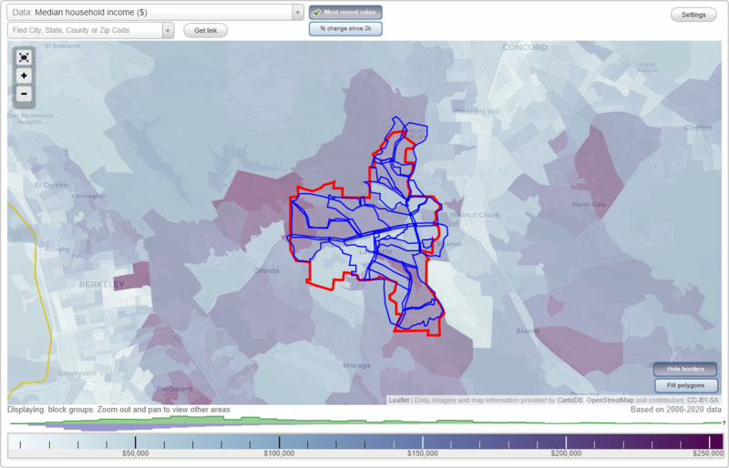
Lafayette, California Neighborhood Map - Income, House Prices, Occupations, Boundaries
Settings
X

- City boundary
- Neighborhood boundaries
Business Search - 14 Million verified businesses
Neighborhoods:
Baywood, Burton Valley, Condit, Downtown Lafayette, Happy Valley, Hidden Oaks, Lafayette Hills, Los Palos, Moraga Boulevard, Mountain View, Northridge, Quandt, Reliez Valley, Silver Dell, Silver Springs, Silverwood, Sky-Hy Ranch, Springhill, Stanley, Tiffany Hills, WoodboroughBaywood neighborhood in Lafayette statistics: (Find on map)
Area: 0.599 square miles
Population: 258
Population density:
Median household income in 2021:
Median rent in in 2021:
Male vs Females
Median age
Average estimated value of detached houses in 2021 (96.9% of all units):
Most popular occupations of males: management occupations (except farmers) (33.6%); sales and office occupations (13.2%); service occupations (12.9%); arts, design, entertainment, sports, and media occupations (5.2%); business and financial operations occupations (5.0%); construction, extraction, and maintenance occupations (4.8%); education, training, and library occupations (4.6%)
Most popular occupations of females: management occupations (except farmers) (22.9%); sales and office occupations (19.5%); business and financial operations occupations (12.3%); healthcare practitioners and technical occupations (9.9%); service occupations (9.5%); education, training, and library occupations (9.2%); material moving occupations (6.1%)
Roads and streets: Reliez Valley Rd; Stagecoach Dr; Echo Springs Rd; Shangri-la Rd (Shangri la Rd); Toyon Rd; Kim Rd; Westwind Rd (W Wind Rd); Mountain Spring Rd (Mountain Springs Rd); Shangri la Dr; Hawks Hill Ct; Reliez Valley Ct; Ponderosa Ct; Reliez Highland Rd; Maverick Ct; Rodeo Ct; Winchester Ct; Colt Ct; Stagecoach Ct; Shangri la Ct (Shangri-la Ct); Service Rd.
Baywood neighborhood detailed profile
Area: 0.599 square miles
Population: 258
Population density:
| Baywood: | 431 people per square mile |
| Lafayette: | 1,670 people per square mile |
Median household income in 2021:
| Baywood: | $199,031 |
| Lafayette: | $192,546 |
Median rent in in 2021:
| Baywood: | $3,501 |
| Lafayette: | $2,001 |
Male vs Females
| Males: | 125 |
| Females: | 132 |
Median age
| Males: | 54.1 years |
| Females: | 52.2 years |
Average estimated value of detached houses in 2021 (96.9% of all units):
| Baywood: | $1,807,928 |
| California: | $881,672 |
Most popular occupations of males: management occupations (except farmers) (33.6%); sales and office occupations (13.2%); service occupations (12.9%); arts, design, entertainment, sports, and media occupations (5.2%); business and financial operations occupations (5.0%); construction, extraction, and maintenance occupations (4.8%); education, training, and library occupations (4.6%)
Most popular occupations of females: management occupations (except farmers) (22.9%); sales and office occupations (19.5%); business and financial operations occupations (12.3%); healthcare practitioners and technical occupations (9.9%); service occupations (9.5%); education, training, and library occupations (9.2%); material moving occupations (6.1%)
Roads and streets: Reliez Valley Rd; Stagecoach Dr; Echo Springs Rd; Shangri-la Rd (Shangri la Rd); Toyon Rd; Kim Rd; Westwind Rd (W Wind Rd); Mountain Spring Rd (Mountain Springs Rd); Shangri la Dr; Hawks Hill Ct; Reliez Valley Ct; Ponderosa Ct; Reliez Highland Rd; Maverick Ct; Rodeo Ct; Winchester Ct; Colt Ct; Stagecoach Ct; Shangri la Ct (Shangri-la Ct); Service Rd.
Baywood neighborhood detailed profile
Burton Valley neighborhood in Lafayette statistics: (Find on map)
Area: 0.721 square miles
Population: 1,140
Population density:
Median household income in 2021:
Median rent in in 2021:
Male vs Females
Median age
Average estimated value of detached houses in 2021 (99.3% of all units):
Most popular occupations of males: management occupations (except farmers) (52.5%); sales and office occupations (10.9%); business and financial operations occupations (9.3%); healthcare practitioners and technical occupations (5.9%); legal occupations (5.7%); life, physical, and social science occupations (3.7%); construction, extraction, and maintenance occupations (3.5%)
Most popular occupations of females: business and financial operations occupations (41.3%); sales and office occupations (18.1%); management occupations (except farmers) (13.3%); education, training, and library occupations (7.9%); healthcare practitioners and technical occupations (7.3%); service occupations (6.6%); transportation occupations (4.1%)
Roads and streets: Rohrer Dr; Silverado Dr; Cam Colorados; Leeward Glen; St Marys Rd; Castle Ct; Cattle Chute Rd; Mc Bride Dr; Dead Horse Canyon Rd; Read Dr; Castello Rd; Bavarian Ln; Cordova Way; Driftwood Dr; Morecroft Rd; Bradbury Dr; Marsha Pl; Silverado Way; Hartwood Ct; E Lowell Ln; Warwick Ct; Lowell Ln W; Park Gate; Contessa Ct; Shire Oaks Ct; Burnt Oak Cir; Bavarian Ct; Wallabi Ct; Hunsaker Canyon Rd; Hermosa Ct; Colorados Ct; Ruppel Pl; Green Acres Ct (Green Acres).
Other features: Grizzly Crk; Las Trampas Crk.
Burton Valley neighborhood detailed profile
Area: 0.721 square miles
Population: 1,140
Population density:
| Burton Valley: | 1,581 people per square mile |
| Lafayette: | 1,670 people per square mile |
Median household income in 2021:
| Burton Valley: | $202,240 |
| Lafayette: | $192,546 |
Median rent in in 2021:
| Burton Valley: | $3,496 |
| Lafayette: | $2,001 |
Male vs Females
| Males: | 582 |
| Females: | 558 |
Median age
| Males: | 44.3 years |
| Females: | 44.3 years |
Average estimated value of detached houses in 2021 (99.3% of all units):
| Burton Valley: | $1,667,678 |
| California: | $881,672 |
Most popular occupations of males: management occupations (except farmers) (52.5%); sales and office occupations (10.9%); business and financial operations occupations (9.3%); healthcare practitioners and technical occupations (5.9%); legal occupations (5.7%); life, physical, and social science occupations (3.7%); construction, extraction, and maintenance occupations (3.5%)
Most popular occupations of females: business and financial operations occupations (41.3%); sales and office occupations (18.1%); management occupations (except farmers) (13.3%); education, training, and library occupations (7.9%); healthcare practitioners and technical occupations (7.3%); service occupations (6.6%); transportation occupations (4.1%)
Roads and streets: Rohrer Dr; Silverado Dr; Cam Colorados; Leeward Glen; St Marys Rd; Castle Ct; Cattle Chute Rd; Mc Bride Dr; Dead Horse Canyon Rd; Read Dr; Castello Rd; Bavarian Ln; Cordova Way; Driftwood Dr; Morecroft Rd; Bradbury Dr; Marsha Pl; Silverado Way; Hartwood Ct; E Lowell Ln; Warwick Ct; Lowell Ln W; Park Gate; Contessa Ct; Shire Oaks Ct; Burnt Oak Cir; Bavarian Ct; Wallabi Ct; Hunsaker Canyon Rd; Hermosa Ct; Colorados Ct; Ruppel Pl; Green Acres Ct (Green Acres).
Other features: Grizzly Crk; Las Trampas Crk.
Burton Valley neighborhood detailed profile
Condit neighborhood in Lafayette statistics: (Find on map)
Area: 0.811 square miles
Population: 3,077
Population density:
Median household income in 2021:
Median rent in in 2021:
Male vs Females
Median age
Housing prices:
Average estimated value of detached houses in 2021 (57.2% of all units):
Average estimated value of townhouses or other attached units in 2021 (10.7% of all units):
Most popular occupations of males: management occupations (except farmers) (21.7%); sales and office occupations (15.8%); service occupations (12.5%); computer and mathematical occupations (11.2%); legal occupations (7.7%); construction, extraction, and maintenance occupations (7.1%); transportation occupations (5.5%)
Most popular occupations of females: healthcare practitioners and technical occupations (22.9%); sales and office occupations (20.0%); management occupations (except farmers) (14.2%); education, training, and library occupations (13.8%); business and financial operations occupations (12.3%); service occupations (12.2%); arts, design, entertainment, sports, and media occupations (2.6%)
Limited-access highways (interstate or state) in this neighborhood: State Rte 24.
Roads and streets: Juanita Dr; Pleasant Hill Rd; Saranap Ave; el Curtola Blvd; Old Tunnel Rd; Kinney Dr; Olympic Blvd; Sunset Loop; Leland Dr (Leland Dr); Condit Rd; Acacia Rd; Freeman Rd; Windsor Dr; Boulevard Way; W Newell Ave; Kendall Rd; Lucy Ln; Windtree Ct; Buchan Dr; Andersen Dr; Ponderosa Ln; Hilton Rd; Raintree Pl; Charles Ct; Kelley Ct; Hidden Oaks; Samantha Dr; Melody Dr; Maryola Ct; Linda Vista Ln; Lindsey Ct; Carolyn Ct; Olde Creek Pl; Meek Pl; Kendall Ct; Mars Ct; Newell Ct; Studebaker Rd; Sanford Ln; Westminster Pl; Ruth Ct; Garden Ct; Bradena Ln; Camino Diablo Frt Rd (Cam Diablo); Hilton Ct; Sweet Rd; Viela Ct; Buckeye Ct; Dale Ct; Patty Way; la Casita Ln; Carrol Pl; Lincolnshire Ct; Laurel Oak Ln; Castleton Pl; Evergreen Ct; Abbey Ct; Willoughby Ct; Manzanita Ct; Stanley Ct; Ford Ln; S Buchan Dr; Iris Ln; Stanwood Ln; Windsor Ct; Circle Creek Dr; Manzana Pl; Hoedel Ct; Greene Pl; Gladys Ct; Bridgefield Rd; Condit Ct; Roderick Ct.
Railroad features: Bay Area Rapid Transit RR.
Other features: Las Trampas Crk; Reliez Crk.
Condit neighborhood detailed profile
Area: 0.811 square miles
Population: 3,077
Population density:
| Condit: | 3,796 people per square mile |
| Lafayette: | 1,670 people per square mile |
Median household income in 2021:
| Condit: | $153,226 |
| Lafayette: | $192,546 |
Median rent in in 2021:
| Condit: | $2,210 |
| Lafayette: | $2,001 |
Male vs Females
| Males: | 1,626 |
| Females: | 1,450 |
Median age
| Males: | 42.6 years |
| Females: | 44.3 years |
Housing prices:
Average estimated value of detached houses in 2021 (57.2% of all units):
| Condit: | $1,400,310 |
| California: | $881,672 |
Average estimated value of townhouses or other attached units in 2021 (10.7% of all units):
| This neighborhood: | $867,670 |
| California: | $745,373 |
Most popular occupations of males: management occupations (except farmers) (21.7%); sales and office occupations (15.8%); service occupations (12.5%); computer and mathematical occupations (11.2%); legal occupations (7.7%); construction, extraction, and maintenance occupations (7.1%); transportation occupations (5.5%)
Most popular occupations of females: healthcare practitioners and technical occupations (22.9%); sales and office occupations (20.0%); management occupations (except farmers) (14.2%); education, training, and library occupations (13.8%); business and financial operations occupations (12.3%); service occupations (12.2%); arts, design, entertainment, sports, and media occupations (2.6%)
Limited-access highways (interstate or state) in this neighborhood: State Rte 24.
Roads and streets: Juanita Dr; Pleasant Hill Rd; Saranap Ave; el Curtola Blvd; Old Tunnel Rd; Kinney Dr; Olympic Blvd; Sunset Loop; Leland Dr (Leland Dr); Condit Rd; Acacia Rd; Freeman Rd; Windsor Dr; Boulevard Way; W Newell Ave; Kendall Rd; Lucy Ln; Windtree Ct; Buchan Dr; Andersen Dr; Ponderosa Ln; Hilton Rd; Raintree Pl; Charles Ct; Kelley Ct; Hidden Oaks; Samantha Dr; Melody Dr; Maryola Ct; Linda Vista Ln; Lindsey Ct; Carolyn Ct; Olde Creek Pl; Meek Pl; Kendall Ct; Mars Ct; Newell Ct; Studebaker Rd; Sanford Ln; Westminster Pl; Ruth Ct; Garden Ct; Bradena Ln; Camino Diablo Frt Rd (Cam Diablo); Hilton Ct; Sweet Rd; Viela Ct; Buckeye Ct; Dale Ct; Patty Way; la Casita Ln; Carrol Pl; Lincolnshire Ct; Laurel Oak Ln; Castleton Pl; Evergreen Ct; Abbey Ct; Willoughby Ct; Manzanita Ct; Stanley Ct; Ford Ln; S Buchan Dr; Iris Ln; Stanwood Ln; Windsor Ct; Circle Creek Dr; Manzana Pl; Hoedel Ct; Greene Pl; Gladys Ct; Bridgefield Rd; Condit Ct; Roderick Ct.
Railroad features: Bay Area Rapid Transit RR.
Other features: Las Trampas Crk; Reliez Crk.
Condit neighborhood detailed profile
Downtown Lafayette neighborhood in Lafayette statistics: (Find on map)
Area: 0.660 square miles
Population: 3,162
Population density:
Median household income in 2021:
Median rent in in 2021:
Male vs Females
Median age
Housing prices:
Average estimated value of detached houses in 2021 (30.8% of all units):
Average estimated value of townhouses or other attached units in 2021 (8.6% of all units):
Most popular occupations of males: management occupations (except farmers) (22.5%); sales and office occupations (17.9%); computer and mathematical occupations (16.2%); life, physical, and social science occupations (7.4%); healthcare practitioners and technical occupations (6.9%); service occupations (6.5%); business and financial operations occupations (5.7%)
Most popular occupations of females: sales and office occupations (30.0%); management occupations (except farmers) (16.7%); education, training, and library occupations (10.1%); arts, design, entertainment, sports, and media occupations (9.7%); healthcare practitioners and technical occupations (9.4%); service occupations (7.9%); business and financial operations occupations (7.3%)
Limited-access highways (interstate or state) in this neighborhood: State Rte 24.
Roads and streets: Mount Diablo Blvd (Mt Diablo Blvd); Golden Gate Way; Moraga Rd; 1st St; Dewing Ave; Lafayette Cir; Brook St; Dyer Dr; Bickerstaff Rd; O'Connor Dr; 2nd St; Oak Hill Rd; Walnut St; Brown Ave; Willow Dr; Oak St; West Rd; Crescent Dr; Hough Ave; Mountain View Dr; Moraga Blvd; Dolores Dr; Happy Valley Rd; Carol Ln; Chestnut St; Songbird Ct; S Thompson Rd; Herman Dr; School St; Almanor Ln; Walnut Dr; Hampton Rd; Blackwood Ln; Woodland Way; Elizabeth St; Berta Ln; Stuart St; Wildwood Ln; Fiesta Ln; Aileen St; Terrace Way; Whitten Ln; Orchard Hill Ct; Creekwood Pl; Orchard Valley Ct (Orchard Valley Ln); Wilkinson Ln; Moon Ct; Cavallero Ln; Plaza Dr; W Creek Ct; Hall Ln; Bell St; East St; Almanor Ct; 3rd St; Colina Ct; Amanda Ln; Blanche Ln.
Railroad features: Bay Area Rapid Transit RR.
Other features: Las Trampas Crk.
Downtown Lafayette neighborhood detailed profile
Area: 0.660 square miles
Population: 3,162
Population density:
| Downtown Lafayette (Downtown): | 4,790 people per square mile |
| Lafayette: | 1,670 people per square mile |
Median household income in 2021:
| Downtown Lafayette (Downtown): | $190,609 |
| Lafayette: | $192,546 |
Median rent in in 2021:
| Downtown Lafayette (Downtown): | $2,353 |
| Lafayette: | $2,001 |
Male vs Females
| Males: | 1,637 |
| Females: | 1,524 |
Median age
| Males: | 43.5 years |
| Females: | 44.1 years |
Housing prices:
Average estimated value of detached houses in 2021 (30.8% of all units):
| Downtown Lafayette (Downtown): | $1,629,519 |
| California: | $881,672 |
Average estimated value of townhouses or other attached units in 2021 (8.6% of all units):
| This neighborhood: | $867,670 |
| California: | $745,373 |
Most popular occupations of males: management occupations (except farmers) (22.5%); sales and office occupations (17.9%); computer and mathematical occupations (16.2%); life, physical, and social science occupations (7.4%); healthcare practitioners and technical occupations (6.9%); service occupations (6.5%); business and financial operations occupations (5.7%)
Most popular occupations of females: sales and office occupations (30.0%); management occupations (except farmers) (16.7%); education, training, and library occupations (10.1%); arts, design, entertainment, sports, and media occupations (9.7%); healthcare practitioners and technical occupations (9.4%); service occupations (7.9%); business and financial operations occupations (7.3%)
Limited-access highways (interstate or state) in this neighborhood: State Rte 24.
Roads and streets: Mount Diablo Blvd (Mt Diablo Blvd); Golden Gate Way; Moraga Rd; 1st St; Dewing Ave; Lafayette Cir; Brook St; Dyer Dr; Bickerstaff Rd; O'Connor Dr; 2nd St; Oak Hill Rd; Walnut St; Brown Ave; Willow Dr; Oak St; West Rd; Crescent Dr; Hough Ave; Mountain View Dr; Moraga Blvd; Dolores Dr; Happy Valley Rd; Carol Ln; Chestnut St; Songbird Ct; S Thompson Rd; Herman Dr; School St; Almanor Ln; Walnut Dr; Hampton Rd; Blackwood Ln; Woodland Way; Elizabeth St; Berta Ln; Stuart St; Wildwood Ln; Fiesta Ln; Aileen St; Terrace Way; Whitten Ln; Orchard Hill Ct; Creekwood Pl; Orchard Valley Ct (Orchard Valley Ln); Wilkinson Ln; Moon Ct; Cavallero Ln; Plaza Dr; W Creek Ct; Hall Ln; Bell St; East St; Almanor Ct; 3rd St; Colina Ct; Amanda Ln; Blanche Ln.
Railroad features: Bay Area Rapid Transit RR.
Other features: Las Trampas Crk.
Downtown Lafayette neighborhood detailed profile
Happy Valley neighborhood in Lafayette statistics: (Find on map)
Area: 1.998 square miles
Population: 2,520
Population density:
Median household income in 2021:
Median rent in in 2021:
Male vs Females
Median age
Housing prices:
Average estimated value of detached houses in 2021 (91.8% of all units):
Average estimated value of townhouses or other attached units in 2021 (6.4% of all units):
Most popular occupations of males: management occupations (except farmers) (30.8%); sales and office occupations (22.1%); business and financial operations occupations (10.4%); architecture and engineering occupations (6.5%); healthcare practitioners and technical occupations (5.2%); computer and mathematical occupations (5.1%); legal occupations (5.1%)
Most popular occupations of females: sales and office occupations (22.8%); management occupations (except farmers) (21.7%); education, training, and library occupations (14.5%); service occupations (13.9%); healthcare practitioners and technical occupations (7.3%); business and financial operations occupations (6.5%); arts, design, entertainment, sports, and media occupations (6.1%)
Limited-access highways (interstate or state) in this neighborhood: State Rte 24.
Roads and streets: Happy Valley Rd; Deer Hill Rd; Upper Happy Valley Rd; Glen Rd; Sierra Vista Way; Cam Vallecito; Oak Hill Rd; S Peardale Dr; Thompson Rd (N Thompson Rd); Valley View Rd; Rose Ln; Valley High; N Peardale Dr; Palo Alto Dr; Laurel Dr; Nordstrom Ln; Canyon Rd; Valory Ln; Natasha Dr; Orchard Rd; Toledo Dr; Monticello Rd; St Francis Dr; Cricket Hill Rd; Deer Trl; Miller Dr; Oleander Dr; Meadow Ln; Redwood Ln; Rahara Dr; Soares Ln; Panorama Dr; Cambridge Dr; Happy Valley Glen Rd; Walter Costa (Walter Costa Trl); White Pine Ln; Wagner Rd; Franklin Ln; Leroy Way; Hastings Ct; Redwood Cir; Serrano Rd; Garden Ln; Hilltop Dr; Iverson Dr; Rancho Diablo Rd (Rancho Diablo Dr); Lois Ln; Cristmont Dr; Hillcrest Dr; Moss Ln; Baker Ln; Hilldale Rd; Lincoln Way; Cowan Rd; Medfield Rd; Cosso Ct; Rose Ct; Tolan Way; Crestmont Pl; Kesserling Rd; Presher Way; Vallecito Ct; Dollis Park Rd; Happy Valley Ct; Happy Valley Ln; Brown Ave; Glen Ct; Magnolia Ln; Hester Ln; Monticello Ct; Ewart Dale Rd; Marguerite Ct; Toledo Ct; Robles Ct; Hidalgo Ct; 1st St; Dahlia Ct; Crescenta Ct; St Francis Ct.
Railroad features: Bay Area Rapid Transit RR.
Happy Valley neighborhood detailed profile
Area: 1.998 square miles
Population: 2,520
Population density:
| Happy Valley: | 1,261 people per square mile |
| Lafayette: | 1,670 people per square mile |
Median household income in 2021:
| Happy Valley: | $216,016 |
| Lafayette: | $192,546 |
Median rent in in 2021:
| Happy Valley: | $3,314 |
| Lafayette: | $2,001 |
Male vs Females
| Males: | 1,210 |
| Females: | 1,309 |
Median age
| Males: | 47.2 years |
| Females: | 46.8 years |
Housing prices:
Average estimated value of detached houses in 2021 (91.8% of all units):
| Happy Valley: | $2,102,062 |
| California: | $881,672 |
Average estimated value of townhouses or other attached units in 2021 (6.4% of all units):
| This neighborhood: | $867,670 |
| California: | $745,373 |
Most popular occupations of males: management occupations (except farmers) (30.8%); sales and office occupations (22.1%); business and financial operations occupations (10.4%); architecture and engineering occupations (6.5%); healthcare practitioners and technical occupations (5.2%); computer and mathematical occupations (5.1%); legal occupations (5.1%)
Most popular occupations of females: sales and office occupations (22.8%); management occupations (except farmers) (21.7%); education, training, and library occupations (14.5%); service occupations (13.9%); healthcare practitioners and technical occupations (7.3%); business and financial operations occupations (6.5%); arts, design, entertainment, sports, and media occupations (6.1%)
Limited-access highways (interstate or state) in this neighborhood: State Rte 24.
Roads and streets: Happy Valley Rd; Deer Hill Rd; Upper Happy Valley Rd; Glen Rd; Sierra Vista Way; Cam Vallecito; Oak Hill Rd; S Peardale Dr; Thompson Rd (N Thompson Rd); Valley View Rd; Rose Ln; Valley High; N Peardale Dr; Palo Alto Dr; Laurel Dr; Nordstrom Ln; Canyon Rd; Valory Ln; Natasha Dr; Orchard Rd; Toledo Dr; Monticello Rd; St Francis Dr; Cricket Hill Rd; Deer Trl; Miller Dr; Oleander Dr; Meadow Ln; Redwood Ln; Rahara Dr; Soares Ln; Panorama Dr; Cambridge Dr; Happy Valley Glen Rd; Walter Costa (Walter Costa Trl); White Pine Ln; Wagner Rd; Franklin Ln; Leroy Way; Hastings Ct; Redwood Cir; Serrano Rd; Garden Ln; Hilltop Dr; Iverson Dr; Rancho Diablo Rd (Rancho Diablo Dr); Lois Ln; Cristmont Dr; Hillcrest Dr; Moss Ln; Baker Ln; Hilldale Rd; Lincoln Way; Cowan Rd; Medfield Rd; Cosso Ct; Rose Ct; Tolan Way; Crestmont Pl; Kesserling Rd; Presher Way; Vallecito Ct; Dollis Park Rd; Happy Valley Ct; Happy Valley Ln; Brown Ave; Glen Ct; Magnolia Ln; Hester Ln; Monticello Ct; Ewart Dale Rd; Marguerite Ct; Toledo Ct; Robles Ct; Hidalgo Ct; 1st St; Dahlia Ct; Crescenta Ct; St Francis Ct.
Railroad features: Bay Area Rapid Transit RR.
Happy Valley neighborhood detailed profile
Hidden Oaks neighborhood in Lafayette statistics: (Find on map)
Area: 0.068 square miles
Population: 169
Population density:
Median household income in 2021:
Median rent in in 2021:
Male vs Females
Median age
Housing prices:
Average estimated value of detached houses in 2021 (85.0% of all units):
Average estimated value of townhouses or other attached units in 2021 (5.0% of all units):
Most popular occupations of males: management occupations (except farmers) (38.0%); education, training, and library occupations (13.5%); legal occupations (11.5%); transportation occupations (7.8%); construction, extraction, and maintenance occupations (5.7%); sales and office occupations (5.2%); architecture and engineering occupations (4.3%)
Most popular occupations of females: management occupations (except farmers) (28.2%); education, training, and library occupations (19.5%); sales and office occupations (17.5%); healthcare practitioners and technical occupations (12.7%); business and financial operations occupations (8.7%); service occupations (7.1%); computer and mathematical occupations (3.7%)
Roads and streets: Condit Rd; Charles Ct; Kelley Ct; Hidden Oaks; Kinney Dr; Samantha Dr; Carolyn Ct; Leland Dr (Leland Dr); Sanford Ln; Meek Pl; Sunset Loop.
Hidden Oaks neighborhood detailed profile
Area: 0.068 square miles
Population: 169
Population density:
| Hidden Oaks: | 2,475 people per square mile |
| Lafayette: | 1,670 people per square mile |
Median household income in 2021:
| Hidden Oaks: | $158,006 |
| Lafayette: | $192,546 |
Median rent in in 2021:
| Hidden Oaks: | $2,262 |
| Lafayette: | $2,001 |
Male vs Females
| Males: | 75 |
| Females: | 93 |
Median age
| Males: | 41.2 years |
| Females: | 42.5 years |
Housing prices:
Average estimated value of detached houses in 2021 (85.0% of all units):
| Hidden Oaks: | $1,383,948 |
| California: | $881,672 |
Average estimated value of townhouses or other attached units in 2021 (5.0% of all units):
| This neighborhood: | $867,670 |
| California: | $745,373 |
Most popular occupations of males: management occupations (except farmers) (38.0%); education, training, and library occupations (13.5%); legal occupations (11.5%); transportation occupations (7.8%); construction, extraction, and maintenance occupations (5.7%); sales and office occupations (5.2%); architecture and engineering occupations (4.3%)
Most popular occupations of females: management occupations (except farmers) (28.2%); education, training, and library occupations (19.5%); sales and office occupations (17.5%); healthcare practitioners and technical occupations (12.7%); business and financial operations occupations (8.7%); service occupations (7.1%); computer and mathematical occupations (3.7%)
Roads and streets: Condit Rd; Charles Ct; Kelley Ct; Hidden Oaks; Kinney Dr; Samantha Dr; Carolyn Ct; Leland Dr (Leland Dr); Sanford Ln; Meek Pl; Sunset Loop.
Hidden Oaks neighborhood detailed profile
Lafayette Hills neighborhood in Lafayette statistics: (Find on map)
Area: 1.093 square miles
Population: 1,257
Population density:
Median household income in 2021:
Median rent in in 2021:
Male vs Females
Median age
Average estimated value of detached houses in 2021 (94.2% of all units):
Most popular occupations of males: management occupations (except farmers) (39.6%); service occupations (24.4%); sales and office occupations (13.2%); transportation occupations (6.6%); construction, extraction, and maintenance occupations (6.0%); computer and mathematical occupations (4.4%); education, training, and library occupations (4.1%)
Most popular occupations of females: management occupations (except farmers) (22.9%); business and financial operations occupations (19.9%); education, training, and library occupations (16.1%); service occupations (10.3%); healthcare practitioners and technical occupations (9.8%); sales and office occupations (8.4%); legal occupations (7.9%)
Roads and streets: Taylor Blvd; Reliez Valley Rd; Gloria Ter; Greenhills Dr; Withers Ave; Highland Ave; Surmont Dr; Haslemere Dr; Rancho View Rd; Pleasant Hill Rd; Johnson Rd; del Rey St; Lombard Ln; Elvia St; Ivanhoe Ave; Vaughn Rd; Sterling Heights Ln; Brookwood Dr; Haslemere Ct; Chapparal Ln; Rancho View Dr; Hannibal Dr; Casa de Cima (Casa de Sima); Hermosa Way; Almaden Ct; Greenhills Ct; Tiana Ter; Marian Ct; del Mar Dr; Terra Teresa; Lomas Verdes Pl; el Cajon Ct; Promintory Ln; Rodeo Ct; del Rey Ct; Benthill Ct; Surmont Ct; Via Ferrari; Gloria Terrace Ct; Attri Ct; Kellie Ann Ct; Isola Ln; Stagecoach Dr; Crestview Ct; Topinera Ln; Beaumont Ct; Surmount Ct; Hillside Ter; Brookwood Ct; Joplin Ct; Ridgecrest Ct; Ivanhoe Ct.
Lafayette Hills neighborhood detailed profile
Area: 1.093 square miles
Population: 1,257
Population density:
| Lafayette Hills (Hills): | 1,150 people per square mile |
| Lafayette: | 1,670 people per square mile |
Median household income in 2021:
| Lafayette Hills (Hills): | $191,698 |
| Lafayette: | $192,546 |
Median rent in in 2021:
| Lafayette Hills (Hills): | $3,501 |
| Lafayette: | $2,001 |
Male vs Females
| Males: | 618 |
| Females: | 638 |
Median age
| Males: | 51.2 years |
| Females: | 50.6 years |
Average estimated value of detached houses in 2021 (94.2% of all units):
| Lafayette Hills (Hills): | $1,807,928 |
| California: | $881,672 |
Most popular occupations of males: management occupations (except farmers) (39.6%); service occupations (24.4%); sales and office occupations (13.2%); transportation occupations (6.6%); construction, extraction, and maintenance occupations (6.0%); computer and mathematical occupations (4.4%); education, training, and library occupations (4.1%)
Most popular occupations of females: management occupations (except farmers) (22.9%); business and financial operations occupations (19.9%); education, training, and library occupations (16.1%); service occupations (10.3%); healthcare practitioners and technical occupations (9.8%); sales and office occupations (8.4%); legal occupations (7.9%)
Roads and streets: Taylor Blvd; Reliez Valley Rd; Gloria Ter; Greenhills Dr; Withers Ave; Highland Ave; Surmont Dr; Haslemere Dr; Rancho View Rd; Pleasant Hill Rd; Johnson Rd; del Rey St; Lombard Ln; Elvia St; Ivanhoe Ave; Vaughn Rd; Sterling Heights Ln; Brookwood Dr; Haslemere Ct; Chapparal Ln; Rancho View Dr; Hannibal Dr; Casa de Cima (Casa de Sima); Hermosa Way; Almaden Ct; Greenhills Ct; Tiana Ter; Marian Ct; del Mar Dr; Terra Teresa; Lomas Verdes Pl; el Cajon Ct; Promintory Ln; Rodeo Ct; del Rey Ct; Benthill Ct; Surmont Ct; Via Ferrari; Gloria Terrace Ct; Attri Ct; Kellie Ann Ct; Isola Ln; Stagecoach Dr; Crestview Ct; Topinera Ln; Beaumont Ct; Surmount Ct; Hillside Ter; Brookwood Ct; Joplin Ct; Ridgecrest Ct; Ivanhoe Ct.
Lafayette Hills neighborhood detailed profile
Los Palos neighborhood in Lafayette statistics: (Find on map)
Area: 0.806 square miles
Population: 1,531
Population density:
Median household income in 2021:
Median rent in in 2021:
Male vs Females
Median age
Average estimated value of detached houses in 2021 (98.4% of all units):
Most popular occupations of males: management occupations (except farmers) (50.9%); sales and office occupations (10.8%); business and financial operations occupations (9.0%); legal occupations (5.8%); construction, extraction, and maintenance occupations (4.0%); architecture and engineering occupations (3.7%); healthcare practitioners and technical occupations (3.7%)
Most popular occupations of females: business and financial operations occupations (32.8%); sales and office occupations (19.0%); management occupations (except farmers) (13.5%); healthcare practitioners and technical occupations (11.9%); education, training, and library occupations (10.6%); service occupations (6.1%); transportation occupations (2.7%)
Roads and streets: St Marys Rd; Glenside Dr; Lucas Dr; Los Palos Dr; Rohrer Dr; Silverado Dr; Lucas Cir; Florence Dr; Michael Ln; Sandalwood Ct; Burton Dr; Murray Ln; Huntleigh Dr; Sweetbrier Cir; Merriewood Dr; Indian Way; Somerset Dr; Glenside Cir; Lancaster Dr; Arrowhead Dr; Augustine Ln; Sharon Ct; Lucas Ct; Somerset Pl; Gold Ct; Arroyo Ct; Hawk Canyon Pl; Olivera Ln; Via Los Colorados; Antonio Ct; Burton Ct; Apache Ct; S Lucille Ln; Los Palos Cir; Crofton Ct; Brent Ct; Burr Ct; Kingsley Pl; Buzzie Ct; Ethan Ct.
Other features: Las Trampas Crk; Grizzly Crk.
Los Palos neighborhood detailed profile
Area: 0.806 square miles
Population: 1,531
Population density:
| Los Palos: | 1,899 people per square mile |
| Lafayette: | 1,670 people per square mile |
Median household income in 2021:
| Los Palos: | $199,343 |
| Lafayette: | $192,546 |
Median rent in in 2021:
| Los Palos: | $3,442 |
| Lafayette: | $2,001 |
Male vs Females
| Males: | 794 |
| Females: | 737 |
Median age
| Males: | 46.1 years |
| Females: | 47.3 years |
Average estimated value of detached houses in 2021 (98.4% of all units):
| Los Palos: | $1,648,350 |
| California: | $881,672 |
Most popular occupations of males: management occupations (except farmers) (50.9%); sales and office occupations (10.8%); business and financial operations occupations (9.0%); legal occupations (5.8%); construction, extraction, and maintenance occupations (4.0%); architecture and engineering occupations (3.7%); healthcare practitioners and technical occupations (3.7%)
Most popular occupations of females: business and financial operations occupations (32.8%); sales and office occupations (19.0%); management occupations (except farmers) (13.5%); healthcare practitioners and technical occupations (11.9%); education, training, and library occupations (10.6%); service occupations (6.1%); transportation occupations (2.7%)
Roads and streets: St Marys Rd; Glenside Dr; Lucas Dr; Los Palos Dr; Rohrer Dr; Silverado Dr; Lucas Cir; Florence Dr; Michael Ln; Sandalwood Ct; Burton Dr; Murray Ln; Huntleigh Dr; Sweetbrier Cir; Merriewood Dr; Indian Way; Somerset Dr; Glenside Cir; Lancaster Dr; Arrowhead Dr; Augustine Ln; Sharon Ct; Lucas Ct; Somerset Pl; Gold Ct; Arroyo Ct; Hawk Canyon Pl; Olivera Ln; Via Los Colorados; Antonio Ct; Burton Ct; Apache Ct; S Lucille Ln; Los Palos Cir; Crofton Ct; Brent Ct; Burr Ct; Kingsley Pl; Buzzie Ct; Ethan Ct.
Other features: Las Trampas Crk; Grizzly Crk.
Los Palos neighborhood detailed profile
Moraga Boulevard neighborhood in Lafayette statistics: (Find on map)
Area: 0.879 square miles
Population: 4,169
Population density:
Median household income in 2021:
Median rent in in 2021:
Male vs Females
Median age
Housing prices:
Average estimated value of detached houses in 2021 (39.7% of all units):
Average estimated value of townhouses or other attached units in 2021 (13.5% of all units):
Most popular occupations of males: management occupations (except farmers) (18.7%); sales and office occupations (18.4%); service occupations (12.6%); life, physical, and social science occupations (10.2%); computer and mathematical occupations (9.2%); construction, extraction, and maintenance occupations (8.0%); business and financial operations occupations (6.4%)
Most popular occupations of females: healthcare practitioners and technical occupations (19.9%); management occupations (except farmers) (19.8%); arts, design, entertainment, sports, and media occupations (17.8%); sales and office occupations (17.1%); business and financial operations occupations (10.4%); education, training, and library occupations (8.9%); service occupations (4.5%)
Limited-access highways (interstate or state) in this neighborhood: State Rte 24.
Roads and streets: Mount Diablo Blvd (Mt Diablo Blvd); Moraga Blvd; Pleasant Hill Rd; Carol Ln; Olympic Blvd; Golden Gate Way; Beechwood Dr; Ameno Dr; Reliez Station Rd; Moraga Rd; 1st St; Janet Ln; Hawthorn Dr; Foye Dr; Dyer Dr; Ridge Rd; Victoria Ave; 2nd St; Monroe Ave; Judith Ln; Old Hawthorne Rd; Hawthorne Dr; Lana Ln; Main Ave; la Canada; Marlene Dr; Stow Ln; Judy Ln; Brown Ave; Willow Dr; Alta Ln; Carl Rd; Bell Vw; Almanor Ln; Walnut Dr; Hampton Rd; Diablo Dr; Blackwood Ln; Woodland Way; 4th St; Elizabeth St; Berta Ln; Stuart St; Andersen Dr; 3rd St; Mount Diablo Ct; Aileen St; Little Ln; Vis Via; Whitcomb Ave; Orchard Hill Ct; Anita Ct; Ameno Ct; Victoria Ct; Creekwood Pl; Orchard Valley Ct (Orchard Valley Ln); Oak View Cir; Cavallero Ln; Plaza Dr; Irene Ln; Vernon Ave; Oakland Ave; Cam del Rio; Katherine Ln; Hall Ln; Yorkshire Ct; Almanor Ct; Regio Ct; Judith Ct.
Railroad features: Bay Area Rapid Transit RR.
Other features: Las Trampas Crk.
Moraga Boulevard neighborhood detailed profile
Area: 0.879 square miles
Population: 4,169
Population density:
| Moraga Boulevard (Moraga): | 4,745 people per square mile |
| Lafayette: | 1,670 people per square mile |
Median household income in 2021:
| Moraga Boulevard (Moraga): | $167,216 |
| Lafayette: | $192,546 |
Median rent in in 2021:
| Moraga Boulevard (Moraga): | $2,531 |
| Lafayette: | $2,001 |
Male vs Females
| Males: | 2,412 |
| Females: | 1,757 |
Median age
| Males: | 42.8 years |
| Females: | 45.5 years |
Housing prices:
Average estimated value of detached houses in 2021 (39.7% of all units):
| Moraga Boulevard (Moraga): | $1,442,383 |
| California: | $881,672 |
Average estimated value of townhouses or other attached units in 2021 (13.5% of all units):
| This neighborhood: | $867,670 |
| California: | $745,373 |
Most popular occupations of males: management occupations (except farmers) (18.7%); sales and office occupations (18.4%); service occupations (12.6%); life, physical, and social science occupations (10.2%); computer and mathematical occupations (9.2%); construction, extraction, and maintenance occupations (8.0%); business and financial operations occupations (6.4%)
Most popular occupations of females: healthcare practitioners and technical occupations (19.9%); management occupations (except farmers) (19.8%); arts, design, entertainment, sports, and media occupations (17.8%); sales and office occupations (17.1%); business and financial operations occupations (10.4%); education, training, and library occupations (8.9%); service occupations (4.5%)
Limited-access highways (interstate or state) in this neighborhood: State Rte 24.
Roads and streets: Mount Diablo Blvd (Mt Diablo Blvd); Moraga Blvd; Pleasant Hill Rd; Carol Ln; Olympic Blvd; Golden Gate Way; Beechwood Dr; Ameno Dr; Reliez Station Rd; Moraga Rd; 1st St; Janet Ln; Hawthorn Dr; Foye Dr; Dyer Dr; Ridge Rd; Victoria Ave; 2nd St; Monroe Ave; Judith Ln; Old Hawthorne Rd; Hawthorne Dr; Lana Ln; Main Ave; la Canada; Marlene Dr; Stow Ln; Judy Ln; Brown Ave; Willow Dr; Alta Ln; Carl Rd; Bell Vw; Almanor Ln; Walnut Dr; Hampton Rd; Diablo Dr; Blackwood Ln; Woodland Way; 4th St; Elizabeth St; Berta Ln; Stuart St; Andersen Dr; 3rd St; Mount Diablo Ct; Aileen St; Little Ln; Vis Via; Whitcomb Ave; Orchard Hill Ct; Anita Ct; Ameno Ct; Victoria Ct; Creekwood Pl; Orchard Valley Ct (Orchard Valley Ln); Oak View Cir; Cavallero Ln; Plaza Dr; Irene Ln; Vernon Ave; Oakland Ave; Cam del Rio; Katherine Ln; Hall Ln; Yorkshire Ct; Almanor Ct; Regio Ct; Judith Ct.
Railroad features: Bay Area Rapid Transit RR.
Other features: Las Trampas Crk.
Moraga Boulevard neighborhood detailed profile
Mountain View neighborhood in Lafayette statistics: (Find on map)
Area: 1.184 square miles
Population: 2,887
Population density:
Median household income in 2021:
Median rent in in 2021:
Male vs Females
Median age
Average estimated value of detached houses in 2021 (37.2% of all units):
Most popular occupations of males: management occupations (except farmers) (24.2%); computer and mathematical occupations (16.8%); sales and office occupations (16.4%); business and financial operations occupations (8.8%); healthcare practitioners and technical occupations (7.6%); architecture and engineering occupations (5.3%); service occupations (5.0%)
Most popular occupations of females: sales and office occupations (30.8%); management occupations (except farmers) (19.4%); education, training, and library occupations (10.8%); service occupations (9.8%); business and financial operations occupations (9.4%); healthcare practitioners and technical occupations (5.7%); life, physical, and social science occupations (5.5%)
Limited-access highways (interstate or state) in this neighborhood: State Rte 24.
Roads and streets: Moraga Rd; Mount Diablo Blvd (Mt Diablo Blvd); Mountain View Dr; Brook St; Mosswood Dr; Boyer Cir; Old Jonas Hill Rd; Highlands Rd; Sundale Rd; Dewing Ave; Lafayette Cir; Tanglewood Dr; Old Mountain Dr (Old Mountain View Dr); Powell Dr; Bickerstaff Rd; Mariposa Rd; Oak St; Mountainview Ln; O'Connor Dr; John Way; Oak Hill Rd; Walnut St; Rimrock Dr; Tofflemire Dr; West Rd; E View Dr; Risa Rd; Crescent Dr; 1st St; Madrone Dr; Hough Ave; Sibert Ct; Dolores Dr; Happy Valley Rd; Tanglewood Pl; Chestnut St; Nemea Ln (Nemea Ln); Songbird Ct; S Thompson Rd; Herman Dr; Mountainview Pl; Village Center; Cerro Encantado; Upland Dr; Old Mountain View Dr; Wildwood Ln; Fiesta Ln; Cerrito Ct; Terrace Way; Whitten Ln; Timber Ln; Highland Ct; Wilkinson Ln; Nephi Ct; Robertson Rd; Moon Ct; Tanglewood Ln; Plaza Dr; Oliver Ct; Rowe Pl; Golden Gate Way; Nemea Ct (Nemea Ct); W Creek Ct; Bell St; East St; Webb Ln; Colina Ct; Amanda Ln; South Rd (South Rd); Mount View Pl; Blanche Ln.
Railroad features: Bay Area Rapid Transit RR.
Mountain View neighborhood detailed profile
Area: 1.184 square miles
Population: 2,887
Population density:
| Mountain View: | 2,438 people per square mile |
| Lafayette: | 1,670 people per square mile |
Median household income in 2021:
| Mountain View: | $206,475 |
| Lafayette: | $192,546 |
Median rent in in 2021:
| Mountain View: | $2,401 |
| Lafayette: | $2,001 |
Male vs Females
| Males: | 1,472 |
| Females: | 1,415 |
Median age
| Males: | 44.4 years |
| Females: | 43.5 years |
Average estimated value of detached houses in 2021 (37.2% of all units):
| Mountain View: | $2,151,004 |
| California: | $881,672 |
Most popular occupations of males: management occupations (except farmers) (24.2%); computer and mathematical occupations (16.8%); sales and office occupations (16.4%); business and financial operations occupations (8.8%); healthcare practitioners and technical occupations (7.6%); architecture and engineering occupations (5.3%); service occupations (5.0%)
Most popular occupations of females: sales and office occupations (30.8%); management occupations (except farmers) (19.4%); education, training, and library occupations (10.8%); service occupations (9.8%); business and financial operations occupations (9.4%); healthcare practitioners and technical occupations (5.7%); life, physical, and social science occupations (5.5%)
Limited-access highways (interstate or state) in this neighborhood: State Rte 24.
Roads and streets: Moraga Rd; Mount Diablo Blvd (Mt Diablo Blvd); Mountain View Dr; Brook St; Mosswood Dr; Boyer Cir; Old Jonas Hill Rd; Highlands Rd; Sundale Rd; Dewing Ave; Lafayette Cir; Tanglewood Dr; Old Mountain Dr (Old Mountain View Dr); Powell Dr; Bickerstaff Rd; Mariposa Rd; Oak St; Mountainview Ln; O'Connor Dr; John Way; Oak Hill Rd; Walnut St; Rimrock Dr; Tofflemire Dr; West Rd; E View Dr; Risa Rd; Crescent Dr; 1st St; Madrone Dr; Hough Ave; Sibert Ct; Dolores Dr; Happy Valley Rd; Tanglewood Pl; Chestnut St; Nemea Ln (Nemea Ln); Songbird Ct; S Thompson Rd; Herman Dr; Mountainview Pl; Village Center; Cerro Encantado; Upland Dr; Old Mountain View Dr; Wildwood Ln; Fiesta Ln; Cerrito Ct; Terrace Way; Whitten Ln; Timber Ln; Highland Ct; Wilkinson Ln; Nephi Ct; Robertson Rd; Moon Ct; Tanglewood Ln; Plaza Dr; Oliver Ct; Rowe Pl; Golden Gate Way; Nemea Ct (Nemea Ct); W Creek Ct; Bell St; East St; Webb Ln; Colina Ct; Amanda Ln; South Rd (South Rd); Mount View Pl; Blanche Ln.
Railroad features: Bay Area Rapid Transit RR.
Mountain View neighborhood detailed profile
Northridge neighborhood in Lafayette statistics: (Find on map)
Area: 1.646 square miles
Population: 1,722
Population density:
Median household income in 2021:
Median rent in in 2021:
Male vs Females
Median age
Housing prices:
Average estimated value of detached houses in 2021 (84.7% of all units):
Average estimated value of townhouses or other attached units in 2021 (11.1% of all units):
Most popular occupations of males: management occupations (except farmers) (26.4%); sales and office occupations (25.4%); business and financial operations occupations (7.1%); architecture and engineering occupations (7.1%); service occupations (6.4%); computer and mathematical occupations (6.3%); healthcare practitioners and technical occupations (6.2%)
Most popular occupations of females: management occupations (except farmers) (23.3%); sales and office occupations (20.4%); education, training, and library occupations (10.8%); healthcare practitioners and technical occupations (10.3%); arts, design, entertainment, sports, and media occupations (9.2%); service occupations (6.7%); life, physical, and social science occupations (6.2%)
Limited-access highways (interstate or state) in this neighborhood: State Rte 24.
Roads and streets: Deer Hill Rd; Happy Valley Rd; Brown Ave; Glen Rd; Sessions Rd; Sierra Vista Way; Panorama Dr; Oak Hill Rd; Thompson Rd (N Thompson Rd); Pleasant Hill Rd; Rose Ln; Laurel Dr; Nordstrom Ln; Valory Ln; Orchard Rd; Monticello Rd; St Francis Dr; Northridge Ln; Miller Dr; Meadow Ln; Redwood Ln; Sky Ln; Mount Diablo Blvd (Mt Diablo Blvd); Happy Valley Glen Rd; Franklin Ln; Monroe Ct; Hastings Ct; Redwood Cir; Serrano Rd; Garden Ln; Quail Run; Hilltop Dr; Iverson Dr; Hillcrest Dr; Moss Ln; Lincoln Way; Elizabeth St; Rose Ct; Presher Way; Dollis Park Rd; Happy Valley Ln; Glen Ct; Magnolia Ln; Hester Ln; Monticello Ct; Harper Ct; Ewart Dale Rd; Robles Ct; Hidalgo Ct; Dahlia Ct; Crescenta Ct; St Francis Ct.
Railroad features: Bay Area Rapid Transit RR.
Northridge neighborhood detailed profile
Area: 1.646 square miles
Population: 1,722
Population density:
| Northridge: | 1,046 people per square mile |
| Lafayette: | 1,670 people per square mile |
Median household income in 2021:
| Northridge: | $207,383 |
| Lafayette: | $192,546 |
Median rent in in 2021:
| Northridge: | $3,375 |
| Lafayette: | $2,001 |
Male vs Females
| Males: | 876 |
| Females: | 846 |
Median age
| Males: | 45.7 years |
| Females: | 47.1 years |
Housing prices:
Average estimated value of detached houses in 2021 (84.7% of all units):
| Northridge: | $1,921,879 |
| California: | $881,672 |
Average estimated value of townhouses or other attached units in 2021 (11.1% of all units):
| This neighborhood: | $867,670 |
| California: | $745,373 |
Most popular occupations of males: management occupations (except farmers) (26.4%); sales and office occupations (25.4%); business and financial operations occupations (7.1%); architecture and engineering occupations (7.1%); service occupations (6.4%); computer and mathematical occupations (6.3%); healthcare practitioners and technical occupations (6.2%)
Most popular occupations of females: management occupations (except farmers) (23.3%); sales and office occupations (20.4%); education, training, and library occupations (10.8%); healthcare practitioners and technical occupations (10.3%); arts, design, entertainment, sports, and media occupations (9.2%); service occupations (6.7%); life, physical, and social science occupations (6.2%)
Limited-access highways (interstate or state) in this neighborhood: State Rte 24.
Roads and streets: Deer Hill Rd; Happy Valley Rd; Brown Ave; Glen Rd; Sessions Rd; Sierra Vista Way; Panorama Dr; Oak Hill Rd; Thompson Rd (N Thompson Rd); Pleasant Hill Rd; Rose Ln; Laurel Dr; Nordstrom Ln; Valory Ln; Orchard Rd; Monticello Rd; St Francis Dr; Northridge Ln; Miller Dr; Meadow Ln; Redwood Ln; Sky Ln; Mount Diablo Blvd (Mt Diablo Blvd); Happy Valley Glen Rd; Franklin Ln; Monroe Ct; Hastings Ct; Redwood Cir; Serrano Rd; Garden Ln; Quail Run; Hilltop Dr; Iverson Dr; Hillcrest Dr; Moss Ln; Lincoln Way; Elizabeth St; Rose Ct; Presher Way; Dollis Park Rd; Happy Valley Ln; Glen Ct; Magnolia Ln; Hester Ln; Monticello Ct; Harper Ct; Ewart Dale Rd; Robles Ct; Hidalgo Ct; Dahlia Ct; Crescenta Ct; St Francis Ct.
Railroad features: Bay Area Rapid Transit RR.
Northridge neighborhood detailed profile
Quandt neighborhood in Lafayette statistics: (Find on map)
Area: 0.243 square miles
Population: 238
Population density:
Median household income in 2021:
Median rent in in 2021:
Male vs Females
Median age
Average estimated value of detached houses in 2021 (96.9% of all units):
Most popular occupations of males: sales and office occupations (31.3%); management occupations (except farmers) (25.9%); architecture and engineering occupations (12.9%); service occupations (7.8%); business and financial operations occupations (6.8%); arts, design, entertainment, sports, and media occupations (5.9%); legal occupations (4.1%)
Most popular occupations of females: sales and office occupations (34.6%); healthcare practitioners and technical occupations (20.8%); community and social services occupations (19.8%); management occupations (except farmers) (8.5%); business and financial operations occupations (7.4%); legal occupations (4.9%); education, training, and library occupations (3.4%)
Roads and streets: Quandt Rd; Pleasant Hill Rd; Hillview Ln; Summit Rd; Stanley Blvd; Laurel Ln; Ronino Way; Masterson Ln; Park Ln; Campo Calle; Nausin Ln; Woodborough Rd; del Arroyo Ct; de Young Ln; Candy Ct; Wooded Creek Ln; Quandt Ct; Stevens Ln; Springhill Rd.
Other features: Reliez Crk.
Quandt neighborhood detailed profile
Area: 0.243 square miles
Population: 238
Population density:
| Quandt: | 980 people per square mile |
| Lafayette: | 1,670 people per square mile |
Median household income in 2021:
| Quandt: | $196,771 |
| Lafayette: | $192,546 |
Median rent in in 2021:
| Quandt: | $3,203 |
| Lafayette: | $2,001 |
Male vs Females
| Males: | 132 |
| Females: | 106 |
Median age
| Males: | 53.2 years |
| Females: | 52.0 years |
Average estimated value of detached houses in 2021 (96.9% of all units):
| Quandt: | $1,886,093 |
| California: | $881,672 |
Most popular occupations of males: sales and office occupations (31.3%); management occupations (except farmers) (25.9%); architecture and engineering occupations (12.9%); service occupations (7.8%); business and financial operations occupations (6.8%); arts, design, entertainment, sports, and media occupations (5.9%); legal occupations (4.1%)
Most popular occupations of females: sales and office occupations (34.6%); healthcare practitioners and technical occupations (20.8%); community and social services occupations (19.8%); management occupations (except farmers) (8.5%); business and financial operations occupations (7.4%); legal occupations (4.9%); education, training, and library occupations (3.4%)
Roads and streets: Quandt Rd; Pleasant Hill Rd; Hillview Ln; Summit Rd; Stanley Blvd; Laurel Ln; Ronino Way; Masterson Ln; Park Ln; Campo Calle; Nausin Ln; Woodborough Rd; del Arroyo Ct; de Young Ln; Candy Ct; Wooded Creek Ln; Quandt Ct; Stevens Ln; Springhill Rd.
Other features: Reliez Crk.
Quandt neighborhood detailed profile
Reliez Valley neighborhood in Lafayette statistics: (Find on map)
Area: 0.816 square miles
Population: 496
Population density:
Median household income in 2021:
Median rent in in 2021:
Male vs Females
Median age
Average estimated value of detached houses in 2021 (95.8% of all units):
Most popular occupations of males: management occupations (except farmers) (36.6%); service occupations (19.2%); sales and office occupations (12.8%); construction, extraction, and maintenance occupations (5.3%); transportation occupations (5.2%); education, training, and library occupations (4.2%); computer and mathematical occupations (4.1%)
Most popular occupations of females: management occupations (except farmers) (23.2%); business and financial operations occupations (16.3%); sales and office occupations (13.4%); education, training, and library occupations (12.8%); healthcare practitioners and technical occupations (10.3%); service occupations (9.3%); legal occupations (6.8%)
Roads and streets: Reliez Valley Rd; la Caminita; Pleasant Hill Rd; Shangri-la Rd (Shangri la Rd); McGraw Ln; Silverdell Rd; Eagle Point Rd; Rancho View Dr; Rancho del Hambre Ct; Blackhawk Rd; Hillside Ter; Greenvalley Dr; Vance Ln; Gable Ln; Rowland Dr; Kincheloe Ct; Edwards Ct; Rancho del Hambre; Billington Ct; Windsong Way; Oakland Rd (Oakland Rd); Greenvalley Ct; Candlelight Dr; Vals Ln; Angelo Ct; Rossi St; Fairholm Ct; Folin Ln; Tichenor Ct; Reliez Manor; Greentree Ct; el Sombro; Eagle Point Ct; Meadowlark Ct; Silverleaf Ct (Silver Leaf Ct); Blackhawk Ct; Green Valley Dr (Green Valley Dr); Green Valley Ln (Green Valley Ln); Blackberry Ct; Fallenleaf Ct; Reliez Ct (Reliez Ct); Redbark Ct (Red Bark Ct); Aspen Ct; Reliez Manor Ct; Shangri la Ct (Shangri-la Ct).
Other features: Reliez Crk.
Reliez Valley neighborhood detailed profile
Area: 0.816 square miles
Population: 496
Population density:
| Reliez Valley: | 608 people per square mile |
| Lafayette: | 1,670 people per square mile |
Median household income in 2021:
| Reliez Valley: | $199,031 |
| Lafayette: | $192,546 |
Median rent in in 2021:
| Reliez Valley: | $3,501 |
| Lafayette: | $2,001 |
Male vs Females
| Males: | 243 |
| Females: | 253 |
Median age
| Males: | 54.1 years |
| Females: | 52.2 years |
Average estimated value of detached houses in 2021 (95.8% of all units):
| Reliez Valley: | $1,807,928 |
| California: | $881,672 |
Most popular occupations of males: management occupations (except farmers) (36.6%); service occupations (19.2%); sales and office occupations (12.8%); construction, extraction, and maintenance occupations (5.3%); transportation occupations (5.2%); education, training, and library occupations (4.2%); computer and mathematical occupations (4.1%)
Most popular occupations of females: management occupations (except farmers) (23.2%); business and financial operations occupations (16.3%); sales and office occupations (13.4%); education, training, and library occupations (12.8%); healthcare practitioners and technical occupations (10.3%); service occupations (9.3%); legal occupations (6.8%)
Roads and streets: Reliez Valley Rd; la Caminita; Pleasant Hill Rd; Shangri-la Rd (Shangri la Rd); McGraw Ln; Silverdell Rd; Eagle Point Rd; Rancho View Dr; Rancho del Hambre Ct; Blackhawk Rd; Hillside Ter; Greenvalley Dr; Vance Ln; Gable Ln; Rowland Dr; Kincheloe Ct; Edwards Ct; Rancho del Hambre; Billington Ct; Windsong Way; Oakland Rd (Oakland Rd); Greenvalley Ct; Candlelight Dr; Vals Ln; Angelo Ct; Rossi St; Fairholm Ct; Folin Ln; Tichenor Ct; Reliez Manor; Greentree Ct; el Sombro; Eagle Point Ct; Meadowlark Ct; Silverleaf Ct (Silver Leaf Ct); Blackhawk Ct; Green Valley Dr (Green Valley Dr); Green Valley Ln (Green Valley Ln); Blackberry Ct; Fallenleaf Ct; Reliez Ct (Reliez Ct); Redbark Ct (Red Bark Ct); Aspen Ct; Reliez Manor Ct; Shangri la Ct (Shangri-la Ct).
Other features: Reliez Crk.
Reliez Valley neighborhood detailed profile
Silver Dell neighborhood in Lafayette statistics: (Find on map)
Area: 0.766 square miles
Population: 720
Population density:
Median household income in 2021:
Median rent in in 2021:
Male vs Females
Median age
Average estimated value of detached houses in 2021 (94.6% of all units):
Most popular occupations of males: management occupations (except farmers) (39.1%); service occupations (24.1%); sales and office occupations (12.6%); transportation occupations (6.5%); construction, extraction, and maintenance occupations (5.8%); computer and mathematical occupations (4.1%); education, training, and library occupations (3.9%)
Most popular occupations of females: management occupations (except farmers) (23.3%); business and financial operations occupations (19.8%); education, training, and library occupations (15.9%); healthcare practitioners and technical occupations (10.4%); service occupations (9.4%); legal occupations (8.3%); sales and office occupations (8.3%)
Roads and streets: Reliez Valley Rd; Pleasant Hill Rd; Rancho View Dr; Monarch Ridge Dr; Beacon Ridge Ln; Silverdell Rd; Greenvalley Dr; Rancho View Rd; Johnson Rd; Shangri la Dr; Hillside Ter; Shangri la Rd (Shangri-la Rd); Lamplight Ct; Vance Ln; Gable Ln; Rowland Dr; McGraw Ln; Kincheloe Ct; Edwards Ct; Beacon Ridge Ct; Billington Ct; Windsong Way; Oakland Rd (Oakland Rd); Robin Ridge Ct; Greenvalley Ct; Candlelight Dr; Vals Ln; Angelo Ct; Rossi St; Piper Ridge Ct; Fairholm Ct; Folin Ln; Tichenor Ct; Reliez Manor; Greentree Ct; el Sombro; Fair Ridge Ct; la Caminita; Rim Ridge Ct; Silverleaf Ct (Silver Leaf Ct); Green Valley Dr (Green Valley Dr); Aspen Ridge Ct; High Ridge Ct (Highridge Ct); Everidge Ct (Ever Ridge Ct); Fox Ridge Ct; Green Valley Ln (Green Valley Ln); Blackberry Ct; Fallenleaf Ct; Reliez Ct (Reliez Ct); Redbark Ct (Red Bark Ct); Aspen Ct; Reliez Manor Ct; Hercules Dr; Owl Ridge Ct.
Silver Dell neighborhood detailed profile
Area: 0.766 square miles
Population: 720
Population density:
| Silver Dell (Silver Dell Rellez): | 940 people per square mile |
| Lafayette: | 1,670 people per square mile |
Median household income in 2021:
| Silver Dell (Silver Dell Rellez): | $191,698 |
| Lafayette: | $192,546 |
Median rent in in 2021:
| Silver Dell (Silver Dell Rellez): | $3,501 |
| Lafayette: | $2,001 |
Male vs Females
| Males: | 354 |
| Females: | 365 |
Median age
| Males: | 51.2 years |
| Females: | 50.6 years |
Average estimated value of detached houses in 2021 (94.6% of all units):
| Silver Dell (Silver Dell Rellez): | $1,807,928 |
| California: | $881,672 |
Most popular occupations of males: management occupations (except farmers) (39.1%); service occupations (24.1%); sales and office occupations (12.6%); transportation occupations (6.5%); construction, extraction, and maintenance occupations (5.8%); computer and mathematical occupations (4.1%); education, training, and library occupations (3.9%)
Most popular occupations of females: management occupations (except farmers) (23.3%); business and financial operations occupations (19.8%); education, training, and library occupations (15.9%); healthcare practitioners and technical occupations (10.4%); service occupations (9.4%); legal occupations (8.3%); sales and office occupations (8.3%)
Roads and streets: Reliez Valley Rd; Pleasant Hill Rd; Rancho View Dr; Monarch Ridge Dr; Beacon Ridge Ln; Silverdell Rd; Greenvalley Dr; Rancho View Rd; Johnson Rd; Shangri la Dr; Hillside Ter; Shangri la Rd (Shangri-la Rd); Lamplight Ct; Vance Ln; Gable Ln; Rowland Dr; McGraw Ln; Kincheloe Ct; Edwards Ct; Beacon Ridge Ct; Billington Ct; Windsong Way; Oakland Rd (Oakland Rd); Robin Ridge Ct; Greenvalley Ct; Candlelight Dr; Vals Ln; Angelo Ct; Rossi St; Piper Ridge Ct; Fairholm Ct; Folin Ln; Tichenor Ct; Reliez Manor; Greentree Ct; el Sombro; Fair Ridge Ct; la Caminita; Rim Ridge Ct; Silverleaf Ct (Silver Leaf Ct); Green Valley Dr (Green Valley Dr); Aspen Ridge Ct; High Ridge Ct (Highridge Ct); Everidge Ct (Ever Ridge Ct); Fox Ridge Ct; Green Valley Ln (Green Valley Ln); Blackberry Ct; Fallenleaf Ct; Reliez Ct (Reliez Ct); Redbark Ct (Red Bark Ct); Aspen Ct; Reliez Manor Ct; Hercules Dr; Owl Ridge Ct.
Silver Dell neighborhood detailed profile
Silver Springs neighborhood in Lafayette statistics: (Find on map)
Area: 0.792 square miles
Population: 1,473
Population density:
Median household income in 2021:
Median rent in in 2021:
Male vs Females
Median age
Average estimated value of detached houses in 2021 (95.6% of all units):
Most popular occupations of males: management occupations (except farmers) (36.9%); sales and office occupations (17.4%); business and financial operations occupations (9.9%); computer and mathematical occupations (9.4%); service occupations (8.4%); architecture and engineering occupations (3.3%); community and social services occupations (2.8%)
Most popular occupations of females: management occupations (except farmers) (24.7%); sales and office occupations (16.3%); education, training, and library occupations (14.8%); healthcare practitioners and technical occupations (13.1%); business and financial operations occupations (11.6%); service occupations (9.8%); arts, design, entertainment, sports, and media occupations (3.6%)
Roads and streets: Sweet Dr; St Marys Rd; Woodview Dr; Solana Dr; Hamlin Rd; Silver Springs Rd; S Silver Springs Rd; Walnut Ln; Moraga Rd; Silver Springs Ct; Old Jonas Hill Rd; Carlyle Ter; Burton Vista Ct; N Silverado Dr; Solana Ct; Silver Crest Ct; Woodview Ct; Jennie Ct; Fernside Ln; Oak Ct; Oliver Ct; Rowe Pl; Evelyn Ct; West Ter; Sweet Ct; East Ter; Silverado Ct; Doreen Way; Grondine Rd.
Silver Springs neighborhood detailed profile
Area: 0.792 square miles
Population: 1,473
Population density:
| Silver Springs: | 1,861 people per square mile |
| Lafayette: | 1,670 people per square mile |
Median household income in 2021:
| Silver Springs: | $191,522 |
| Lafayette: | $192,546 |
Median rent in in 2021:
| Silver Springs: | $3,182 |
| Lafayette: | $2,001 |
Male vs Females
| Males: | 777 |
| Females: | 695 |
Median age
| Males: | 43.3 years |
| Females: | 44.6 years |
Average estimated value of detached houses in 2021 (95.6% of all units):
| Silver Springs: | $1,667,678 |
| California: | $881,672 |
Most popular occupations of males: management occupations (except farmers) (36.9%); sales and office occupations (17.4%); business and financial operations occupations (9.9%); computer and mathematical occupations (9.4%); service occupations (8.4%); architecture and engineering occupations (3.3%); community and social services occupations (2.8%)
Most popular occupations of females: management occupations (except farmers) (24.7%); sales and office occupations (16.3%); education, training, and library occupations (14.8%); healthcare practitioners and technical occupations (13.1%); business and financial operations occupations (11.6%); service occupations (9.8%); arts, design, entertainment, sports, and media occupations (3.6%)
Roads and streets: Sweet Dr; St Marys Rd; Woodview Dr; Solana Dr; Hamlin Rd; Silver Springs Rd; S Silver Springs Rd; Walnut Ln; Moraga Rd; Silver Springs Ct; Old Jonas Hill Rd; Carlyle Ter; Burton Vista Ct; N Silverado Dr; Solana Ct; Silver Crest Ct; Woodview Ct; Jennie Ct; Fernside Ln; Oak Ct; Oliver Ct; Rowe Pl; Evelyn Ct; West Ter; Sweet Ct; East Ter; Silverado Ct; Doreen Way; Grondine Rd.
Silver Springs neighborhood detailed profile
Silverwood neighborhood in Lafayette statistics: (Find on map)
Area: 0.640 square miles
Population: 1,200
Population density:
Median household income in 2021:
Median rent in in 2021:
Male vs Females
Median age
Average estimated value of detached houses in 2021 (95.2% of all units):
Most popular occupations of males: sales and office occupations (27.7%); management occupations (except farmers) (13.7%); business and financial operations occupations (13.4%); construction, extraction, and maintenance occupations (11.3%); life, physical, and social science occupations (7.8%); computer and mathematical occupations (4.9%); arts, design, entertainment, sports, and media occupations (4.8%)
Most popular occupations of females: education, training, and library occupations (21.3%); service occupations (18.3%); sales and office occupations (15.9%); arts, design, entertainment, sports, and media occupations (12.6%); healthcare practitioners and technical occupations (11.7%); management occupations (except farmers) (11.2%); architecture and engineering occupations (4.1%)
Limited-access highways (interstate or state) in this neighborhood: State Rte 24.
Roads and streets: Hidden Valley Rd; Acalanes Rd; Mount Diablo Blvd (Mt Diablo Blvd); Crest Rd; Diablo Cir; Knox Dr; Woodside Ct; Chapel Dr; Whiteoak Dr; Glorietta Blvd; Coralee Ln; Silverwood Dr; Juniper Dr (Juniper Dr); Middle Rd; Revere Rd; Robert Rd; Blackthorn Dr; Valente Dr; Marianne Dr; Mario Way; Barn Ln; Cabernet Ct; Pigeon Ct; Valente Ct; Paulson Ct; Fiora Pl; Black Forest Ct; Legion Ct; Butler Dr; Arbor Way; Corte Rinaldo; Wendy Ln; Revere Ct; el Nido Ranch Rd; W Arbor Way.
Railroad features: Bay Area Rapid Transit RR.
Silverwood neighborhood detailed profile
Area: 0.640 square miles
Population: 1,200
Population density:
| Silverwood: | 1,876 people per square mile |
| Lafayette: | 1,670 people per square mile |
Median household income in 2021:
| Silverwood: | $237,596 |
| Lafayette: | $192,546 |
Median rent in in 2021:
| Silverwood: | $3,441 |
| Lafayette: | $2,001 |
Male vs Females
| Males: | 581 |
| Females: | 619 |
Median age
| Males: | 48.0 years |
| Females: | 43.0 years |
Average estimated value of detached houses in 2021 (95.2% of all units):
| Silverwood: | $1,574,570 |
| California: | $881,672 |
Most popular occupations of males: sales and office occupations (27.7%); management occupations (except farmers) (13.7%); business and financial operations occupations (13.4%); construction, extraction, and maintenance occupations (11.3%); life, physical, and social science occupations (7.8%); computer and mathematical occupations (4.9%); arts, design, entertainment, sports, and media occupations (4.8%)
Most popular occupations of females: education, training, and library occupations (21.3%); service occupations (18.3%); sales and office occupations (15.9%); arts, design, entertainment, sports, and media occupations (12.6%); healthcare practitioners and technical occupations (11.7%); management occupations (except farmers) (11.2%); architecture and engineering occupations (4.1%)
Limited-access highways (interstate or state) in this neighborhood: State Rte 24.
Roads and streets: Hidden Valley Rd; Acalanes Rd; Mount Diablo Blvd (Mt Diablo Blvd); Crest Rd; Diablo Cir; Knox Dr; Woodside Ct; Chapel Dr; Whiteoak Dr; Glorietta Blvd; Coralee Ln; Silverwood Dr; Juniper Dr (Juniper Dr); Middle Rd; Revere Rd; Robert Rd; Blackthorn Dr; Valente Dr; Marianne Dr; Mario Way; Barn Ln; Cabernet Ct; Pigeon Ct; Valente Ct; Paulson Ct; Fiora Pl; Black Forest Ct; Legion Ct; Butler Dr; Arbor Way; Corte Rinaldo; Wendy Ln; Revere Ct; el Nido Ranch Rd; W Arbor Way.
Railroad features: Bay Area Rapid Transit RR.
Silverwood neighborhood detailed profile
Sky-Hy Ranch neighborhood in Lafayette statistics: (Find on map)
Area: 1.305 square miles
Population: 1,906
Population density:
Median household income in 2021:
Median rent in in 2021:
Male vs Females
Median age
Average estimated value of detached houses in 2021 (94.1% of all units):
Most popular occupations of males: management occupations (except farmers) (24.8%); sales and office occupations (22.9%); computer and mathematical occupations (14.2%); service occupations (11.2%); business and financial operations occupations (10.7%); community and social services occupations (5.2%); healthcare practitioners and technical occupations (3.8%)
Most popular occupations of females: management occupations (except farmers) (32.3%); education, training, and library occupations (14.4%); sales and office occupations (13.7%); service occupations (12.7%); business and financial operations occupations (7.9%); healthcare practitioners and technical occupations (7.9%); arts, design, entertainment, sports, and media occupations (5.5%)
Roads and streets: St Marys Rd; Woodview Dr; N Lucille Ln; S Lucille Ln; Mildred Ln; Old Jonas Hill Rd; S Silver Springs Rd; Silver Springs Rd; Florence Dr; Walnut Ln; Betty Ln; Sky Hy Cir; Helen Ln; Silver Springs Ct; Sweet Dr; N Silverado Dr; Helen Ave; Silver Crest Ct; Woodview Ct; Peacock Blvd; Dawkins Dr; Frederica Ave; Fernside Ln; Wallabi Ct; Sky Hy Ct; Sky Ranch Ct; Evelyn Ct; Sweet Ct; Silverado Ct; Grondine Rd.
Other features: Las Trampas Crk.
Sky-Hy Ranch neighborhood detailed profile
Area: 1.305 square miles
Population: 1,906
Population density:
| Sky-Hy Ranch: | 1,461 people per square mile |
| Lafayette: | 1,670 people per square mile |
Median household income in 2021:
| Sky-Hy Ranch: | $209,591 |
| Lafayette: | $192,546 |
Median rent in in 2021:
| Sky-Hy Ranch: | $3,325 |
| Lafayette: | $2,001 |
Male vs Females
| Males: | 975 |
| Females: | 930 |
Median age
| Males: | 43.4 years |
| Females: | 41.8 years |
Average estimated value of detached houses in 2021 (94.1% of all units):
| Sky-Hy Ranch: | $1,667,678 |
| California: | $881,672 |
Most popular occupations of males: management occupations (except farmers) (24.8%); sales and office occupations (22.9%); computer and mathematical occupations (14.2%); service occupations (11.2%); business and financial operations occupations (10.7%); community and social services occupations (5.2%); healthcare practitioners and technical occupations (3.8%)
Most popular occupations of females: management occupations (except farmers) (32.3%); education, training, and library occupations (14.4%); sales and office occupations (13.7%); service occupations (12.7%); business and financial operations occupations (7.9%); healthcare practitioners and technical occupations (7.9%); arts, design, entertainment, sports, and media occupations (5.5%)
Roads and streets: St Marys Rd; Woodview Dr; N Lucille Ln; S Lucille Ln; Mildred Ln; Old Jonas Hill Rd; S Silver Springs Rd; Silver Springs Rd; Florence Dr; Walnut Ln; Betty Ln; Sky Hy Cir; Helen Ln; Silver Springs Ct; Sweet Dr; N Silverado Dr; Helen Ave; Silver Crest Ct; Woodview Ct; Peacock Blvd; Dawkins Dr; Frederica Ave; Fernside Ln; Wallabi Ct; Sky Hy Ct; Sky Ranch Ct; Evelyn Ct; Sweet Ct; Silverado Ct; Grondine Rd.
Other features: Las Trampas Crk.
Sky-Hy Ranch neighborhood detailed profile
Springhill neighborhood in Lafayette statistics: (Find on map)
Area: 0.597 square miles
Population: 465
Population density:
Median household income in 2021:
Median rent in in 2021:
Male vs Females
Median age
Average estimated value of detached houses in 2021 (96.8% of all units):
Most popular occupations of males: sales and office occupations (30.2%); management occupations (except farmers) (25.9%); architecture and engineering occupations (12.5%); service occupations (7.1%); business and financial operations occupations (7.0%); arts, design, entertainment, sports, and media occupations (6.2%); legal occupations (4.4%)
Most popular occupations of females: sales and office occupations (34.4%); healthcare practitioners and technical occupations (19.7%); community and social services occupations (17.9%); management occupations (except farmers) (9.8%); business and financial operations occupations (7.1%); legal occupations (4.5%); education, training, and library occupations (3.2%)
Roads and streets: Springhill Rd; Martino Rd; Springhill Rd (Brown Dr); Leslyn Ln; Blackhawk Rd; Eagle Point Rd; N Scenic Dr; Goyak Dr; Pleasant Hill Rd; Greenbank Dr; Springhill Ln; Southampton Pl; San Reliez Ct; Hillview Ln; Springhill Ct; Prado Way; Eagle Point Ct; Springhill Manor; Meadowlark Ct; Blackhawk Ct.
Other features: Reliez Crk.
Springhill neighborhood detailed profile
Area: 0.597 square miles
Population: 465
Population density:
| Springhill: | 779 people per square mile |
| Lafayette: | 1,670 people per square mile |
Median household income in 2021:
| Springhill: | $234,523 |
| Lafayette: | $192,546 |
Median rent in in 2021:
| Springhill: | $3,198 |
| Lafayette: | $2,001 |
Male vs Females
| Males: | 255 |
| Females: | 210 |
Median age
| Males: | 52.3 years |
| Females: | 50.1 years |
Average estimated value of detached houses in 2021 (96.8% of all units):
| Springhill: | $1,877,624 |
| California: | $881,672 |
Most popular occupations of males: sales and office occupations (30.2%); management occupations (except farmers) (25.9%); architecture and engineering occupations (12.5%); service occupations (7.1%); business and financial operations occupations (7.0%); arts, design, entertainment, sports, and media occupations (6.2%); legal occupations (4.4%)
Most popular occupations of females: sales and office occupations (34.4%); healthcare practitioners and technical occupations (19.7%); community and social services occupations (17.9%); management occupations (except farmers) (9.8%); business and financial operations occupations (7.1%); legal occupations (4.5%); education, training, and library occupations (3.2%)
Roads and streets: Springhill Rd; Martino Rd; Springhill Rd (Brown Dr); Leslyn Ln; Blackhawk Rd; Eagle Point Rd; N Scenic Dr; Goyak Dr; Pleasant Hill Rd; Greenbank Dr; Springhill Ln; Southampton Pl; San Reliez Ct; Hillview Ln; Springhill Ct; Prado Way; Eagle Point Ct; Springhill Manor; Meadowlark Ct; Blackhawk Ct.
Other features: Reliez Crk.
Springhill neighborhood detailed profile
Stanley neighborhood in Lafayette statistics: (Find on map)
Area: 0.837 square miles
Population: 2,560
Population density:
Median household income in 2021:
Median rent in in 2021:
Male vs Females
Median age
Housing prices:
Average estimated value of detached houses in 2021 (72.4% of all units):
Average estimated value of townhouses or other attached units in 2021 (13.6% of all units):
Most popular occupations of males: management occupations (except farmers) (20.3%); sales and office occupations (17.8%); construction, extraction, and maintenance occupations (13.8%); business and financial operations occupations (9.3%); life, physical, and social science occupations (8.0%); service occupations (7.9%); computer and mathematical occupations (5.8%)
Most popular occupations of females: sales and office occupations (29.4%); management occupations (except farmers) (26.2%); business and financial operations occupations (12.5%); healthcare practitioners and technical occupations (11.5%); education, training, and library occupations (7.4%); service occupations (7.2%); arts, design, entertainment, sports, and media occupations (3.8%)
Roads and streets: Moraga Blvd; St Marys Rd; Reliez Station Rd; Las Trampas Rd; Olympic Blvd; Glenside Dr; Beechwood Dr; Las Huertas Rd; School St; Andreasen Dr; Hawthorn Dr; Moraga Rd; Foye Dr; Ridge Rd; Broadmoor Ct; Olympic Oaks Dr; Carol Ln; Roxanne Ln; Monroe Ave; Pleasant Hill Rd; Rosedale Ave; Old Hawthorne Rd; Hawthorne Dr; Lana Ln; la Canada; Santa Maria Way; Topper Ln; Avalon Ave; Judy Ln; 1st St; Hope Ln; Birdhaven Ct; Carl Rd; Brookdale Ct; Topper Ct; Phillips Rd; Diablo Dr; Mc Ellen Way; Andersen Dr; Mc Ellen Ct; Little Ln; Los Palos Mnr; Avalon Ct; Whitcomb Ave; Oak View Cir; Skywood Rd; Irene Ln; James Pl; Vernon Ave; Oakland Ave; Cam del Rio; Old Millstone Ln; Santa Maria Ct; Spruce Ln; Yorkshire Ct; Ava Ct; Paradise Ct.
Other features: Las Trampas Crk.
Stanley neighborhood detailed profile
Area: 0.837 square miles
Population: 2,560
Population density:
| Stanley: | 3,060 people per square mile |
| Lafayette: | 1,670 people per square mile |
Median household income in 2021:
| Stanley: | $172,560 |
| Lafayette: | $192,546 |
Median rent in in 2021:
| Stanley: | $2,699 |
| Lafayette: | $2,001 |
Male vs Females
| Males: | 1,333 |
| Females: | 1,227 |
Median age
| Males: | 41.5 years |
| Females: | 42.8 years |
Housing prices:
Average estimated value of detached houses in 2021 (72.4% of all units):
| Stanley: | $1,414,614 |
| California: | $881,672 |
Average estimated value of townhouses or other attached units in 2021 (13.6% of all units):
| This neighborhood: | $867,670 |
| California: | $745,373 |
Most popular occupations of males: management occupations (except farmers) (20.3%); sales and office occupations (17.8%); construction, extraction, and maintenance occupations (13.8%); business and financial operations occupations (9.3%); life, physical, and social science occupations (8.0%); service occupations (7.9%); computer and mathematical occupations (5.8%)
Most popular occupations of females: sales and office occupations (29.4%); management occupations (except farmers) (26.2%); business and financial operations occupations (12.5%); healthcare practitioners and technical occupations (11.5%); education, training, and library occupations (7.4%); service occupations (7.2%); arts, design, entertainment, sports, and media occupations (3.8%)
Roads and streets: Moraga Blvd; St Marys Rd; Reliez Station Rd; Las Trampas Rd; Olympic Blvd; Glenside Dr; Beechwood Dr; Las Huertas Rd; School St; Andreasen Dr; Hawthorn Dr; Moraga Rd; Foye Dr; Ridge Rd; Broadmoor Ct; Olympic Oaks Dr; Carol Ln; Roxanne Ln; Monroe Ave; Pleasant Hill Rd; Rosedale Ave; Old Hawthorne Rd; Hawthorne Dr; Lana Ln; la Canada; Santa Maria Way; Topper Ln; Avalon Ave; Judy Ln; 1st St; Hope Ln; Birdhaven Ct; Carl Rd; Brookdale Ct; Topper Ct; Phillips Rd; Diablo Dr; Mc Ellen Way; Andersen Dr; Mc Ellen Ct; Little Ln; Los Palos Mnr; Avalon Ct; Whitcomb Ave; Oak View Cir; Skywood Rd; Irene Ln; James Pl; Vernon Ave; Oakland Ave; Cam del Rio; Old Millstone Ln; Santa Maria Ct; Spruce Ln; Yorkshire Ct; Ava Ct; Paradise Ct.
Other features: Las Trampas Crk.
Stanley neighborhood detailed profile
Tiffany Hills neighborhood in Lafayette statistics: (Find on map)
Area: 1.213 square miles
Population: 1,615
Population density:
Median household income in 2021:
Median rent in in 2021:
Male vs Females
Median age
Average estimated value of detached houses in 2021 (99.6% of all units):
Most popular occupations of males: management occupations (except farmers) (35.0%); business and financial operations occupations (15.1%); sales and office occupations (15.1%); legal occupations (8.3%); computer and mathematical occupations (5.6%); life, physical, and social science occupations (4.5%); arts, design, entertainment, sports, and media occupations (4.3%)
Most popular occupations of females: sales and office occupations (24.3%); management occupations (except farmers) (19.6%); service occupations (17.2%); education, training, and library occupations (14.9%); healthcare practitioners and technical occupations (7.6%); business and financial operations occupations (7.0%); arts, design, entertainment, sports, and media occupations (3.1%)
Limited-access highways (interstate or state) in this neighborhood: State Rte 24.
Roads and streets: Los Arabis Dr; el Nido Ranch Rd; Via Roble; Howard Hills Rd; Quail Ridge Rd; Camellia Ln; Canyon Rd (Canyon Rd); Estates Dr; Hidden Valley Rd; Lorinda Ln; Dolores Dr; S Tilden Ln; Pine Ln; Via Media; Via Oneg; Via Baja; N Tilden Ln; Via Alta; Upper Happy Valley Rd; Rancho Rd; Timothy Rd; Franke Ln; Sunnybrook Dr; Sunnyhills Rd; Via Nueva; Lizann Dr; Leach Rd (Leach Rd); Via Pajaro; Maloyan Ln; Los Arabis Ln; Quail Ridge Ct; Lorna Dr (Lorna Dr); Monson Ln; Via Magdalena; S Acres Rd; Oak Knoll Rd.
Railroad features: Bay Area Rapid Transit RR.
Tiffany Hills neighborhood detailed profile
Area: 1.213 square miles
Population: 1,615
Population density:
| Tiffany Hills (Via Roble): | 1,331 people per square mile |
| Lafayette: | 1,670 people per square mile |
Median household income in 2021:
| Tiffany Hills (Via Roble): | $247,062 |
| Lafayette: | $192,546 |
Median rent in in 2021:
| Tiffany Hills (Via Roble): | $3,266 |
| Lafayette: | $2,001 |
Male vs Females
| Males: | 773 |
| Females: | 841 |
Median age
| Males: | 49.0 years |
| Females: | 44.7 years |
Average estimated value of detached houses in 2021 (99.6% of all units):
| Tiffany Hills (Via Roble): | $2,219,445 |
| California: | $881,672 |
Most popular occupations of males: management occupations (except farmers) (35.0%); business and financial operations occupations (15.1%); sales and office occupations (15.1%); legal occupations (8.3%); computer and mathematical occupations (5.6%); life, physical, and social science occupations (4.5%); arts, design, entertainment, sports, and media occupations (4.3%)
Most popular occupations of females: sales and office occupations (24.3%); management occupations (except farmers) (19.6%); service occupations (17.2%); education, training, and library occupations (14.9%); healthcare practitioners and technical occupations (7.6%); business and financial operations occupations (7.0%); arts, design, entertainment, sports, and media occupations (3.1%)
Limited-access highways (interstate or state) in this neighborhood: State Rte 24.
Roads and streets: Los Arabis Dr; el Nido Ranch Rd; Via Roble; Howard Hills Rd; Quail Ridge Rd; Camellia Ln; Canyon Rd (Canyon Rd); Estates Dr; Hidden Valley Rd; Lorinda Ln; Dolores Dr; S Tilden Ln; Pine Ln; Via Media; Via Oneg; Via Baja; N Tilden Ln; Via Alta; Upper Happy Valley Rd; Rancho Rd; Timothy Rd; Franke Ln; Sunnybrook Dr; Sunnyhills Rd; Via Nueva; Lizann Dr; Leach Rd (Leach Rd); Via Pajaro; Maloyan Ln; Los Arabis Ln; Quail Ridge Ct; Lorna Dr (Lorna Dr); Monson Ln; Via Magdalena; S Acres Rd; Oak Knoll Rd.
Railroad features: Bay Area Rapid Transit RR.
Tiffany Hills neighborhood detailed profile
Woodborough neighborhood in Lafayette statistics: (Find on map)
Area: 0.569 square miles
Population: 1,039
Population density:
Median household income in 2021:
Median rent in in 2021:
Male vs Females
Median age
Housing prices:
Average estimated value of detached houses in 2021 (70.1% of all units):
Average estimated value of townhouses or other attached units in 2021 (8.7% of all units):
Most popular occupations of males: sales and office occupations (23.7%); management occupations (except farmers) (21.0%); service occupations (12.3%); computer and mathematical occupations (8.7%); architecture and engineering occupations (5.5%); legal occupations (5.4%); business and financial operations occupations (5.2%)
Most popular occupations of females: sales and office occupations (27.1%); healthcare practitioners and technical occupations (24.0%); business and financial operations occupations (10.8%); management occupations (except farmers) (9.4%); community and social services occupations (8.9%); education, training, and library occupations (7.6%); service occupations (7.5%)
Limited-access highways (interstate or state) in this neighborhood: State Rte 24.
Roads and streets: Cam Diablo (Camino Diablo Rd); Stanley Blvd; Bacon Ct; Pleasant Hill Rd; Dunsyre Dr; Springbrook Rd; Nogales St; Bacon Way; Acalanes Ave; Pleasant Hill Cir; Vacation Dr; Loveland Dr; Palomares St; Peaceful Ln; Via Gabarda (Via Gabarda Way); Henri Hill Ln; Circle Creek Dr; Plymouth Rd; Quandt Rd; Saranap Ave; Happy Hollow Ct; el Curtola Blvd; Warner Ct; Ortega St; Camino Ct; Sunridge Ct; Pearles St; Cam Justin; Barott Rd; Secluded Pl; Nogales Ct; Iris Ct; Circle Creek Ct; Tres Almendras; Gilmore Ct; Clover Ct; Chatton Ct; Circle Creek Ln; Deer Hill Rd; Palomares Ct.
Railroad features: Bay Area Rapid Transit RR.
Other features: Reliez Crk.
Woodborough neighborhood detailed profile
Area: 0.569 square miles
Population: 1,039
Population density:
| Woodborough: | 1,825 people per square mile |
| Lafayette: | 1,670 people per square mile |
Median household income in 2021:
| Woodborough: | $179,034 |
| Lafayette: | $192,546 |
Median rent in in 2021:
| Woodborough: | $2,613 |
| Lafayette: | $2,001 |
Male vs Females
| Males: | 585 |
| Females: | 454 |
Median age
| Males: | 46.8 years |
| Females: | 46.8 years |
Housing prices:
Average estimated value of detached houses in 2021 (70.1% of all units):
| Woodborough: | $1,812,221 |
| California: | $881,672 |
Average estimated value of townhouses or other attached units in 2021 (8.7% of all units):
| This neighborhood: | $867,670 |
| California: | $745,373 |
Most popular occupations of males: sales and office occupations (23.7%); management occupations (except farmers) (21.0%); service occupations (12.3%); computer and mathematical occupations (8.7%); architecture and engineering occupations (5.5%); legal occupations (5.4%); business and financial operations occupations (5.2%)
Most popular occupations of females: sales and office occupations (27.1%); healthcare practitioners and technical occupations (24.0%); business and financial operations occupations (10.8%); management occupations (except farmers) (9.4%); community and social services occupations (8.9%); education, training, and library occupations (7.6%); service occupations (7.5%)
Limited-access highways (interstate or state) in this neighborhood: State Rte 24.
Roads and streets: Cam Diablo (Camino Diablo Rd); Stanley Blvd; Bacon Ct; Pleasant Hill Rd; Dunsyre Dr; Springbrook Rd; Nogales St; Bacon Way; Acalanes Ave; Pleasant Hill Cir; Vacation Dr; Loveland Dr; Palomares St; Peaceful Ln; Via Gabarda (Via Gabarda Way); Henri Hill Ln; Circle Creek Dr; Plymouth Rd; Quandt Rd; Saranap Ave; Happy Hollow Ct; el Curtola Blvd; Warner Ct; Ortega St; Camino Ct; Sunridge Ct; Pearles St; Cam Justin; Barott Rd; Secluded Pl; Nogales Ct; Iris Ct; Circle Creek Ct; Tres Almendras; Gilmore Ct; Clover Ct; Chatton Ct; Circle Creek Ln; Deer Hill Rd; Palomares Ct.
Railroad features: Bay Area Rapid Transit RR.
Other features: Reliez Crk.
Woodborough neighborhood detailed profile