Menlo Park, California Neighborhood Map - Income, House Prices, Occupations, Boundaries
Settings
X

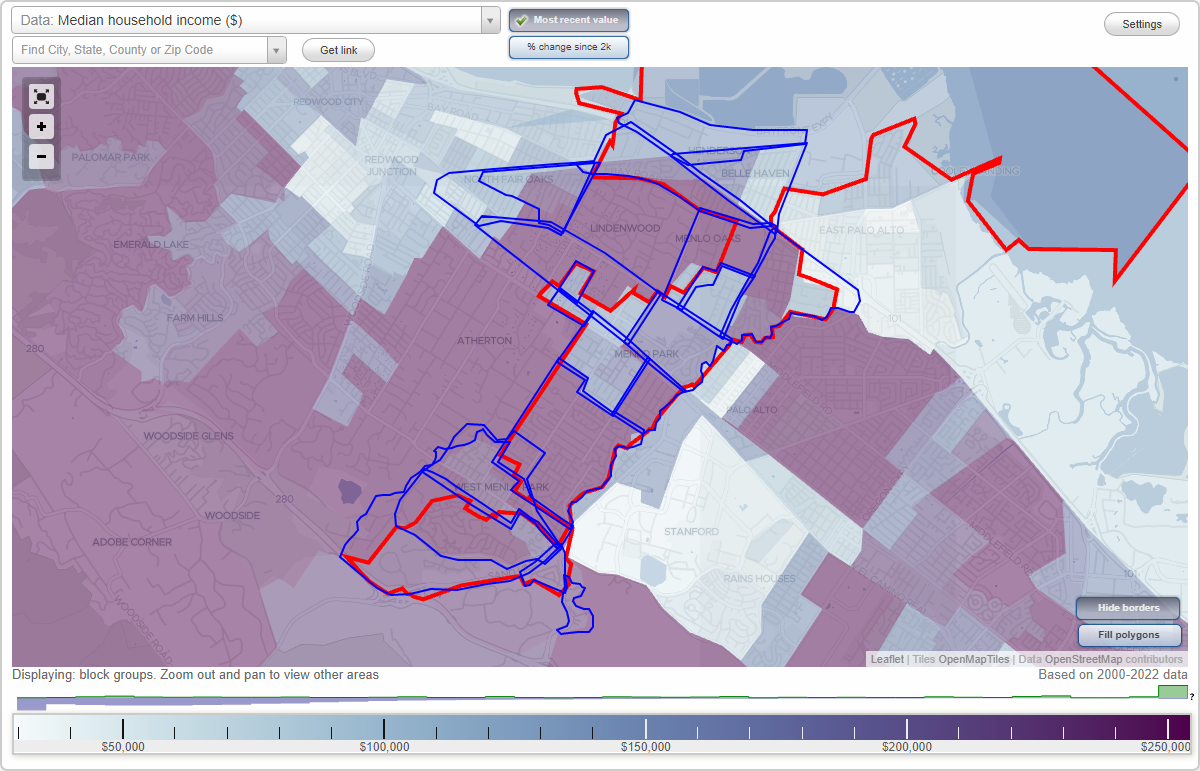
- City boundary
- Neighborhood boundaries
Business Search - 14 Million verified businesses
Neighborhoods:
Allied Arts, Belle Haven, Central Menlo Park, Downtown Menlo Park, Fair Oaks, Felton Gables, Flood Park Triangle, Henderson, Linfield Oaks, Menlo Oaks, Nativity, North Fair Oaks, Pine Forest, Sharon Heights, Stanford Hills, Stanford Weekend Acres, The Willows, University Heights, Vintage Oaks, West Menlo ParkAllied Arts neighborhood in Menlo Park statistics: (Find on map)
Area: 0.245 square miles
Population: 1,513
Population density:
Median household income in 2021:
Median rent in in 2021:
Male vs Females
Median age
Most popular occupations of males: sales and office occupations (22.2%); management occupations (except farmers) (19.2%); service occupations (10.0%); architecture and engineering occupations (9.3%); healthcare practitioners and technical occupations (7.9%); computer and mathematical occupations (7.7%); education, training, and library occupations (7.2%)
Most popular occupations of females: management occupations (except farmers) (22.7%); healthcare practitioners and technical occupations (17.7%); sales and office occupations (14.7%); arts, design, entertainment, sports, and media occupations (13.0%); education, training, and library occupations (9.5%); business and financial operations occupations (9.0%); life, physical, and social science occupations (7.0%)
Highways in this neighborhood: el Camino Real (State Hwy 82).
Roads and streets: Creek Dr; Middle Ave; College Ave; Cambridge Ave; University Dr; Yale Rd; Arbor Rd; Partridge Ave; Harvard Ave; Princeton Rd; Alto Ln; Cornell Rd; Blake St.
Other features: San Francisquito Crk.
Other features: San Francisquito Crk.
Allied Arts neighborhood detailed profile
Area: 0.245 square miles
Population: 1,513
Population density:
| Allied Arts (Stanford Park): | 6,185 people per square mile |
| Menlo Park: | 3,326 people per square mile |
Median household income in 2021:
| Allied Arts (Stanford Park): | $197,656 |
| Menlo Park: | $179,913 |
Median rent in in 2021:
| Allied Arts (Stanford Park): | $3,343 |
| Menlo Park: | $2,001 |
Male vs Females
| Males: | 760 |
| Females: | 753 |
Median age
| Males: | 39.2 years |
| Females: | 33.8 years |
Most popular occupations of males: sales and office occupations (22.2%); management occupations (except farmers) (19.2%); service occupations (10.0%); architecture and engineering occupations (9.3%); healthcare practitioners and technical occupations (7.9%); computer and mathematical occupations (7.7%); education, training, and library occupations (7.2%)
Most popular occupations of females: management occupations (except farmers) (22.7%); healthcare practitioners and technical occupations (17.7%); sales and office occupations (14.7%); arts, design, entertainment, sports, and media occupations (13.0%); education, training, and library occupations (9.5%); business and financial operations occupations (9.0%); life, physical, and social science occupations (7.0%)
Highways in this neighborhood: el Camino Real (State Hwy 82).
Roads and streets: Creek Dr; Middle Ave; College Ave; Cambridge Ave; University Dr; Yale Rd; Arbor Rd; Partridge Ave; Harvard Ave; Princeton Rd; Alto Ln; Cornell Rd; Blake St.
Other features: San Francisquito Crk.
Other features: San Francisquito Crk.
Allied Arts neighborhood detailed profile
Belle Haven neighborhood in Menlo Park statistics: (Find on map)
Area: 0.535 square miles
Population: 4,898
Population density:
Median household income in 2021:
Median rent in in 2021:
Male vs Females
Median age
Average estimated value of detached houses in 2021 (63.1% of all units):
Most popular occupations of males: sales and office occupations (17.7%); construction, extraction, and maintenance occupations (15.0%); transportation occupations (14.7%); service occupations (13.8%); management occupations (except farmers) (12.4%); production occupations (5.3%); computer and mathematical occupations (5.0%)
Most popular occupations of females: sales and office occupations (37.5%); service occupations (22.7%); education, training, and library occupations (10.3%); business and financial operations occupations (7.5%); healthcare practitioners and technical occupations (6.2%); management occupations (except farmers) (3.4%); life, physical, and social science occupations (3.3%)
Limited-access highways (interstate or state) in this neighborhood: Bayshore Fwy (US Hwy 101); Willow Rd (State Hwy 84).
Roads and streets: Pierce Rd; Hamilton Ave; Ivy Dr; Newbridge St; Van Buren Rd; Carlton Ave; Madera Ave; Sevier Ave; Hollyburne Ave; Terminal Ave; Windermere Ave; Henderson Ave; US Hwy 101; Chilco St; Almanor Ave; Market Pl; Modoc Ave; Hill Ave; Berkeley Ave; Saratoga Ave; del Norte Ave; Plumas Ave; Howard St; Bieber Ave; Henderson Pl; Alpine Ave; Menlo Oaks Dr; Alberni St; Ringwood Ave.
Railroad features: Union Pacific RR.
Other features: Hetch Hetchy.
Belle Haven neighborhood detailed profile
Area: 0.535 square miles
Population: 4,898
Population density:
| Belle Haven: | 9,153 people per square mile |
| Menlo Park: | 3,326 people per square mile |
Median household income in 2021:
| Belle Haven: | $145,732 |
| Menlo Park: | $179,913 |
Median rent in in 2021:
| Belle Haven: | $2,195 |
| Menlo Park: | $2,001 |
Male vs Females
| Males: | 2,430 |
| Females: | 2,468 |
Median age
| Males: | 37.1 years |
| Females: | 36.1 years |
Average estimated value of detached houses in 2021 (63.1% of all units):
| Belle Haven: | $1,300,684 |
| California: | $881,672 |
Most popular occupations of males: sales and office occupations (17.7%); construction, extraction, and maintenance occupations (15.0%); transportation occupations (14.7%); service occupations (13.8%); management occupations (except farmers) (12.4%); production occupations (5.3%); computer and mathematical occupations (5.0%)
Most popular occupations of females: sales and office occupations (37.5%); service occupations (22.7%); education, training, and library occupations (10.3%); business and financial operations occupations (7.5%); healthcare practitioners and technical occupations (6.2%); management occupations (except farmers) (3.4%); life, physical, and social science occupations (3.3%)
Limited-access highways (interstate or state) in this neighborhood: Bayshore Fwy (US Hwy 101); Willow Rd (State Hwy 84).
Roads and streets: Pierce Rd; Hamilton Ave; Ivy Dr; Newbridge St; Van Buren Rd; Carlton Ave; Madera Ave; Sevier Ave; Hollyburne Ave; Terminal Ave; Windermere Ave; Henderson Ave; US Hwy 101; Chilco St; Almanor Ave; Market Pl; Modoc Ave; Hill Ave; Berkeley Ave; Saratoga Ave; del Norte Ave; Plumas Ave; Howard St; Bieber Ave; Henderson Pl; Alpine Ave; Menlo Oaks Dr; Alberni St; Ringwood Ave.
Railroad features: Union Pacific RR.
Other features: Hetch Hetchy.
Belle Haven neighborhood detailed profile
Central Menlo Park neighborhood in Menlo Park statistics: (Find on map)
Area: 1.109 square miles
Population: 5,294
Population density:
Median household income in 2021:
Median rent in in 2021:
Male vs Females
Median age
Average estimated value of detached houses in 2021 (96.7% of all units):
Most popular occupations of males: management occupations (except farmers) (33.9%); sales and office occupations (16.6%); computer and mathematical occupations (12.3%); legal occupations (8.2%); business and financial operations occupations (7.3%); arts, design, entertainment, sports, and media occupations (5.3%); architecture and engineering occupations (3.9%)
Most popular occupations of females: management occupations (except farmers) (27.1%); sales and office occupations (14.9%); education, training, and library occupations (11.5%); business and financial operations occupations (8.7%); arts, design, entertainment, sports, and media occupations (8.6%); service occupations (7.9%); life, physical, and social science occupations (4.4%)
Roads and streets: Santa Cruz Ave; San Mateo Dr; Valparaiso Ave; Arbor Rd; Bay Laurel Dr; Cotton St; Hermosa Way; Hobart St; Olive St; Oakdell Dr; Oak Ave; Stanford Ave; Middle Ave; Lemon St; Windsor Dr; Vine St; Orange Ave; Hillview Dr; Elder Ave; Oak Knoll Ln; N Lemon Ave; Wallea Dr; Politzer Dr; Hesketh Dr; Doris Dr; White Oak Dr; Johnson St; Corine Ln (Corinne Ln); Evergreen St; Magnolia St (Magnolia Ave); Ambar Way; Cloud Ave; Holly Ave; Poppy Ave; Avy Ave; Croner Ave; Santa Rita Ave; Rosefield Way; Claire Pl; Garden Ln; Sherman Ave; Edgewood Dr (Edgewood Ln); Maywood Ln; Delfino Way; American Way; May Brown Ave; Roberts Dr; Garland Dr; Westfield Dr; Palm Ct; Louise St; Werth Ave; Grace Dr; Atkinson Ln; St Francis Pl; Pineview Ln; Fanita Way; August Cir; Oakfield Ln; Wood Ln; Hidden Oaks Dr; Brandon Way; Nancy Way; Seymour Ln; Saxon Way; Castle Way; Windsor Way; Elder Ct; Hermosa Pl; Middle Ct; Whitaker Way; White Oak Ct; Williams Ct (William Ct); Stanford Ct; Barbara Ln; Reyna Pl; Cheryl Pl; Trudy Ln; Hesketh Ct; Sharon Rd; Cathy Pl; Randall Pl; Bolton Pl; Patricia Pl; Garland Pl; Cotton Pl; Hillview Pl; Lomitas Ct; Helen Pl; Pembroke Pl; Magnolia Ct; St Francis Ct.
Other features: San Francisquito Crk.
Roads and streets: .
Other features: San Francisquito Crk.
Central Menlo Park neighborhood detailed profile
Area: 1.109 square miles
Population: 5,294
Population density:
| Central Menlo Park (Central): | 4,776 people per square mile |
| Menlo Park: | 3,326 people per square mile |
Median household income in 2021:
| Central Menlo Park (Central): | $213,763 |
| Menlo Park: | $179,913 |
Median rent in in 2021:
| Central Menlo Park (Central): | $3,312 |
| Menlo Park: | $2,001 |
Male vs Females
| Males: | 2,577 |
| Females: | 2,717 |
Median age
| Males: | 41.0 years |
| Females: | 41.6 years |
Average estimated value of detached houses in 2021 (96.7% of all units):
| Central Menlo Park (Central): | $3,777,052 |
| California: | $881,672 |
Most popular occupations of males: management occupations (except farmers) (33.9%); sales and office occupations (16.6%); computer and mathematical occupations (12.3%); legal occupations (8.2%); business and financial operations occupations (7.3%); arts, design, entertainment, sports, and media occupations (5.3%); architecture and engineering occupations (3.9%)
Most popular occupations of females: management occupations (except farmers) (27.1%); sales and office occupations (14.9%); education, training, and library occupations (11.5%); business and financial operations occupations (8.7%); arts, design, entertainment, sports, and media occupations (8.6%); service occupations (7.9%); life, physical, and social science occupations (4.4%)
Roads and streets: Santa Cruz Ave; San Mateo Dr; Valparaiso Ave; Arbor Rd; Bay Laurel Dr; Cotton St; Hermosa Way; Hobart St; Olive St; Oakdell Dr; Oak Ave; Stanford Ave; Middle Ave; Lemon St; Windsor Dr; Vine St; Orange Ave; Hillview Dr; Elder Ave; Oak Knoll Ln; N Lemon Ave; Wallea Dr; Politzer Dr; Hesketh Dr; Doris Dr; White Oak Dr; Johnson St; Corine Ln (Corinne Ln); Evergreen St; Magnolia St (Magnolia Ave); Ambar Way; Cloud Ave; Holly Ave; Poppy Ave; Avy Ave; Croner Ave; Santa Rita Ave; Rosefield Way; Claire Pl; Garden Ln; Sherman Ave; Edgewood Dr (Edgewood Ln); Maywood Ln; Delfino Way; American Way; May Brown Ave; Roberts Dr; Garland Dr; Westfield Dr; Palm Ct; Louise St; Werth Ave; Grace Dr; Atkinson Ln; St Francis Pl; Pineview Ln; Fanita Way; August Cir; Oakfield Ln; Wood Ln; Hidden Oaks Dr; Brandon Way; Nancy Way; Seymour Ln; Saxon Way; Castle Way; Windsor Way; Elder Ct; Hermosa Pl; Middle Ct; Whitaker Way; White Oak Ct; Williams Ct (William Ct); Stanford Ct; Barbara Ln; Reyna Pl; Cheryl Pl; Trudy Ln; Hesketh Ct; Sharon Rd; Cathy Pl; Randall Pl; Bolton Pl; Patricia Pl; Garland Pl; Cotton Pl; Hillview Pl; Lomitas Ct; Helen Pl; Pembroke Pl; Magnolia Ct; St Francis Ct.
Other features: San Francisquito Crk.
Roads and streets: .
Other features: San Francisquito Crk.
Central Menlo Park neighborhood detailed profile
Downtown Menlo Park neighborhood in Menlo Park statistics: (Find on map)
Area: 0.443 square miles
Population: 2,732
Population density:
Median household income in 2021:
Median rent in in 2021:
Male vs Females
Median age
Housing prices:
Average estimated value of detached houses in 2021 (25.2% of all units):
Average estimated value of townhouses or other attached units in 2021 (8.5% of all units):
Most popular occupations of males: computer and mathematical occupations (26.9%); management occupations (except farmers) (14.5%); education, training, and library occupations (13.1%); sales and office occupations (8.9%); life, physical, and social science occupations (7.2%); business and financial operations occupations (6.0%); healthcare practitioners and technical occupations (5.7%)
Most popular occupations of females: education, training, and library occupations (20.7%); life, physical, and social science occupations (19.1%); management occupations (except farmers) (15.8%); sales and office occupations (13.6%); healthcare practitioners and technical occupations (7.9%); business and financial operations occupations (7.1%); computer and mathematical occupations (6.0%)
Highways in this neighborhood: State Hwy 82 (el Camino Real).
Roads and streets: University Dr; Santa Cruz Ave; Middle Ave; Crane St; Roble Ave; Menlo Ave; Valparaiso Ave; Oak Grove Ave; Arbor Rd; Fremont St; Live Oak Ave; Johnson St; Hoover St; Alma St; Merrill St; Chestnut St; Evelyn St; Florence Ln; Kenwood Dr; Curtis St; Glenwood Ave; Maloney St; Garwood Way; Rose Ave; Millie Ave; Ravenswood Ave; Morey Dr; Derry Ln; Alice Ln; Oak Ln; Johnston Ln; Doyle St; Chateau Dr; Lee Dr; Blake St; Elizabeth Ln; Crane Way; Mallet Ct; Oak Grove Plz; Ryan's Ln; Versailles St; Chestnut Ln; Fremont Pl; Escondido Ln; Curtis Way.
Railroad features: Union Pacific RR.
Downtown Menlo Park neighborhood detailed profile
Area: 0.443 square miles
Population: 2,732
Population density:
| Downtown Menlo Park (Downtown): | 6,161 people per square mile |
| Menlo Park: | 3,326 people per square mile |
Median household income in 2021:
| Downtown Menlo Park (Downtown): | $181,786 |
| Menlo Park: | $179,913 |
Median rent in in 2021:
| Downtown Menlo Park (Downtown): | $2,592 |
| Menlo Park: | $2,001 |
Male vs Females
| Males: | 1,175 |
| Females: | 1,556 |
Median age
| Males: | 39.1 years |
| Females: | 37.7 years |
Housing prices:
Average estimated value of detached houses in 2021 (25.2% of all units):
| Downtown Menlo Park (Downtown): | $4,394,475 |
| California: | $881,672 |
Average estimated value of townhouses or other attached units in 2021 (8.5% of all units):
| This neighborhood: | $1,792,453 |
| California: | $745,373 |
Most popular occupations of males: computer and mathematical occupations (26.9%); management occupations (except farmers) (14.5%); education, training, and library occupations (13.1%); sales and office occupations (8.9%); life, physical, and social science occupations (7.2%); business and financial operations occupations (6.0%); healthcare practitioners and technical occupations (5.7%)
Most popular occupations of females: education, training, and library occupations (20.7%); life, physical, and social science occupations (19.1%); management occupations (except farmers) (15.8%); sales and office occupations (13.6%); healthcare practitioners and technical occupations (7.9%); business and financial operations occupations (7.1%); computer and mathematical occupations (6.0%)
Highways in this neighborhood: State Hwy 82 (el Camino Real).
Roads and streets: University Dr; Santa Cruz Ave; Middle Ave; Crane St; Roble Ave; Menlo Ave; Valparaiso Ave; Oak Grove Ave; Arbor Rd; Fremont St; Live Oak Ave; Johnson St; Hoover St; Alma St; Merrill St; Chestnut St; Evelyn St; Florence Ln; Kenwood Dr; Curtis St; Glenwood Ave; Maloney St; Garwood Way; Rose Ave; Millie Ave; Ravenswood Ave; Morey Dr; Derry Ln; Alice Ln; Oak Ln; Johnston Ln; Doyle St; Chateau Dr; Lee Dr; Blake St; Elizabeth Ln; Crane Way; Mallet Ct; Oak Grove Plz; Ryan's Ln; Versailles St; Chestnut Ln; Fremont Pl; Escondido Ln; Curtis Way.
Railroad features: Union Pacific RR.
Downtown Menlo Park neighborhood detailed profile
Fair Oaks neighborhood in Menlo Park statistics: (Find on map)
Area: 0.695 square miles
Population: 8,023
Population density:
Median household income in 2021:
Median rent in in 2021:
Male vs Females
Median age
Housing prices:
Average estimated value of detached houses in 2021 (73.1% of all units):
Average estimated value of townhouses or other attached units in 2021 (14.1% of all units):
Most popular occupations of males: service occupations (20.5%); construction, extraction, and maintenance occupations (13.4%); sales and office occupations (12.2%); management occupations (except farmers) (8.9%); transportation occupations (8.4%); business and financial operations occupations (6.7%); material moving occupations (6.1%)
Most popular occupations of females: service occupations (32.7%); sales and office occupations (15.3%); management occupations (except farmers) (9.1%); education, training, and library occupations (8.9%); healthcare practitioners and technical occupations (6.2%); life, physical, and social science occupations (5.0%); material moving occupations (3.8%)
Roads and streets: Middlefield Rd; Edison Way; 15th Ave (Palmer Ln); Fair Oaks Ave; Marsh Rd; 14th Ave; 9th Ave; 5th Ave; San Benito Ave; 6th Ave; 4th Ave; 2nd Ave; Dumbarton Ave; 7th Ave; Berkshire Ave; Park Rd; 3rd Ave; 18th Ave; 1st Ave; Encina Ave; Oak Dr; 17th Ave; 12th Ave; Placitas Ave; Northside Ave; 16th Ave; Bay Rd; Holbrook Ln; Pacific Ave; 8th Ave; Williams Ave; Semicircular Rd; Huntington Ave; 10th Ave; 11th Ave; Curtis Ave; Crocker Ave; Calvin Ave; Westside Ave; Flood Ave; Athlone Way; Westmoreland Ave; Heritage Ct; Athlone Ct; Sweet William Ln; Lorne Ct (Lorne Ln); Light Way; Dunne Ct (Dann Ct); Glendale Ave (342).
Railroad features: Union Pacific RR; Freight; (Caltrain).
Other features: Hetch Hetchy.
Fair Oaks neighborhood detailed profile
Area: 0.695 square miles
Population: 8,023
Population density:
| Fair Oaks: | 11,544 people per square mile |
| Menlo Park: | 3,326 people per square mile |
Median household income in 2021:
| Fair Oaks: | $130,537 |
| Menlo Park: | $179,913 |
Median rent in in 2021:
| Fair Oaks: | $2,556 |
| Menlo Park: | $2,001 |
Male vs Females
| Males: | 4,199 |
| Females: | 3,824 |
Median age
| Males: | 36.7 years |
| Females: | 34.7 years |
Housing prices:
Average estimated value of detached houses in 2021 (73.1% of all units):
| Fair Oaks: | $1,732,458 |
| California: | $881,672 |
Average estimated value of townhouses or other attached units in 2021 (14.1% of all units):
| This neighborhood: | $4,776,591 |
| California: | $745,373 |
Most popular occupations of males: service occupations (20.5%); construction, extraction, and maintenance occupations (13.4%); sales and office occupations (12.2%); management occupations (except farmers) (8.9%); transportation occupations (8.4%); business and financial operations occupations (6.7%); material moving occupations (6.1%)
Most popular occupations of females: service occupations (32.7%); sales and office occupations (15.3%); management occupations (except farmers) (9.1%); education, training, and library occupations (8.9%); healthcare practitioners and technical occupations (6.2%); life, physical, and social science occupations (5.0%); material moving occupations (3.8%)
Roads and streets: Middlefield Rd; Edison Way; 15th Ave (Palmer Ln); Fair Oaks Ave; Marsh Rd; 14th Ave; 9th Ave; 5th Ave; San Benito Ave; 6th Ave; 4th Ave; 2nd Ave; Dumbarton Ave; 7th Ave; Berkshire Ave; Park Rd; 3rd Ave; 18th Ave; 1st Ave; Encina Ave; Oak Dr; 17th Ave; 12th Ave; Placitas Ave; Northside Ave; 16th Ave; Bay Rd; Holbrook Ln; Pacific Ave; 8th Ave; Williams Ave; Semicircular Rd; Huntington Ave; 10th Ave; 11th Ave; Curtis Ave; Crocker Ave; Calvin Ave; Westside Ave; Flood Ave; Athlone Way; Westmoreland Ave; Heritage Ct; Athlone Ct; Sweet William Ln; Lorne Ct (Lorne Ln); Light Way; Dunne Ct (Dann Ct); Glendale Ave (342).
Railroad features: Union Pacific RR; Freight; (Caltrain).
Other features: Hetch Hetchy.
Fair Oaks neighborhood detailed profile
Felton Gables neighborhood in Menlo Park statistics: (Find on map)
Area: 0.067 square miles
Population: 278
Population density:
Median household income in 2021:
Median rent in in 2021:
Male vs Females
Median age
Housing prices:
Average estimated value of detached houses in 2021 (7.0% of all units):
Average estimated value of townhouses or other attached units in 2021 (14.6% of all units):
Most popular occupations of males: management occupations (except farmers) (26.9%); computer and mathematical occupations (25.0%); sales and office occupations (11.8%); business and financial operations occupations (10.4%); education, training, and library occupations (5.5%); community and social services occupations (4.8%); service occupations (4.3%)
Most popular occupations of females: management occupations (except farmers) (26.1%); education, training, and library occupations (20.7%); life, physical, and social science occupations (20.4%); healthcare practitioners and technical occupations (16.6%); computer and mathematical occupations (8.0%); legal occupations (3.9%); service occupations (3.9%)
Roads and streets: Felton Dr; Encinal Ave; Arden Rd; Lennox Ave; Tudor Dr; Felton Pl; Sussex Pl.
Felton Gables neighborhood detailed profile
Area: 0.067 square miles
Population: 278
Population density:
| Felton Gables: | 4,135 people per square mile |
| Menlo Park: | 3,326 people per square mile |
Median household income in 2021:
| Felton Gables: | $168,553 |
| Menlo Park: | $179,913 |
Median rent in in 2021:
| Felton Gables: | $2,576 |
| Menlo Park: | $2,001 |
Male vs Females
| Males: | 130 |
| Females: | 147 |
Median age
| Males: | 36.3 years |
| Females: | 37.0 years |
Housing prices:
Average estimated value of detached houses in 2021 (7.0% of all units):
| Felton Gables: | $6,144,586 |
| California: | $881,672 |
Average estimated value of townhouses or other attached units in 2021 (14.6% of all units):
| This neighborhood: | $1,923,616 |
| California: | $745,373 |
Most popular occupations of males: management occupations (except farmers) (26.9%); computer and mathematical occupations (25.0%); sales and office occupations (11.8%); business and financial operations occupations (10.4%); education, training, and library occupations (5.5%); community and social services occupations (4.8%); service occupations (4.3%)
Most popular occupations of females: management occupations (except farmers) (26.1%); education, training, and library occupations (20.7%); life, physical, and social science occupations (20.4%); healthcare practitioners and technical occupations (16.6%); computer and mathematical occupations (8.0%); legal occupations (3.9%); service occupations (3.9%)
Roads and streets: Felton Dr; Encinal Ave; Arden Rd; Lennox Ave; Tudor Dr; Felton Pl; Sussex Pl.
Felton Gables neighborhood detailed profile
Flood Park Triangle neighborhood in Menlo Park statistics: (Find on map)
Area: 0.567 square miles
Population: 3,153
Population density:
Median household income in 2021:
Median rent in in 2021:
Male vs Females
Median age
Housing prices:
Average estimated value of detached houses in 2021 (89.4% of all units):
Average estimated value of townhouses or other attached units in 2021 (22.7% of all units):
Most popular occupations of males: management occupations (except farmers) (27.8%); service occupations (16.7%); computer and mathematical occupations (8.7%); business and financial operations occupations (8.3%); sales and office occupations (6.7%); architecture and engineering occupations (6.6%); life, physical, and social science occupations (4.9%)
Most popular occupations of females: management occupations (except farmers) (18.6%); service occupations (16.7%); sales and office occupations (15.2%); education, training, and library occupations (9.8%); arts, design, entertainment, sports, and media occupations (9.1%); business and financial operations occupations (7.8%); healthcare practitioners and technical occupations (6.9%)
Limited-access highways (interstate or state) in this neighborhood: Bayshore Fwy (US Hwy 101).
Roads and streets: Bay Rd; Pierce Rd; Hedge Rd; Van Buren Rd; US Hwy 101; Bohannon Dr; Scott Dr; Marsh Rd; Lorelei Ln; Oakhurst Pl; Ringwood Ave; Sonoma Ave; Oakland Ave; Greenwood Dr; Campbell Ave; Dunsmuir Way; del Norte Ave; Menlo Oaks Dr; Peggy Ln; Almanor Ave; Oakwood Pl; Berkeley Ave; Tehama Ave; Callie Ln; Henderson Ave; Timothy Ln; Windermere Ave; Theresa Ct; Hollyburne Ave; Greenwood Pl; Iris Ln; Harmon Dr; Sevier Ave; State Hwy 84; Christopher Way; Madera Ave; Ivy Dr; Athlone Ct; Sheridan Dr; Sonoma Pl; Page St.
Railroad features: Union Pacific RR.
Other features: Hetch Hetchy.
Flood Park Triangle neighborhood detailed profile
Area: 0.567 square miles
Population: 3,153
Population density:
| Flood Park Triangle (Flood Park): | 5,566 people per square mile |
| Menlo Park: | 3,326 people per square mile |
Median household income in 2021:
| Flood Park Triangle (Flood Park): | $140,690 |
| Menlo Park: | $179,913 |
Median rent in in 2021:
| Flood Park Triangle (Flood Park): | $2,871 |
| Menlo Park: | $2,001 |
Male vs Females
| Males: | 1,429 |
| Females: | 1,724 |
Median age
| Males: | 36.2 years |
| Females: | 36.6 years |
Housing prices:
Average estimated value of detached houses in 2021 (89.4% of all units):
| Flood Park Triangle (Flood Park): | $2,013,204 |
| California: | $881,672 |
Average estimated value of townhouses or other attached units in 2021 (22.7% of all units):
| This neighborhood: | $4,498,284 |
| California: | $745,373 |
Most popular occupations of males: management occupations (except farmers) (27.8%); service occupations (16.7%); computer and mathematical occupations (8.7%); business and financial operations occupations (8.3%); sales and office occupations (6.7%); architecture and engineering occupations (6.6%); life, physical, and social science occupations (4.9%)
Most popular occupations of females: management occupations (except farmers) (18.6%); service occupations (16.7%); sales and office occupations (15.2%); education, training, and library occupations (9.8%); arts, design, entertainment, sports, and media occupations (9.1%); business and financial operations occupations (7.8%); healthcare practitioners and technical occupations (6.9%)
Limited-access highways (interstate or state) in this neighborhood: Bayshore Fwy (US Hwy 101).
Roads and streets: Bay Rd; Pierce Rd; Hedge Rd; Van Buren Rd; US Hwy 101; Bohannon Dr; Scott Dr; Marsh Rd; Lorelei Ln; Oakhurst Pl; Ringwood Ave; Sonoma Ave; Oakland Ave; Greenwood Dr; Campbell Ave; Dunsmuir Way; del Norte Ave; Menlo Oaks Dr; Peggy Ln; Almanor Ave; Oakwood Pl; Berkeley Ave; Tehama Ave; Callie Ln; Henderson Ave; Timothy Ln; Windermere Ave; Theresa Ct; Hollyburne Ave; Greenwood Pl; Iris Ln; Harmon Dr; Sevier Ave; State Hwy 84; Christopher Way; Madera Ave; Ivy Dr; Athlone Ct; Sheridan Dr; Sonoma Pl; Page St.
Railroad features: Union Pacific RR.
Other features: Hetch Hetchy.
Flood Park Triangle neighborhood detailed profile
Henderson neighborhood in Menlo Park statistics: (Find on map)
Area: 0.504 square miles
Population: 775
Population density:
Median household income in 2021:
Median rent in in 2021:
Male vs Females
Median age
Average estimated value of detached houses in 2021 (60.0% of all units):
Most popular occupations of males: transportation occupations (21.6%); sales and office occupations (17.4%); service occupations (13.1%); management occupations (except farmers) (11.7%); construction, extraction, and maintenance occupations (10.4%); material moving occupations (5.5%); healthcare practitioners and technical occupations (5.2%)
Most popular occupations of females: sales and office occupations (38.7%); service occupations (18.3%); business and financial operations occupations (10.7%); education, training, and library occupations (10.1%); healthcare practitioners and technical occupations (8.8%); life, physical, and social science occupations (4.8%); community and social services occupations (3.5%)
Limited-access highways (interstate or state) in this neighborhood: State Hwy 84 (Bayfront Expy); State Hwy 84 (US Hwy 101, Bayshore Fwy); Willow Rd (State Hwy 84).
Highways in this neighborhood: State Hwy 84 (Marsh Rd).
Roads and streets: State Hwy 84; Constitution Dr; Chilco St; Terminal Ave; Jefferson Dr; US Hwy 101; Independence Dr; Chrysler Dr; Commonwealth Dr; Haven Ave.
Railroad features: Union Pacific RR.
Henderson neighborhood detailed profile
Area: 0.504 square miles
Population: 775
Population density:
| Henderson: | 1,537 people per square mile |
| Menlo Park: | 3,326 people per square mile |
Median household income in 2021:
| Henderson: | $130,506 |
| Menlo Park: | $179,913 |
Median rent in in 2021:
| Henderson: | $2,651 |
| Menlo Park: | $2,001 |
Male vs Females
| Males: | 429 |
| Females: | 346 |
Median age
| Males: | 37.0 years |
| Females: | 36.0 years |
Average estimated value of detached houses in 2021 (60.0% of all units):
| Henderson: | $1,377,613 |
| California: | $881,672 |
Most popular occupations of males: transportation occupations (21.6%); sales and office occupations (17.4%); service occupations (13.1%); management occupations (except farmers) (11.7%); construction, extraction, and maintenance occupations (10.4%); material moving occupations (5.5%); healthcare practitioners and technical occupations (5.2%)
Most popular occupations of females: sales and office occupations (38.7%); service occupations (18.3%); business and financial operations occupations (10.7%); education, training, and library occupations (10.1%); healthcare practitioners and technical occupations (8.8%); life, physical, and social science occupations (4.8%); community and social services occupations (3.5%)
Limited-access highways (interstate or state) in this neighborhood: State Hwy 84 (Bayfront Expy); State Hwy 84 (US Hwy 101, Bayshore Fwy); Willow Rd (State Hwy 84).
Highways in this neighborhood: State Hwy 84 (Marsh Rd).
Roads and streets: State Hwy 84; Constitution Dr; Chilco St; Terminal Ave; Jefferson Dr; US Hwy 101; Independence Dr; Chrysler Dr; Commonwealth Dr; Haven Ave.
Railroad features: Union Pacific RR.
Henderson neighborhood detailed profile
Linfield Oaks neighborhood in Menlo Park statistics: (Find on map)
Area: 0.495 square miles
Population: 3,587
Population density:
Median household income in 2021:
Median rent in in 2021:
Male vs Females
Median age
Housing prices:
Average estimated value of detached houses in 2021 (36.4% of all units):
Average estimated value of townhouses or other attached units in 2021 (8.7% of all units):
Most popular occupations of males: computer and mathematical occupations (21.9%); management occupations (except farmers) (21.6%); healthcare practitioners and technical occupations (13.4%); service occupations (9.1%); education, training, and library occupations (9.0%); sales and office occupations (8.2%); life, physical, and social science occupations (5.0%)
Most popular occupations of females: management occupations (except farmers) (22.8%); education, training, and library occupations (20.9%); business and financial operations occupations (13.3%); computer and mathematical occupations (11.7%); healthcare practitioners and technical occupations (8.2%); life, physical, and social science occupations (7.1%); sales and office occupations (6.8%)
Roads and streets: Alma St; Middlefield Rd; Willow Rd; Laurel St; Waverley St; Linfield Dr; E Creek Dr; Ravenswood Ave; Sherwood Way; D St; Claremont Way; W 3rd St; E 1st St; Burgess Dr; 2nd St (W 2nd St); W 4th St; E 2nd St; Mielke Dr; W 1st St; Hopkins St; E 4th St; Homewood Pl (E Homewood Pl); Barron St; A St; Willow Pl; Kent Pl; Thurlow St; Claremont Pl; E Creek Pl; Linfield Pl; Waverley Ct; Manor Pl.
Railroad features: Union Pacific RR.
Other features: San Francisquito Crk.
Other features: San Francisquito Crk.
Linfield Oaks neighborhood detailed profile
Area: 0.495 square miles
Population: 3,587
Population density:
| Linfield Oaks: | 7,248 people per square mile |
| Menlo Park: | 3,326 people per square mile |
Median household income in 2021:
| Linfield Oaks: | $181,430 |
| Menlo Park: | $179,913 |
Median rent in in 2021:
| Linfield Oaks: | $3,085 |
| Menlo Park: | $2,001 |
Male vs Females
| Males: | 1,709 |
| Females: | 1,878 |
Median age
| Males: | 37.8 years |
| Females: | 36.3 years |
Housing prices:
Average estimated value of detached houses in 2021 (36.4% of all units):
| Linfield Oaks: | $3,235,868 |
| California: | $881,672 |
Average estimated value of townhouses or other attached units in 2021 (8.7% of all units):
| This neighborhood: | $1,792,453 |
| California: | $745,373 |
Most popular occupations of males: computer and mathematical occupations (21.9%); management occupations (except farmers) (21.6%); healthcare practitioners and technical occupations (13.4%); service occupations (9.1%); education, training, and library occupations (9.0%); sales and office occupations (8.2%); life, physical, and social science occupations (5.0%)
Most popular occupations of females: management occupations (except farmers) (22.8%); education, training, and library occupations (20.9%); business and financial operations occupations (13.3%); computer and mathematical occupations (11.7%); healthcare practitioners and technical occupations (8.2%); life, physical, and social science occupations (7.1%); sales and office occupations (6.8%)
Roads and streets: Alma St; Middlefield Rd; Willow Rd; Laurel St; Waverley St; Linfield Dr; E Creek Dr; Ravenswood Ave; Sherwood Way; D St; Claremont Way; W 3rd St; E 1st St; Burgess Dr; 2nd St (W 2nd St); W 4th St; E 2nd St; Mielke Dr; W 1st St; Hopkins St; E 4th St; Homewood Pl (E Homewood Pl); Barron St; A St; Willow Pl; Kent Pl; Thurlow St; Claremont Pl; E Creek Pl; Linfield Pl; Waverley Ct; Manor Pl.
Railroad features: Union Pacific RR.
Other features: San Francisquito Crk.
Other features: San Francisquito Crk.
Linfield Oaks neighborhood detailed profile
Menlo Oaks neighborhood in Menlo Park statistics: (Find on map)
Area: 0.504 square miles
Population: 2,227
Population density:
Median household income in 2021:
Median rent in in 2021:
Male vs Females
Median age
Housing prices:
Average estimated value of detached houses in 2021 (83.1% of all units):
Average estimated value of townhouses or other attached units in 2021 (3.4% of all units):
Most popular occupations of males: management occupations (except farmers) (30.8%); service occupations (15.0%); business and financial operations occupations (12.2%); computer and mathematical occupations (11.6%); architecture and engineering occupations (7.5%); sales and office occupations (5.4%); arts, design, entertainment, sports, and media occupations (5.0%)
Most popular occupations of females: management occupations (except farmers) (20.3%); service occupations (20.3%); education, training, and library occupations (12.1%); arts, design, entertainment, sports, and media occupations (9.8%); business and financial operations occupations (7.8%); legal occupations (7.0%); sales and office occupations (7.0%)
Limited-access highways (interstate or state) in this neighborhood: Bayshore Fwy (US Hwy 101).
Roads and streets: Ringwood Ave; Menlo Oaks Dr; Bay Rd; Willow Rd; Berkeley Ave; Arlington Way; Coleman Ave; Seminary Dr; Hospital Pl; Gloria Cir; W Perimeter Rd; S Perimeter Rd; Colby Ave; Redwood Ave; Hanna Way; Middlefield Rd; Peninsula Way; N Perimeter Rd; Oak Ave; Recreation Ave; Warehouse Rd; Park Ln; Madison Way; College Ave; Shoppe Ln; US Hwy 101; Plaza Ln; Frederick Ct; Entrada Way; Alder Pl; Brady Pl.
Menlo Oaks neighborhood detailed profile
Area: 0.504 square miles
Population: 2,227
Population density:
| Menlo Oaks: | 4,419 people per square mile |
| Menlo Park: | 3,326 people per square mile |
Median household income in 2021:
| Menlo Oaks: | $173,464 |
| Menlo Park: | $179,913 |
Median rent in in 2021:
| Menlo Oaks: | $2,452 |
| Menlo Park: | $2,001 |
Male vs Females
| Males: | 1,055 |
| Females: | 1,172 |
Median age
| Males: | 38.9 years |
| Females: | 41.6 years |
Housing prices:
Average estimated value of detached houses in 2021 (83.1% of all units):
| Menlo Oaks: | $2,201,553 |
| California: | $881,672 |
Average estimated value of townhouses or other attached units in 2021 (3.4% of all units):
| This neighborhood: | $1,792,453 |
| California: | $745,373 |
Most popular occupations of males: management occupations (except farmers) (30.8%); service occupations (15.0%); business and financial operations occupations (12.2%); computer and mathematical occupations (11.6%); architecture and engineering occupations (7.5%); sales and office occupations (5.4%); arts, design, entertainment, sports, and media occupations (5.0%)
Most popular occupations of females: management occupations (except farmers) (20.3%); service occupations (20.3%); education, training, and library occupations (12.1%); arts, design, entertainment, sports, and media occupations (9.8%); business and financial operations occupations (7.8%); legal occupations (7.0%); sales and office occupations (7.0%)
Limited-access highways (interstate or state) in this neighborhood: Bayshore Fwy (US Hwy 101).
Roads and streets: Ringwood Ave; Menlo Oaks Dr; Bay Rd; Willow Rd; Berkeley Ave; Arlington Way; Coleman Ave; Seminary Dr; Hospital Pl; Gloria Cir; W Perimeter Rd; S Perimeter Rd; Colby Ave; Redwood Ave; Hanna Way; Middlefield Rd; Peninsula Way; N Perimeter Rd; Oak Ave; Recreation Ave; Warehouse Rd; Park Ln; Madison Way; College Ave; Shoppe Ln; US Hwy 101; Plaza Ln; Frederick Ct; Entrada Way; Alder Pl; Brady Pl.
Menlo Oaks neighborhood detailed profile
Nativity neighborhood in Menlo Park statistics: (Find on map)
Area: 0.826 square miles
Population: 2,528
Population density:
Median household income in 2021:
Median rent in in 2021:
Male vs Females
Median age
Housing prices:
Average estimated value of detached houses in 2021 (40.6% of all units):
Average estimated value of townhouses or other attached units in 2021 (14.5% of all units):
Most popular occupations of males: management occupations (except farmers) (28.6%); computer and mathematical occupations (16.6%); business and financial operations occupations (11.1%); sales and office occupations (10.7%); architecture and engineering occupations (5.6%); service occupations (4.9%); education, training, and library occupations (3.9%)
Most popular occupations of females: management occupations (except farmers) (24.3%); education, training, and library occupations (15.4%); life, physical, and social science occupations (12.3%); healthcare practitioners and technical occupations (11.5%); sales and office occupations (8.4%); computer and mathematical occupations (6.3%); service occupations (5.3%)
Roads and streets: Middlefield Rd; Laurel St; Felton Dr; Oak Grove Ave; Ravenswood Ave; Glenwood Ave; Encinal Ave; Fair Oaks Ln; Watkins Ave; Semicircular Rd; Burns Ave; Garwood Way; Mc Cormick Ln; Jennings Ln; Lane Pl; Mount Vernon Ln; Arden Rd; Lennox Ave; Marcussen Dr; Pine St; Mills St; Alma St; Noel Dr; Arrowhead Ln; Alma Ln; Virginia Ln; Moulton Dr; Glendale Ave; Dinkelspiel Station Ln; Rebecca Ln; Prior Ln; Mills Ct; Laurel Pl; Fennwood Dr; Cherry Ave; Stone Pine Ln; Tudor Dr; Marianna Ln; Surrey Ln; Bassett Ln; Lloyden Dr; Felton Pl; Sussex Pl.
Railroad features: Union Pacific RR; Caltrain.
Nativity neighborhood detailed profile
Area: 0.826 square miles
Population: 2,528
Population density:
| Nativity: | 3,059 people per square mile |
| Menlo Park: | 3,326 people per square mile |
Median household income in 2021:
| Nativity: | $162,729 |
| Menlo Park: | $179,913 |
Median rent in in 2021:
| Nativity: | $2,734 |
| Menlo Park: | $2,001 |
Male vs Females
| Males: | 1,235 |
| Females: | 1,292 |
Median age
| Males: | 36.7 years |
| Females: | 36.6 years |
Housing prices:
Average estimated value of detached houses in 2021 (40.6% of all units):
| Nativity: | $3,924,477 |
| California: | $881,672 |
Average estimated value of townhouses or other attached units in 2021 (14.5% of all units):
| This neighborhood: | $1,792,453 |
| California: | $745,373 |
Most popular occupations of males: management occupations (except farmers) (28.6%); computer and mathematical occupations (16.6%); business and financial operations occupations (11.1%); sales and office occupations (10.7%); architecture and engineering occupations (5.6%); service occupations (4.9%); education, training, and library occupations (3.9%)
Most popular occupations of females: management occupations (except farmers) (24.3%); education, training, and library occupations (15.4%); life, physical, and social science occupations (12.3%); healthcare practitioners and technical occupations (11.5%); sales and office occupations (8.4%); computer and mathematical occupations (6.3%); service occupations (5.3%)
Roads and streets: Middlefield Rd; Laurel St; Felton Dr; Oak Grove Ave; Ravenswood Ave; Glenwood Ave; Encinal Ave; Fair Oaks Ln; Watkins Ave; Semicircular Rd; Burns Ave; Garwood Way; Mc Cormick Ln; Jennings Ln; Lane Pl; Mount Vernon Ln; Arden Rd; Lennox Ave; Marcussen Dr; Pine St; Mills St; Alma St; Noel Dr; Arrowhead Ln; Alma Ln; Virginia Ln; Moulton Dr; Glendale Ave; Dinkelspiel Station Ln; Rebecca Ln; Prior Ln; Mills Ct; Laurel Pl; Fennwood Dr; Cherry Ave; Stone Pine Ln; Tudor Dr; Marianna Ln; Surrey Ln; Bassett Ln; Lloyden Dr; Felton Pl; Sussex Pl.
Railroad features: Union Pacific RR; Caltrain.
Nativity neighborhood detailed profile
North Fair Oaks neighborhood in Menlo Park statistics: (Find on map)
Area: 0.357 square miles
Population: 3,138
Population density:
Median household income in 2021:
Median rent in in 2021:
Male vs Females
Median age
Housing prices:
Average estimated value of detached houses in 2021 (89.5% of all units):
Average estimated value of townhouses or other attached units in 2021 (6.1% of all units):
Most popular occupations of males: sales and office occupations (13.8%); construction, extraction, and maintenance occupations (13.6%); service occupations (13.3%); transportation occupations (10.8%); computer and mathematical occupations (9.1%); management occupations (except farmers) (8.9%); architecture and engineering occupations (8.6%)
Most popular occupations of females: service occupations (18.3%); sales and office occupations (16.1%); management occupations (except farmers) (12.8%); education, training, and library occupations (10.7%); healthcare practitioners and technical occupations (8.6%); life, physical, and social science occupations (7.0%); material moving occupations (7.0%)
Roads and streets: Edison Way; 15th Ave (Palmer Ln); Marsh Rd; Fair Oaks Ave; 14th Ave; 18th Ave; San Benito Ave; 17th Ave; 12th Ave; Park Rd; 16th Ave; 9th Ave; Bay Rd; Holbrook Ln; 8th Ave; 7th Ave; 5th Ave; 10th Ave; 11th Ave; Oak Dr; 6th Ave; Middlefield Rd; Encina Ave; Placitas Ave; 4th Ave; Athlone Way; Heritage Ct; 3rd Ave; Athlone Ct; Sweet William Ln; Lorne Ct (Lorne Ln); Light Way; Dunne Ct (Dann Ct).
Railroad features: Union Pacific RR.
Other features: Hetch Hetchy.
North Fair Oaks neighborhood detailed profile
Area: 0.357 square miles
Population: 3,138
Population density:
| North Fair Oaks: | 8,781 people per square mile |
| Menlo Park: | 3,326 people per square mile |
Median household income in 2021:
| North Fair Oaks: | $159,194 |
| Menlo Park: | $179,913 |
Median rent in in 2021:
| North Fair Oaks: | $2,866 |
| Menlo Park: | $2,001 |
Male vs Females
| Males: | 1,635 |
| Females: | 1,502 |
Median age
| Males: | 38.0 years |
| Females: | 39.0 years |
Housing prices:
Average estimated value of detached houses in 2021 (89.5% of all units):
| North Fair Oaks: | $1,758,145 |
| California: | $881,672 |
Average estimated value of townhouses or other attached units in 2021 (6.1% of all units):
| This neighborhood: | $4,912,090 |
| California: | $745,373 |
Most popular occupations of males: sales and office occupations (13.8%); construction, extraction, and maintenance occupations (13.6%); service occupations (13.3%); transportation occupations (10.8%); computer and mathematical occupations (9.1%); management occupations (except farmers) (8.9%); architecture and engineering occupations (8.6%)
Most popular occupations of females: service occupations (18.3%); sales and office occupations (16.1%); management occupations (except farmers) (12.8%); education, training, and library occupations (10.7%); healthcare practitioners and technical occupations (8.6%); life, physical, and social science occupations (7.0%); material moving occupations (7.0%)
Roads and streets: Edison Way; 15th Ave (Palmer Ln); Marsh Rd; Fair Oaks Ave; 14th Ave; 18th Ave; San Benito Ave; 17th Ave; 12th Ave; Park Rd; 16th Ave; 9th Ave; Bay Rd; Holbrook Ln; 8th Ave; 7th Ave; 5th Ave; 10th Ave; 11th Ave; Oak Dr; 6th Ave; Middlefield Rd; Encina Ave; Placitas Ave; 4th Ave; Athlone Way; Heritage Ct; 3rd Ave; Athlone Ct; Sweet William Ln; Lorne Ct (Lorne Ln); Light Way; Dunne Ct (Dann Ct).
Railroad features: Union Pacific RR.
Other features: Hetch Hetchy.
North Fair Oaks neighborhood detailed profile
Pine Forest neighborhood in Menlo Park statistics: (Find on map)
Area: 0.068 square miles
Population: 276
Population density:
Median household income in 2021:
Median rent in in 2021:
Male vs Females
Median age
Average estimated value of detached houses in 2021 (7.8% of all units):
Most popular occupations of males: management occupations (except farmers) (25.8%); computer and mathematical occupations (24.4%); sales and office occupations (12.7%); business and financial operations occupations (10.8%); education, training, and library occupations (5.4%); community and social services occupations (4.7%); service occupations (4.6%)
Most popular occupations of females: management occupations (except farmers) (26.2%); education, training, and library occupations (20.2%); life, physical, and social science occupations (19.8%); healthcare practitioners and technical occupations (16.2%); computer and mathematical occupations (7.9%); service occupations (4.4%); community and social services occupations (3.8%)
Highways in this neighborhood: State Hwy 82 (el Camino Real).
Roads and streets: Stone Pine Ln; Encinal Ave; Garwood Way; Forest Ln.
Railroad features: Union Pacific RR.
Pine Forest neighborhood detailed profile
Area: 0.068 square miles
Population: 276
Population density:
| Pine Forest (Park Forest): | 4,050 people per square mile |
| Menlo Park: | 3,326 people per square mile |
Median household income in 2021:
| Pine Forest (Park Forest): | $175,285 |
| Menlo Park: | $179,913 |
Median rent in in 2021:
| Pine Forest (Park Forest): | $2,566 |
| Menlo Park: | $2,001 |
Male vs Females
| Males: | 129 |
| Females: | 147 |
Median age
| Males: | 29.6 years |
| Females: | 28.7 years |
Average estimated value of detached houses in 2021 (7.8% of all units):
| Pine Forest (Park Forest): | $6,829,949 |
| California: | $881,672 |
Most popular occupations of males: management occupations (except farmers) (25.8%); computer and mathematical occupations (24.4%); sales and office occupations (12.7%); business and financial operations occupations (10.8%); education, training, and library occupations (5.4%); community and social services occupations (4.7%); service occupations (4.6%)
Most popular occupations of females: management occupations (except farmers) (26.2%); education, training, and library occupations (20.2%); life, physical, and social science occupations (19.8%); healthcare practitioners and technical occupations (16.2%); computer and mathematical occupations (7.9%); service occupations (4.4%); community and social services occupations (3.8%)
Highways in this neighborhood: State Hwy 82 (el Camino Real).
Roads and streets: Stone Pine Ln; Encinal Ave; Garwood Way; Forest Ln.
Railroad features: Union Pacific RR.
Pine Forest neighborhood detailed profile
Sharon Heights neighborhood in Menlo Park statistics: (Find on map)
Area: 1.496 square miles
Population: 3,947
Population density:
Median household income in 2021:
Median rent in in 2021:
Male vs Females
Median age
Housing prices:
Average estimated value of detached houses in 2021 (49.1% of all units):
Average estimated value of townhouses or other attached units in 2021 (9.4% of all units):
Most popular occupations of males: management occupations (except farmers) (38.5%); business and financial operations occupations (14.1%); sales and office occupations (9.2%); computer and mathematical occupations (7.9%); architecture and engineering occupations (6.7%); healthcare practitioners and technical occupations (6.2%); education, training, and library occupations (5.7%)
Most popular occupations of females: management occupations (except farmers) (20.2%); healthcare practitioners and technical occupations (14.0%); education, training, and library occupations (11.5%); life, physical, and social science occupations (9.6%); business and financial operations occupations (9.5%); computer and mathematical occupations (8.7%); sales and office occupations (7.9%)
Limited-access highways (interstate or state) in this neighborhood: Junipero Serra Fwy (I- 280).
Roads and streets: Sand Hill Rd; Sharon Park Dr; Walsh Rd; Monte Rosa Dr; Trinity Dr; Altschul Ave; Sand Hill Cir; Sharon Rd; Lassen Dr; Continental Dr; Siskiyou Dr; Tioga Dr; Sandhill Rd; Sharon Oaks Dr; Reservoir Rd; Santa Cruz Ave; Valley Rd; Klamath Dr; Avy Ave; Eastridge Ave; Bellair Way; Valparaiso Ave; Cascade Dr; Hallmark Cir; la Loma Dr; Hillside Ave; Crest Ln; Deanna Dr; Alameda (Alameda de Las Pulgas); Tallwood Ct; Warner Range Ave; Sargent Ln; Shasta Ln; Sierra Dr; Oak Hollow Way; Loma Prieta Ln; Campo Bello Ln; Clayton Dr; Sunset Ln; Olympic Ave; Whitney Dr; Belbrook Way; Blueridge Ave; Saga Ln; Zachary Ct; Valley Ct; Meadow Ln; Cam A Los Cerros; Schwie Ave; Knoll Vis; Moore Rd; Biltmore Ln; Mansion Ct; Lassen Ct; Oliver Ct; Sunset Ct; Trinity Ct; Brent Ct; Susan Gale Ct; Sharon Ct; Whitney Ct; Cascade Ct; Campo Bello Ct; Ayres Ln; Siskiyou Pl; Carter Way; Sunrise Ct; Alexis Ct; Carriage Ct; Alpine Rd.
Sharon Heights neighborhood detailed profile
Area: 1.496 square miles
Population: 3,947
Population density:
| Sharon Heights (Sharon Height): | 2,638 people per square mile |
| Menlo Park: | 3,326 people per square mile |
Median household income in 2021:
| Sharon Heights (Sharon Height): | $206,722 |
| Menlo Park: | $179,913 |
Median rent in in 2021:
| Sharon Heights (Sharon Height): | $3,362 |
| Menlo Park: | $2,001 |
Male vs Females
| Males: | 1,890 |
| Females: | 2,056 |
Median age
| Males: | 44.0 years |
| Females: | 45.2 years |
Housing prices:
Average estimated value of detached houses in 2021 (49.1% of all units):
| Sharon Heights (Sharon Height): | $4,140,567 |
| California: | $881,672 |
Average estimated value of townhouses or other attached units in 2021 (9.4% of all units):
| This neighborhood: | $2,176,000 |
| California: | $745,373 |
Most popular occupations of males: management occupations (except farmers) (38.5%); business and financial operations occupations (14.1%); sales and office occupations (9.2%); computer and mathematical occupations (7.9%); architecture and engineering occupations (6.7%); healthcare practitioners and technical occupations (6.2%); education, training, and library occupations (5.7%)
Most popular occupations of females: management occupations (except farmers) (20.2%); healthcare practitioners and technical occupations (14.0%); education, training, and library occupations (11.5%); life, physical, and social science occupations (9.6%); business and financial operations occupations (9.5%); computer and mathematical occupations (8.7%); sales and office occupations (7.9%)
Limited-access highways (interstate or state) in this neighborhood: Junipero Serra Fwy (I- 280).
Roads and streets: Sand Hill Rd; Sharon Park Dr; Walsh Rd; Monte Rosa Dr; Trinity Dr; Altschul Ave; Sand Hill Cir; Sharon Rd; Lassen Dr; Continental Dr; Siskiyou Dr; Tioga Dr; Sandhill Rd; Sharon Oaks Dr; Reservoir Rd; Santa Cruz Ave; Valley Rd; Klamath Dr; Avy Ave; Eastridge Ave; Bellair Way; Valparaiso Ave; Cascade Dr; Hallmark Cir; la Loma Dr; Hillside Ave; Crest Ln; Deanna Dr; Alameda (Alameda de Las Pulgas); Tallwood Ct; Warner Range Ave; Sargent Ln; Shasta Ln; Sierra Dr; Oak Hollow Way; Loma Prieta Ln; Campo Bello Ln; Clayton Dr; Sunset Ln; Olympic Ave; Whitney Dr; Belbrook Way; Blueridge Ave; Saga Ln; Zachary Ct; Valley Ct; Meadow Ln; Cam A Los Cerros; Schwie Ave; Knoll Vis; Moore Rd; Biltmore Ln; Mansion Ct; Lassen Ct; Oliver Ct; Sunset Ct; Trinity Ct; Brent Ct; Susan Gale Ct; Sharon Ct; Whitney Ct; Cascade Ct; Campo Bello Ct; Ayres Ln; Siskiyou Pl; Carter Way; Sunrise Ct; Alexis Ct; Carriage Ct; Alpine Rd.
Sharon Heights neighborhood detailed profile
Stanford Hills neighborhood in Menlo Park statistics: (Find on map)
Area: 0.116 square miles
Population: 277
Population density:
Median household income in 2021:
Median rent in in 2021:
Male vs Females
Median age
Average estimated value of detached houses in 2021 (43.1% of all units):
Most popular occupations of males: management occupations (except farmers) (23.4%); business and financial operations occupations (13.3%); sales and office occupations (8.8%); education, training, and library occupations (7.9%); construction, extraction, and maintenance occupations (6.1%); computer and mathematical occupations (6.0%); architecture and engineering occupations (5.1%)
Most popular occupations of females: management occupations (except farmers) (18.0%); life, physical, and social science occupations (15.5%); sales and office occupations (15.4%); business and financial operations occupations (14.8%); healthcare practitioners and technical occupations (10.7%); computer and mathematical occupations (9.3%); education, training, and library occupations (5.9%)
Roads and streets: Branner Dr; Alpine Rd; Sand Hill Rd; Campbell Ln; Anderson Way; Santa Cruz Ave.
Stanford Hills neighborhood detailed profile
Area: 0.116 square miles
Population: 277
Population density:
| Stanford Hills: | 2,384 people per square mile |
| Menlo Park: | 3,326 people per square mile |
Median household income in 2021:
| Stanford Hills: | $205,361 |
| Menlo Park: | $179,913 |
Median rent in in 2021:
| Stanford Hills: | $2,676 |
| Menlo Park: | $2,001 |
Male vs Females
| Males: | 146 |
| Females: | 131 |
Median age
| Males: | 40.9 years |
| Females: | 44.9 years |
Average estimated value of detached houses in 2021 (43.1% of all units):
| Stanford Hills: | $2,499,339 |
| California: | $881,672 |
Most popular occupations of males: management occupations (except farmers) (23.4%); business and financial operations occupations (13.3%); sales and office occupations (8.8%); education, training, and library occupations (7.9%); construction, extraction, and maintenance occupations (6.1%); computer and mathematical occupations (6.0%); architecture and engineering occupations (5.1%)
Most popular occupations of females: management occupations (except farmers) (18.0%); life, physical, and social science occupations (15.5%); sales and office occupations (15.4%); business and financial operations occupations (14.8%); healthcare practitioners and technical occupations (10.7%); computer and mathematical occupations (9.3%); education, training, and library occupations (5.9%)
Roads and streets: Branner Dr; Alpine Rd; Sand Hill Rd; Campbell Ln; Anderson Way; Santa Cruz Ave.
Stanford Hills neighborhood detailed profile
Stanford Weekend Acres neighborhood in Menlo Park statistics: (Find on map)
Area: 0.093 square miles
Population: 174
Population density:
Median household income in 2021:
Median rent in in 2021:
Male vs Females
Median age
Most popular occupations of males: management occupations (except farmers) (19.3%); business and financial operations occupations (13.6%); sales and office occupations (9.1%); construction, extraction, and maintenance occupations (7.5%); education, training, and library occupations (7.3%); computer and mathematical occupations (6.3%); service occupations (6.3%)
Most popular occupations of females: business and financial operations occupations (18.0%); management occupations (except farmers) (16.9%); sales and office occupations (15.1%); healthcare practitioners and technical occupations (12.9%); computer and mathematical occupations (11.2%); life, physical, and social science occupations (10.4%); legal occupations (8.8%)
Roads and streets: Alpine Rd; Homer Ln; Bishop Ln; Happy Hollow Ln; Stowe Ln; Rural Ln; Sneckner Ct; Wildwood Ln; Stowe Ct.
Other features: San Francisquito Crk.
Other features: San Francisquito Crk.
Stanford Weekend Acres neighborhood detailed profile
Area: 0.093 square miles
Population: 174
Population density:
| Stanford Weekend Acres: | 1,865 people per square mile |
| Menlo Park: | 3,326 people per square mile |
Median household income in 2021:
| Stanford Weekend Acres: | $203,750 |
| Menlo Park: | $179,913 |
Median rent in in 2021:
| Stanford Weekend Acres: | $2,310 |
| Menlo Park: | $2,001 |
Male vs Females
| Males: | 90 |
| Females: | 84 |
Median age
| Males: | 46.1 years |
| Females: | 51.6 years |
Most popular occupations of males: management occupations (except farmers) (19.3%); business and financial operations occupations (13.6%); sales and office occupations (9.1%); construction, extraction, and maintenance occupations (7.5%); education, training, and library occupations (7.3%); computer and mathematical occupations (6.3%); service occupations (6.3%)
Most popular occupations of females: business and financial operations occupations (18.0%); management occupations (except farmers) (16.9%); sales and office occupations (15.1%); healthcare practitioners and technical occupations (12.9%); computer and mathematical occupations (11.2%); life, physical, and social science occupations (10.4%); legal occupations (8.8%)
Roads and streets: Alpine Rd; Homer Ln; Bishop Ln; Happy Hollow Ln; Stowe Ln; Rural Ln; Sneckner Ct; Wildwood Ln; Stowe Ct.
Other features: San Francisquito Crk.
Other features: San Francisquito Crk.
Stanford Weekend Acres neighborhood detailed profile
The Willows neighborhood in Menlo Park statistics: (Find on map)
Area: 0.691 square miles
Population: 6,885
Population density:
Median household income in 2021:
Median rent in in 2021:
Male vs Females
Median age
Average estimated value of detached houses in 2021 (73.3% of all units):
Most popular occupations of males: management occupations (except farmers) (31.6%); computer and mathematical occupations (22.8%); business and financial operations occupations (8.4%); service occupations (8.1%); legal occupations (7.4%); healthcare practitioners and technical occupations (6.2%); architecture and engineering occupations (4.2%)
Most popular occupations of females: management occupations (except farmers) (24.4%); education, training, and library occupations (15.0%); service occupations (10.7%); business and financial operations occupations (10.4%); sales and office occupations (8.3%); life, physical, and social science occupations (8.0%); healthcare practitioners and technical occupations (7.2%)
Limited-access highways (interstate or state) in this neighborhood: Bayshore Fwy (US Hwy 101).
Roads and streets: Woodland Ave; Willow Rd; Laurel Ave; O Connor St; US Hwy 101; Menalto Ave; W Bayshore Rd; Central Ave; E O'Keefe St; Gilbert Ave; Pope St; Oak Ct; University Ave; Durham St; Donohoe St; Chester St; Concord Dr; Marmona Dr; McKendry Dr; Haight St; Lexington Dr; Elm St; Manhattan Ave; Euclid Ave; Green St; W O Connor St; Okeefe St; Robin Way; Arnold Way; Blackburn Ave; Trenton Way; Elliott Dr; Grayson Ct; Middlefield Rd; Barton Way; Ralmar Ave; Baywood Ave; Clover Ln; O Keefe St; Regal Ct; O'Keefe St; Byers Dr; Addison Ave; Nova Ln; Beacon St; Oakwood Dr; Falk Ct; Poplar Ave; Woodland Ct; Emma Ln; Shirley Way; Russell Ct; Dumbarton Ave; Cleland Pl; French Ct; Barton Pl; Marmona Ct.
Other features: San Francisquito Crk.
Roads and streets: .
Other features: San Francisquito Crk.
The Willows neighborhood detailed profile
Area: 0.691 square miles
Population: 6,885
Population density:
| The Willows: | 9,962 people per square mile |
| Menlo Park: | 3,326 people per square mile |
Median household income in 2021:
| The Willows: | $224,295 |
| Menlo Park: | $179,913 |
Median rent in in 2021:
| The Willows: | $2,749 |
| Menlo Park: | $2,001 |
Male vs Females
| Males: | 3,610 |
| Females: | 3,274 |
Median age
| Males: | 38.0 years |
| Females: | 39.0 years |
Average estimated value of detached houses in 2021 (73.3% of all units):
| The Willows: | $2,177,345 |
| California: | $881,672 |
Most popular occupations of males: management occupations (except farmers) (31.6%); computer and mathematical occupations (22.8%); business and financial operations occupations (8.4%); service occupations (8.1%); legal occupations (7.4%); healthcare practitioners and technical occupations (6.2%); architecture and engineering occupations (4.2%)
Most popular occupations of females: management occupations (except farmers) (24.4%); education, training, and library occupations (15.0%); service occupations (10.7%); business and financial operations occupations (10.4%); sales and office occupations (8.3%); life, physical, and social science occupations (8.0%); healthcare practitioners and technical occupations (7.2%)
Limited-access highways (interstate or state) in this neighborhood: Bayshore Fwy (US Hwy 101).
Roads and streets: Woodland Ave; Willow Rd; Laurel Ave; O Connor St; US Hwy 101; Menalto Ave; W Bayshore Rd; Central Ave; E O'Keefe St; Gilbert Ave; Pope St; Oak Ct; University Ave; Durham St; Donohoe St; Chester St; Concord Dr; Marmona Dr; McKendry Dr; Haight St; Lexington Dr; Elm St; Manhattan Ave; Euclid Ave; Green St; W O Connor St; Okeefe St; Robin Way; Arnold Way; Blackburn Ave; Trenton Way; Elliott Dr; Grayson Ct; Middlefield Rd; Barton Way; Ralmar Ave; Baywood Ave; Clover Ln; O Keefe St; Regal Ct; O'Keefe St; Byers Dr; Addison Ave; Nova Ln; Beacon St; Oakwood Dr; Falk Ct; Poplar Ave; Woodland Ct; Emma Ln; Shirley Way; Russell Ct; Dumbarton Ave; Cleland Pl; French Ct; Barton Pl; Marmona Ct.
Other features: San Francisquito Crk.
Roads and streets: .
Other features: San Francisquito Crk.
The Willows neighborhood detailed profile
University Heights neighborhood in Menlo Park statistics: (Find on map)
Area: 0.579 square miles
Population: 3,650
Population density:
Median household income in 2021:
Median rent in in 2021:
Male vs Females
Median age
Housing prices:
Average estimated value of detached houses in 2021 (80.9% of all units):
Average estimated value of townhouses or other attached units in 2021 (8.9% of all units):
Most popular occupations of males: management occupations (except farmers) (35.3%); business and financial operations occupations (15.4%); sales and office occupations (11.7%); computer and mathematical occupations (10.2%); life, physical, and social science occupations (4.7%); healthcare practitioners and technical occupations (4.3%); architecture and engineering occupations (3.9%)
Most popular occupations of females: management occupations (except farmers) (19.1%); healthcare practitioners and technical occupations (12.9%); sales and office occupations (12.9%); life, physical, and social science occupations (12.7%); education, training, and library occupations (11.9%); service occupations (6.4%); legal occupations (6.0%)
Roads and streets: Alameda (Alameda de Las Pulgas); Altschul Ave; Santa Cruz Ave; Valparaiso Ave; Cam A Los Cerros; Cam de Los Robles; Cloud Ave; Sherman Ave; Avy Ave; 529 (Barney Ave); Stanford Ave; Vine St; Orange Ave; Sharon Rd; Leland Ave; Cam de Los Arboles (Cam por Los Arboles); Ashton Ave; Sterling Ave; Gordon Ave; Oakley Ave; Cam Al Lago; Cedar Ave; Monterey Ave; Manzanita Ave; Mills Ave; Sandhill Rd; Palo Alto Way; Lucky Ave; Walsh Rd; Liberty Park Ave; Harkins Ave; Dakin Ave; Vasilakos Way; Franks Ln; Perry Ave; Prospect St; Montana Ln; Patterson Ave; Cerros Manor; San Juan Ave; Rondo Way; Harrison Way; Broadacres Rd; Los Robles Ct; Vasilakos Ct; Barney Ct; Wendy Way; Cowell Ln; Crocus Ct; Arbol Grande Ct; Cedar Ct; Spiros Way; Alpine Rd.
University Heights neighborhood detailed profile
Area: 0.579 square miles
Population: 3,650
Population density:
| University Heights: | 6,301 people per square mile |
| Menlo Park: | 3,326 people per square mile |
Median household income in 2021:
| University Heights: | $221,178 |
| Menlo Park: | $179,913 |
Median rent in in 2021:
| University Heights: | $3,094 |
| Menlo Park: | $2,001 |
Male vs Females
| Males: | 1,725 |
| Females: | 1,924 |
Median age
| Males: | 41.2 years |
| Females: | 43.3 years |
Housing prices:
Average estimated value of detached houses in 2021 (80.9% of all units):
| University Heights: | $3,045,547 |
| California: | $881,672 |
Average estimated value of townhouses or other attached units in 2021 (8.9% of all units):
| This neighborhood: | $2,176,000 |
| California: | $745,373 |
Most popular occupations of males: management occupations (except farmers) (35.3%); business and financial operations occupations (15.4%); sales and office occupations (11.7%); computer and mathematical occupations (10.2%); life, physical, and social science occupations (4.7%); healthcare practitioners and technical occupations (4.3%); architecture and engineering occupations (3.9%)
Most popular occupations of females: management occupations (except farmers) (19.1%); healthcare practitioners and technical occupations (12.9%); sales and office occupations (12.9%); life, physical, and social science occupations (12.7%); education, training, and library occupations (11.9%); service occupations (6.4%); legal occupations (6.0%)
Roads and streets: Alameda (Alameda de Las Pulgas); Altschul Ave; Santa Cruz Ave; Valparaiso Ave; Cam A Los Cerros; Cam de Los Robles; Cloud Ave; Sherman Ave; Avy Ave; 529 (Barney Ave); Stanford Ave; Vine St; Orange Ave; Sharon Rd; Leland Ave; Cam de Los Arboles (Cam por Los Arboles); Ashton Ave; Sterling Ave; Gordon Ave; Oakley Ave; Cam Al Lago; Cedar Ave; Monterey Ave; Manzanita Ave; Mills Ave; Sandhill Rd; Palo Alto Way; Lucky Ave; Walsh Rd; Liberty Park Ave; Harkins Ave; Dakin Ave; Vasilakos Way; Franks Ln; Perry Ave; Prospect St; Montana Ln; Patterson Ave; Cerros Manor; San Juan Ave; Rondo Way; Harrison Way; Broadacres Rd; Los Robles Ct; Vasilakos Ct; Barney Ct; Wendy Way; Cowell Ln; Crocus Ct; Arbol Grande Ct; Cedar Ct; Spiros Way; Alpine Rd.
University Heights neighborhood detailed profile
Vintage Oaks neighborhood in Menlo Park statistics: (Find on map)
Area: 0.277 square miles
Population: 2,097
Population density:
Median household income in 2021:
Median rent in in 2021:
Male vs Females
Median age
Housing prices:
Average estimated value of detached houses in 2021 (35.5% of all units):
Average estimated value of townhouses or other attached units in 2021 (8.4% of all units):
Most popular occupations of males: management occupations (except farmers) (22.3%); computer and mathematical occupations (21.6%); healthcare practitioners and technical occupations (14.3%); education, training, and library occupations (9.0%); service occupations (8.9%); sales and office occupations (7.5%); life, physical, and social science occupations (5.5%)
Most popular occupations of females: management occupations (except farmers) (22.8%); education, training, and library occupations (21.7%); business and financial operations occupations (13.8%); computer and mathematical occupations (12.0%); healthcare practitioners and technical occupations (7.5%); life, physical, and social science occupations (7.0%); sales and office occupations (6.7%)
Roads and streets: Seminary Dr; Willow Rd; Middlefield Rd; Coleman Ave; Santa Monica Ave; Santa Margarita Ave; S Perimeter Rd; Hanna Way; Gilbert Ave; Nash Ave; Riordan Pl; Coleman Pl; College Ave; Elmwood Pl; Alder Pl; San Luis Dr; San Andreas Ct; San Clemente; Brady Pl; Pepperwood Ct.
Vintage Oaks neighborhood detailed profile
Area: 0.277 square miles
Population: 2,097
Population density:
| Vintage Oaks (South of Seminary): | 7,581 people per square mile |
| Menlo Park: | 3,326 people per square mile |
Median household income in 2021:
| Vintage Oaks (South of Seminary): | $172,132 |
| Menlo Park: | $179,913 |
Median rent in in 2021:
| Vintage Oaks (South of Seminary): | $3,122 |
| Menlo Park: | $2,001 |
Male vs Females
| Males: | 989 |
| Females: | 1,107 |
Median age
| Males: | 37.9 years |
| Females: | 32.5 years |
Housing prices:
Average estimated value of detached houses in 2021 (35.5% of all units):
| Vintage Oaks (South of Seminary): | $3,235,868 |
| California: | $881,672 |
Average estimated value of townhouses or other attached units in 2021 (8.4% of all units):
| This neighborhood: | $1,792,453 |
| California: | $745,373 |
Most popular occupations of males: management occupations (except farmers) (22.3%); computer and mathematical occupations (21.6%); healthcare practitioners and technical occupations (14.3%); education, training, and library occupations (9.0%); service occupations (8.9%); sales and office occupations (7.5%); life, physical, and social science occupations (5.5%)
Most popular occupations of females: management occupations (except farmers) (22.8%); education, training, and library occupations (21.7%); business and financial operations occupations (13.8%); computer and mathematical occupations (12.0%); healthcare practitioners and technical occupations (7.5%); life, physical, and social science occupations (7.0%); sales and office occupations (6.7%)
Roads and streets: Seminary Dr; Willow Rd; Middlefield Rd; Coleman Ave; Santa Monica Ave; Santa Margarita Ave; S Perimeter Rd; Hanna Way; Gilbert Ave; Nash Ave; Riordan Pl; Coleman Pl; College Ave; Elmwood Pl; Alder Pl; San Luis Dr; San Andreas Ct; San Clemente; Brady Pl; Pepperwood Ct.
Vintage Oaks neighborhood detailed profile
West Menlo Park neighborhood in Menlo Park statistics: (Find on map)
Area: 1.360 square miles
Population: 6,111
Population density:
Median household income in 2021:
Median rent in in 2021:
Male vs Females
Median age
Housing prices:
Average estimated value of detached houses in 2021 (67.0% of all units):
Average estimated value of townhouses or other attached units in 2021 (8.6% of all units):
Most popular occupations of males: management occupations (except farmers) (34.3%); business and financial operations occupations (13.7%); sales and office occupations (11.4%); computer and mathematical occupations (10.2%); architecture and engineering occupations (5.5%); healthcare practitioners and technical occupations (5.0%); education, training, and library occupations (4.8%)
Most popular occupations of females: management occupations (except farmers) (18.3%); sales and office occupations (12.7%); life, physical, and social science occupations (12.3%); healthcare practitioners and technical occupations (12.0%); education, training, and library occupations (11.8%); business and financial operations occupations (7.1%); legal occupations (5.8%)
Roads and streets: Sharon Park Dr; Alameda (Alameda de Las Pulgas); Santa Cruz Ave; Valparaiso Ave; Trinity Dr; Altschul Ave; Monte Rosa Dr; Sharon Rd; Cam Al Lago; Avy Ave; Cam A Los Cerros; Walsh Rd; Cam de Los Robles; Lassen Dr; Cloud Ave; Continental Dr; Sherman Ave; 529 (Barney Ave); Tioga Dr; Sharon Oaks Dr; Cam de Los Arboles (Cam por Los Arboles); Orange Ave; Elder Ave; N Lemon Ave; Ashton Ave; Sterling Ave; Gordon Ave; Oakley Ave; Eastridge Ave; Bellair Way; Cedar Ave; Monterey Ave; Cascade Dr; Hallmark Cir; Manzanita Ave; la Loma Dr; Sand Hill Rd; Mills Ave; Hillside Ave; Crest Ln; Deanna Dr; Tallwood Ct; Warner Range Ave; Lucky Ave; Sierra Dr; Oak Hollow Way; Loma Prieta Ln; Campo Bello Ln; Cowell Ln; Clayton Dr; Croner Ave; Olympic Ave; Liberty Park Ave; Klamath Dr; Harkins Ave; Whitney Dr; Blueridge Ave; Delfino Way; American Way; Dakin Ave; Vasilakos Way; Franks Ln; Zachary Ct; Pineview Ln; Meadow Ln; Prospect St; Hidden Oaks Dr; Montana Ln; Nancy Way; Patterson Ave; Schwie Ave; Knoll Vis; Biltmore Ln; Cerros Manor; San Juan Ave; Mansion Ct; Lassen Ct; Elder Ct; Oliver Ct; Rondo Way; Trinity Ct; Whitaker Way; Brent Ct; Harrison Way; Susan Gale Ct; Sharon Ct; Williams Ct (William Ct); Los Robles Ct; Whitney Ct; Cascade Ct; Vasilakos Ct; Campo Bello Ct; Trudy Ln; Ayres Ln; Barney Ct; Wendy Way; Carter Way; Crocus Ct; Arbol Grande Ct; Sunrise Ct; Alexis Ct; Cedar Ct; Carriage Ct; Spiros Way; Alpine Rd.
West Menlo Park neighborhood detailed profile
Area: 1.360 square miles
Population: 6,111
Population density:
| West Menlo Park (West Menlo): | 4,495 people per square mile |
| Menlo Park: | 3,326 people per square mile |
Median household income in 2021:
| West Menlo Park (West Menlo): | $222,669 |
| Menlo Park: | $179,913 |
Median rent in in 2021:
| West Menlo Park (West Menlo): | $3,172 |
| Menlo Park: | $2,001 |
Male vs Females
| Males: | 2,949 |
| Females: | 3,161 |
Median age
| Males: | 41.9 years |
| Females: | 44.0 years |
Housing prices:
Average estimated value of detached houses in 2021 (67.0% of all units):
| West Menlo Park (West Menlo): | $3,306,133 |
| California: | $881,672 |
Average estimated value of townhouses or other attached units in 2021 (8.6% of all units):
| This neighborhood: | $2,176,000 |
| California: | $745,373 |
Most popular occupations of males: management occupations (except farmers) (34.3%); business and financial operations occupations (13.7%); sales and office occupations (11.4%); computer and mathematical occupations (10.2%); architecture and engineering occupations (5.5%); healthcare practitioners and technical occupations (5.0%); education, training, and library occupations (4.8%)
Most popular occupations of females: management occupations (except farmers) (18.3%); sales and office occupations (12.7%); life, physical, and social science occupations (12.3%); healthcare practitioners and technical occupations (12.0%); education, training, and library occupations (11.8%); business and financial operations occupations (7.1%); legal occupations (5.8%)
Roads and streets: Sharon Park Dr; Alameda (Alameda de Las Pulgas); Santa Cruz Ave; Valparaiso Ave; Trinity Dr; Altschul Ave; Monte Rosa Dr; Sharon Rd; Cam Al Lago; Avy Ave; Cam A Los Cerros; Walsh Rd; Cam de Los Robles; Lassen Dr; Cloud Ave; Continental Dr; Sherman Ave; 529 (Barney Ave); Tioga Dr; Sharon Oaks Dr; Cam de Los Arboles (Cam por Los Arboles); Orange Ave; Elder Ave; N Lemon Ave; Ashton Ave; Sterling Ave; Gordon Ave; Oakley Ave; Eastridge Ave; Bellair Way; Cedar Ave; Monterey Ave; Cascade Dr; Hallmark Cir; Manzanita Ave; la Loma Dr; Sand Hill Rd; Mills Ave; Hillside Ave; Crest Ln; Deanna Dr; Tallwood Ct; Warner Range Ave; Lucky Ave; Sierra Dr; Oak Hollow Way; Loma Prieta Ln; Campo Bello Ln; Cowell Ln; Clayton Dr; Croner Ave; Olympic Ave; Liberty Park Ave; Klamath Dr; Harkins Ave; Whitney Dr; Blueridge Ave; Delfino Way; American Way; Dakin Ave; Vasilakos Way; Franks Ln; Zachary Ct; Pineview Ln; Meadow Ln; Prospect St; Hidden Oaks Dr; Montana Ln; Nancy Way; Patterson Ave; Schwie Ave; Knoll Vis; Biltmore Ln; Cerros Manor; San Juan Ave; Mansion Ct; Lassen Ct; Elder Ct; Oliver Ct; Rondo Way; Trinity Ct; Whitaker Way; Brent Ct; Harrison Way; Susan Gale Ct; Sharon Ct; Williams Ct (William Ct); Los Robles Ct; Whitney Ct; Cascade Ct; Vasilakos Ct; Campo Bello Ct; Trudy Ln; Ayres Ln; Barney Ct; Wendy Way; Carter Way; Crocus Ct; Arbol Grande Ct; Sunrise Ct; Alexis Ct; Cedar Ct; Carriage Ct; Spiros Way; Alpine Rd.
West Menlo Park neighborhood detailed profile