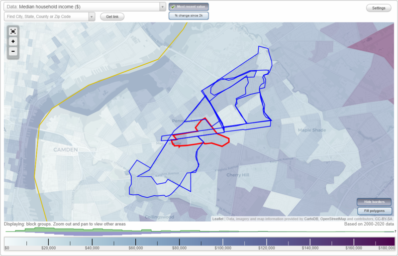
Merchantville, New Jersey Neighborhood Map - Income, House Prices, Occupations, Boundaries
Settings
X

- City boundary
- Neighborhood boundaries
Business Search - 14 Million verified businesses
Neighborhoods:
Bloomfield, Collins Tract, Cooper, East Pennsausken, Iron Rock, Jordantown, Meadowbrook, Village, WellwoodBloomfield neighborhood in Merchantville statistics: (Find on map)
Area: 1.402 square miles
Population: 10,389
Population density:
Median household income in 2021:
Median rent in in 2021:
Male vs Females
Median age
Housing prices:
Average estimated value of detached houses in 2021 (63.7% of all units):
Average estimated value of townhouses or other attached units in 2021 (14.4% of all units):
Average estimated value of housing units in 2-unit structures in 2021 (14.2% of all units):
Most popular occupations of males: sales and office occupations (20.3%); material moving occupations (14.6%); service occupations (13.8%); production occupations (8.9%); construction, extraction, and maintenance occupations (8.8%); transportation occupations (7.0%); management occupations (except farmers) (5.7%)
Most popular occupations of females: sales and office occupations (29.7%); service occupations (17.1%); business and financial operations occupations (11.8%); management occupations (except farmers) (7.8%); healthcare practitioners and technical occupations (7.0%); material moving occupations (5.4%); education, training, and library occupations (5.0%)
Highways in this neighborhood: Kaighns Ave (State Rte 38); S Crescent Blvd (US Hwy 130); State Rte 70.
Roads and streets: Marlton Pike; Browning Rd; Lexington Ave; Roosevelt Ave; Garfield Ave; Schleicher Ave (Homestead Ave); Clayton Ave; Garden Ave; Elvena Ave; Woodbine Ave; Witherspoon Ave; Laurel Ave; Mansion Blvd; Terrace Ave; Baker Ave; Beacon Ave; Volan St; Walton Ave; Royal Ave; Russell Ave; Myrtle Ave; Cuthbert Blvd; Magnolia Ave; Burwood Ave; Springfield Ave; King Ave; Frosthoffer Ave; Wisteria Ave; Drexel Ave; Henwood Ave; Oak Ter; Victoria Ave; Sinkinson Ave; Halpin Ave; Birch Ave; Holmecrest Rd; Florida Blvd; Edwards Ave; Harding Rd; Plymouth Ave; Caroline Ave; Westwood Ln; Chapel Ave; Orchard Way; Golfview Dr; W End Ave; Gaumer Ave; Peabody Ave; Cynwyd Ave; Poplar Ave; Toms Ave; Lafayette Ave; Henwood Rd; Graham St; Greene Ave; Golfview Ct; Bloomfield Ave; Sherwood Ter; Scovel Ave; Willow Ave; Wisteria St; Front St; Miller Dr; Hamilton Ave; Kelsey Ave; Carmen St; Linden Ave; Stanley St; Hampton Rd; Strand Ave; Roosevelt Ave (S 42nd St); Harris Ave; Teitelman Ave; Columbus Ave; Walton Ct; Whitman Ave.
Other features: Chandlers Run.
Bloomfield neighborhood detailed profile
Area: 1.402 square miles
Population: 10,389
Population density:
| Bloomfield: | 7,412 people per square mile |
| Merchantville: | 6,311 people per square mile |
Median household income in 2021:
| Bloomfield: | $67,650 |
| Merchantville: | $75,568 |
Median rent in in 2021:
| Bloomfield: | $1,032 |
| Merchantville: | $878 |
Male vs Females
| Males: | 5,271 |
| Females: | 5,118 |
Median age
| Males: | 34.8 years |
| Females: | 41.1 years |
Housing prices:
Average estimated value of detached houses in 2021 (63.7% of all units):
| Bloomfield: | $181,671 |
| Merchantville: | $261,926 |
Average estimated value of townhouses or other attached units in 2021 (14.4% of all units):
| This neighborhood: | $160,978 |
| borough: | $156,026 |
Average estimated value of housing units in 2-unit structures in 2021 (14.2% of all units):
| This neighborhood: | $187,516 |
| Merchantville: | $205,508 |
Most popular occupations of males: sales and office occupations (20.3%); material moving occupations (14.6%); service occupations (13.8%); production occupations (8.9%); construction, extraction, and maintenance occupations (8.8%); transportation occupations (7.0%); management occupations (except farmers) (5.7%)
Most popular occupations of females: sales and office occupations (29.7%); service occupations (17.1%); business and financial operations occupations (11.8%); management occupations (except farmers) (7.8%); healthcare practitioners and technical occupations (7.0%); material moving occupations (5.4%); education, training, and library occupations (5.0%)
Highways in this neighborhood: Kaighns Ave (State Rte 38); S Crescent Blvd (US Hwy 130); State Rte 70.
Roads and streets: Marlton Pike; Browning Rd; Lexington Ave; Roosevelt Ave; Garfield Ave; Schleicher Ave (Homestead Ave); Clayton Ave; Garden Ave; Elvena Ave; Woodbine Ave; Witherspoon Ave; Laurel Ave; Mansion Blvd; Terrace Ave; Baker Ave; Beacon Ave; Volan St; Walton Ave; Royal Ave; Russell Ave; Myrtle Ave; Cuthbert Blvd; Magnolia Ave; Burwood Ave; Springfield Ave; King Ave; Frosthoffer Ave; Wisteria Ave; Drexel Ave; Henwood Ave; Oak Ter; Victoria Ave; Sinkinson Ave; Halpin Ave; Birch Ave; Holmecrest Rd; Florida Blvd; Edwards Ave; Harding Rd; Plymouth Ave; Caroline Ave; Westwood Ln; Chapel Ave; Orchard Way; Golfview Dr; W End Ave; Gaumer Ave; Peabody Ave; Cynwyd Ave; Poplar Ave; Toms Ave; Lafayette Ave; Henwood Rd; Graham St; Greene Ave; Golfview Ct; Bloomfield Ave; Sherwood Ter; Scovel Ave; Willow Ave; Wisteria St; Front St; Miller Dr; Hamilton Ave; Kelsey Ave; Carmen St; Linden Ave; Stanley St; Hampton Rd; Strand Ave; Roosevelt Ave (S 42nd St); Harris Ave; Teitelman Ave; Columbus Ave; Walton Ct; Whitman Ave.
Other features: Chandlers Run.
Bloomfield neighborhood detailed profile
Collins Tract neighborhood in Merchantville statistics: (Find on map)
Area: 0.366 square miles
Population: 4,105
Population density:
Median household income in 2021:
Median rent in in 2021:
Male vs Females
Median age
Housing prices:
Average estimated value of detached houses in 2021 (75.1% of all units):
Average estimated value of townhouses or other attached units in 2021 (19.3% of all units):
Average estimated value of housing units in 2-unit structures in 2021 (11.4% of all units):
Most popular occupations of males: sales and office occupations (24.0%); construction, extraction, and maintenance occupations (22.8%); material moving occupations (13.8%); business and financial operations occupations (9.1%); service occupations (8.2%); management occupations (except farmers) (6.7%); healthcare practitioners and technical occupations (3.7%)
Most popular occupations of females: sales and office occupations (29.6%); service occupations (21.4%); business and financial operations occupations (10.8%); healthcare practitioners and technical occupations (8.6%); education, training, and library occupations (6.1%); management occupations (except farmers) (5.5%); life, physical, and social science occupations (4.9%)
Highways in this neighborhood: US Hwy 130 (N Crescent Blvd).
Roads and streets: Rogers Ave; Irving Ave; Harvey Ave; Bethel Ave; Norwood Ave; Cove Rd; Grant Ave; Sherman Ave; Collins Ave; Madison Ave; Wyndam Rd; Githens Ave; Walnut Ave; Cedar Ave; Park Ave; Penn St; Denby Ave; N Centre St; Horner Ave; Jackson Ave; Clement Ave; Hillcrest Ave.
Railroad features: Penn Central RR.
Collins Tract neighborhood detailed profile
Area: 0.366 square miles
Population: 4,105
Population density:
| Collins Tract: | 11,223 people per square mile |
| Merchantville: | 6,311 people per square mile |
Median household income in 2021:
| Collins Tract: | $79,099 |
| Merchantville: | $75,568 |
Median rent in in 2021:
| Collins Tract: | $1,086 |
| Merchantville: | $878 |
Male vs Females
| Males: | 1,925 |
| Females: | 2,179 |
Median age
| Males: | 38.0 years |
| Females: | 40.3 years |
Housing prices:
Average estimated value of detached houses in 2021 (75.1% of all units):
| Collins Tract: | $180,586 |
| Merchantville: | $261,926 |
Average estimated value of townhouses or other attached units in 2021 (19.3% of all units):
| This neighborhood: | $161,304 |
| borough: | $156,026 |
Average estimated value of housing units in 2-unit structures in 2021 (11.4% of all units):
| This neighborhood: | $205,508 |
| Merchantville: | $205,508 |
Most popular occupations of males: sales and office occupations (24.0%); construction, extraction, and maintenance occupations (22.8%); material moving occupations (13.8%); business and financial operations occupations (9.1%); service occupations (8.2%); management occupations (except farmers) (6.7%); healthcare practitioners and technical occupations (3.7%)
Most popular occupations of females: sales and office occupations (29.6%); service occupations (21.4%); business and financial operations occupations (10.8%); healthcare practitioners and technical occupations (8.6%); education, training, and library occupations (6.1%); management occupations (except farmers) (5.5%); life, physical, and social science occupations (4.9%)
Highways in this neighborhood: US Hwy 130 (N Crescent Blvd).
Roads and streets: Rogers Ave; Irving Ave; Harvey Ave; Bethel Ave; Norwood Ave; Cove Rd; Grant Ave; Sherman Ave; Collins Ave; Madison Ave; Wyndam Rd; Githens Ave; Walnut Ave; Cedar Ave; Park Ave; Penn St; Denby Ave; N Centre St; Horner Ave; Jackson Ave; Clement Ave; Hillcrest Ave.
Railroad features: Penn Central RR.
Collins Tract neighborhood detailed profile
Cooper neighborhood in Merchantville statistics: (Find on map)
Area: 2.242 square miles
Population: 14,585
Population density:
Median household income in 2021:
Median rent in in 2021:
Male vs Females
Median age
Housing prices:
Average estimated value of detached houses in 2021 (60.5% of all units):
Average estimated value of townhouses or other attached units in 2021 (17.5% of all units):
Average estimated value of housing units in 2-unit structures in 2021 (15.9% of all units):
Average estimated '21 value of housing units in 5-or-more-unit structures (16.7% of all units):
Most popular occupations of males: sales and office occupations (20.6%); service occupations (14.3%); material moving occupations (13.6%); construction, extraction, and maintenance occupations (8.8%); production occupations (8.1%); transportation occupations (7.4%); management occupations (except farmers) (6.6%)
Most popular occupations of females: sales and office occupations (27.8%); service occupations (17.4%); business and financial operations occupations (11.0%); healthcare practitioners and technical occupations (8.1%); management occupations (except farmers) (6.6%); material moving occupations (6.2%); education, training, and library occupations (5.6%)
Highways in this neighborhood: US Hwy 30 (US Hwy 130, S Crescent Blvd); US Hwy 30 (Admiral Wilson Blvd); N Crescent Blvd (US Hwy 130); US Hwy 30; State Rte 70.
Roads and streets: Dr Charles Brimm Blvd (Kaighns Ave); Marlton Pike; N Park Dr; Browning Rd; Lexington Ave; Central Hwy; Roosevelt Ave; W Chestnut Ave; Garfield Ave; W Maple Ave; Schleicher Ave (Homestead Ave); Garden Ave; Federal Ovp St; Elvena Ave; Clayton Ave; Woodbine Ave; Witherspoon Ave; Laurel Ave; Mansion Blvd; Terrace Ave; Baker Ave; Beacon Ave; Volan St; Walton Ave; Springfield Ave; Royal Ave; Russell Ave; Myrtle Ave; Airport Hwy; Burwood Ave; King Ave; Frosthoffer Ave; E Maple Ave; Magnolia Ave; Drexel Ave; Waldorf Ave; Maple Ave; Harris Ave; Wisteria Ave; Lee Ave; McClellan Ave; Henwood Ave; Earle St; Marlton Ave (Marlton Pike); Oak Ter; Victoria Ave; Poplar Ave; Sinkinson Ave; W End Ave; Halpin Ave; Birch Ave; Holmecrest Rd; Cuthbert Blvd; Highland Ave; Florida Blvd; Edwards Ave; Harding Rd; Rudderow Ave; Plymouth Ave; Chandlers Ave; Caroline Ave; Westwood Ln; Chapel Ave; Orchard Way; Golfview Dr; Morris St; Colonial Hwy; Gaumer Ave; Peabody Ave; Cynwyd Ave; Roosevelt Ave (S 42nd St); Woodland Ave; Linden Ave; Rosemont Ave; Hamilton Ave; Toms Ave; E Park Ave; Lafayette Ave; Whitman Ave; Henwood Rd; E Chestnut Ave; S Cove Rd; Graham St; Clark Ave; Willgoos Ave; N 43rd St; Greene Ave; Golfview Ct; Bloomfield Ave; Sherwood Ter; Scovel Ave; Airport Highway Ln; S Center St (S Centre St); W Park Ave; Fithian Ave; Teitelman Ave; Strand Ave; Willow Ave; Franklin Ave; Euclid Ave; Clinton Ave; Clifton Ave; Alexander Ave; Wisteria St; Bethel Ave; Front St; Miller Dr; N 41st St; Kelsey Ave; Carmen St; Stanley St; Crump Ln (Krump Aly); Curtis Ave; Colonial Ln; Columbus Ave; Walton Ct; N 42nd St; 41st St; Federal St; Dr Charles Brimm Blvd.
Railroad features: Penn Central RR.
Other features: Chandlers Run.
Cooper neighborhood detailed profile
Area: 2.242 square miles
Population: 14,585
Population density:
| Cooper: | 6,504 people per square mile |
| Merchantville: | 6,311 people per square mile |
Median household income in 2021:
| Cooper: | $83,143 |
| Merchantville: | $75,568 |
Median rent in in 2021:
| Cooper: | $1,233 |
| Merchantville: | $878 |
Male vs Females
| Males: | 7,246 |
| Females: | 7,339 |
Median age
| Males: | 43.9 years |
| Females: | 49.4 years |
Housing prices:
Average estimated value of detached houses in 2021 (60.5% of all units):
| Cooper: | $183,902 |
| Merchantville: | $261,926 |
Average estimated value of townhouses or other attached units in 2021 (17.5% of all units):
| This neighborhood: | $160,971 |
| borough: | $156,026 |
Average estimated value of housing units in 2-unit structures in 2021 (15.9% of all units):
| This neighborhood: | $188,211 |
| Merchantville: | $205,508 |
Average estimated '21 value of housing units in 5-or-more-unit structures (16.7% of all units):
| Cooper: | $183,509 |
| New Jersey: | $343,430 |
Most popular occupations of males: sales and office occupations (20.6%); service occupations (14.3%); material moving occupations (13.6%); construction, extraction, and maintenance occupations (8.8%); production occupations (8.1%); transportation occupations (7.4%); management occupations (except farmers) (6.6%)
Most popular occupations of females: sales and office occupations (27.8%); service occupations (17.4%); business and financial operations occupations (11.0%); healthcare practitioners and technical occupations (8.1%); management occupations (except farmers) (6.6%); material moving occupations (6.2%); education, training, and library occupations (5.6%)
Highways in this neighborhood: US Hwy 30 (US Hwy 130, S Crescent Blvd); US Hwy 30 (Admiral Wilson Blvd); N Crescent Blvd (US Hwy 130); US Hwy 30; State Rte 70.
Roads and streets: Dr Charles Brimm Blvd (Kaighns Ave); Marlton Pike; N Park Dr; Browning Rd; Lexington Ave; Central Hwy; Roosevelt Ave; W Chestnut Ave; Garfield Ave; W Maple Ave; Schleicher Ave (Homestead Ave); Garden Ave; Federal Ovp St; Elvena Ave; Clayton Ave; Woodbine Ave; Witherspoon Ave; Laurel Ave; Mansion Blvd; Terrace Ave; Baker Ave; Beacon Ave; Volan St; Walton Ave; Springfield Ave; Royal Ave; Russell Ave; Myrtle Ave; Airport Hwy; Burwood Ave; King Ave; Frosthoffer Ave; E Maple Ave; Magnolia Ave; Drexel Ave; Waldorf Ave; Maple Ave; Harris Ave; Wisteria Ave; Lee Ave; McClellan Ave; Henwood Ave; Earle St; Marlton Ave (Marlton Pike); Oak Ter; Victoria Ave; Poplar Ave; Sinkinson Ave; W End Ave; Halpin Ave; Birch Ave; Holmecrest Rd; Cuthbert Blvd; Highland Ave; Florida Blvd; Edwards Ave; Harding Rd; Rudderow Ave; Plymouth Ave; Chandlers Ave; Caroline Ave; Westwood Ln; Chapel Ave; Orchard Way; Golfview Dr; Morris St; Colonial Hwy; Gaumer Ave; Peabody Ave; Cynwyd Ave; Roosevelt Ave (S 42nd St); Woodland Ave; Linden Ave; Rosemont Ave; Hamilton Ave; Toms Ave; E Park Ave; Lafayette Ave; Whitman Ave; Henwood Rd; E Chestnut Ave; S Cove Rd; Graham St; Clark Ave; Willgoos Ave; N 43rd St; Greene Ave; Golfview Ct; Bloomfield Ave; Sherwood Ter; Scovel Ave; Airport Highway Ln; S Center St (S Centre St); W Park Ave; Fithian Ave; Teitelman Ave; Strand Ave; Willow Ave; Franklin Ave; Euclid Ave; Clinton Ave; Clifton Ave; Alexander Ave; Wisteria St; Bethel Ave; Front St; Miller Dr; N 41st St; Kelsey Ave; Carmen St; Stanley St; Crump Ln (Krump Aly); Curtis Ave; Colonial Ln; Columbus Ave; Walton Ct; N 42nd St; 41st St; Federal St; Dr Charles Brimm Blvd.
Railroad features: Penn Central RR.
Other features: Chandlers Run.
Cooper neighborhood detailed profile
East Pennsausken neighborhood in Merchantville statistics: (Find on map)
Area: 1.913 square miles
Population: 5,910
Population density:
Median household income in 2021:
Median rent in in 2021:
Male vs Females
Median age
Housing prices:
Average estimated value of detached houses in 2021 (76.2% of all units):
Average estimated value of townhouses or other attached units in 2021 (5.4% of all units):
Average estimated '21 value of housing units in 5-or-more-unit structures (8.5% of all units):
Most popular occupations of males: sales and office occupations (18.0%); production occupations (12.3%); service occupations (11.9%); management occupations (except farmers) (10.9%); transportation occupations (7.6%); healthcare practitioners and technical occupations (7.3%); construction, extraction, and maintenance occupations (7.2%)
Most popular occupations of females: sales and office occupations (28.3%); healthcare practitioners and technical occupations (17.7%); education, training, and library occupations (13.7%); service occupations (12.7%); management occupations (except farmers) (10.0%); business and financial operations occupations (6.7%); material moving occupations (3.1%)
Other features: Pennsauken Creek South Br (Pennsauken Crk S Br).
Highways in this neighborhood: N Crescent Blvd (US Hwy 130); State Rte 90.
Roads and streets: Wyndam Rd; Park Ave; Haddonfield Rd; Corbett Rd; Union Ave; Collins Ave; Grant Ave; Gladwyn Ave; Finlaw Ave; Cooper Ave; Marion Ave; Orchard Ave; Herbert Ave; Stockton Ave; Rogers Ave; Irving Ave; Githens Ave; New Jersey Ave; Powell Ave; Osler Ave; Harvey Ave; Walnut Ave; Cedar Ave; Howard Ave; Greenbrier Rd; New York Ave; Wolf Ave; Baxter Ave; Morton St (Morton Ave); Harrowgate Dr; Crofton Ln; Msgr Fallon Dr; Prince Ave; Wessex Dr; Burning Tree Rd; Palace Ct; Hesson Ln; Burrough Dover Ln; Weymouth Dr; Buckingham Ln; New Hampshire Ln; Pennsylvania Ave; Elm Ave; Delaware Ave; Pettit Ln; Pettit Rd; Fork Landing Rd; Hadley Dr; Colonial Ave; Tauton Dr; Starr Rd; Oakley Dr; New Jersey Ct; Doral Dr; Florence Ave; Smiley Ave; Freeman Ave; St Martins Rd; Fairway Blvd; Foehl Ave; Davies Ave; Manall Ave; Rockafellow Ave; Patterson Ln; Piersanti Dr; Shelley Ln; Githens Ave (School Ln); York Rd; Par Ct; Dickens Dr; Miller Ct; Jackson Ave; Broad St; Connecticut Ave; Maryland Ave; Schoolhouse Ln; Barclay Ave; Bailey Ave; Piersanti Ct; Rhode Island Ct; Wessex Rd; Silver Ave; Iron Rock Ct; Delaware Ct; Connecticut Ct; Oakley Pl; Tarrington Ct; Burning Tree Ct; Pettit Ct; Fenwick Ct; Greensway Walk; Kent Ct; Horseshoe Ct; Wessex Ct; Greenbriar Rd (Greenbrier Rd).
Railroad features: Penn Central RR.
Other features: South Branch Pennsauken Crk; Puchack Run; Pennsauken Creek South Br (Pennsauken Crk S Br).
East Pennsausken neighborhood detailed profile
Area: 1.913 square miles
Population: 5,910
Population density:
| East Pennsausken: | 3,090 people per square mile |
| Merchantville: | 6,311 people per square mile |
Median household income in 2021:
| East Pennsausken: | $91,717 |
| Merchantville: | $75,568 |
Median rent in in 2021:
| East Pennsausken: | $373 |
| Merchantville: | $878 |
Male vs Females
| Males: | 3,072 |
| Females: | 2,837 |
Median age
| Males: | 43.6 years |
| Females: | 47.5 years |
Housing prices:
Average estimated value of detached houses in 2021 (76.2% of all units):
| East Pennsausken: | $215,706 |
| Merchantville: | $261,926 |
Average estimated value of townhouses or other attached units in 2021 (5.4% of all units):
| This neighborhood: | $606,547 |
| borough: | $156,026 |
Average estimated '21 value of housing units in 5-or-more-unit structures (8.5% of all units):
| East Pennsausken: | $156,454 |
| New Jersey: | $343,430 |
Most popular occupations of males: sales and office occupations (18.0%); production occupations (12.3%); service occupations (11.9%); management occupations (except farmers) (10.9%); transportation occupations (7.6%); healthcare practitioners and technical occupations (7.3%); construction, extraction, and maintenance occupations (7.2%)
Most popular occupations of females: sales and office occupations (28.3%); healthcare practitioners and technical occupations (17.7%); education, training, and library occupations (13.7%); service occupations (12.7%); management occupations (except farmers) (10.0%); business and financial operations occupations (6.7%); material moving occupations (3.1%)
Other features: Pennsauken Creek South Br (Pennsauken Crk S Br).
Highways in this neighborhood: N Crescent Blvd (US Hwy 130); State Rte 90.
Roads and streets: Wyndam Rd; Park Ave; Haddonfield Rd; Corbett Rd; Union Ave; Collins Ave; Grant Ave; Gladwyn Ave; Finlaw Ave; Cooper Ave; Marion Ave; Orchard Ave; Herbert Ave; Stockton Ave; Rogers Ave; Irving Ave; Githens Ave; New Jersey Ave; Powell Ave; Osler Ave; Harvey Ave; Walnut Ave; Cedar Ave; Howard Ave; Greenbrier Rd; New York Ave; Wolf Ave; Baxter Ave; Morton St (Morton Ave); Harrowgate Dr; Crofton Ln; Msgr Fallon Dr; Prince Ave; Wessex Dr; Burning Tree Rd; Palace Ct; Hesson Ln; Burrough Dover Ln; Weymouth Dr; Buckingham Ln; New Hampshire Ln; Pennsylvania Ave; Elm Ave; Delaware Ave; Pettit Ln; Pettit Rd; Fork Landing Rd; Hadley Dr; Colonial Ave; Tauton Dr; Starr Rd; Oakley Dr; New Jersey Ct; Doral Dr; Florence Ave; Smiley Ave; Freeman Ave; St Martins Rd; Fairway Blvd; Foehl Ave; Davies Ave; Manall Ave; Rockafellow Ave; Patterson Ln; Piersanti Dr; Shelley Ln; Githens Ave (School Ln); York Rd; Par Ct; Dickens Dr; Miller Ct; Jackson Ave; Broad St; Connecticut Ave; Maryland Ave; Schoolhouse Ln; Barclay Ave; Bailey Ave; Piersanti Ct; Rhode Island Ct; Wessex Rd; Silver Ave; Iron Rock Ct; Delaware Ct; Connecticut Ct; Oakley Pl; Tarrington Ct; Burning Tree Ct; Pettit Ct; Fenwick Ct; Greensway Walk; Kent Ct; Horseshoe Ct; Wessex Ct; Greenbriar Rd (Greenbrier Rd).
Railroad features: Penn Central RR.
Other features: South Branch Pennsauken Crk; Puchack Run; Pennsauken Creek South Br (Pennsauken Crk S Br).
East Pennsausken neighborhood detailed profile
Iron Rock neighborhood in Merchantville statistics: (Find on map)
Area: 0.529 square miles
Population: 2,287
Population density:
Median household income in 2021:
Median rent in in 2021:
Male vs Females
Median age
Housing prices:
Average estimated value of detached houses in 2021 (89.8% of all units):
Average estimated value of townhouses or other attached units in 2021 (4.7% of all units):
Average estimated '21 value of housing units in 5-or-more-unit structures (6.1% of all units):
Most popular occupations of males: production occupations (21.4%); sales and office occupations (18.5%); service occupations (12.8%); management occupations (except farmers) (8.1%); computer and mathematical occupations (6.4%); community and social services occupations (4.8%); healthcare practitioners and technical occupations (4.6%)
Most popular occupations of females: sales and office occupations (37.1%); education, training, and library occupations (16.4%); healthcare practitioners and technical occupations (13.2%); business and financial operations occupations (9.2%); management occupations (except farmers) (8.9%); service occupations (6.9%); architecture and engineering occupations (4.8%)
Other features: Pennsauken Creek South Br (Pennsauken Crk S Br).
Roads and streets: Park Ave; New Jersey Ave; Haddonfield Rd; Osler Ave; Herbert Ave; Stockton Ave; Orchard Ave; New York Ave; Palace Ct; Buckingham Ln; Delaware Ave; New Jersey Ct; Smiley Ave; St Martins Rd; Fairway Blvd; Marion Ave; Par Ct; Connecticut Ave; Maryland Ave; Schoolhouse Ln; Silver Ave; Iron Rock Ct; Delaware Ct; Connecticut Ct; New Hampshire Ln; Greensway Walk.
Railroad features: Penn Central RR.
Other features: South Branch Pennsauken Crk; Pennsauken Creek South Br (Pennsauken Crk S Br).
Iron Rock neighborhood detailed profile
Area: 0.529 square miles
Population: 2,287
Population density:
| Iron Rock: | 4,323 people per square mile |
| Merchantville: | 6,311 people per square mile |
Median household income in 2021:
| Iron Rock: | $91,216 |
| Merchantville: | $75,568 |
Median rent in in 2021:
| Iron Rock: | $336 |
| Merchantville: | $878 |
Male vs Females
| Males: | 1,225 |
| Females: | 1,062 |
Median age
| Males: | 44.5 years |
| Females: | 51.6 years |
Housing prices:
Average estimated value of detached houses in 2021 (89.8% of all units):
| Iron Rock: | $62,330 |
| Merchantville: | $261,926 |
Average estimated value of townhouses or other attached units in 2021 (4.7% of all units):
| This neighborhood: | $264,143 |
| borough: | $156,026 |
Average estimated '21 value of housing units in 5-or-more-unit structures (6.1% of all units):
| Iron Rock: | $157,222 |
| New Jersey: | $343,430 |
Most popular occupations of males: production occupations (21.4%); sales and office occupations (18.5%); service occupations (12.8%); management occupations (except farmers) (8.1%); computer and mathematical occupations (6.4%); community and social services occupations (4.8%); healthcare practitioners and technical occupations (4.6%)
Most popular occupations of females: sales and office occupations (37.1%); education, training, and library occupations (16.4%); healthcare practitioners and technical occupations (13.2%); business and financial operations occupations (9.2%); management occupations (except farmers) (8.9%); service occupations (6.9%); architecture and engineering occupations (4.8%)
Other features: Pennsauken Creek South Br (Pennsauken Crk S Br).
Roads and streets: Park Ave; New Jersey Ave; Haddonfield Rd; Osler Ave; Herbert Ave; Stockton Ave; Orchard Ave; New York Ave; Palace Ct; Buckingham Ln; Delaware Ave; New Jersey Ct; Smiley Ave; St Martins Rd; Fairway Blvd; Marion Ave; Par Ct; Connecticut Ave; Maryland Ave; Schoolhouse Ln; Silver Ave; Iron Rock Ct; Delaware Ct; Connecticut Ct; New Hampshire Ln; Greensway Walk.
Railroad features: Penn Central RR.
Other features: South Branch Pennsauken Crk; Pennsauken Creek South Br (Pennsauken Crk S Br).
Iron Rock neighborhood detailed profile
Jordantown neighborhood in Merchantville statistics: (Find on map)
Area: 0.778 square miles
Population: 2,724
Population density:
Median household income in 2021:
Median rent in in 2021:
Male vs Females
Median age
Housing prices:
Average estimated value of detached houses in 2021 (61.3% of all units):
Average estimated value of townhouses or other attached units in 2021 (4.8% of all units):
Average estimated '21 value of housing units in 5-or-more-unit structures (13.0% of all units):
Most popular occupations of males: sales and office occupations (18.2%); construction, extraction, and maintenance occupations (13.0%); service occupations (11.3%); transportation occupations (11.0%); material moving occupations (10.2%); management occupations (except farmers) (9.6%); production occupations (6.6%)
Most popular occupations of females: sales and office occupations (28.3%); healthcare practitioners and technical occupations (16.4%); service occupations (16.4%); management occupations (except farmers) (12.3%); education, training, and library occupations (11.2%); material moving occupations (5.5%); business and financial operations occupations (4.0%)
Roads and streets: Grant Ave; Corbett Rd; Union Ave; Gladwyn Ave; Cooper Ave; Finlaw Ave; Park Ave; Collins Ave; Rogers Ave; Marion Ave; Walnut Ave; Githens Ave; Cedar Ave; Howard Ave; Irving Ave; Wolf Ave; Harrowgate Dr; Crofton Ln; Broad St; Herbert Ave; Wessex Dr; Burning Tree Rd; Stockton Ave; Hesson Ln; Weymouth Dr; Orchard Ave; Collins Ln; Pennsylvania Ave; Elm Ave; Pettit Ln; Pettit Rd; Hadley Dr; Tauton Dr; Harvey Ave; Starr Rd; Oakley Dr; Doral Dr; Foehl Ave; Davies Ave; Manall Ave; Rockafellow Ave; Patterson Ln; Piersanti Dr; Githens Ave (School Ln); Miller Ct; New Hampshire Ln; Piersanti Ct; Rhode Island Ct; Wessex Rd; Oakley Pl; Burning Tree Ct; Pettit Ct; Kent Ct; Wessex Ct.
Railroad features: Penn Central RR.
Other features: Puchack Run; South Branch Pennsauken Crk.
Jordantown neighborhood detailed profile
Area: 0.778 square miles
Population: 2,724
Population density:
| Jordantown: | 3,499 people per square mile |
| Merchantville: | 6,311 people per square mile |
Median household income in 2021:
| Jordantown: | $85,183 |
| Merchantville: | $75,568 |
Median rent in in 2021:
| Jordantown: | $414 |
| Merchantville: | $878 |
Male vs Females
| Males: | 1,394 |
| Females: | 1,329 |
Median age
| Males: | 43.6 years |
| Females: | 47.0 years |
Housing prices:
Average estimated value of detached houses in 2021 (61.3% of all units):
| Jordantown: | $162,684 |
| Merchantville: | $261,926 |
Average estimated value of townhouses or other attached units in 2021 (4.8% of all units):
| This neighborhood: | $160,099 |
| borough: | $156,026 |
Average estimated '21 value of housing units in 5-or-more-unit structures (13.0% of all units):
| Jordantown: | $183,509 |
| New Jersey: | $343,430 |
Most popular occupations of males: sales and office occupations (18.2%); construction, extraction, and maintenance occupations (13.0%); service occupations (11.3%); transportation occupations (11.0%); material moving occupations (10.2%); management occupations (except farmers) (9.6%); production occupations (6.6%)
Most popular occupations of females: sales and office occupations (28.3%); healthcare practitioners and technical occupations (16.4%); service occupations (16.4%); management occupations (except farmers) (12.3%); education, training, and library occupations (11.2%); material moving occupations (5.5%); business and financial operations occupations (4.0%)
Roads and streets: Grant Ave; Corbett Rd; Union Ave; Gladwyn Ave; Cooper Ave; Finlaw Ave; Park Ave; Collins Ave; Rogers Ave; Marion Ave; Walnut Ave; Githens Ave; Cedar Ave; Howard Ave; Irving Ave; Wolf Ave; Harrowgate Dr; Crofton Ln; Broad St; Herbert Ave; Wessex Dr; Burning Tree Rd; Stockton Ave; Hesson Ln; Weymouth Dr; Orchard Ave; Collins Ln; Pennsylvania Ave; Elm Ave; Pettit Ln; Pettit Rd; Hadley Dr; Tauton Dr; Harvey Ave; Starr Rd; Oakley Dr; Doral Dr; Foehl Ave; Davies Ave; Manall Ave; Rockafellow Ave; Patterson Ln; Piersanti Dr; Githens Ave (School Ln); Miller Ct; New Hampshire Ln; Piersanti Ct; Rhode Island Ct; Wessex Rd; Oakley Pl; Burning Tree Ct; Pettit Ct; Kent Ct; Wessex Ct.
Railroad features: Penn Central RR.
Other features: Puchack Run; South Branch Pennsauken Crk.
Jordantown neighborhood detailed profile
Meadowbrook neighborhood in Merchantville statistics: (Find on map)
Area: 0.264 square miles
Population: 477
Population density:
Median household income in 2021:
Median rent in in 2021:
Male vs Females
Median age
Housing prices:
Average estimated value of detached houses in 2021 (89.8% of all units):
Average estimated value of townhouses or other attached units in 2021 (7.9% of all units):
Average estimated '21 value of housing units in 5-or-more-unit structures (4.0% of all units):
Most popular occupations of males: management occupations (except farmers) (19.7%); healthcare practitioners and technical occupations (17.2%); sales and office occupations (15.7%); service occupations (12.8%); transportation occupations (10.0%); computer and mathematical occupations (4.7%); construction, extraction, and maintenance occupations (4.7%)
Most popular occupations of females: healthcare practitioners and technical occupations (28.6%); service occupations (17.0%); education, training, and library occupations (14.0%); sales and office occupations (12.8%); business and financial operations occupations (7.2%); management occupations (except farmers) (5.5%); computer and mathematical occupations (3.6%)
Highways in this neighborhood: US Hwy 130 (N Crescent Blvd, Westfield Camden Tpke); State Rte 90.
Roads and streets: Wyndam Rd; Greenbrier Rd; Union Ave; Baxter Ave; Msgr Fallon Dr; Corbett Rd; Finlaw Ave; Florence Ave; Prince Ave; Powell Ave; Shelley Ln; York Rd; Dickens Dr; Jackson Ave; Haddonfield Rd; Tarrington Ct; Fenwick Ct; Horseshoe Ct; Greenbriar Rd (Greenbrier Rd).
Other features: Puchack Run.
Meadowbrook neighborhood detailed profile
Area: 0.264 square miles
Population: 477
Population density:
| Meadowbrook: | 1,808 people per square mile |
| Merchantville: | 6,311 people per square mile |
Median household income in 2021:
| Meadowbrook: | $102,456 |
| Merchantville: | $75,568 |
Median rent in in 2021:
| Meadowbrook: | $1,587 |
| Merchantville: | $878 |
Male vs Females
| Males: | 236 |
| Females: | 240 |
Median age
| Males: | 47.6 years |
| Females: | 51.1 years |
Housing prices:
Average estimated value of detached houses in 2021 (89.8% of all units):
| Meadowbrook: | $6,487,665 |
| Merchantville: | $261,926 |
Average estimated value of townhouses or other attached units in 2021 (7.9% of all units):
| This neighborhood: | $470,400 |
| borough: | $156,026 |
Average estimated '21 value of housing units in 5-or-more-unit structures (4.0% of all units):
| Meadowbrook: | $157,222 |
| New Jersey: | $343,430 |
Most popular occupations of males: management occupations (except farmers) (19.7%); healthcare practitioners and technical occupations (17.2%); sales and office occupations (15.7%); service occupations (12.8%); transportation occupations (10.0%); computer and mathematical occupations (4.7%); construction, extraction, and maintenance occupations (4.7%)
Most popular occupations of females: healthcare practitioners and technical occupations (28.6%); service occupations (17.0%); education, training, and library occupations (14.0%); sales and office occupations (12.8%); business and financial operations occupations (7.2%); management occupations (except farmers) (5.5%); computer and mathematical occupations (3.6%)
Highways in this neighborhood: US Hwy 130 (N Crescent Blvd, Westfield Camden Tpke); State Rte 90.
Roads and streets: Wyndam Rd; Greenbrier Rd; Union Ave; Baxter Ave; Msgr Fallon Dr; Corbett Rd; Finlaw Ave; Florence Ave; Prince Ave; Powell Ave; Shelley Ln; York Rd; Dickens Dr; Jackson Ave; Haddonfield Rd; Tarrington Ct; Fenwick Ct; Horseshoe Ct; Greenbriar Rd (Greenbrier Rd).
Other features: Puchack Run.
Meadowbrook neighborhood detailed profile
Village neighborhood in Merchantville statistics: (Find on map)
Area: 2.558 square miles
Population: 8,093
Population density:
Median household income in 2021:
Median rent in in 2021:
Male vs Females
Median age
Housing prices:
Average estimated value of detached houses in 2021 (71.5% of all units):
Average estimated value of townhouses or other attached units in 2021 (10.3% of all units):
Average estimated '21 value of housing units in 5-or-more-unit structures (9.5% of all units):
Most popular occupations of males: sales and office occupations (20.9%); service occupations (14.2%); production occupations (10.4%); management occupations (except farmers) (10.2%); construction, extraction, and maintenance occupations (8.5%); transportation occupations (7.4%); material moving occupations (5.9%)
Most popular occupations of females: sales and office occupations (32.7%); healthcare practitioners and technical occupations (15.6%); service occupations (13.2%); education, training, and library occupations (12.9%); management occupations (except farmers) (8.7%); business and financial operations occupations (6.4%); material moving occupations (2.3%)
Other features: Pennsauken Creek South Br (Pennsauken Crk S Br).
Highways in this neighborhood: N Crescent Blvd (US Hwy 130); State Rte 90; Palmyra Bridge Rd (Palmyra Bridge Blvd, State Rte 73).
Roads and streets: Haddonfield Rd; Wyndam Rd; Union Ave; Park Ave; Corbett Rd; Collins Ave; Grant Ave; Rudderow Ave; Gladwyn Ave; Finlaw Ave; Cooper Ave; Maple Ave; New Jersey Ave; Marion Ave; Orchard Ave; Herbert Ave; Stockton Ave; Rogers Ave; Irving Ave; Githens Ave; Collins Ln; Pennsauken Hwy; Powell Ave; Bryn Mawr Ave; Osler Ave; Westfield Ave; Harvey Ave; Walnut Ave; New York Ave; Cedar Ave; Commerce Hwy; Howard Ave; Greenbrier Rd; Delaware Ave; Wolf Ave; Baxter Ave; Morton St (Morton Ave); Harrowgate Dr; Crofton Ln; Elm Ave; Broad St; Msgr Fallon Dr; Prince Ave; Wessex Dr; Burning Tree Rd; Palace Ct; Maryland Ave; Hesson Ln; Burrough Dover Ln; Weymouth Dr; Buckingham Ln; New Hampshire Ln; Pennsylvania Ave; Pettit Ln; Pettit Rd; Fork Landing Rd; Hadley Dr; Colonial Ave; Tauton Dr; Starr Rd; Oakley Dr; Rogers Blvd; New Jersey Ct; Doral Dr; Florence Ave; Manor Ave; Smiley Ave; Freeman Ave; St Martins Rd; Fairway Blvd; Foehl Ave; Davies Ave; Manall Ave; Rockafellow Ave; Patterson Ln; Piersanti Dr; Shelley Ln; Githens Ave (School Ln); York Rd; Par Ct; Dickens Dr; Miller Ct; Jackson Ave; Connecticut Ave; Howard St; Schoolhouse Ln; Barclay Ave; Bailey Ave; Industrial Hwy (John Tipton Blvd); Volney Ave; Avignon Way; Willis Ave; Burling Ave; Piersanti Ct; Rhode Island Ct; Wessex Rd; Silver Ave; Iron Rock Ct; Delaware Ct; Connecticut Ct; Oakley Pl; Tarrington Ct; Burning Tree Ct; Pettit Ct; Fenwick Ct; Greensway Walk; Kent Ct; Horseshoe Ct; Wessex Ct; Greenbriar Rd (Greenbrier Rd).
Railroad features: Penn Central RR.
Other features: South Branch Pennsauken Crk; Puchack Run; Pennsauken Crk S Br (Pennsauken Creek South Br).
Village neighborhood detailed profile
Area: 2.558 square miles
Population: 8,093
Population density:
| Village: | 3,163 people per square mile |
| Merchantville: | 6,311 people per square mile |
Median household income in 2021:
| Village: | $91,450 |
| Merchantville: | $75,568 |
Median rent in in 2021:
| Village: | $495 |
| Merchantville: | $878 |
Male vs Females
| Males: | 4,140 |
| Females: | 3,952 |
Median age
| Males: | 43.6 years |
| Females: | 47.4 years |
Housing prices:
Average estimated value of detached houses in 2021 (71.5% of all units):
| Village: | $166,435 |
| Merchantville: | $261,926 |
Average estimated value of townhouses or other attached units in 2021 (10.3% of all units):
| This neighborhood: | $160,099 |
| borough: | $156,026 |
Average estimated '21 value of housing units in 5-or-more-unit structures (9.5% of all units):
| Village: | $183,509 |
| New Jersey: | $343,430 |
Most popular occupations of males: sales and office occupations (20.9%); service occupations (14.2%); production occupations (10.4%); management occupations (except farmers) (10.2%); construction, extraction, and maintenance occupations (8.5%); transportation occupations (7.4%); material moving occupations (5.9%)
Most popular occupations of females: sales and office occupations (32.7%); healthcare practitioners and technical occupations (15.6%); service occupations (13.2%); education, training, and library occupations (12.9%); management occupations (except farmers) (8.7%); business and financial operations occupations (6.4%); material moving occupations (2.3%)
Other features: Pennsauken Creek South Br (Pennsauken Crk S Br).
Highways in this neighborhood: N Crescent Blvd (US Hwy 130); State Rte 90; Palmyra Bridge Rd (Palmyra Bridge Blvd, State Rte 73).
Roads and streets: Haddonfield Rd; Wyndam Rd; Union Ave; Park Ave; Corbett Rd; Collins Ave; Grant Ave; Rudderow Ave; Gladwyn Ave; Finlaw Ave; Cooper Ave; Maple Ave; New Jersey Ave; Marion Ave; Orchard Ave; Herbert Ave; Stockton Ave; Rogers Ave; Irving Ave; Githens Ave; Collins Ln; Pennsauken Hwy; Powell Ave; Bryn Mawr Ave; Osler Ave; Westfield Ave; Harvey Ave; Walnut Ave; New York Ave; Cedar Ave; Commerce Hwy; Howard Ave; Greenbrier Rd; Delaware Ave; Wolf Ave; Baxter Ave; Morton St (Morton Ave); Harrowgate Dr; Crofton Ln; Elm Ave; Broad St; Msgr Fallon Dr; Prince Ave; Wessex Dr; Burning Tree Rd; Palace Ct; Maryland Ave; Hesson Ln; Burrough Dover Ln; Weymouth Dr; Buckingham Ln; New Hampshire Ln; Pennsylvania Ave; Pettit Ln; Pettit Rd; Fork Landing Rd; Hadley Dr; Colonial Ave; Tauton Dr; Starr Rd; Oakley Dr; Rogers Blvd; New Jersey Ct; Doral Dr; Florence Ave; Manor Ave; Smiley Ave; Freeman Ave; St Martins Rd; Fairway Blvd; Foehl Ave; Davies Ave; Manall Ave; Rockafellow Ave; Patterson Ln; Piersanti Dr; Shelley Ln; Githens Ave (School Ln); York Rd; Par Ct; Dickens Dr; Miller Ct; Jackson Ave; Connecticut Ave; Howard St; Schoolhouse Ln; Barclay Ave; Bailey Ave; Industrial Hwy (John Tipton Blvd); Volney Ave; Avignon Way; Willis Ave; Burling Ave; Piersanti Ct; Rhode Island Ct; Wessex Rd; Silver Ave; Iron Rock Ct; Delaware Ct; Connecticut Ct; Oakley Pl; Tarrington Ct; Burning Tree Ct; Pettit Ct; Fenwick Ct; Greensway Walk; Kent Ct; Horseshoe Ct; Wessex Ct; Greenbriar Rd (Greenbrier Rd).
Railroad features: Penn Central RR.
Other features: South Branch Pennsauken Crk; Puchack Run; Pennsauken Crk S Br (Pennsauken Creek South Br).
Village neighborhood detailed profile
Wellwood neighborhood in Merchantville statistics: (Find on map)
Area: 0.889 square miles
Population: 7,509
Population density:
Median household income in 2021:
Median rent in in 2021:
Male vs Females
Median age
Housing prices:
Average estimated value of detached houses in 2021 (63.6% of all units):
Average estimated value of townhouses or other attached units in 2021 (16.3% of all units):
Average estimated value of housing units in 2-unit structures in 2021 (15.4% of all units):
Average estimated '21 value of housing units in 5-or-more-unit structures (20.3% of all units):
Most popular occupations of males: sales and office occupations (22.0%); construction, extraction, and maintenance occupations (17.5%); material moving occupations (12.7%); service occupations (11.3%); business and financial operations occupations (9.5%); management occupations (except farmers) (8.1%); education, training, and library occupations (4.5%)
Most popular occupations of females: sales and office occupations (25.5%); service occupations (19.2%); business and financial operations occupations (10.8%); healthcare practitioners and technical occupations (9.9%); management occupations (except farmers) (6.6%); education, training, and library occupations (6.0%); life, physical, and social science occupations (4.3%)
Highways in this neighborhood: N Crescent Blvd (US Hwy 130).
Roads and streets: W Chestnut Ave; Rogers Ave; Bethel Ave; E Chestnut Ave; W Maple Ave; Irving Ave; Norwood Ave; Harvey Ave; Cove Rd; Cedar Ave; Walnut Ave; Grant Ave; E Maple Ave; Whitman Ter; Sherman Ave; Maple Ave; Horner Ave; Collins Ave; Madison Ave; Wyndam Rd; Penn St; Githens Ave; Park Ave; Browning Rd; Merchantville Ave; E Park Ave; N Chestnut Ave; Rudderow Ave; Gilmore Ave; E Walnut Ave; N Centre St (N Center St); Denby Ave; Springfield Ave; Federal Ovp St; W Walnut Ave; Lexington Ave; N Centre St; E Cedar Ave; Chestnut Ave; 49th St (Linden Ave); S Cove Rd; W Cedar Ave; N 43rd St; 48th St; Jackson Ave; S Center St (S Centre St); Morris St; Marion Ave; W Park Ave; Fithian Ave; 47th St; Franklin Ave; Euclid Ave; Linden Ave; Clinton Ave; Clifton Ave; Alexander Ave; E Hollywood Cir; Leslie Ave; Clement Ave; Crump Ln (Krump Aly); Curtis Ave; W Hollywood Cir; Poplar Ave; Rockland Ct; N 42nd St; Hillcrest Ave; Federal St.
Railroad features: Penn Central RR.
Wellwood neighborhood detailed profile
Area: 0.889 square miles
Population: 7,509
Population density:
| Wellwood: | 8,448 people per square mile |
| Merchantville: | 6,311 people per square mile |
Median household income in 2021:
| Wellwood: | $79,847 |
| Merchantville: | $75,568 |
Median rent in in 2021:
| Wellwood: | $973 |
| Merchantville: | $878 |
Male vs Females
| Males: | 3,543 |
| Females: | 3,965 |
Median age
| Males: | 34.9 years |
| Females: | 39.6 years |
Housing prices:
Average estimated value of detached houses in 2021 (63.6% of all units):
| Wellwood: | $180,592 |
| Merchantville: | $261,926 |
Average estimated value of townhouses or other attached units in 2021 (16.3% of all units):
| This neighborhood: | $161,262 |
| borough: | $156,026 |
Average estimated value of housing units in 2-unit structures in 2021 (15.4% of all units):
| This neighborhood: | $205,508 |
| Merchantville: | $205,508 |
Average estimated '21 value of housing units in 5-or-more-unit structures (20.3% of all units):
| Wellwood: | $183,509 |
| New Jersey: | $343,430 |
Most popular occupations of males: sales and office occupations (22.0%); construction, extraction, and maintenance occupations (17.5%); material moving occupations (12.7%); service occupations (11.3%); business and financial operations occupations (9.5%); management occupations (except farmers) (8.1%); education, training, and library occupations (4.5%)
Most popular occupations of females: sales and office occupations (25.5%); service occupations (19.2%); business and financial operations occupations (10.8%); healthcare practitioners and technical occupations (9.9%); management occupations (except farmers) (6.6%); education, training, and library occupations (6.0%); life, physical, and social science occupations (4.3%)
Highways in this neighborhood: N Crescent Blvd (US Hwy 130).
Roads and streets: W Chestnut Ave; Rogers Ave; Bethel Ave; E Chestnut Ave; W Maple Ave; Irving Ave; Norwood Ave; Harvey Ave; Cove Rd; Cedar Ave; Walnut Ave; Grant Ave; E Maple Ave; Whitman Ter; Sherman Ave; Maple Ave; Horner Ave; Collins Ave; Madison Ave; Wyndam Rd; Penn St; Githens Ave; Park Ave; Browning Rd; Merchantville Ave; E Park Ave; N Chestnut Ave; Rudderow Ave; Gilmore Ave; E Walnut Ave; N Centre St (N Center St); Denby Ave; Springfield Ave; Federal Ovp St; W Walnut Ave; Lexington Ave; N Centre St; E Cedar Ave; Chestnut Ave; 49th St (Linden Ave); S Cove Rd; W Cedar Ave; N 43rd St; 48th St; Jackson Ave; S Center St (S Centre St); Morris St; Marion Ave; W Park Ave; Fithian Ave; 47th St; Franklin Ave; Euclid Ave; Linden Ave; Clinton Ave; Clifton Ave; Alexander Ave; E Hollywood Cir; Leslie Ave; Clement Ave; Crump Ln (Krump Aly); Curtis Ave; W Hollywood Cir; Poplar Ave; Rockland Ct; N 42nd St; Hillcrest Ave; Federal St.
Railroad features: Penn Central RR.
Wellwood neighborhood detailed profile